Ascent Certificate
Region — Eastern Sayan, Tunka Goltsy, Baruun-Khandagai valley. Peak — Barun 2874. GPS coordinates: 51°56′7.07″ N, 102°10′8.32″ E. Route — via the western ridge, proposed category 2A. Route type — rocky.
Route Characteristics
Elevation gain — 500 m, length — about 900 m. Used for belay: rock pitons — 0, chocks — 0. Climbing hours: 6, days — 1. No overnight stays.
Leader: Popov Valery Nikolaevich — Master of Sports of the USSR.
Participants: Otmakhov Alexander – badge, Anikin Artem – badge.
Departure from base camp: July 6, 2010. Departure on route — 9:00. Summit — 13:00. Return — 15:00.
Organization: FAIО.
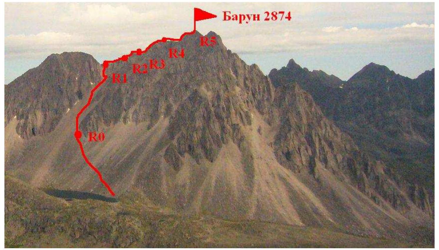
General view of Barun peak
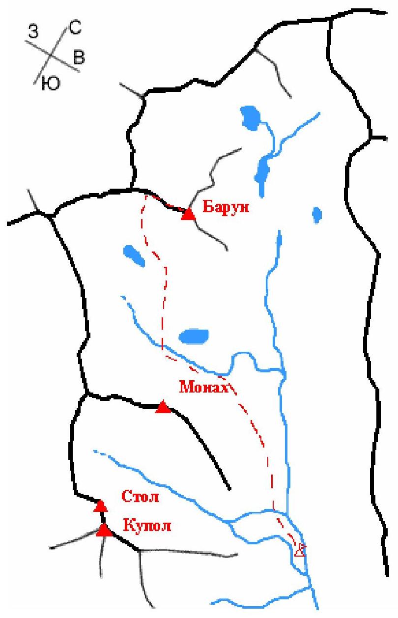
Scheme of Baruun-Khandagai valley
UIAA Scheme
| Section # | Rock Pitons | Chocks | Route | Section difficulty | Section length, m | Slope, degrees |
|---|---|---|---|---|---|---|
| 12 | - | - | Photo 4 Barun 2874 R5 | |||
| 11 | - | - | 1 | 60 | 35 | |
| 10 | - | - | 1 | 60 | 45 | |
| 9 | - | - | 1 | 40 | 35 | |
| 8 | - | - | Photo 3 | 2 | 20 | 50 |
| 7 | - | - | 1 | 20 | 30 | |
| 6 | - | - | 1 | 60 | 35 | |
| 5 | - | - | 2 | 20 | 60 | |
| 4 | - | - | 2 | 20 | 45 | |
| 3 | - | - | 1 | 60 | 35 | |
| 2 | - | - | Photo 1,2 R1 | 2 | 15 | 60 |
| 1 | - | - | R0 | 500 | 45 |
Route Description
R0–R1. Ascent via the southern scree couloir, before reaching the saddle between Barun and Uzlovaya peaks, 15 m via slabs of 2nd category.
R1–R2. From the saddle, up the ridge with simultaneous belay on a protrusion, two ropes to the first pinnacle, bypass via a ledge on the left.
R2–R3. Exit to the ridge via a crack 20 m 2nd category, along the ridge to the second pinnacle three ropes, go through the pinnacle.
R3–R4. After bypassing large slabs on the left, continue along the ridge, two ropes to the third pinnacle, 20 m 2nd category.
R4–R5. Exit to the summit of Barun from the northern side.
Descent via the ascent route.
Photo 1 Section 2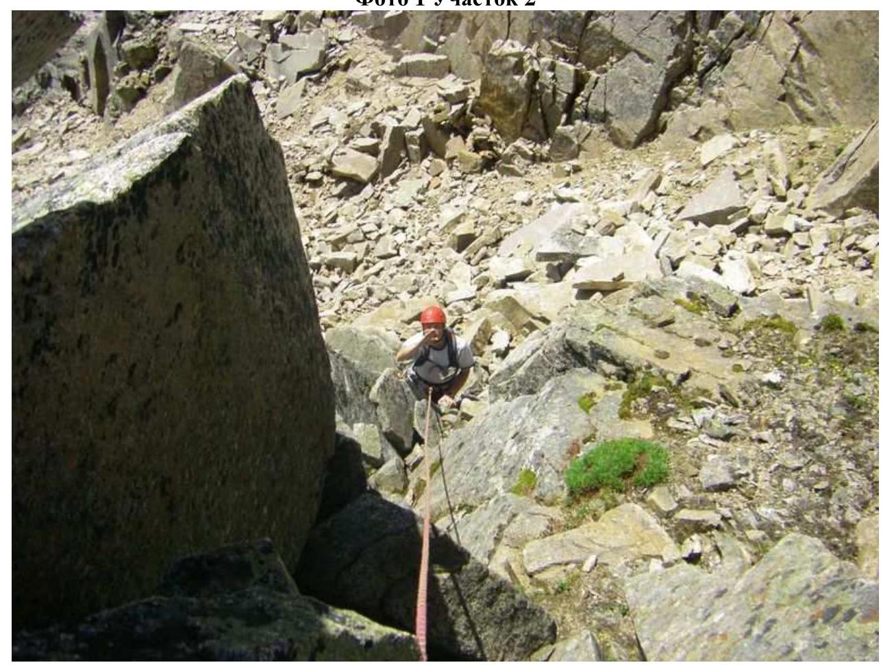
Photo 2 Section 2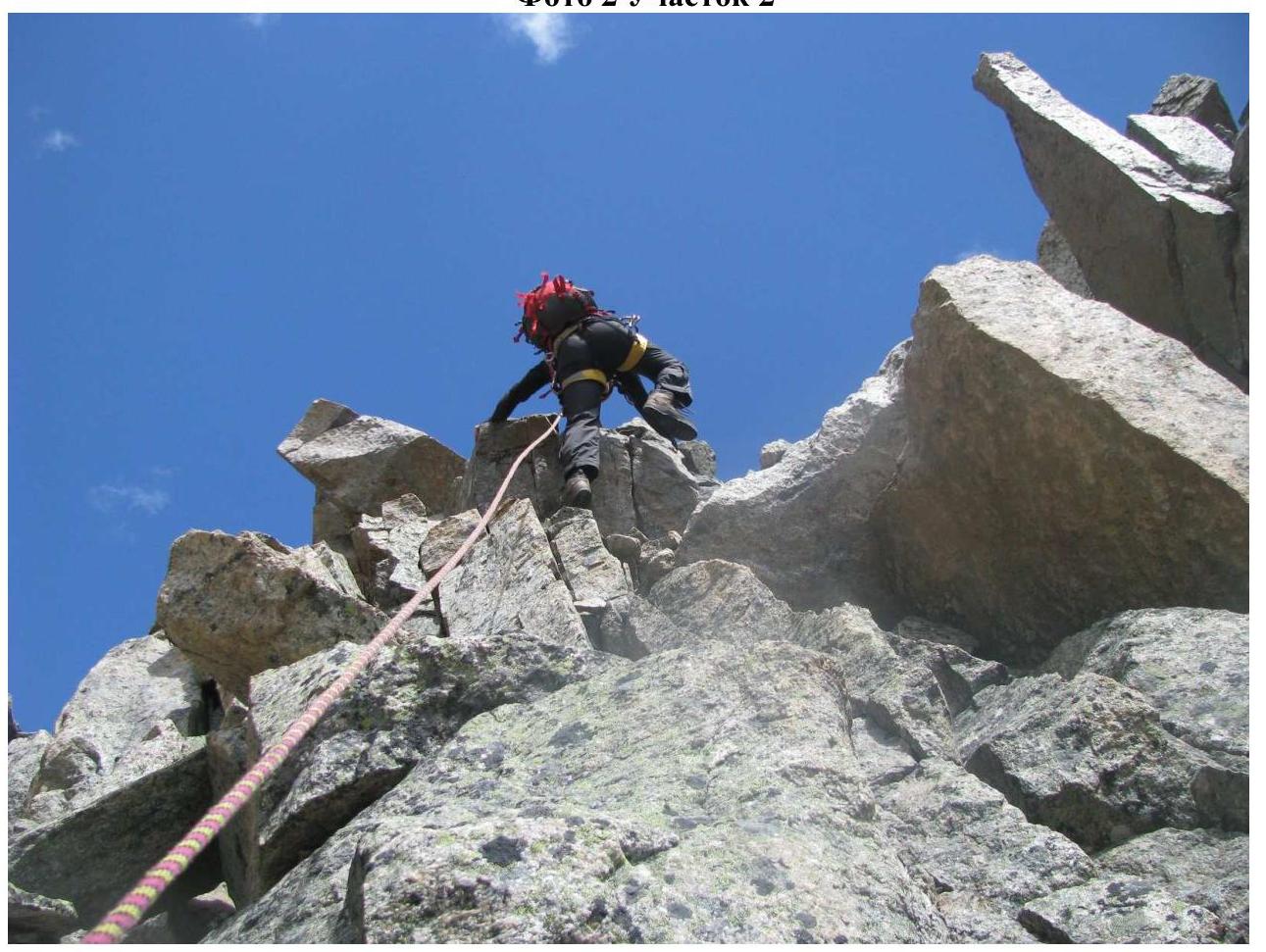
Photo 3 Section 8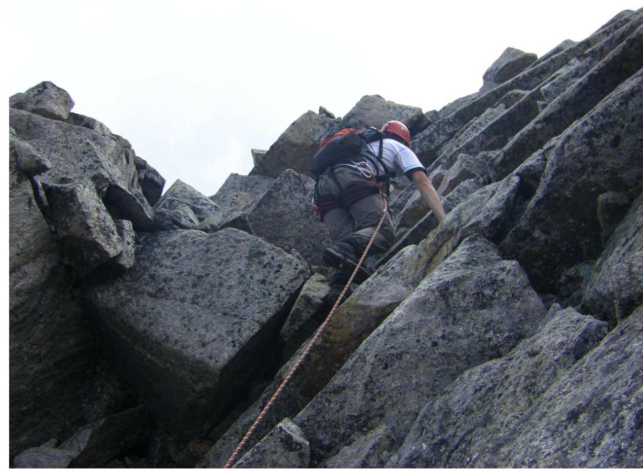
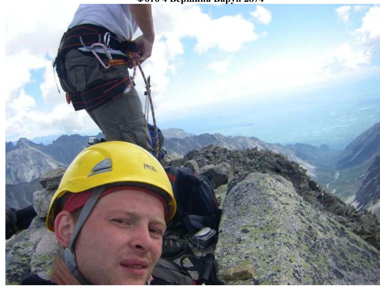
Photo 4 Barun 2874 summit