
Ascent certificate for Mt. Abrek, 2396 m, via the Western ridge, category 2B
- Eastern Sayan, Tunkinskie Goltsy ridge, Serebryanoe (Vetryany) valley, section 6.1.2. 2. Mt. Abrek, 2396 m, via the Western ridge. 3. Proposed category 2B, first ascent. 4. The route is rocky. 5. Elevation gain 200 m, length 480 m, average slope 30°. 6. 15 pitons hammered: rock and chock stones. 7. Team's travel time — 5 hours. 8. No overnight stays on the route. 9. Team: Afanasiev A.E. — Master of Sports
Klepikov A.A. — 3rd sports category, Maklakova I.A. — 3rd sports category, Melikhov A.P. — 3rd sports category
- Coach Afanasiev A.E. — Master of Sports
- Ascent to the summit and return — August 31, 2007. Second ascent made on April 27, 2017, by a team of military personnel with 2nd sports category. Photographs are attached in the report from both teams.
Description of the ascent route to Mt. Abrek, 2396 m, via the Western ridge from Bezoblachny pass (Bezbablovy tourist pass), category 2B
From the base camp at Serebryanoe lake to the pass between Mt. Plastun and Mt. Abrek — 2 hours walking. The ascent to the pass goes through an avalanche-prone southern slope and couloirs. One needs to choose the path:
- first across rocky outcrops,
- then under the rocks from right to left,
- then to the right along the ridge.
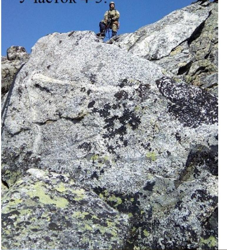
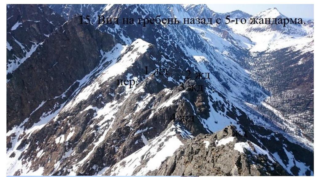
Sect. 0–1 15 m, 20°, category I. Ridge. Sect. 1–2 15 m, 70°, category II+. Chimney. Ascent to a gendarme. Sect. 2–3 25 m, category I. Descent from the gendarme. Sect. 3–4 25 m, 20°, category I+. Ridge. Sect. 4–5 25 m, 60°, category III-. Descent to the right using a rappel. Sect. 5–6 60 m, category II+. Bypass 2nd gendarme to the right. Sect. 6–7 60 m, category II-. Bypass 3rd gendarme to the left. Sect. 7–8 50 m, 50°, category II+. Along the ridge to the 4th gendarme. Sect. 8–9 7 meters along the ridge. Sect. 9–10 70 m, 45°, category II+. Ascent along the ridge to the 5th gendarme. Sect. 10–11 40 m, 40°, category II-. Traverse to the left of the sharp ridge. Sect. 11–12 30 m, 70°, category III+. 10-meter inclined crack to the left and then along weathered rocks, exit to the ridge. Sect. 12–13 60 m, category II-. Along the ridge to the summit. Descent to the southeast along the ridge. 1 rappel descent to a couloir on the right. Down the couloir to the cirque of Serebryanoe valley.
UIAA table for Mt. Abrek via the Western ridge, category 2B
| Mt. Abrek | Length b m | Steepness a | Difficulty b | Number of pitons hammered | |
|---|---|---|---|---|---|
| Pitons B | Chock stones e | ||||
| □ | |||||
| 1 | 50 | 35 | II– | ||
| 30 | 70 | III+ | 1 | 3 | |
 | 40 | 40 | II– | 1 | |
| :--: | :--: | :--: | :--: | :--: | :--: |
 | 70 | 45 | II+ | 2 | 1 |
| 50 | 50 | II+ | 1 | 1 | |
 | 60 | 30 | II– | 1 | |
 | 60 | 30 | II+ | 2 | |
| 25 | 60 | III– | |||
| 25 | 20 | I+ | |||
| 25 | I- | ||||
| 15 | 70 | II+ | 2 | ||
| 15 | 20 | I- |
- Panorama of Vetryany, from Tunkinskaya valley
to the right.
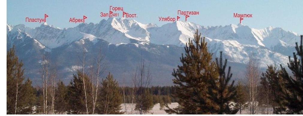
Gorets-3
-
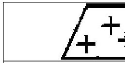
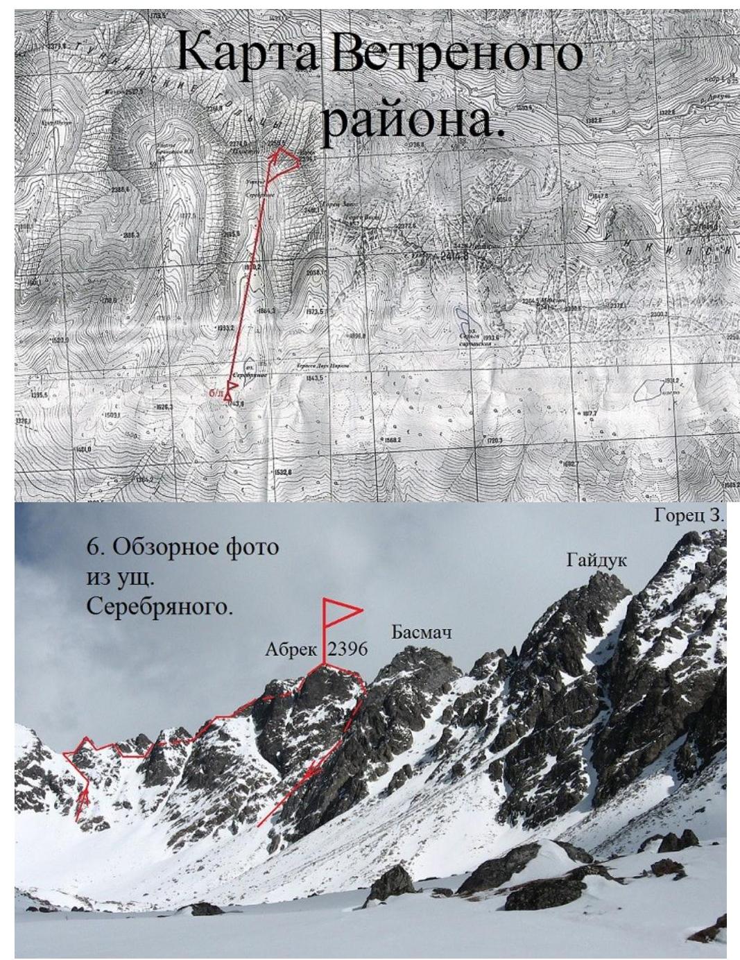
Overview photo from Serebryanoe valley.
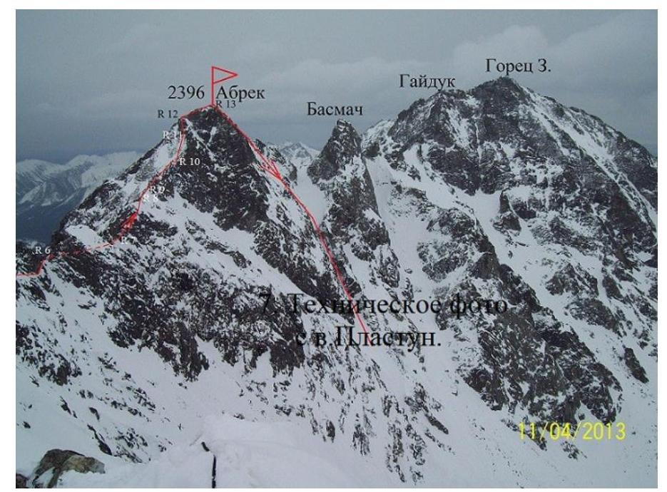
-
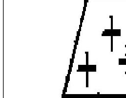
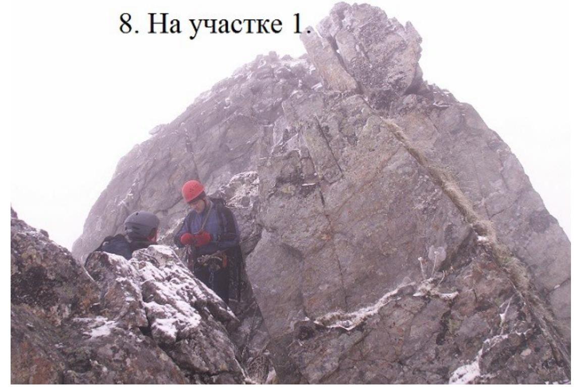
On section 1.
-
Descent from 1st gendarme. Section 4–5
-
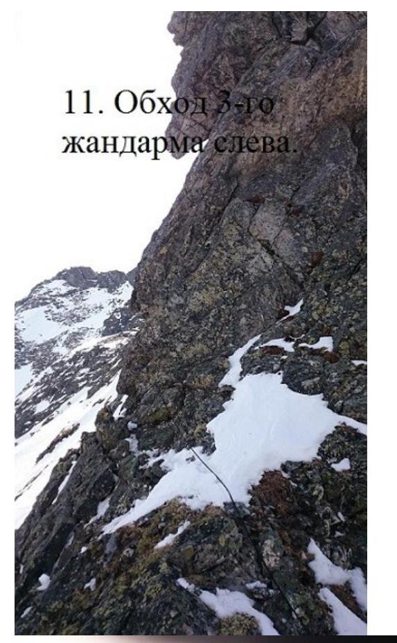
2nd gendarme is bypassed to the right.
-
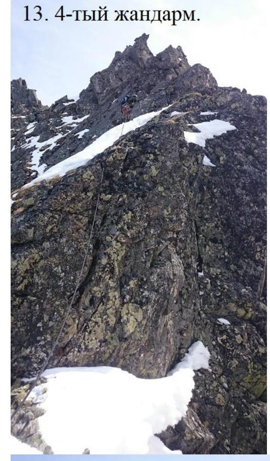
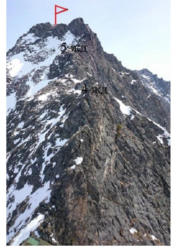
Section 7–8. On 4th gendarme.
-
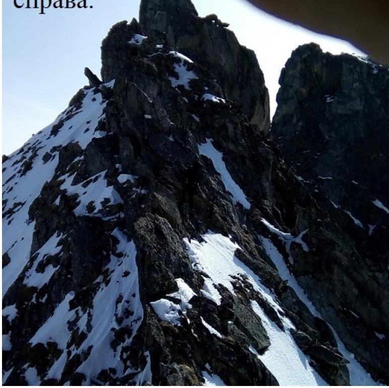
View of the ridge towards the summit from 3rd gendarme.
-
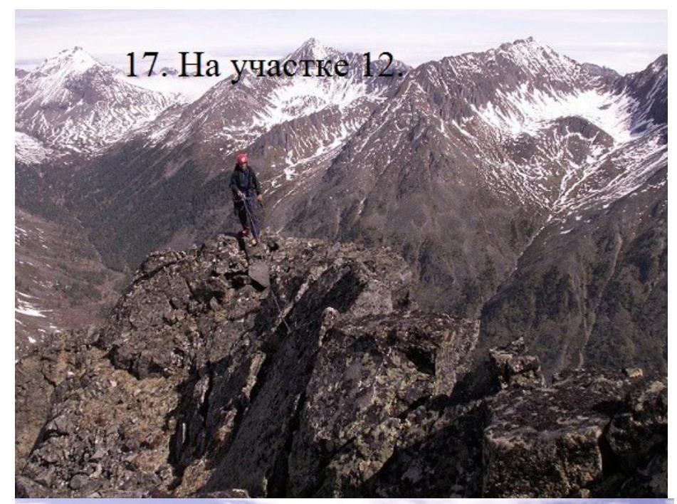
Crux of the route. Section 11–12
-
On the summit of Abrek.
