Ascent Passport
- East Sayan, Bolshoy Sayan Ridge, Moguvek gorge, section 6.1.
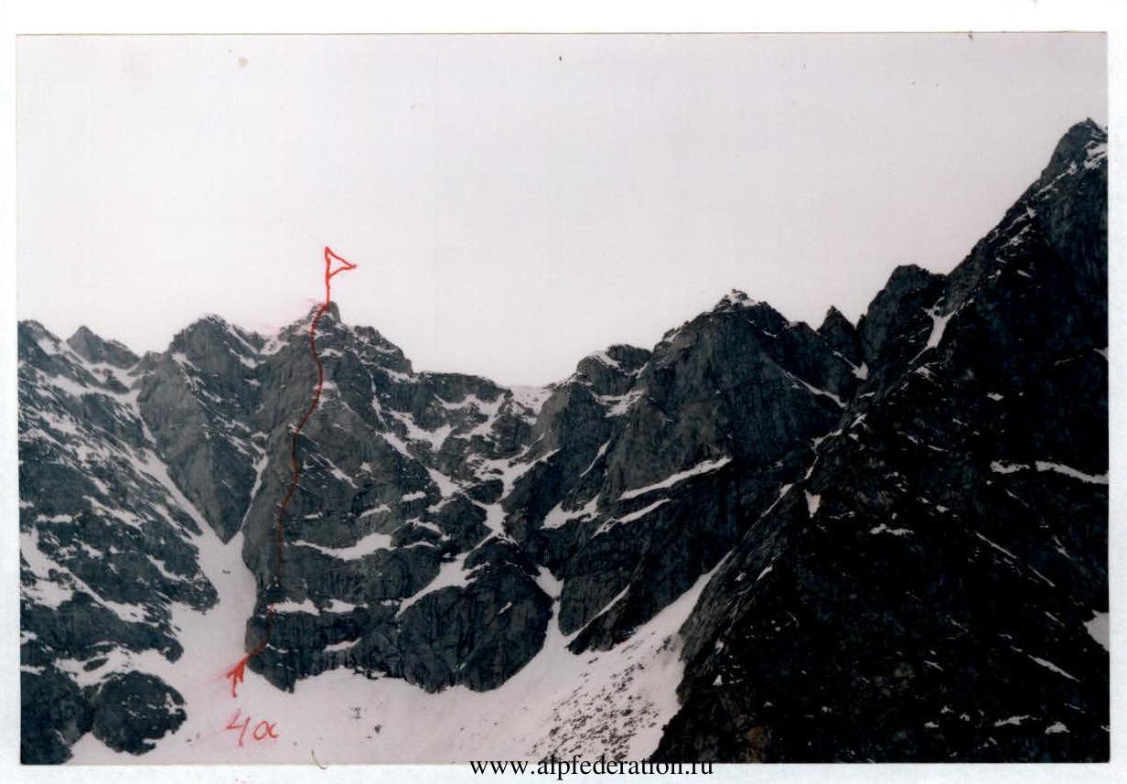
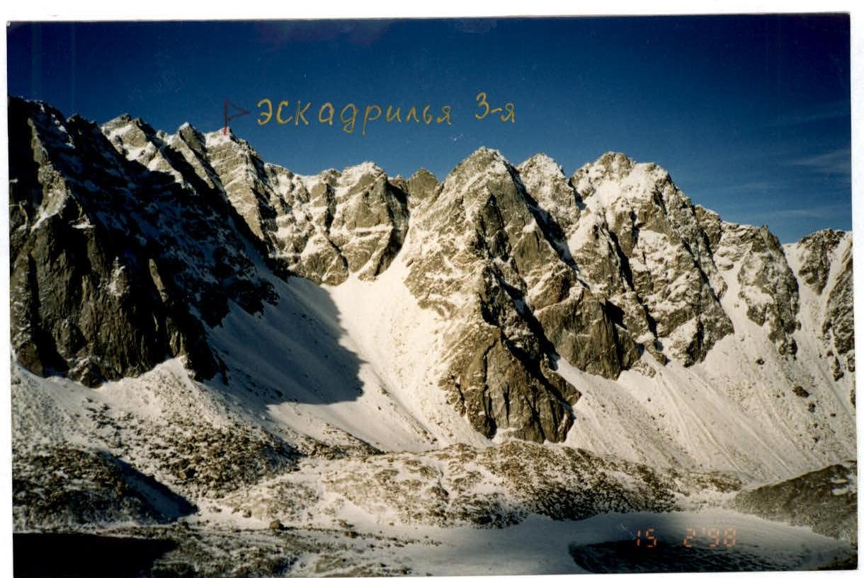
- Eskadrilya 3-ya "Bantik" peak, 3177 m, via the Southeast counterfort.
- Proposed 4A category of difficulty, first ascent.
- Route type — rock.
- Height difference — 300 m, length — 450 m, average steepness — 55°.
- Pitons driven: rock and chocks — 38 pcs.
- Team's travel time — 8 hours.
- No overnight stays.
- Group:
- Afanasiev A. E. MS
- Voilichenko S. K. 2nd sports category
- Sazonov R. A. 2nd sports category
- Coach: Afanasiev A. E. MS
- Approach to the route and return — May 9, 2004.
Description of the ascent route to Eskadrilya 3-ya "Bantik" peak 3177 m via the Southeast ridge 4A category of difficulty.
The route is located in the far right corner of the Leonov — Opasnaya cirque. The ridge is obvious, beautiful, and unambiguous.
- R0–R1 30 m. 55° 3. Rock with cracks on the right face of the ridge. At the top of the section — bypass the first rusty rock to the right.
- R1–R2 15 m. 40° 2. Snow shelf.
- R2–R3 40 m. 60° 4. Rocks of the right face with permafrost bumps. Under the rusty cornice on the ridge.
- R3–R4 50 m. 65° 4. Bypass the second rusty overhang to the right. Exit to the ridge. Control cairn on a large flat rock.
- R4–R5 5 m. 40° 1. Snow ridge.
- R5–R6 45 m. 65° 4. Bypass the third rusty overhang on the left face. Exit to the ridge.
- R6–R7 8 m. 45° 2. Traverse across snow to the right.
- R7–R8 45 m. 50° 4. Across the slabs of the right face to the ridge.
- R8–R9 15 m. 65° 3. Crack-shelf rocks.
- R9–R10 30 m. 40° 2. Across snow to the right of the ridge.
- R10–R11 15 m. 30° 1. Snow ridge.
- R11–R12 60 m. 60° 3. Wide rock ridge.
- R12–R13 30 m. 30° 1. Snow ridge.
- R13–R14 55 m. 45° 2. Wide snow-rock ridge. Exit to Eskadrilya 3-ya "Bantik" peak.
Descent follows a traverse of 2A category of difficulty to the saddle between 1st and 2nd Eskadrilya peaks and further down the southeast couloir, initially 2nd sports category, to the Moguvek cirque to the start of the route.
| Pitons | Chocks | UIAA Signs | Section | Length | Steepness |
|---|---|---|---|---|---|
| P | Summit | ||||
| R14 | |||||
| 2 | |||||
| + | R13 2 | 55 m | 45° | ||
| + | |||||
| + | R12 1 | 30 m | 30° | ||
| 3 | 5 | ||||
| R11 3 | 60 m | 60° | |||
| + | R10 1 | 15 m | 30° | ||
| +++ | R9 2 | 30 m | 40° | ||
| 1 | 1 | R8 3 | 8 m | 45° | |
| 4 | 4 | ||||
| R7 4 | 45 m | 50° | |||
| +-+ | R6 2 | 8 m | 45° | ||
| R5 4 | 45 m | 65° | |||
| 3 | 4 | + | R4 1 | 5 m | 40° |
| 4 | 4 | ||||
| R3 4 | 50 m | 65° | |||
| 4 | 3 | ||||
| R2 4 | 40 m | 60° | |||
| R1 2 | 15 m | 40° | |||
| 3 | 3 | ||||
| R0 3 | 30 m | 55° | |||
| Total | |||||
| 24 | 24 |
 Eskadrilya 3-ya peak. Route 4A.
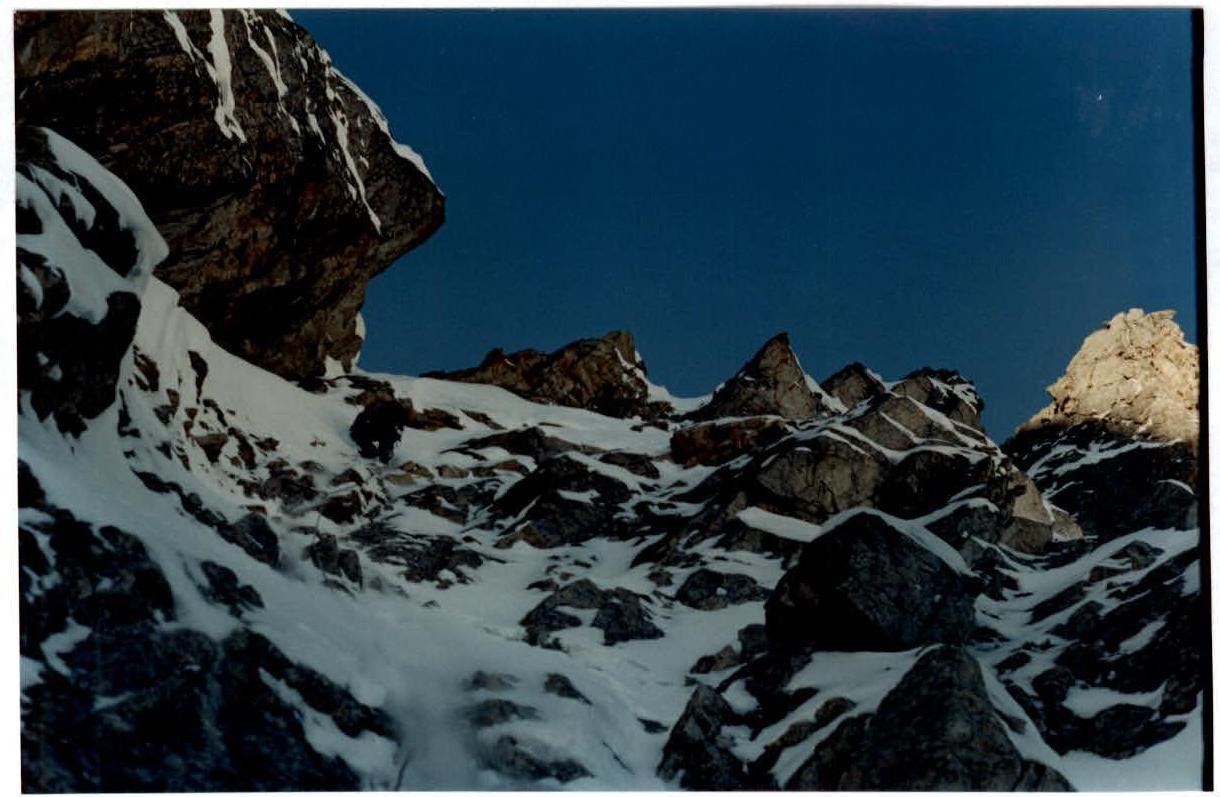
 View of the route.
 Photopanorama. Eskadrilya 3-ya.
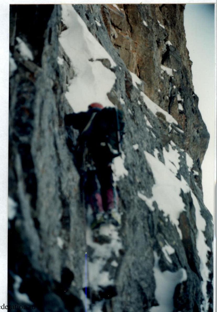
 Section R3–R4.
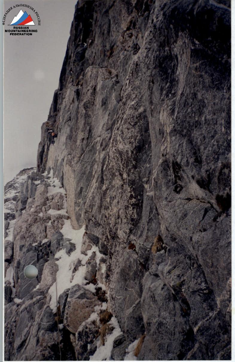 Section R5–R6.
 Section R7–R8.