Irkutsk Regional Public Organization Active Recreation and Alpinism Club Gory Baikala
MOUNTAINS ▲ of Baikal baikalmountain.com
Report on the First Ascent
To Pik Kuzmina, 2974 m, via the Central Counterfort of the South Face. Approximately 3B category of difficulty. Irkutsk, 2016
Climbing Passport
-
Eastern Sayan, Bolshoy Sayan Ridge, Muguvek River gorge. Section number according to the classification table 6.1.
-
Pik Kuzmina, 2974 m (summit coordinates: 51°44′9.74″ N 100°37′35.89″ E), via the central counterfort of the South Face.
-
Category of difficulty: proposed 3B category of difficulty, first ascent.
-
Route character: rock.
-
Route elevation gain: 360 m. Route length: 620 m. Length of sections with IV–V category of difficulty: 45 m. Average steepness: entire route — 50°.
-
Number of pitons left on the route: 0. Number of cams/chocks used on the route: 14/0.
-
Team's total climbing time: 5 h 15 min, no overnight stays.
-
Team leader: Glazunov Evgeny Vladimirovich (Master of Sports).
Team members:
- Blednykh Sergey, 3rd sports category
- Vorozhbitskaya Ksenia, 3rd sports category
- Ilyashenko Vitaly, 3rd sports category
-
Coach: Glazunov Evgeny Vladimirovich (Master of Sports).
-
Departure for the route: 06:00, May 2, 2016. Reached the summit — 11:15, May 2, 2016. Returned to Base Camp — 12:15, May 2, 2016.
-
Alpinism Club "Gory Baikala".
Overview of the Climbing Area, Sports Characteristics, and Tactical Actions of the Team
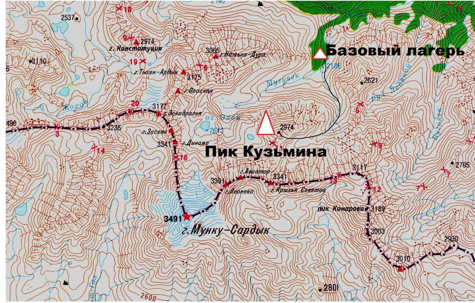
The summit of Pik Kuzmina is located in the left spur of the Muguvek River gorge, Bolshoy Sayan Ridge, Eastern Sayan mountain system.
The peak was named by tourists in honor of the Irkutsk tourist Alexander Evgrafovich Kuzmin, who tragically died in 2006. The peak also has a second unofficial name "Muguvek".
[Links][Links]:
There were no classified routes to the summit, but there is a simple walking ascent from the "Krylya Sovetov" pass, popular among tourists. The approach from the base camp takes no more than 1–2 hours, depending on the amount of snow. Its location is convenient and attractive for making a first ascent. The route we chose passes through a pronounced counterfort in the central part of the wall. The route is logical, clearly tied to the terrain, and the rocks on the route are monolithic, with a sufficient number of cracks and fissures for organizing protection. The route features interesting climbing, as well as sections where the terrain is predominantly snowy. We recommend this route to subsequent groups, as it is logical and relatively accessible; we recommend it as a first 3B route.
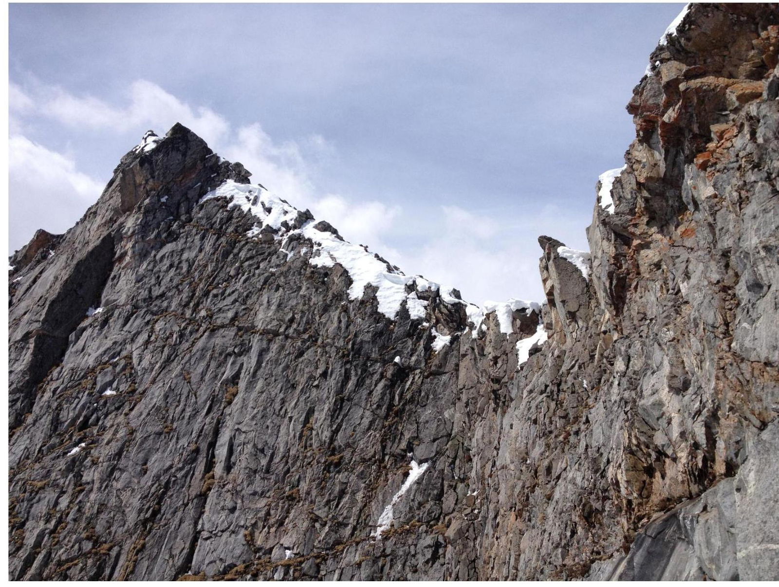
General View of the Summit
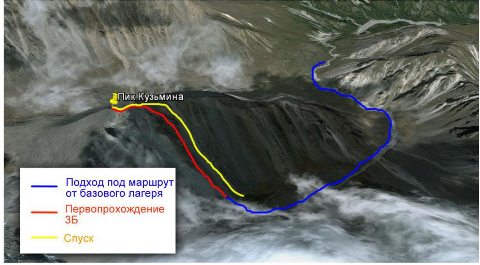
Map-Scheme of the Area and Approach Route
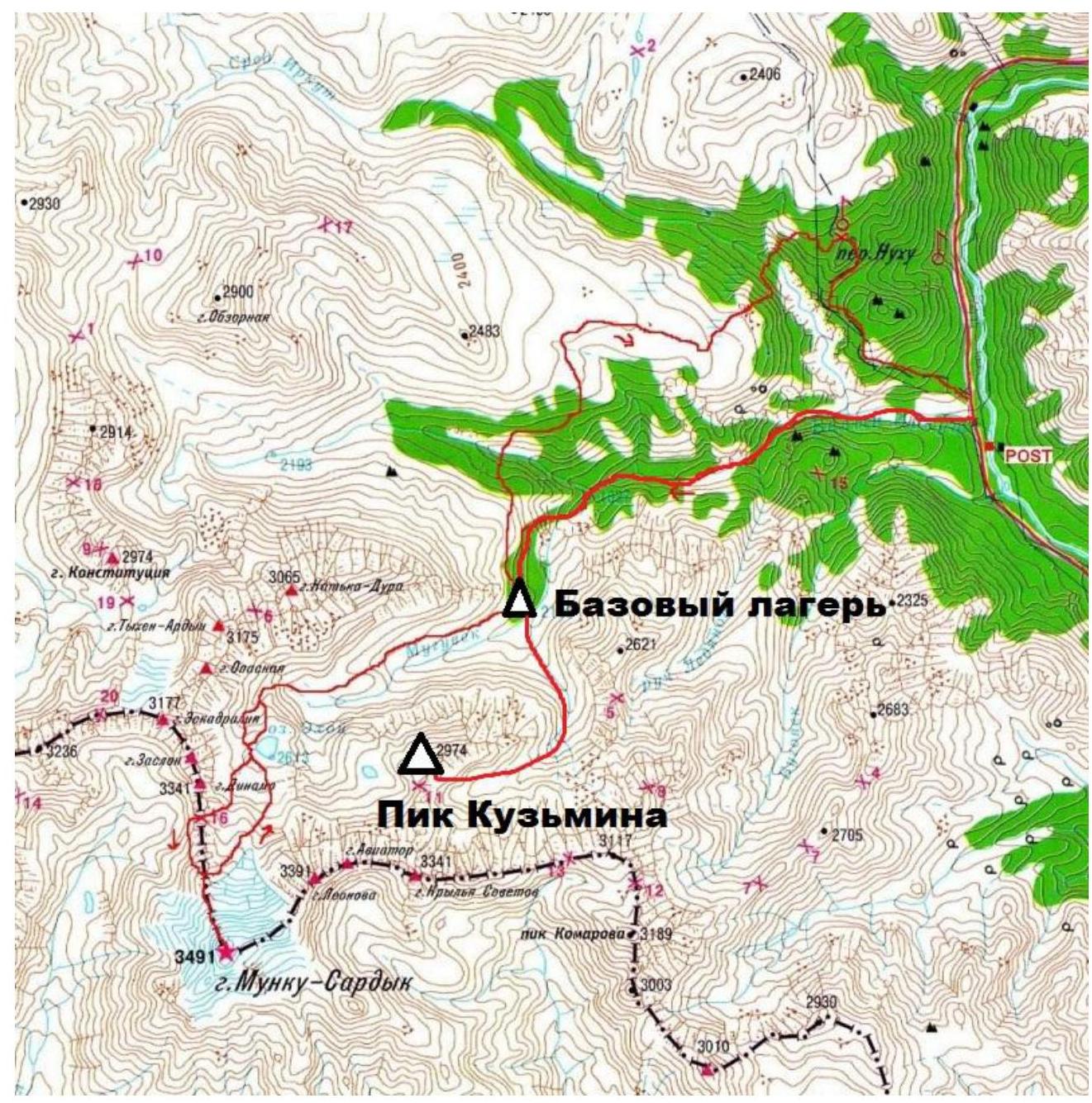
Map-Scheme of the Area and Approach Route
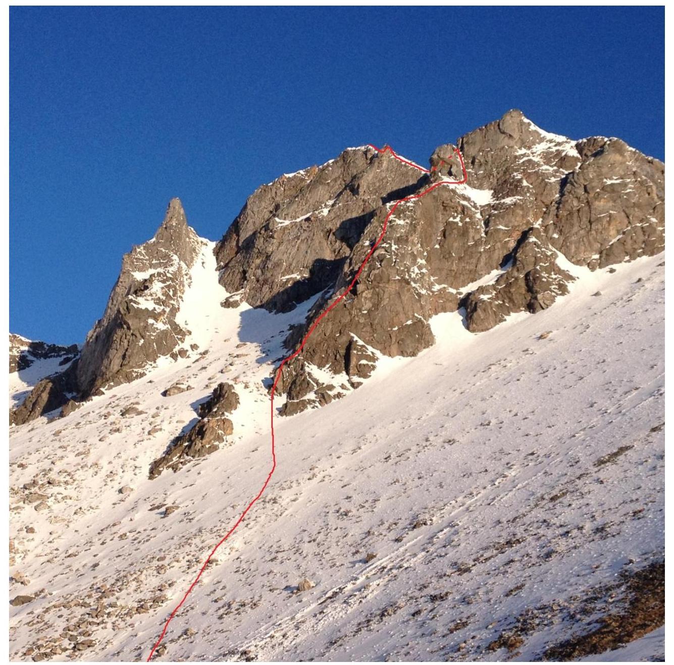
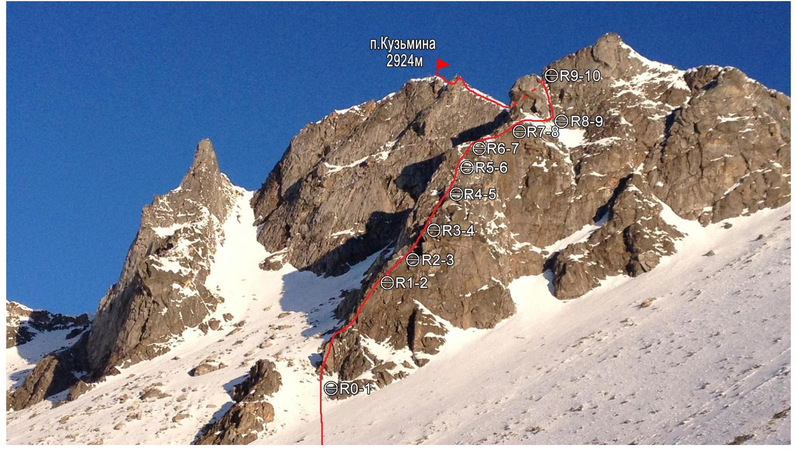
Technical Photo of the Route
UIAA Scheme

Route Description by Sections
Approach to the start of the route from the Pik Kuzmina cirque via a snowy slope; move along the snowy slope towards the characteristic counterfort in the central part of the South Face.
0–1. Internal corner from left to right, then a small ridge, followed by a rock wall. Pass the wall, behind which is a belay station on a ledge. 50 m. 60° III.
1–2. Move along a diagonal inclined ledge to the right until it ends. 50 m. 55° III.
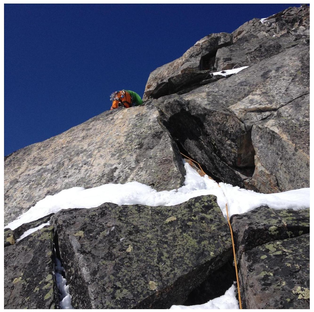
2–3. Internal corner with a crack, then a traverse to the left across slabs, exit onto a ledge, from the ledge move into a chimney, continue moving up the chimney until it becomes less steep. Crux section. 45 m. 80° IV–V.
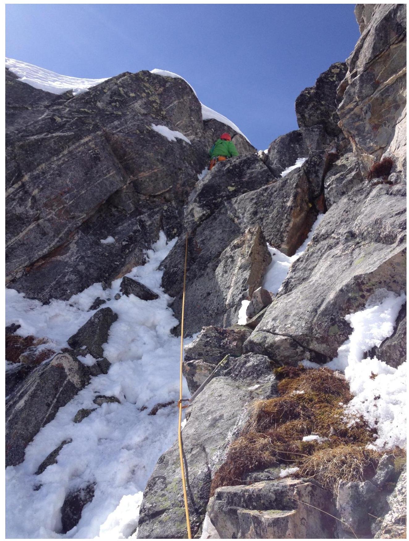
3–4. From the belay station, move upwards across monolithic rocks via a system of cracks and walls; at the end of the section, an internal corner, behind which is a more gentle terrain. 55 m. 60° III–IV.
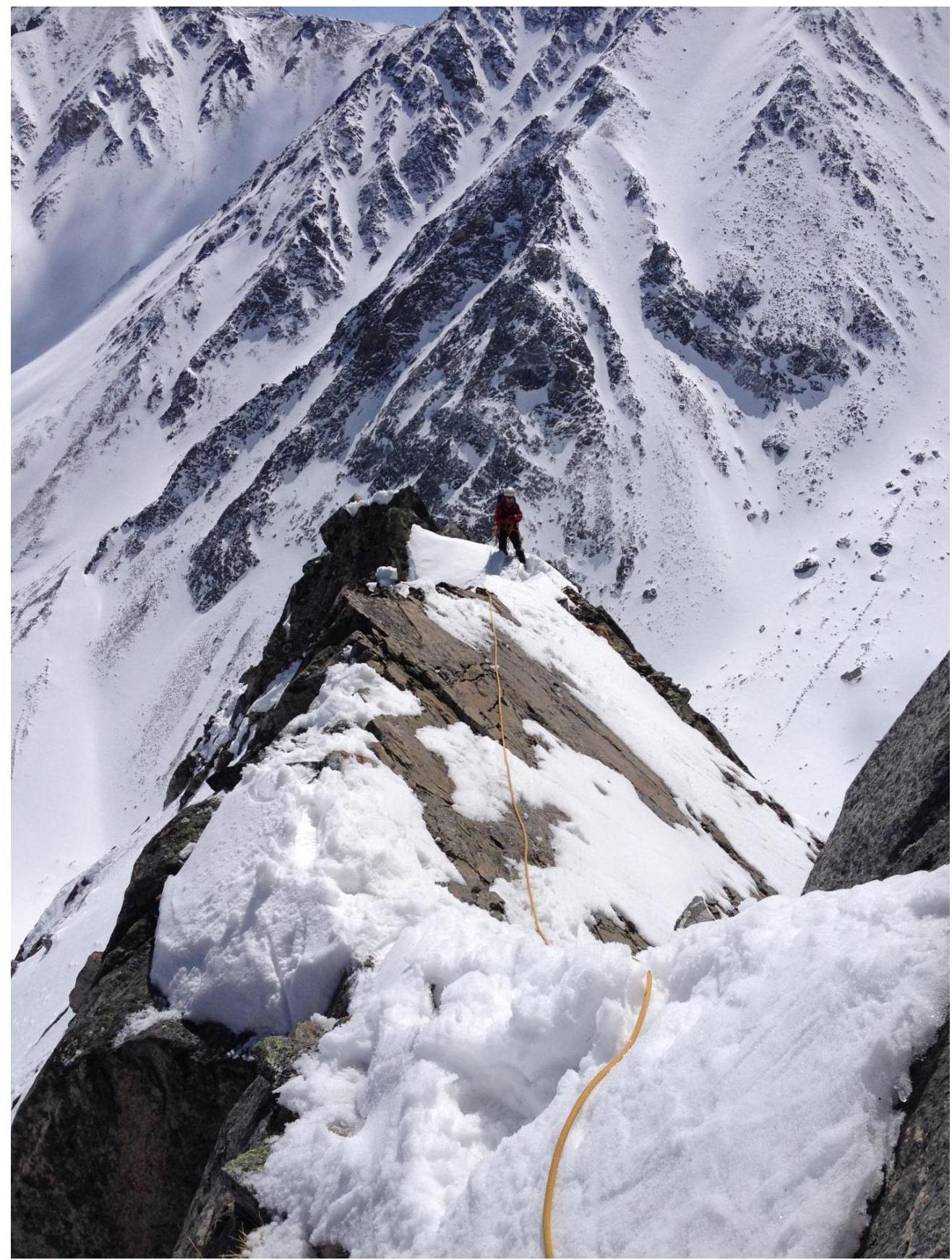
4–5. Simultaneous movement along the counterfort ridge through a series of walls and ledges. 50 m. 70° III–IV.
5–6. Exit onto a sharp ridge, behind which is a vertical wall with a large cornice; bypass it to the right along a ledge, where there is a belay station at the base of a chimney filled with snow. 30 m. 45° III.
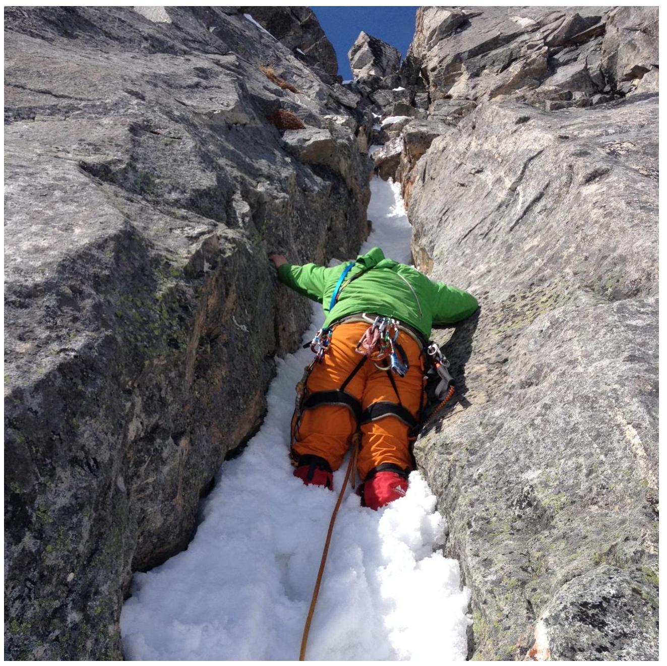
6–7. Move upwards through the chimney filled with snow; behind the chimney, a traverse to the right onto a ledge, where a belay station was set up. 40 m. 70° IV.
7–8. From the belay station, move upwards to the right — into an internal corner. Climb the corner to a connecting ridge. 30 m. 70° III.
8–9. From the connecting ridge, slightly to the left, into an internal corner, which leads to a snowy slope. Climb the slope to the main (East) ridge. 50 m. 55° III.
9–10. Climb along the ridge to the summit. 200 m. 40° I–II.
Descent from the summit:
- Return along the ascent route to R9.
- Continue along the East ridge to a characteristic connecting ridge.
- From the connecting ridge, descend along the snowy slope to the SW.
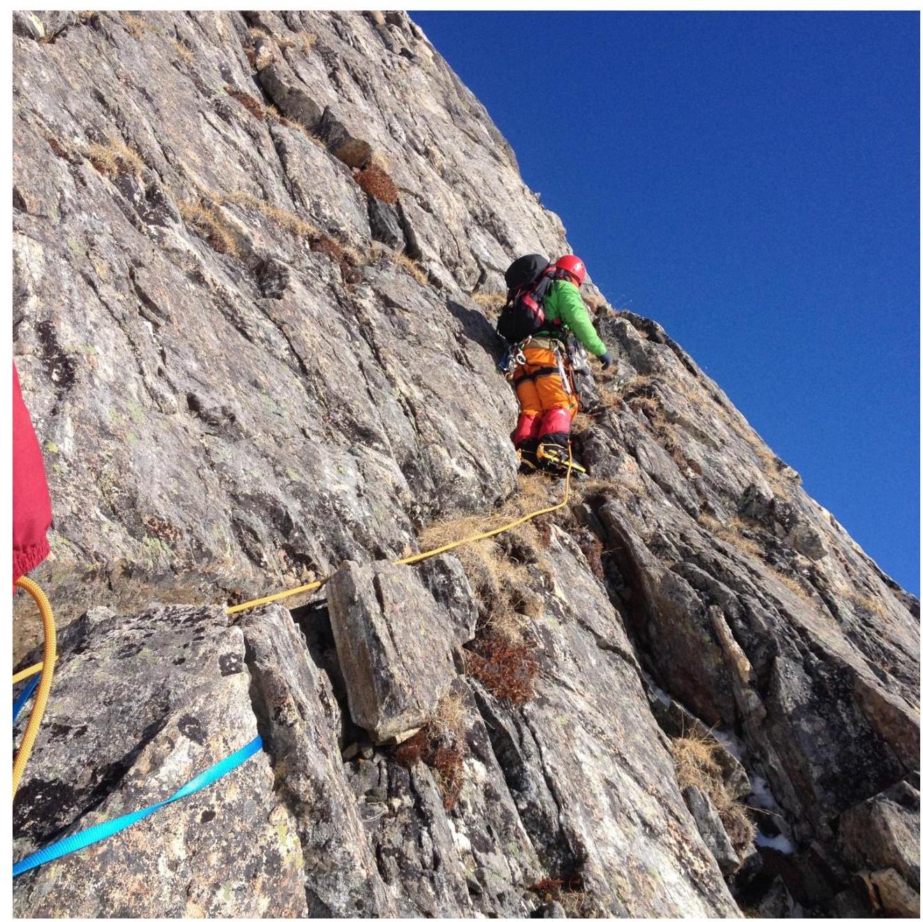
Section 1–2
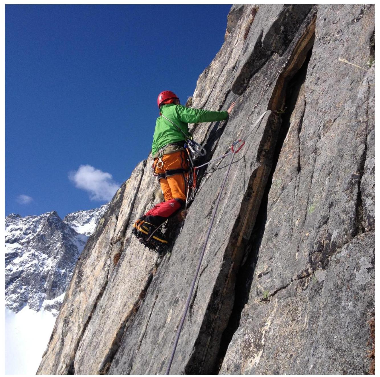
Section 2–3
Section 3–4
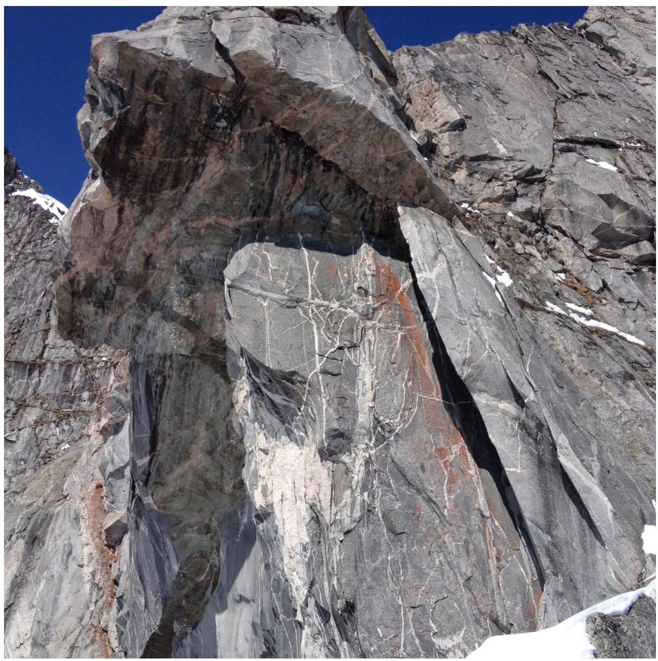
The wall with a characteristic cornice is bypassed on the right and serves as a good landmark visible from any point.