Ascend passport to the peak Krylya Sovetov 3341 m, via Eastern ridge, cat. 2B.
-
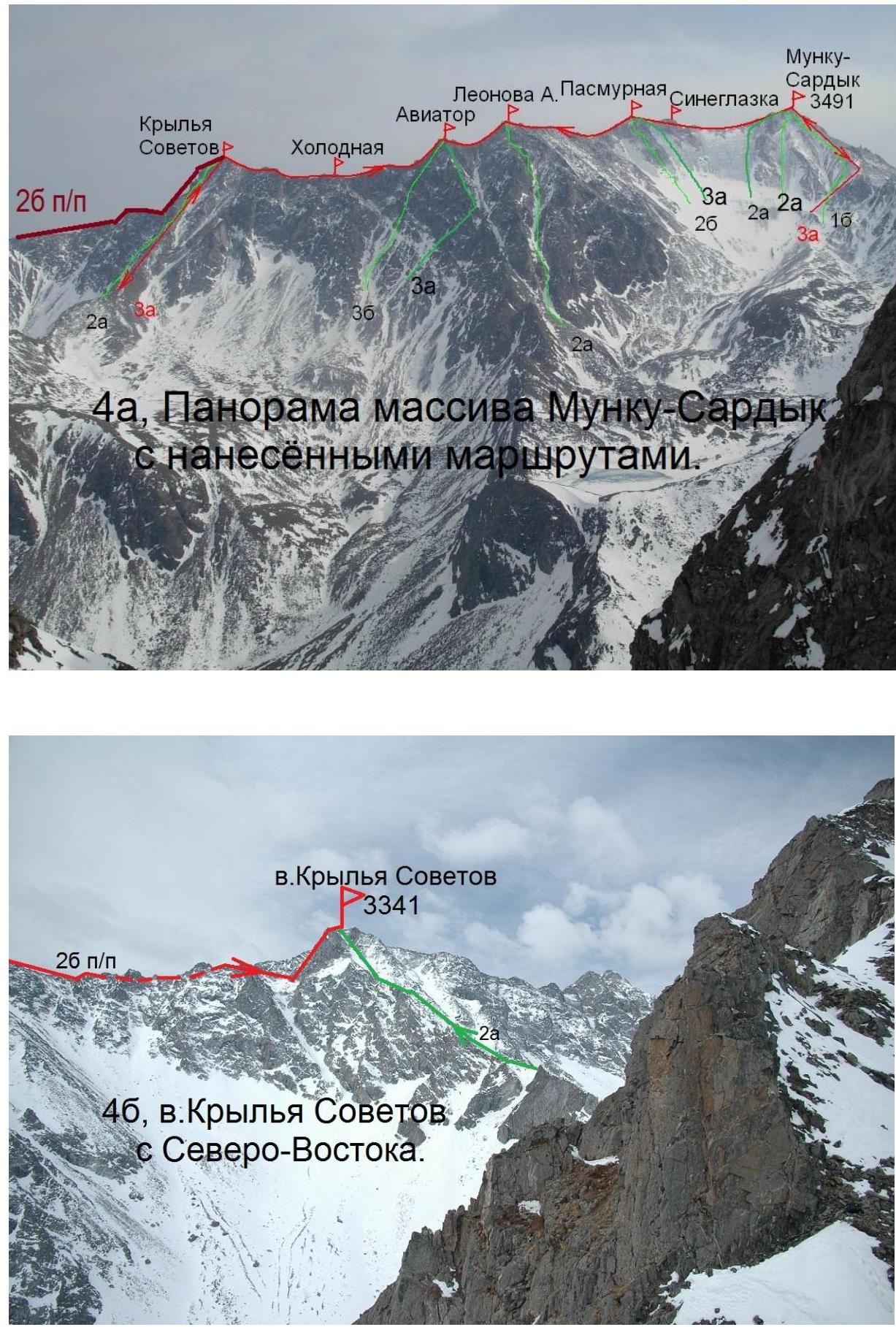
Eastern Sayan, Bolshoy Sayan ridge, Moguvek gorge, section 6.1.1.
-
Ascend to the peak Krylya Sovetov (3341 m), via Eastern ridge.
-
Proposed cat. 2B, first ascend.
-
Route character: rocky.
-
Height difference 300 m, length 630 m, average steepness 35°.
-
Pitons driven: rocky and закладных 14.
-
Team's walking hours — 8 h.
-
No overnight stays on the route.
-
Group:
Afanasyev A.E. MS, Il'inskiy V.A. 3rd sports cat., Kikina E.I. 1st sports cat.
- Coach Afanasyev A.E. MS
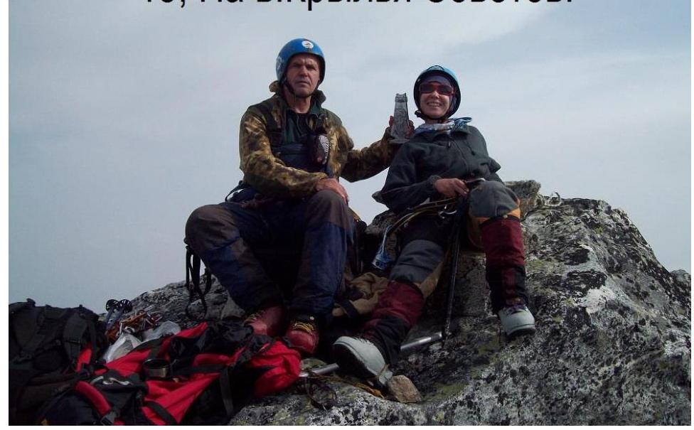
- Ascend to the peak and return on May 4, 2012.
Route description of ascend to the peak Krylya Sovetov 3341 m via Eastern ridge, cat. 2B.
Approach to the Pogranichny pass from the base camp near the forest boundary takes 5 h. Further West along the flat ridge, about 1 h walk with rest, to the sharp ridge. Before the sharp ridge, belay is necessary.
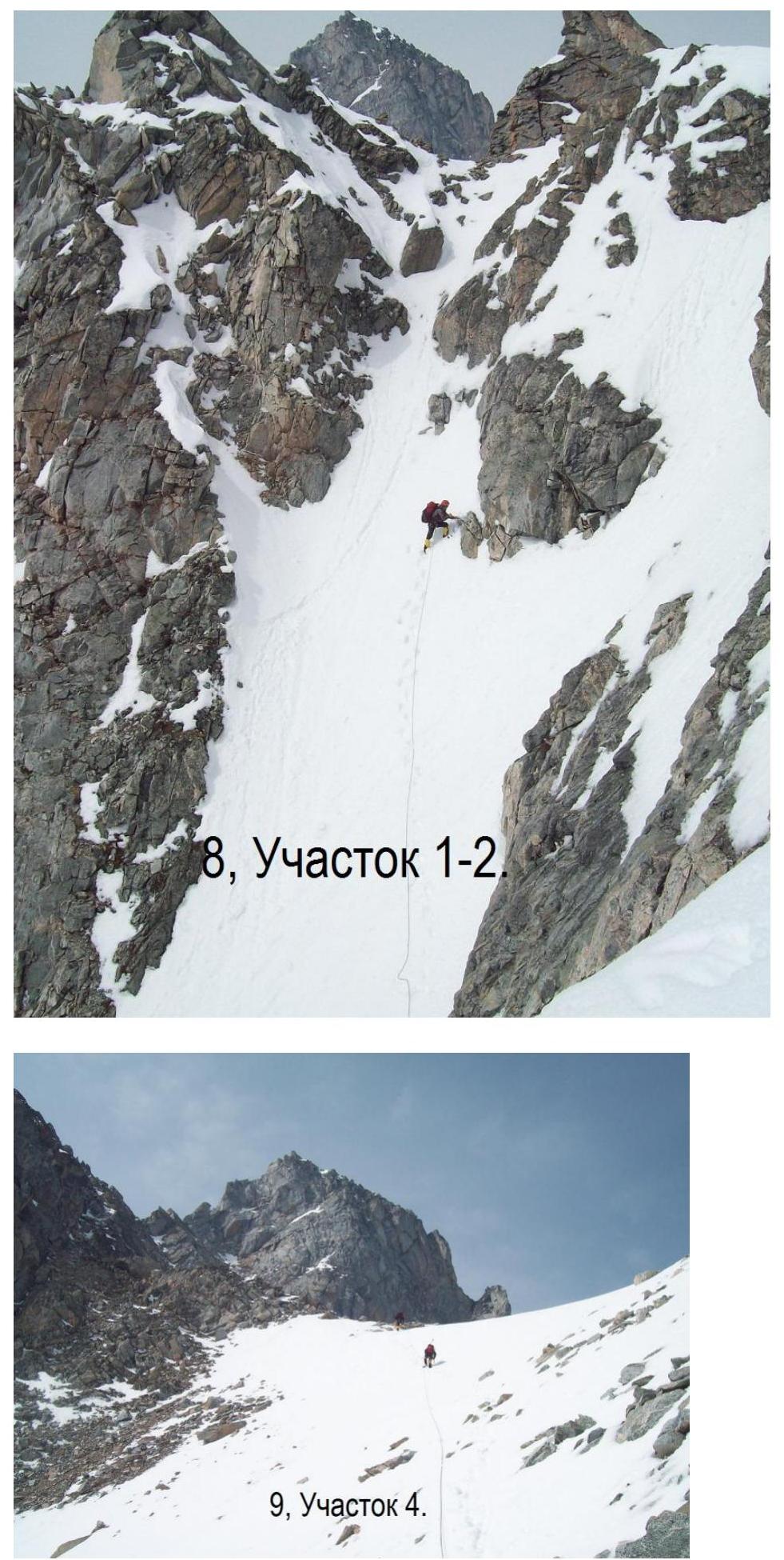
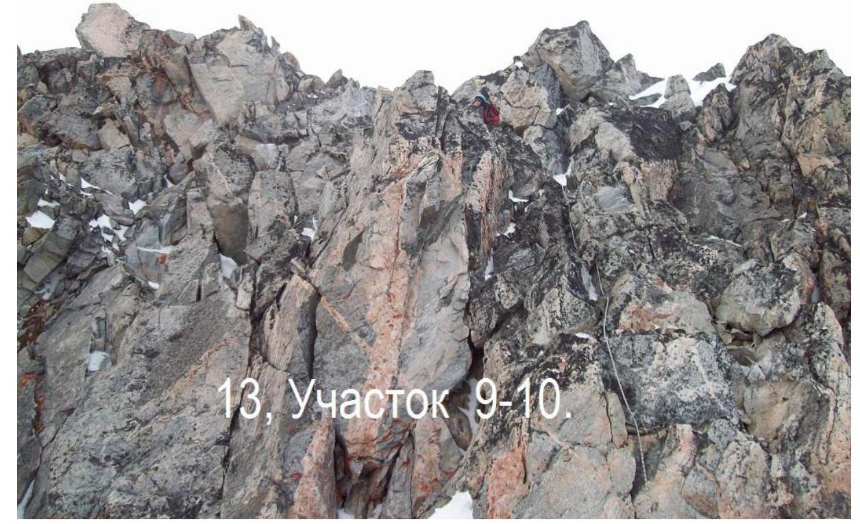
Section 0–1 60 m. I+ Snow slope 40° to the left of the ridge. Section 1–2 70 m. II– Downhill to the left of the ridge along the snow slope 45°. Down 25 m, up 45 m. Exit to the saddle in the Southern spur. Section 2–3 20 m. 80° III– Rappel into the third depression to the left of the Eastern ridge. 2 h work from the start of the sharp ridge. Section 3–4 120 m. 40° I+ To the left of the ridge along the snow, traverse with height gain. Exit to the ridge. Section 4–5 80 m. I+ Traverse to the right of the ridge along the talus slope 40°. Approach to a distinct crevice with North-East exposure. Section 5–6 30 m. 80° IV– Crevice. (5 belay points). Section 6–7 70 m. 40° II– Couloir upwards to the left. (2 belay points). Section 7–8 60 m. 60° IV– One-sided inner corner upwards to the right. Along the right edge plate. Key section of the route. Exit to a rocky outcrop. (5 belay points). Section 8–9 50 m. 55° III+ Rock terrain of medium difficulty, reliable. (2 belay points). Section 9–10 70 m. 10° I– Rocky ridge. Exit to the peak. Descent along the ridge to the West towards peak Aviator 40 m. Further downwards to the right along the descending couloir, approx. cat. 1. One sports section 20 m. Upper part — talus with loose rocks on a 40° slope. Lower part — snow-filled couloir. Possible avalanche danger! There is a classified route 2A cat. to the peak along the Northern ridge.
- Krylya Sovetov in the Munku-Sardyk massif

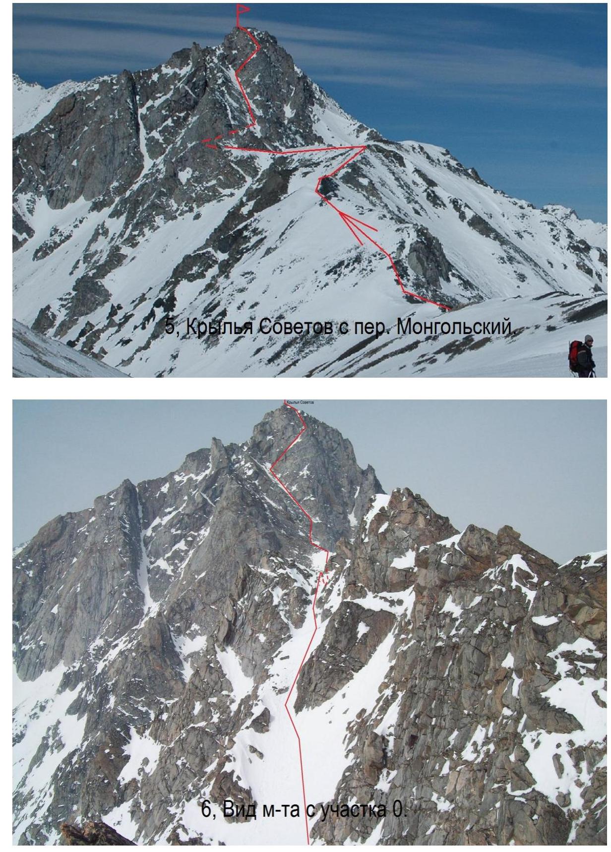
6, view of section R0

- Section R4.
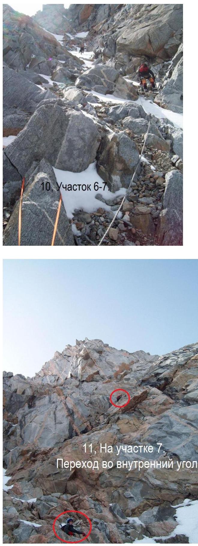
Transition to the inner corner.
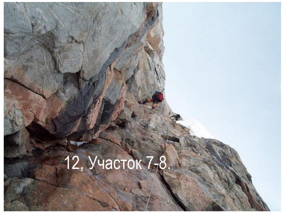
12, Section R7–R8.

15, on peak Krylya Sovetov.
Footnotes
-
46, peak Krylya Sovetov from North-East. ↩


