Climbing Passport
- East Sayan, Bolshoy Sayan ridge, Moguvek gorge, section 6.1.
- Aviator peak, 3333 m, via North-Eastern counterfort.
- Proposed category 3B, first ascent.
- The route is rocky in nature.
- Height difference 220 m, length 380 m, average slope 55°.
- Pitons driven: rock and wired 28 pcs.
- Team's travel hours — 6 hours.
- No overnight stays.
- Group: Afanasyev A.E. MS Gutarev Yu. III sports category, Davydenko M. III sports category, Lukina E. III sports category
- Coach Afanasyev A.E. MS
- Approach to the route and return on May 6, 2004.
Description of the ascent route to Aviator peak via North-Eastern counterfort category 3B.
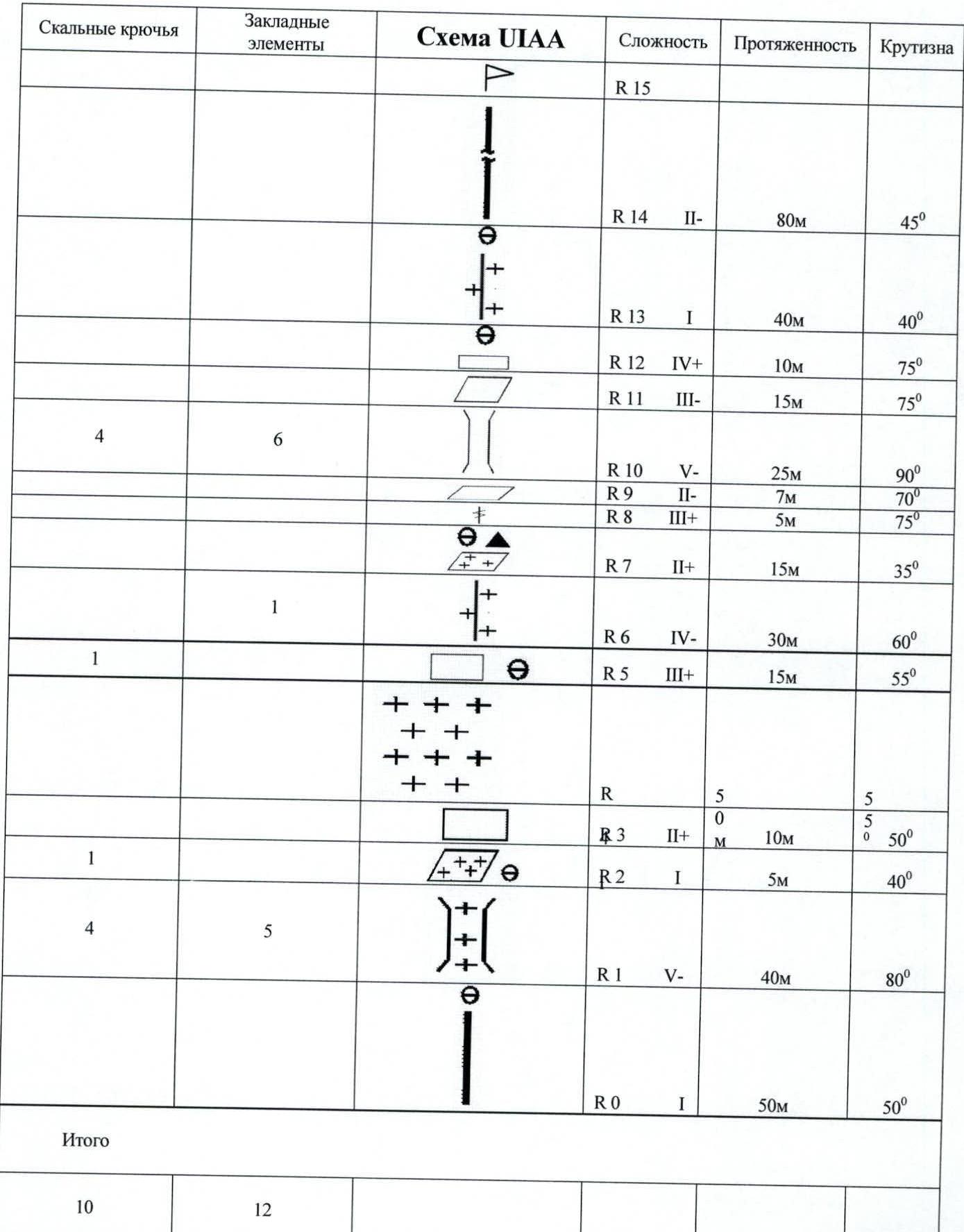
The approach is the same as to Krylya. On the terrace — to the right and along the couloir between Aviator and the left gendarme. Sect. R0–R1 50 m. 50° I+. Destroyed ridge. Sect. R1–R2 40 m. 80° V—. Chimney. Sect. R2–R3 5 m. 40° I+. Snow shelf to the left upwards. Sect. R3–R4 10 m. 50° II+. Large-block rocks. Sect. R4–R5 50 m. 40° I–. Snow slope to the left of the ridge. Sect. R5–R6 15 m. 55° III+. Monolith. Sect. R6–R7 30 m. 60° IV–. Blind crack with rime ice. Sect. R7–R8 15 m. 35° II+. Sloping snowy shelf to the left. Control tour in a vitamin can, hammered into a crack. Sect. R8–R9 5 m. 75° III+. Crack. Sect. R9–R10 7 m. 70° II–. Traverse along a narrow shelf to the right. Sect. R10–R11 25 m. 90° V—. Chimney. Sect. R11–R12 15 m. 75° III–. Traverse to the left. Sect. R12–R13 10 m. 75° IV+. Slabs. Sect. R13–R14 40 m. 40° I+. Snow slope. Sect. R14–R15 80 m. 45° II–. Snowy destroyed rocky ridge. 10 meters to the right to Aviator peak. Descent to the east behind the gendarme and then to the left into the North couloir.
Mt. Aviator 3333 m via North-Eastern counterfort category 3B.
| Rock Pitons | Wired Elements | UIAA Diagram | Difficulty | Length | Slope |
|---|---|---|---|---|---|
| R15 | |||||
| R14 | II– | 80 m | 45° | ||
| R13 | I | 40 m | 40° | ||
| R12 | IV+ | 10 m | 75° | ||
| R11 | III– | 15 m | 75° | ||
| 4 | 6 | R10 | V— | 25 m | 90° |
| R9 | II– | 7 m | 70° | ||
| R8 | III+ | 5 m | 75° | ||
| 1 | R7 | II+ | 15 m | 35° | |
| R6 | IV– | 30 m | 60° | ||
| 1 | R5 | III+ | 15 m | 55° | |
| R4 | |||||
| 1 | R3 | II+ | 10 m | 50° | |
| R2 | I | 5 m | 40° | ||
| 4 | 5 | R1 | V— | 40 m | 80° |
| R0 | I | 50 m | 50° | ||
| Total | 10 | 12 |
Mt. Aviator. Route 3B
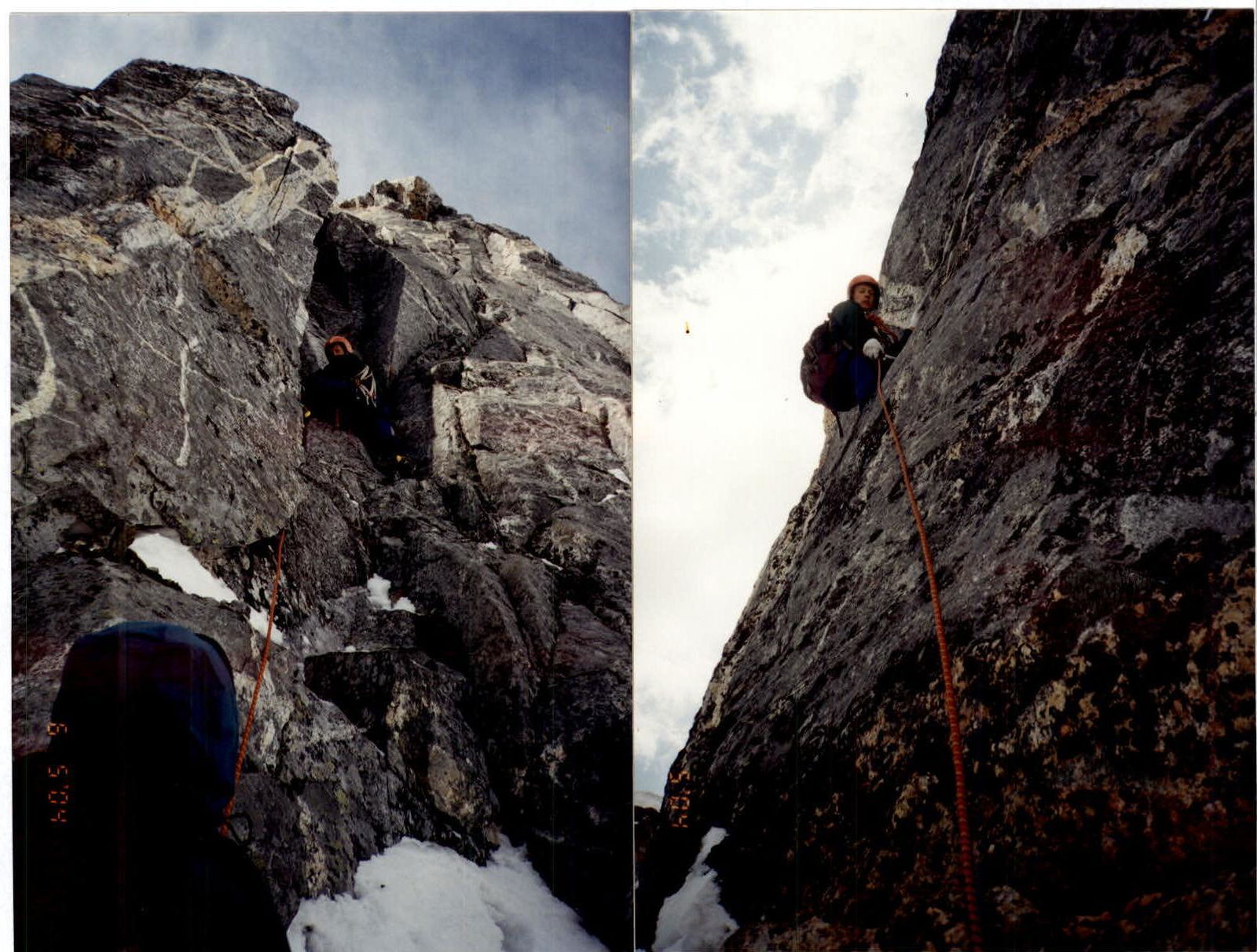
 Sections R1–R2, R6–R7.
Mt. Aviator. North-Eastern counterfort category 3B.
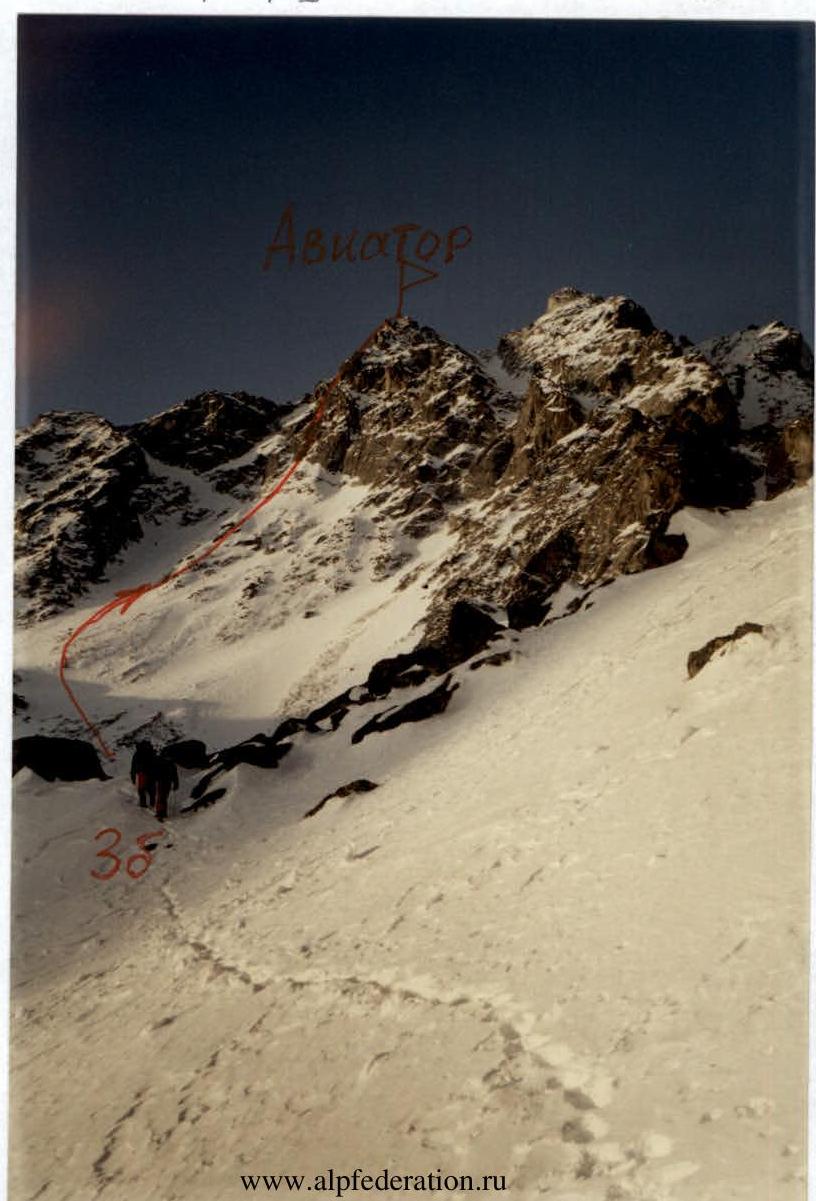 Start of the route. Approach.
Mt. Aviator. Route 3B (map-diagram)