Climbing passport for v. Aviator 3333 m, via the counterfort of the North-West ridge.
- Eastern Sayan, Bolshoy Mugovek ridge, section 6.1.1. 2. The summit Aviator (3333 m), counterfort of the North-West. 3. Proposed category of difficulty, first ascent. 4. The character of the route is rocky. 5. Height difference 350 m, length 585 m, average steepness 50°. 6. Pitons driven: rock and : 7. Team's walking hours — 8 hours. 8. No overnight stays on the route. 9. Group:
Kikina J
Description of the route to the summit Aviator (3333 m) via the North counterfort of the North-East ridge, op. 3i
The approach to the route from the base camp of the forest takes 3–4 hours.
To the lower part of the couloir:
- By Aviator and Krylya Sovetov approach with an approach to the route 3b on Aviator.
- Then move to the right along the left boundary of a vaguely defined scree snow-filled triangle in the direction of the left side of the North counterfort.
- Start the route along the inner corner to the left of the counterfort.
Sect. 0–R1 60 m. 50° II– Snowy inner corner: the side is vertical, short, the right one is wide.
Sect. R1–R2 40 m. 55° II– Snowy ledge to the right upwards.
Sect. R2–R3 20 m. 55° II+ Snowy ledge forward, counterfort.
Sect. R3–R4, 55 m, 65°, IV–, Inner corner on the left, cf. In the upper part, the left wall is vertical, a small ledge on the counterfort before a steep sharp corner.
Sect. R4–R5, 30 m, 35°, II+, Sharp rocky ridge.
Diagram of the route Cat. diff. on v. Aviator via NE ridge in UIAA symbols.
| v. Aviator | Length M | Steepness ° | Difficulty | Number of pitons driven | |
|---|---|---|---|---|---|
| 20 | 20 | II– | |||
| 100 | 50 | III+ | 1 | 4 | |
| 60 | 40 | III– | 1 | ||
| 30 | 40 | II+ | |||
| 120 | 40 | II+ | |||
| 90 | 55 | IV+ | 3 | 4 | |
| 30 | 35 | II+ | |||
| 55 | 65 | IV– | 3 | 2 | |
| 20 | 55 | II+ | |||
| 40 | 55 | II– | |||
| 60 | 50 | II– |
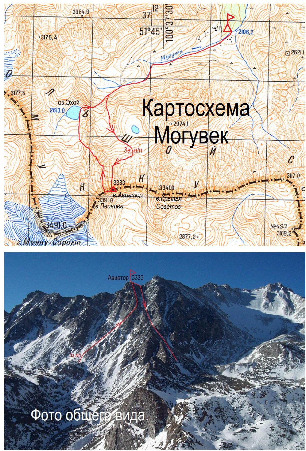
General
view photo.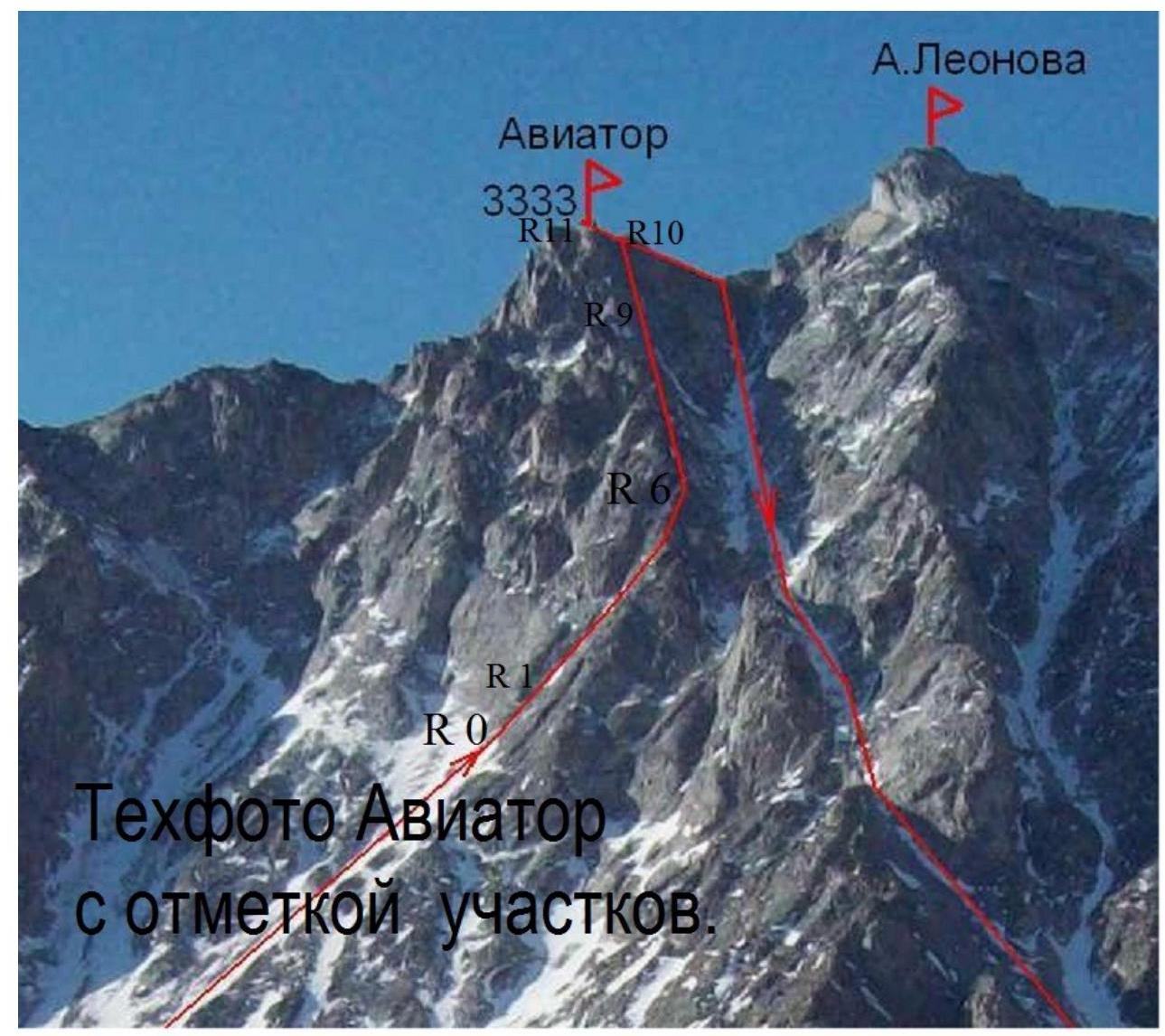
Text photo Aviator with section
marks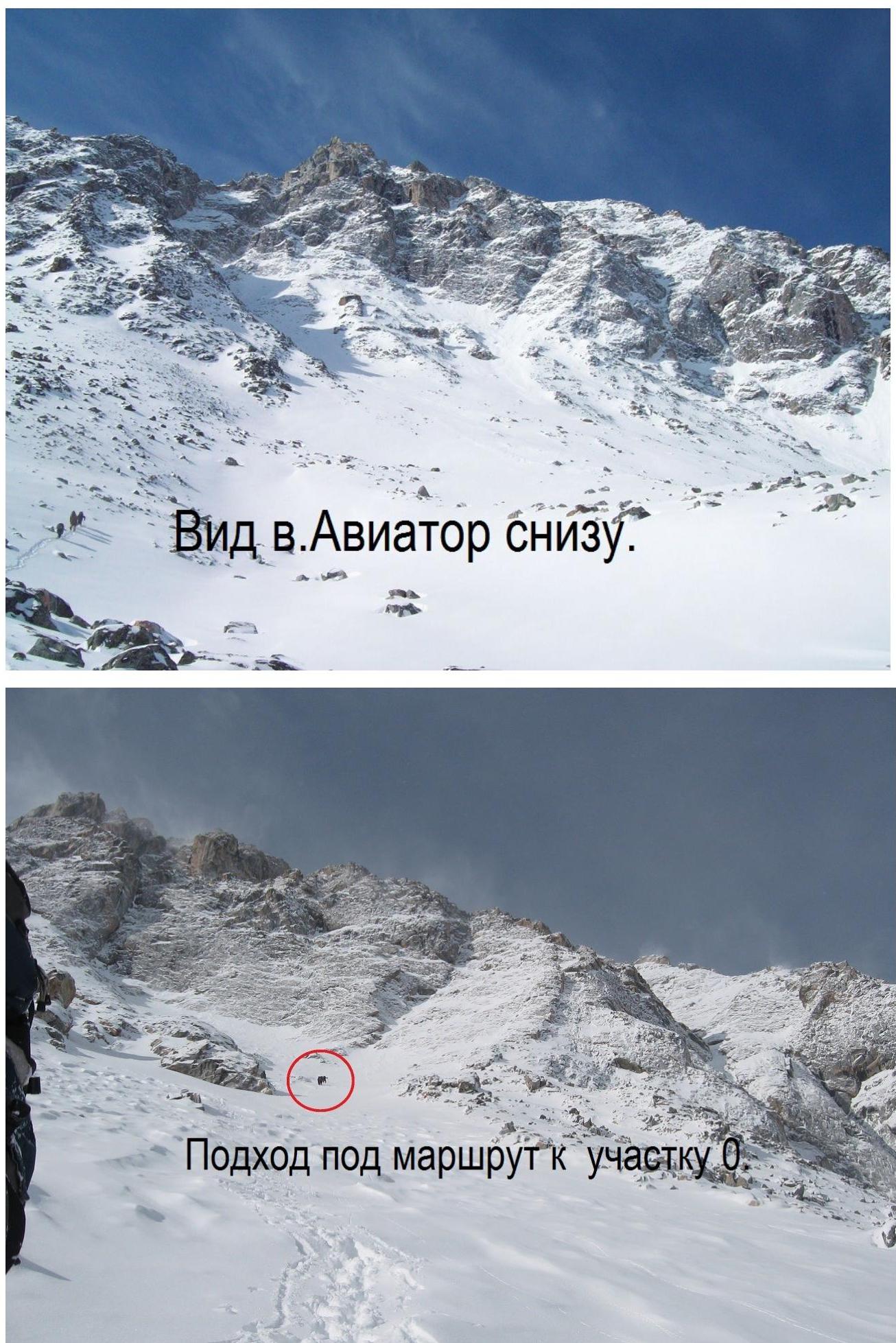
Approach to the route to section
R0.
On section
R1–R2.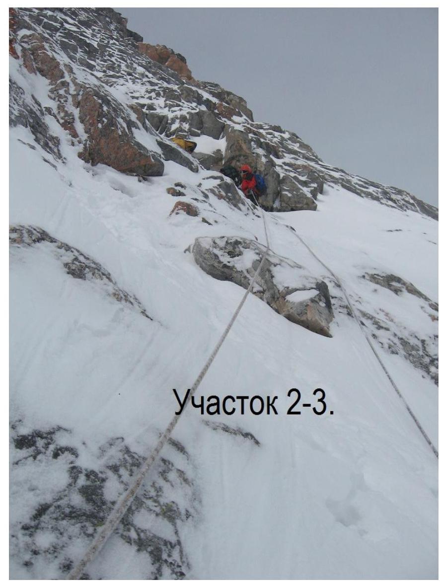
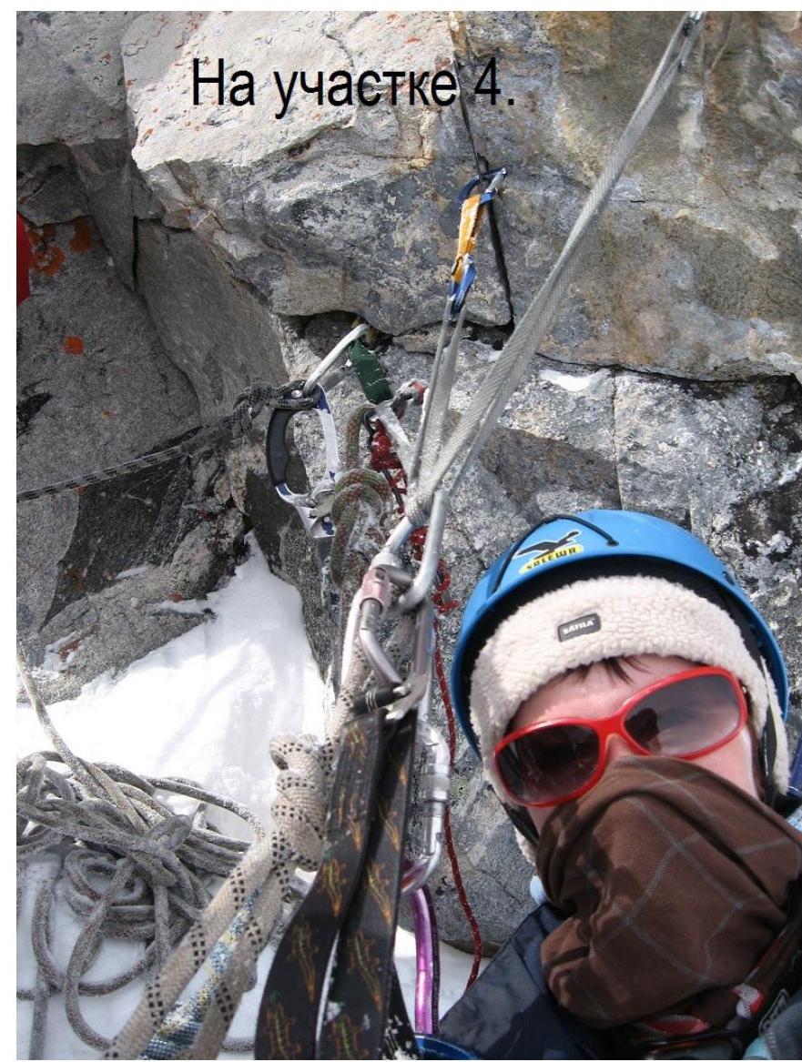
Section
R2–R3.