1. Climbing Passport
- Area: Yazgulemsky Ridge (Central Pamir). Valley: Grumm-Grzhimailo Glacier Section number according to the 1999 classification table — 4.12
- Name of the peak: Peak Revolyutsii. Name of the route: via the north-eastern slope from Grumm-Grzhimailo Glacier (via the plateau of Vertikal Pass).
- Proposed category — 5A cat. diff.
- Character of the route: Ice and snow
- Height difference of the route: 1174 m (by altimeter) Route length: 3047 m. Length of the section: 5 cat. diff. — 2 m, 6 cat. diff. — 0 m. Average steepness: main part of the route — 39° whole route — 23.8°
- Pitons left on the route: total — 0; including bolted pitons — 0. Pitons used on the route: Ice screws — 20, rock pitons — 0, Stationary bolted pitons — 0, including TCO — 0, Removable bolted pitons — 0, including TCO — 0. Total TCO used — 0.
- Team's climbing hours: 16 hours, 2 days
- Leader: Lebedev Andrey Aleksandrovich Participants: Lvov Vyacheslav Yuryevich; Malakhov Boris Vladimirovich; Nistratov Igor Igorevich; Rykalov Petr Vladimirovich. Reached 6900 m: Gabunia Zurab Richardovich; Maksimovich Yuri Aleksandrovich.
- Coach: Lebedev Andrey Aleksandrovich
- Departure to the route: 9:15 August 6, 1999 Reached the summit: 14:10 August 8, 1999 Descent to the base camp: 14:40 August 8, 1999
From the report on a mountaineering trip to Central Pamir. Together — Imeno Kemp. Russia — 1999.
2. Peak Photographs
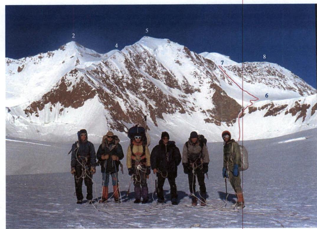 Fig.1. View of Peak Revolyutsii from Grumm-Grzhimailo Glacier.
Taken on August 9, 1999 after the ascent. Summits of Peak Revolyutsii:
Fig.1. View of Peak Revolyutsii from Grumm-Grzhimailo Glacier.
Taken on August 9, 1999 after the ascent. Summits of Peak Revolyutsii:
- 2 — Central,
- 4 — Main,
- 5 — Peak Vertikal (6424),
- 6 — plateau of Vertikal Pass,
- 7 — saddle of Revolyutsii Pass,
- 8 — peak 6350.
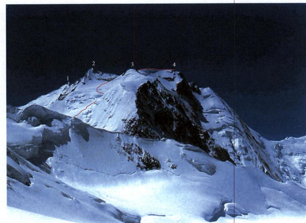 Fig.2. Peak Revolyutsii from north-northeast. Taken on August 5, 1999 from the
western slope of Omar Khayyam Pass. Summits of Peak Revolyutsii:
Fig.2. Peak Revolyutsii from north-northeast. Taken on August 5, 1999 from the
western slope of Omar Khayyam Pass. Summits of Peak Revolyutsii:
- 1 — South,
- 2 — Central,
- 3 — North,
- 4 — Main.
3. Area Map
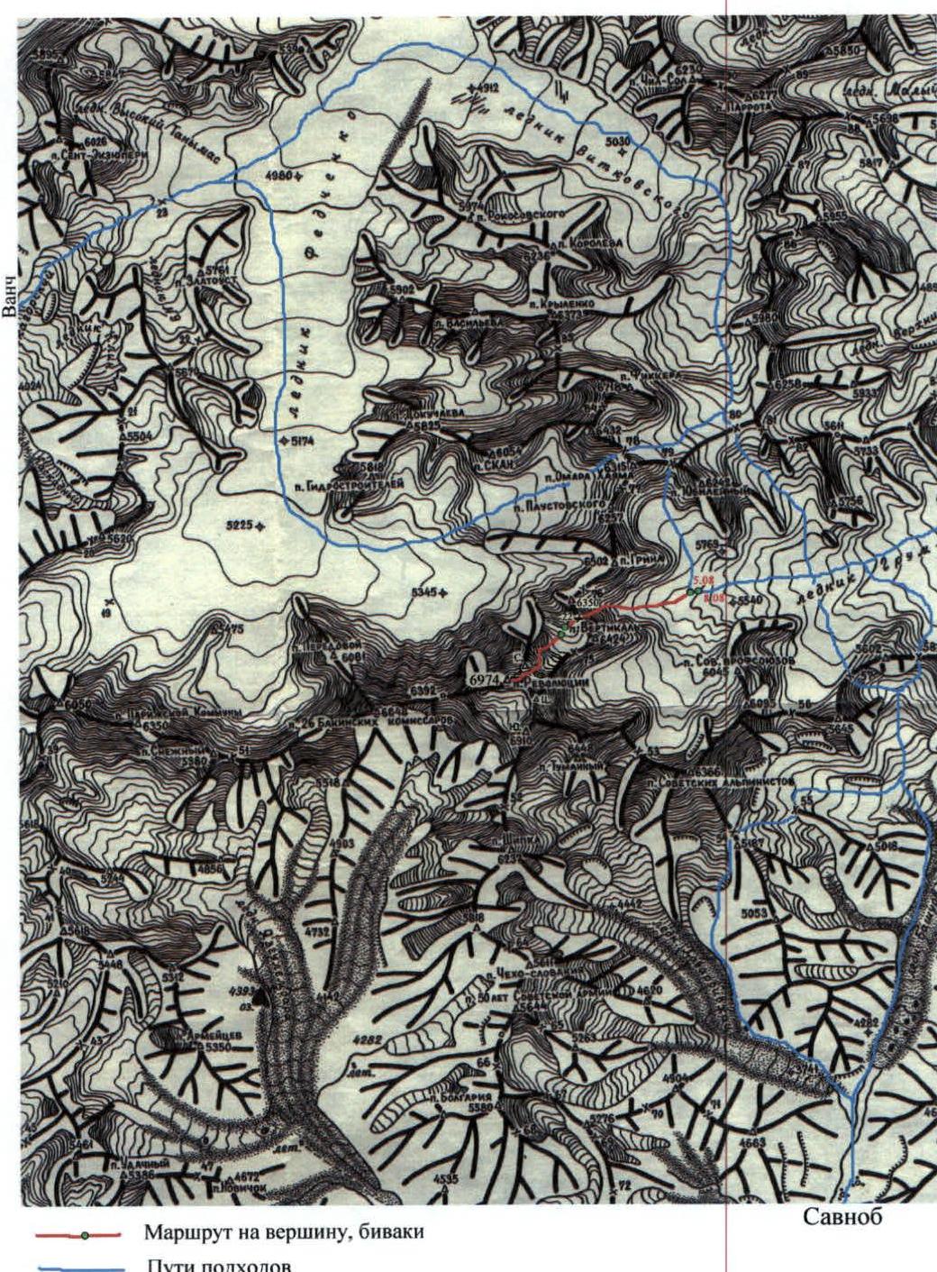
On the map: 23 — Abdukagor Pass; 78 — Omar Khayyam Pass; 79 — Yubileiny Pass; 80 — Zimovskikh Pass; 57 — Bartang Pass; 58 — Kamenny Tsvetok Pass; 76 — Vertikal Pass; 75 — Ugarov Saddle; 22 — Revolyutsii Pass; 54 — Zheleznodorozhnik Pass; 55 — Optimalny Pass.
4. Area Overview
Peak Revolyutsii (6974) is located in the Yazgulemsky Ridge at its junction with the northern spur, which separates the Fedchenko and Grumm-Grzhimailo Glaciers. Therefore, the northwestern and northern slopes of the peak descend to the Fedchenko Glacier, and the northeastern slopes — to the Grumm-Grzhimailo Glacier. The upper reaches of the Fedchenko Glacier can be accessed from the Vanch valley through Abdukagor Pass. The upper reaches of the Grumm-Grzhimailo Glacier can be accessed either from the Vítkovského Glacier through Zimovskikh Pass, or directly from the Fedchenko Glacier through the combination of Omar Khayyam and Yubileiny passes. From the south, from Savnob, it is easiest to reach the Grumm-Grzhimailo Glacier through Bartang or Kamenny Tsvetok passes. It is also possible to ascend along the Grumm-Grzhimailo Glacier from the Tanymas river valley. Our expedition used the combination of Omar Khayyam and Yubileiny passes and crossed on August 5, 1999 from the Fedchenko Glacier to the Grumm-Grzhimailo Glacier, where it set up an advanced base camp at the foot of Peak Revolyutsii.
5. Peak Diagrams
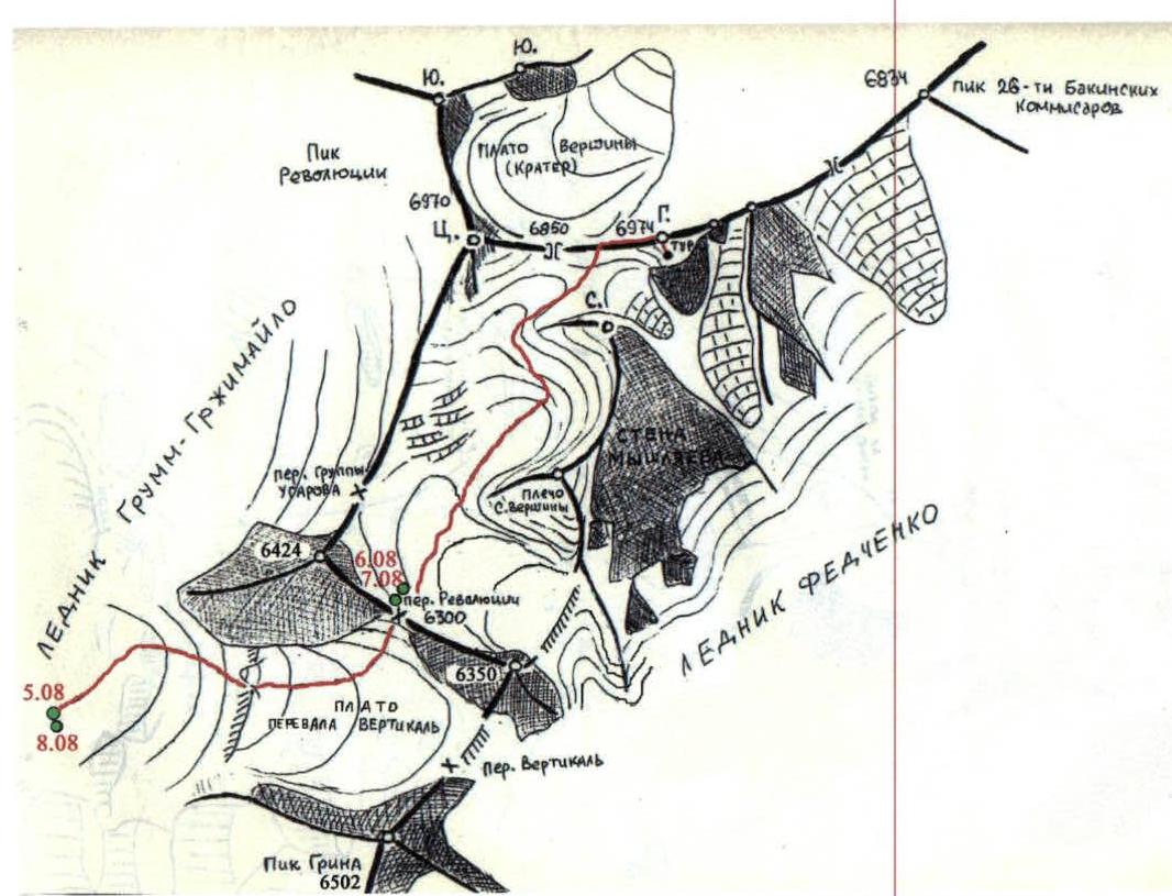
Diag.1. Map-diagram of the north-eastern slope of Peak Revolyutsii, Revolyutsii and Vertikal Passes
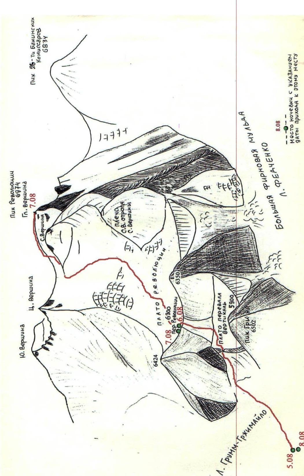
Diag.2. Structure of the north-eastern slope of Peak Revolyutsii, Revolyutsii and Vertikal Passes
6. Technical Photographs of the Route
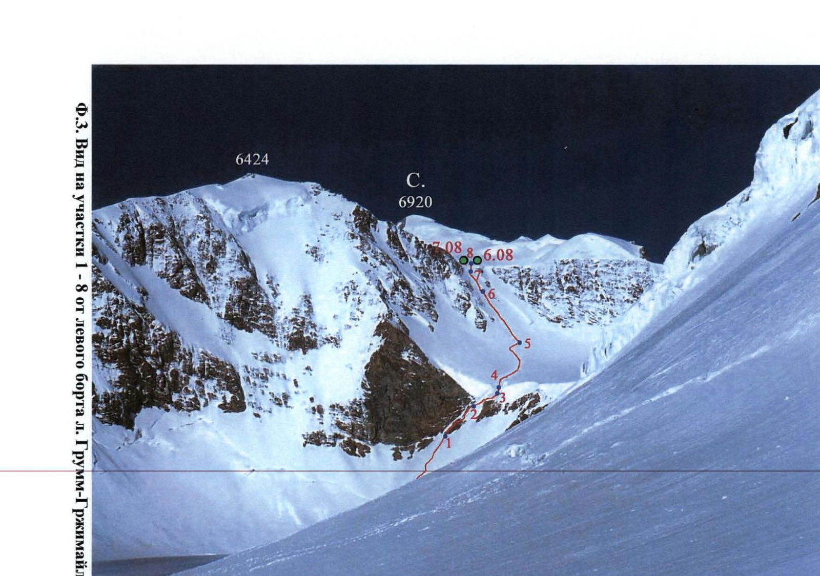 Fig.3. View of sections 1–8 from the left side of Grumm-Grzhimailo Glacier
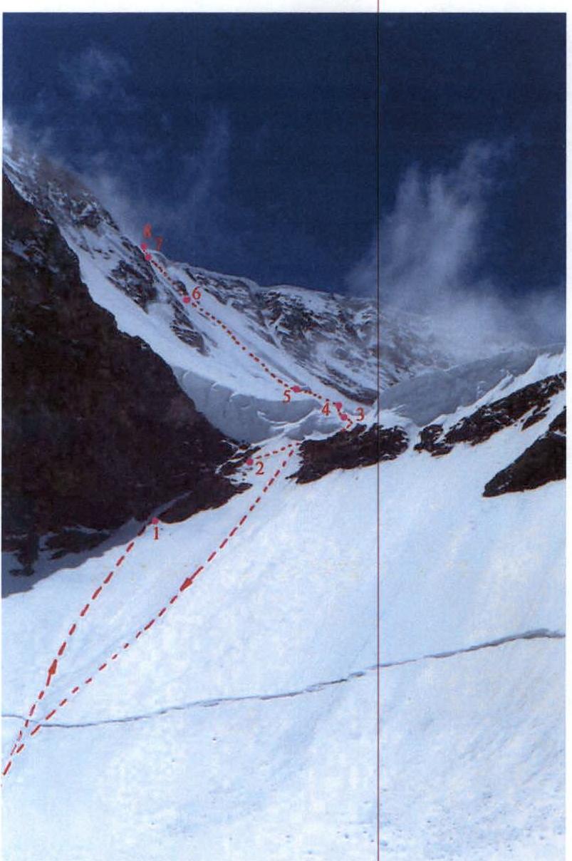 Fig.4. View of sections 1–8 from the foot of the peak.
On the plateau of Vertikal Pass, we ascended while
staying close to the rocks, as we were concerned about ice avalanches.
On the descent from the summit, we went straight down the slope.
Fig.4. View of sections 1–8 from the foot of the peak.
On the plateau of Vertikal Pass, we ascended while
staying close to the rocks, as we were concerned about ice avalanches.
On the descent from the summit, we went straight down the slope.
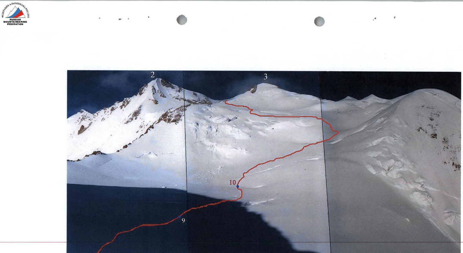 Fig.5. View of the Central and North summits of Peak Revolyutsii from Revolyutsii Pass. 2 — Central; 3 — North. Sections 9, 10
and almost the entire section 11 are visible.
Fig.5. View of the Central and North summits of Peak Revolyutsii from Revolyutsii Pass. 2 — Central; 3 — North. Sections 9, 10
and almost the entire section 11 are visible.
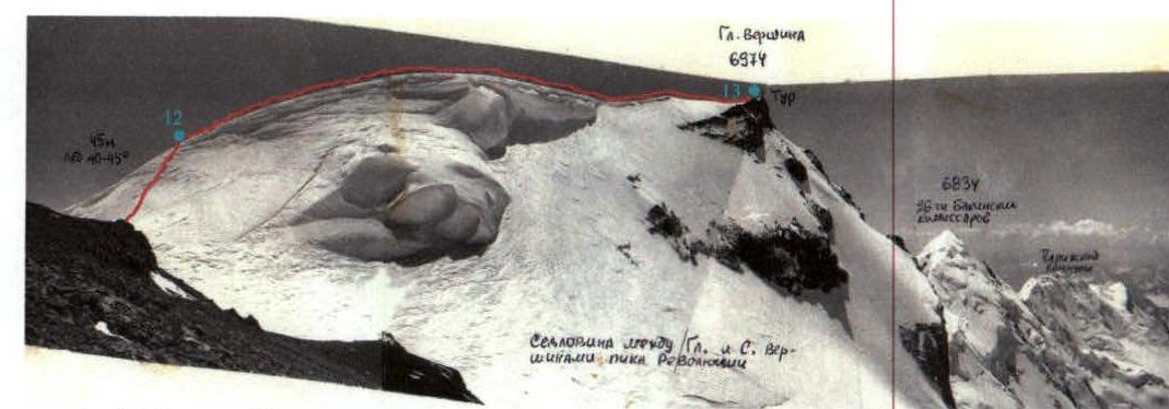 Fig.6. View from the North summit to the Main summit. Sections 12, 13 are visible.
Taken on August 9, 1990.
Fig.6. View from the North summit to the Main summit. Sections 12, 13 are visible.
Taken on August 9, 1990.
7. Route Sections Table
| № | Section Name | Start Height | End Height | Photo | Difficulty | Length (m) | Steepness (°) |
|---|---|---|---|---|---|---|---|
| 13 | Snow ridge | 6932 | 6974 | 2,6 | 1 | 250 | 0–15° |
| 12 | Ice slope | 6900 | 6932 | 6 | 3 | 45 | 45° |
| 11 | Snow-ice slope | 6200 | 6900 | 2,5 | 1 | 1600 | 20–25°, местами до 35° |
| 10 | Snow plateau | 6200 | 6200 | 5 | 1 | 100 | 0° |
| 9 | Snow slope | 6305 | 6200 | - | 1 | 220 | 25° |
| 8 | Ice wall (ledge) | 6303 | 6305 | 3,4 | 5 | 2 | 80° |
| 7 | Snow slope (Snow deep, loose) | 6242 | 6303 | 3,4 | 4 | 80 | 50° |
| 6 | Snow-ice slope | 6066 | 6242 | 3,4,8 | 3 | 250 | 45° |
| 5 | Snow plateau | 5998 | 6066 | 3,4 | 1 | 200 | 20° |
| 4 | Ice wall | 5990 | 5998 | 3,4 | 4 | 10 | 50° |
| 3 | Inclined traverse of ice slope | 5950 | 5990 | 3,4,7 | 3 | 80 | 45° |
| 2 | Broken rocks on slope | 5892 | 5950 | 3,4 | 2 | 80 | 45° |
| 1 | Ice slope | 5800 | 5892 | 3,4 | 3 | 130 | 45° |
9. Photo Illustrations
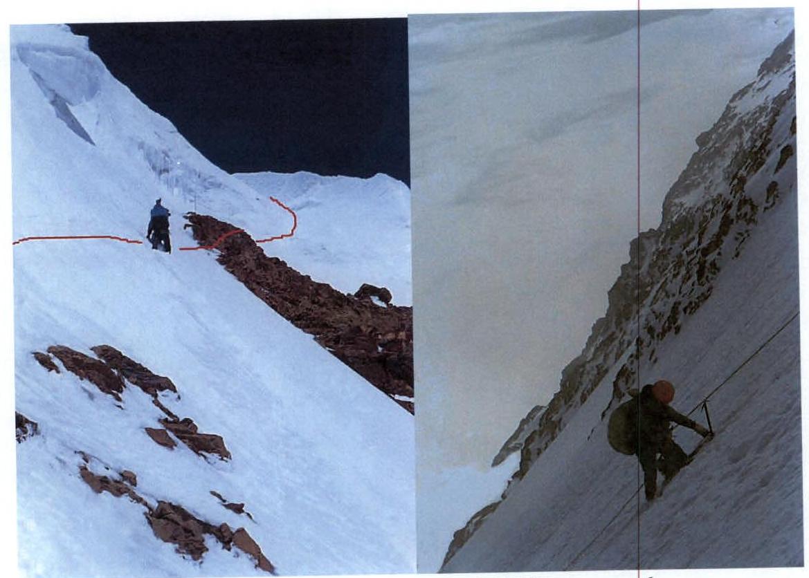 Fig.7. On section 3
Fig.8. On section 6
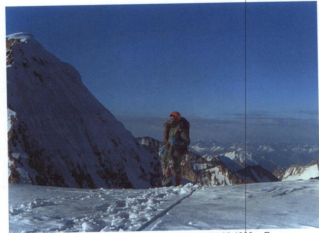 Fig.9. Ascent to Revolyutsii Pass on the evening of August 6, 1999. To the left,
the eastern wall of Peak Grin.
Fig.9. Ascent to Revolyutsii Pass on the evening of August 6, 1999. To the left,
the eastern wall of Peak Grin.