ASCENT DOCUMENT
- Ascent classification: Technical.
- Ascent region (as per ETMР): Pamir, Yazgulyam range, Rushan Gates area (Oduudy Pass).
- Peak, its height and ascent route: N. Polikarpov peak (4900) from the west.
- Expected difficulty category: 2A.
- Route characteristics: elevation gain – 500 m, average slope – 45°. Length of sections: R1–60 m, R2–40 m, R3–50 m.
- Number of pitons: for belay: rock – 4; ice –; bolted –. for creating artificial anchor points –.
- Number of climbing hours: 7–8.
- Number of nights, their characteristics: None.
- Surname, name and patronymic of the leader and participants, their sports qualification:
- Mashkov V.S. — Master of Sports
- Lorenz E.O. — Candidate for Master of Sports
- Pshenichny V.A. — 3rd sports category
- Tashmamatov D.
- Team coach: Lorenz E.O.
The group started the ascent and returned to the camp on August 16, 1985.
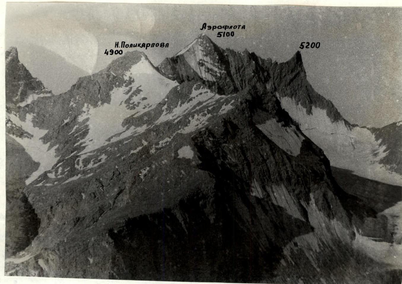
Area Map
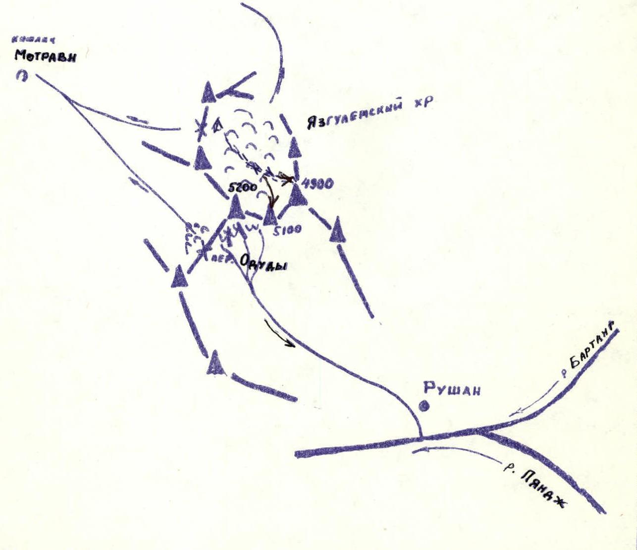

 The approach from the bivouac on the left lateral moraine to the start of the route takes just over an hour — 1 hour 20 minutes.
The route begins on steep, scree-covered western slopes; the ascent to the saddle takes 1.5–2 hours.
Further movement is along the scree-covered northern ridge towards the rocks. The lower part of the ridge is relatively gentle, but its steepness gradually increases. Some sections are bypassed on snow.
To the right of the rock wall, there is a small, wide chimney and then short walls and scree-covered ledges lead to a small monolithic rocky ridge. Then, along an inclined scree-covered ledge, an inner corner, and a traverse along a narrow ledge along the wall to an inner corner. The rocks are of medium difficulty. The further path to the summit:
- along a series of scree-covered inclined ledges under the summit tower.
- The ascent to the summit is via a short 4–5 m chimney-cleft.
The descent is via the ascent route. The ascent takes 7–8 hours.