Ascent Record
- Climbing category — technical
- Climbing area — Pamiro-Alai, Rushan Range
- Ascent route — first ascent to Peak Kosmonavtov via the east ridge (5420 m)
- Ascent characteristics:
- height difference — 700 m
- average steepness — 35–40°
- length of difficult sections — 100 m
- Pitons used:
- rock — 2
- ice —
- screw —
- Duration — 7 hours
- Number of bivouacs — none
- The ascent was made by a group of climbers from the sports committee expedition of the Tajik SSR.
- Surname, name, patronymic of the leader, participants and their qualification:
- Solovyov Mikhail Alexandrovich — 2nd sports category
- Belintsev Vyacheslav Timofeevich — 2nd sports category
- Kozlov Pavel Vladimirovich — 2nd sports category
- Kapitanova Tatyana Vasilyevna — 2nd sports category
- Suzdalev Sergey Semyonovich — 2nd sports category
- Team coach:
- Sogrin Sergey Nikolaevich — Master of Sports of the USSR
- The ascent was made on July 30, 1975.
Peak Kosmonavtov
(photo from Klunnikov pass)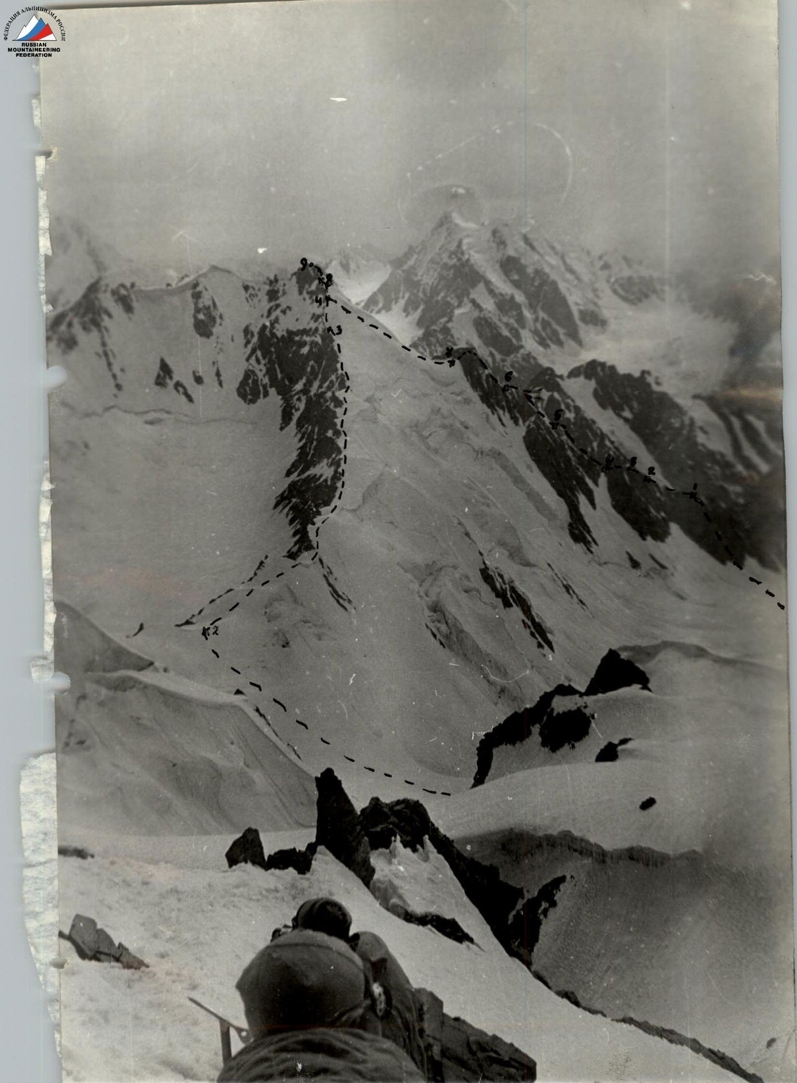
Description of the ascent route
From the expedition base camp, follow the trail through the Udariy summer pasture to the right moraine of the Raumid glacier, taking 4 hours to reach the bivouac.
- From the bivouac on the right lateral moraine of the Raumid glacier, move onto the glacier and approach the pass between Peak Klunnikov and Peak Kosmonavtov. The pass is the lowest point on the east ridge of Peak Kosmonavtov. The approach takes 1.5 hours.
- A snow slope of average steepness leads to the ridge. Simultaneous belay. The ascent to the ridge takes 0.5 hours.
- Ascend along the wide snow ridge to the pre-summit slope, taking 1.5 hours. Movement is simultaneous.
- The pre-summit slope is a snow slope with a steepness of 45–50°, leading to a ridge with cornices hanging to the left and above. Movement is alternating, belay via ice axe. Then, pass below the cornices on the left to reach the rocks forming the summit.
- The final ascent to the summit is via moderately difficult rocks and a rocky couloir. Belay is via pitons and rock features. Two rock pitons were used. The section is 60 m long.
The descent from the summit follows the ascent route.
The group assesses the route as Category 2A.
Table of main characteristics of the ascent route
Ascent route — Peak Kosmonavtov via the east ridge.
| № | Steepness | Length | Character of section | Category of difficulty | Method of movement / belay | Quality of belay | Time | Rock pitons | Ice screws | Screw pitons | Snow anchors | Notes |
|---|---|---|---|---|---|---|---|---|---|---|---|---|
| R0 | 10° | 3 km | Closed glacier | - | Simultaneous movement | Good | 1.5 h | - | - | - | - | At the moraine in a tent |
| R1 | 40–45° | 200 m | Snow slope | 2 | Simultaneous belay | Good | 0.5 h | - | - | - | - | - |
| R2 | 25–30° | 1.5 km | Snow ridge | 1 | Simultaneous movement | Good | 1.5 h | - | - | - | - | - |
| R3 | 45–50° | 60 m | Snow slope, ridge | 2 | Belay via ice axe | Good | 1 h | - | - | - | - | - |
| R4 | 50° | 60 m | Rocky outcrops and couloir | 2 | Piton belay and via rock features | Good | 0.5 h | 2 | - | - | - | - |
Coach — Sogrin S.N., Master of Sports of the USSR. Group leader — Solovyov M.A., 2nd sports category.