Report on the First Ascent of Peak 5965 (Leonard Euler Peak, 6022)
Moscow, 2013
1. Climbing Passport
Region: Zaalaysky Ridge (North Pamir). Valley: Nura. Classification table section number for 2013: 4.4. Peak name: Euler Peak. Route name: via the northwestern edge and northern ridge. Proposed category: 4A. Route type: ice and snow. Height difference: 1540 m. Route length: 3400 m. Average steepness: 27°. Hooks left on the route: 0. Hooks used on the route: ice screws - 24. Team's total climbing hours: 18 hours, 2.5 days. Team leader: Andrei Alexandrovich Lebedev (Moscow), Master of Sports of International Class in tourism. Team members:
- Andrei Viktorovich Zharov (Moscow, Zelenograd)
- Ivan Nikolaevich Zhdanov (Moscow)
- Yuri Alexandrovich Maksimovich (Moscow)
- Bogdan Dmitrievich Savchinskiy (Kiev) Coach: Andrei Alexandrovich Lebedev Departure for the route: 8:00 AM, August 8, 2013. Reaching the summit: 2:00 PM, August 9, 2013. Descent to Nura Glacier: 12:00 PM, August 10, 2013.
2. Photo of the Peak
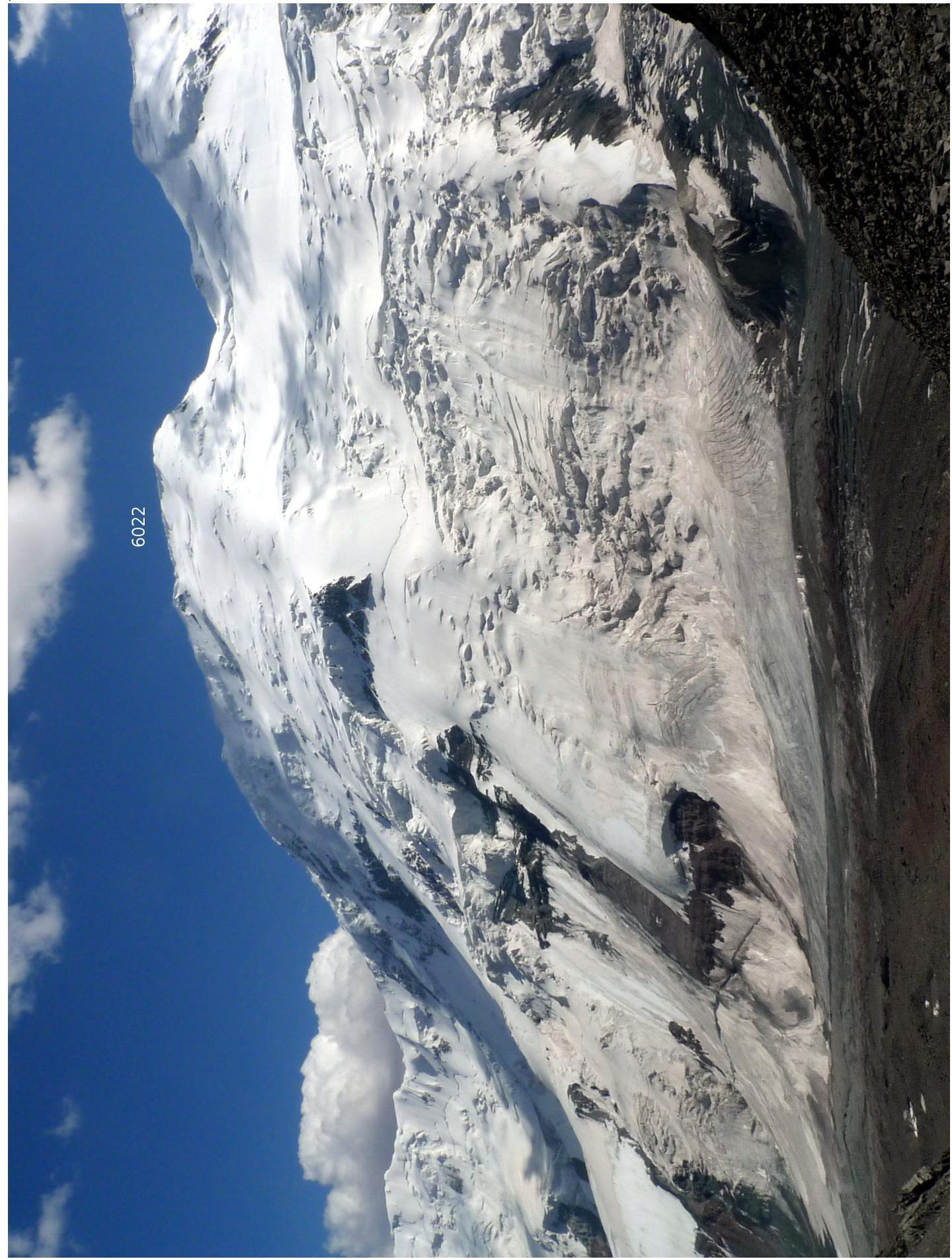 Fig.1. View of Euler Peak from the north, from the southern slope of Verkhniy Nura Pass (5050, 3A).
3. General Information about the Peak
As the first ascenders, we named the peak after Leonard Euler - Peak 5985 (according to V. Lyapin's diagram) or 5965 (according to the General Staff map), located on the border between Kyrgyzstan and China, in the watershed of the Zaalaysky Ridge, 4 km east of Zarya Vostoka Peak (6349). The coordinates of the highest point: 39° 27.81′ N, 73° 42.11′ E.
4. The Peak in a Panorama
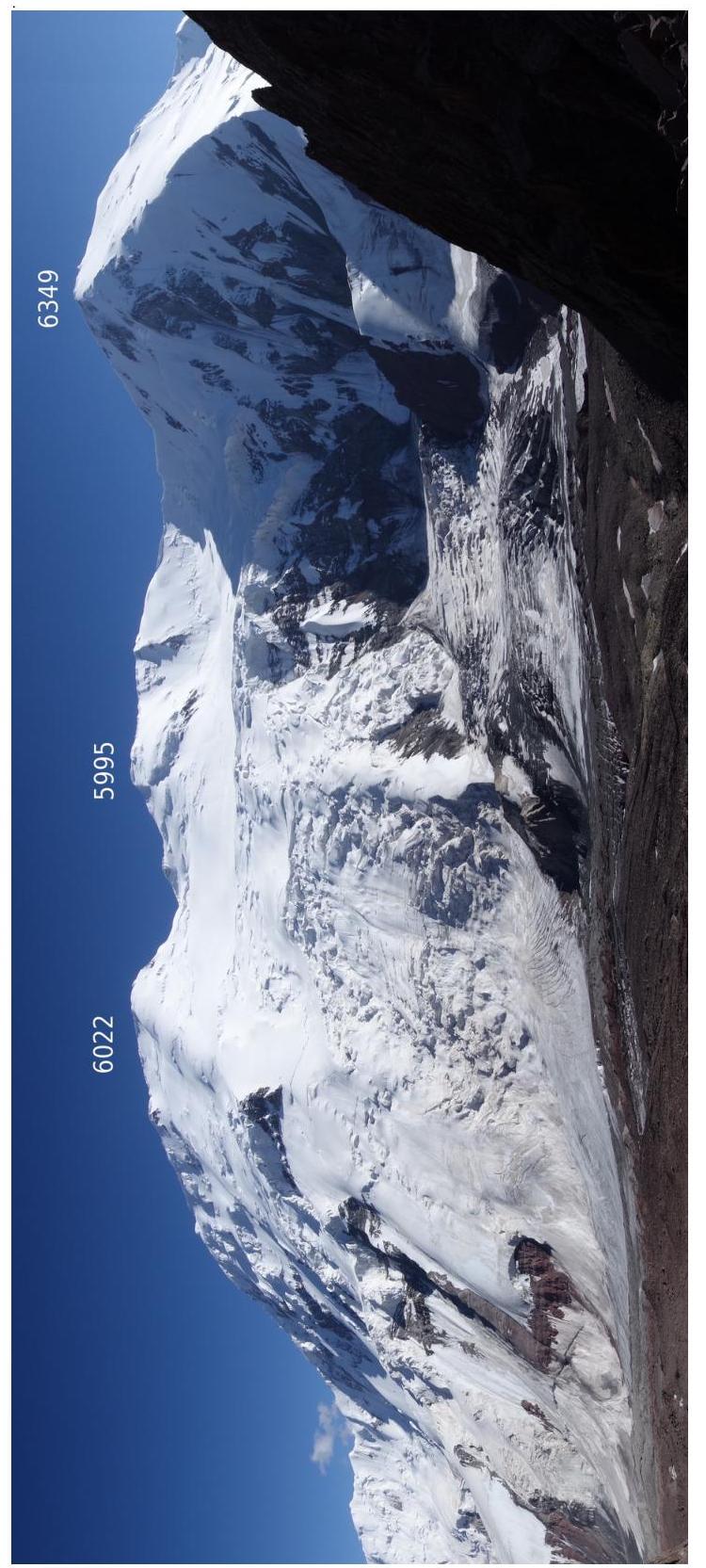 Fig.2. View from the north, from the southern slope of Verkhniy Nura Pass. From left to right:
- Euler Peak (6022)
- Peak 5995
- Zarya Vostoka (6349).
5. The Peak on a Schematic Map

Fig.1. Euler Peak on Vadim Lyapin's schematic map.
6. Motivation behind the Peak's Name
In 2009, a successful German expedition to Irkeshtam (Otchaylo) Peak (5820 m) took place [1], located in the Zaalaysky Ridge, 15 km east of Euler Peak. The expedition named Irkeshtam Peak as Leibniz Peak, after the outstanding German mathematician, one of the founders of differential and integral calculus. For patriotic reasons, we decided to name Peak 6022 (5985, 5965) after Leonard Euler - no less an outstanding mathematician, a genius of all times and peoples, favorite of Catherine the Great, academician of the St. Petersburg Academy of Sciences, author of the famous formula exp(ix) = cos(x) + i·sin(x), and many other equally significant results.
7. Data Confirming the Height of 6022 m
On Vadim Lyapin's schematic map and the General Staff map, another peak, 5995, is identified between Peak 5985 (5965) and Zarya Vostoka. However, when observed from Euler Peak, this peak was below the horizon. In Photo 3, a view from Euler Peak to the west is presented. A horizontal line is drawn below the horizon from the peaks of the Sarykalinsky Ridge - Chukurbashi (5811) and Krasnykh Komandirov (5821), which are known to be lower than Euler Peak. This line touches the highest point of Peak 5995 on the right. This allows us to conclude that Euler Peak is higher than Peak 5995. Indeed, at the summit of Euler Peak, our GPS receiver, with a stable signal from 12 satellites, consistently showed 6022 m.
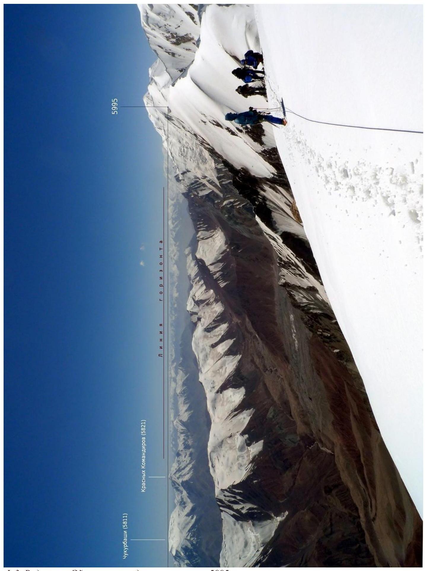
Fig. 3. View from Euler Peak to the west towards Peak 5995.
8. Technical Photograph of the Route
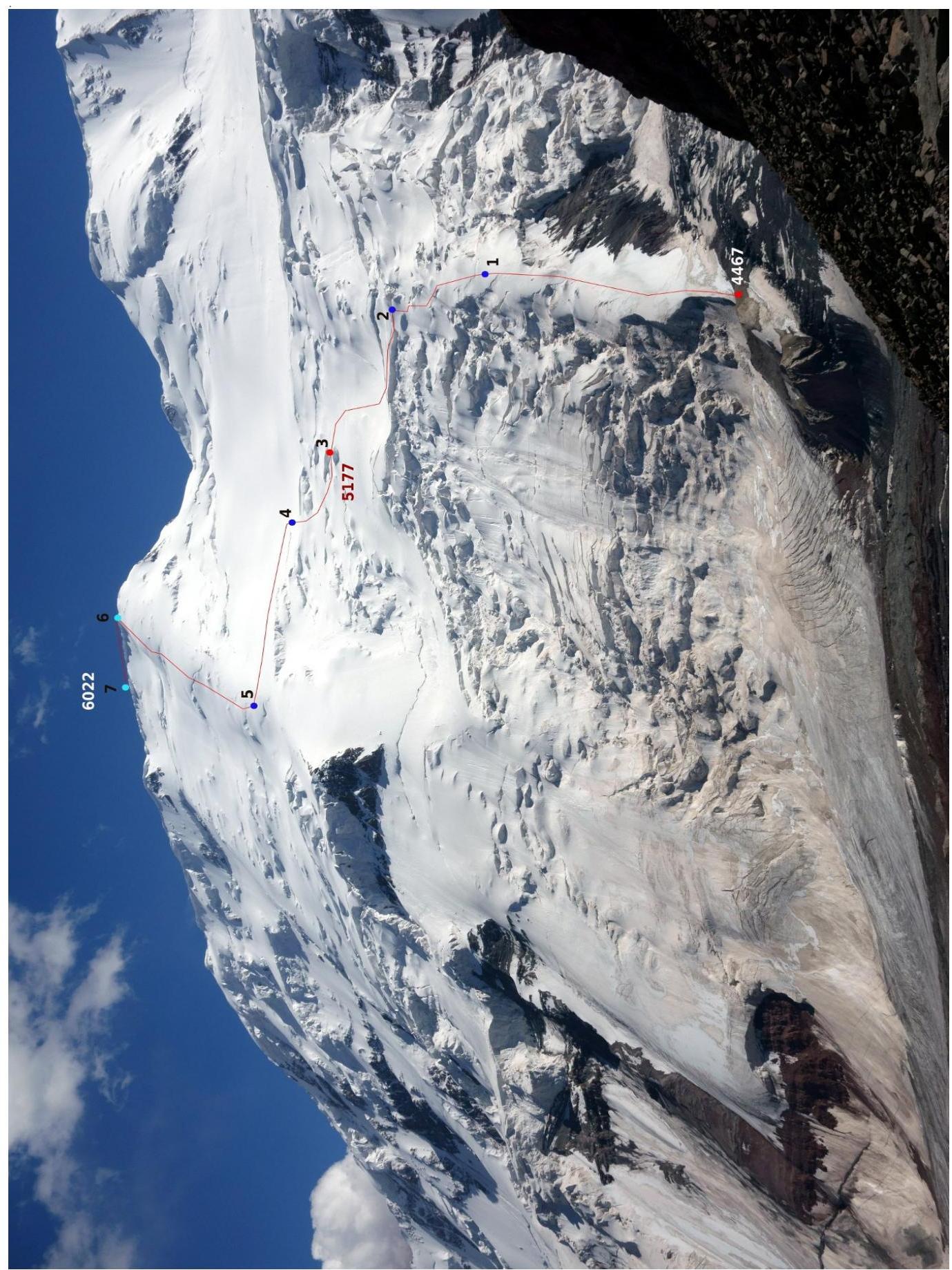 Fig.4. View of Euler Peak from the north, from the southern slope of Verkhniy Nura Pass. Black numbers mark the ends of route sections described in Table 1.
- 4467 - advanced base camp
- 5177 - assault camp
9. Characteristics of Route Sections
| N | Section Name | Start Height | End Height | ΔH | Projected Length | Path Length | Steep. | Character |
|---|---|---|---|---|---|---|---|---|
| 1 | Ice Edge | 4480 | 4830 | 350 | 540 | 643 | 33° | Lower half of the path - open ice |
| 2 | Icefall | 4830 | 5000 | 170 | 250 | 302 | 34° | Alternating ice fractures and short steep snow-ice ascents |
| 3 | Traverse of Snow Slope | 5000 | 5177 | 177 | 450 | 483 | 21° | |
| 4 | Icefall | 5177 | 5280 | 103 | 210 | 234 | 26° | Navigating between fractures |
| 5 | Traverse of Snow Slope | 5280 | 5450 | 170 | 550 | 575 | 17° | |
| 6 | Northern Ridge | 5450 | 5945 | 495 | 710 | 865 | 35° | Wide firn-covered ridge, occasional hard ice outcrops |
| 7 | Summit Ridge | 5945 | 6022 | 77 | 300 | 310 | 14° | Relatively wide snow ridge with cornices to the north |
| TOTAL | 1542 | 3010 | 3412 | 27° |
Table 1. Characteristics of route sections.
10. Route Profile
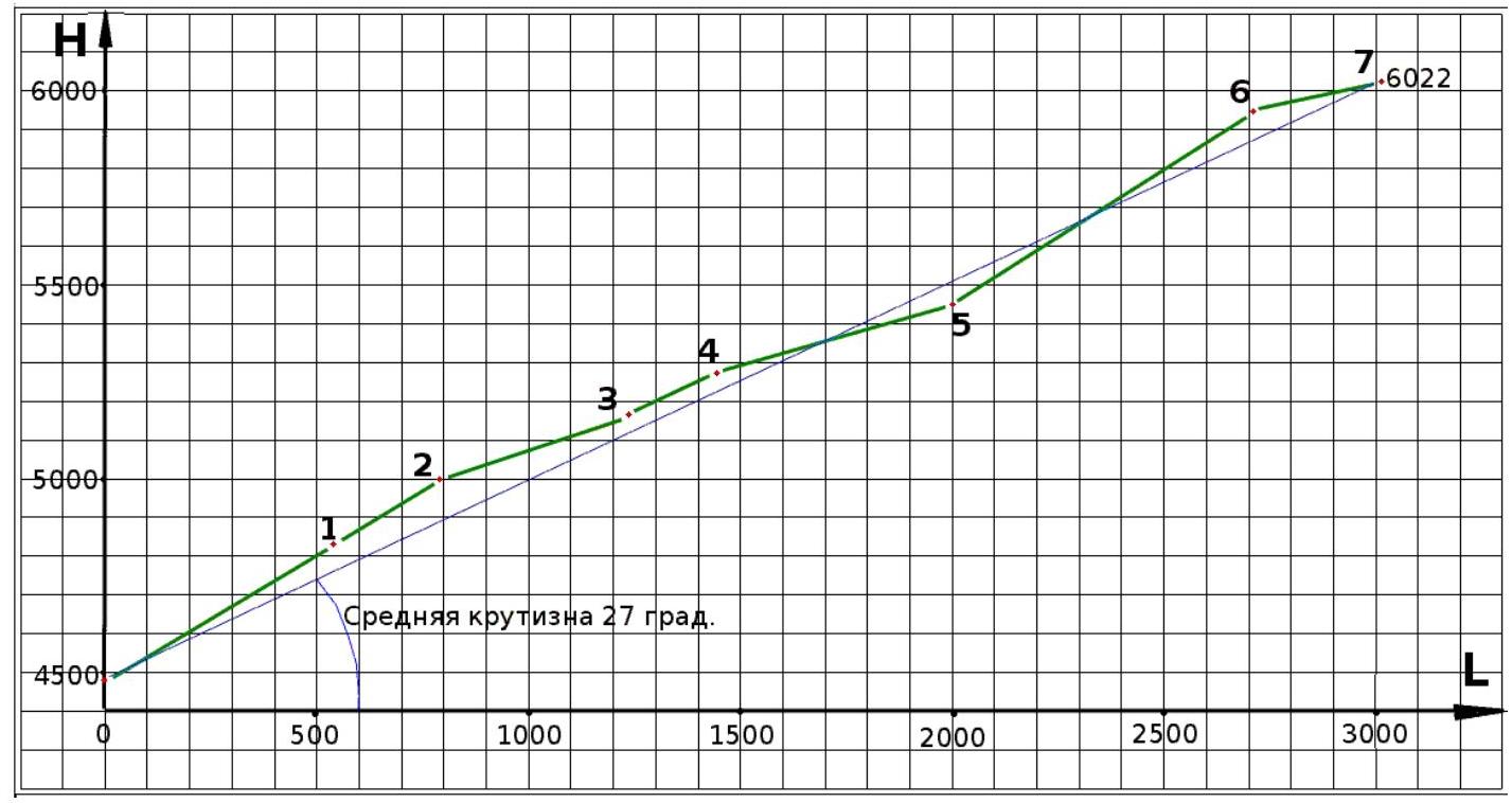
Fig. 2. Route profile. Black numbers mark the ends of route sections described in Table 1.
11. Photographic Materials and Ascent Description
On August 8, at 8:00 AM, we began our ascent. Directly from the talus slopes (4467 m), where we had spent the night, an ice edge led upwards (Section 1).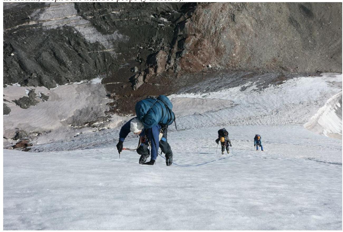 Fig. 5. At the bottom, the edge was truly icy, so we traversed about 300 m in a rope team with ice screw protection. I warned the group about the high risk of a long fall, especially for the second climber, and emphasized the need to make every effort to self-arrest in case of a fall.
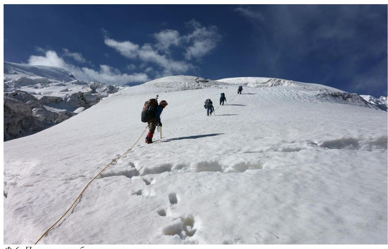 Fig. 6. Later, snow appeared on the edge.
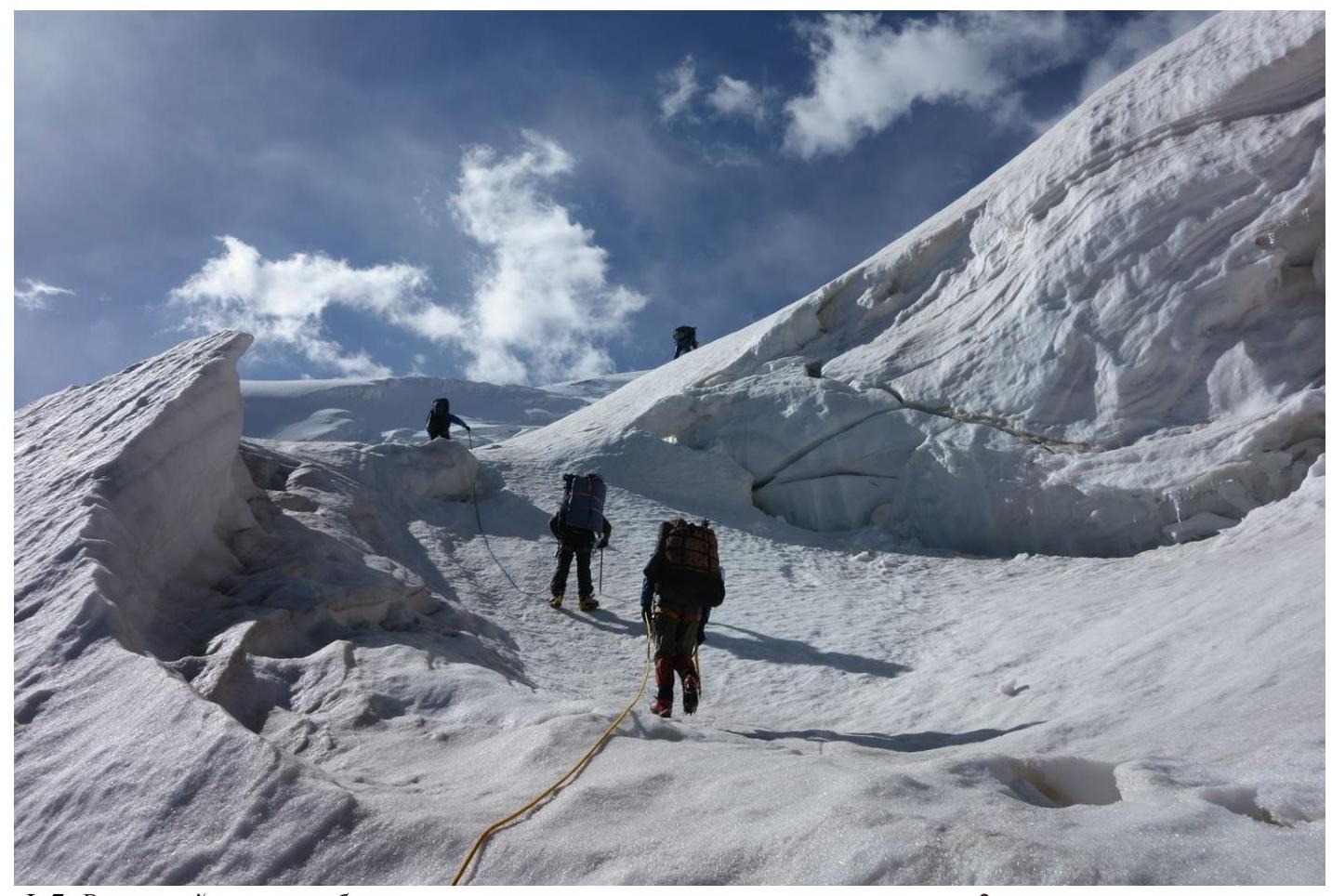 Fig. 7. At the top of the edge, we entered a zone of fractures, marking the start of Section 2.
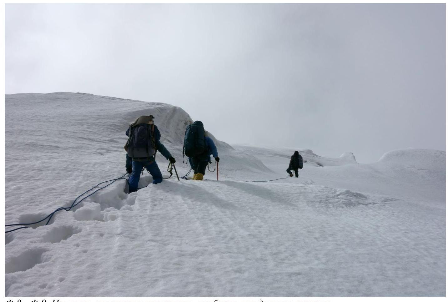 Fig.8—Fig.9. A grueling trek ensued, particularly challenging on the ascents.
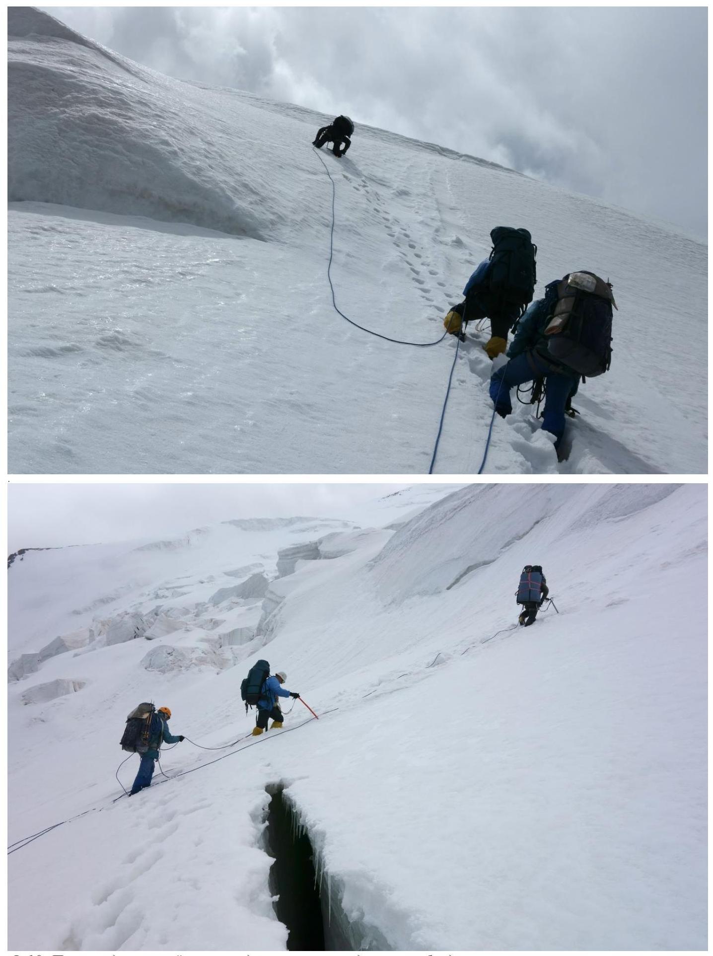 Fig. 10. Ascending the steep sections alternated with crossing bottomless crevasses on fragile snow bridges.
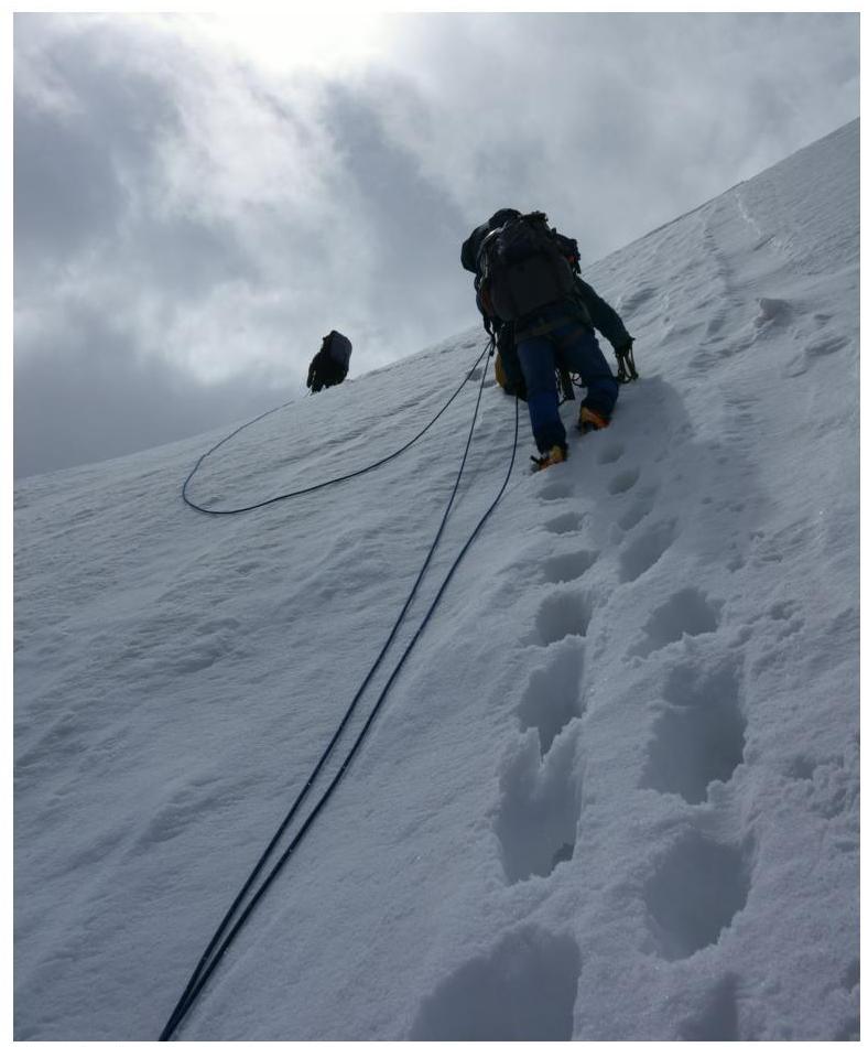 Fig.11. Another ascent.
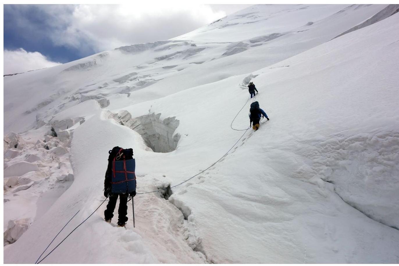 Fig.12. Approaching Section 3. It was nearing noon, and we were already very tired in the snow, so after passing another ascent and the subsequent series of fractures, we hastened to find a place to camp.
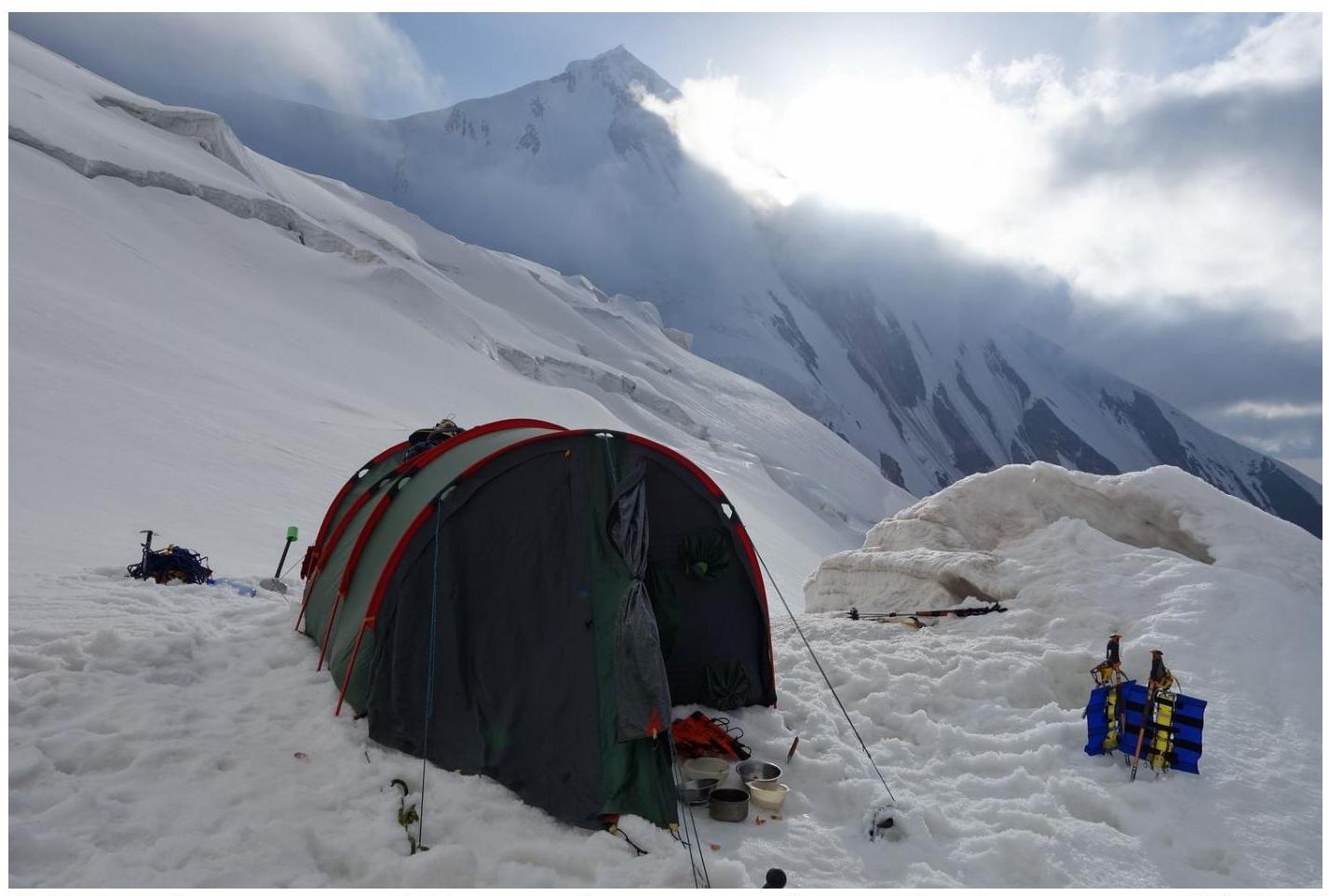 Fig.13. Here, at 5177 m, we set up our assault camp. Camp coordinates: 39° 28.43′ N, 73° 41.53′ E.
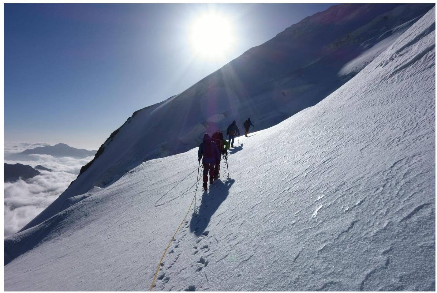 Fig.14. On August 9, at 9:00 AM, we set out towards the northern ridge of Euler Peak. Section 4.
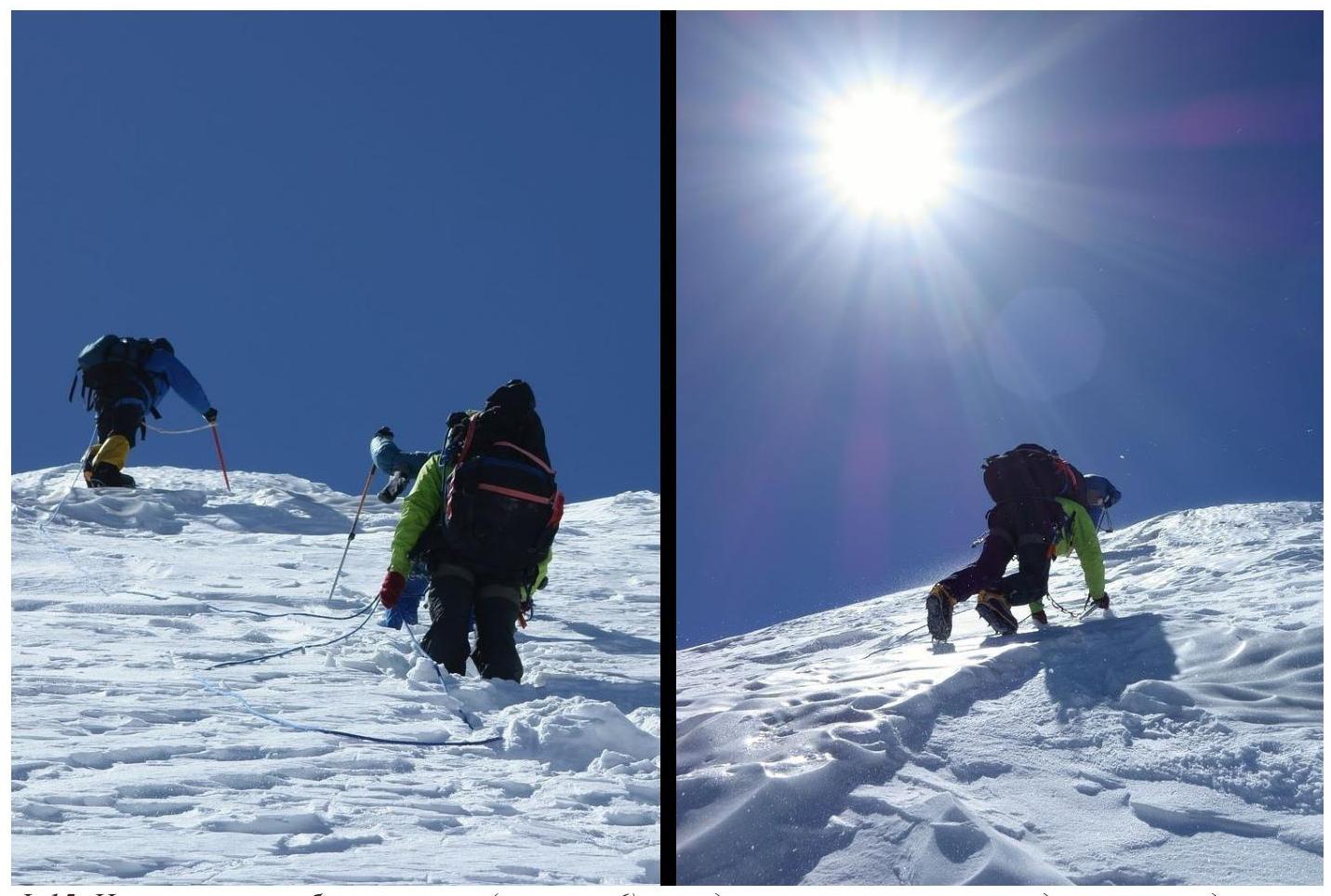 Fig.15. On the northern ridge of the peak (Section 6), we encountered steep sections and even hard, blown ice.
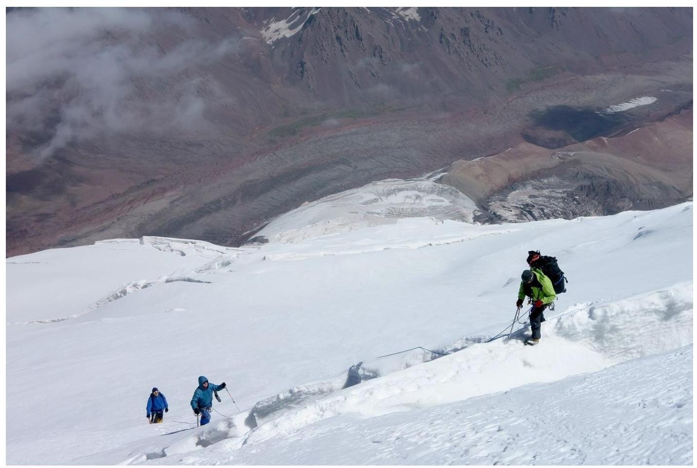 Fig.16. We also encountered fractures. However, overall, the northern ridge was much simpler than the approach to the assault camp. It was just physically demanding, as we had to ascend 800 m on untracked snow and descend before sunset.
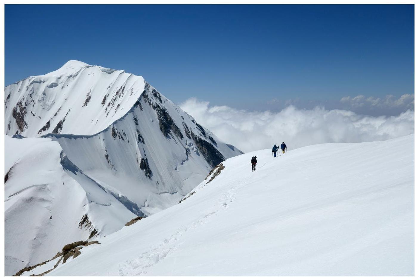 Fig.17. Finally, we reached the summit ridge (entered Section 7). We were on the western shoulder of Euler Peak (6002). Behind us was Zarya Vostoka (6349).
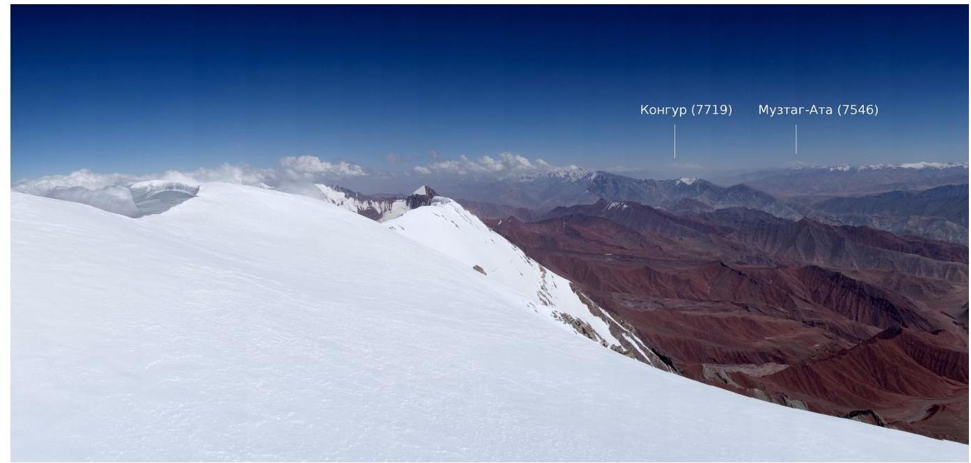 Fig.18. This is a photo taken five meters from the highest point. The highest point is on a cornice. From the vantage point, it's clear that the ridge to the east descends. Visible are the peaks of Kongur (7719) and Muztagh Ata (7546). Coordinates of the vantage point: 39° 27.81′ N, 73° 42.11′ E. Height 6022 m.
The view from the same point to the west is shown in Fig. 3.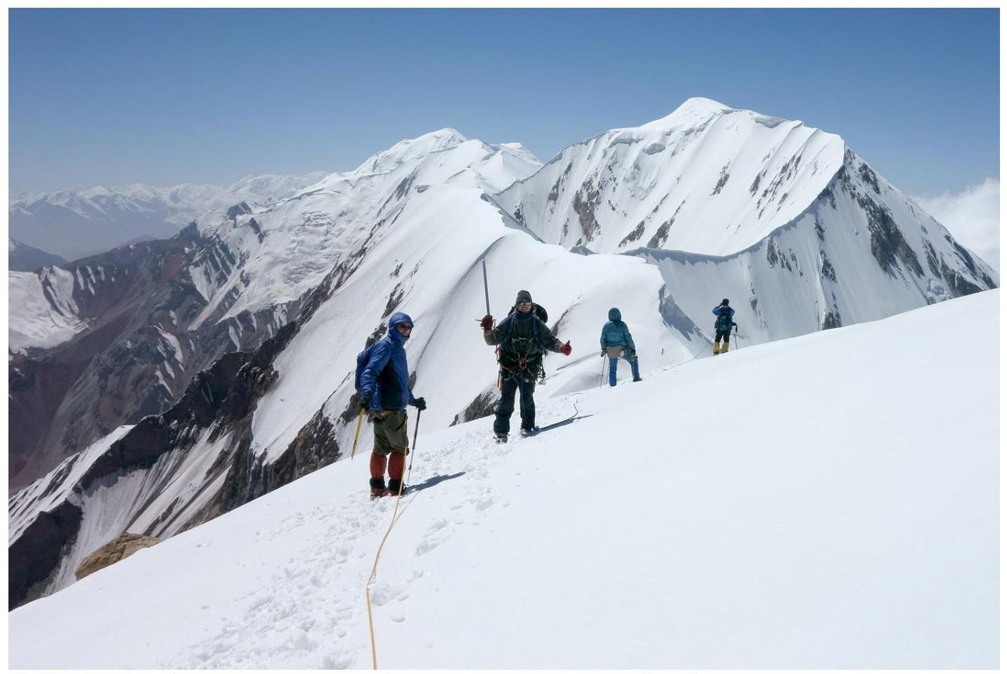 Fig.19. Well, it was time to hurry back to camp. We waved our ice axes in farewell and headed down.
12. Report Authors
- Andrei Lebedev (text, table, graph, photo markup)
- Andrei Zharov (photographs)
- Ivan Zhdanov (photographs)
13. References
- Pik Leibniz. http://de.wikipedia.org/wiki/Pik_Leibniz↗
- A.A. Lebedev. The tale of how we discovered the easternmost six-thousander of the Zaalaysky Ridge. Risk website, 2013. http://www.risk.ru/users/leb/199381↗
- A.A. Lebedev. Report on a mountaineering trip in the Eastern Zaalai region, 2013. http://static.turclubmai.ru/papers/2116↗