Report on the First Ascent of Petrovskogo Peak (4700 m) via the Southwest Ridge
Climbing Report
Climbing Details
- Pamir. Trans-Alay Range.
Petrovskogo Peak 4700 m. Assumed category 4B, first ascent. Rock climbing.
Height difference: 600 m.
Route length (wall section): 900 m.
- Section lengths: II–III — 700 m, IV — 150 m, V — 50 m
- Average slope: main part of the route — 40°.
- Number of pitons left on the route: total — 0;
- Total gear used on the route: ice screws — 0, rock pitons — 7, chocks — 30.
- Total number of artificial protection points (ITOs) used — 0.
- Team's total climbing hours: 11 hours, 1 day (without overnight stays)
- Team:
Sergey Seliverstov (leader)
- Pavel Vyazovetsky
- Viktor Filinov
- Senior coach: Fedor Efimovich Popov
- Departure from base camp: 8:00, August 12, 2015.
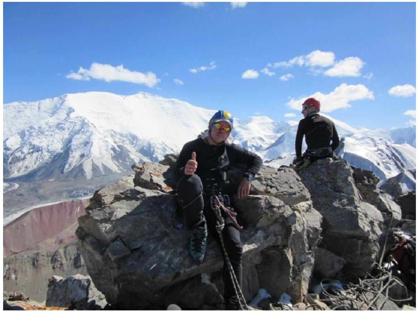
Reached the summit: 17:00, August 12, 2015.
Returned to base camp: 19:00, August 12, 2015.
View of the summit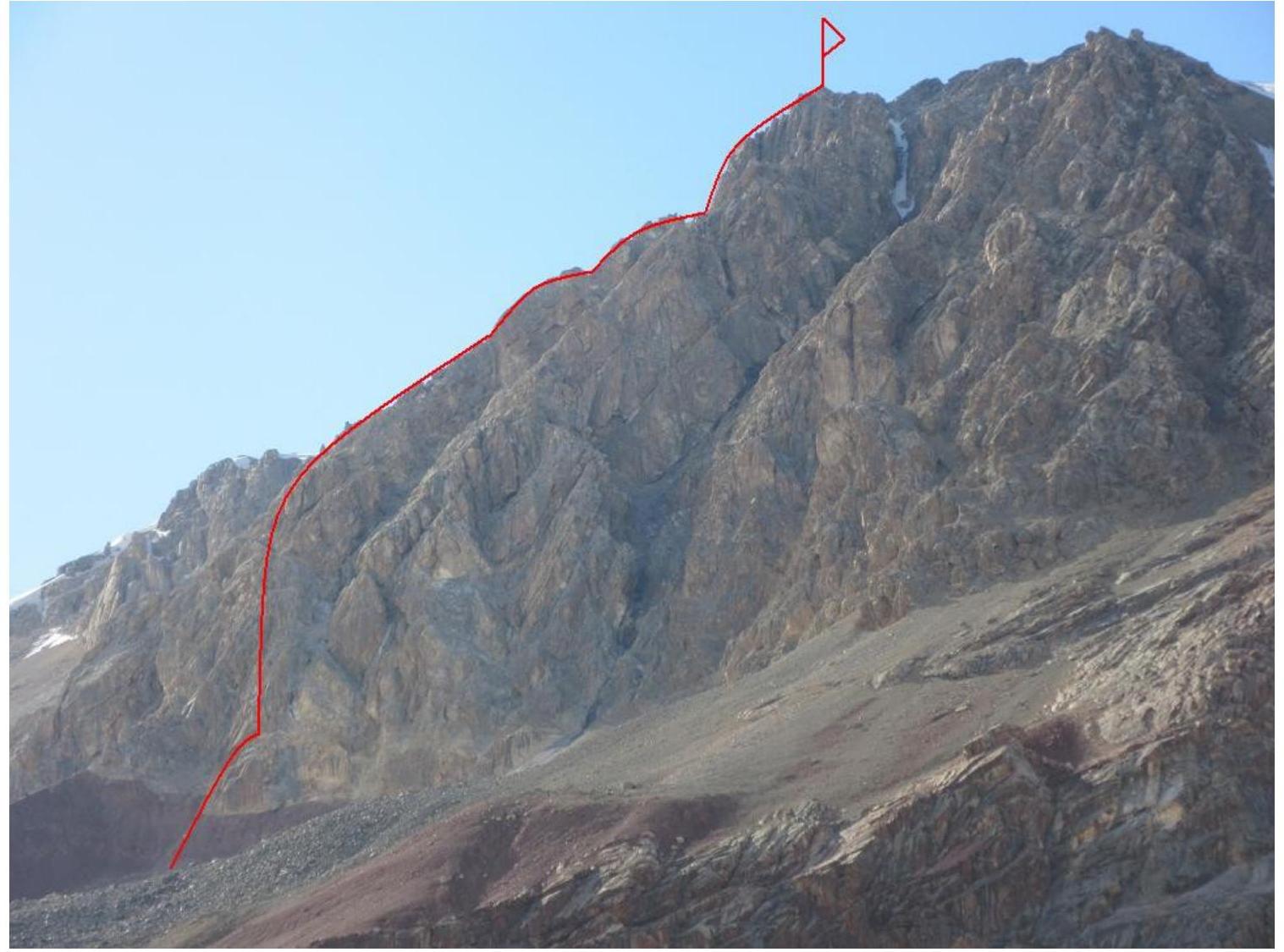
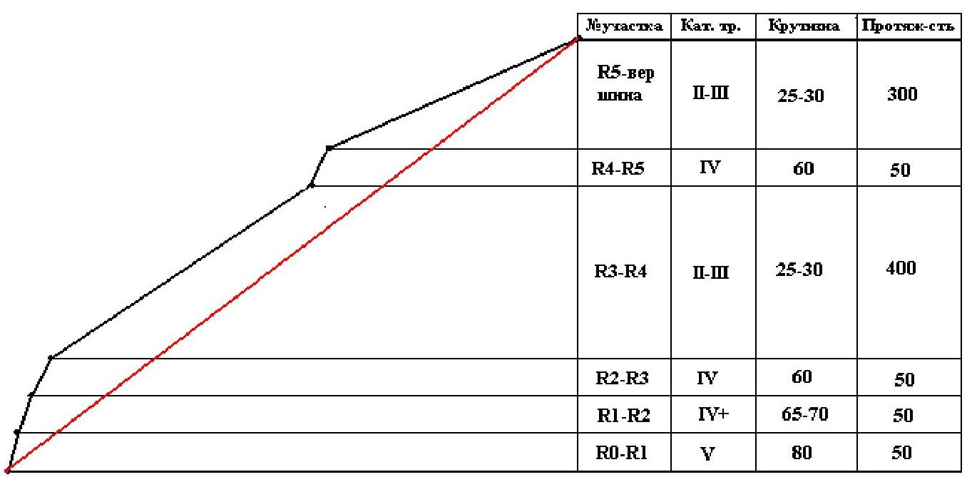
Route scheme今 θP₅, 300 m, 25–30°, II–III
今 θR₄, 50 m, 60°, IV
θ R₁, 50 m, 60°, IV
θ
θ R₁, 50 m, 65–80°, IV+
θ
θ, 50 m, 80°, V
Route Profile
Route Description
Departed from Achiik-Tasha base camp at 8:00. Reached the route at 11:00. Reached the summit at 17:00. Descended to base camp at 19:00.
From Achiik-Tasha, followed a normal trail to Lukovaya glade. Then turned right, down to the river. Crossed the main river and followed the right dry stream bed westward and upward.
Then exited the stream bed onto a moraine and followed it to the start of the climbing route. Approached the rock wall via a steep, hard clay slope. 50–70 meters of unpleasant climbing with no protection and risk of falling. Climbed with ice axes.
Reached the corner and began rock climbing.
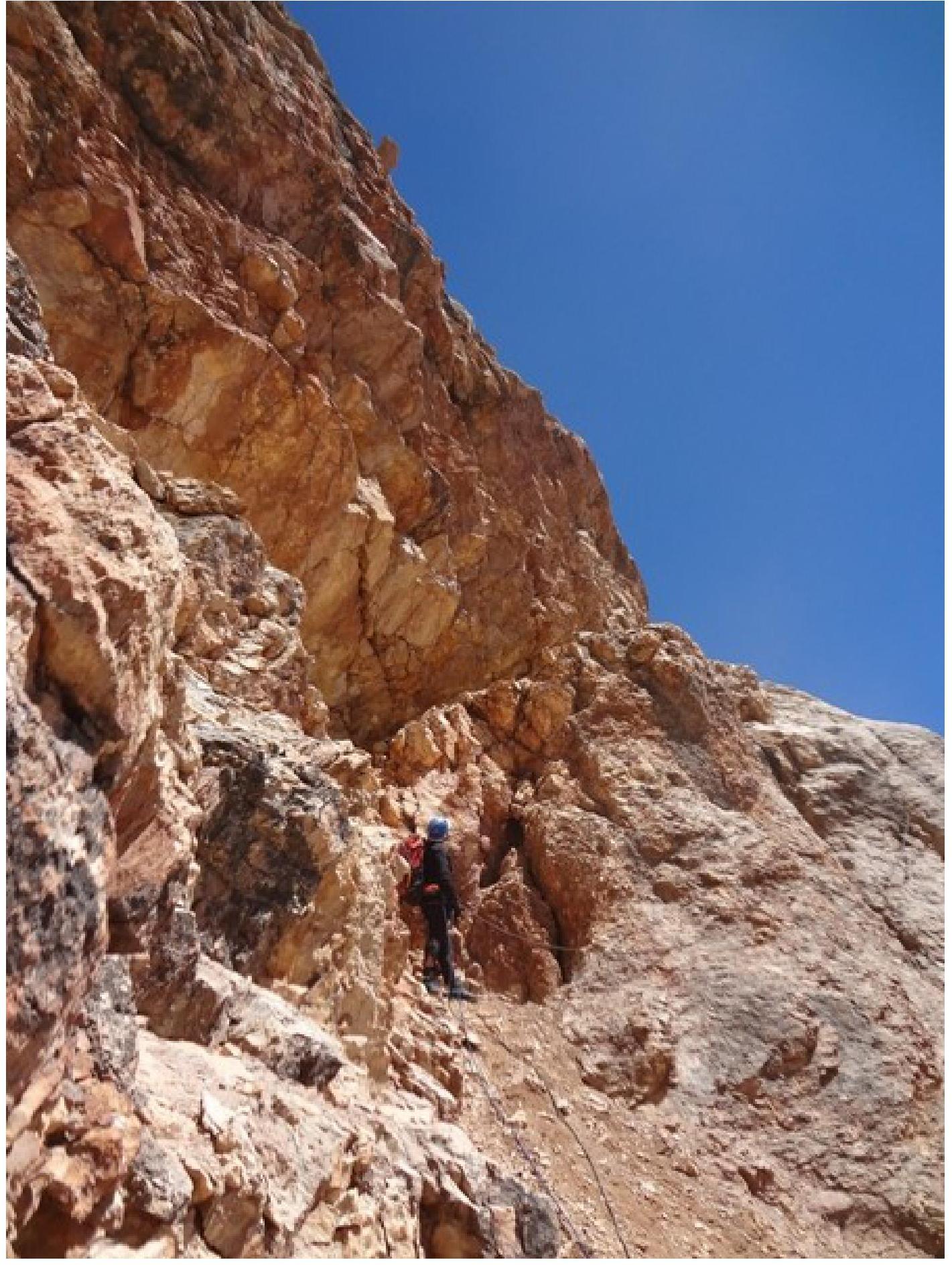
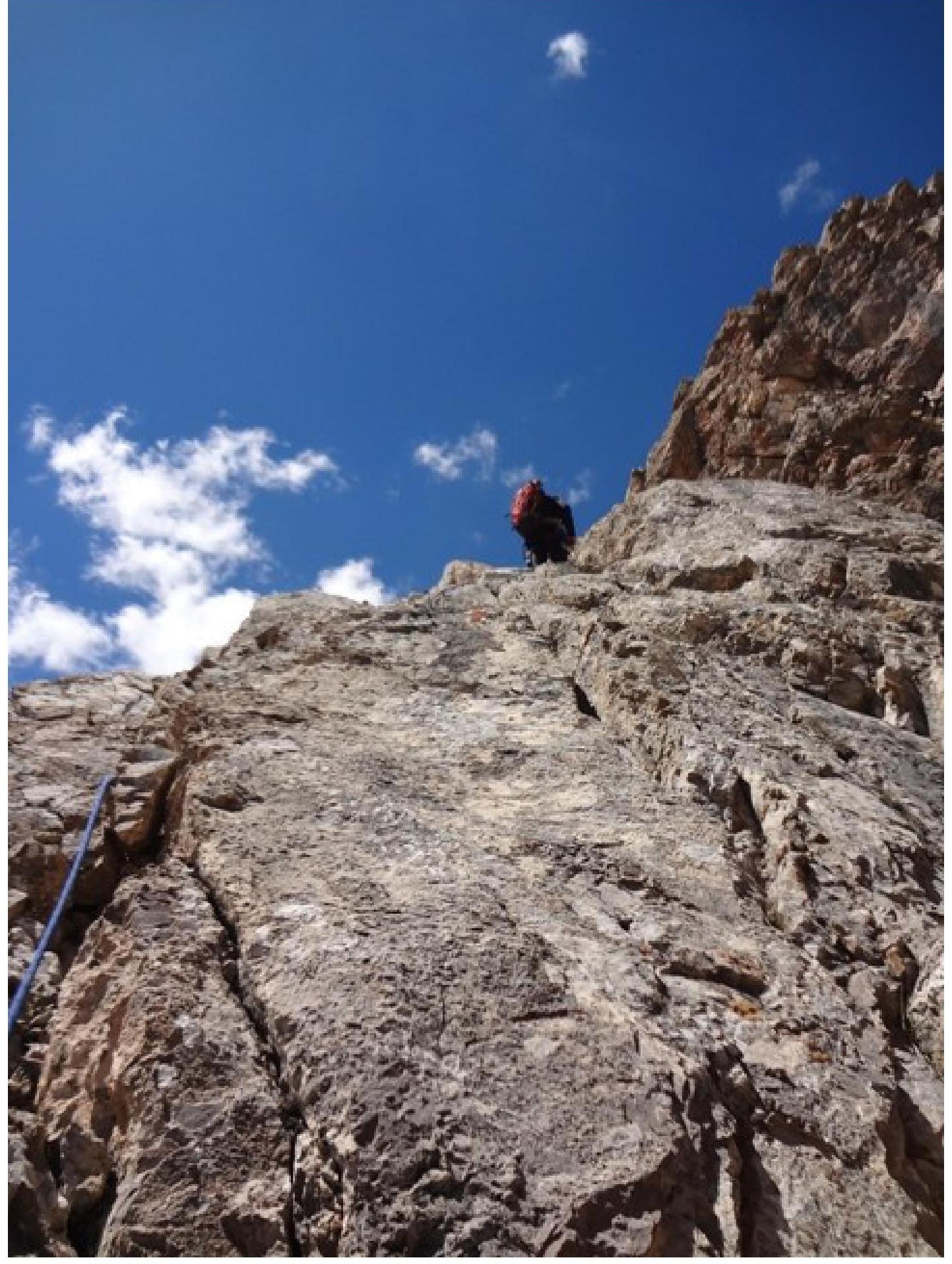
- R0–R1: Moved right from the corner onto a slab, then up through an internal corner. The corner was steep and sometimes overhanging. Exited left onto a ledge. Station on the ledge. 50 m, 80°, V.
- R1–R2: Climbed straight up from the station through a system of small ledges and wall sections. 50 m, 65–70°, IV+.
- R1–R2: Climbed up towards the ridge. The slope eased. 50 m, 60°, IV.
- R3–R4: Long ridge section. Climbed simultaneously, but encountered some complex wall sections that required alternate protection. Reached a gendarme, bypassed it on the left, and ended at a chimney. 400 m, 25–30°, II–III.
- R4–R5: Large chimney with many loose rock blocks. The chimney led to the ridge. Required careful climbing. 50 m, 60°, IV.
- R5–R6: After the station, climbed a steep 8-meter wall, then followed the ridge to the summit. 300 m, 25–30°, II–III.
Reached the summit at 17:00. Had a snack, dropped the rock gear, put on crampons, and descended. Descended via the eastern ridge, belayed. Unclipped when exiting the snowy-icy section onto scree. Returned to Achiik-Tash base camp by 19:00.
Section R0–R1
...
Section R2–R3

Section R3–R4
Section R4–R5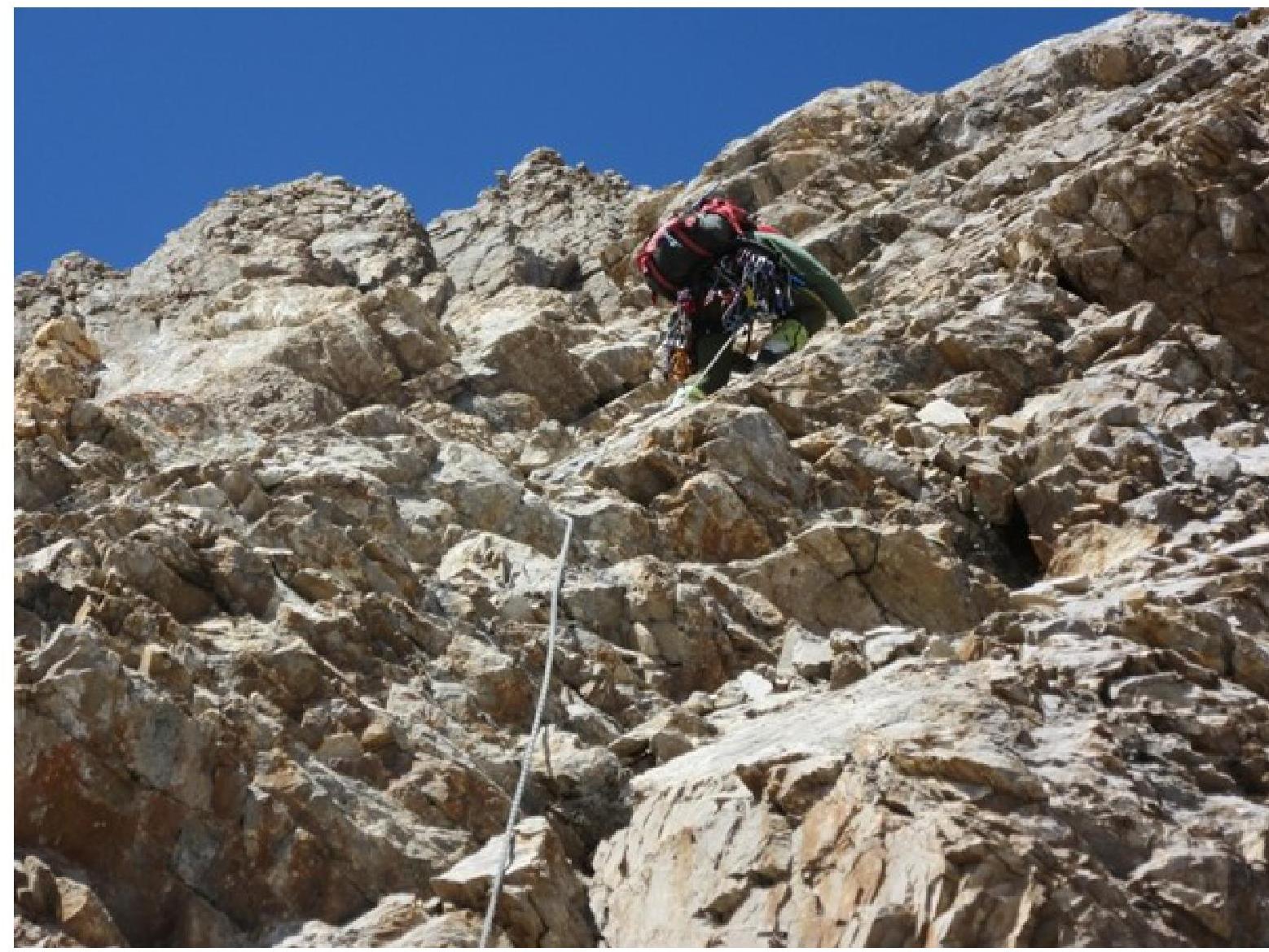
Section R5–R6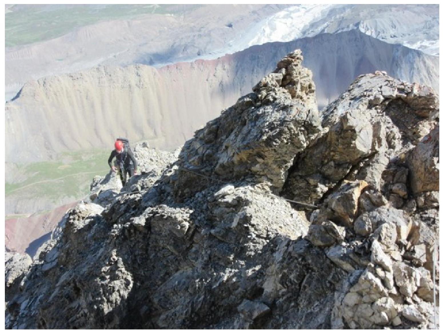
Reached the summit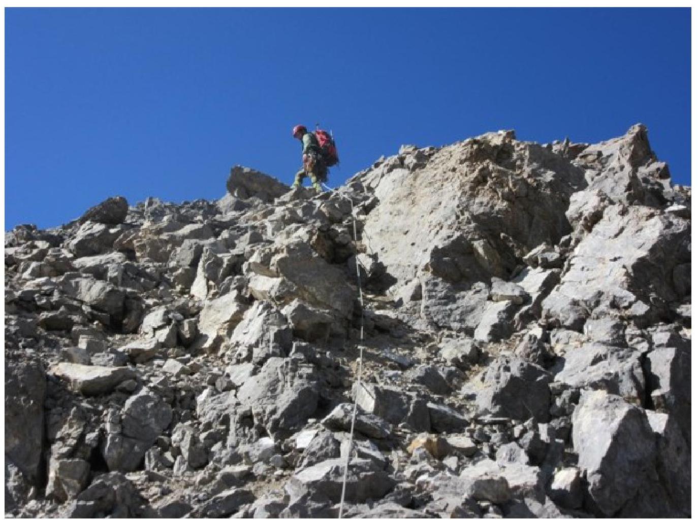
Summit