Climbing Report: Lenin Peak (7134) via the West Ridge from Malaya Saukdara Glacier
1. Climbing Passport
Region: Trans-Alay Range (North Pamir). Valley: Sauksay. Classification category according to the 2013 table – 4.4. Peak name: Lenin Peak. Route name: via the West Ridge from Malaya Saukdara Glacier. Proposed category – 5A. Route type: ice and snow. Route elevation gain: 2360 m (by altimeter). Team's total climbing hours: 24 hours, 3 days.
Team leader: Andrei Alexandrovich Lebedev (Moscow), Master of Sports of International Class in Tourism.
Team members:
- Alexei Alexandrovich Vorobyev (Podolsk)
- Andrei Viktorovich Zharov (Moscow, Zelenograd)
- Ivan Nikolaevich Zhdanov (Moscow)
- Bogdan Dmitrievich Savchinskiy (Kiev)
- Alexei Sergeevich Timoshenkov (Moscow, Zelenograd)
- Oleg Zigmontovich Yanchevskiy (Kiev)
Coach: Andrei Alexandrovich Lebedev.
Departure for the route: 8:30 AM, August 24, 2009. Summit reached: 12:00 PM, August 27, 2009. Descent to Camp 1 on Lenin Glacier: 11:00 AM, August 28, 2009.
2. General Photograph of the Summit
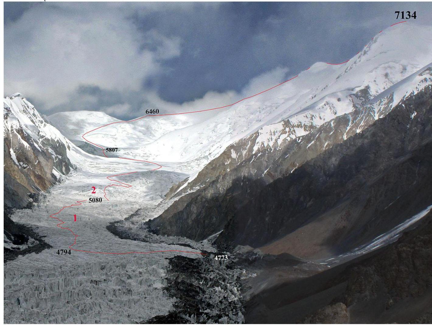 Fig. 1. View of Malaya Saukdara Glacier and the route from Udobny Pass (between the tongues of Bolshaya and Malaya Saukdara Glaciers).
3. Route Map
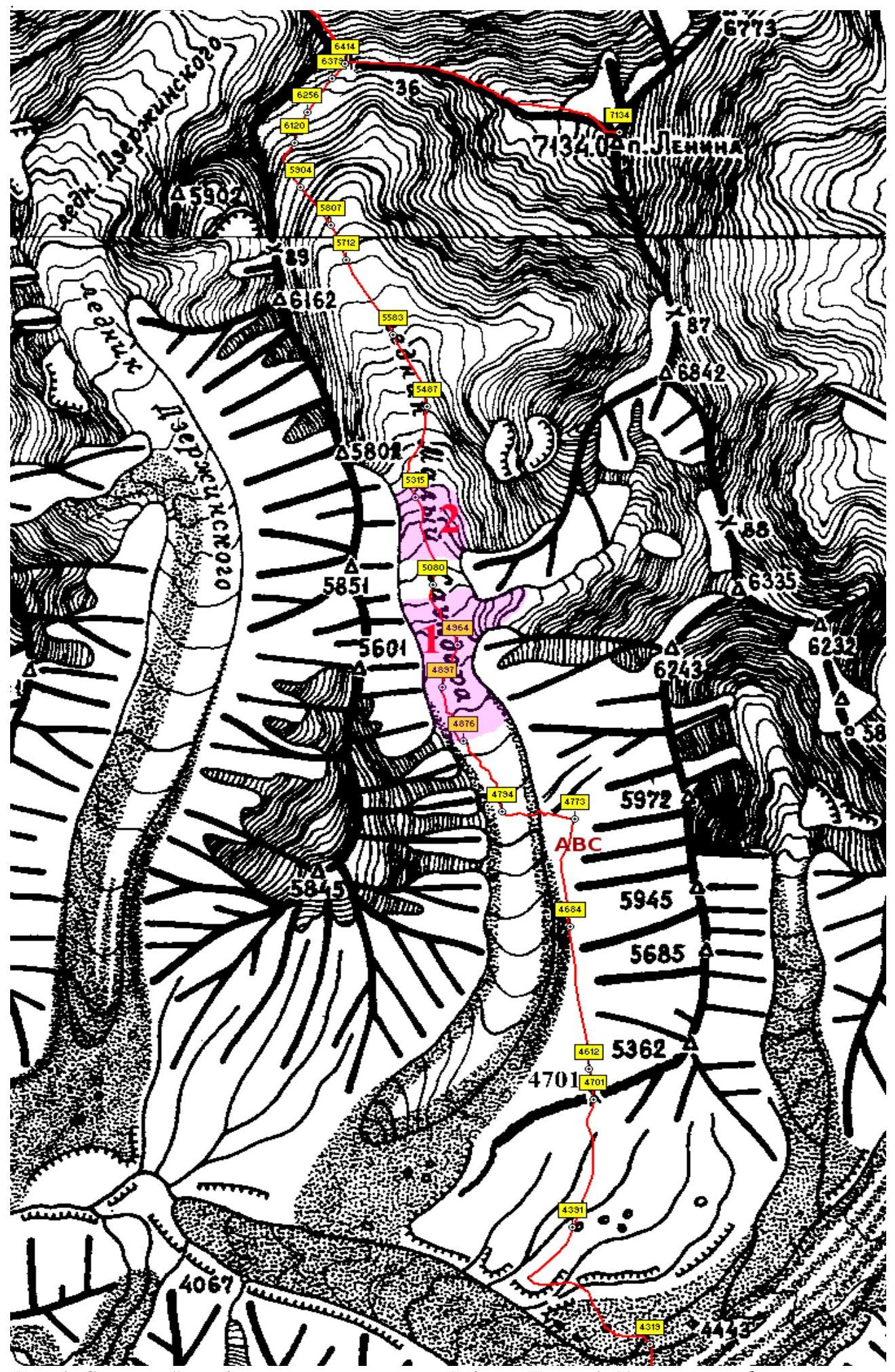
Fig. 1. Map of the area (based on Vadim Lyapin's map). Red numbers and pink color mark:
- lower (1) and upper (2) icefalls of Malaya Saukdara.
4. Description of Characteristic Points on the Route
| Elevation | Source | Latitude | Longitude | Point Description |
|---|---|---|---|---|
| 4319 | GPS | 39 12.838 | 72 52.857 | Right bank of Bolshaya Saukdara Glacier. |
| 4701 | GPS | 39 14.427 | 72 52.447 | Udobny Pass. |
| 4612 | GPS | 39 14.625 | 72 52.415 | Meadow with a stream. |
| 4773 | GPS | 39 16.247 | 72 52.314 | Start of the route. Camp site (ABC), stream in a moraine pocket. |
| 4794 | GPS | 39 16.294 | 72 51.776 | Point of completing the glacier crossing to its right part, turning north. |
| 4876 | GPS | 39 16.748 | 72 51.490 | Start of the lower icefall on Malaya Saukdara Glacier. |
| 5080 | GPS | 39 17.760 | 72 51.266 | Plateau between the lower and upper icefalls. |
| 5315 | GPS | 39 18.330 | 72 51.139 | Exit from the upper icefall of Malaya Saukdara Glacier. |
| 5807 | GPS | 39 20.091 | 72 50.523 | Base of the slope of Lenin Peak's West Ridge. |
| 6414 | GPS | 39 21.139 | 72 50.638 | Camp site on Lenin Peak's West Ridge. |
| 7134 | 39 20.870 | 72 52.771 | Lenin Peak. |
5. Time Calculation for an Acclimatized Group and Climbing Schedule
| Date | Day Number | Transition Description | Time Taken |
|---|---|---|---|
| 24.08 | 1 | Camp on moraine 4773 – plateau 5080. | 8:30 AM to 8:00 PM |
| 25.08 | 2 | Camp 5080 – base of West Ridge (5807). | 9:00 AM to 6:00 PM |
| 26.08 | 3 | Camp 5807 – West Ridge 6414. | 9:00 AM to 1:00 PM |
| 27.08 | 4 | Camp 6414 – Lenin Peak (7134). | 8:30 AM to 12:00 PM |
6. Approach to the Start of the Route
The description is given from the right bank of Bolshaya Saukdara Glacier (point 4319). The terms "left" and "right" are used in an orographic sense.
There are two options for passing from the Bolshaya Saukdara valley to the left-bank moraine pocket of Malaya Saukdara Glacier. The first option is to move along Malaya Saukdara from the end of its tongue. The second option is via Udobny Pass (4701, 1A) in the southwest spur of peak 5362, see the area map in Fig. 1 and photo 2.
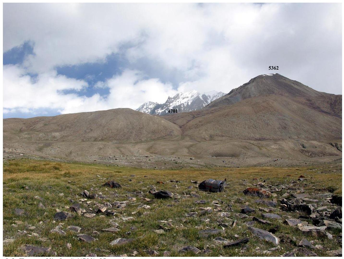 Fig. 2. Udobny Pass (4701). South slope.
Descent from the pass to the north into the left-bank moraine pocket of Malaya Saukdara involves a 90 m height loss on small scree. In the moraine pocket at an elevation of 4612 m, streams run through a green meadow. This is a convenient place for setting up a camp. However, this camp is too far from the glacier exit, and it's very difficult to pass the lower icefall in one day. Therefore, for ascending Malaya Saukdara Glacier, it's recommended to set up a camp opposite the glacier exit at an elevation of 4773 m, see photo 1. Here, in the left-bank moraine pocket, there's also a stream.
7. Illustrated Climbing Description
Malaya Saukdara Glacier is a surging glacier, so its condition changes from year to year. The description of the path on the glacier is given as of summer 2009.
The lower part of the glacier from the end of its tongue to an elevation of 4750 m is a continuous impassable jumble of seracs, see photo 1. This entire lower section can be bypassed along the pockets and scree of the left-bank moraine. At an elevation of 4800 m, a western rock rib of peak 6243 cuts into the glacier. On the section from 4750 to 4800 m, along the left bank of the glacier, there's a band of seracs 80–150 m wide. Only here, opposite point 4773, see photo 1, is it possible to exit onto the glacier, see photo 3, which is relatively calm in the center and near the right bank (at point 4794), see photos 1 and 4.
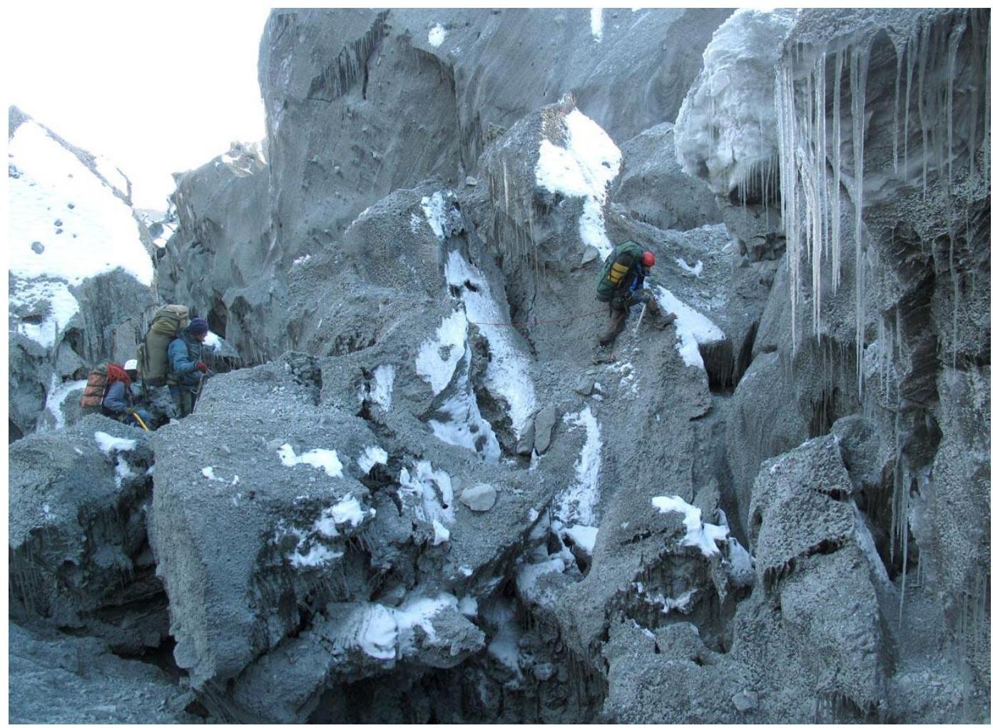 Fig. 3. Exit onto Malaya Saukdara Glacier opposite point 4773.
 Fig. 4. Crossing Malaya Saukdara Glacier from point 4773 to the right part of the glacier, to point 4794.
Above point 4876 and up to a small plateau at an elevation of 5080 m, the glacier forms a difficult lower icefall, representing a series of wide crevasses with their bottoms filled with ice debris, see photos 5–10.
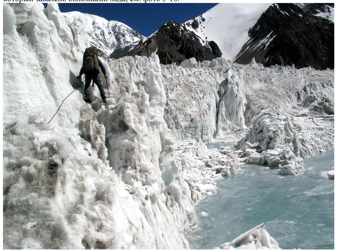 Fig. 5. At the start of the lower icefall of Malaya Saukdara Glacier.
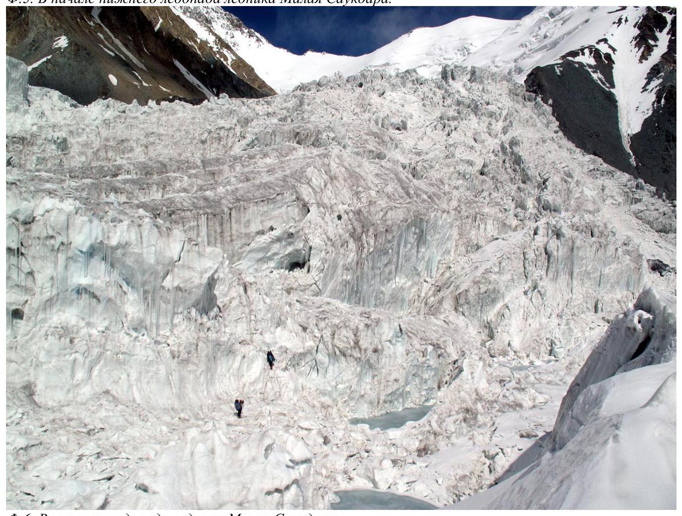 Fig. 6. In the lower icefall of Malaya Saukdara Glacier.
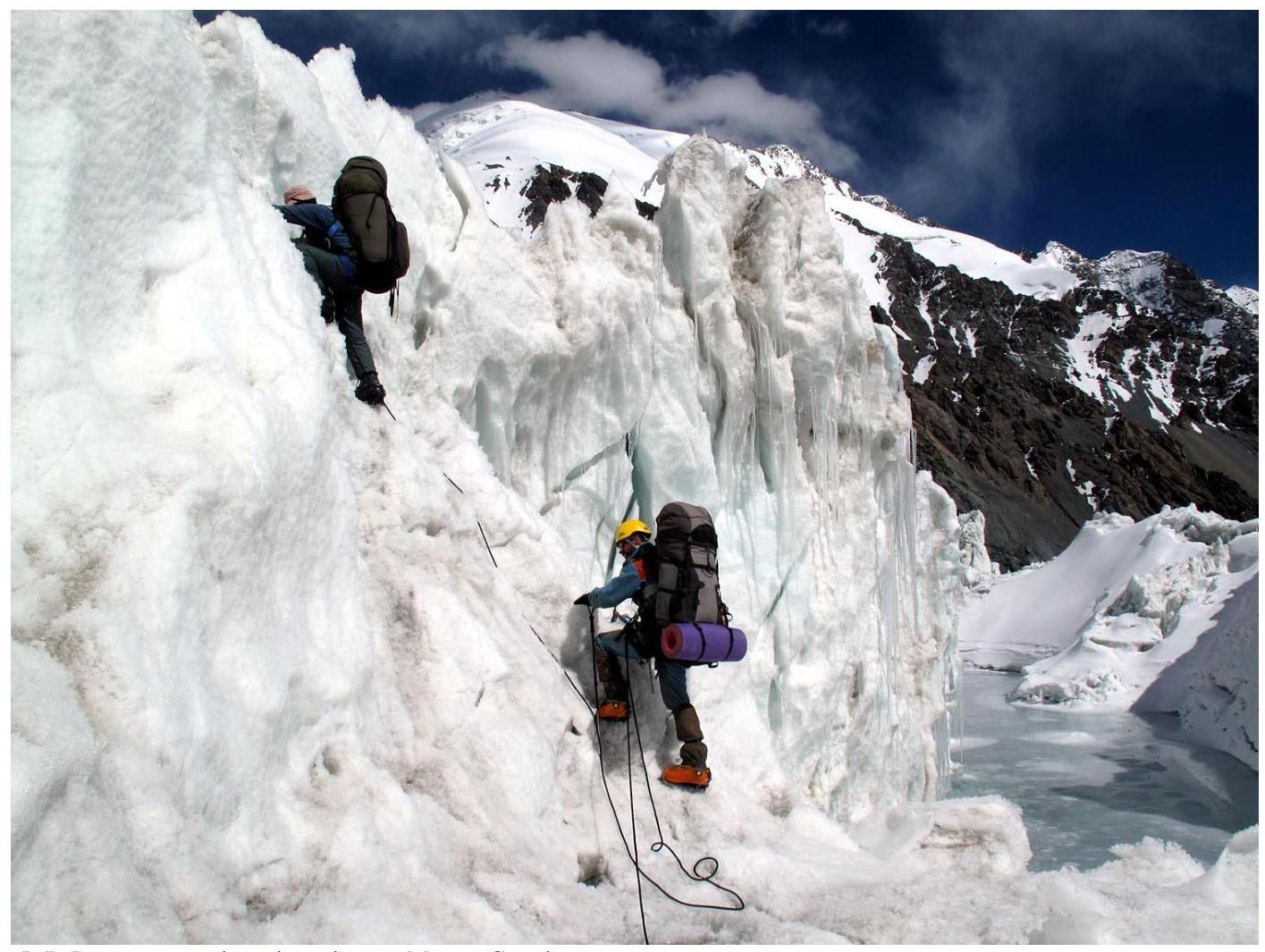 Fig. 7. In the lower icefall of Malaya Saukdara Glacier.
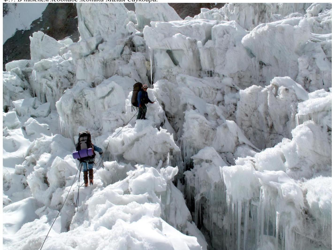 Fig. 8. In the lower icefall of Malaya Saukdara Glacier.
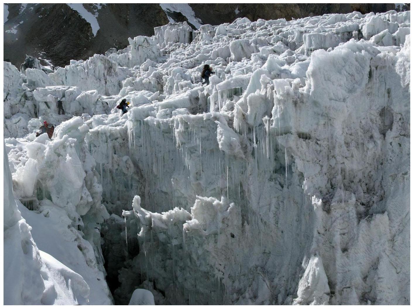 Fig. 9. In the lower icefall of Malaya Saukdara Glacier.
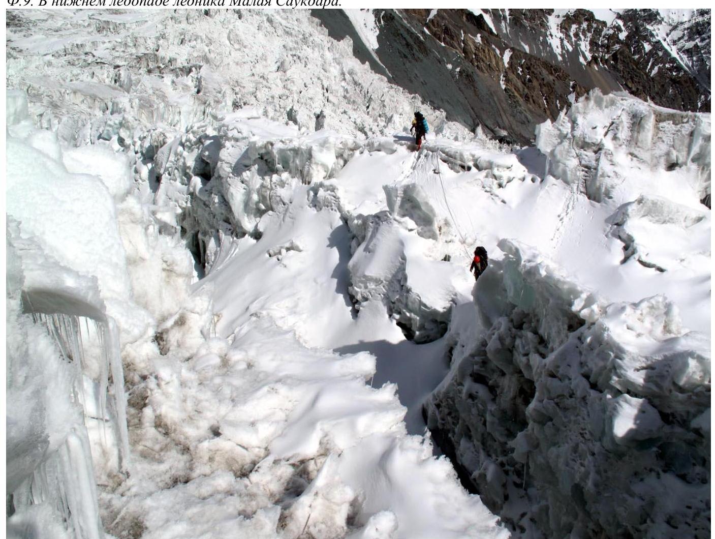 Fig. 10. In the lower icefall of Malaya Saukdara Glacier.
The lower icefall of Malaya Saukdara ends with an exit onto a small plateau 5080, beyond which the upper icefall begins, see photo 11. It's significantly simpler, but in its upper part, it ends with a series of wide crevasses. These crevasses can be overcome between the center and the eastern edge of the glacier. Here, they approach a complex icefall with overhanging seracs, widen, and turn into wide crevasses filled with ice debris, see Fig. 12.
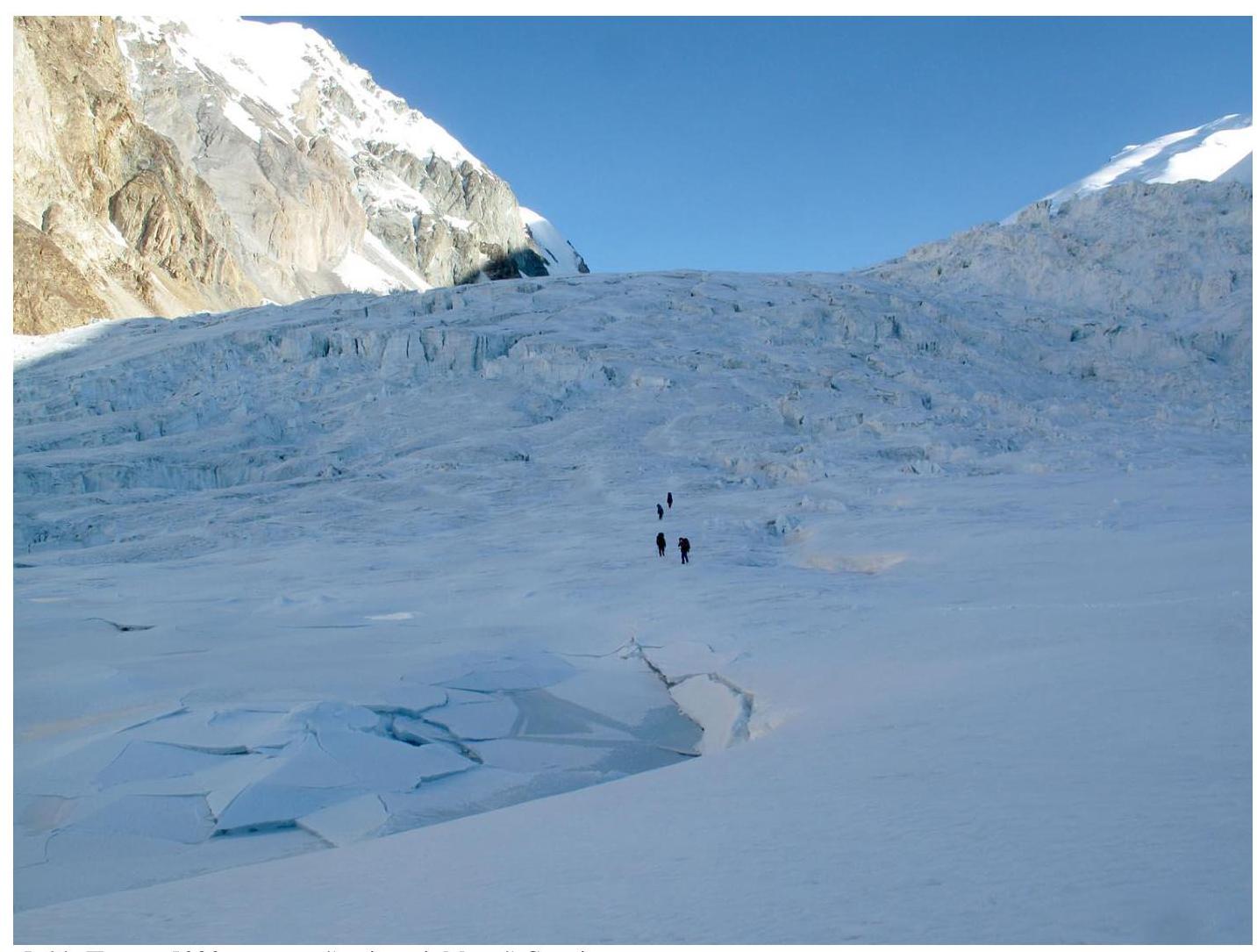 Fig. 11. Plateau 5080 and the upper icefall of Malaya Saukdara.
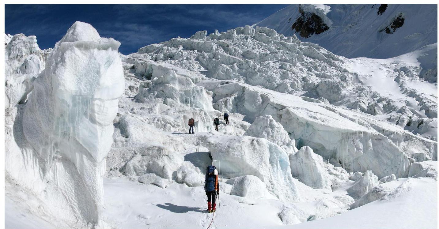 Fig. 12. Bypassing the crevasses of the upper icefall of Malaya Saukdara along the boundary with the complex icefall near the left bank of the glacier.
Above 5400, the glacier becomes gentle and takes on the character of a snow plateau. In the far northwest corner, near the right bank of the glacier, a gentle sloping ledge begins, leading to the West Ridge of Lenin Peak (6460).
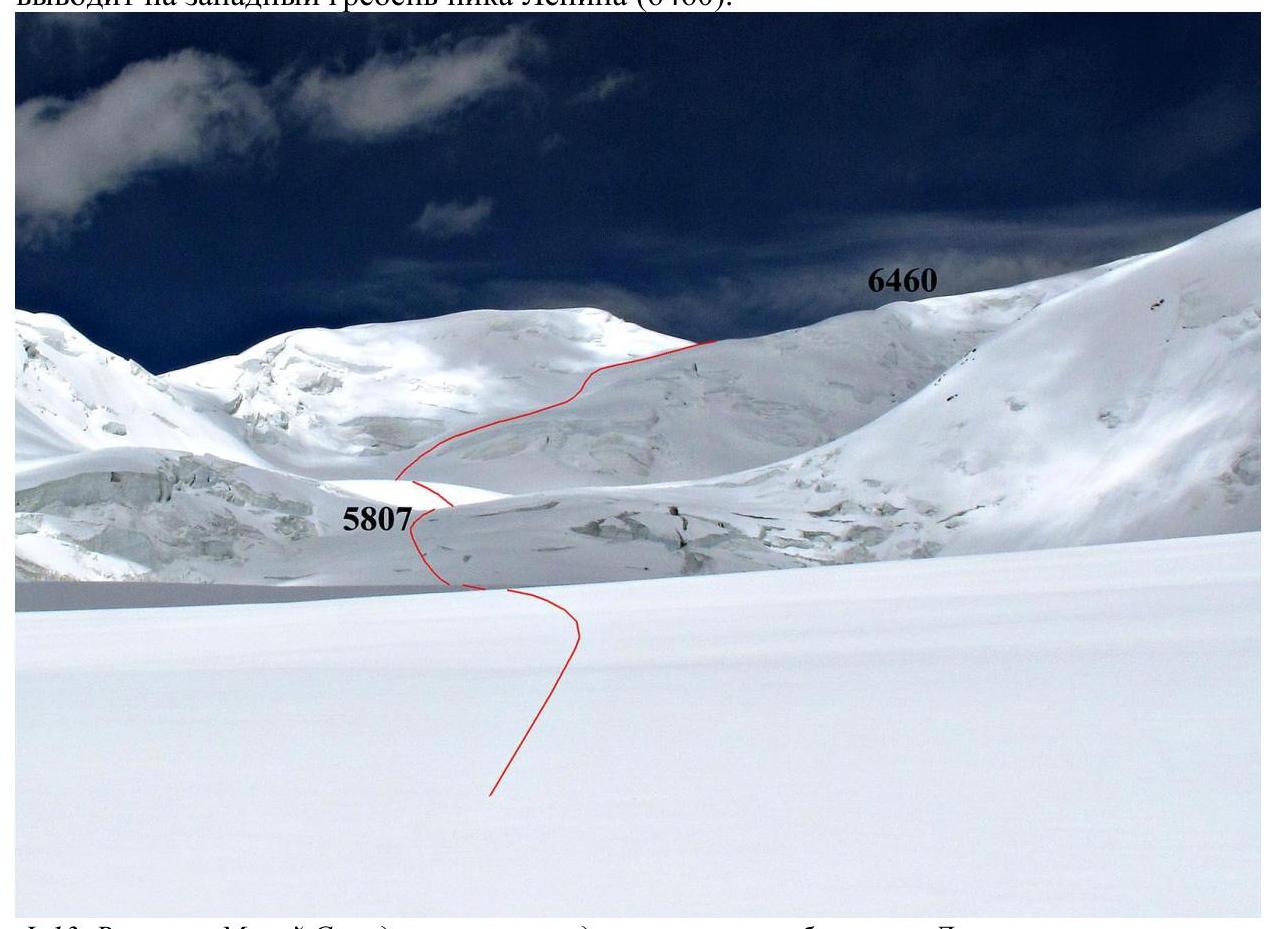 Fig. 13. Upper reaches of Malaya Saukdara and the ascent path to the West Ridge of Lenin Peak.
There's usually little snow on the ridge itself, as it's blown away by strong winds. Therefore, it's better to set up a camp 100–150 meters before reaching the ridge at point 6414. Here, there's enough snow to build a snow fortress around the tents, see photo 14.
 Fig. 14. Camp 6414 on the West Ridge of Lenin Peak.
The path to the summit of Lenin Peak along the West Ridge is well-known (the most popular route, "classic"). One can fall with serious consequences only in two places:
- The first place is a steep rise on the ridge (50–70 m), ending its gentle lower part. This rise is often called the "knife," see photo 15 (the knife is marked with the number 1). Usually, this section is equipped with a fixed rope.
The second place is the traverse (about 40–50 m) on the north slope of Lenin Peak to bypass the rock belt, see photo 15 (the start of the traverse is marked with the number 2). The slope's steepness on the traverse is about 35°, see photo 17. It's not customary to equip this place with a fixed rope.
Beyond the snowfields, see photo 18, a gentle and long ascent to the summit begins along scree islands and snow patches between them, see photo 19.
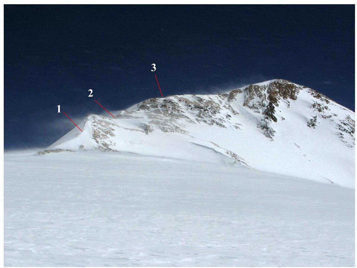 Fig. 15. 1 — "knife," 2 — start of the traverse to bypass the rock belt, 3 — there, behind the rocks, are the snowfields of Parachutists' Plateau.
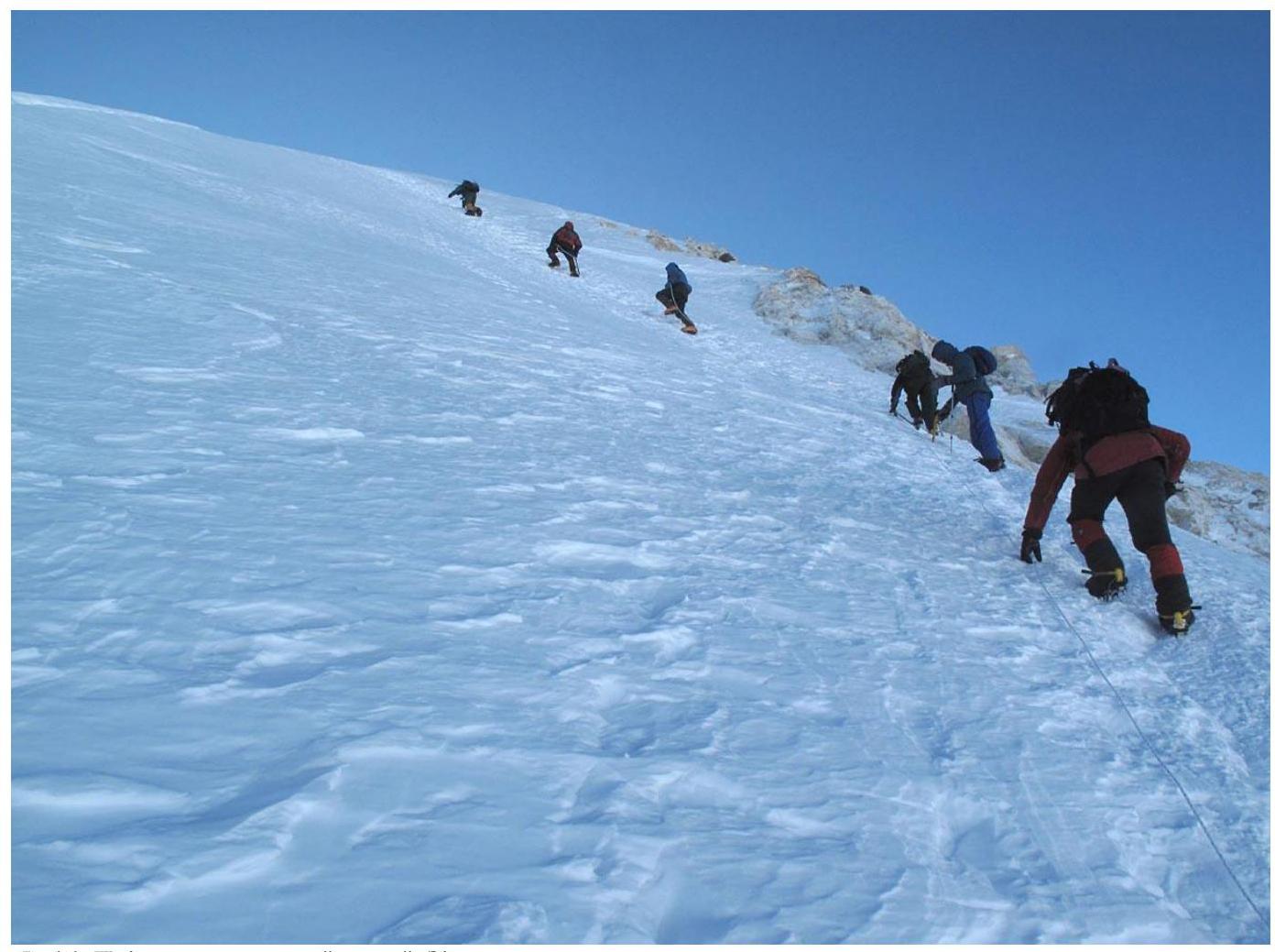 Fig. 16. Ascent to the right of the "knife." Here, a rope was sticking out of the snow.
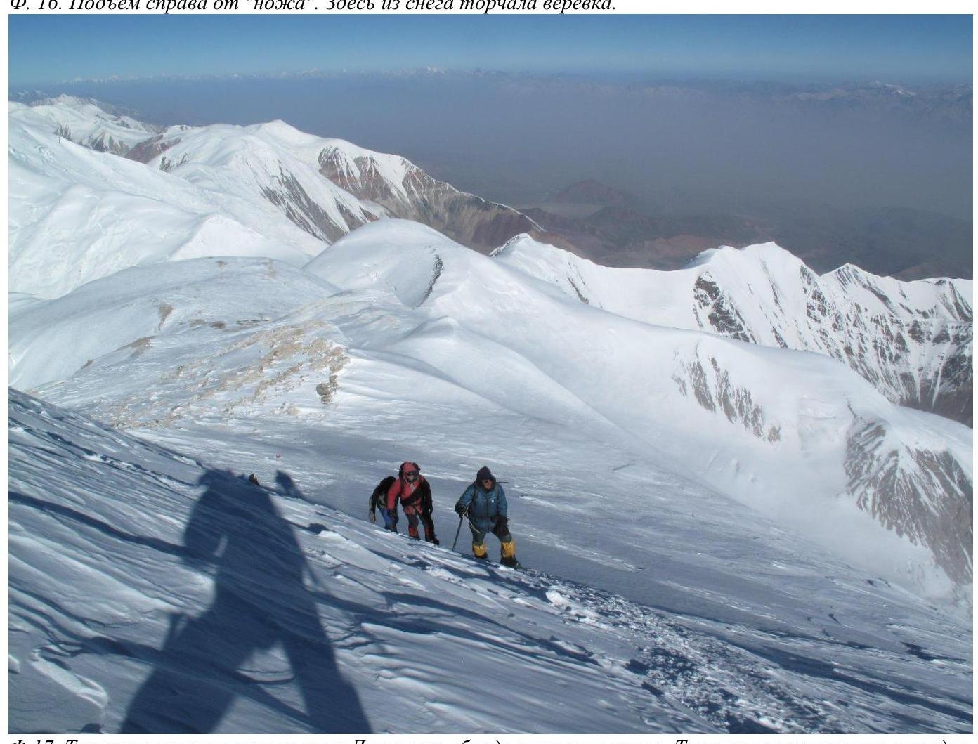 Fig. 17. Traverse on the north slope of Lenin Peak to bypass the rock belt. The traverse ends with an exit onto Parachutists' Plateau.
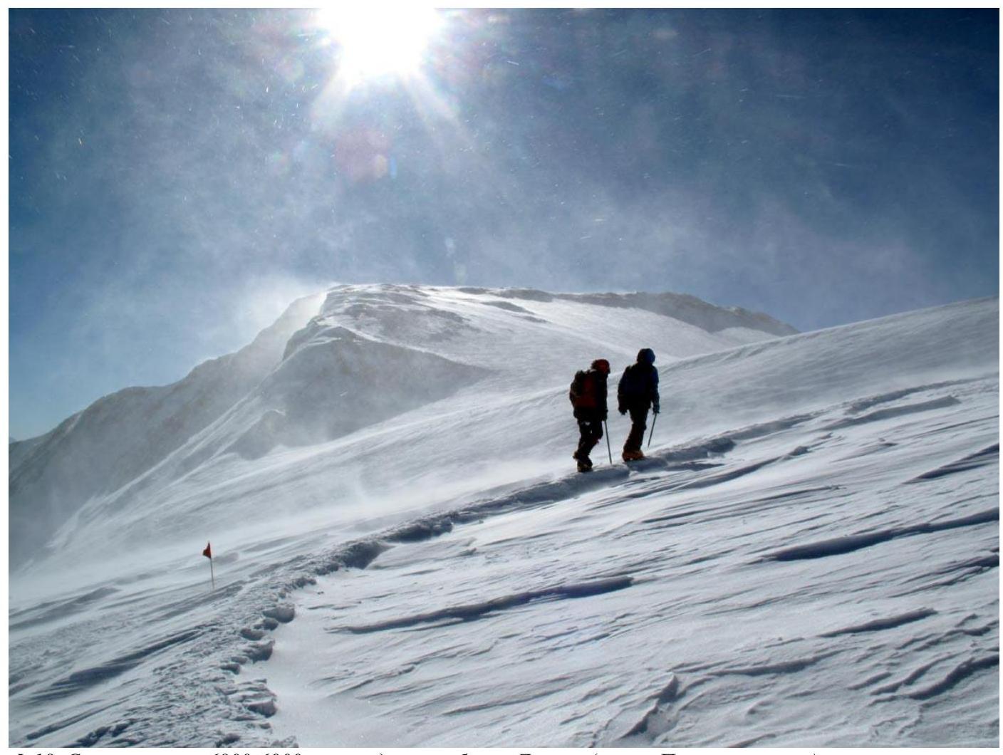 Fig. 18. Snowfields 6800–6900 on the West Ridge of Lenin Peak (Parachutists' Plateau).
Fig. 19. Scree on the pre-summit part of the West Ridge of Lenin Peak.
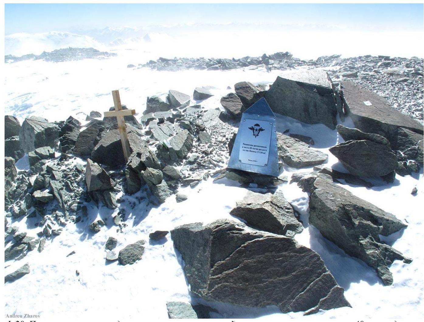 Fig. 20. Monument to Ryazan paratroopers, erected on the summit plateau in honor of the 40th anniversary of the parachute jump onto Lenin Peak.
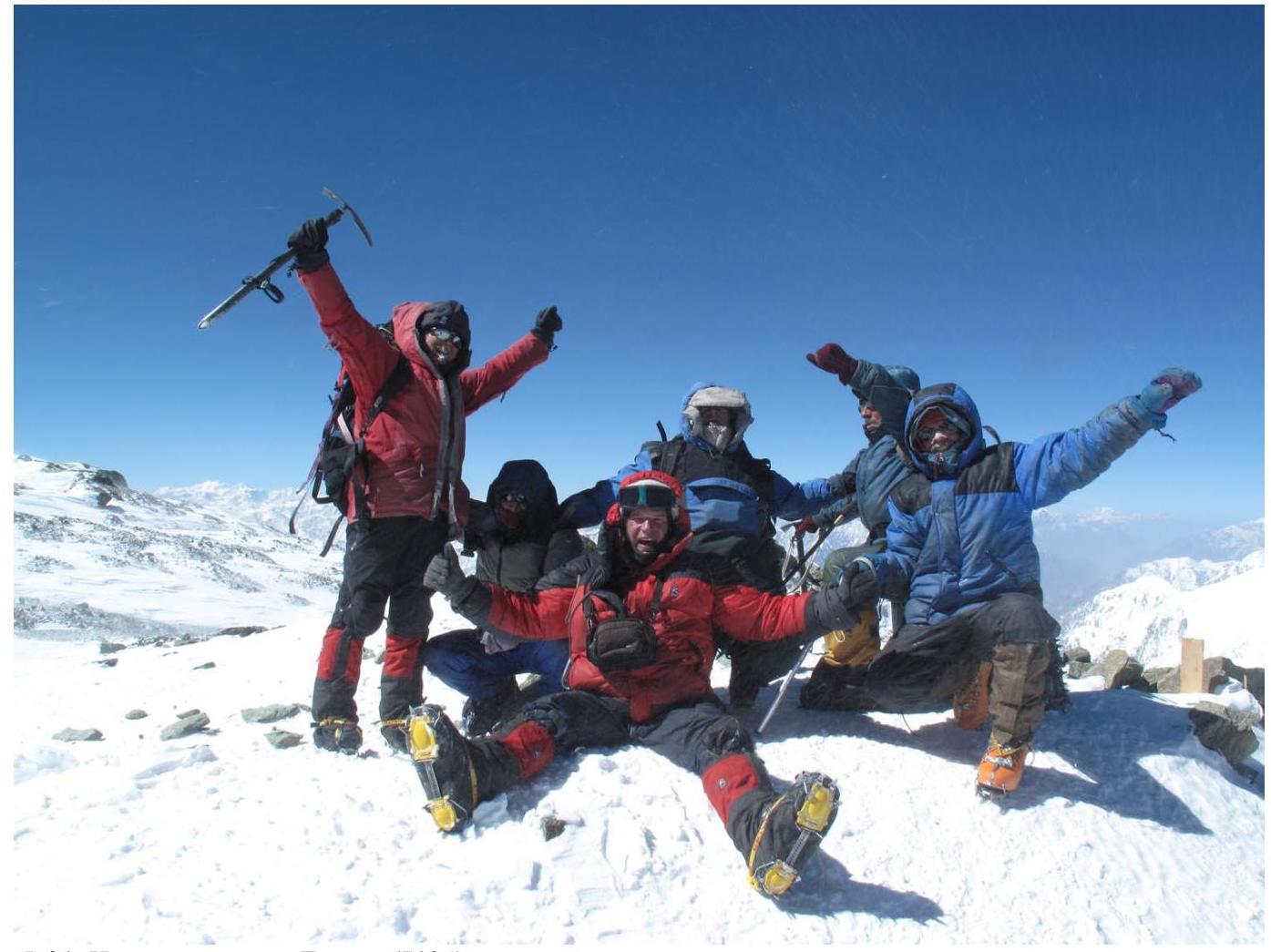 Fig. 21. At the summit of Lenin Peak (7134).
8. Organization of the Climb
The climb was conducted as part of the "Pamir Marathon 2009" — an autonomous trek across Pamir with ascents to peaks Revolution (6940), Communism (7495), and Lenin (7134) [1].
9. Authors of the Report
The author of the text, tables, and maps is Andrei Lebedev. Photos by Andrei Zharov, except for three photos by Ivan Zhdanov: Fig. 2, Fig. 12, Fig. 15.
10. References
- A.A. Lebedev. Report on a mountaineering trip across Central and North Pamir with ascents to peaks Revolution, Communism, and Lenin. 2009. http://static.turclubmai.ru/papers/1847/0_ch.htm↗
- A. A. Lebedev. Pamir Marathon 2009 (film about a foot journey across Pamir with ascents to peaks Revolution, Communism, and Lenin). http://static.turclubmai.ru/papers/1907/↗