
Ascent Passport
- Ascent area: 2.9.a, Dagestan mountains
- Ascent class: rock climbing
- Peak, its height: Tlili-meer, 2456 m
- Ascent route: via NW ridge and from S
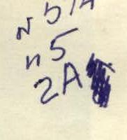
- Proposed difficulty category: 2A
- Route characteristics: height difference — 500 m, average steepness — 40°, section lengths: Ia difficulty — 1000 m, Iб — 80 m, II — 80 m.
- Pitons: rock — 7, chocks — 2
- Number of nights and their characteristics: overnight stay behind Gogoтль village
- Surname, initials of the leader and participants, their sports qualification:
- Kozorezov E.F. — 1st sports category
- Aliev G.N. — II sports category
- Mamedov A.G. — II sports category
- Chupanov M.K. — II sports category
- Khestanov S.N. — III sports category
- Aliskandiev A.A. — III sports category
- Ascent date: November 8, 1984
- Team coach: Kozorezov E.F.
Return for re-registration. Give a name to the route and explain it.
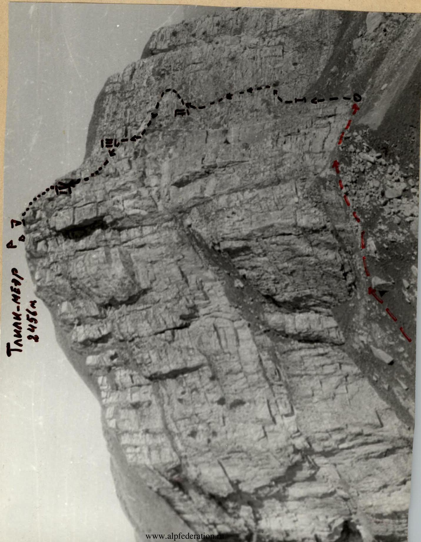
Mt. Tlili-meer. View from Khunzakh plateau (6-3)
1. General characteristics of the mountain
The Tlili-meer massif («Saddle-mountain», Avar language) is located in Inner Dagestan on the border of Gunibsky and Sovetsky districts. Tlili-meer stands out sharply against the background of the surrounding plateau-like mountains due to its relative height and original form.
In its structure, Tlili-meer is a narrow plateau stretching from southwest to northeast. It is a typical table mountain of synclinal form, formed by four horizons of hard limestones and dolomites. The height difference from the valleys of Avar and Andi Koisu rivers is about 1 km.
The first known ascent to the mountain was made in 1937 by representatives from Khunzakh. Then it was repeatedly climbed by tourists following the Erpeli — Gunib route. There are no easy paths to the mountain!
Even the classic ascent path requires certain rock climbing skills and rope installation, as it passes over a 600–700-meter abyss towards the village of Kuyada. Climbing Tlili-meer in the off-season and winter periods fully meets the requirements of alpine routes of 2B category.
2. Description of the approach to the route
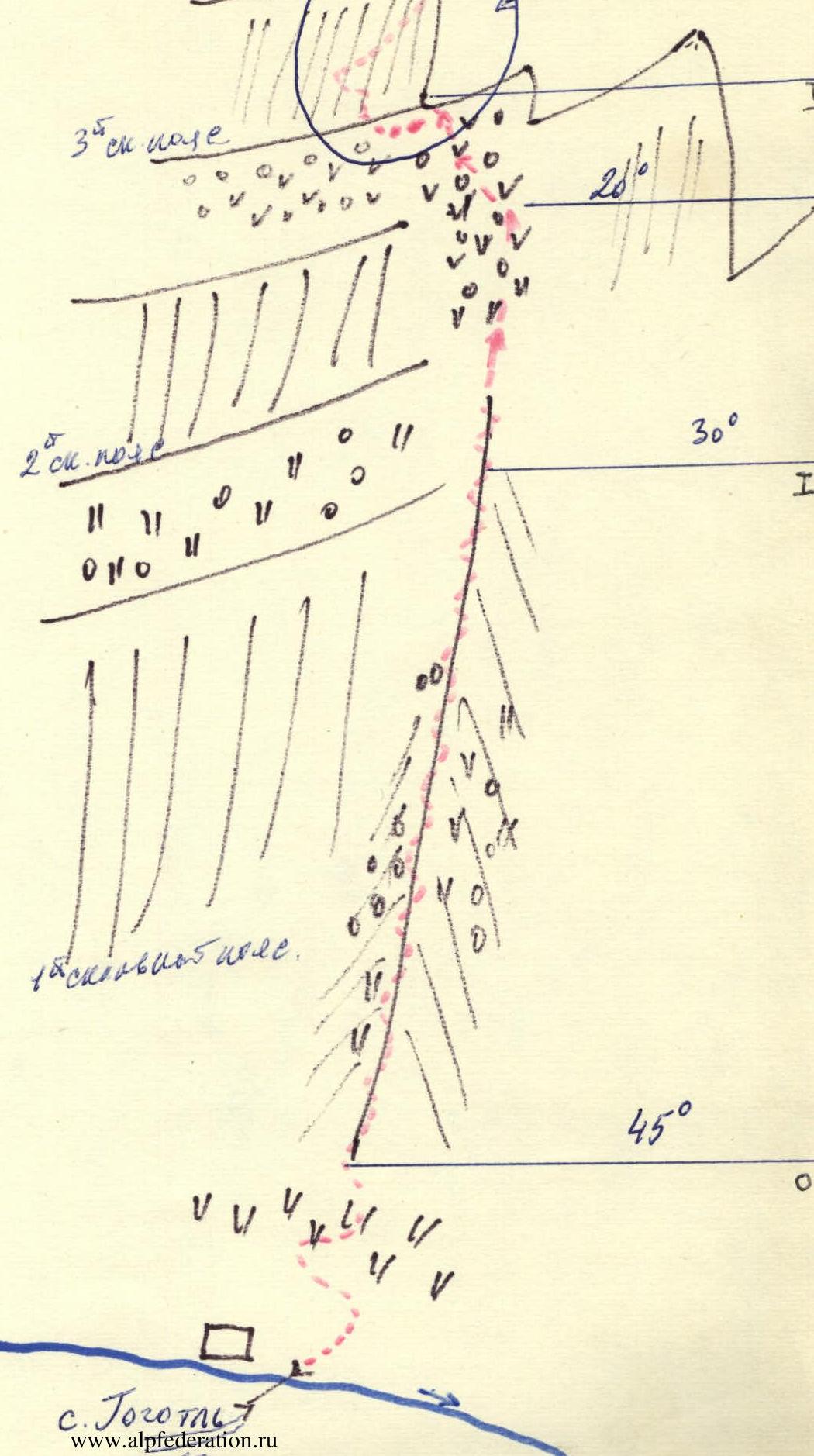
Beyond Gogoтль village, cross the river near the mill and ascend straight up the grassy slope of average steepness. Having reached a characteristic steep edge of the ridge leading to the right shoulder of Tlili-meer, follow a vaguely defined trail.
In winter:
- the edge is snow-covered,
- cornices are found on the right side.
With a good state of the trail (absence of snow or dense grass), it is usually possible to reach wide grassy areas within 1.5 hours, from which one can approach the wall of the 4th rock belt of the mountain via a large scree. Here, among large boulders, there are several water sources (2–4 hours from Gogoтль).
Further, having reached the shale ridge, bypass it on the right side of the 4th rock belt and, having walked 30–40 m, approach the rocky part under the start of the route.
3. Route description
The route begins behind the wall bend. First along the scree, then up a short internal corner and further along a ledge (with a belay point through выступs or a piton) approach a vertical internal corner (about 30 m), leading to a narrow ledge where a "station" is organized. The rocks are hard with sloping, "negative" holds, pitons don't go in well, chocks are not held.
Further:
- right along the ledge 5 m,
- then up the internal corner,
- along a slab,
- to a narrow sloping ledge, which diagonally across the wall leads to a 4-meter wall.
Then:
- again along a ledge ("station") under a niche,
- behind which a steep turn to the right,
- along a heavily destroyed internal corner exit to bypass a rocky ledge onto the plateau.
To the left of the exit point — a cairn. Descent is via the ascent path. From point P1, it's a sport climbing descent with rope retrieval. Along the entire rocky part of the route, ropes with reliable piton belays are necessary.
Required minimum equipment:
- main rope — 4×40 m
- sacrificial cordelette — 2–3 m
- pitons with carabiners — 6–8 pcs.
- hammer — 1 pc.
- standard equipment.
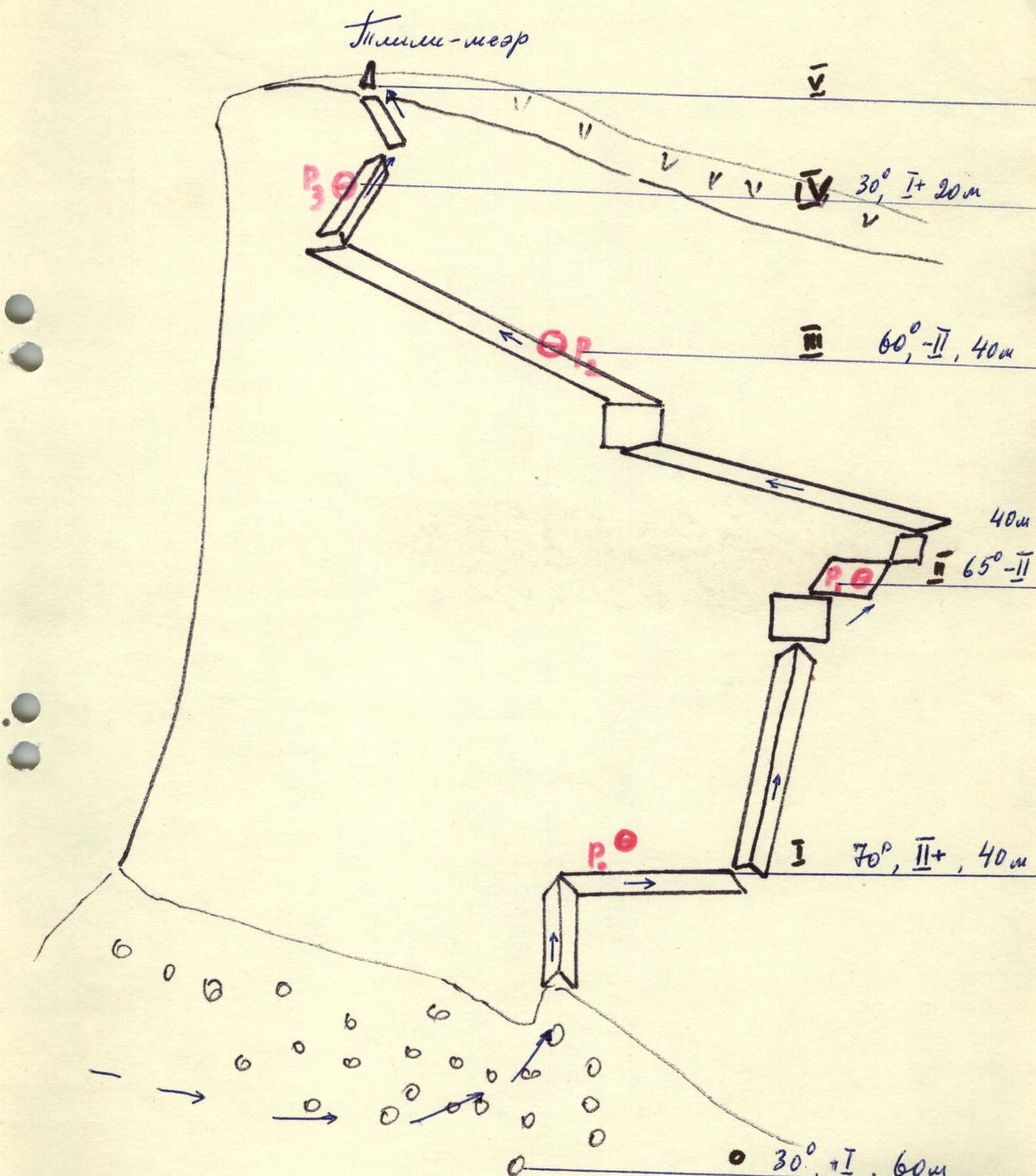
Route sections table

| Date | Designation | Steepness/° | Length/m | Terrain characteristics | Category | Condition | Weather | Pitons (rock) | Chocks | Protrusions |
|---|---|---|---|---|---|---|---|---|---|---|
| November 8 | O–I | 30 | 60 | ledge | 1 | frozen scree | good | – | – | 2 |
| 1984 | I–II | 70 | 40 | internal corner | 2+ | destroyed rocks | – | 2 | 1 | 1 |
| II–III | 65 | 40 | walls, ledges | 2 | monolith | – | 2 | 1 | – | |
| III–IV | 60 | 40 | ledge, internal corner | 2 | – | fog | 2 | – | 1 | |
| IV–V | 30 | 20 | ledge | 1+ | destroyed rocks | – | 1 | – | 1 |
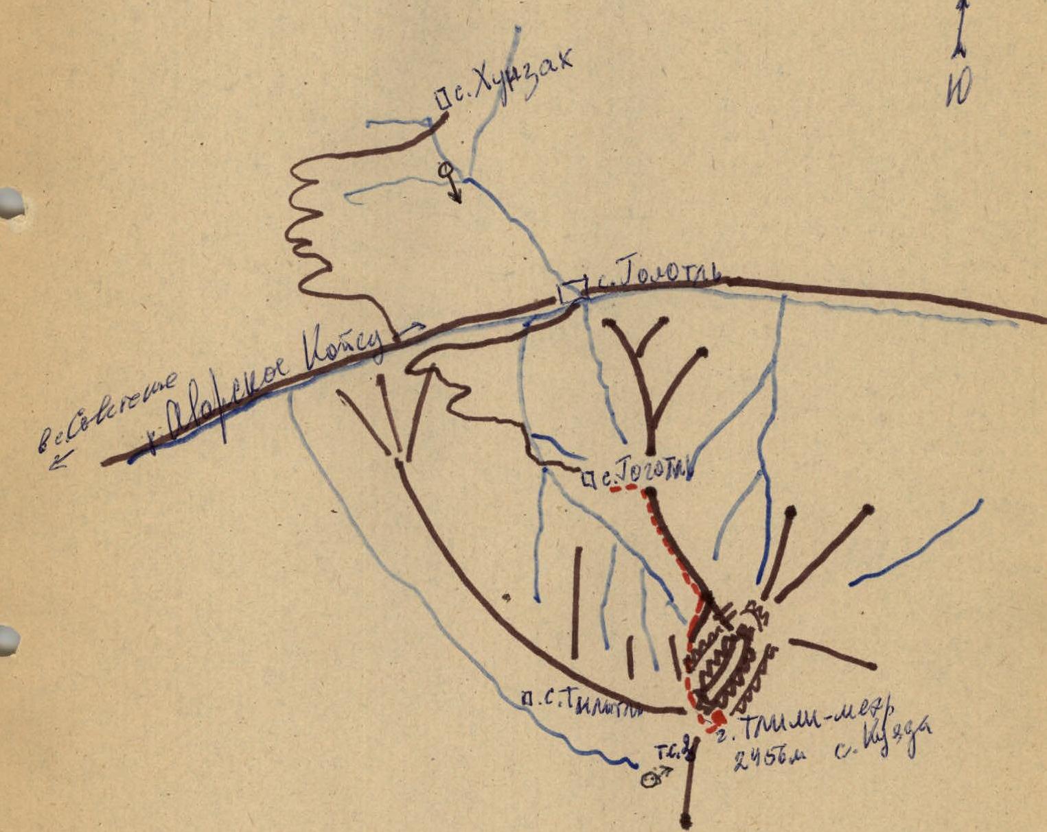
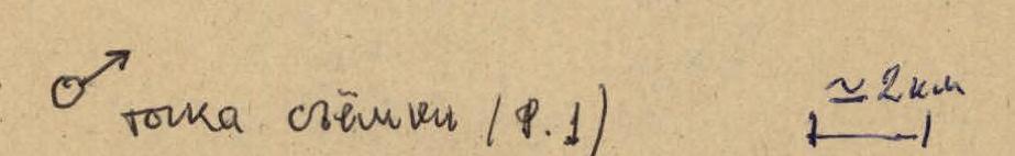
Area map
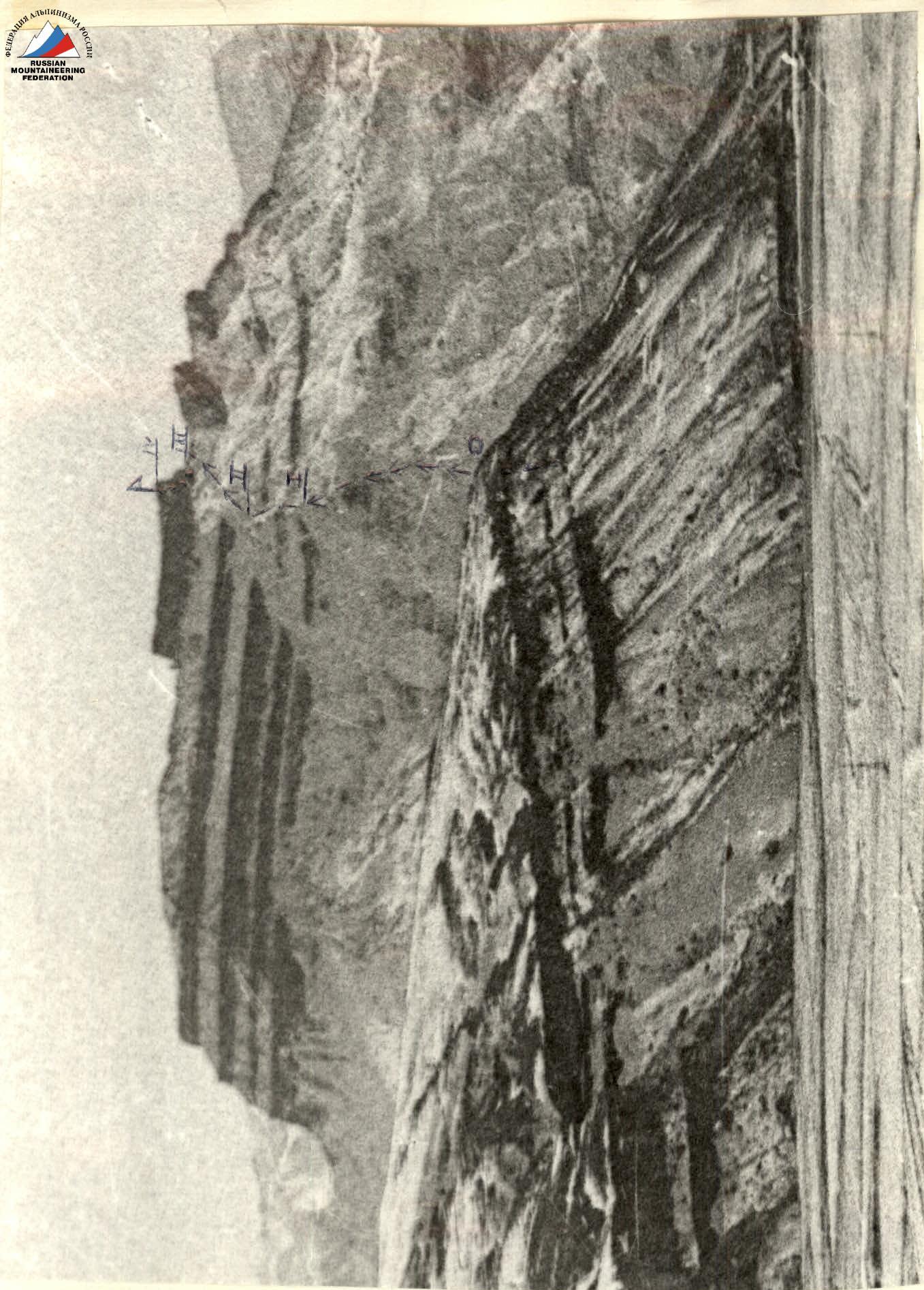
 4.2 4th rock belt of Tlili-meer (photo from T.S. 2 on the map)
Route diagram in UIAA symbols

Comments
Sign in to leave a comment