ASCENT DOCUMENT
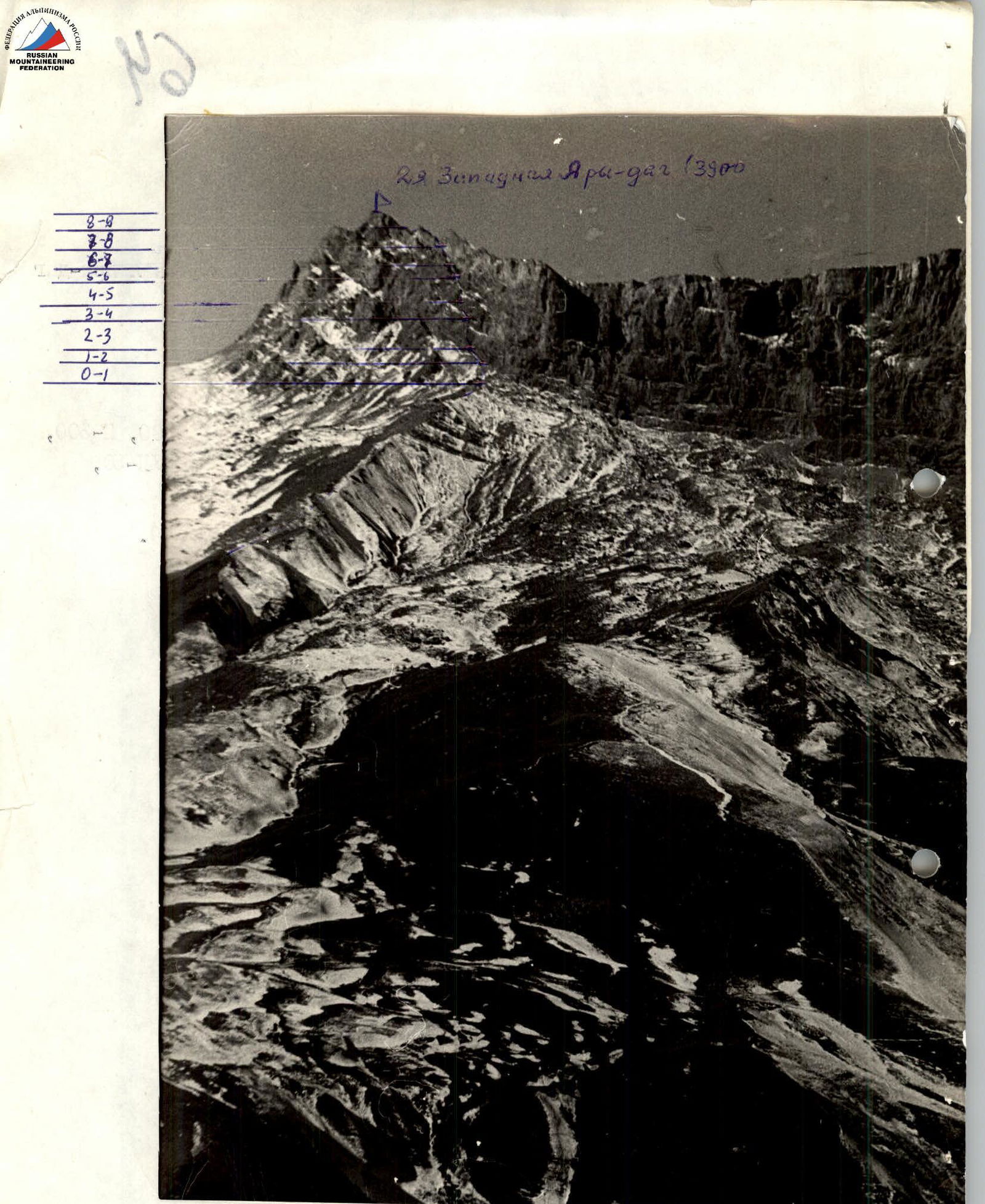
I. Ascent class — rock climbing 2. Ascent area — 2.9 Eastern Caucasus Seldi 3. Peak, its height, and ascent route — 2nd Western Yary-dag (3900 m) via the western wall 4. Proposed difficulty category — 3B 5. Route characteristics: height difference — 800 m average steepness — 55–60° section lengths: R1-200, R2-300, R3-50, R4-12, R5-100, R6-40, R7-50, R8-60, R9-30 6. Pitons driven: for belaying: rock — 15 ice — 0 bolt — 0 for creating I.T.O.: rock — 0 ice — 0 bolt — 0 7. Number of climbing hours — 9 hours 8. Number of nights and their characteristics — overnight stay under the route or in the village of Kurush 9. Surname, name, patronymic of the leader and participants, their sports classification: Peresada A.V. — 1st sports category Falin V.E. — 1st sports category 10. Team coach — Nezamutdinov A.B. 11. Date of departure and return — February 11, 1979
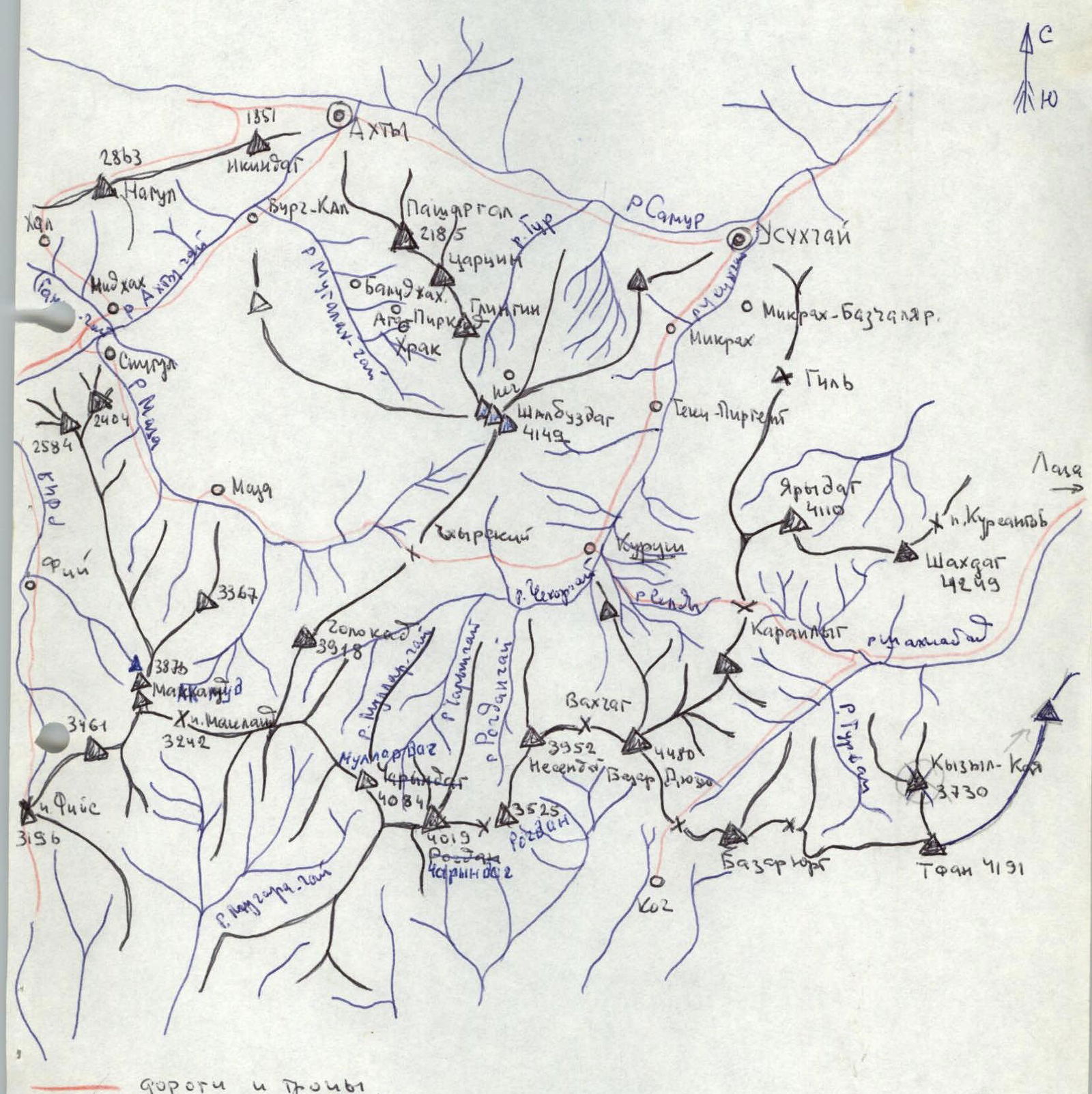
 Map of the area
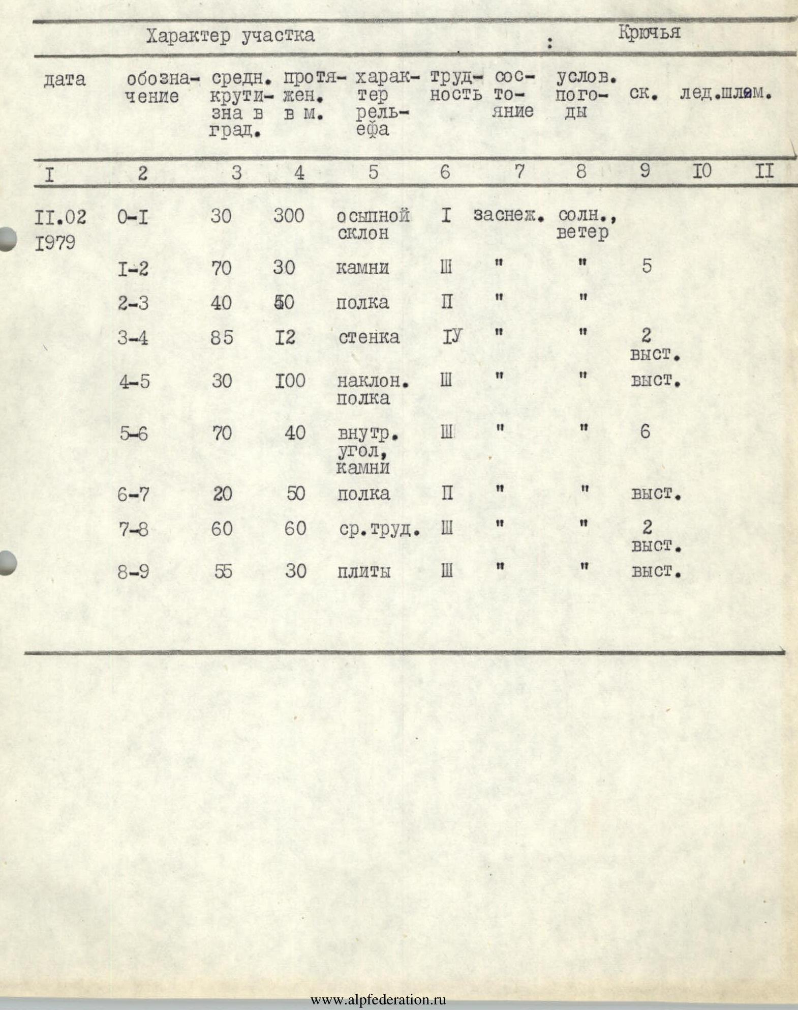
Table
 Description of the route to V. 2nd Western Yarydag (3900 m) via the western wall, 3B category of difficulty
From the village of Kurush, after crossing the bridge and ascending left along the grassy ridge, we approach the rocks. The ascent time is 2–3 hours. The landmark is the red rocks at the base of the wall to the right of the couloir, where water flows in the summer.
Approaching the wall, it is necessary to traverse the talus slope for 200 m to three large stones lying at the base of the chimney. The route goes through the chimney, with piton belays.
After 30 m, the chimney leads to a wide, talus-filled ledge. Along the ledge, move simultaneously up and to the right for about 50 m until the ledge starts to narrow.
From here, the next ledge is visible above. To reach it, it is necessary to overcome a 12-meter vertical wall, which is smooth and has few cracks for pitons.
Again, there is an inclined ledge that goes up and to the right. After passing about 100 m, a steep inner corner with small and brittle holds goes up, turning into a chimney at the top. The section length is 40 m. Belay is with pitons.
Again, there is a ledge, and further to the right, after 50 m, the ledge widens, forming a talus-filled, inclined area.
From the area:
- up and to the left along steep rocks with many protrusions — 60 m to the exit onto the plateau;
- to the right along gentle slabs covered with snow and small rubble — 30 m to the summit with a cairn.
Descent to the Kurush pass, and then to the village of Kurush.


