 № 574
p.3.
Over the rock.
№ 574
p.3.
Over the rock.
Ascent Passport
2.10.39
- Ascent class: rock climbing
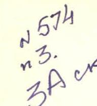
- Ascent area: 2.96, Dagestan mountains
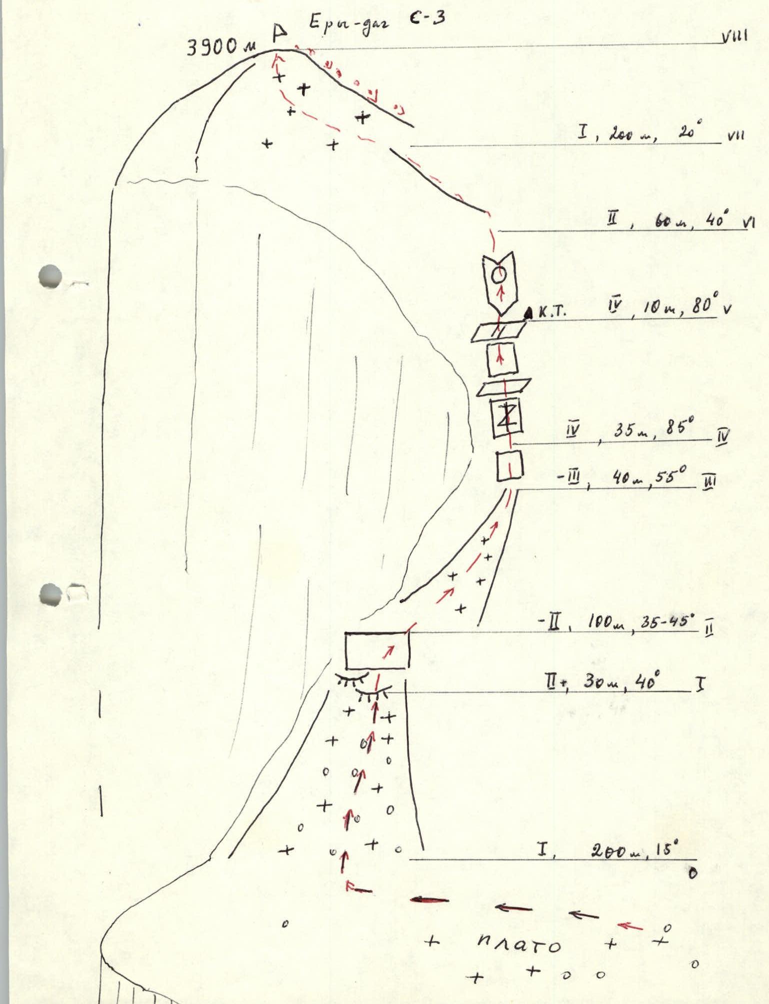
- Peak, its height, ascent route: Ery-dag, 3900 m, N-3, from the plateau and along the 3rd ridge
- Difficulty category: 3A
- Route characteristics:
- height difference — 400 m,
- length of sections: I difficulty category — 400 m,
- II — 190 m,
- III — 40 m,
- IV — 45 m
- Number of pitons driven: 7 rock, 2 chocks
- Number of walking hours: 10
- Number of nights and their characteristics: overnight stay in the camp under the slope of the Yarudag massif
- Participants' names, their sports qualification:
- Mamedov A.G., II sports category
- Slobodenyuk Yu.Yu., I sports category
- Ascent date: June 12, 1986
- Team coach: Timoshin M.E.
- Organization: Goskomsport DASSR

- Ery-dag N-3 from the plateau and along the 3rd ridge, Mamedov A.G., 1986
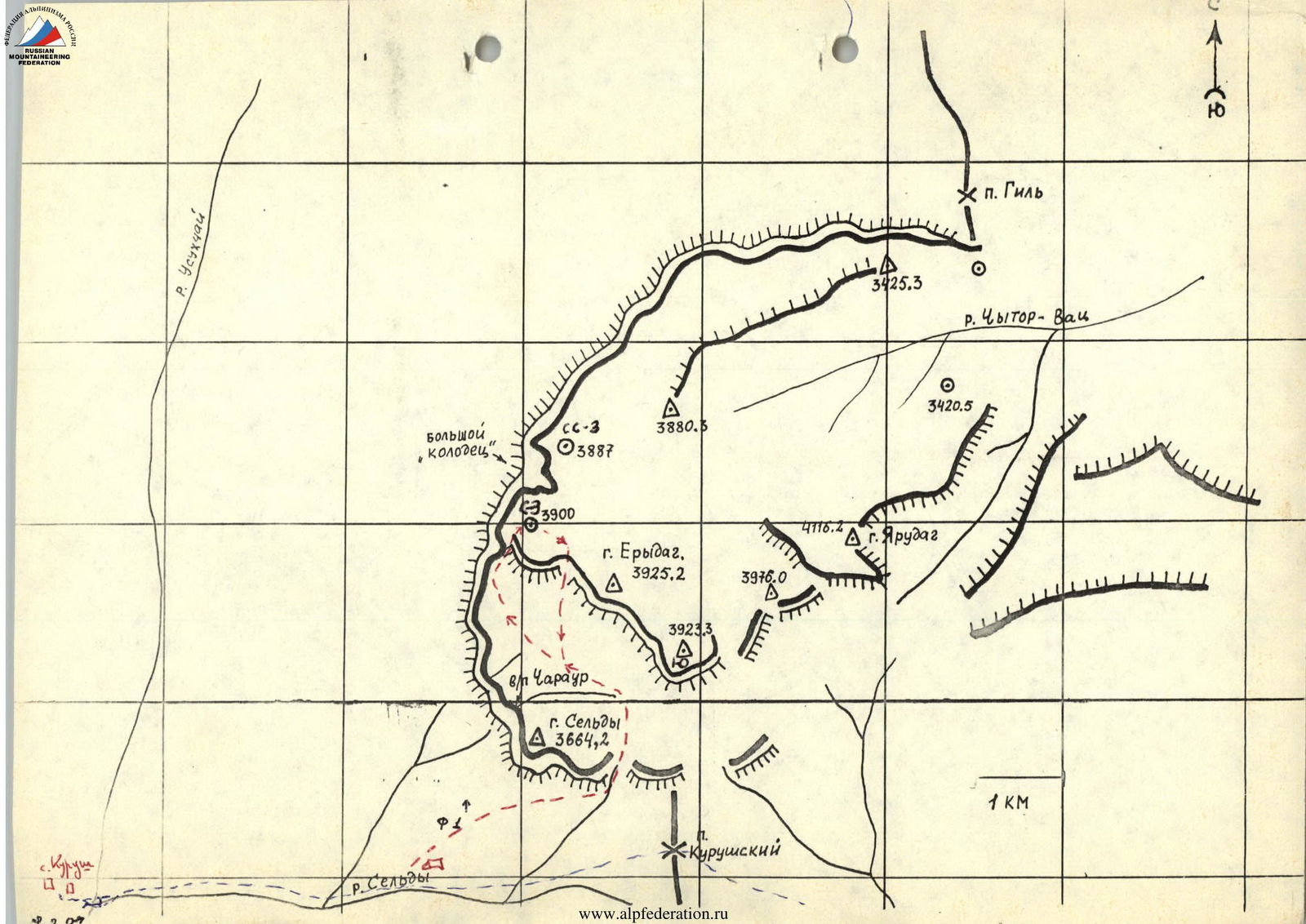
- Ery-dag N-3 from the plateau from the S, Tulaev M., 1980 Photo 1. Ery-dag N-3, view from the S
Route Description
From the overnight stay under the Yarudag massif (departure approximately at 5:00) approach the route of 25 difficulty category and reach the lower plateau of the massif. Move in the direction of the northwestern peak. The start of the route is from the southwestern side of the peak, characterized by a wide scree, limited on the right by rock bastions and on the left by a precipice. In the upper part, low rocks are visible. Time to ascend from the overnight stay to the start of the route — 3 hours.
Rappel in! The rocks are climbed by free climbing (simultaneously) and lead to the ridge of the counterforce. To the right, enter a steep snowy couloir (scree in summer). The couloir is traversed on the right side, 2 ropes, and then along the scree approach the rocks in the middle part of the couloir. (Piton protection.) Along the rocks of medium difficulty, approach the cleft in the wall — vertically split slabs. When passing through the wall, it is advisable to use wide chocks.
The cleft leads to a narrow inclined ledge under a low wall, which is climbed by free climbing on the right. Leads to a scree ledge. (Piton protection.)
To the right, a control cairn!
Then approach the smoothed wall, which is overcome on the right along the inner corner (stone plug!).
Exit onto a narrow rocky ridge, which leads to a wide summit slope.
Time to ascend to the peak from the start of the route — 4 hours.
Descent from the peak:
- along the eastern slope of 16 difficulty category,
- then along the ascent route.
Note: the route partially coincides with the upper part of the route of 5A difficulty category (Ery-dag along the 3rd wall), but in the traversed version is an independent route when approaching from the plateau from the side of Sel'dy mountain.
 Ery-dag N-3, view from the W. Photo 2.
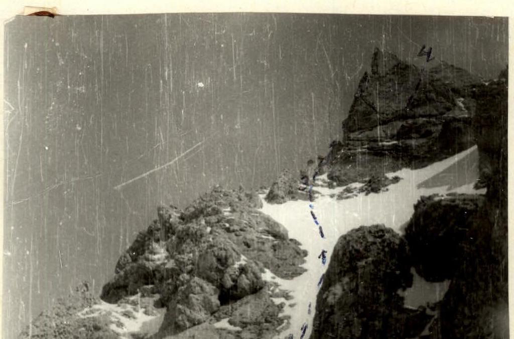 Sections 2–3; 3–4. Photo 3.