 2.10.39
Ascent Record
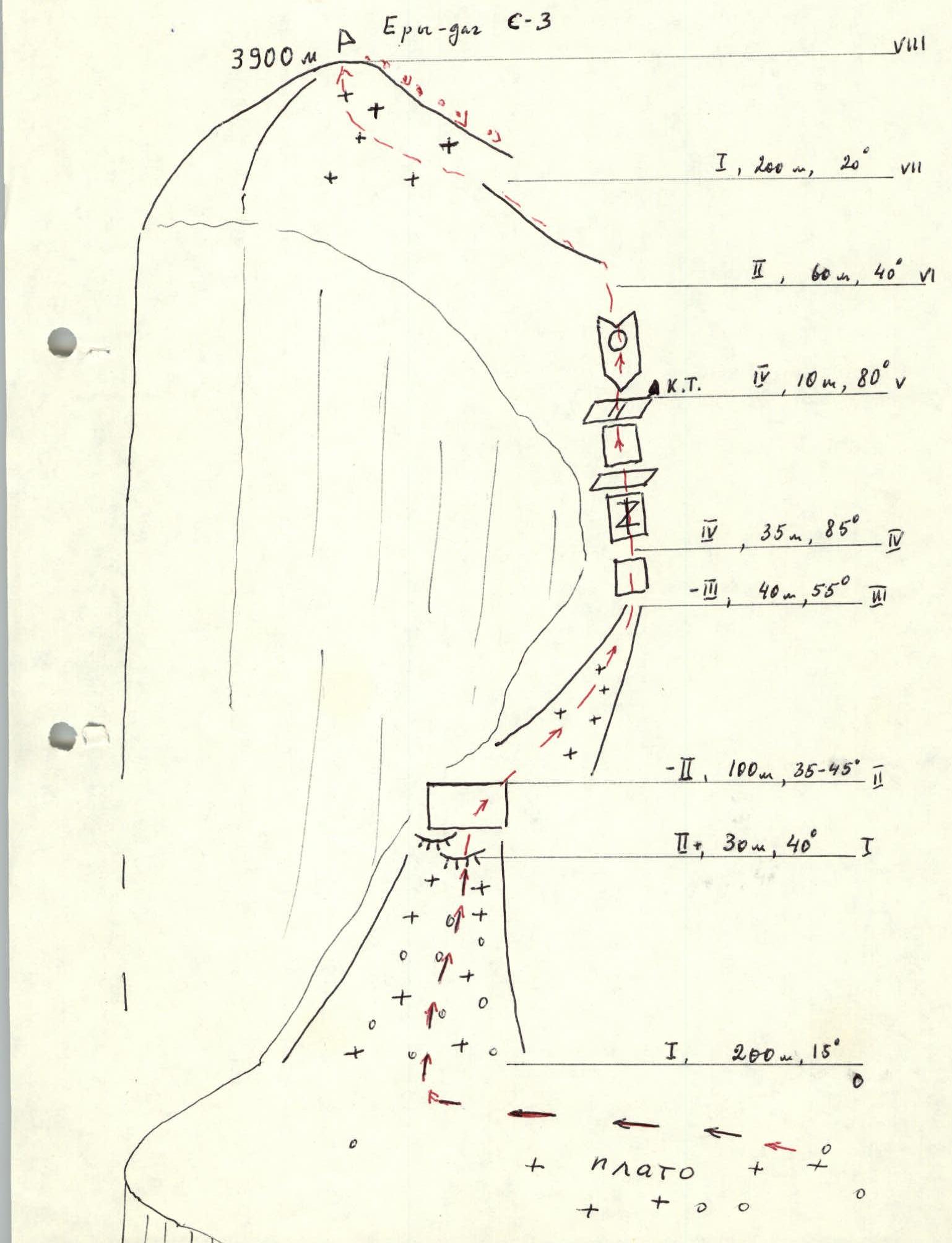
I. Ascent type: rock climbing 2. Ascent area: 2.96, Dagestan mountains 3. Peak, its height, ascent route: Ery-dag, 3900 m, via S-3 from the plateau and 3rd category slope 4. Difficulty category: 3A 5. Route characteristics: elevation gain — 400 m, section lengths: Category I difficulty — 400 m, II — « — — 190 m, III — « — — 40 m, IV — « — — 45 m. 6. Pitons used: 7 rock, 2 chocks 7. Total climbing hours: 10 h 8. Number of nights and their characteristics: 10 nights at the camp under the S slope of Yarudag massif 9. Climbers' names, their sports qualification: Mamedov A.G. II sports category Slobodenyuk Yu.Yu. I sports category 10. Ascent date: June 12, 1986 11. Team coach: Timoshin M.E. 12. Organization: Goskomsport DASSR
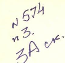
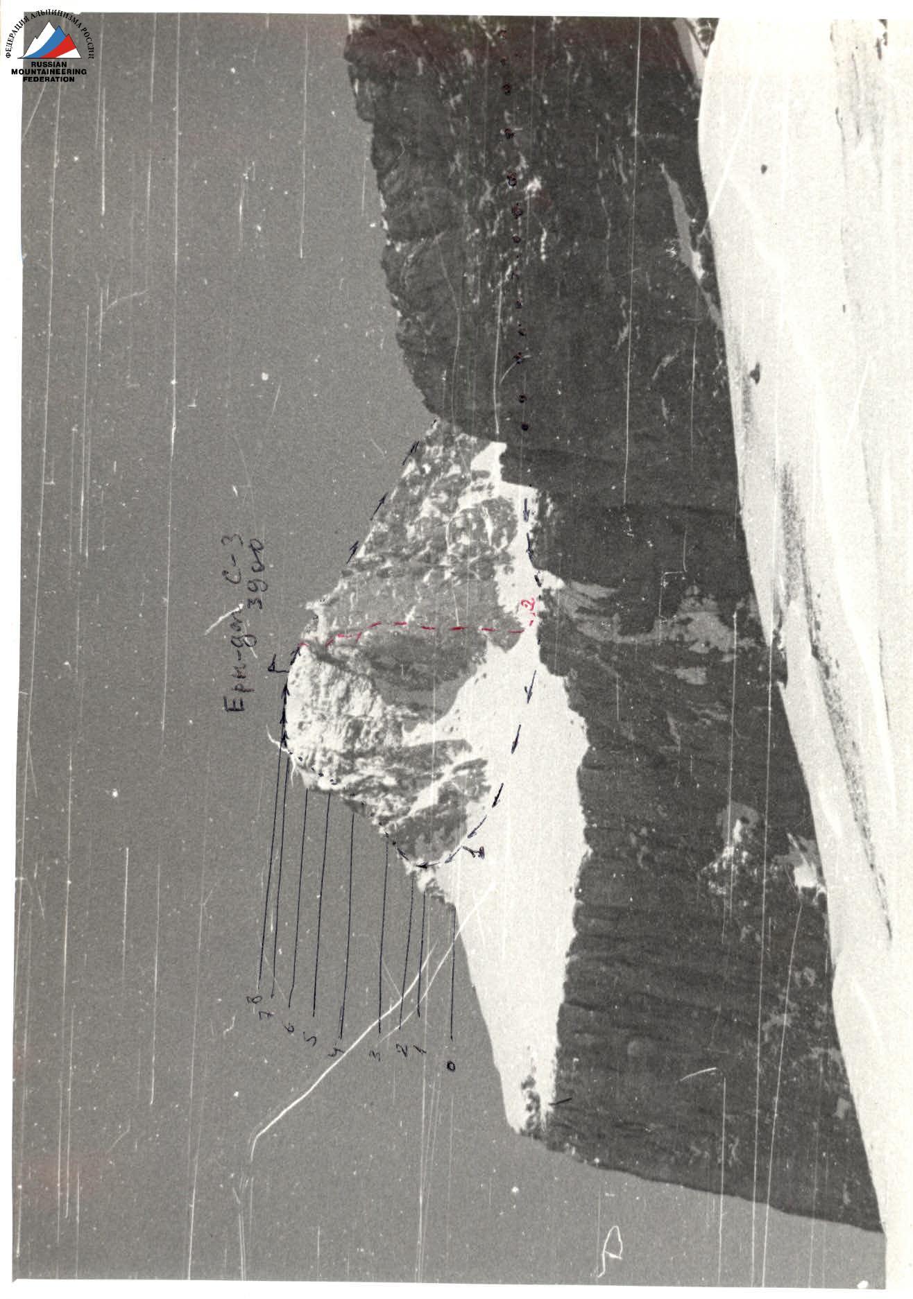 Photo 1. Ery-dag S-3, view from S.
Route Description
From the campsite under Yarudag massif (departure around 5:00 AM) approach the route of category 2B difficulty and reach the lower plateau of the massif. Move towards the northwestern peak.
The beginning of the route from the southwestern side of the peak is characterized by:
- a wide scree slope bounded on the right by rock bastions;
- a precipice to the left.
In the upper part, low rocks are visible.
Time from campsite to the start of the route — 3 h.
Rappel in! The rocks are climbed using free climbing (simultaneously) and lead to the ridge of the counterfort. To the right, enter a steep snowy couloir (scree in summer).
The couloir is climbed:
- on the right side, 2 ropes;
- then approach the rocks in the middle part of the couloir via scree (pitons used for protection).
Rocks of moderate difficulty lead to a crack in the wall — vertically split slabs. When climbing the wall, it's advisable to use wide chocks.
The crack leads to a narrow inclined ledge under a low wall, which is climbed using free climbing on the right. It leads to the main ledge (pitons used for protection).
To the right, a control cairn!
Then, approach a smooth wall, which is overcome on the right via an inner corner (cairn!).
Enter a narrow rocky ridge, which leads to a wide summit slope.
- Time from the start of the route to the summit — 4 h.
- Descent from the summit — via the eastern slope, category 1B difficulty, then follow the ascent route.
Note: the route partially coincides with the upper part of the category 5A route (Ery-dag via the 3rd wall), but in the climbed variant, it's an independent route when approaching from the plateau from the side of Sel'dy peak.
 |
|---|
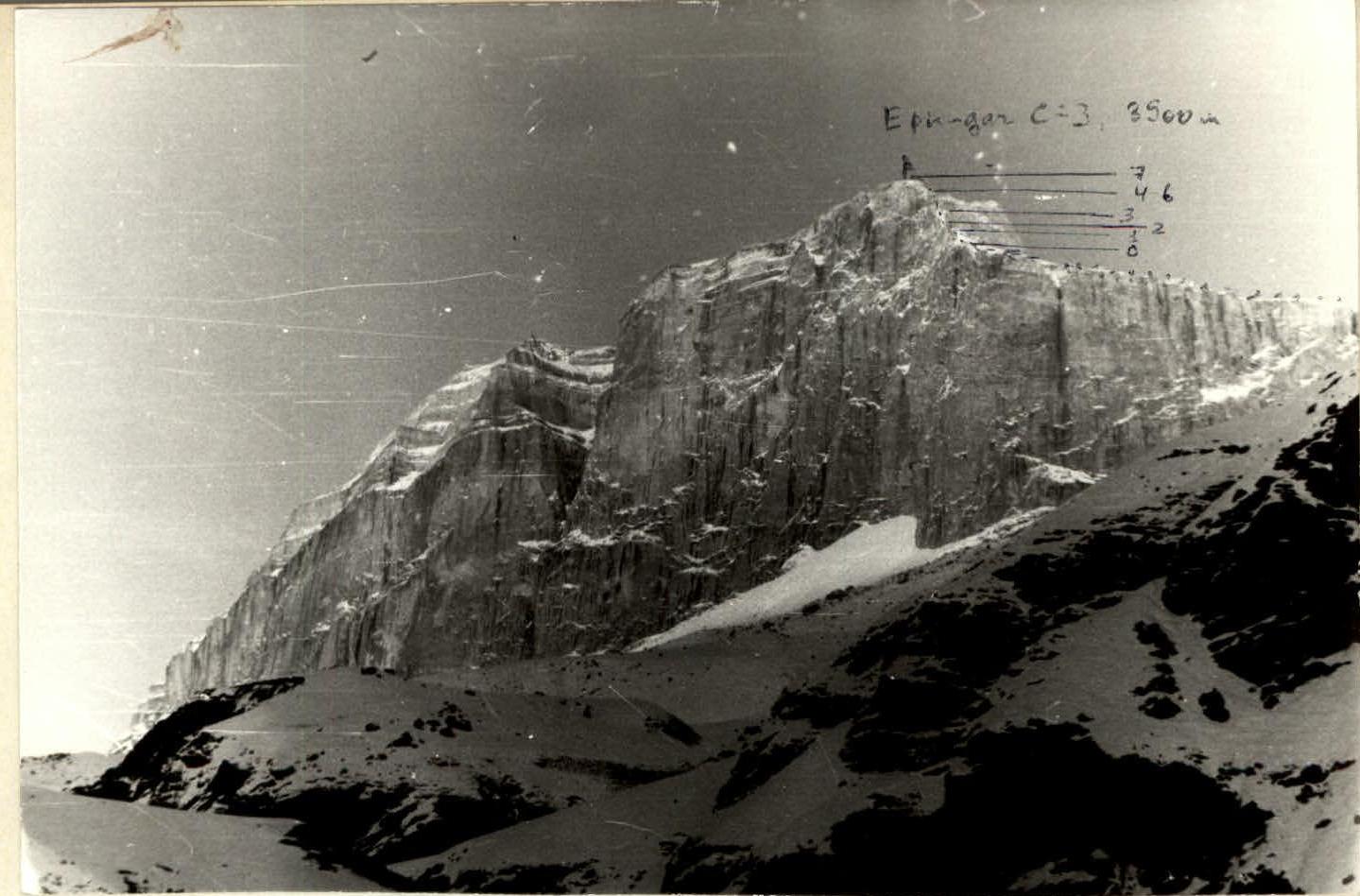 Photo 2. Ery-dag S-3, view from W.
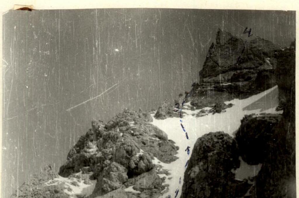 Photo 3. Sections R2–R3; R3–R4.