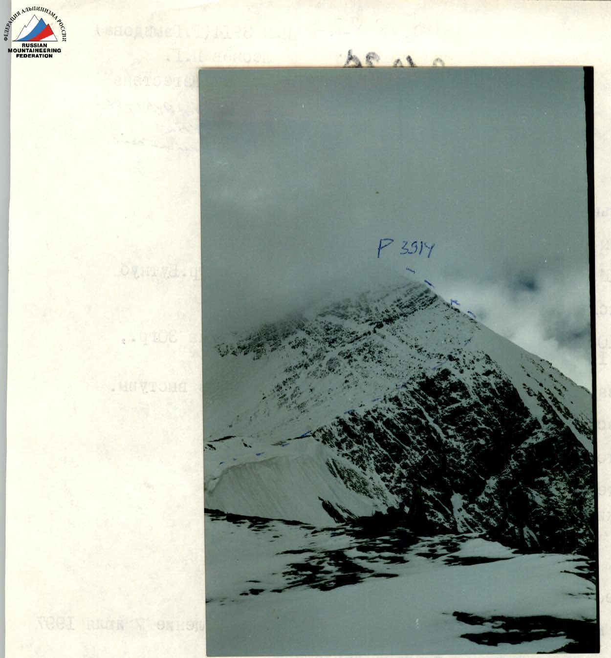
PASSPORT I. Rock class. 2. Caucasus, Dagestan mountains, Nukatl ridge. 3. Peak 3914 m (G. Gamidova) via the south-eastern ridge from Butnub pass 4. Proposed category 1B, first ascent 5. Elevation gain 2200 m, length 2200 m, average slope 30°, sections of category 1 difficulty — 200 m, sections of category 2 difficulty — 200 m 6. Pitons and nuts were not used, protection through rock features. 7. Climbing hours — 6 8. Overnight stays: only under the route 9. Leader: Leonov Pyotr Georgievich
Participants:
- Aliev Kamil Alievich
- Kuznetsov Stanislav Yurievich
- Makhanov Tagir Magomedovich
- Makovkin Mikhail Ivanovich
- Coach: Leonov P.G.
- Start of the route: July 7, 1997, summit and return July 7, 1997.
- Organization: Dagestan Alpine Federation
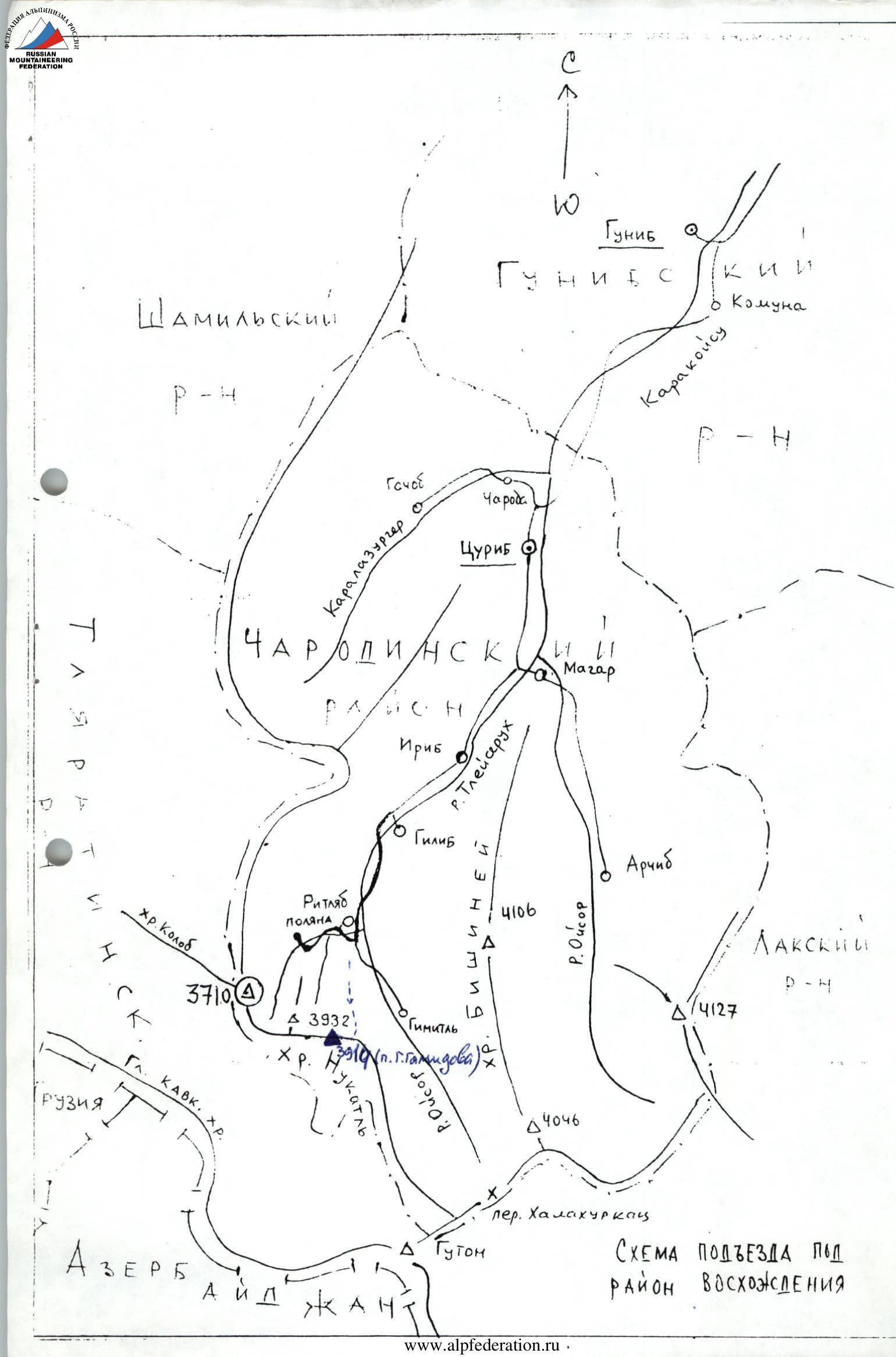
 Description of the approach to the route.
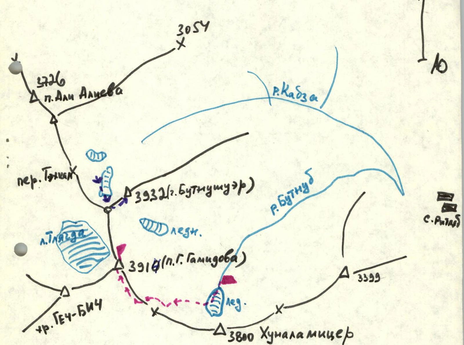
From the district center Tsurib (Charodinsky district) 32 km south along the highway to the village Ritlyab (2200 m). Past the farm, then along the right (orographic) bank of the Butnub stream on the trail, bypassing the summer camp, approach the upper reaches of this stream under the frontal moraine of the Khunalumitzer glacier. Biwak (approx. 2850 m). From the village Ritlyab 2.5–4 hours.
Description of the approach to the route.
From the district center Tsurib (Charodinsky district) 32 km south along the highway to the village Ritlyab (2200 m). Past the farm, then along the right (orographic) bank of the Butnub stream on the trail, bypassing the summer camp, approach the upper reaches of this stream under the frontal moraine of the Khunalumitzer glacier. Biwak (approx. 2850 m). From the village Ritlyab 2.5–4 hours.
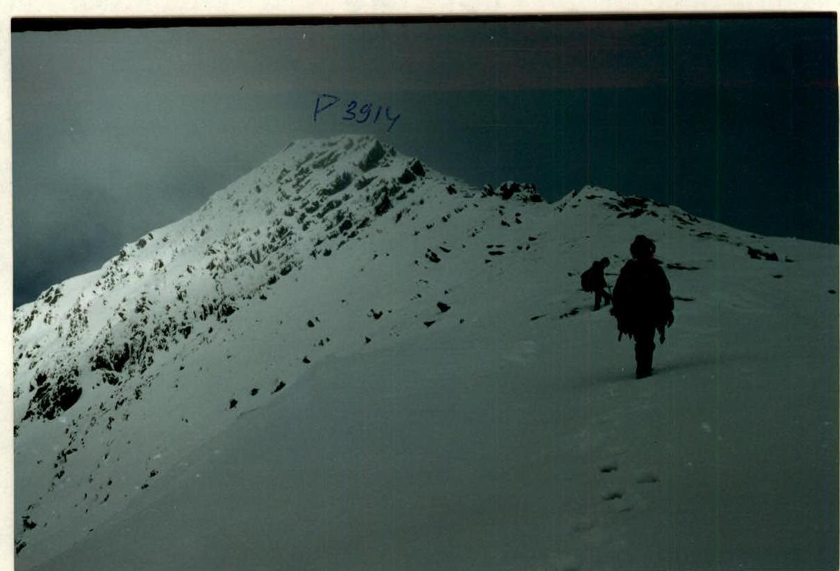
Route description. From the bivouac:
- First on the glacier, then up the slopes into the cirque under the Butnub pass.
- Snow cornices overhang the entire ridge.
- A safe path is up to the right on steep simple rocks.
- Cross the couloir (avalanches!).
- On simple rocks, reach a steep snowy ridge that abuts the main ridge.
- On a gentle, then steep (up to 45°) snowy ridge, reach the south-eastern ridge of peak 3914 m.
- Butnub pass remains to the left and below.
From the bivouac — 4 hours.
- Turn right.
- On a simple ridge (protection), overcoming short walls directly, reach the summit of peak 3914 m.
From the bivouac — 6 hours.
Descent via the ascent route.
 Dagestan. Nukatl ridge.
 → → → group route (Leonov, 97) → → → route 2A (Doppo, 91)