
REPORT ON THE FIRST ASCENT TO THE SUMMIT OF DZHarlam CENTRAL (3160 m) VIA THE ROUTE 4A cat. diff. ALONG THE SOUTH-WESTERN WALL AND SOUTHERN BUTTRESS BY THE "UAL" TEAM ON APRIL 1, 2024
I. Ascent Passport
| №№ p.p. | 1. General Information | |
|---|---|---|
| 1.1 | Full Name, Sports Rank of the Leader | Chikin Artyom Borisovich 1st sports rank |
| 1.2 | Full Name, Sports Rank of the Participants | Chelekhsaty Villi Levanovich 3rd sports rank |
| 1.3 | Full Name of the Coach | Yakovenko Alexander Nikolaevich |
| 1.4 | Organization | GC «UAL» |
| 2. Characteristics of the Ascent Object | ||
| 2.1 | Region | Dzheyrakhsky district. Republic of Ingushetia |
| 2.2 | Valley | Dzheyrakh valley |
| 2.3 | Section Number according to the 2013 Classification Table | Caucasus; 2.9. From the Krestoviy Pass to the Shaviklde peak |
| 2.4 | Name and Height of the Summit | Dzharlam Central 3160 m |
| 3. Characteristics of the Route | ||
| 3.1 | Route Name | along the South-Western wall and Southern buttress |
| 3.2 | Proposed Category of Difficulty | 4A |
| 3.3 | Degree of Route Exploration | First ascent |
| 3.4 | Nature of the Route Terrain | Rock |
| 3.5 | Height Difference of the Route | 500 m |
| 3.6 | Route Length | 600 m |
| 3.7 | Technical Elements of the Route | 1st cat. rocks – 220 m. 2nd cat. rocks – 10 m. 3rd cat. rocks – 80 m. 4th cat. rocks – 140 m. 5th cat. rocks – 125 m. 6th cat. rocks – 25 m. |
| 3.8 | Descent from the Summit | along the north-western ridge 1B cat. diff. |
| 3.9 | Additional Route Characteristics | No water, snow in the off-season and winter |
| 4. Characteristics of the Team's Actions | ||
| 4.1 | Time of Movement (team's walking hours, indicated in hours and days) | 5 h 30 min |
| 4.2 | Overnights | |
| 4.3 | Start of the Route | 9:00 April 1, 2024 |
| 4.4 | Summit Ascent | 14:30 April 1, 2024 |
| 4.5 | Return to the Base Camp | 17:00 April 1, 2024 |
| 5. Person Responsible for the Report | ||
| 5.1 | Full Name, e-mail | Chikin A.B. artem.chikin@mail.ru |
II. Ascent Description
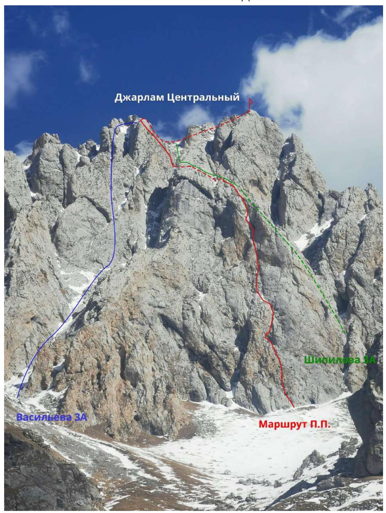 1.1. General photo of the summit of Dzharlam.
 1.2. Technical photograph.
 1.3. UIAA Scheme.
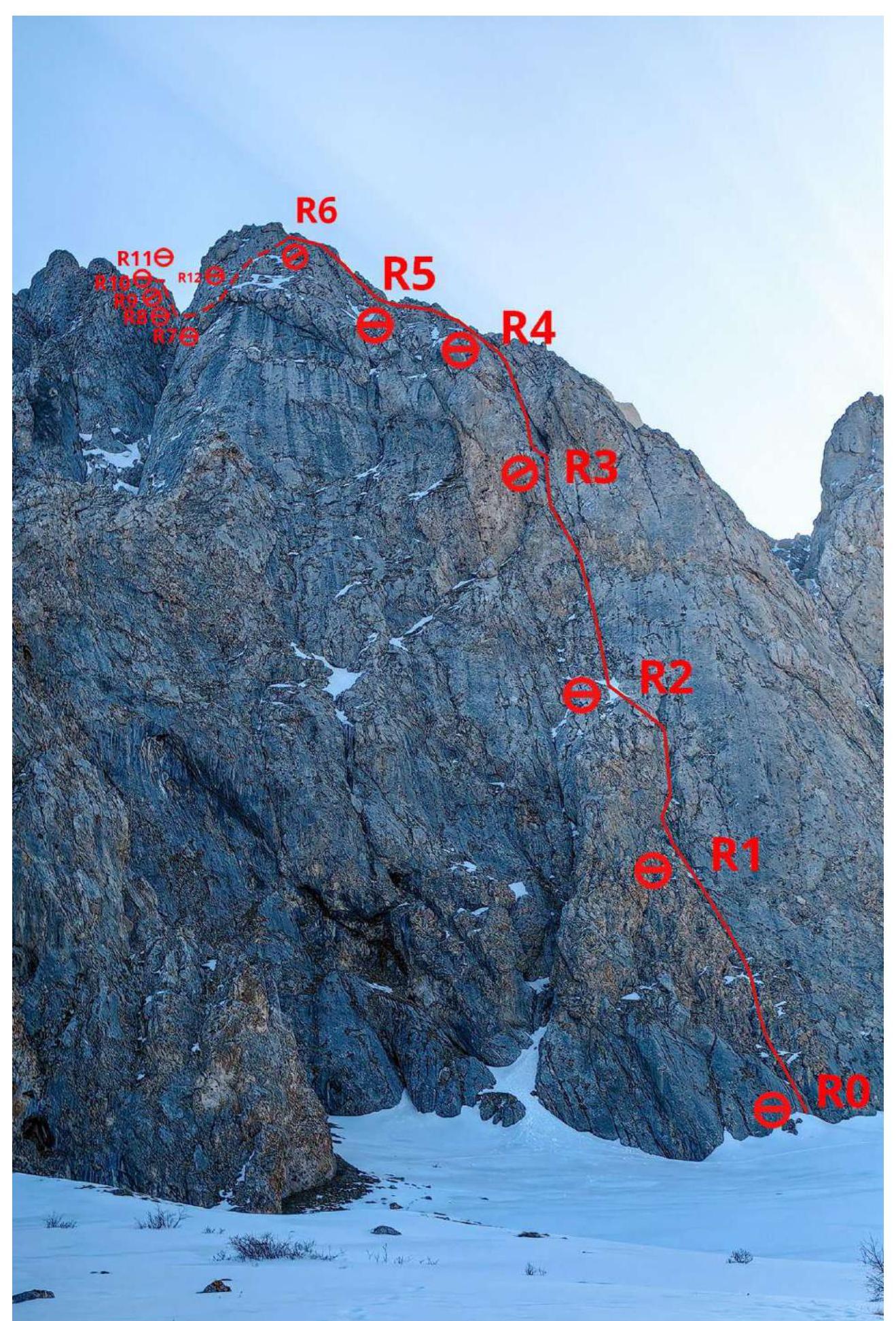
2. Route Characteristics
| Section № | Name, Number of Pitons | Belay Points, Characteristic B symbol ax | UIAA Route Line Symbols | Section Difficulty in Symbols | Section Length, m | Steepness ° | |
|---|---|---|---|---|---|---|---|
| Friends | Pitons | ||||||
| R11–R12 | 0–0 | 0–0 | 1 cat. diff. | 150 | 20 | ||
| R10–R11 | 0–0 | 2–0 | 2–4 cat. diff. | 40 | 50–60 | ||
| R9–R10 | 0–0 | 0–0 | 1 cat. diff. | 20 | 10 | ||
| R8–R9 | 1–0 | 3–0 | 4 cat. diff. | 50 | 60 | ||
| R7–R8 | 1–0 | 3–0 | 4 cat. diff. | 40 | 70 | ||
| R6–R7 | 0–0 | 0–0 |  | 1 cat. diff. | 50 | 20 | |
| R4–R5 R5–R6 | 2–0 | 1–0 |  | 3–4 cat. diff. | 100 | 50 | |
| R3–R4 | 2–0 | 6–0 |  | 5–6 cat. diff. | 40 | 80 | |
| R1–R2 | 3–0 | 8–0 |  |  | 5–6, 4 cat. diff. | 80 | 80 |
| R0–R1 | 2–0 | 5–0 |  |  | 4, 5, 4 cat. diff. | 50 | 60 |
3. Characteristics of the Team's Actions
3.1
| Section № | Description | Photo № |
|---|---|---|
| R0–R1 | Start from a small niche, along the grey wall with washed-out, sharp holds. Further along the yellow rocks with rich relief, inner corner, and up to the grotto-niche. Belay on anchors, friends, and sand clocks. Station in the left part of the grotto on anchors. | 1,2 |
| R1–R2 | From the grotto, climb left along the wall – V–VI climbing, bypassing and then traversing right into the chimney – inner corner – VI climbing. Then up along the inner corner, at the end a small chimney with an overhang, exit to an inclined shelf. Relief under the belay with any equipment, sand clocks. Station at the top of the shelf on anchors. | 3,4 |
| R2–R3 | Along the walls with vertical cracks and further into the rusty inner corner – VI climbing, along it to the chimney with a through hole. Belay with friends and anchors. Station before the chimney on large friends and anchors, better to make it deeper in the chimney, as further climbing is directly above the chimney. | 5 |
| R3–R4 | Along the wall with a slit left of the chimney and further to the right to the inner corner – VI climbing. Straight up to the exit onto the southern buttress. Belay on friends and anchors. Station on anchors, on the buttress ledges. | 6,7 |
| R4–R5 | Along the buttress straight up, sometimes left, sometimes right. Simultaneous movement is possible. Belay on ledges, anchors, friends. | 8 |
| R5–R6 | The buttress turns to the right along the direction of movement. Several descents down, a sharp ridge, and exit to the rappel station on the ledge. Belay on ledges, friends. | 9 |
| R6–R7 | 25 m rappel into the couloir. Along the couloir on foot, bypassing the gendarme on the buttress, 50 m towards the saddle and the next tower of the buttress. | 10,11 |
| R7–R8 | Along the wall with good but loose holds to a small ledge on the outcrop. Belay on anchors and friends. Station on anchors. | 12 |
| R8–R9 | To the right to the inner corner, going diagonally to the right and up. Along it to the inclined shelf. Belay on friends and anchors. Station on anchors. | 13 |
| R9–R10 | To the right along the shelf 15 m. Here, at the wall, there is a control cairn. Station on anchors. | 14 |
| R10–R11 | Up along the destroyed wall towards the ridge. On the ridge to the right and at the end, descend behind the bend. Belay on anchors. Station beyond the ridge bend. | 15,16 |
| R11–R12 | Along the slope about 150 m on foot to ascend to the summit of Dzharlam Central. | 16 |
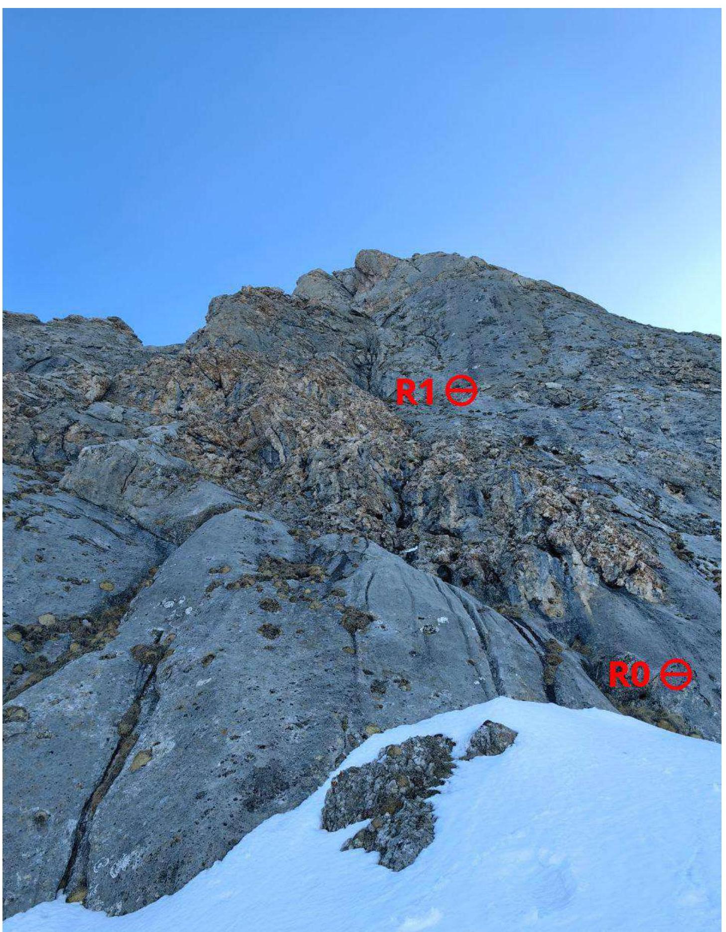
Photo 1. Start of the route R0–R1
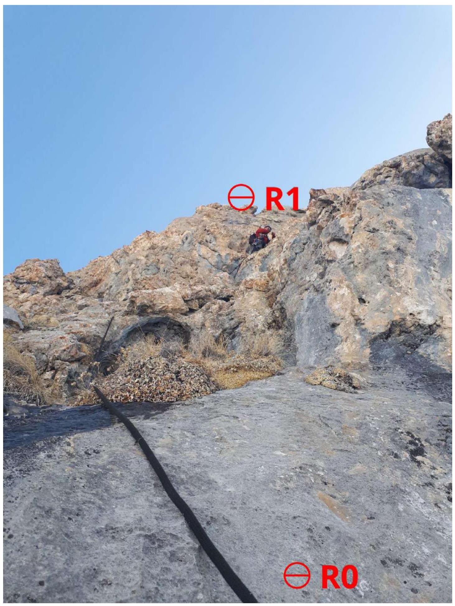
Photo 2. Section R0–R1
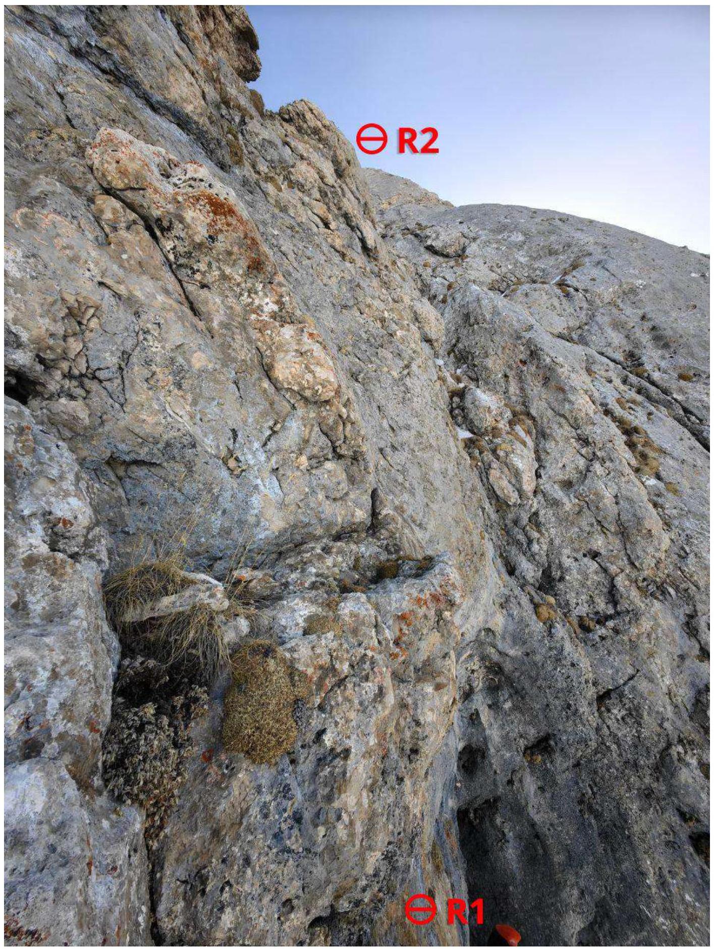
Photo 3. Section R1–R2
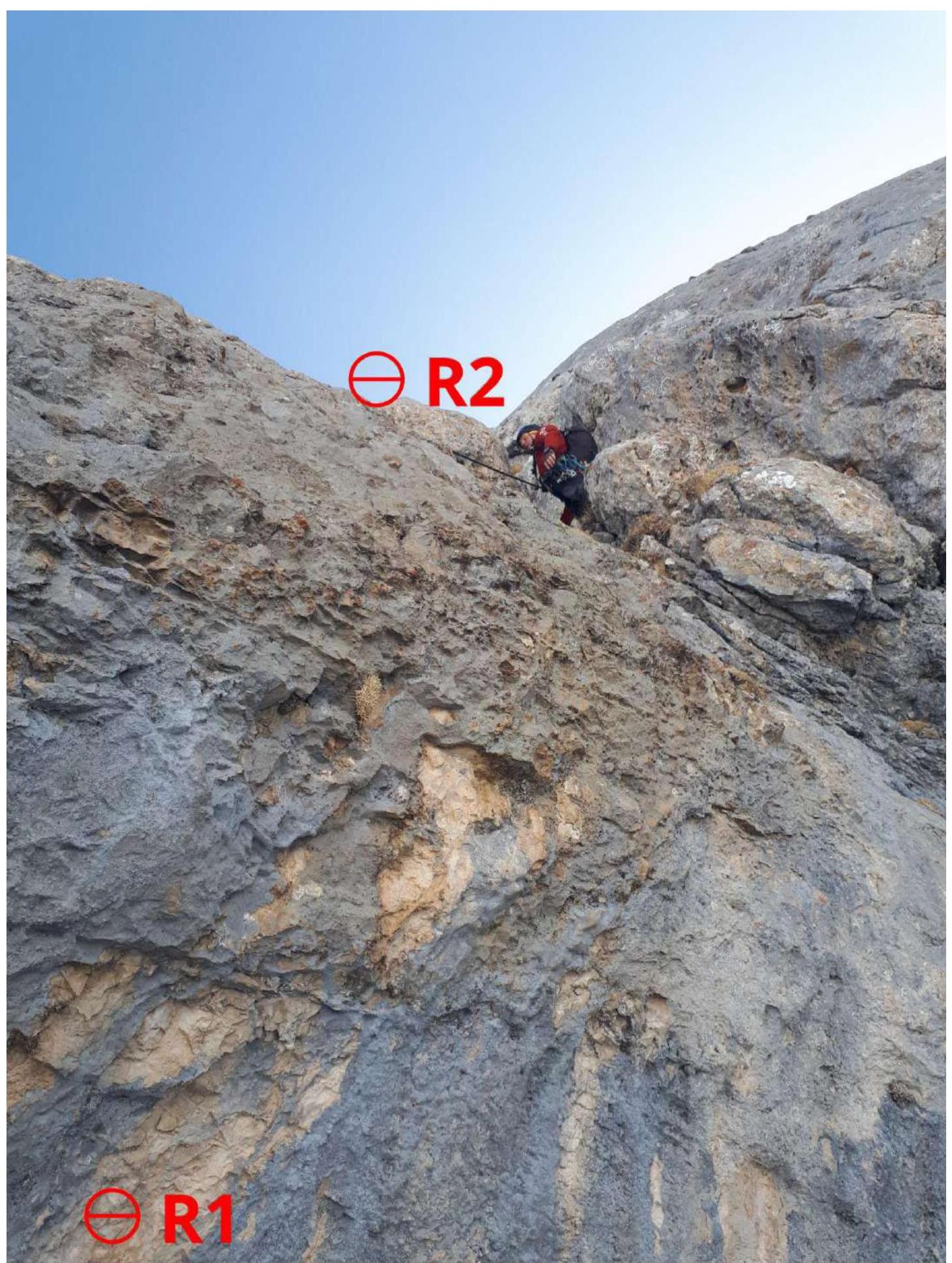
Photo 4. Section R1–R2 after climbing the grotto on the left

Photo 5. Section R2–R3
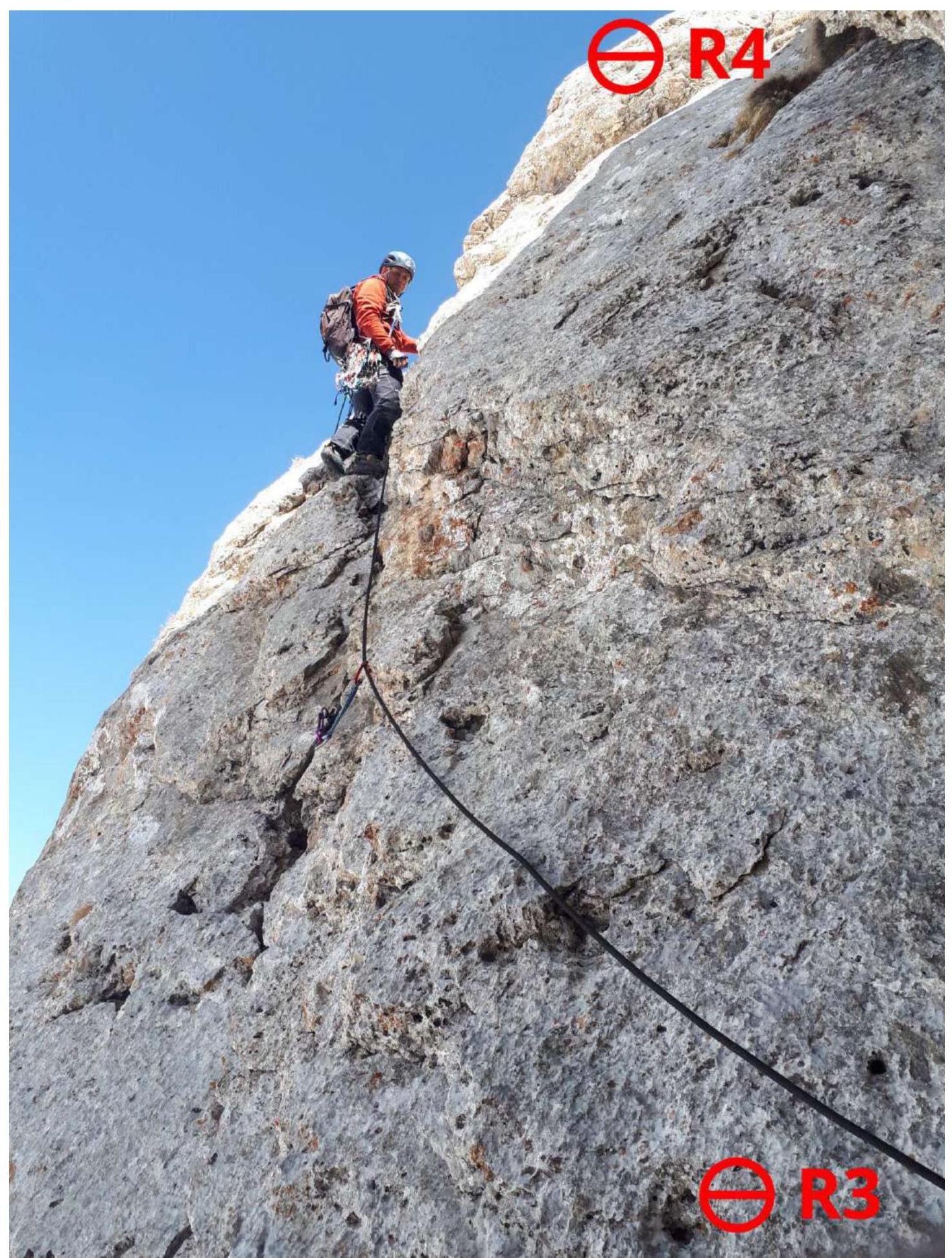
Photo 6. Section R3–R4
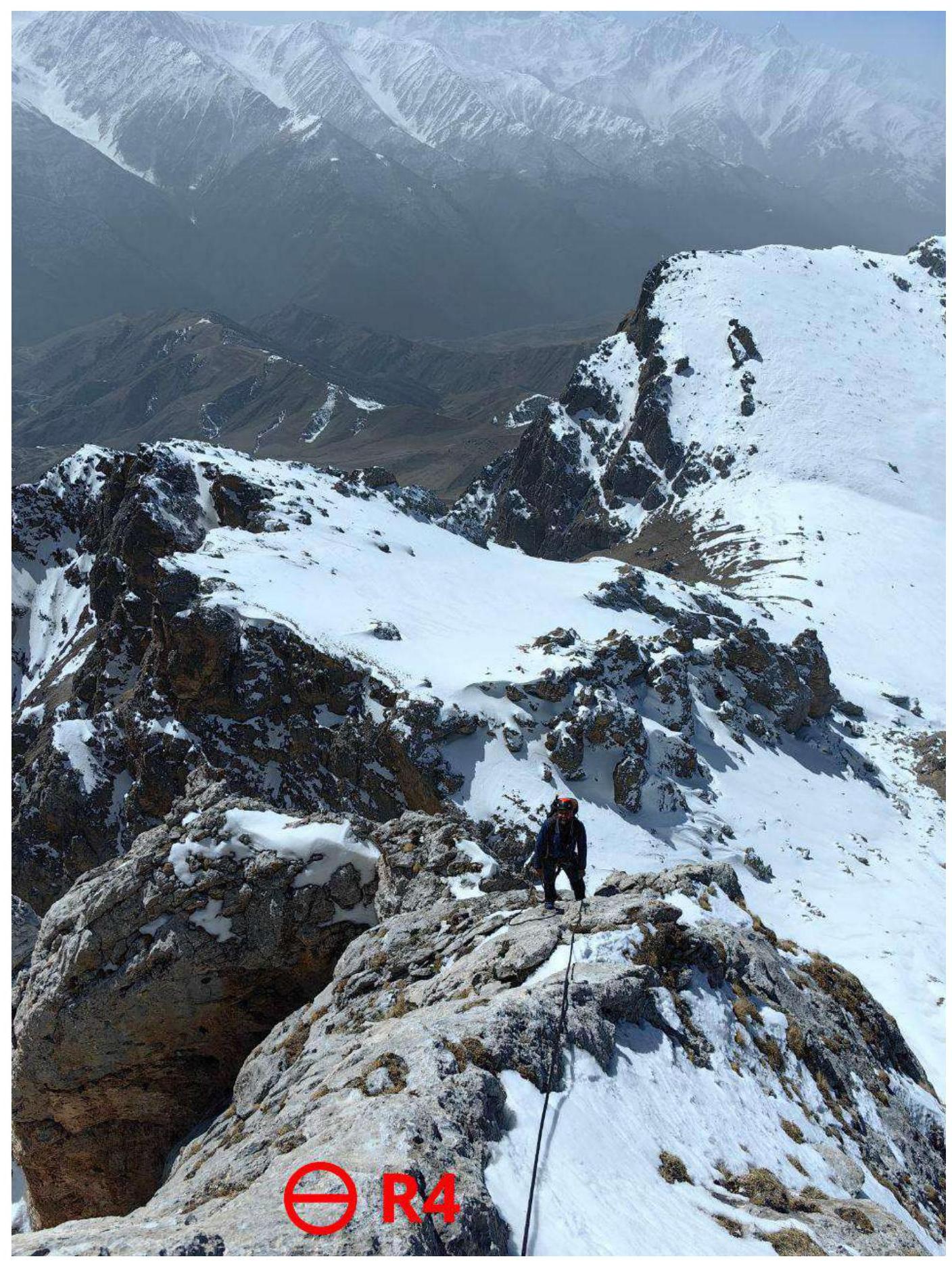
Photo 7. View down4 from station R4
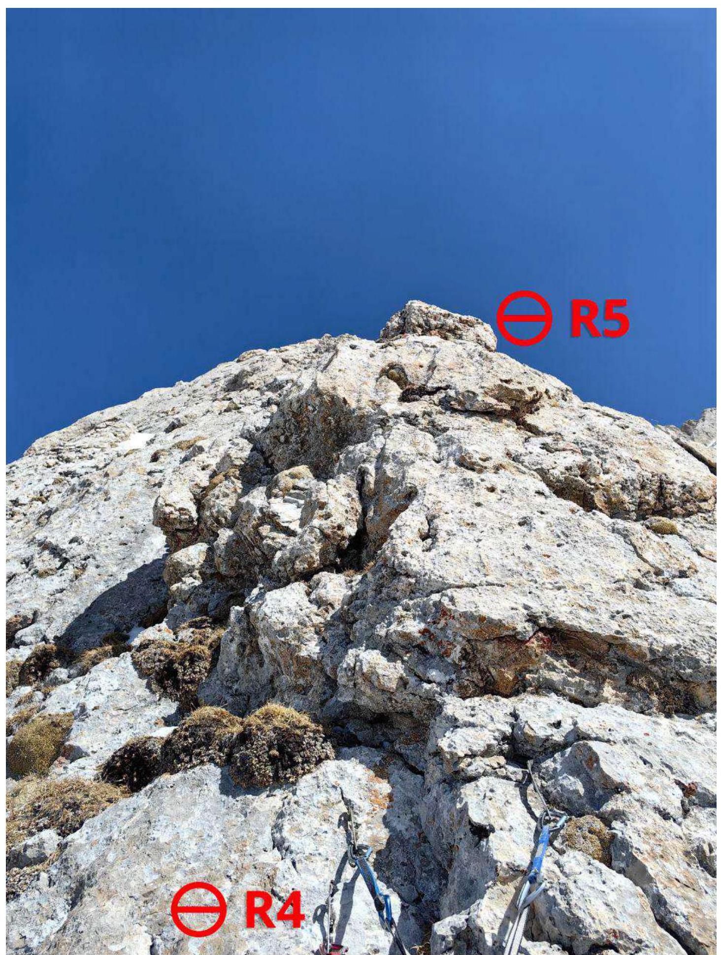
Photo 8. Section R4–R5
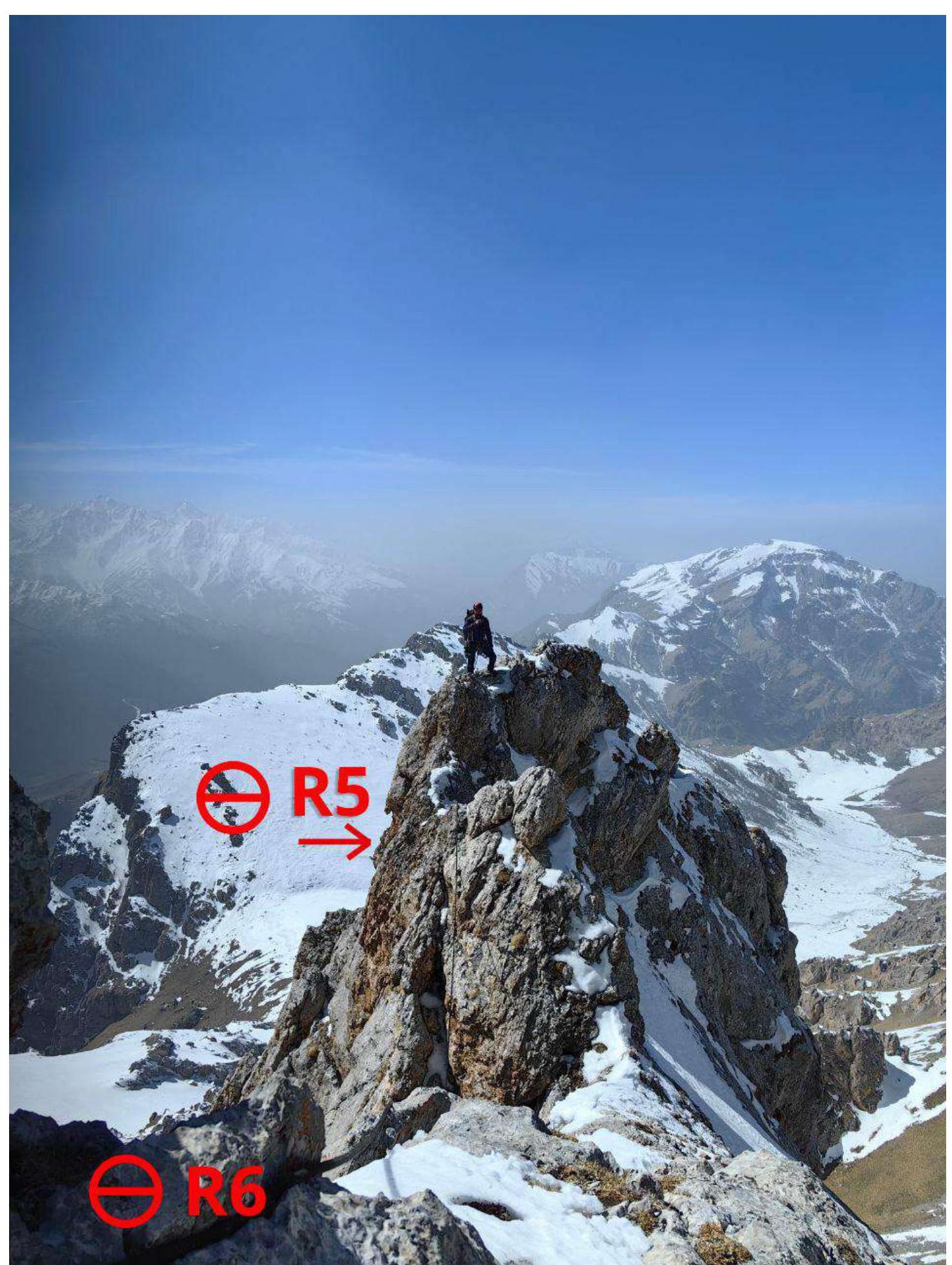
Photo 9. Section R5–R6
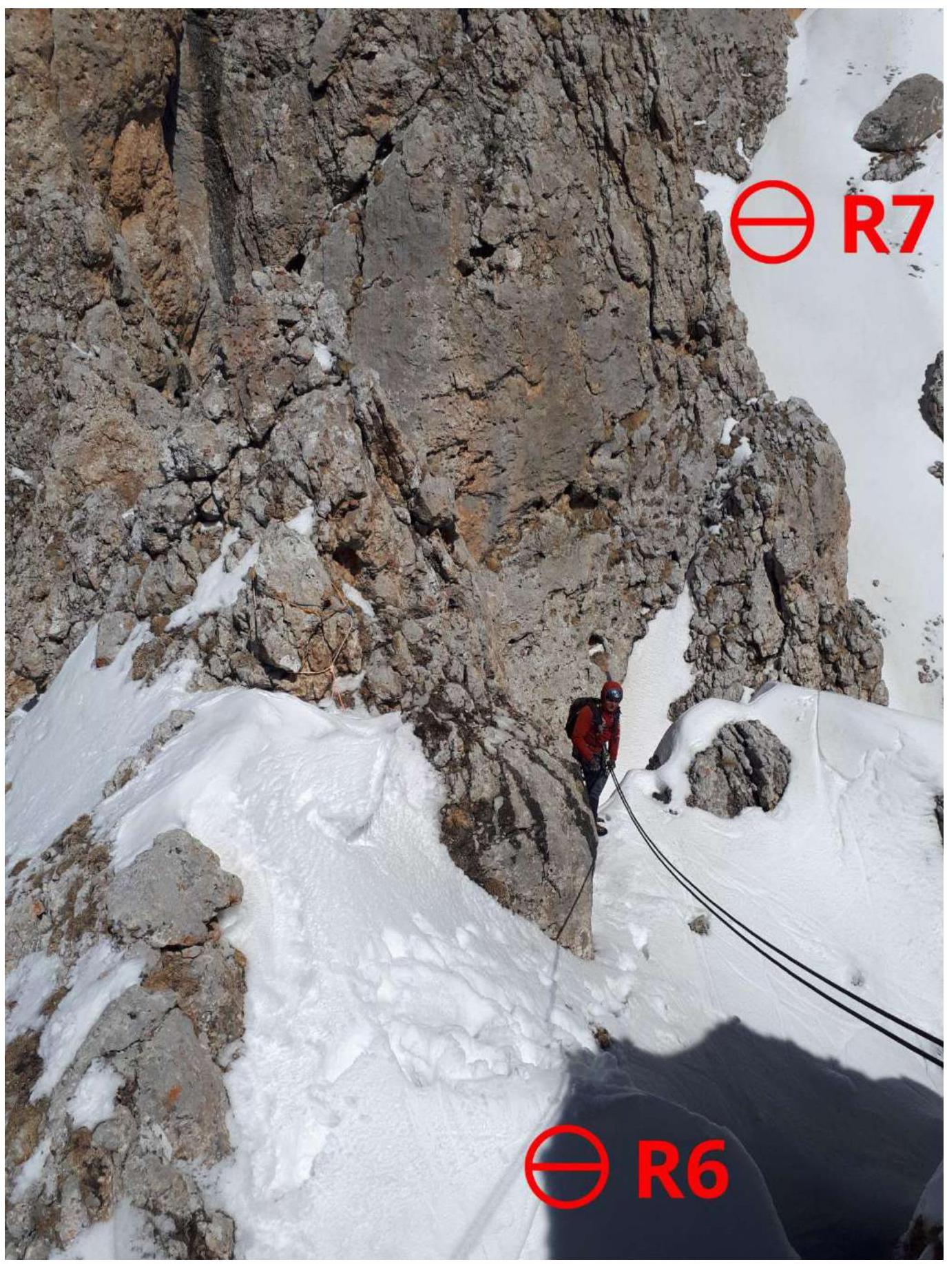
Photo 10. Section R6–R7 — 25 m rappel into the couloir
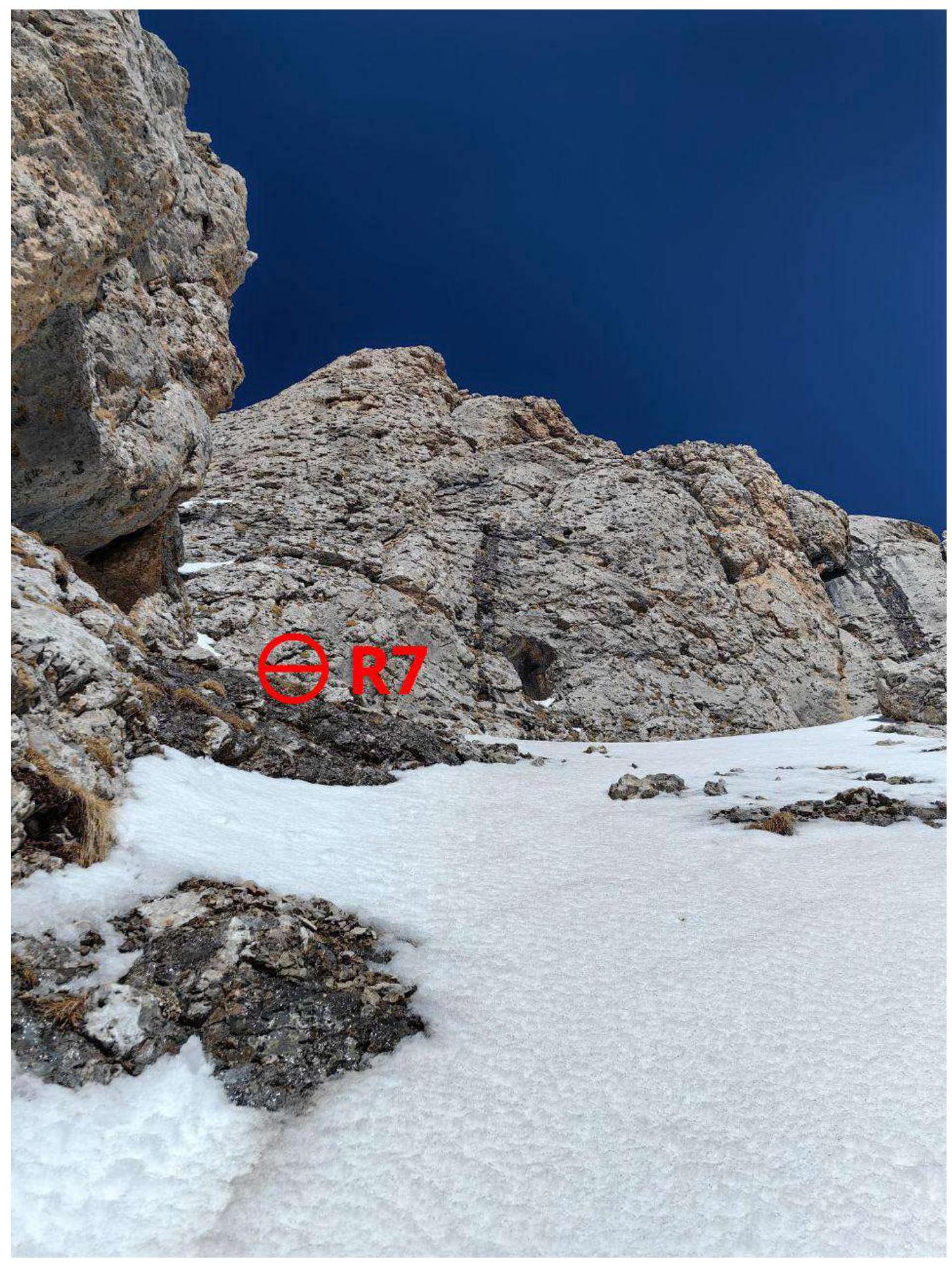
Photo 11. Section R6–R7 — bypassing the gendarme after the rappel
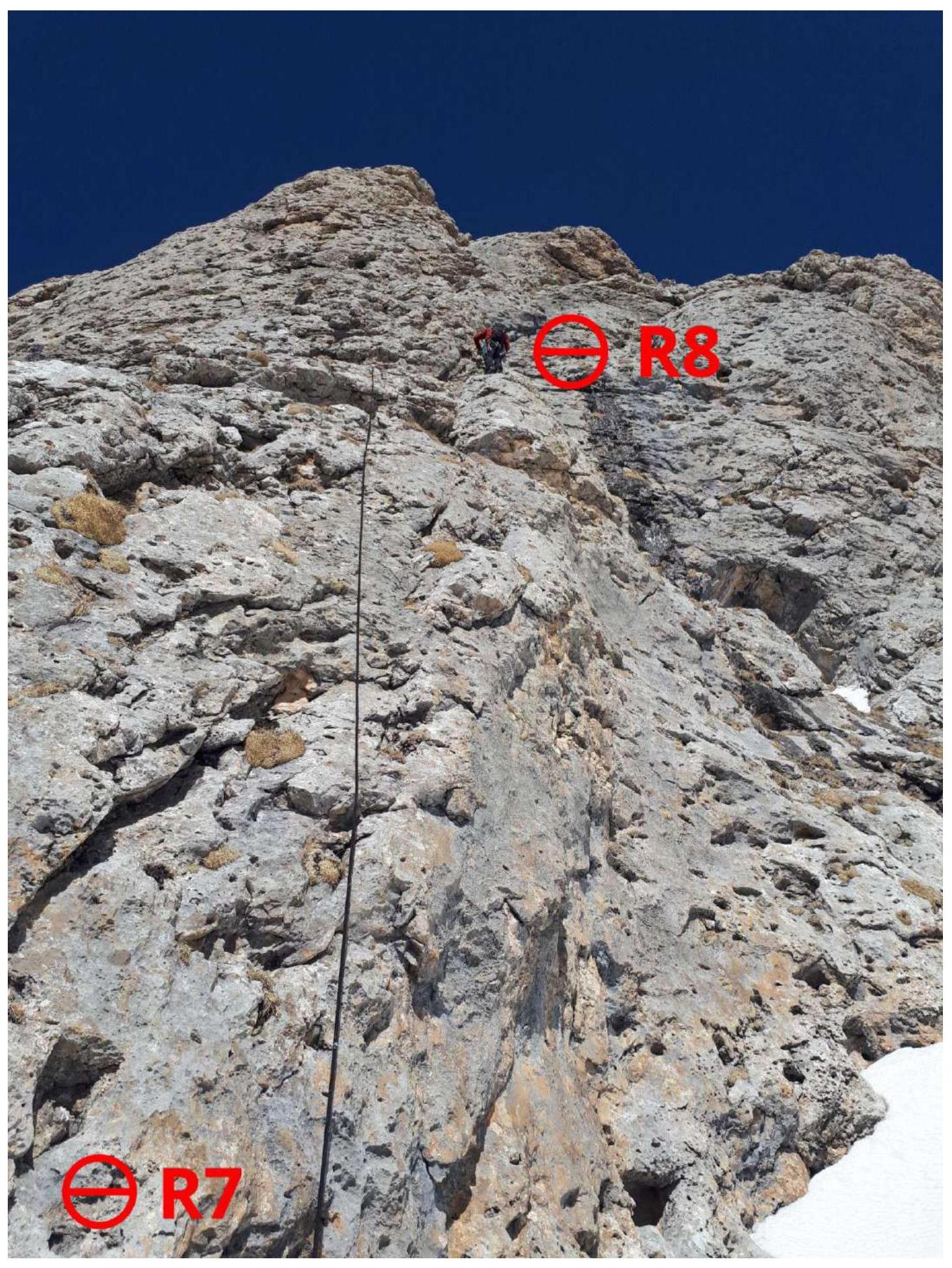
Photo 12. Section R7–R8
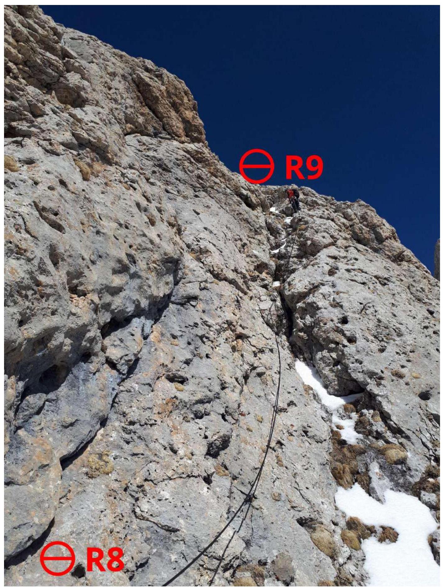
Photo 13. Section R8–R9
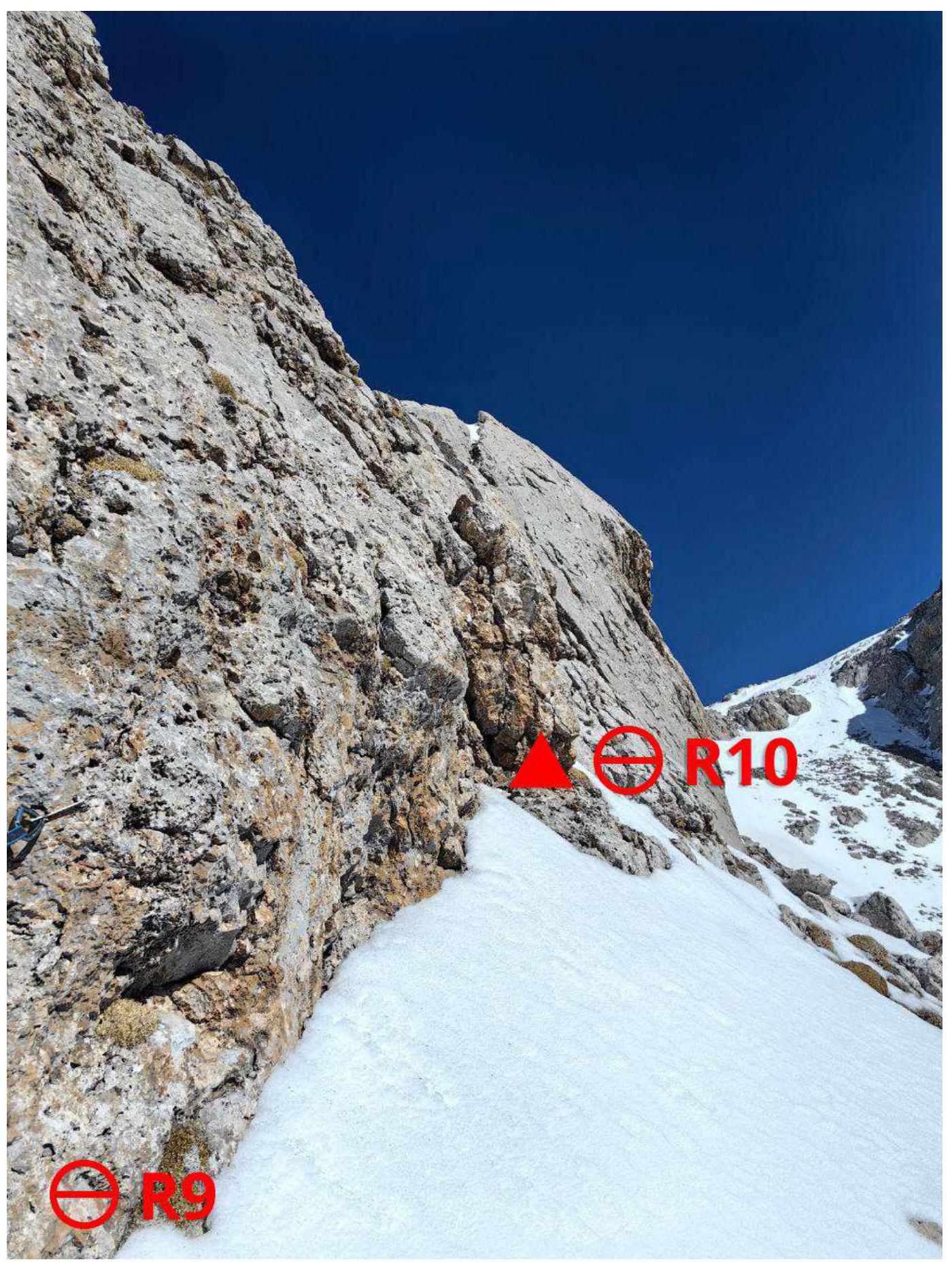
Photo 14. Section R9–R10. At the end of the shelf — control cairn.
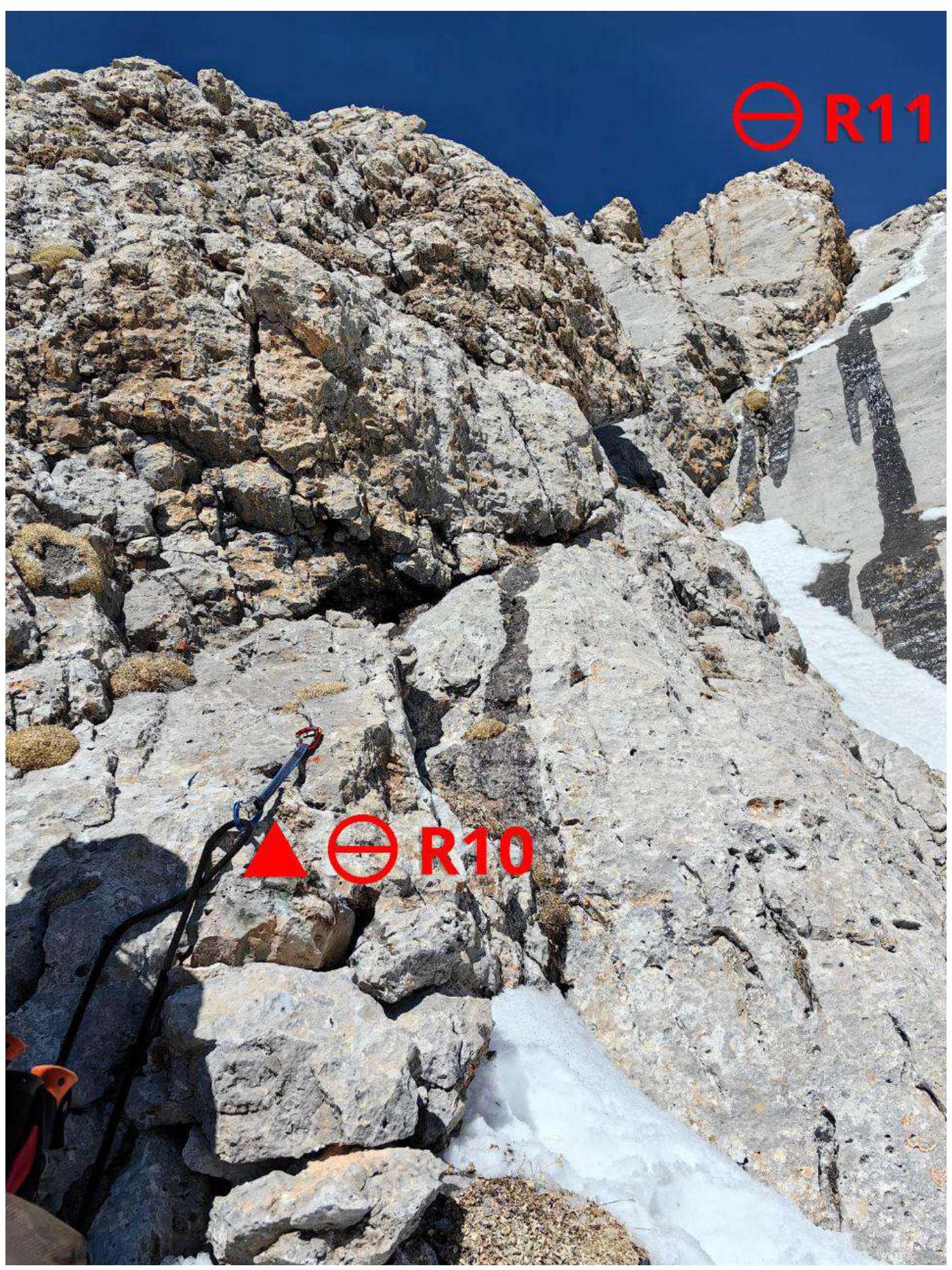
Photo 15. Section R10–R11 — control cairn.

Photo 16. Section R11–R12
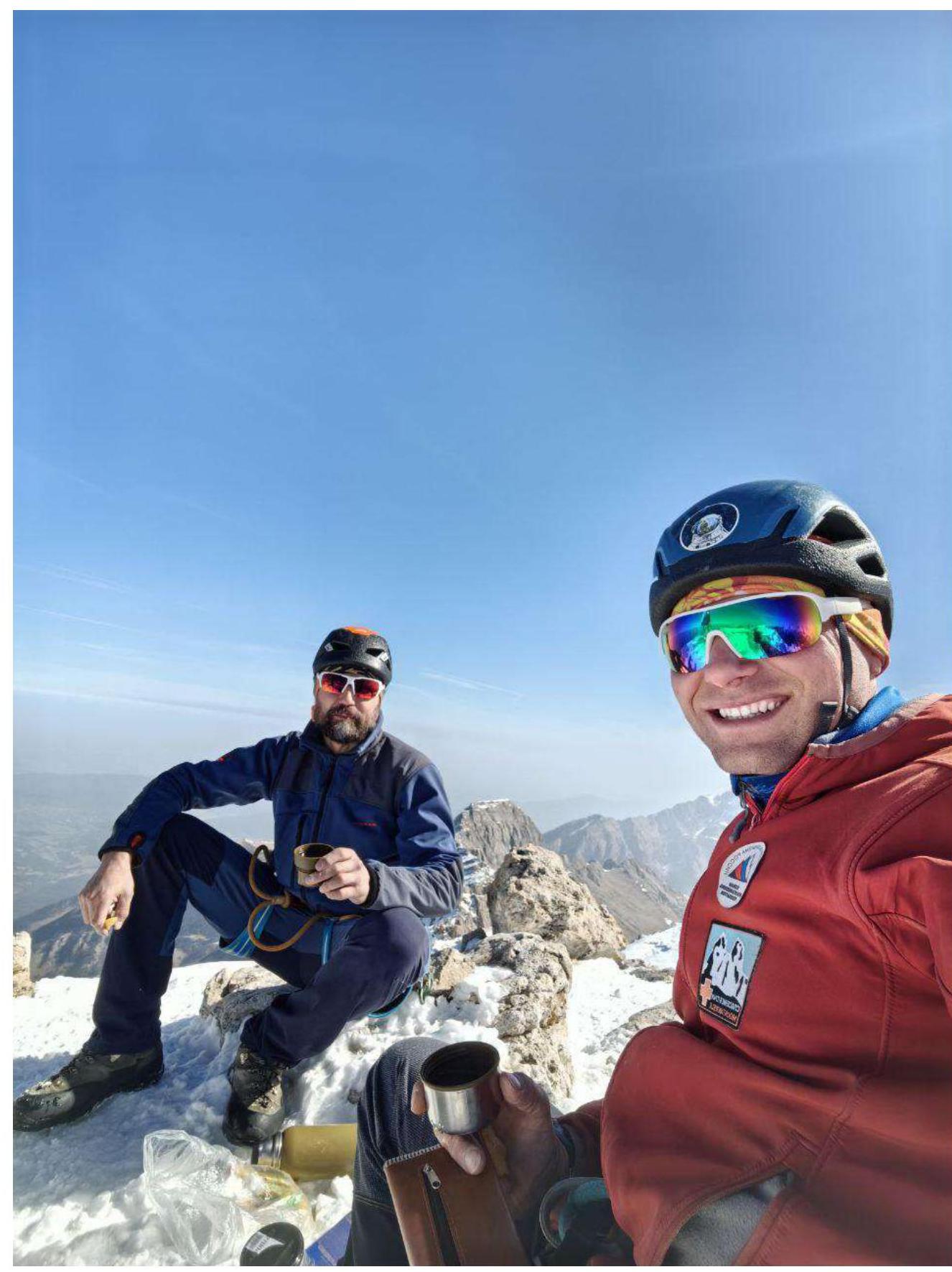
3.2 Photo 17. Team on the summit
3.3. The summit Dzharlam Central is located east of the Dzharlam Pass. From v. Guli to the pass is 2–3 h. Then you need to:
- Turn to the east
- Walk along the gully
- Further along the grassy ridges to the right part of the Dzharlam Central wall.
The route is recommended for sports teams. The route is significantly more challenging than the 3A route by Shipilov on Dzharlam Central and is similar in difficulty to the 4A route by Zurulaev on Zub. It's an interesting, logical line to the summit. Climbing on the key ropes is quite challenging. On the buttress, simultaneous movement is possible with good climbing skills.
Passage Features:
- It's advisable to climb when dry and in crampons.
- If it's not possible to complete the route in a day, on section R7, you can exit onto the 3A route by Shipilov and finish climbing along the couloir and the short wall at the end.
- In the off-season, there is snow on the route — crampons may be necessary.
Descent via route 1B along the north-western ridge, with one 10 m rappel on the descent.
Comments
Sign in to leave a comment