
REPORT ON THE FIRST ASCENT TO THE SUMMIT OF DZHarLAM (2867 m) VIA ROUTE 2A cat. diff., ALONG THE TERRACES OF THE SOUTHERN WALL ("CHEREPASHKI") BY THE "UAL" TEAM ON APRIL 28, 2023
I. ASCENT DOCUMENTATION
| № | 1. General Information | |
|---|---|---|
| 1.1 | Full Name, sports rank of the leader | Chikin Artem Borisovich 1st sports rank |
| 1.2 | Full Name, sports rank of participants | Kublakova S. 3rd sports rank, Kalashnikov P. 3rd sports rank, Morozova Yu. 3rd sports rank |
| 1.3 | Full Name of coach | Yakovenko Alexander Nikolaevich |
| 1.4 | Organization | Group "UAL" |
| 2. Characteristics of the ascent object | ||
| 2.1 | Region | Dzheyrakhsky district. Republic of Ingushetia |
| 2.2 | Gorge | Dzheyrakh gorge |
| 2.3 | Section number according to the 2013 classification table | Caucasus; 2.9. From the Krepostovy pass to the Shaviklde peak |
| 2.4 | Name and height of the peak | Dzharlam 2867 m |
| 3. Characteristics of the route | ||
| 3.1 | Name of the route | along the terraces of the Southern wall |
| 3.2 | Proposed category of difficulty | 2A |
| 3.3 | Degree of route development | First ascent |
| 3.4 | Relief characteristics of the route | Rocky |
| 3.5 | Height difference of the route | 500 m |
| 3.6 | Route length | 1200 m |
| 3.7 | Technical elements of the route | I cat. diff. — 20 m. II cat. diff. — 48 m. III cat. diff. — 25 m. IV cat. diff. — 18 m. |
| 3.8 | Descent from the summit | via route 1B along the Southern couloir and eastern ridge |
| 3.9 | Additional route characteristics | No water, snow in the off-season and winter |
| 4. Characteristics of the team's actions | ||
| 4.1 | Time of movement (team's walking hours, indicated in hours and days) | 3 h 30 min |
| 4.2 | Overnight stays | |
| 4.3 | Start of the route | 6:50 April 28, 2023 |
| 4.4 | Reaching the summit | 10:20 April 28, 2023 |
| 4.5 | Return to the base camp | 14:00 April 28, 2023 |
| 5. Person responsible for the report | ||
| 5.1 | Full Name, e-mail | Chikin A. B. artem.chikin@mail.ru |
II. ASCENT DESCRIPTION
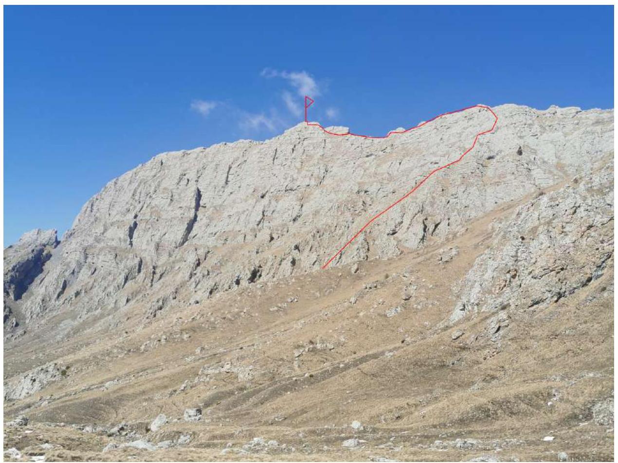 1.1. General photo of the summit of Dzharlam
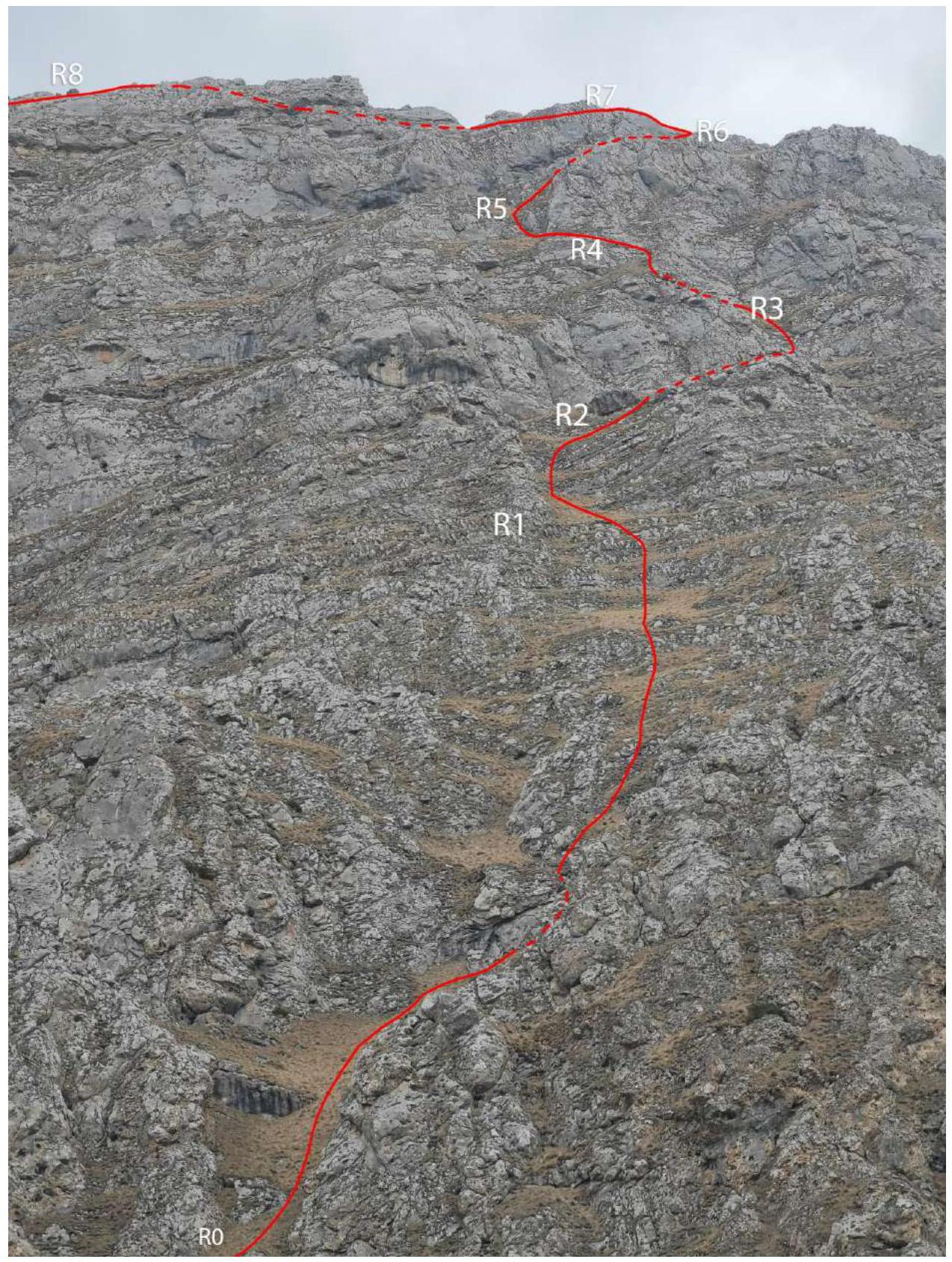 1.2. Route scheme by sections to the ridge
| Section № | Relief characteristics | Category of difficulty | Length, m | Type and number of hooks |
|---|---|---|---|---|
| R0–R1 | Grassy slope | n/c | 300 m | - |
| R1–R2 | Rocky steps | 2 | 10 m | - |
| R2–R3 | Wall | 3 | 10 m | - |
| R3–R4 | Wall | 2 | 8 m | - |
| R4–R5 | Wall | 4 | 5 m | Friends 2 pcs. |
| R5–R6 | Grassy slope | n/c | 100 m | - |
| R6–R7 | Rocky ridge | 4 | 10 m | Protrusion |
| R7–R8 | Scree couloir | n/c | 200 m | - |
| R8–R9 | Grassy ridge | n/c | 200 m | - |
| R9–R10 | Rocky blocks | 2 | 30 m | Simultaneous |
| R10–R11 | Grassy terraces | n/c | 300 m | - |
| R11–R12 | Ridge – inner corner | 3 | 15 m | Protrusions |
3. CHARACTERISTICS OF THE TEAM'S ACTIONS
| Section № | Description | Photo number |
|---|---|---|
| R0–R1 | The route begins with a grassy couloir, which narrows after 100 m and then turns into a grassy slope with rock outcrops, all of which are bypassed on the grass. 350 m. | 1,2 |
| R1–R2 | Overcome 2 rocky steps 2. The first is 4 m, the second is 6 m, and exit via the next grassy ledge under the wall. Insurance is simultaneous. | 3 |
| R2–R3 | Gentle wall with grass 10 m, 3. Move from right to left, to the next grassy ledge, and then to the next wall. Insurance is simultaneous. | 4 |
| R3–R4 | Wall with a grassy ledge, passed in a zigzag from right to left. 8 m 2. Then exit to a grassy ledge and approach the next wall. Insurance is simultaneous. | 5 |
| R4–R5 | Rocky wall with a crack-split. 8 m. 4. A station can be organized on the exit to the left on a protrusion. For insurance, friends and cams. | 6 |
| R5–R6 | Move along a grassy terrace upwards to the right, towards the passage and bend in the ridge. 100 m. | 7 |
| R6–R7 | Climb over the ridge and, turning left, climb along the ridge for about 10 m 4. Psychologically, it can be scary. The key to the route. At the exit, on the ledge, a control cairn! For insurance, loops and friends. | 8 |
| R7–R8 | Pass along the ridge, bypassing rocks on the ledges into the couloir of route 1B, which leads to the main ridge of Dzharlam 200 m. Then the route follows 1B "Along the S. couloir and E. ridge". | 9 |
| R8–R9 | Move along the ridge and mainly along its southern side, reach the depression in the ridge. 200 m. | 10 |
| R9–R10 | Start climbing up rocky blocks and boulders 2. 30 m and then along the ridge and southern side towards the visible summit tower. | 11 |
| R10–R11 | Before the summit tower, bypass the overhanging rusty rocks on the left, from the southern side along grassy terraces. | 12 |
| R11–R12 | Turn right, approach the inner corner in the ridge, climb through it onto the ridge and left along the ridge, rocks 3. 15 m. Then, after 50 m, the summit. For insurance, loops. | 13,14 |
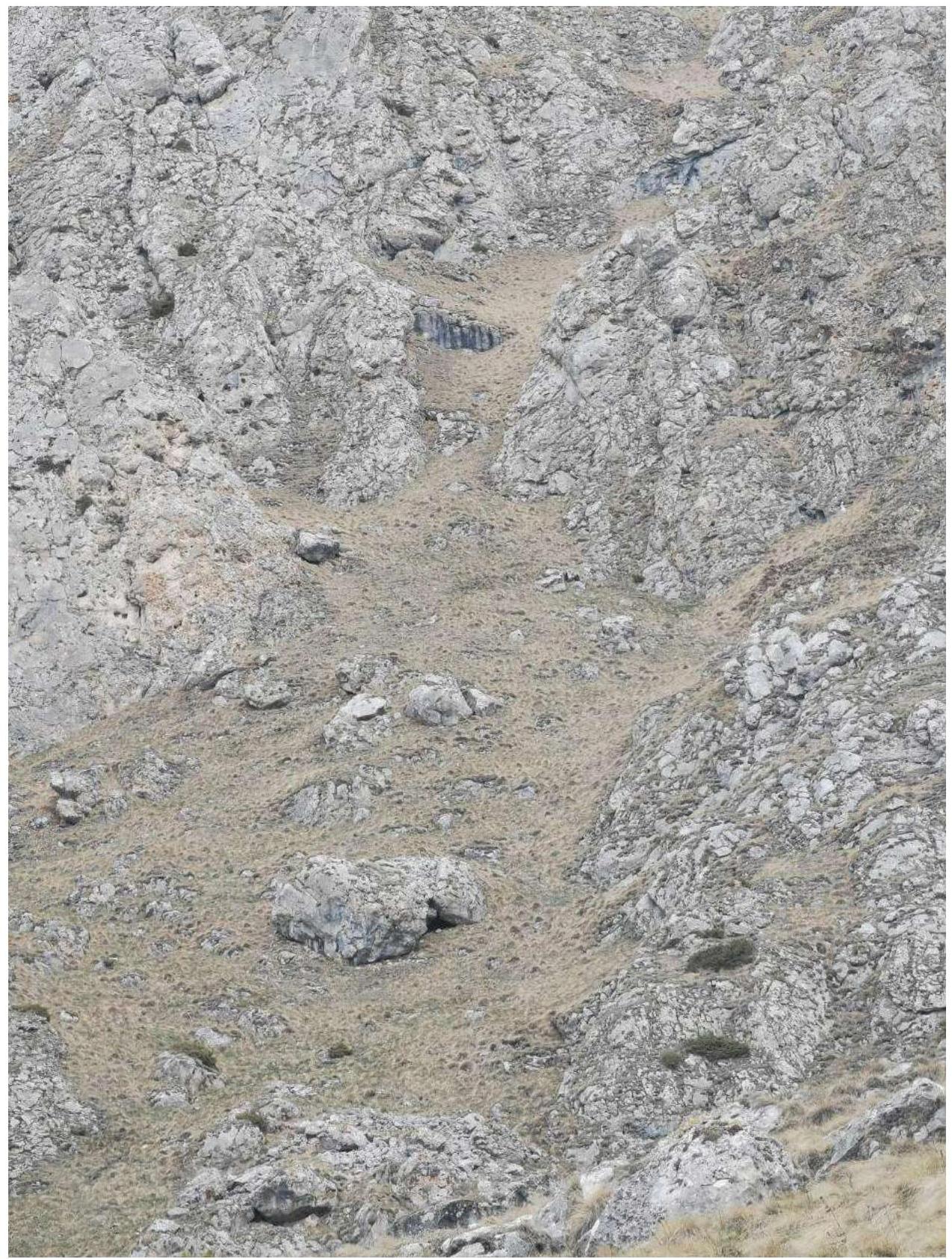 Photo 1. Start of the route R0
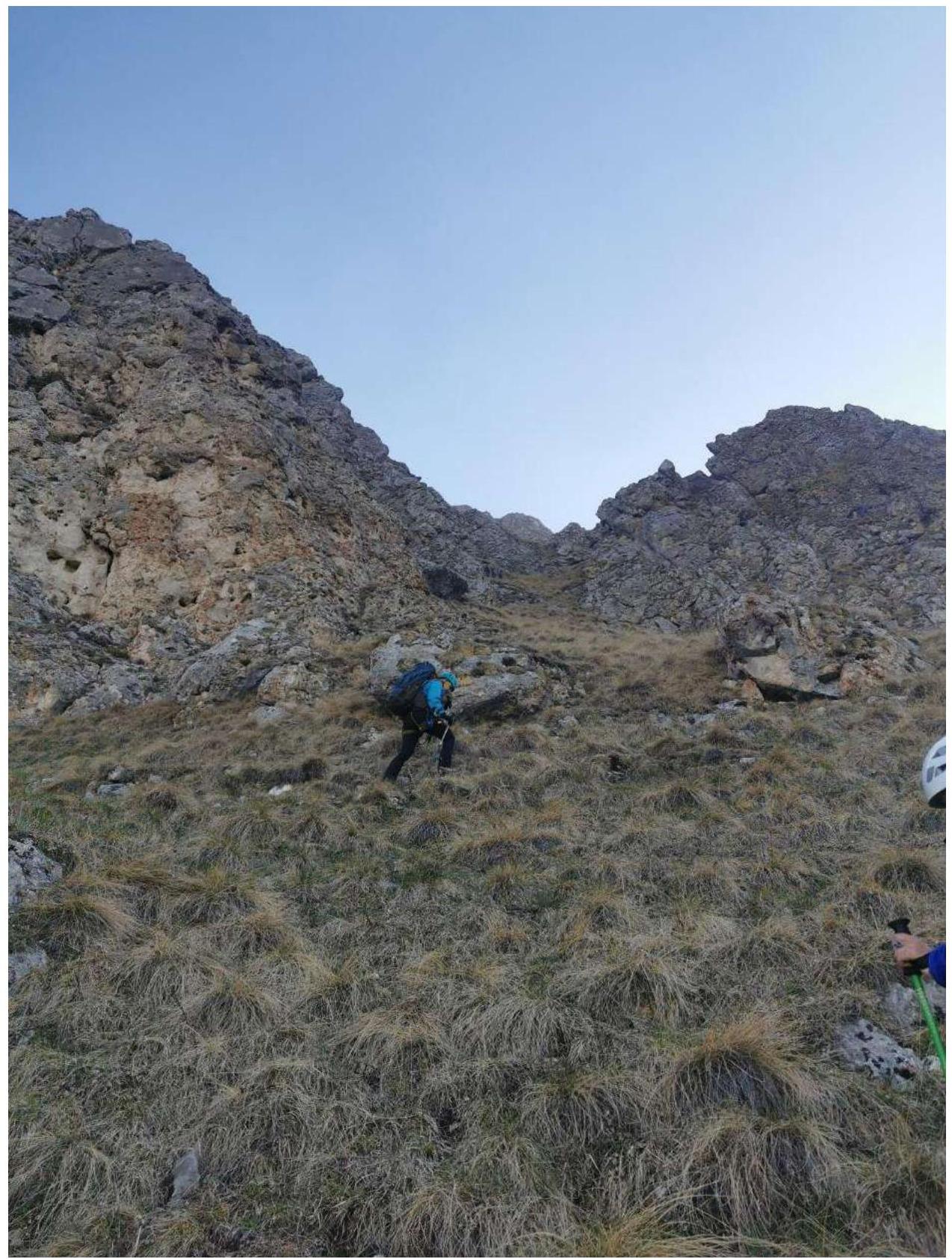 Photo 2. Section R0–R1
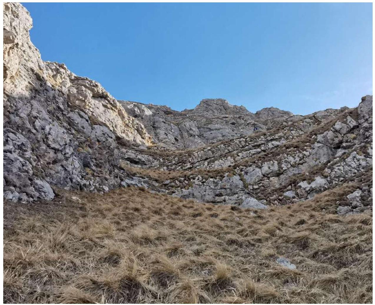 Photo 3. Section R1–R2 rocky steps
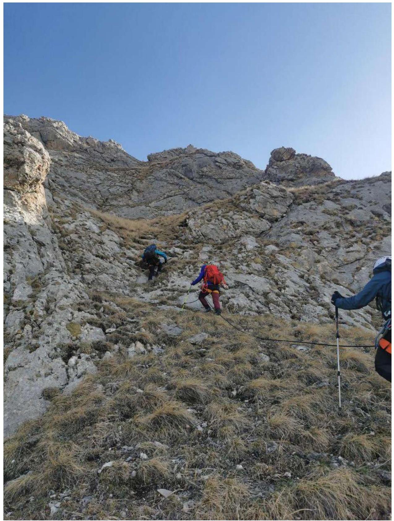 Photo 4. Section R2–R3
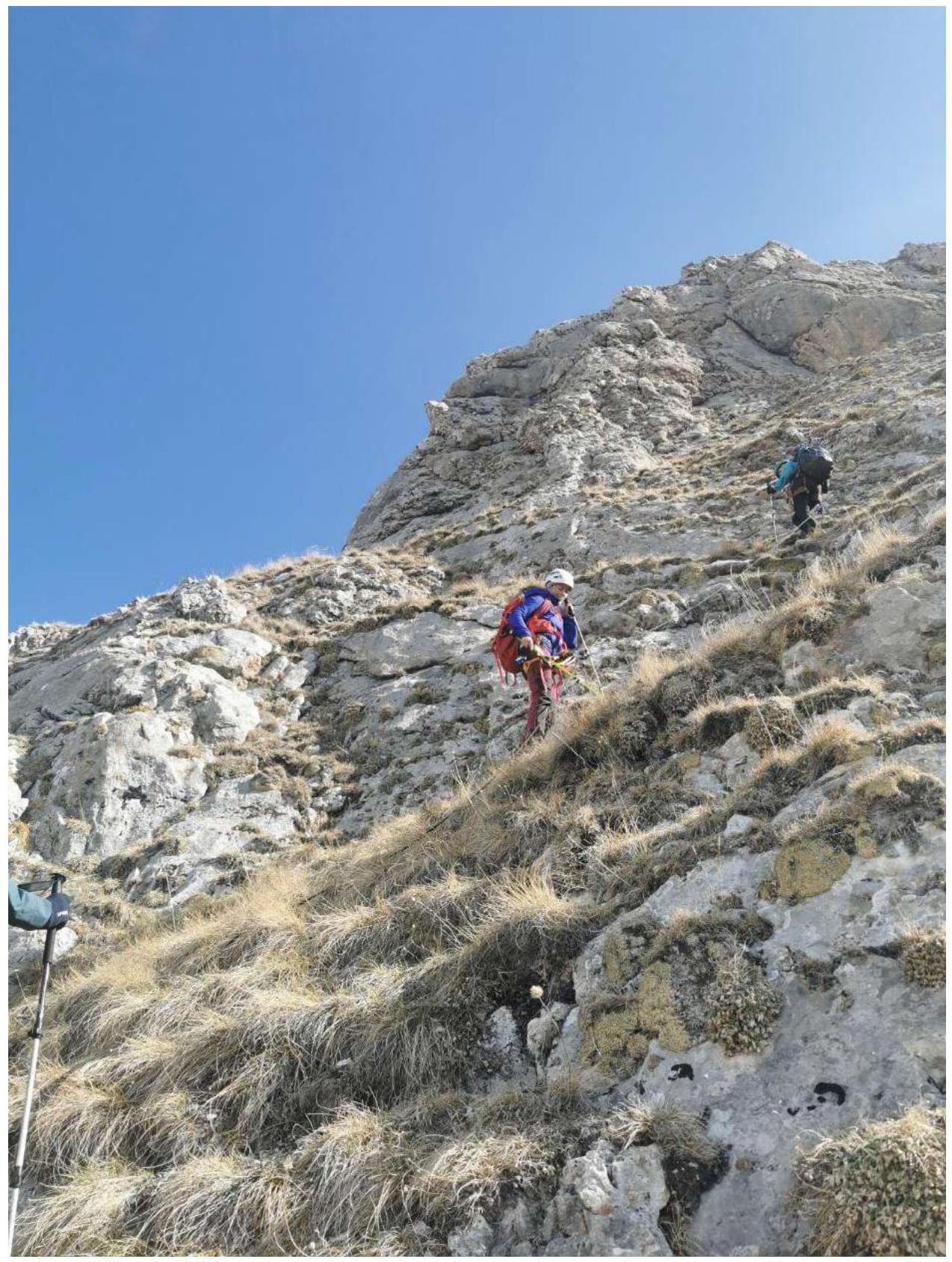 Photo 5. Section R3–R4
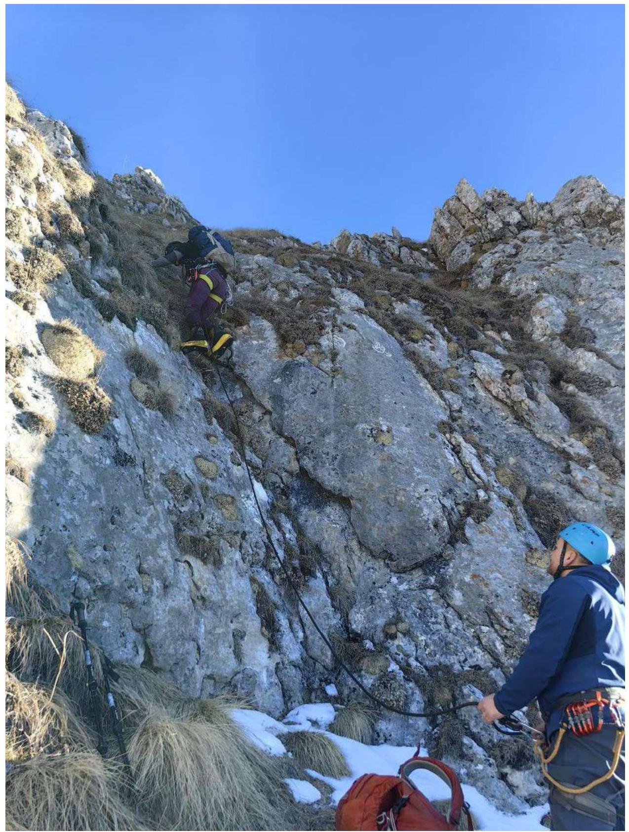 Photo 6. Section R4–R5
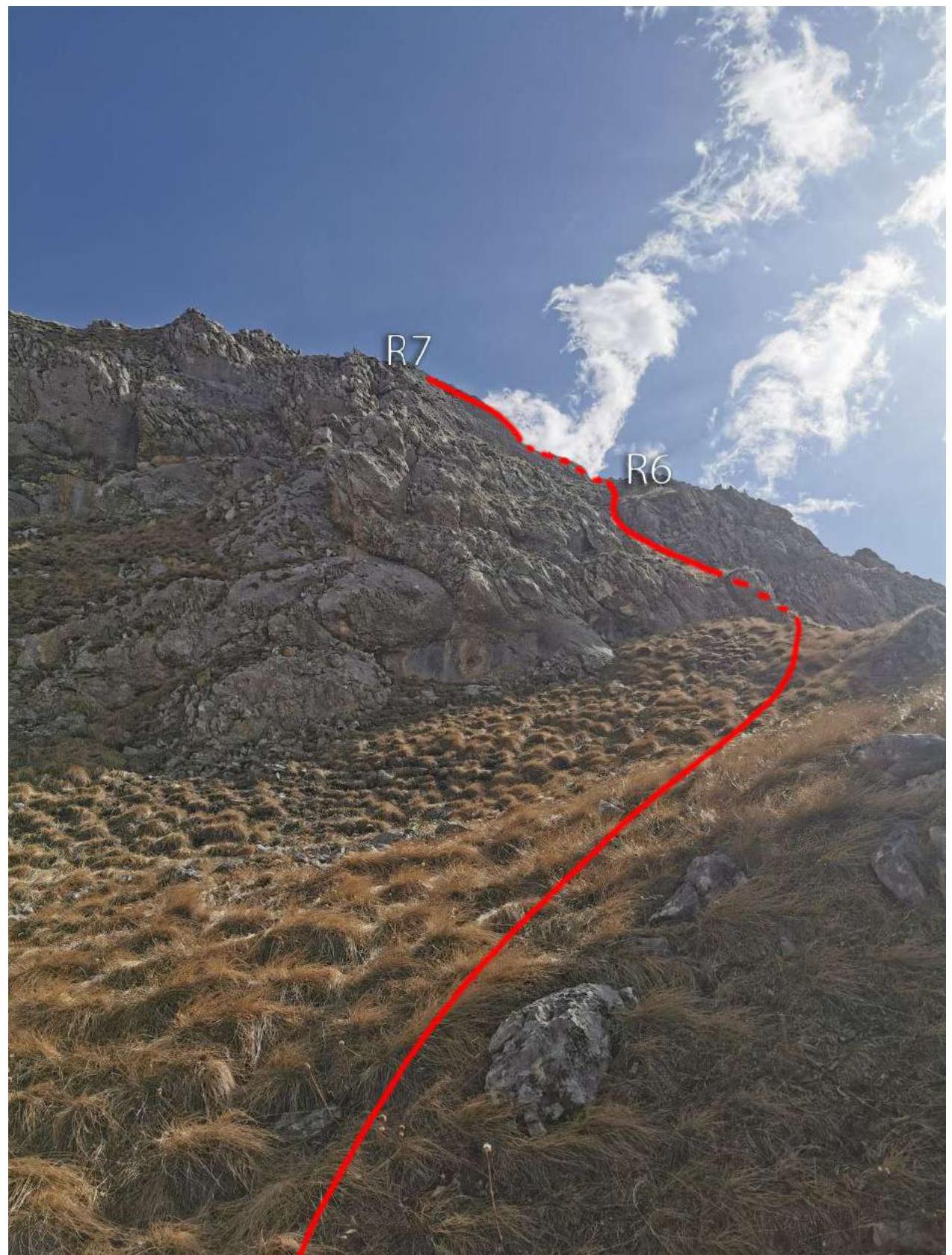 Photo 7. Section R5–R6
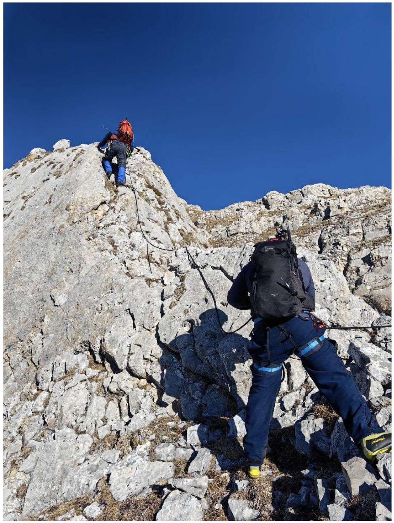 Photo 8. Section R6–R7
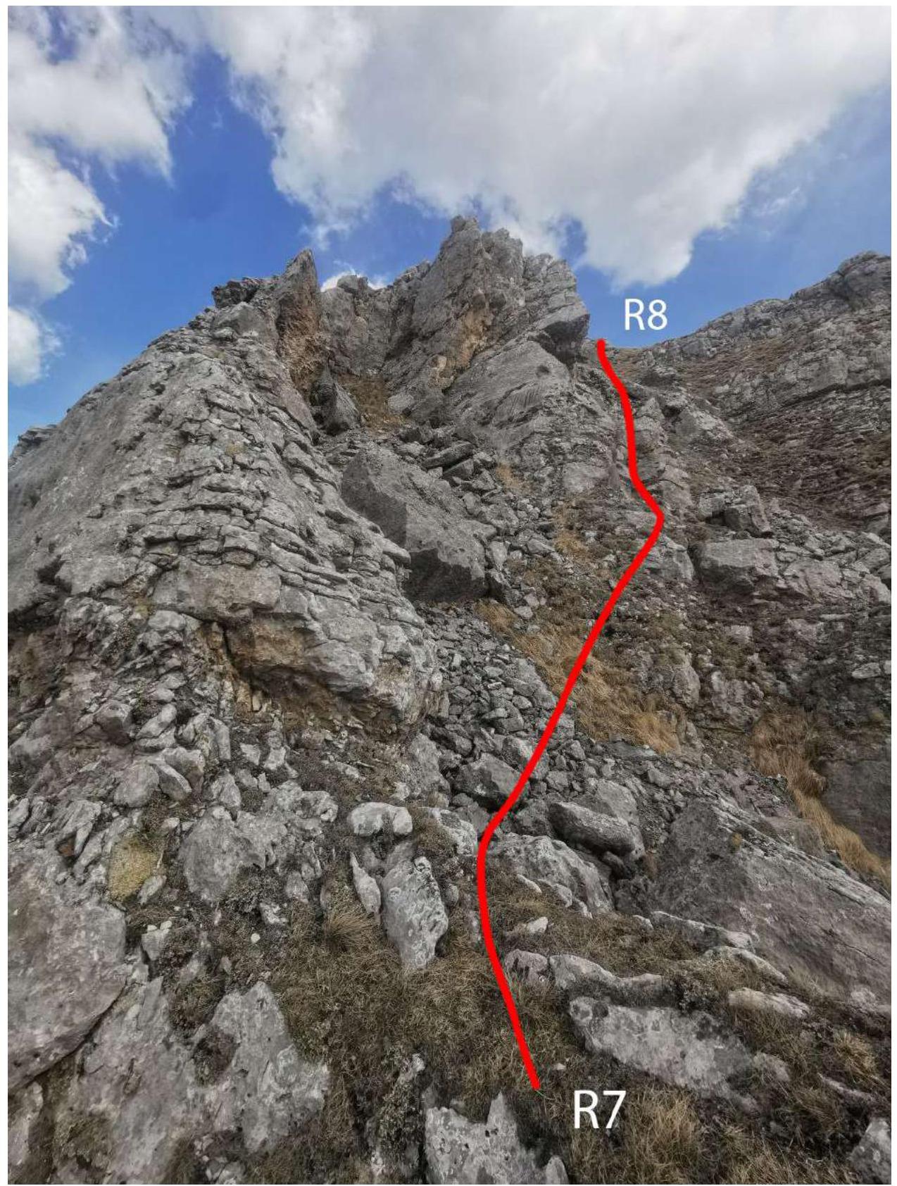 Photo 9. Section R7–R8
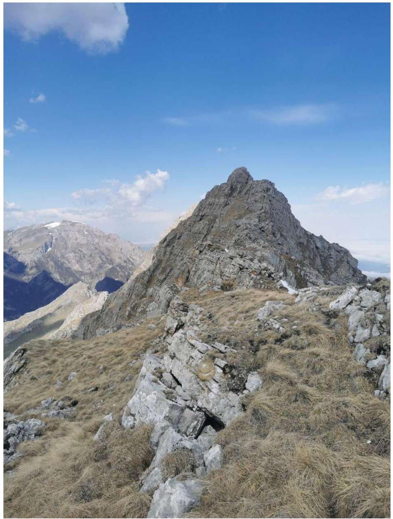 Photo 10. Section R8–R9
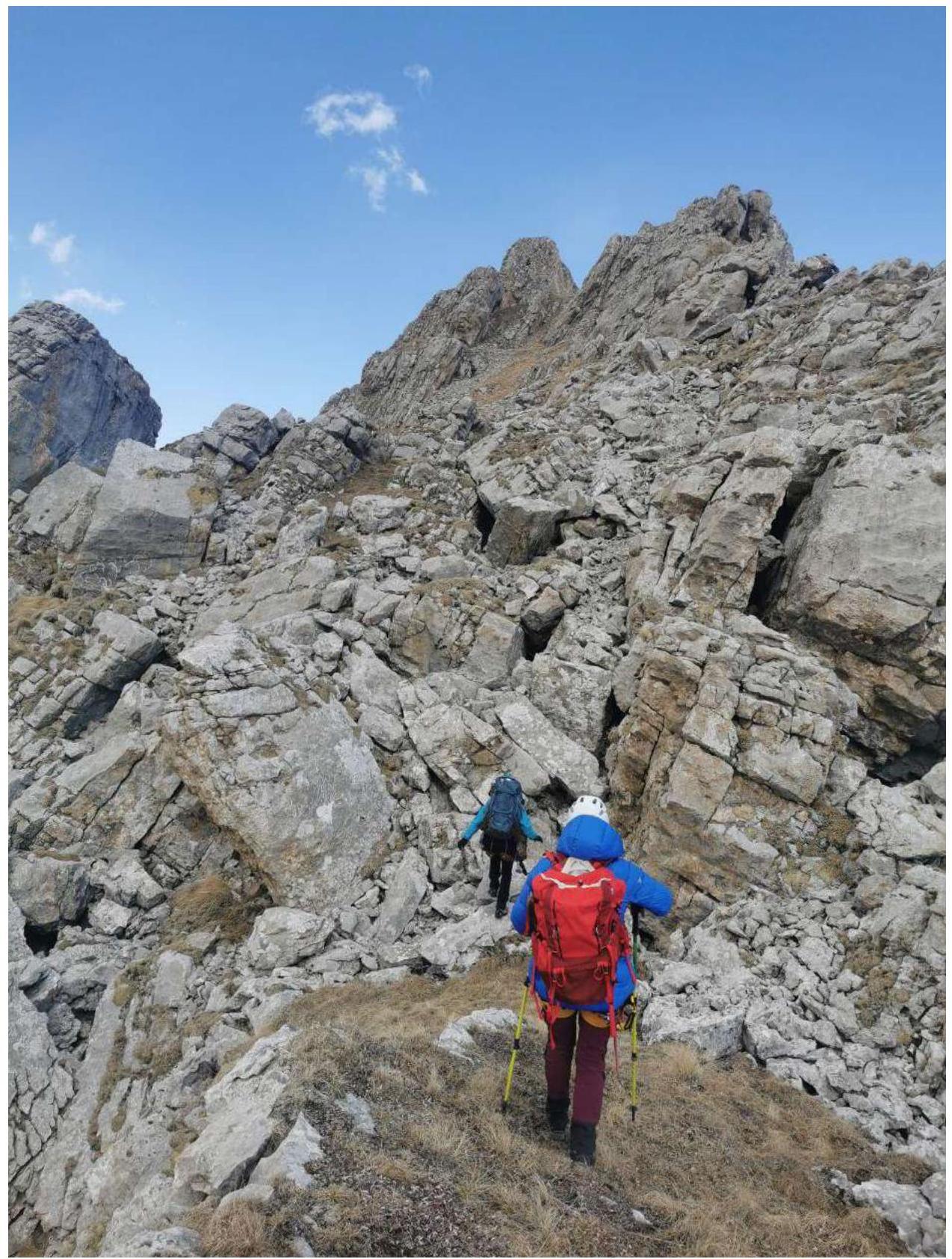 Photo 11. Section R9–R10
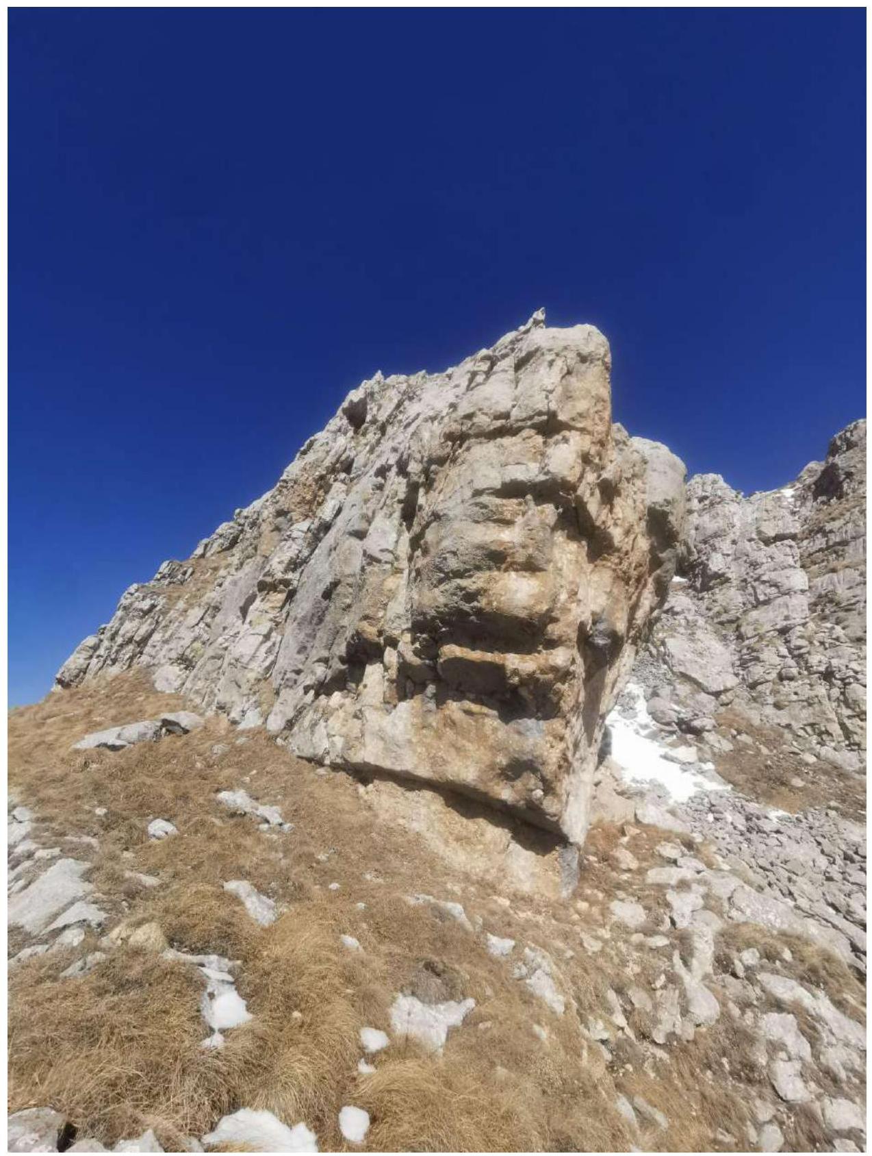 Photo 12. Bypassing rocks before the summit R10–R11
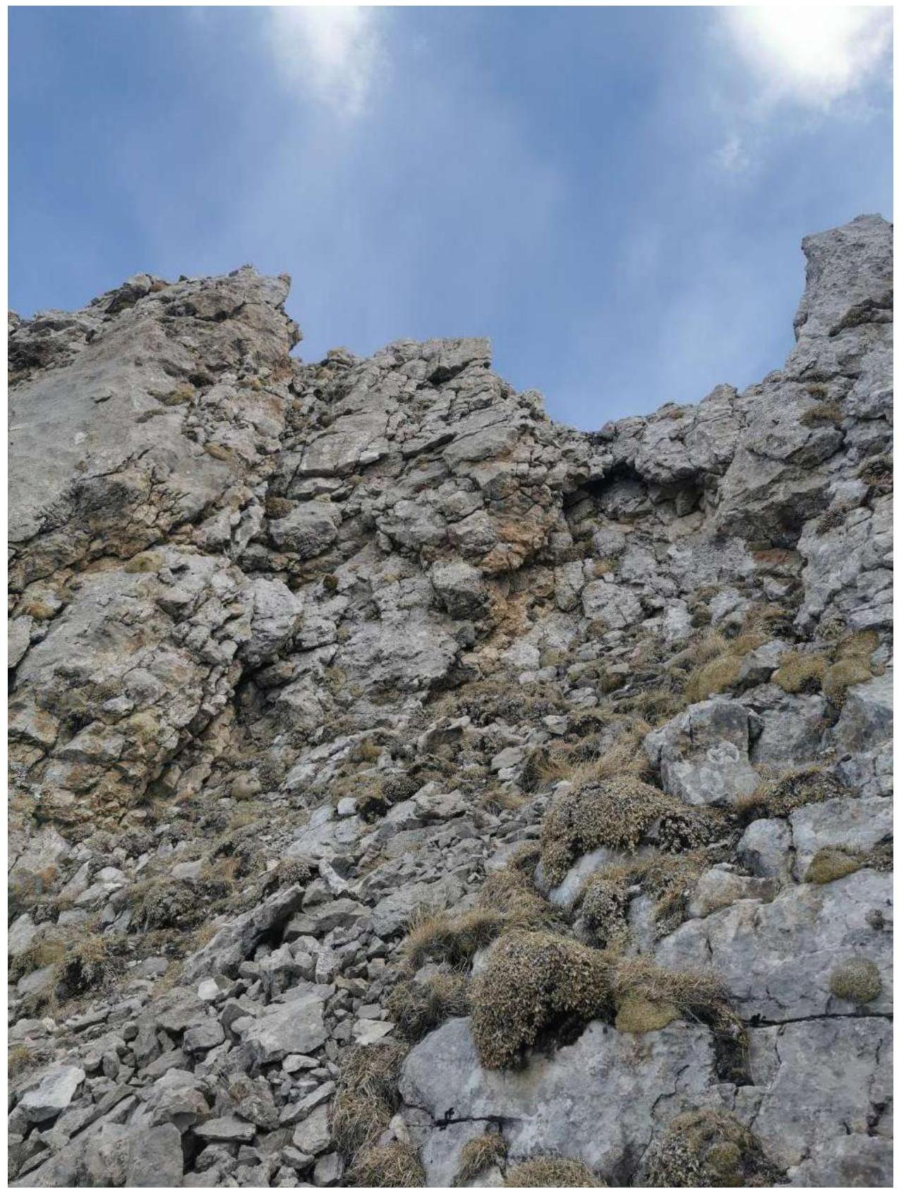 Photo 13. Section R11–R12
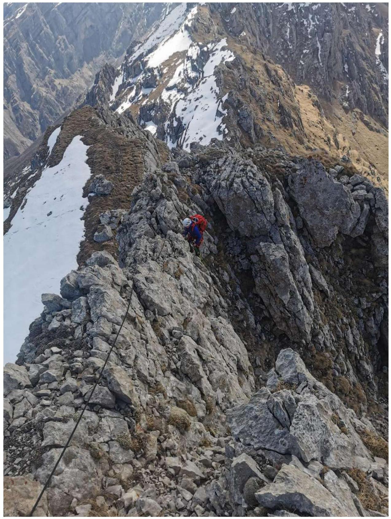 Photo 14. Passage of section R11–R12
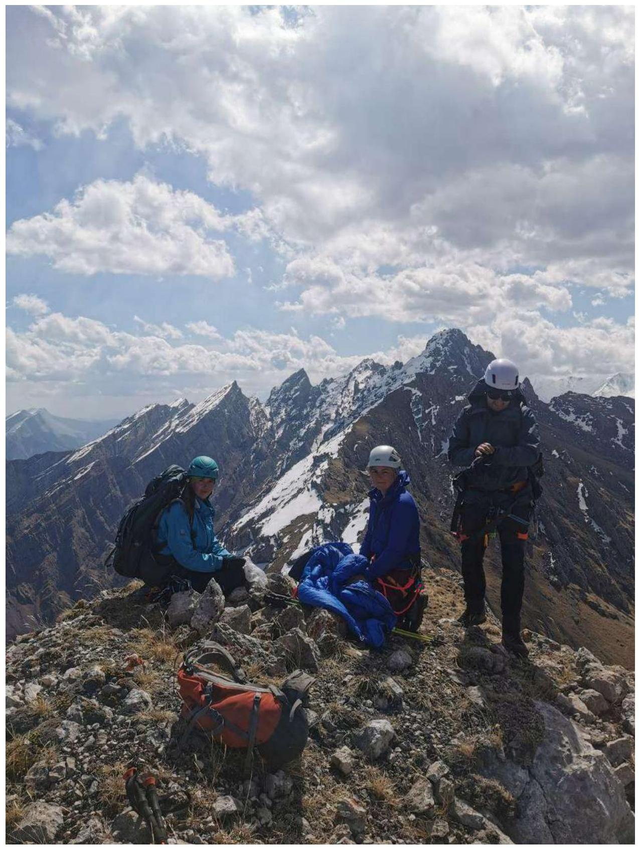 Photo 15. Team on the summit
The summit of Dzharlam is located north of the Dzharlam pass, further along the ridge from the peaks Novice and Tower. From the village of Guli to the pass takes 2–3 hours.
Next, you need to:
- Start descending directly north, down, in the direction of the visible large "spade" of Dzharlam.
- Walk along the riverbed.
- Reach the middle of the wall, where a visible grassy terrace begins, descending diagonally through the southern wall of Dzharlam.
The route is recommended for training groups. The retreat from the route back to the pass is quite exhausting, so the ascent with an overnight stay on the Dzharlam pass is recommended. Interesting, logical line to the summit. In the off-season, there is snow in the couloir and on the ridge, crampons may be needed.
On the descent from the summit:
- R11–R12 via rocks, there is a loop.
- Descent via the couloir of route 1B is rockfall-prone, it is recommended to move in a tight group along the sides of the couloir.
Comments
Sign in to leave a comment