
Report
ON THE FIRST ASCENT TO THE SUMMIT OF GIRIYAG VIA THE EASTERN SLOPE ROUTE, CATEGORY 2B BY THE TEAM OF THE ALPINE CAMPS MANAGEMENT FOR THE PERIOD FROM OCTOBER 18, 2022 TO OCTOBER 18, 2022
1. Ascent Passport
| № | 1. General Information | |
|---|---|---|
| 1.1 | Full Name, Sports Rank of the Leader | Denisov Andrei Yurievich – 2nd rank |
| 1.2 | Full Name, Sports Rank of the Participants | Gusev Denis Alekseevich – 3rd rank |
| 1.3 | Full Name of the Coach | Yakovenko Alexander Nikolaevich – Master of Sports |
| 1.4 | Organization | Alpine Camps Management |
| 2. Characteristics of the Ascent Object | ||
| 2.1 | Region | 2.9 from Krestovyi Pass to Shaviklde Peak |
| 2.2 | Valley | Dzheyrakh Valley |
| 2.3 | Number according to the 2013 Classification Table | - |
| 2.4 | Name and Height of the Peak | Mt. Giriag, 2863 m |
| 2.5 | Geographical Coordinates of the Peak (Latitude/Longitude), GPS Coordinates | 42.84035, 44.79916 |
| 3. Characteristics of the Route | ||
| 3.1 | Route Name | Eastern Wall |
| 3.2 | Proposed Category of Difficulty | 2B |
| 3.3 | Degree of Route Exploration | First Ascent |
| 3.4 | Nature of the Route Terrain | Rocky |
| 3.5 | Height Difference of the Route (altimeter or GPS data) | 317 m |
| 3.6 | Route Length (in meters) | 1075 m |
| 3.7 | Technical Elements of the Route (total length of sections of varying difficulty with indication of terrain type: ice-snow, rocky) | Category I rocky – 895 m. Category II rocky – 30 m. Category III rocky – 130 m. Category IV rocky – 20 m. Movement on closed glacier – 0 m. Rappelling (on descent) – 0 m. |
| 3.8 | Descent from the Summit | Via NW grassy slope, no category |
| 3.9 | Additional Route Characteristics | No water along the route. Recommended to bring. No issues expected in winter. Abundant grass. |
| 4. Characteristics of the Team's Actions | ||
| 4.1 | Time of Movement (team's walking hours, in hours and days) | 1 day, 8.5 hours from the start of the route to "Kyazi" Base Camp |
| 4.2 | Overnights | None |
| 4.3 | Start of the Route | 10:00, October 29, 2020 |
| 4.4 | Reaching the Summit | 15:55, October 29, 2020 |
| 4.5 | Return to Base Camp | 18:30, October 29, 2020 |
| 5. Person Responsible for the Report | ||
| 5.1 | Full Name, e-mail | Denisov Andrei Yurievich, andr3172@ya.ru |
2. Ascent Description
Characteristics of the Ascent Object
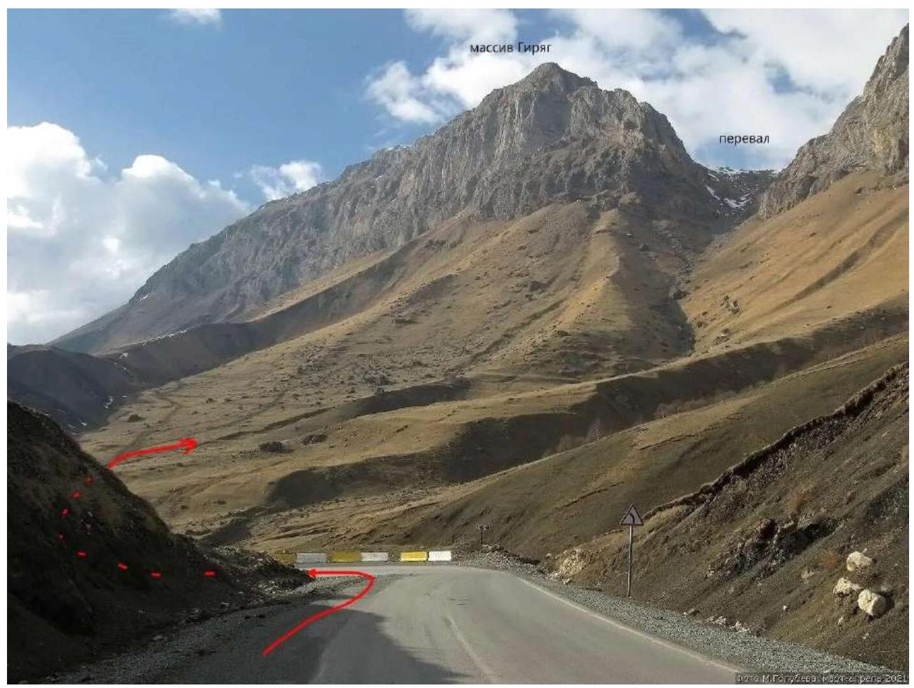
Fig. 1. General view of the peak. Photo taken from the road.
Route Profile Photo
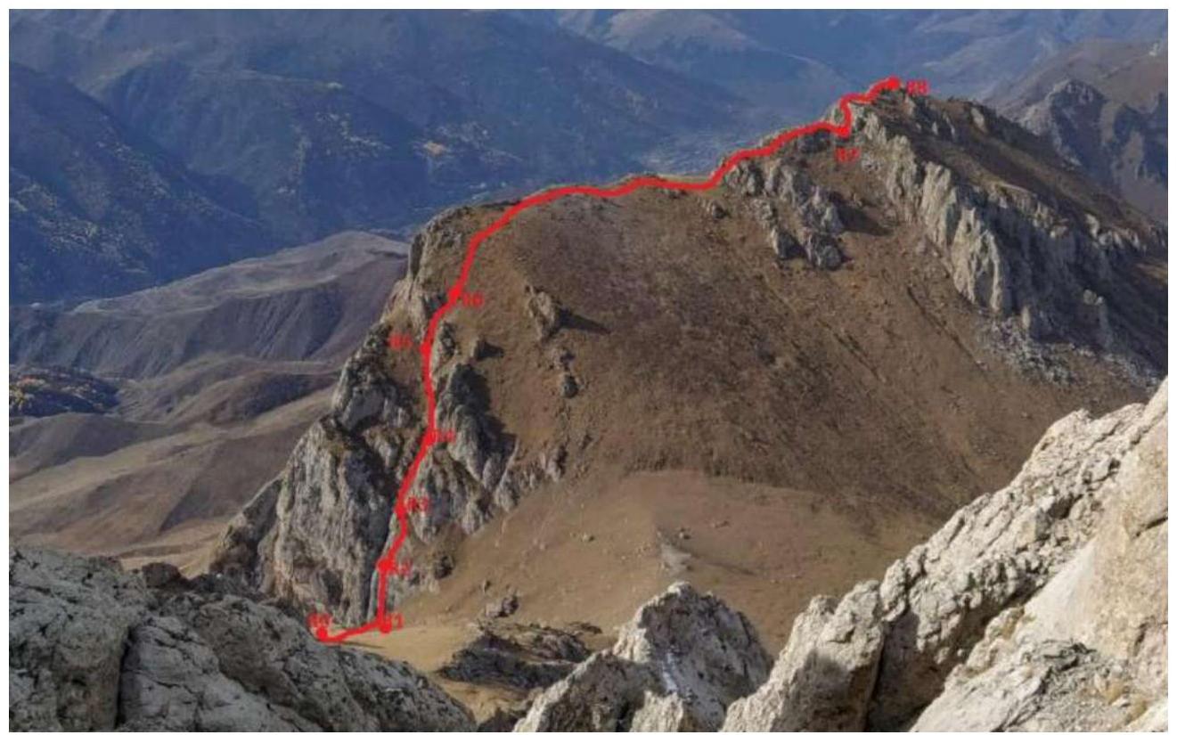
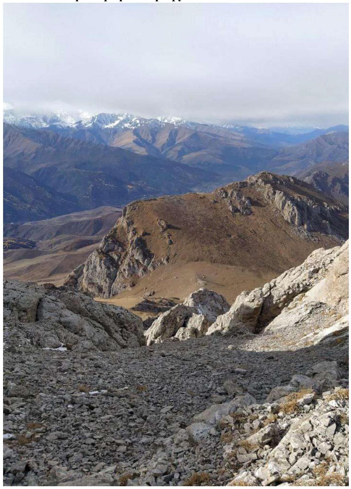
Fig. 2. Photo from the 1B route on Jarlam Central. The entire route to the summit is visible.
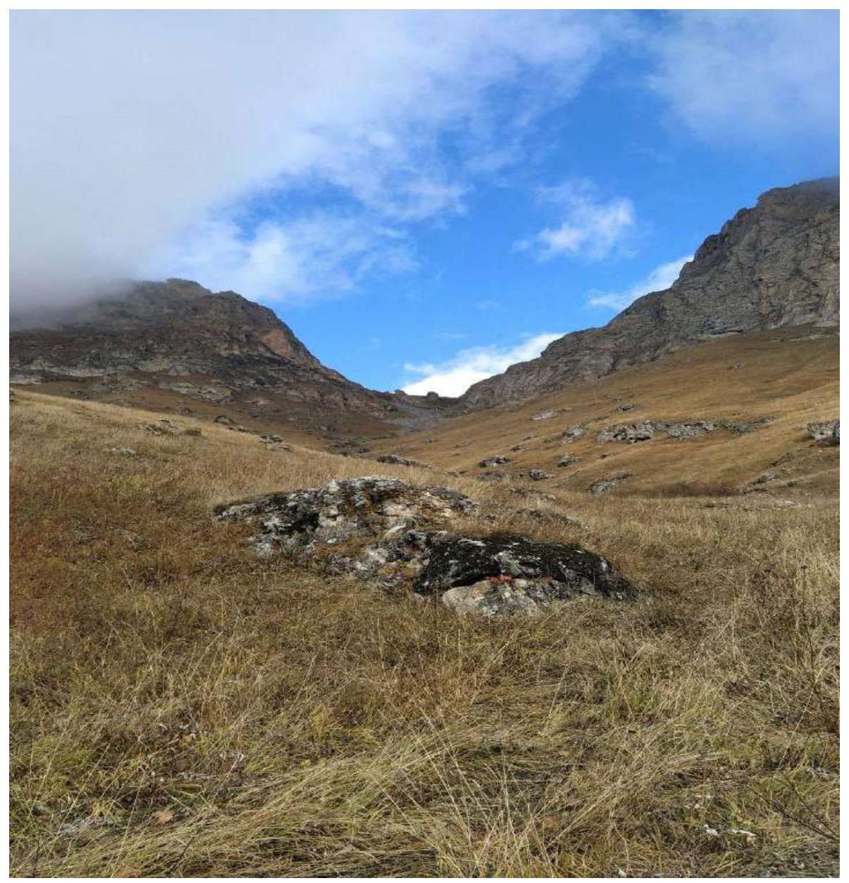
Fig. 3. View of Jarlam Pass from the road.
0

Fig. 5. Photopanorama of the area.

Geographical Location of the Area
The ascent object — Mt. Giriag, 2863 m high, is located in the Republic of Ingushetia, Dzheyrakhsky District, Tsey-loam Ridge (Rocky Ridge) in the Caucasus mountain system.
"The Rocky Ridge has a monoclinal structure and a latitudinal orientation. Its southern slope is steep or cliffy, while the northern slope is more gentle. The surface is either rounded and smooth or has sharp outlines in the form of teeth and pyramids."
The highest point of the Rocky Ridge:
- on the western segment between the Terek and Assa rivers – Mt. Stolovaya (Myat-Loam, 2993 m);
- on the eastern segment – Leymo-loam (3100 m);
- between the Assa river and the sources of the Akkichi river – Mt. Skalistaya (Khakhalgi, 3032 m).
To the south of this ridge lies a wide longitudinal North-Jurassic depression, covering the space between the foot of the Rocky Ridge escarpment and the northern spurs of the Lateral Ridge. The depression's surface is composed of Lower and Middle Jurassic sandy-clayey-shaly strata, weakly resistant to erosion. The longitudinal valleys of the rivers are associated with the locations of such rocks:
- Armkhi
- Galgachi
- Guloy-khi
- Tkhabachoch
From the "Kyazi" alpine camp, one needs to head along the road towards the village of Guli. From the first house on the right, turn right and continue along the dirt road. Then, in the direction of Jarlam Pass, before reaching the pass, the landmark is a large stone and a barbed wire fence with a gate; from there, turn left and move under the eastern wall (100 m). In the middle, there is a large internal angle; the route goes along the right part of the angle, with a crack as a landmark; on the right, there is a convenient station on hourglasses. This is the start of the route.
From the base camp to the starting point, it takes about 1.5 hours if you drive to Jarlam Pass by car.
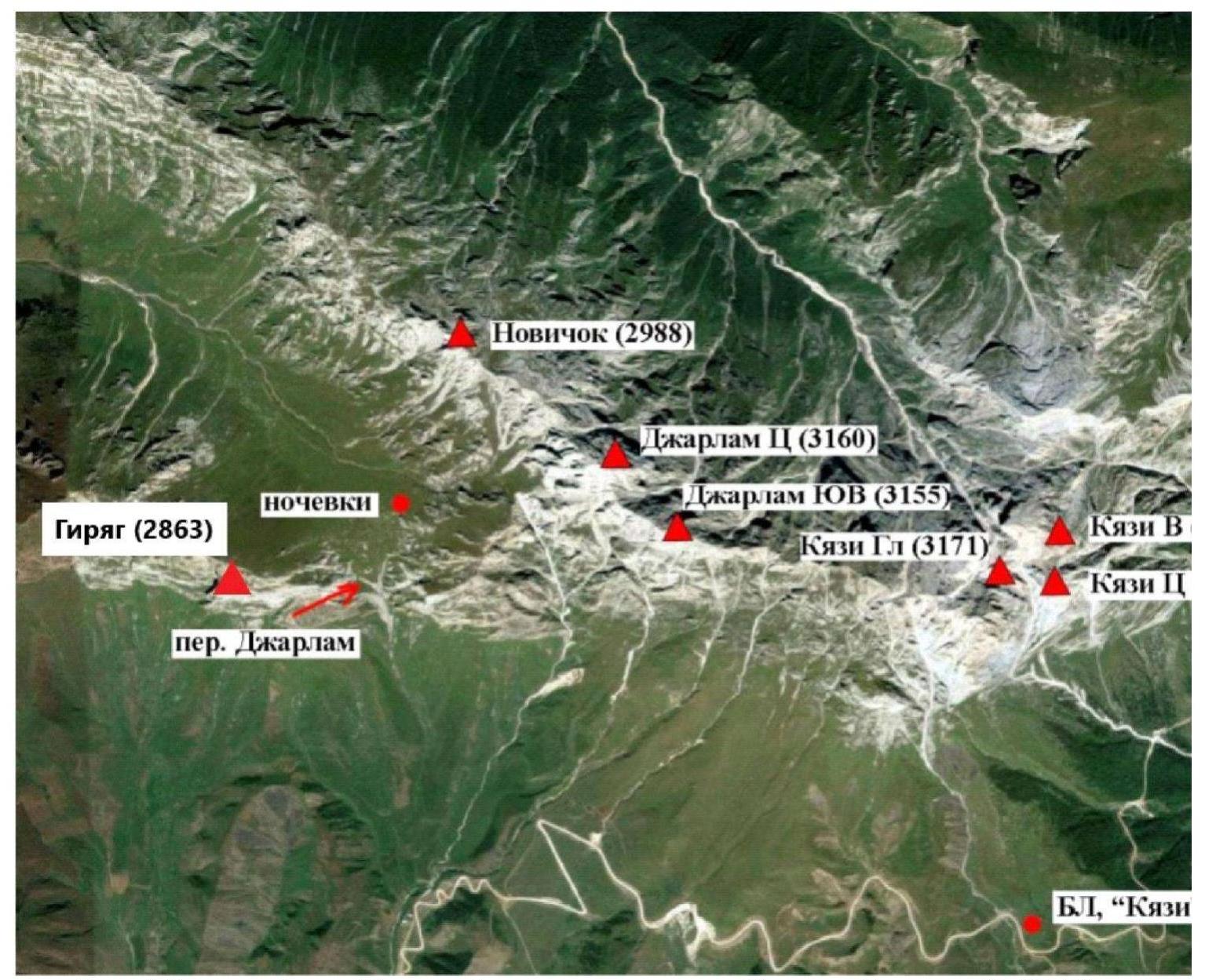
Fig. 6. Map of the area. (Photograph taken from the report "Traverse Jarlam Central (3160) – Novice (2988) – Category 3A")
2. Route Characteristics
2.1. Technical Photograph of the Route
2.2. Section Numbers
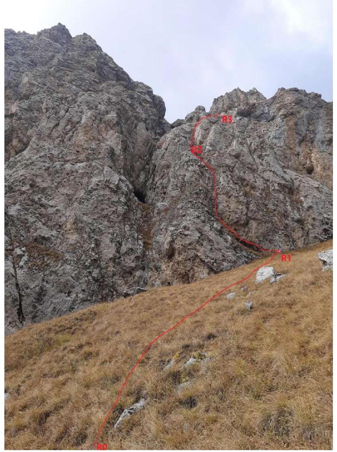
Fig. 7. Section R0–R1–R2–R3. Photo by: Andrei Denisov.
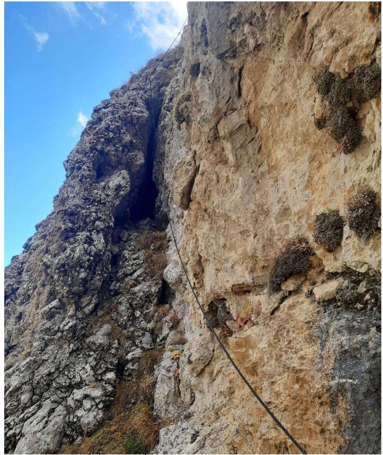
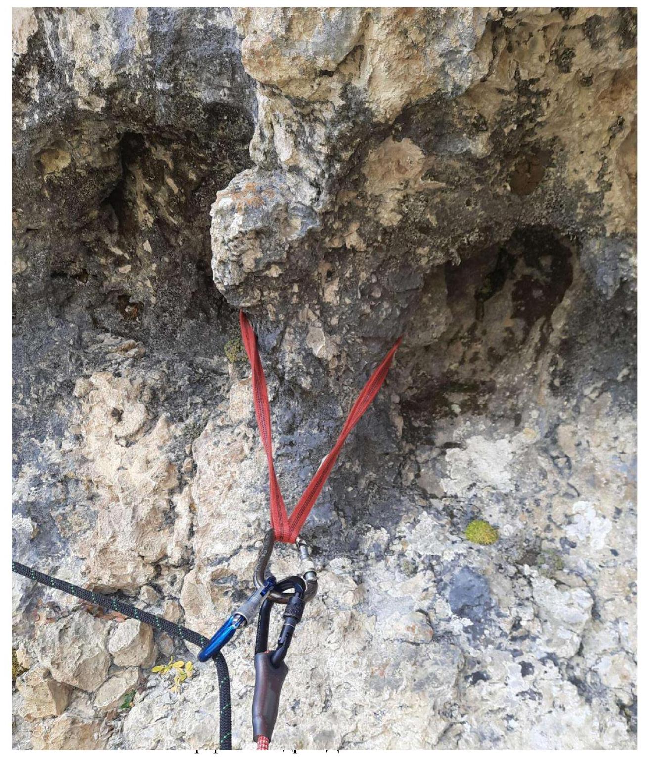
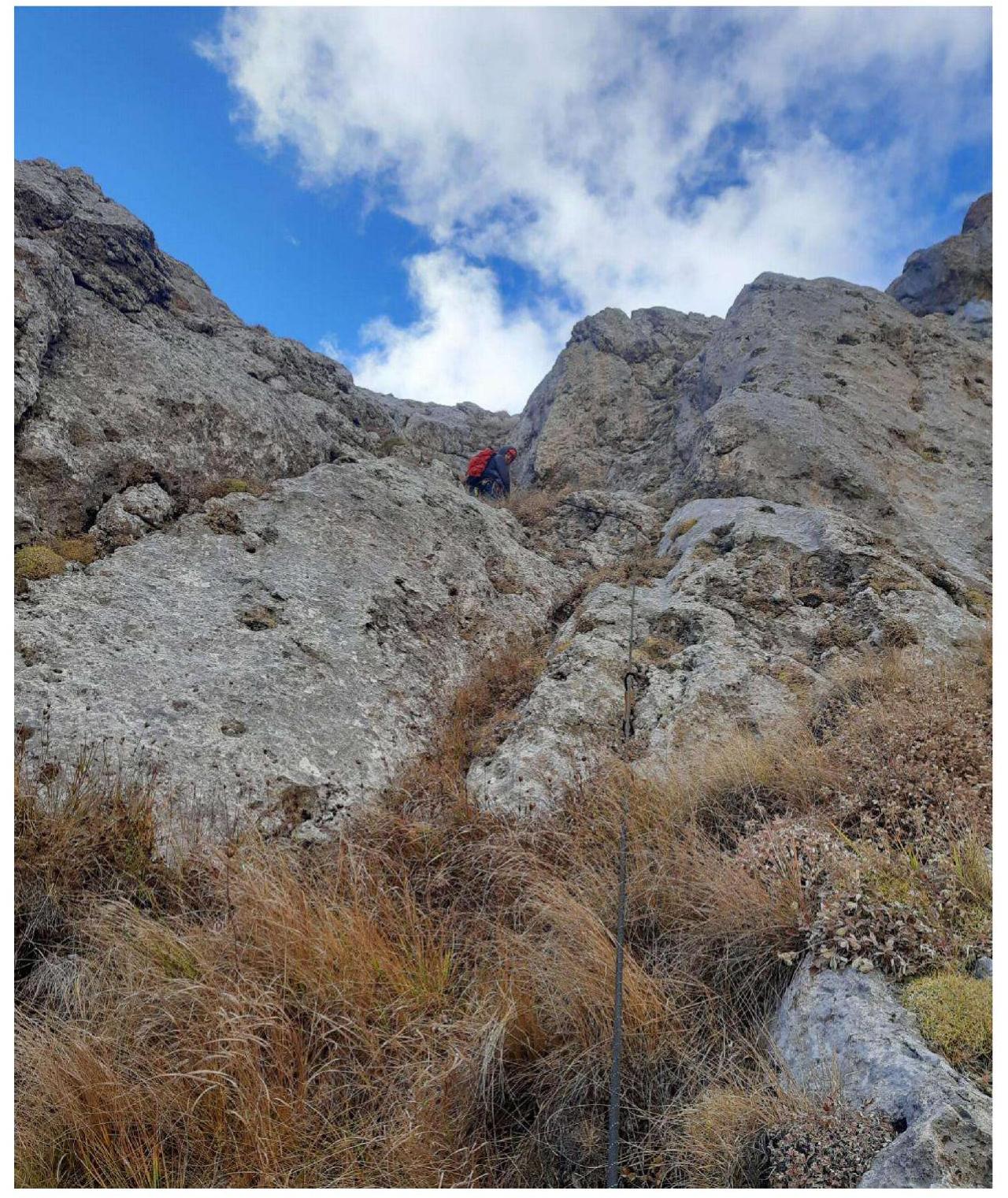
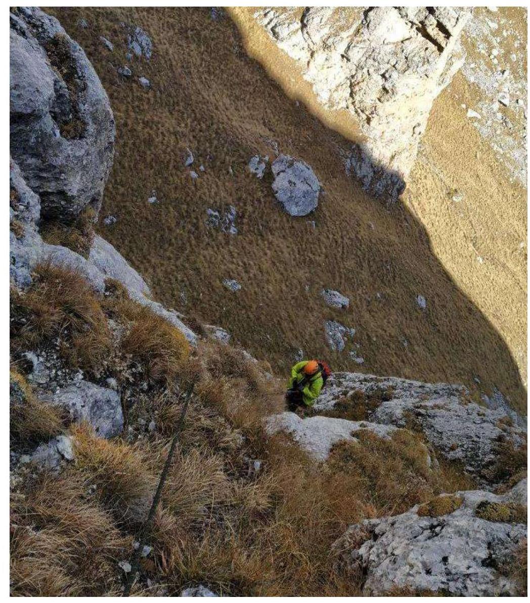
Fig. 11. Section R1–R2 (second part, view from the station). Photo by: Denis Gusev.
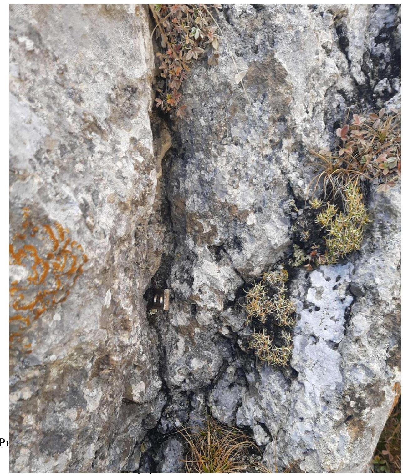
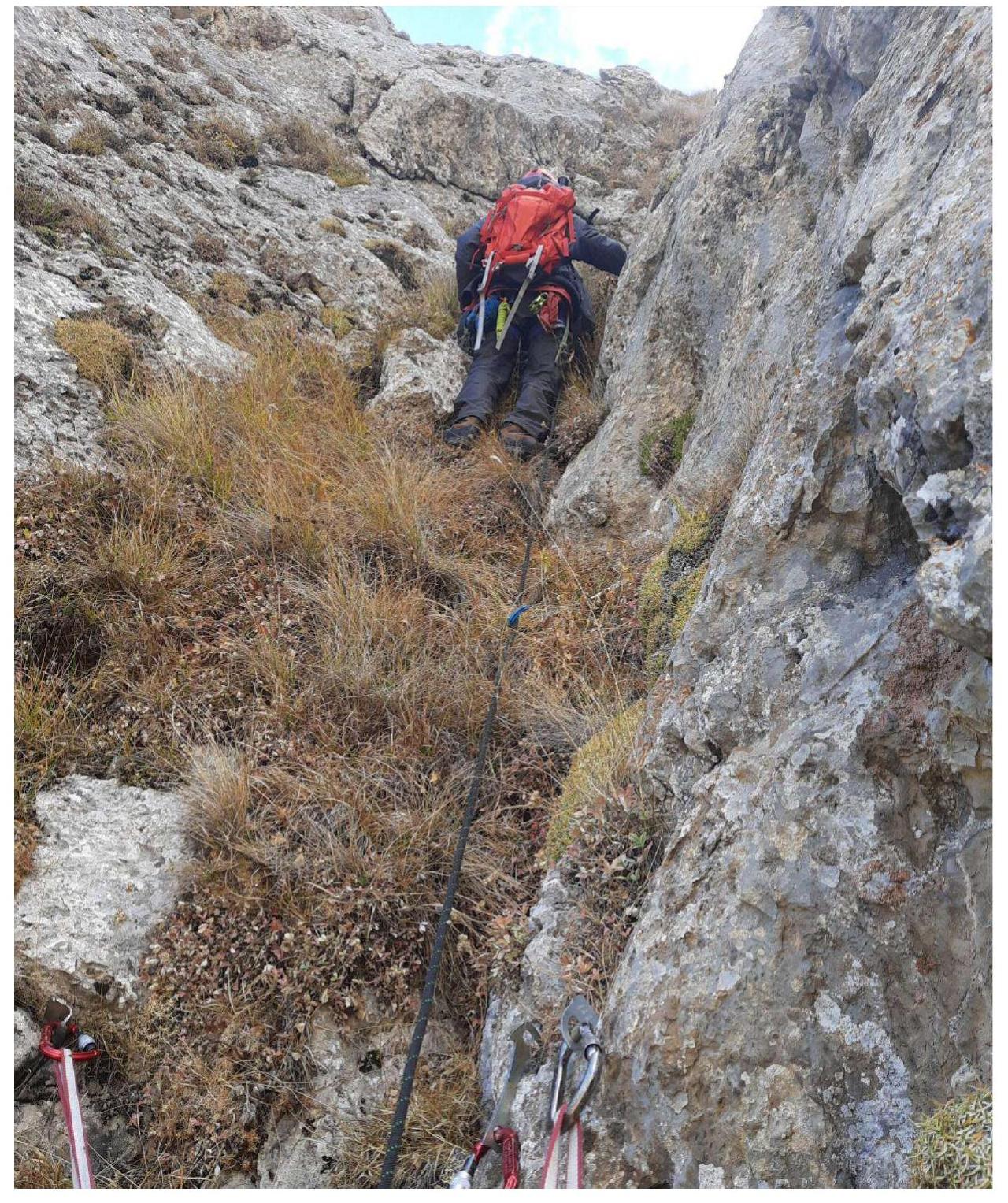
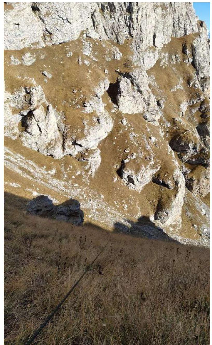
Fig. 14. Section R2–R3 (second part, view from the station).
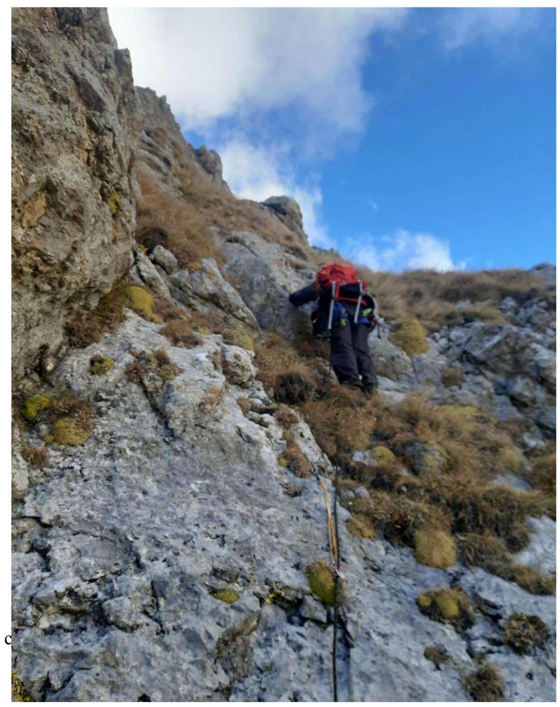
Fig. 15. Section R3–R4 (first part).
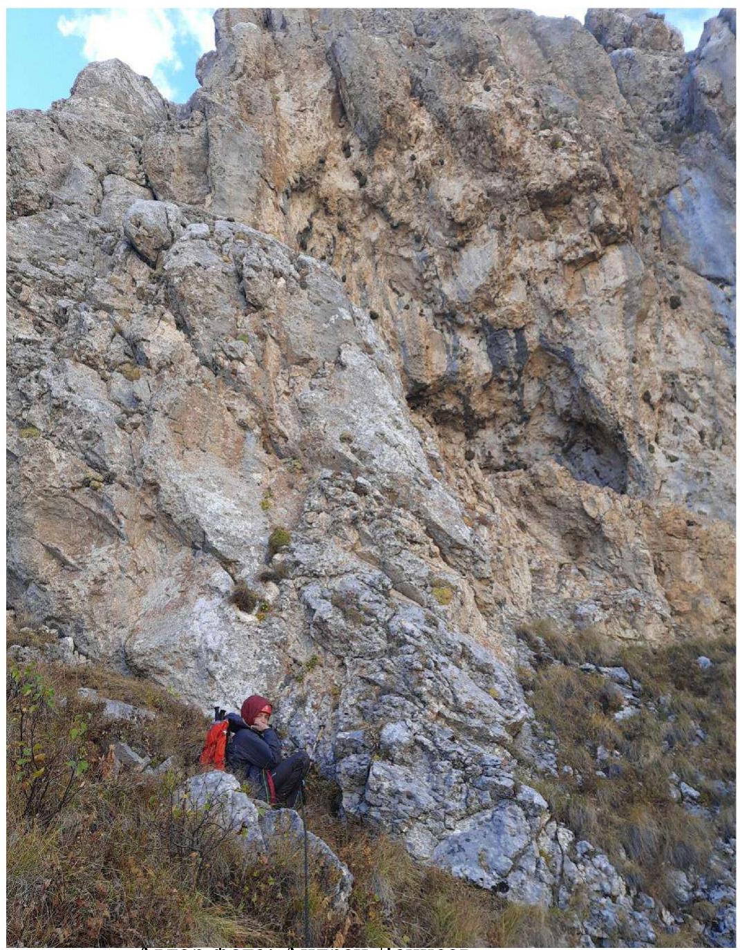
Photo by: Andrei Denisov.
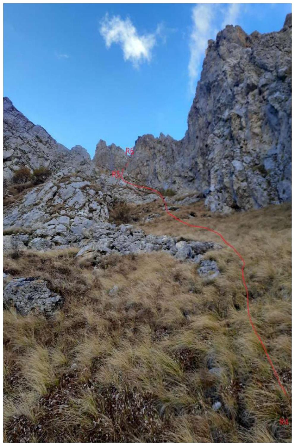
Fig. 17. Sections R4–R5–R6. Photo by: Andrei Denisov.
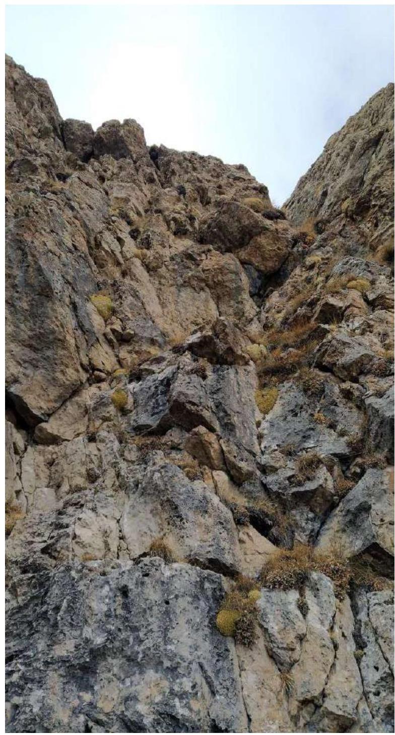
Fig. 18. Sections R5–R6. Photo by: Andrei Denisov.
2.3. Technical Characteristics of the Route
| Section № | Terrain Characteristics | Category of Difficulty | Length, m | Steepness | Type and Number of Anchors |
|---|---|---|---|---|---|
| R0–R1 | Grassy slope | I | 150 m | 30° | 0 |
| R1–R2 | Crack, internal angle, rocky walls, inclined ledge, grass | IV | 50 m | 65°–70° | Friend – 1; Anchor hook – 7 |
| R2–R3 | Internal angle, grassy inclined ledge | III | 50 m | 55°–60° | Friend – 2; Anchor hook – 4 |
| R3–R4 | Inclined ledge, grassy ledge | II | 40 m | 30°–50° | Friend – 1; Anchor hook – 3 |
| R4–R5 | Grassy slope | I | 180 m | 45°–30° | 0 |
| R5–R6 | Internal angle, grass | II | 50 m | 70°–50° | Friend – 4; Anchor hook – 2 |
| R6–R7 | Grassy ridge | I | 300 m | 0° | 0 |
| R7–R8 | Grassy ridge, indistinct gendarmes | I | 355 m | 10°–15° | 0 |
2.4. Technical Characteristics of the Route in UIAA Symbols

3. Characteristics of the Team's Actions
3.1. Brief Description of the Route Passage
| Section № | Description | Photo № |
|---|---|---|
| R0–R1 | From the barbed wire fence, move left under the eastern wall, landmark – a large internal angle with a hole in the middle of the wall, a convenient station on hourglasses to the right of the crack. | Fig. 6 |
| R1–R2 | From the station, start moving to the right of the internal angle along the pronounced internal angle and crack, then overcome a series of small rocky ledges and approach a spot where it is convenient to organize an insurance station. Station on anchors. Organization of top-rope belay for the second by the first. The first ten meters are complex climbing with scarce terrain. Key part of the route. | Fig. 7, 8, 9, 10 |
| R2–R3 | From the station, move left into the internal angle and overcome a 3-meter rocky wall, then continue along the inclined grassy ledge. Station on anchors. Organization of top-rope belay for the second by the first. | Fig. 13 |
| R3–R4 | From the station, continue moving up-right along the inclined ledge, exit onto a grassy slope, and move towards the grotto. Conveniently organize an insurance station on anchors 5 meters before the grotto. Organization of top-rope belay for the second by the first. | Fig. 14 |
| R4–R5 | From the station, exit left onto a wide grassy slope and move simultaneously towards the false summit. | Fig. 15 |
| R5–R6 | To the right of the summit, a station on hourglasses and a friend on a small wall and a wide crack lead to a grassy slope, station on a stone, top-rope belay for the second. | Fig. 16 |
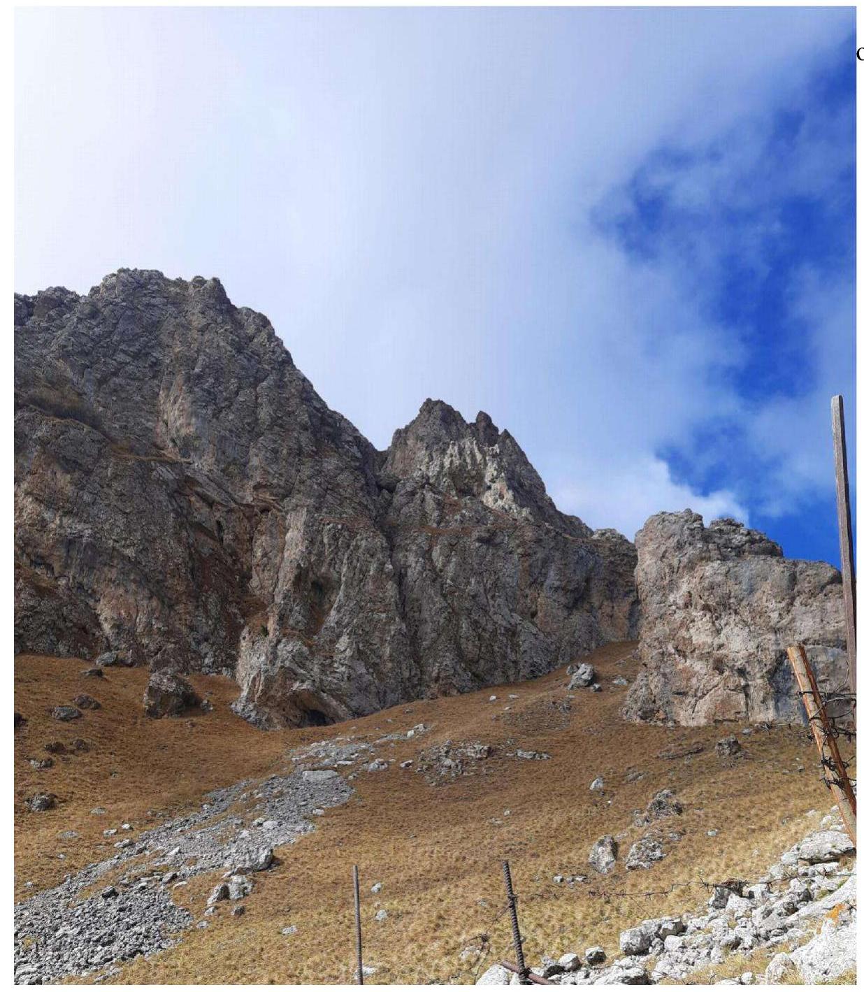
| R6–R7 | Ascend to a cairn with a stick, continue along the ridge to the first indistinct gendarme. Simultaneous movement. Belay through the terrain for 300 m. | |
| R7–R8 | Continue along the ridge, overcome several indistinct gendarmes, and reach the summit with a cairn – 355 m. |
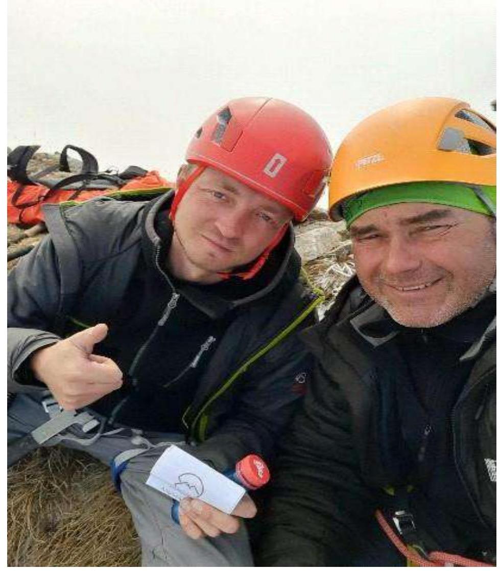
3.2. Team Photo at the Summit near the Control Cairn
3.3. Route Safety Assessment
The route turned out to be logical. Practically every 50 m, there are convenient places to organize insurance stations where several people can gather. The first rope is key due to the large angle and scarce terrain for intermediate points; the first 10 m have loose rocks.
Throughout the route, there is communication, both cellular and internet, as well as radio communication, through which it is convenient to contact the base camp. Additionally, near the pass, there are traditional overnight stays for climbers ascending Jarlam Peak and others. Water can be found there if the supplies were miscalculated, though the chances are low. Often, people are present at these overnight stays, so they can also be used to relay communication between groups or to the base camp.
Recommendation for future climbers: anchors and friends work best. It's not advisable to forget gloves to protect against thorns and sharp rocks. Caution! On the descent, an ice axe or trekking poles may be useful because the grass can be very slippery.
The descent begins from the summit to section R8. From R8 down the NW grassy slope. Then, head towards Jarlam Pass, and further along a well-trodden path down to the road.
This route was completed on October 18, 2022. Along the route, specifically on sections R0–R6, there were no signs of human activity. No constructed cairn or left sports equipment was encountered along the way, which may indicate that we have traversed a new line on the known peak Giriag. A well-constructed cairn with a note was found on the summit. We left our note and headed down.
Based on the objective complexity of the technical part of the route on Giriag via the eastern wall and comparing it with other routes previously completed by Denisov A. and Gusev D., it is proposed to classify it as Category 2B.