
Report
On the first ascent to the summit of Княжна Ольга via the South Edge route, category 4A, by the team of the Climbing Camps Management for the period from March 2, 2022, to March 2, 2022.
I. Climbing Report
| 1. General Information | ||
|---|---|---|
| 1.1 | Full name, sports rank of the leader | Volkov Andrey Vyacheslavovich, 2nd sports rank |
| 1.2 | Full name, sports rank of participants | Gurenko Taras Yuryevich – 2nd sports rank |
| 1.3 | Full name of the coach | Yakovenko Alexander Nikolayevich – Master of Sports |
| 1.4 | Organization | Climbing Camps Management |
| 2. Characteristics of the Climbing Object | ||
| 2.1 | Region | From the Kreстовый Pass to the Shaviklde peak |
| 2.2 | Valley | Djeyrakh |
| 2.3 | Section number according to the 2013 classification table | |
| 2.4 | Name and height of the summit | Mt. Княжна Ольга 2929 m |
| 2.5 | Geographical coordinates of the summit (latitude/longitude), GPS coordinates | Latitude 42°50′42.81″ N Longitude 44°52′1.43″ E |
| 3. Characteristics of the Route | ||
| 3.1 | Name of the route | South Edge |
| 3.2 | Proposed category of difficulty | 4A |
| 3.3 | Degree of route exploration | first ascent |
| 3.4 | Nature of the route terrain | Rocky |
| 3.5 | Height difference of the route (altimeter or GPS data) | 800 m |
| 3.6 | Length of the route (in meters) | 1807 m |
| 3.7 | Technical elements of the route (total length of sections of varying difficulty with terrain type (ice-snow, rocky)) | Category I rocky – 1250 m. Category II rocky – 395 m. Category III rocky – 0 m. Category IV rocky – 162 m. Category V rocky – 0 m. Category VI rocky – 0 m. |
| 3.8 | Average steepness of the route, (°) | – |
| 3.9 | Average steepness of the main part of the route, (°) | – |
| 3.10 | Descent from the summit | Via category 2B, Mendin |
| 3.11 | Additional characteristics of the route | There is no water along the entire route. It's recommended to bring it. After rain and fresh snow, grassy slopes can be very slippery. |
| 4. Characteristics of the Team's Actions | ||
| 4.1 | Time of movement (team's walking hours, in hours and | 15 hours from the Keli tower complex to the summit and back |
| days) | ||
| :-- | :-- | :--: |
| 4.2 | Overnights | – |
| 4.3 | Time spent processing the route | – |
| 4.4 | Start of the route | Hour, date, month, year |
| 4.5 | Reaching the summit | Hour, date, month, year |
| 4.6 | Return to the base camp | Hour, date, month, year |
| 5. Meteorological Conditions | ||
| 5.1 | Temperature, °C | – |
| 5.2 | Wind speed, m/s | – |
| 5.3 | Precipitation | – |
| 5.4 | Visibility, m | – |
| 6. Person Responsible for the Report | ||
| 6.1 | Full name, e-mail | Volkov Andrey Vyacheslavovich, alter729@mail.ru |
II. Description of the Ascent
1. Characteristics of the Climbing Object
1.1.

The summit of Княжна Ольга. March 2, 2022 – photo from the Кулейлам pass 2200 m. Photo 1.
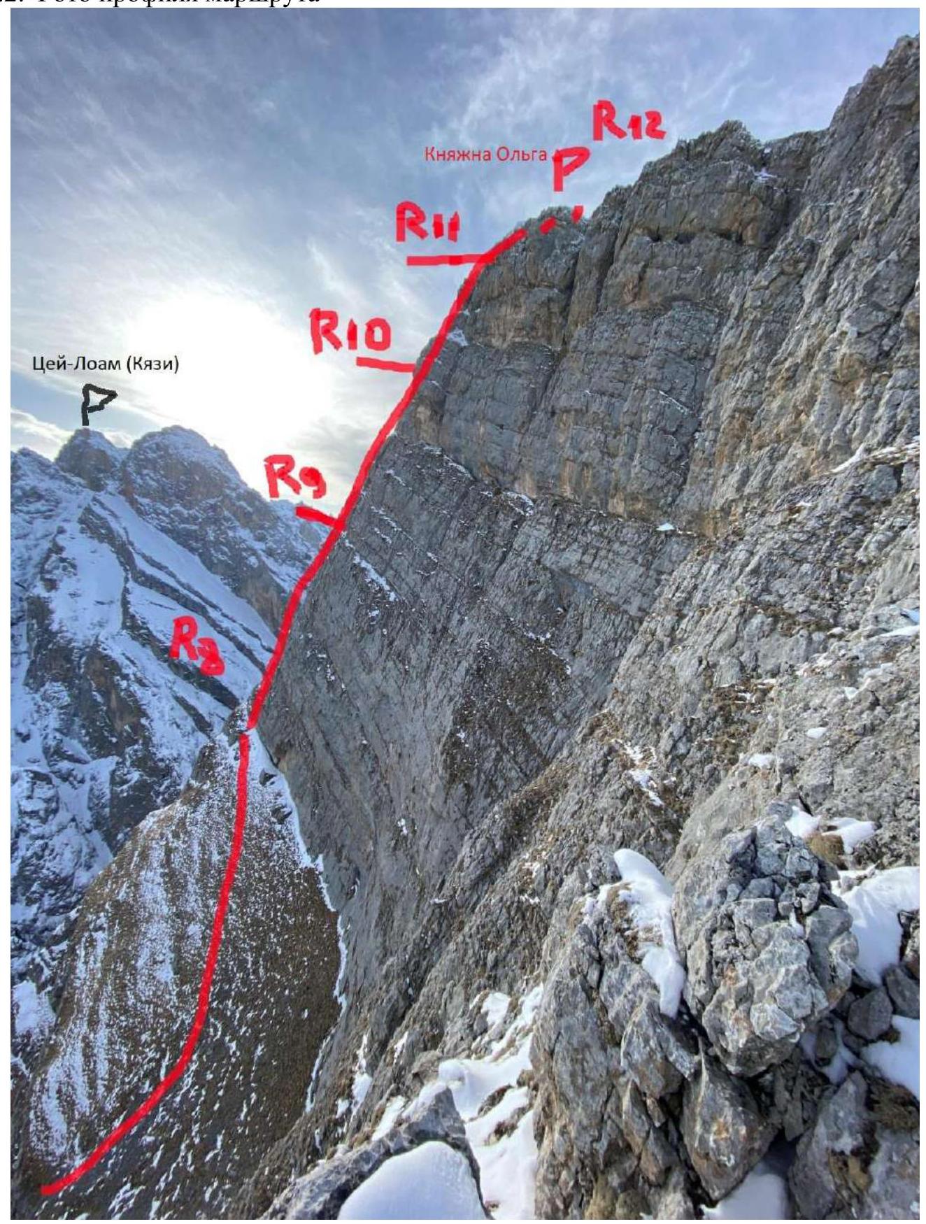
1.2. Profile Photo of the Route
The summit of Княжна Ольга. March 2, 2022 – photo taken during the descent via route 2B Mendina. Photo 2.
1.3. Photopanorama of the Area
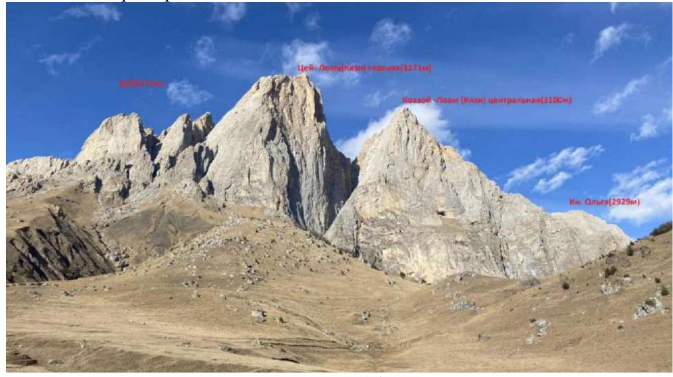
From the Кязи camp. Photo 3.
1.4. Map of the Area
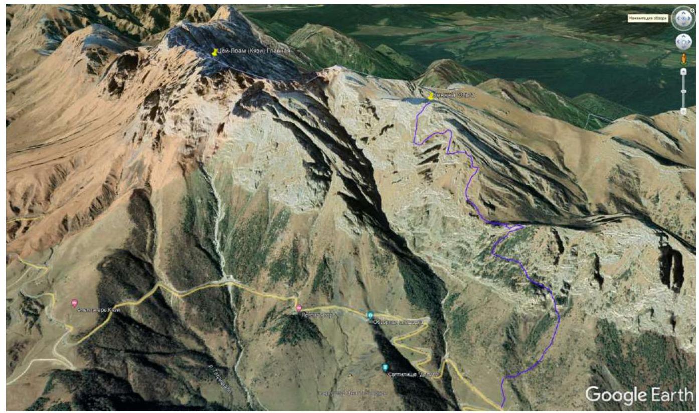
Photo 4.
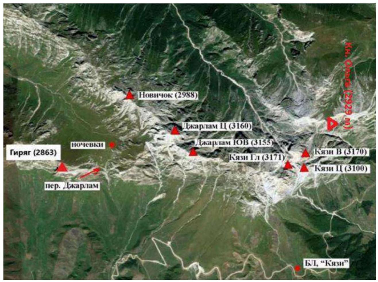
Photo 5.
2. Characteristics of the Route
2.1. Technical Scheme of the Route
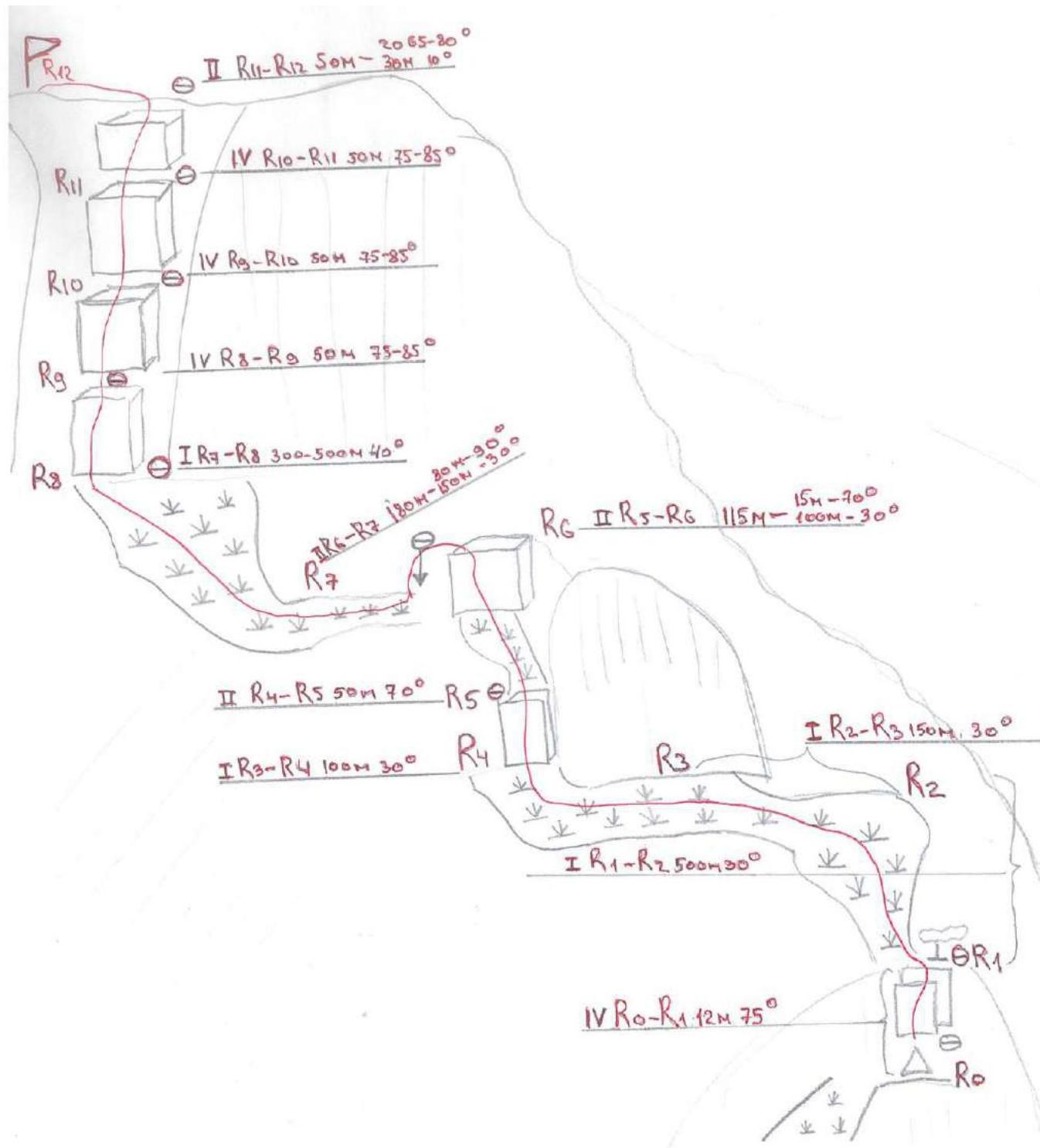
2.2. Route Diagram in UIAA Symbols.
| Section # | Name and number of pitons (#) | Insurance points, characteristics in symbols | Route lines in UIAA symbols | Difficulty of the section in symbols | Length of the section, m | Steepness, ° | ||
|---|---|---|---|---|---|---|---|---|
| Friends | Pitons | Nuts | ||||||
| R11–R12 | 2 | 1 | 2 | II | 30 m | 10° | ||
| 20 m | 65–85° | |||||||
| R10–R11 | 3 | 3 | 4 | IV | 50 m | 75–85° | ||
| R9–R10 | 4 | 4 | 4 | IV | 50 m | 75–85° | ||
| R8–R9 | 2 | 3 | 4 | IV | 50 m | 75–85° | ||
| R7–R8 | – | – | – | I | 300–500 m | 40° | ||
| R6–R7 | – | 2 | – | II | 150 m | 30° | ||
| 30 m | 90° | |||||||
| R5–R6 | 1 | – | 1 | II | 15 m | 70–80° | ||
| 100 m | 30° | |||||||
| R4–R5 | 1 | – | 4 | II | 50 m | 70° | ||
| R3–R4 | – | – | – | I | 100 m | 30° | ||
| R2–R3 | – | – | – | I | 150 m | 30° | ||
| R1–R2 | – | – | – | I | 500 m | 30° | ||
| R0–R1 | 1 | 1 | 2 | IV | 12 m | 75–85° |
3. Characteristics of the Team's Actions
3.1. Approach
The route begins from the Keli tower complex's graveyards, crossing a gully with a small stream, and moves up a grassy slope along the gully to the remains of a temple. From the temple, 100 m up, we turn left onto a trail leading along rocky shelves. The trail leads to a saddle. From the saddle, we descend left to a pass. From the saddle, the start of the route is visible (Photo 1).
R0–R1 Category IV
From the control tour, climb a 12 m wall (angle 75–85°) to a pine tree. Station on the pine tree. First key point of the route.
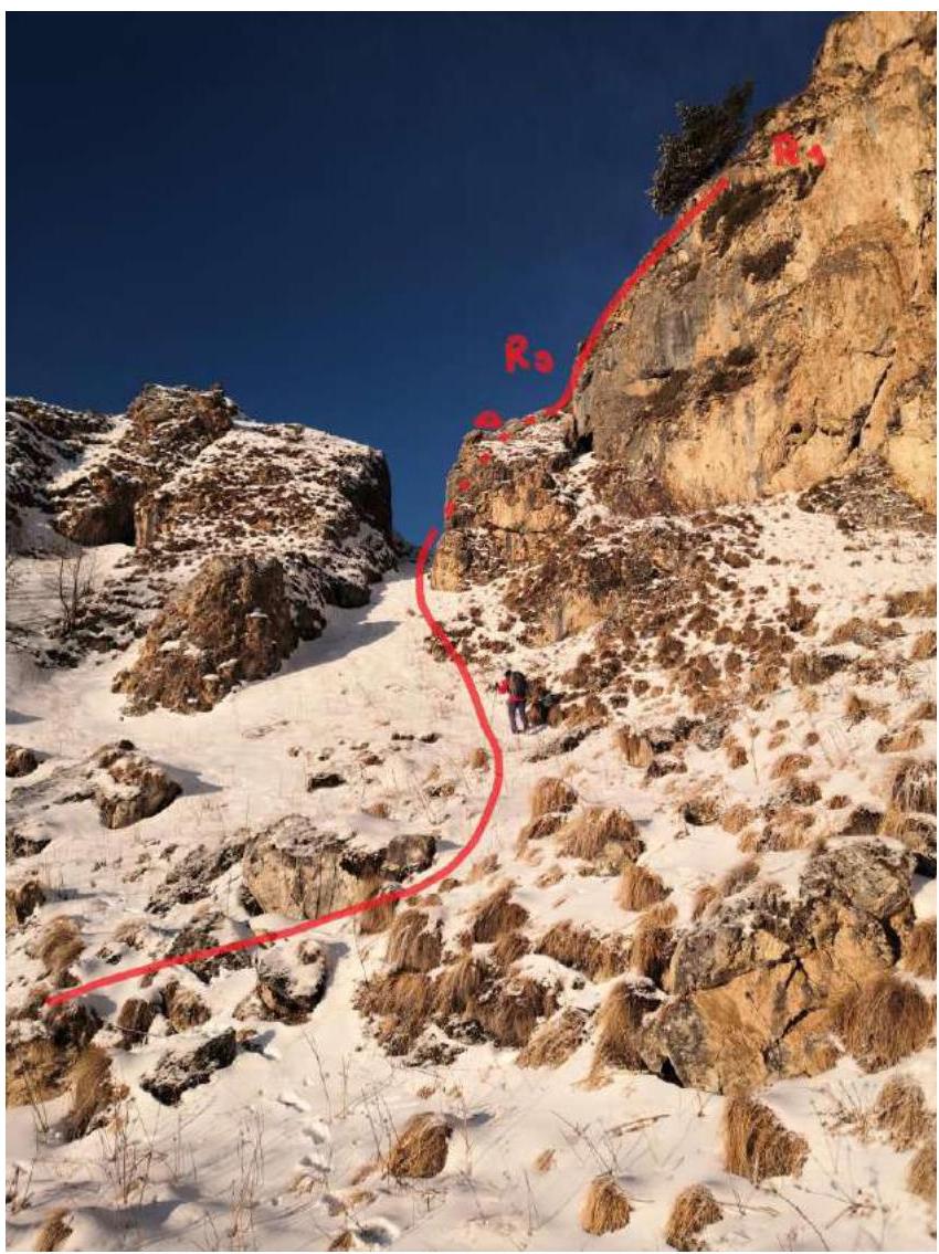
Photo 6. March 2, 2022.
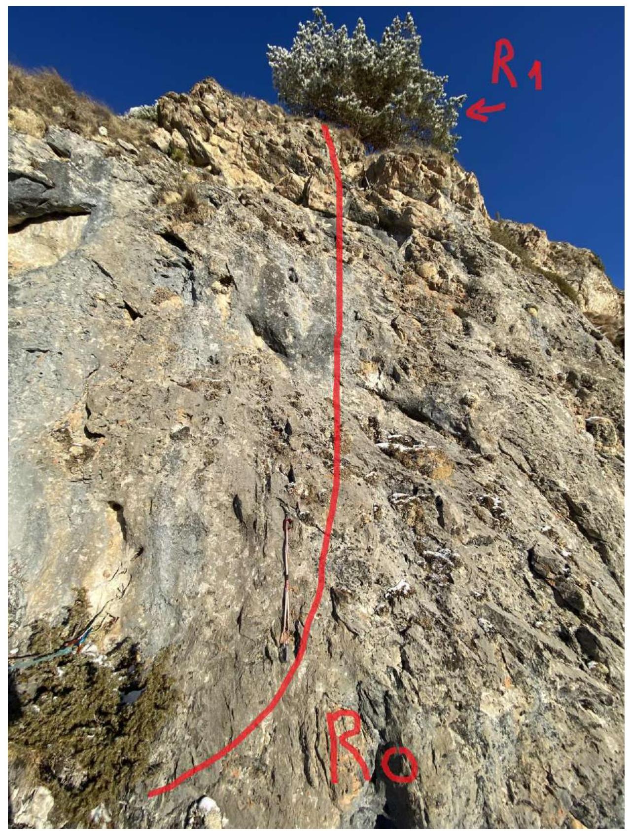
Photo 7. March 2, 2022.
R1–R2 Category I
From the pine tree, ascend a grassy slope 500 m, angle 30°.
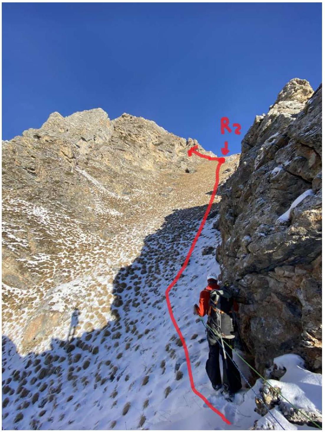
Photo 8. March 2, 2022.
R2–R3 Category I
Then, move left onto grassy slopes to rocks 150 m, angle 30° (Figure 2).

Photo 9. March 2, 2022.
R3–R4 Category I
Traverse left on a grassy slope under rocks, past a system of rocky grottos, and exit onto a saddle (platform) R4 (Figure 2).
R4–R5 Category II
From the saddle, ascend a rocky edge 50 m, 70°, climbing 3.
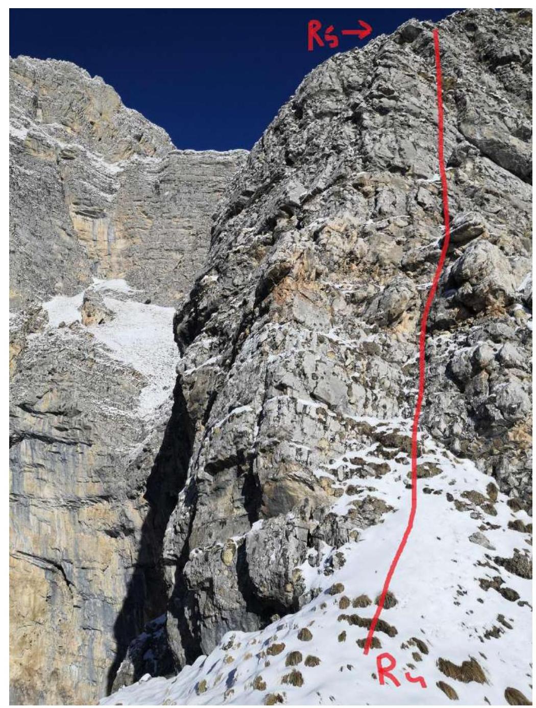
Photo 10. March 2, 2022.
R5–R6 Category II
Then, 100 m along a grassy edge to a wall. Up the wall 15 m, angle 70–80°, climbing 4.
Then, left along a grassy edge to a rappel anchor (R6), left of the wall.
R6–R7 Category II
Rappel 30 m to a grassy slope. From R6, a depression in the rock is visible, containing an ancient sanctuary R7.
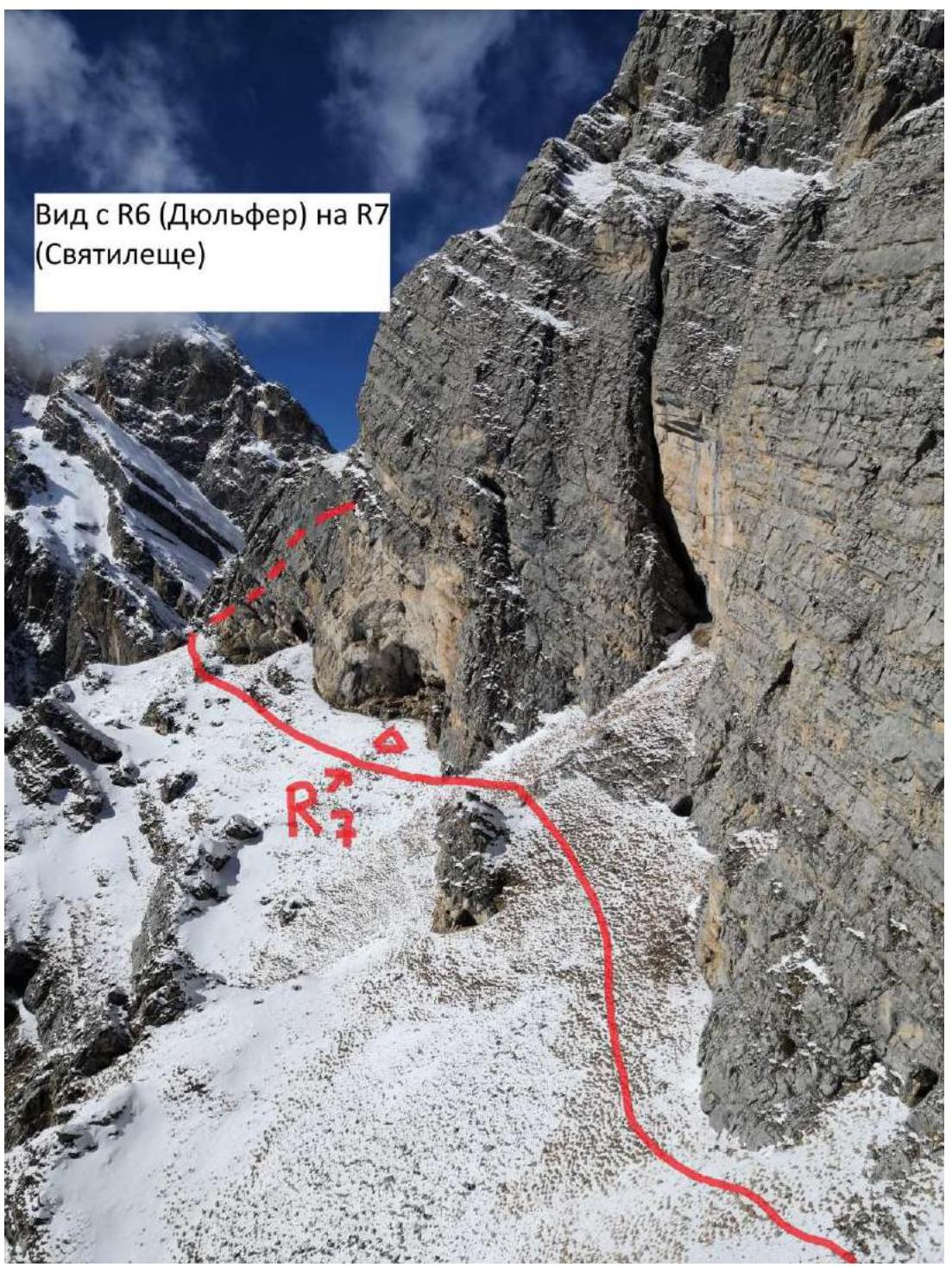
Photo 11. View from R6 (rappel) to R7 (sanctuary). March 2, 2022.
R7–R8 Category I
Then, move under the rock and exit onto a grassy slope leading to the southern edge, exiting onto the summit.

Photo 12. March 2, 2022.
R8–R9 Category IV
Ascend a rocky wall 45 m, angle 75–85°, climbing 5 with elements of attentiveness 6. Station on a convenient ledge. From R8 to R11 – second key point of the route.
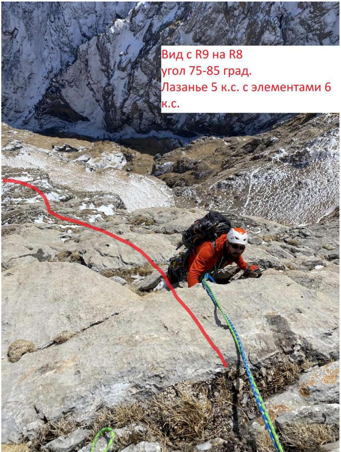
Photo 13. March 2, 2022.
R9–R10 Category IV
Ascend a rocky wall 50 m, angle 75–85°, climbing 5 with elements of attentiveness 6. Station on a convenient ledge.
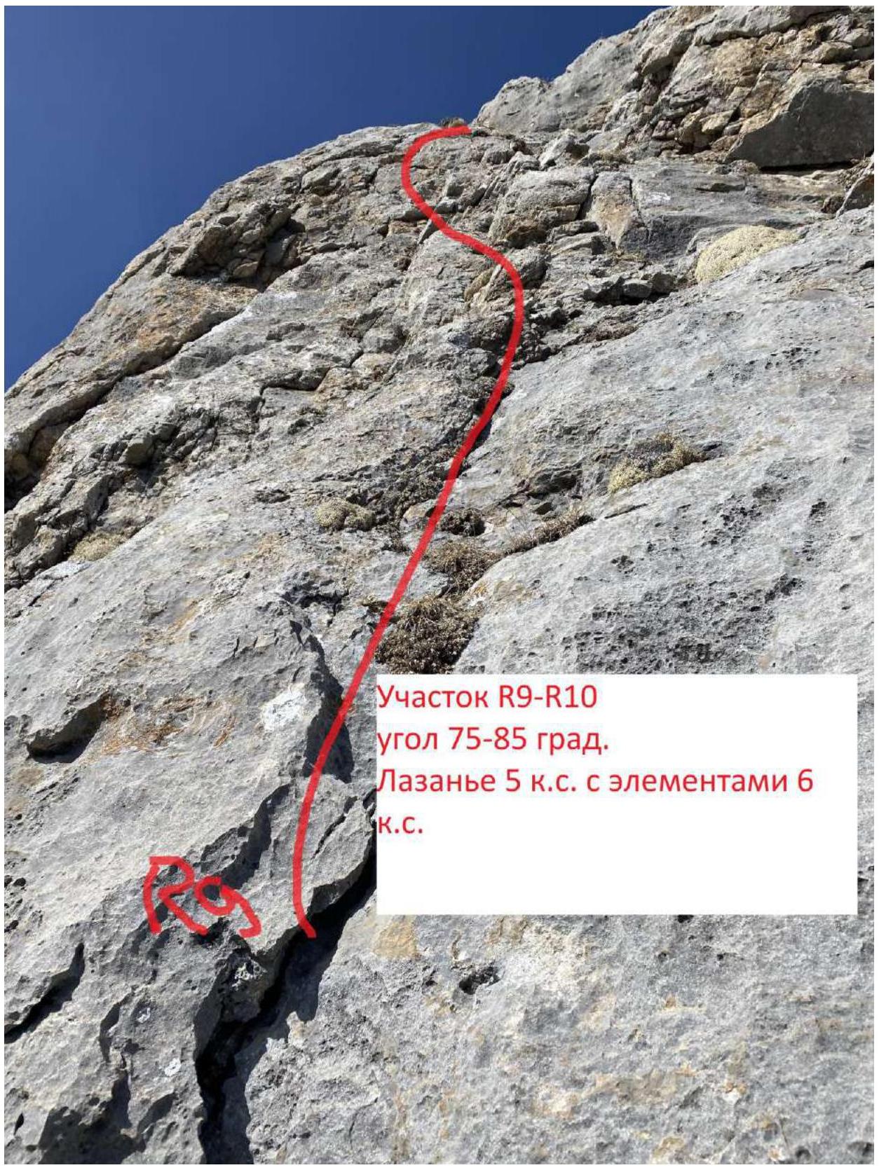
Photo 14. March 2, 2022.
R10–R11 Category IV
Ascend a rocky wall 50 m, angle 75–85°, climbing 5 with elements of attentiveness 6. Station on a convenient ledge.
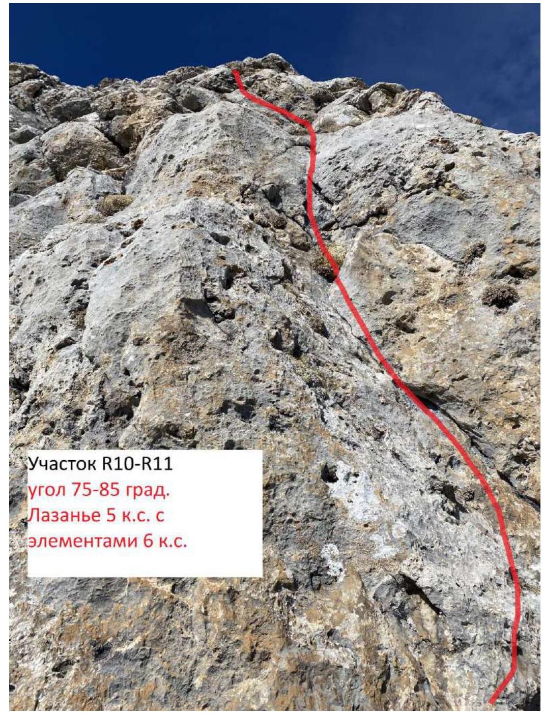
Photo 15. March 2, 2022.
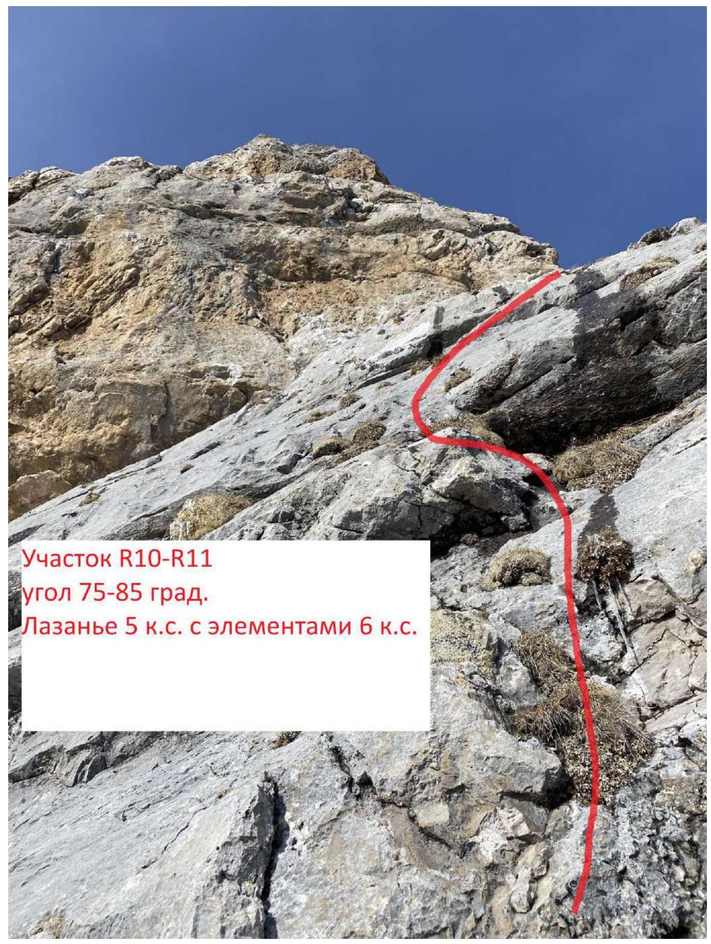
Photo 16. March 2, 2022.
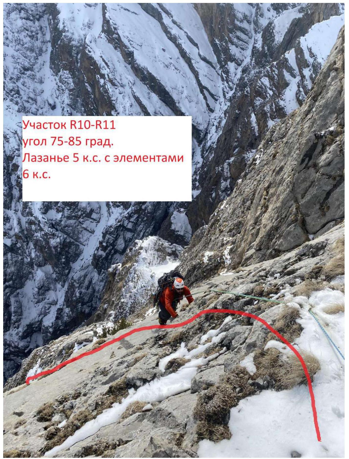
Photo 17. March 2, 2022.
R11–R12 Category II
Ascend a rocky wall 20 m, angle 65–85°, climbing 4. Exit onto the summit ridge, then left 30 m to the control tour on the summit.
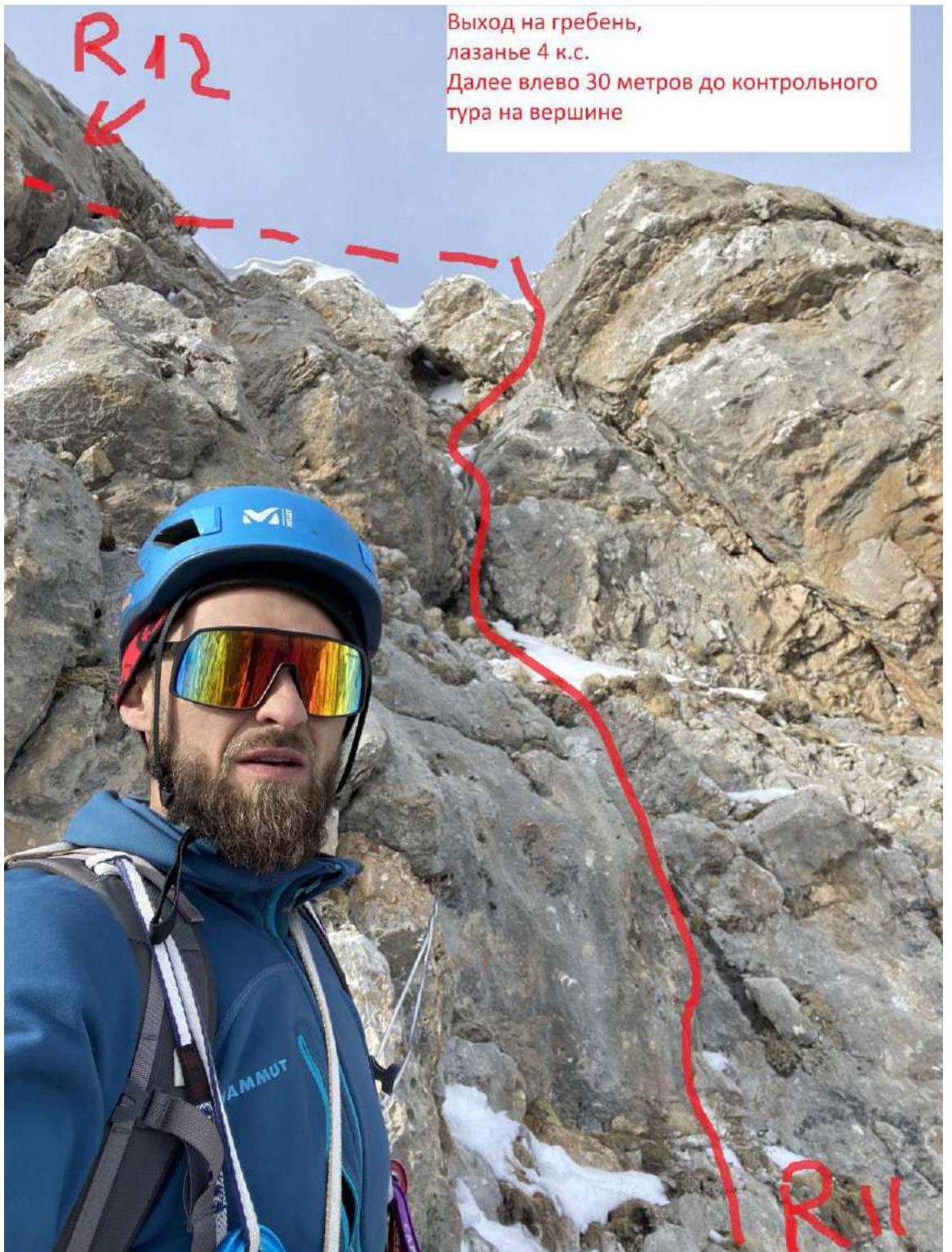
Photo 18. March 2, 2022.
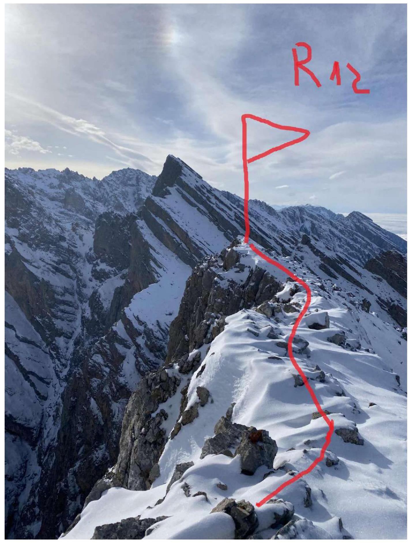
Photo 19. March 2, 2022.
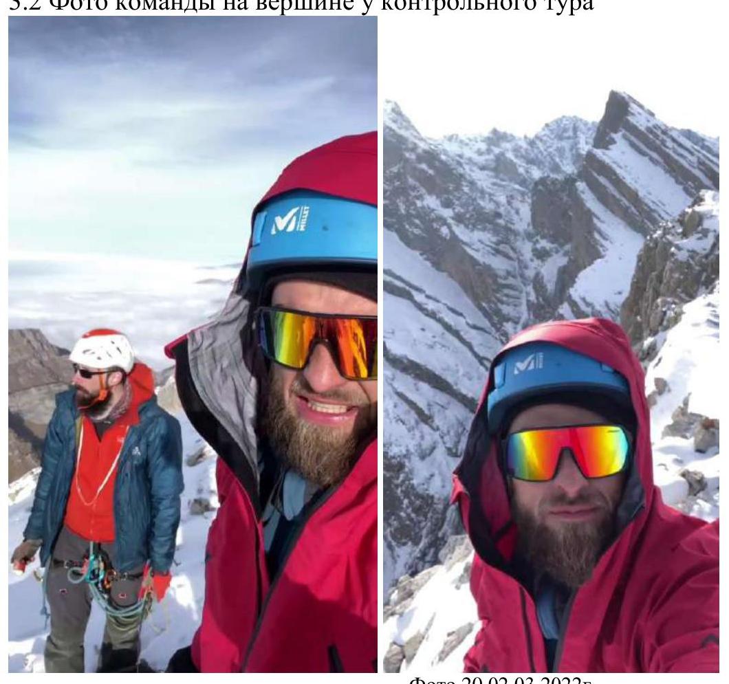
3.2. Photo of the Team at the Summit by the Control Tour
Photo 20. March 2, 2022.
3.3. The route turned out to be logical, with convenient points for setting up stations every 50 m at key sections, allowing several people to gather without risking falling rocks. Cellular coverage is available throughout the route; radio communication with the Кязи alpine camp is unstable in the lower part of the route, but stable from section R8 onwards.
Recommendations for future climbers: Pitons, anchors, and medium-sized protection work well. It's advisable to bring an ice axe or trekking poles and crampons, as the grass can be very slippery and snowy.
Attention! Descent via 2B Mendina. There are 5 descent stations equipped on the descent; be careful not to mistake the edge (it forks in the middle of the descent).
Based on the objective complexity of the technical part of the route to the summit of Княжна Ольга via the South Edge and comparing it with other routes previously climbed by Volkov A.V. (Голдор Главная 4A, Зуб 4A, Джангитау 4Б) and Gurenko T.Y., it is proposed to classify it as category 4A. Classifying the route as category 3A or lower would pose significant challenges for climbers with lower qualification and experience.