
Report on the First Ascent
Dzharlam
Via the South-West Tower Wall "Raz-dva-tri"
Bogdanov A.V. 3B
2022
Climbing Passport
| 1. General Information | ||
|---|---|---|
| 1.1 | Full Name, Sports Category of the Leader | Bogdanov Alexey Vladimirovich, 1st sports category |
| 1.2 | Full Name, Sports Category of the Participants | Gorshkov Nikita Alekseevich, 2nd sports category; Shcheglov Vasily Gennadievich, 2nd sports category; Kholenkov Alexey Alexandrovich, 3rd sports category; Kholenkov Sergey Alexandrovich, 3rd sports category; Kholenkov Dmitry Alexandrovich, 3rd sports category |
| 1.3 | Organization | OFSO "Federation of Alpinism of Nizhny Novgorod Region" |
| 2. Characteristics of the Climbing Object | ||
| 2.1 | Region | Caucasus |
| 2.2 | Valley | Dzheyrakhsky district |
| 2.4 | Name and Height of the Summit | Dzharlam (2930) |
| 2.5 | Geographical Coordinates of the Summit (Latitude/Longitude), GPS Coordinates | N 42°51′32″ E 44°48′0″ |
| 3. Characteristics of the Route | ||
| 3.1 | Terrain Characteristics of the Route | Rocky |
| 3.2 | Difficulty Category | 3B |
| 3.3 | Name, Year of the First Ascent | Via the South-West Tower Wall, 2022 |
| 3.2 | Height Difference of the Route (altimeter or GPS data, m) | 450 |
| 3.3 | Route Length (in meters) | 930 |
| 3.4 | Descent from the Summit | From the summit along the ridge towards the Novichok peak until a large gendarme with vertical walls, and to the right of the gendarme, between it and a rock outcrop, descend into a scree couloir (rappel 50 m). Then down the scree slope turning into a grassy field, traverse the slope, and descend to the trail. Follow the trail to the right towards the Dzharlam pass. |
| 3.5 | Additional Route Characteristics | The route includes challenging sections of 5+ category. Use anchors and friends as protection points. Not recommended for groups with low rock climbing skills. |
| 4. Characteristics of the Team's Actions | ||
| 4.1 | Time on the Route (team's travel hours) — time to the summit — total time including descent — time between bivouacs | 8 h 00 min, 9 h 15 min, 11 h 00 min. |
| 4.3 | Time at Control Points | Departure from bivouacs on the Dzharlam pass — 06:30 (April 23, 2022) — Reached the wall — 08:00 — Reached the summit — 16:00 — Returned to bivouacs — 17:30 (April 23, 2022) |
| 5. Weather Conditions | ||
| 5.0 | April 23, 2022, clear, slight cloudiness in the evening | |
| 6. Person Responsible for the Report | ||
| 6.1 | Full Name, e-mail | Bogdanov Alexey Vladimirovich 2965056@gmail.com 8 (987) 537-55-93 |
Section lengths: n-k – 180 m, I category – 35 m, II category – 390 m, III category – 90 m, IV category – 100 m, V category – 135 m. Maximum steepness of the wall section — 80°; Average steepness of the wall section — 65°; Average steepness of the entire route — 50°.
Protection points used:
- anchor hooks – 25
- pitons – 4
- protection devices – 35
Protection points left on the route: Total – 0
Movement Table by Sections
| Section | Length | Steepness | Terrain Characteristics | Category | Number of Pitons |
|---|---|---|---|---|---|
| R0–R1 | 150 | 30 | Grass, rocks | 1Б | 0 |
| R1–R2 | 40 | 60 | Rocky | 3 | 6 |
| R2–R3 | 40 | 30 | Grass, rocks | 2 | 5 |
| R3–R4 | 50 | 60 | Rocky | 3 | 8 |
| R4–R5 | 50 | 65 | Rocky | 4 | 9 |
| R5–R6 | 35 | 65 | Grass, rocks | 5 | 6 |
| R6–R7 | 50 | 70 | Grass, rocks | 5 | 8 |
| R7–R8 | 30 | 25 | Grass | 1Б | 0 |
| R8–R9 | 50 | 80 | Rocky | 5 | 8 |
| R9–R10 | 35 | 20 | Grass | 1 | 4 |
| R10–R11 | 50 | 70 | Rocky | 4 | 8 |
| R11–R12 | 350 | 20 | Grass, rocks | 2 | 0 |
Equipment used by the group:
- anchor hooks – 8 pcs.
- pitons – 2 pcs.
- friends – 11 pcs.
- set of chocks – 10 pcs.
- ropes: static, dynamic
Map of the area
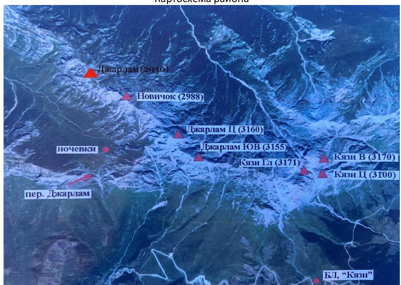
Ascent line
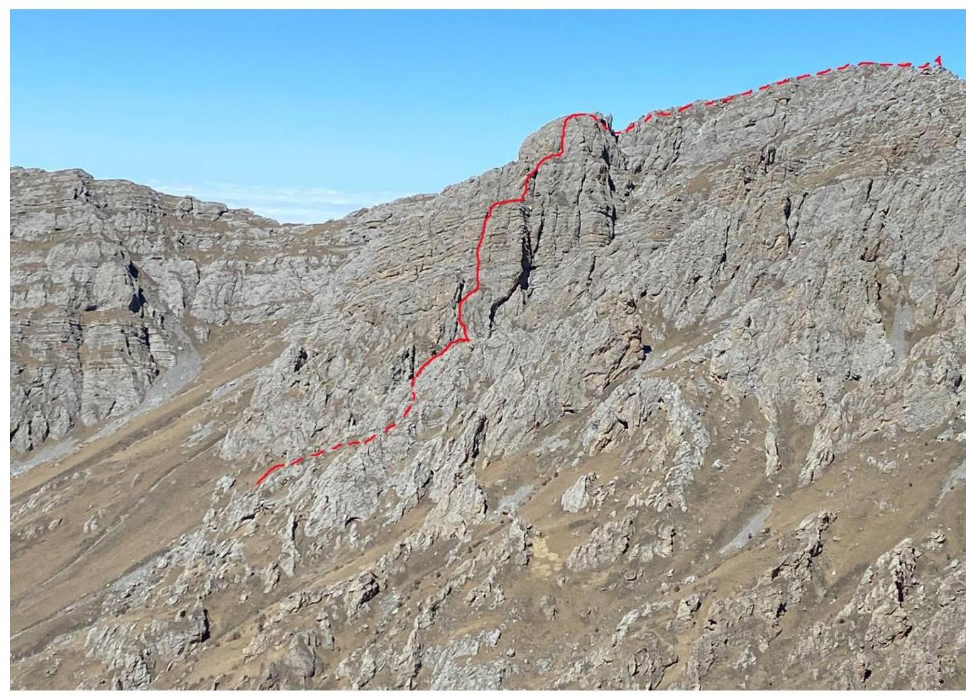
Route Description
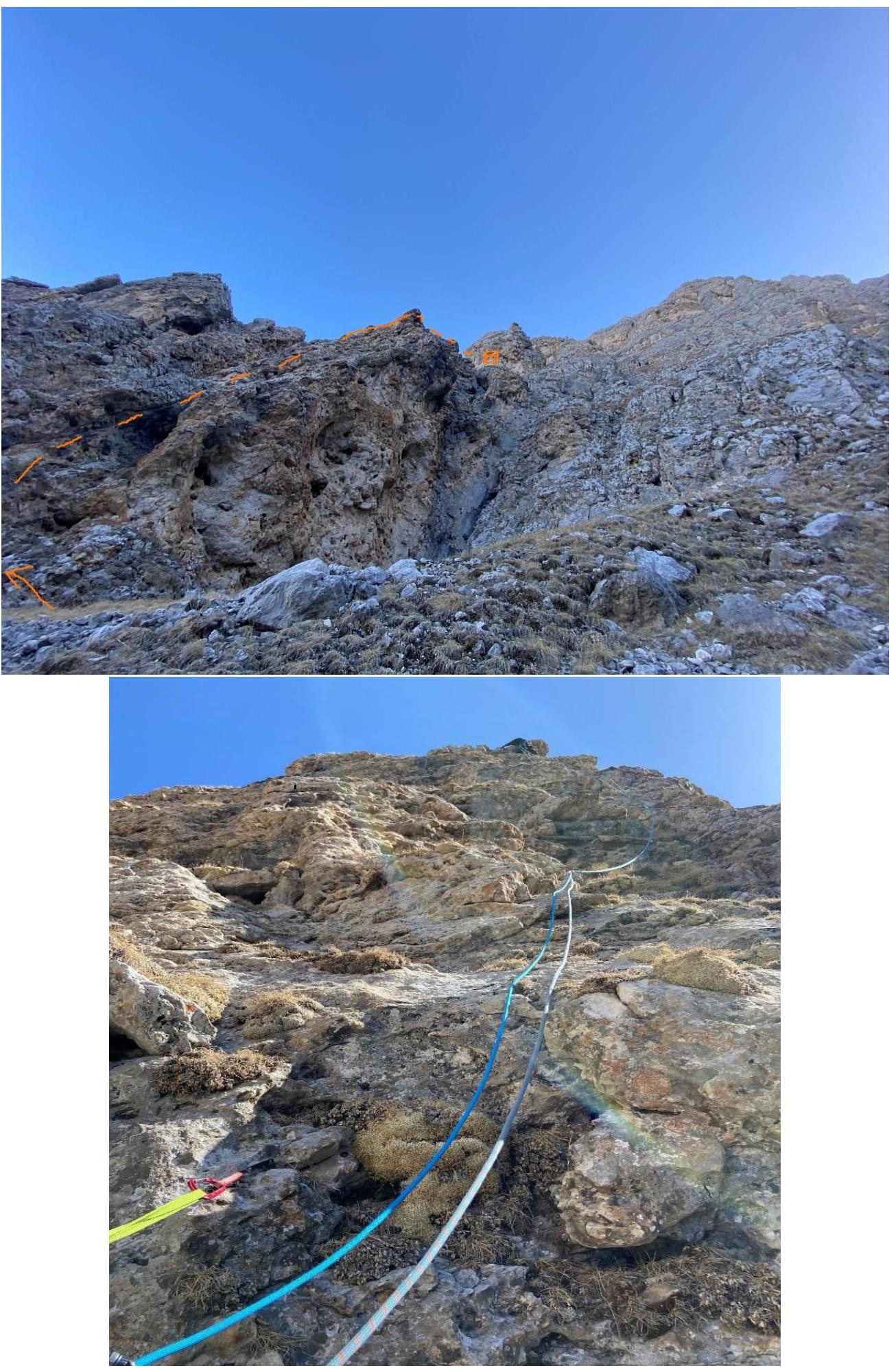
Approach: up a grassy slope to the base of the wall. From the village of Guli, move up along the stream bed towards the Dzharlam pass for 1.5–2 hours. In the middle part of the ascent, near a large boulder, there is a water source (no water further on the route). From the pass, move down along the left side of the valley; after 20 minutes of descent, cross the stream bed and, keeping to the rocks on the right and upwards, ascend to the base of the visible wall via large scree to a couloir to the right of a large grotto. This is the start of the route; then move right and up through rocks and grassy ledges.
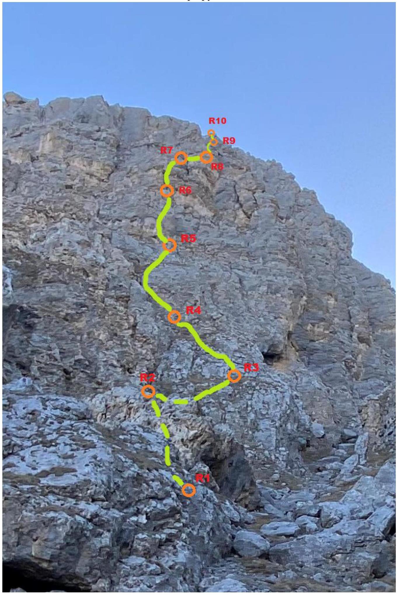
R0–R1. Movement up the scree couloir with grassy and rocky ledges to the right and upwards for 150 m (easy), approaching characteristic rust-colored rocks with large cavities on the left wall of the couloir. The steepness of this section is 30°. Station R1 is under a "plug" at the base of a small angle, on two friends and one anchor.
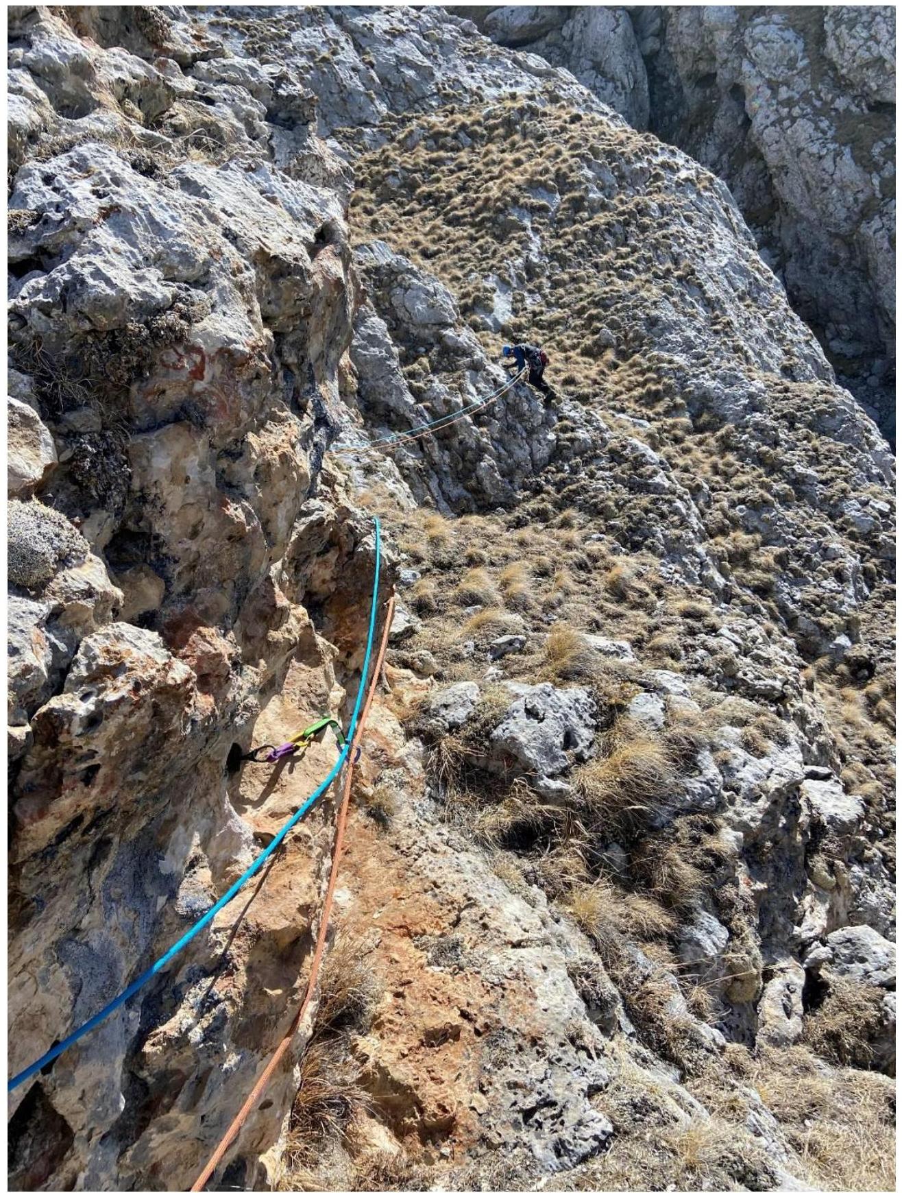
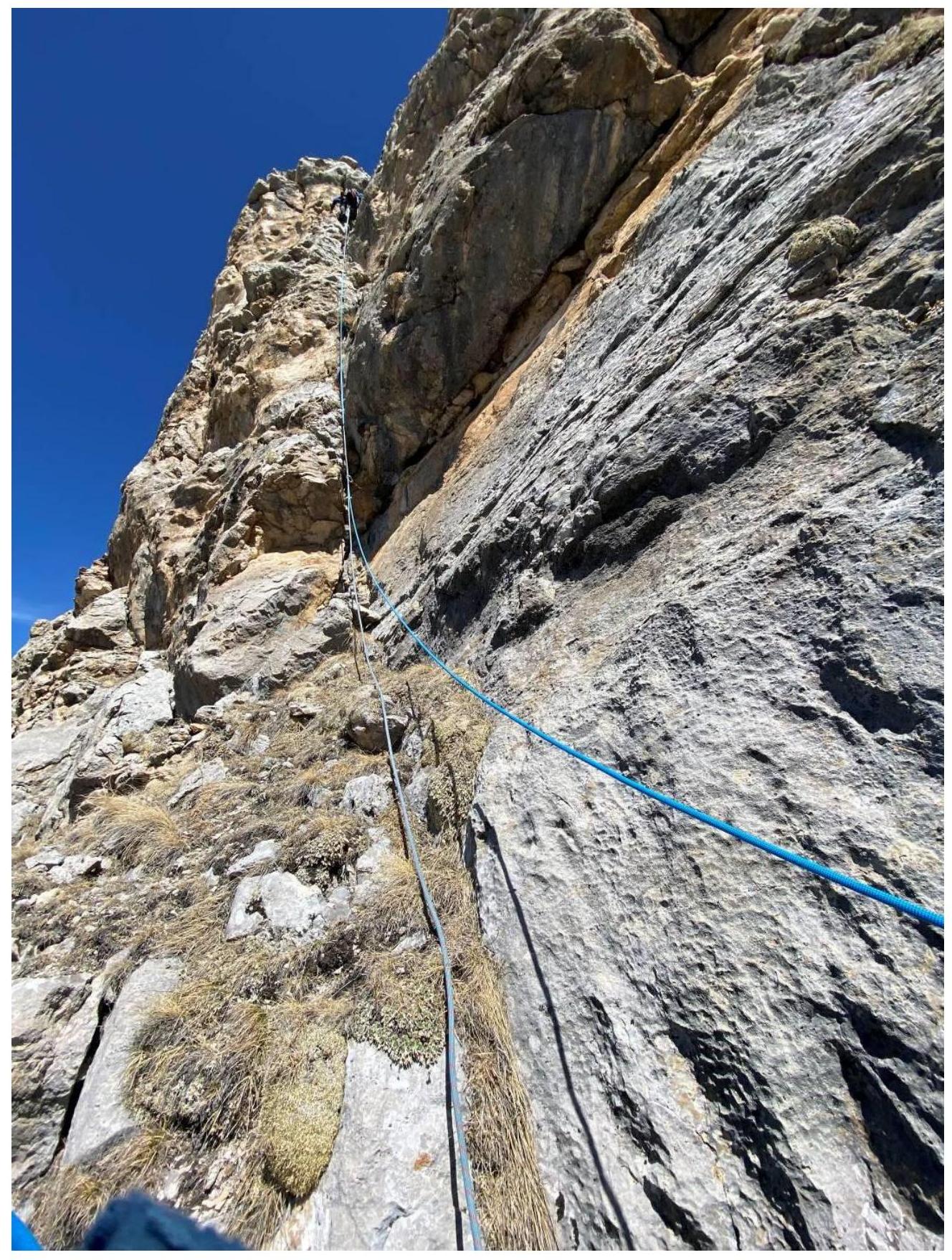
R1–R2. Move right and up a small wall, emerging onto the top of the rust-colored rocks. Exit onto a small ridge. Rocks of category 3, steepness 60°. Protection on friends and anchors. Station R2 is on a ledge, on two friends and one chock.
R2–R3. Traverse along a ledge for 10 m, slightly down, then along an oblique grassy ledge, steepness 30°, to the right towards the base of a small slab. Protection on friends. Section length 30 m. Station R3 is under a small wall in a crevice, on two friends and one anchor.
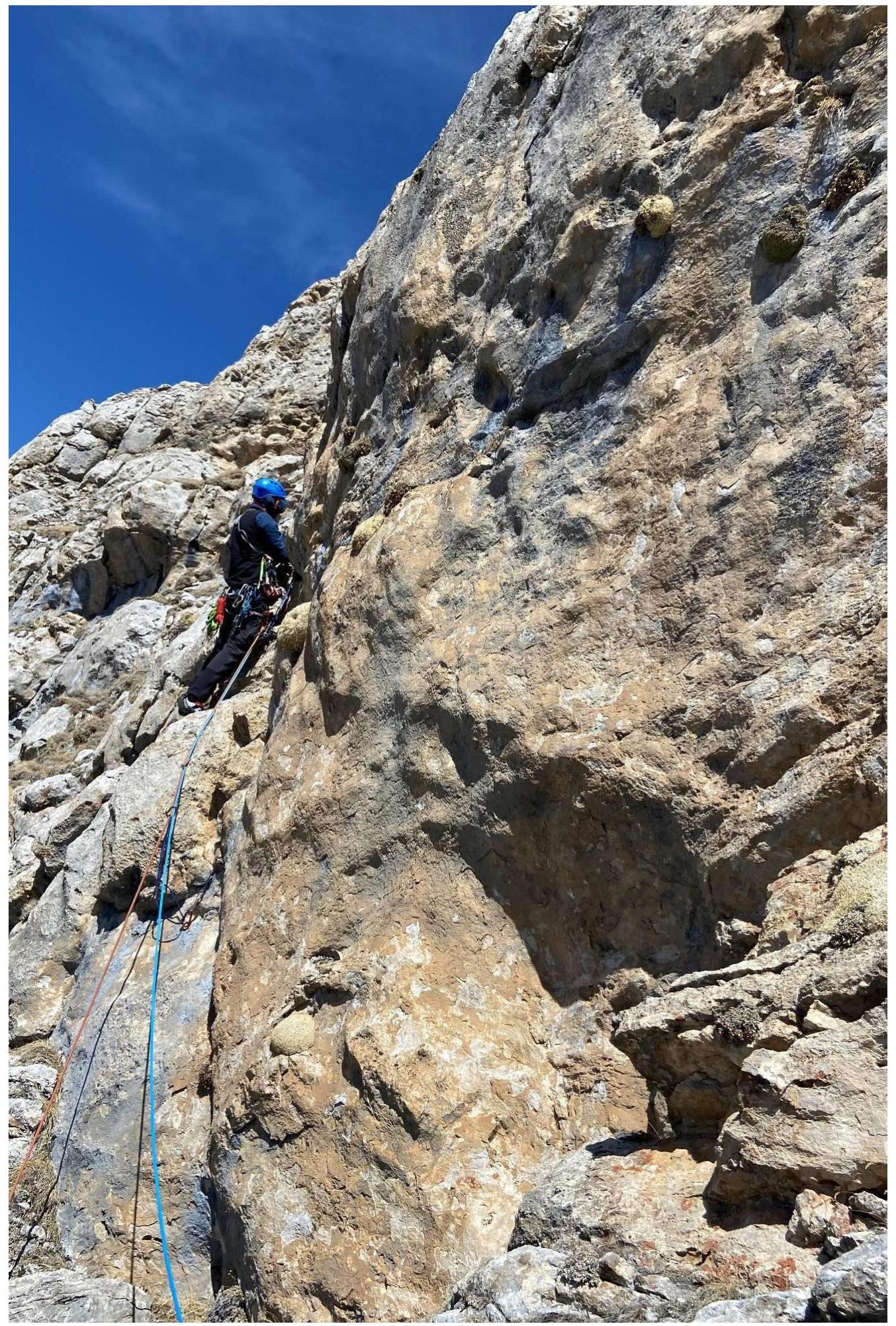
R3–R4. From the station, 5 m of challenging climbing (4+), then 30 m of category 3, 5 m of category 4, exit onto a small grassy ledge. Slope steepness 60°. Protection along the way (5 friends, 3 anchors). Station R4 is on a ledge 5 m from an internal angle, on a friend and two pitons.
R4–R5. From the station, left and up towards a small overhang for 35 m, category 3, then 15 m of category 5 along an internal angle. Protection on friends (6 pcs.), anchors (2 pcs.), 1 chock. Steepness 65°. Station R5 is on a ledge on two anchors and one friend.
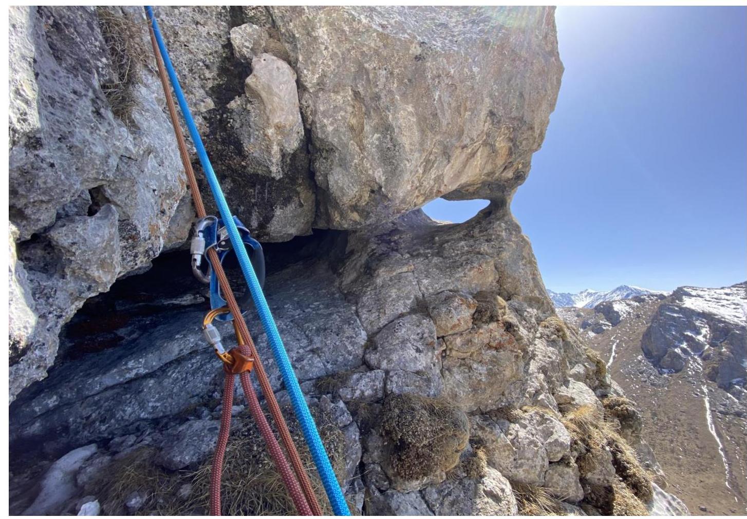
R5–R6. Traverse along a ledge to the left, then 25 m up a wall. Challenging climbing of category 5+ through a small overhang. Steepness 65°. 4 friends, 2 anchors. Station R6 is on a ledge under a yellow wall on two anchors and one friend.
R6–R7. A characteristic feature is a large oblique ledge extending to the left and down. Pass 3 m to the left along a narrowing grassy ledge — a challenging spot, climbing 5+. Then up through slabs and crevices for 25 m, climbing category 5. Station R7 is at the start of the ledge. Steepness 70°.
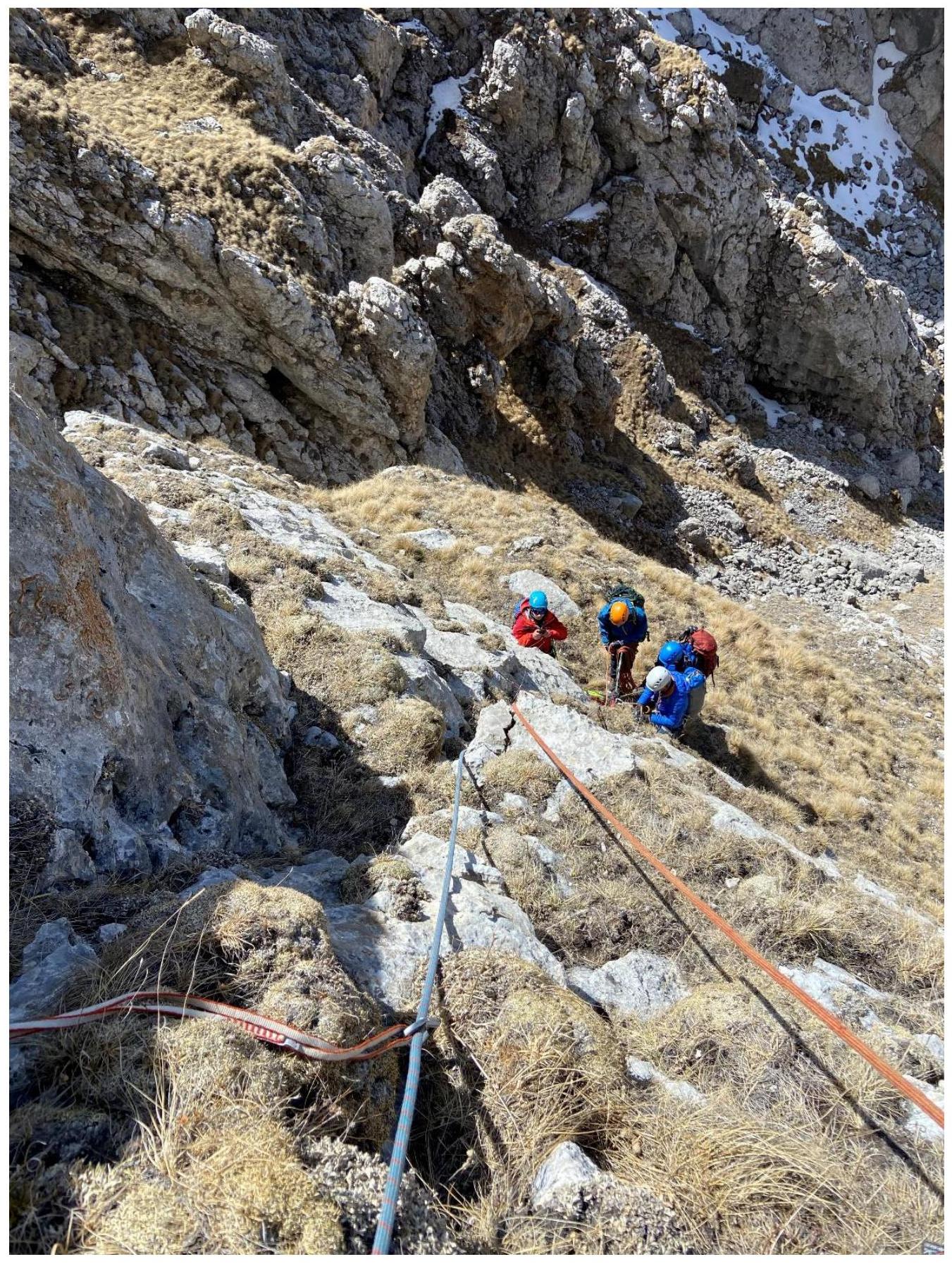
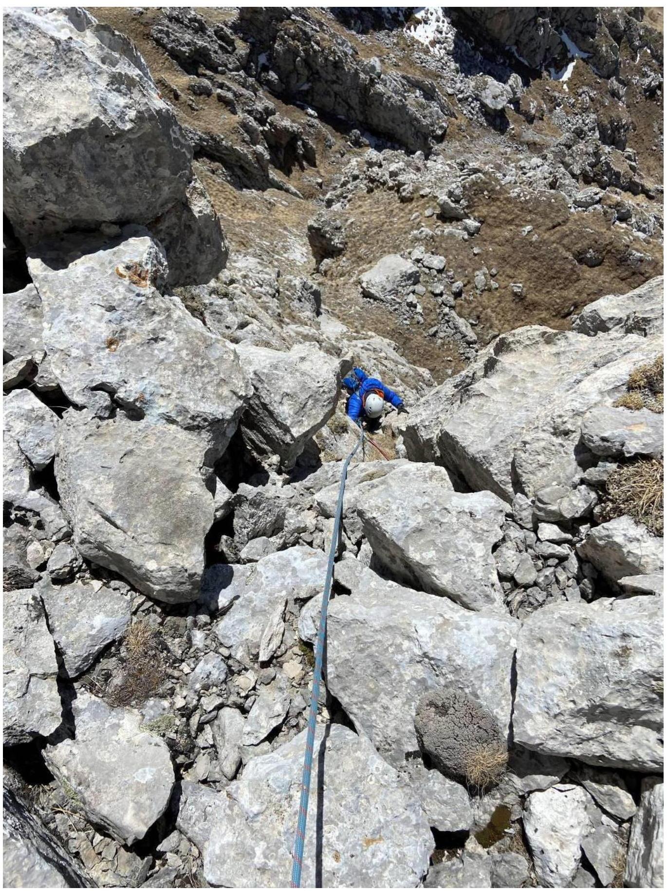
R7–R8. Traverse along ledges to the right for 30 m. No category. Slope steepness 25°. Station R8 is on a ledge under a wall.
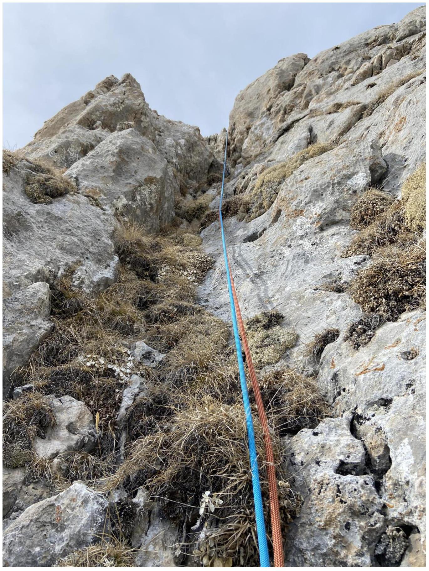
R8–R9. Up through a system of cracks and slabs for 40 m, category 5. Then exit onto a ledge. Station R9 is on a boulder. Section length 50 m. Steepness 80°. The key point of the route.
R9–R10. Traverse along a ledge to the right for 35 m. Easy rocks and ledges with grass, categories 1–2. Can be traversed simultaneously. Station R9 is on a sharp boulder under a wall. Slope inclination about 20°.
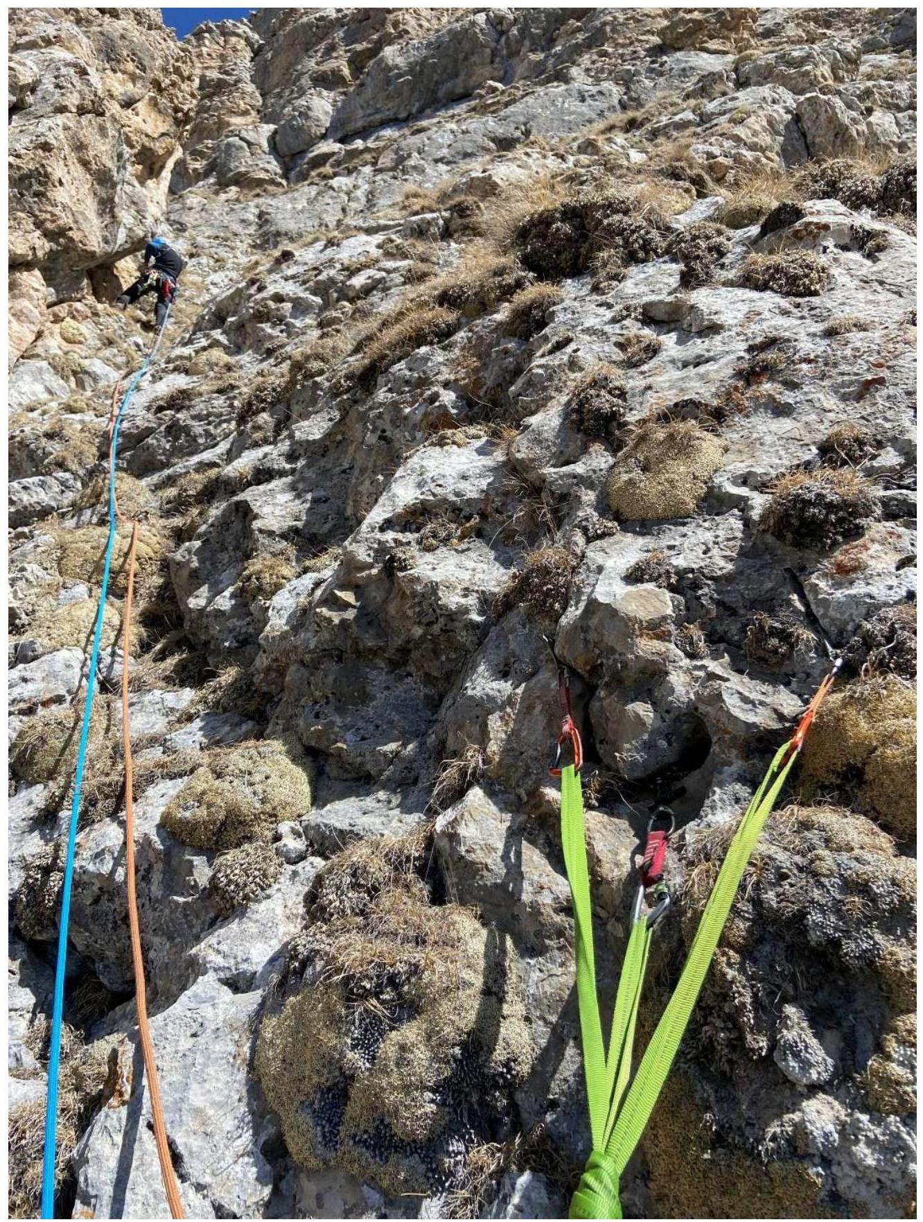
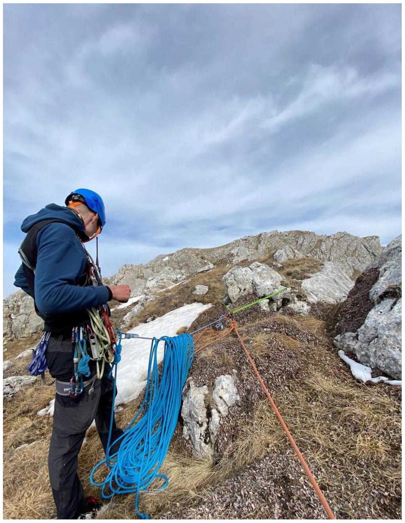
R10–R11. 3 m from the station along a ledge, then 45 m up a crevice to a ridge, rocks category 4. Slope steepness 70°. For protection, used friends and two anchors. Station R11 is on a ridge, on a lying boulder.
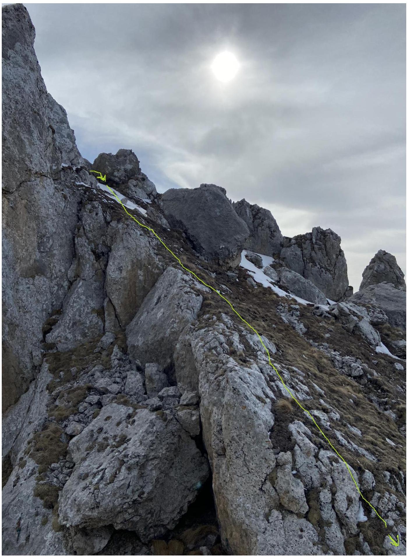
Further along the ridge, 20 m to a control cairn.
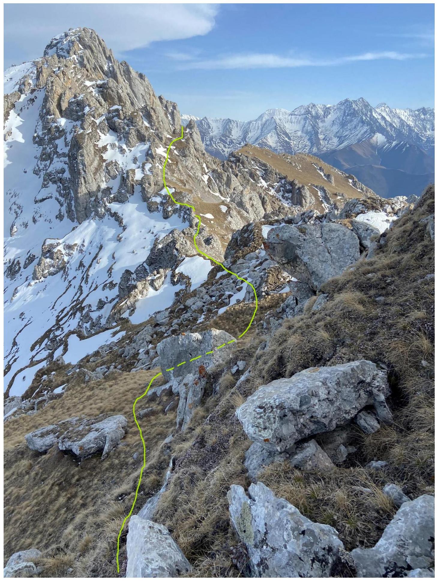
R11–R12. Descend slightly from the "Tower", through a small depression, move right and up along the ridge through easy rocks and grassy ledges for 350 m to the summit.
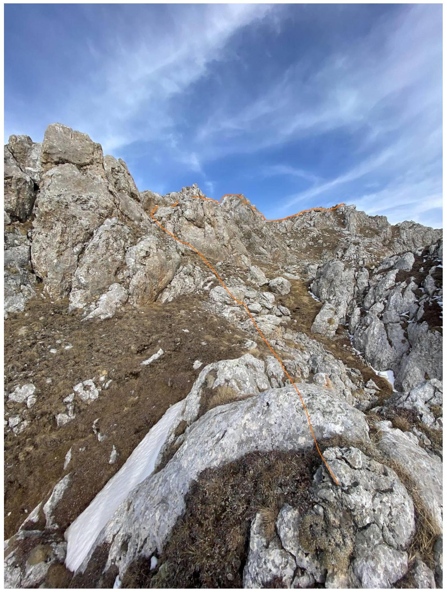
From the summit, continue along the ridge in the opposite direction from the ascent route. Along the ridge for 400 m through rocks with grassy outcrops to a large gendarme with vertical walls, and to the right of the gendarme, between it and a rock outcrop, descend into a scree couloir (rappel 50 m). Then down the scree slope turning into a grassy field, traverse to a rocky ridge, exit onto the next field, and along the slopes of "Novichok", traverse down to the trail; follow the trail to the right towards the bivouacs on the Dzharlam pass.
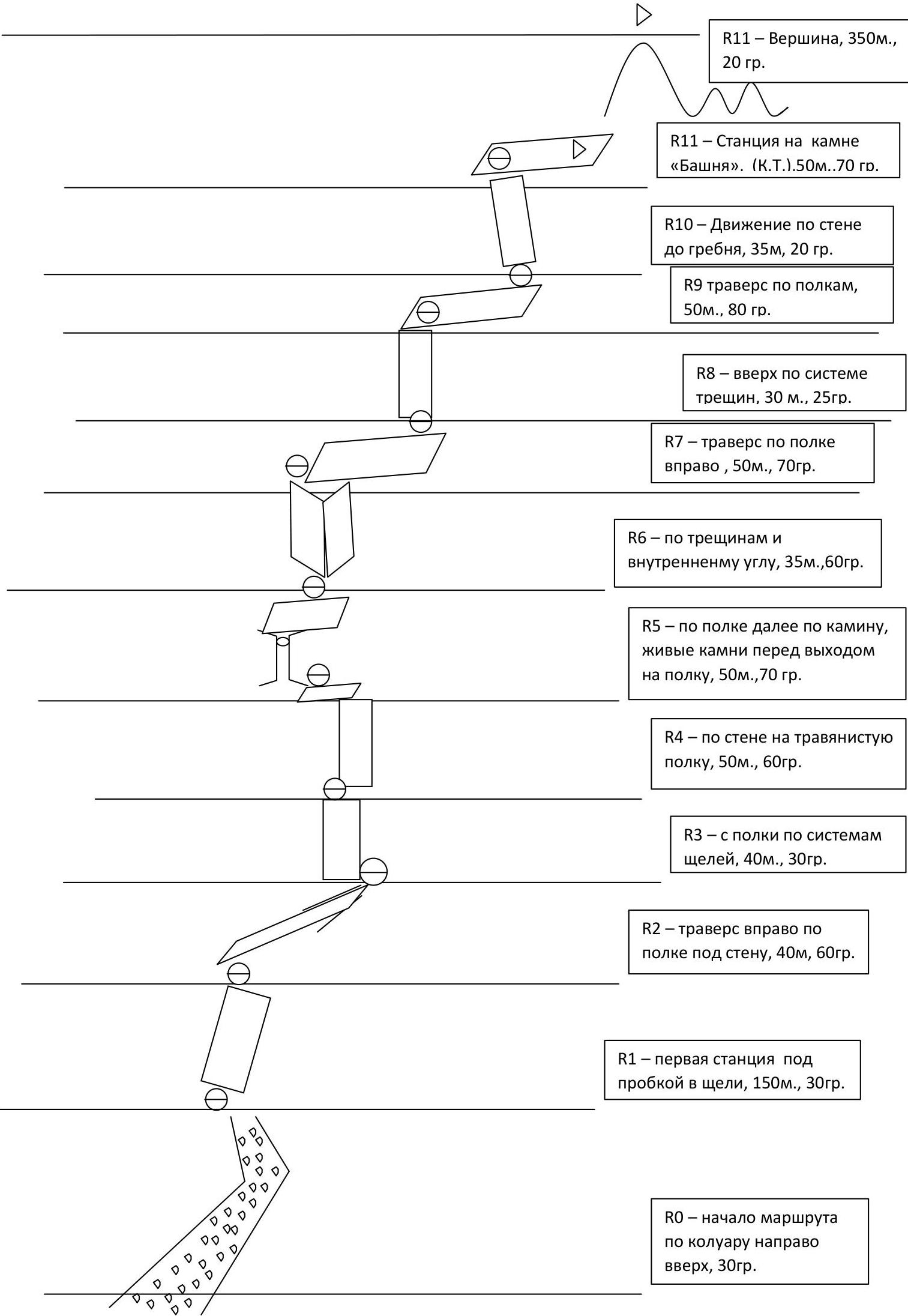
R0 — start of the route up the couloir to the right and up, 30°. Diagram of the wall section of the route
Photos of the Route
Approach to station R1:
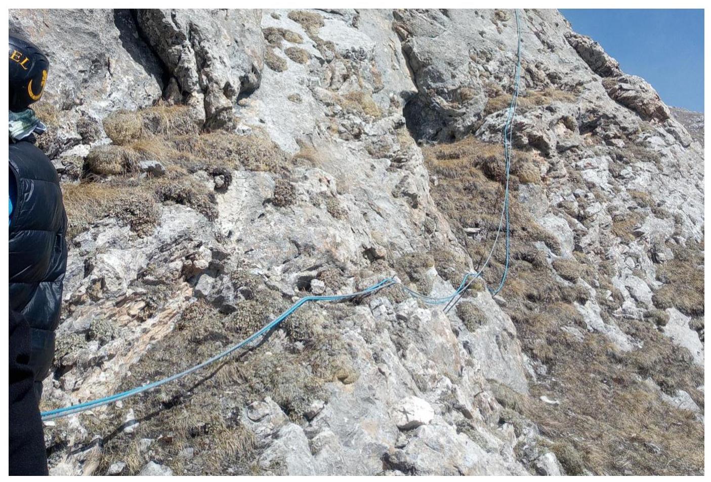
Section R1–R2
Section R2–R3

Section R3–R4
Section R3–R4 from top to bottom
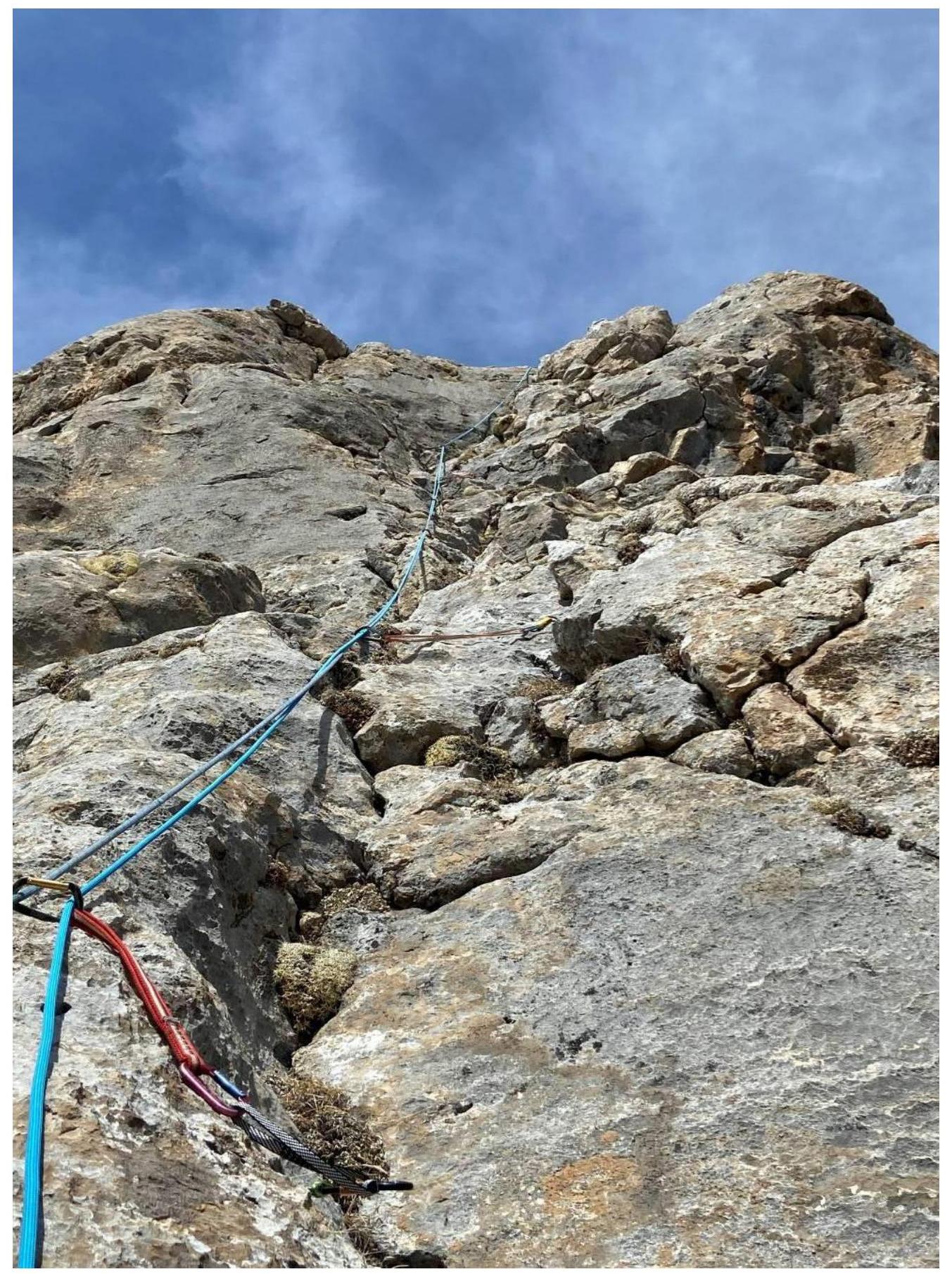
Section R4–R5
Section R5–R6
R5–R6, view from above (caution on exiting the station, many loose rocks)
Section R6–R7
Section R6–R7 (small grotto in the middle of the section)
Section R7–R8
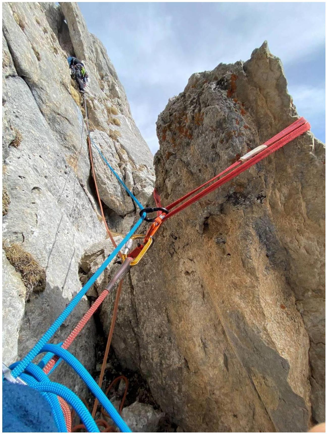
Section R8–R9
Section R9–R10
Start of movement on section R10–R11
Section R10–R11
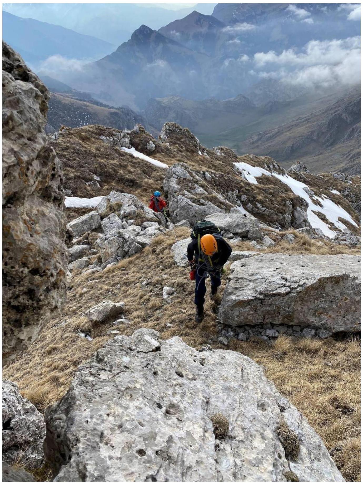
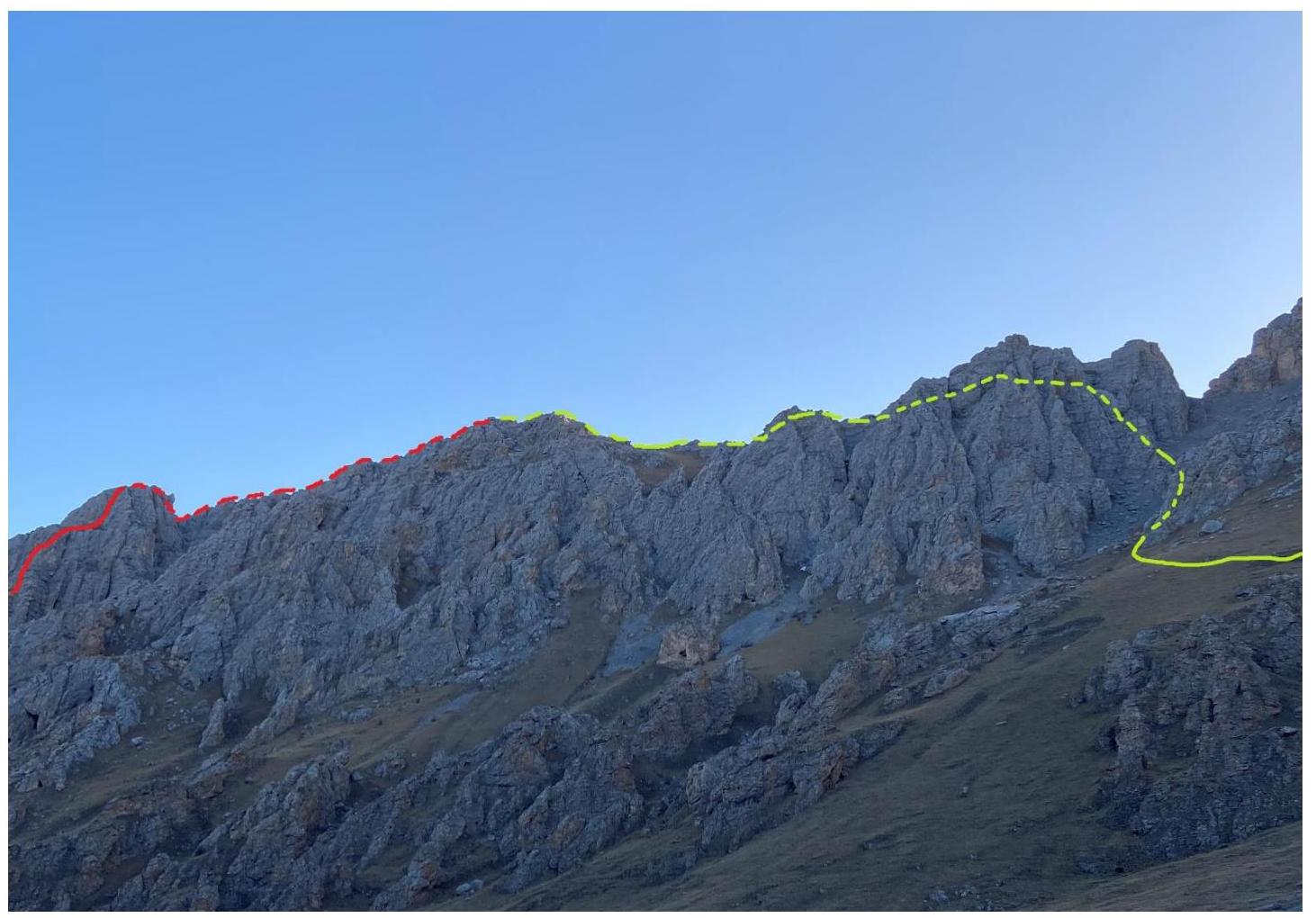
Exit to the top of the ridge (Tower)
Descent from the "Tower" towards the pre-summit ridge
Movement through easy rocks towards the summit

Summit
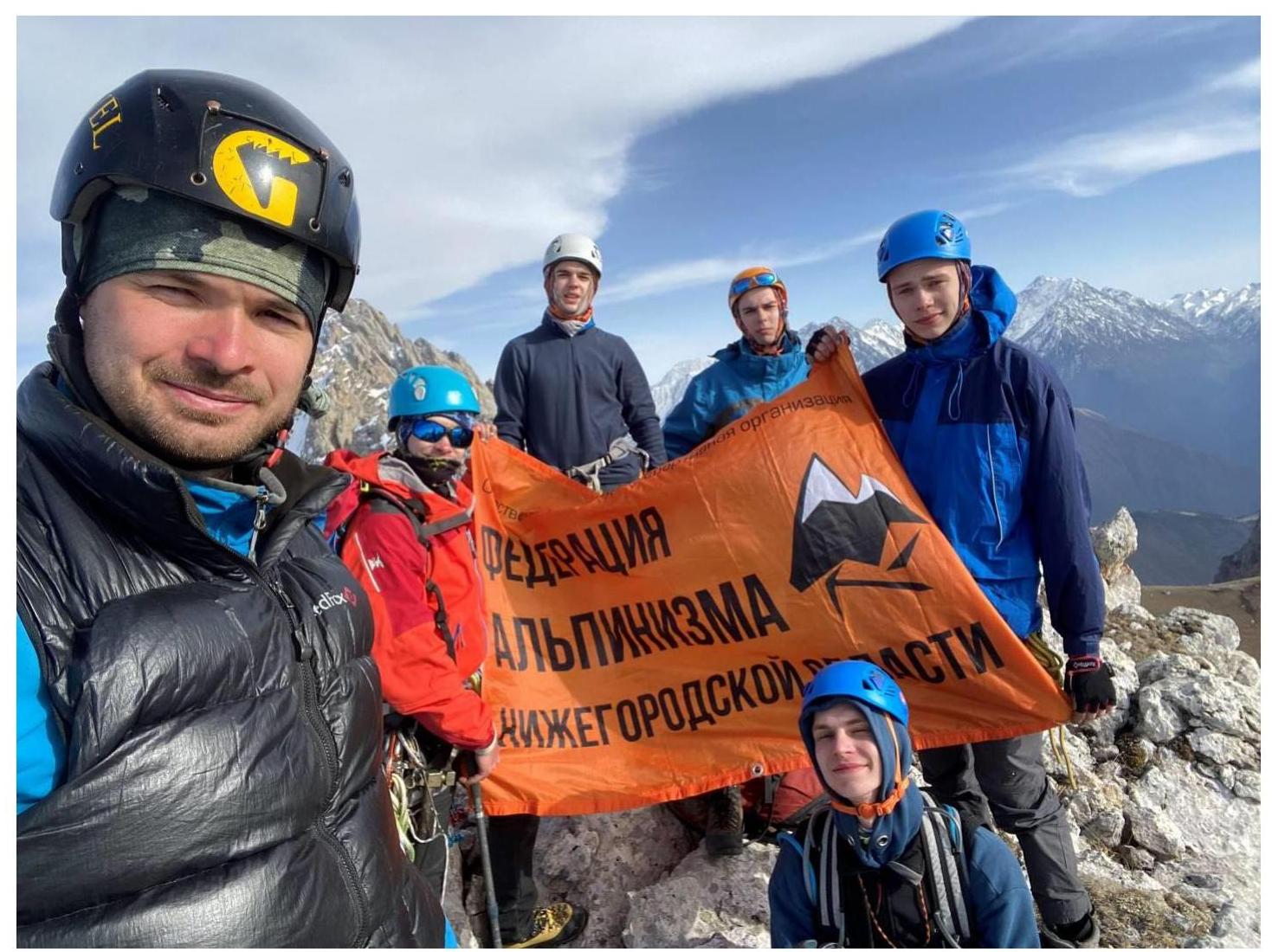
Summit
Descent from the summit towards the rappel
Descent diagram

Descent to bivouacs