
Report
On the first ascent to the summit of Tsey-Loam via the South Couloir through the saddle and West Ridge, category 4B, by the team of the Climbing Camps Administration, for the period from December 31, 2021 to December 31, 2021.
I. Ascent Passport
| 1. General Information | ||
|---|---|---|
| 1.1 | Full name, sports rank of the team leader | Ivan Vasilievich Kergin, 1st sports rank |
| 1.2 | Full name, sports rank of participants | Alena Mikhailovna Panova, CMS |
| 1.3 | Full name of coach | Alexander Nikolayevich Yakovenko |
| 1.4 | Organization | Climbing Camps Administration |
| 2. Characteristics of the Ascent Object | ||
| 2.1 | Region | Caucasus, from the Pereval Krestovy to v. Shaviklde |
| 2.2 | Valley | Armkhi |
| 2.3 | Number according to the 2013 Classification Table | 2.9 |
| 2.4 | Name and height of the summit | Tsey-Loam (Kyazi), 3171 m |
| 2.5 | Geographic coordinates of the summit (latitude/longitude), GPS coordinates | |
| 3. Route Characteristics | ||
| 3.1 | Route Name | South Couloir through the saddle and West Ridge |
| 3.2 | Proposed difficulty category | 4B |
| 3.3 | Route exploration degree | First ascent |
| 3.4 | Route terrain characteristics | Rocky |
| 3.5 | Route elevation gain (data from altimeter or GPS) | Total route — 551 m. Main part of the route — 310 m. |
| 3.6 | Route length (in meters) | 1409 m |
| 3.7 | Technical elements of the route (total length of sections with different difficulty categories, indicating terrain type (ice/snow, rocky)) | 1A rocky — 1070 m. 2A rocky — 75 m. 3A rocky — 50 m. 4A rocky — 54 m. 5A rocky — 120 m. 6A rocky — 40 m. |
| 3.8 | Average route slope, (°) | - |
| 3.9 | Average slope of the main part of the route, (°) | - |
| 3.10 | Descent from the summit | Category 2A |
| 3.11 | Additional route characteristics | Possible ice (in the couloir), rockfall |
| 4. Team Actions Characteristics | ||
| 4.1 | Time in motion (team's walking hours, in hours and days) | 13 h |
| 4.2 | Overnights | No |
| :--: | :--: | :--: |
| 4.3 | Route processing time | No |
| 4.4 | Start of the route | 7:00, December 31, 2021 |
| 4.5 | Summit arrival | 20:00, December 31, 2021 |
| 4.6 | Return to the base camp | 23:10, December 31, 2021 |
| 5. Weather Conditions Characteristics | ||
| 5.1 | Temperature, °C | 0–5 °C |
| 5.2 | Wind speed, m/s | 0 m/s |
| 5.3 | Precipitation | No |
| 5.4 | Visibility, m | Clear |
| 6. Person responsible for the report | ||
| 6.1 | Full name, e-mail | Ivan Vasilievich Kergin, ivan.kergin@mail.ru |
II. Ascent Description
1. Characteristics of the Ascent Object
1.1. General photo of the summit
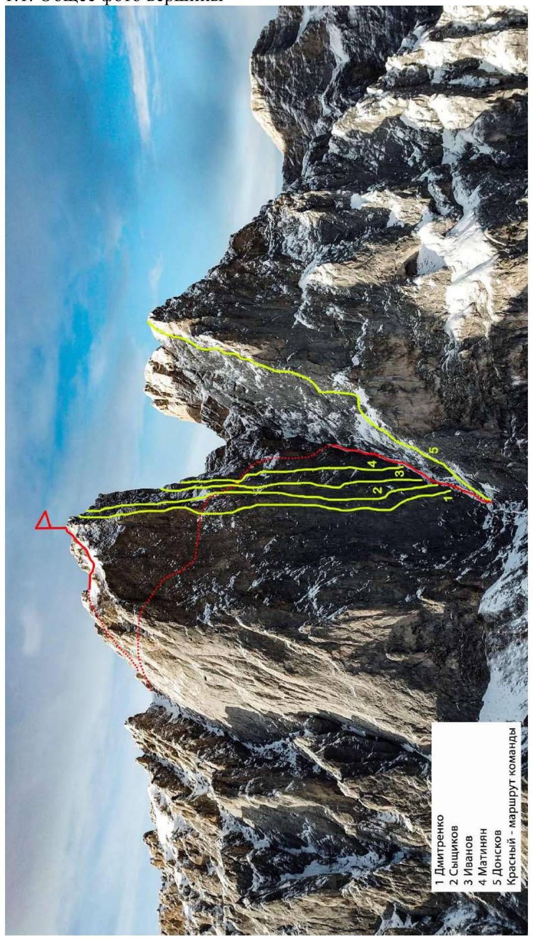
Fig. 1. Taken with a drone. Photo by Evgeny Glazunov
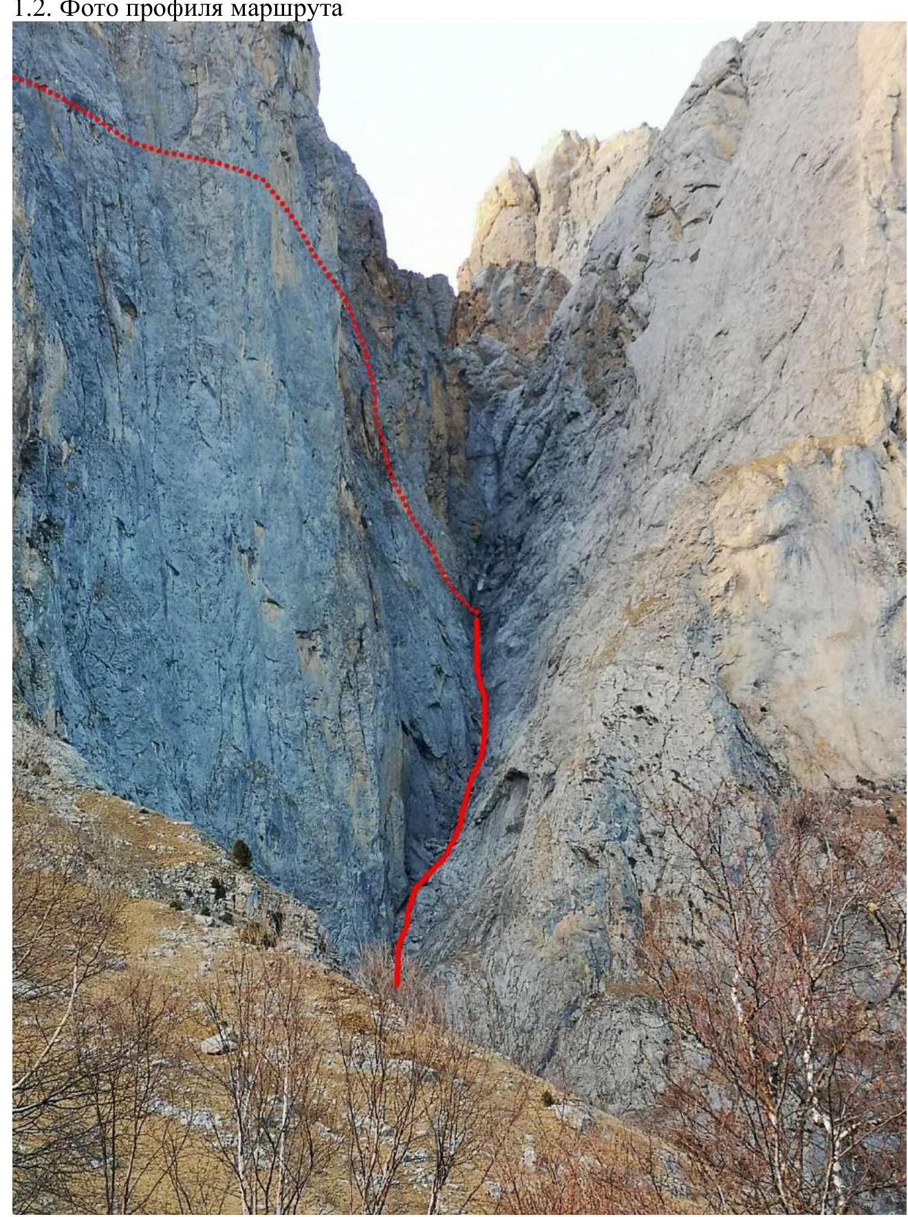
Fig. 2. Taken during the approach
2. Route Characteristics
2.1. Technical photograph of the route; Section numbers; UIAA symbol route diagram
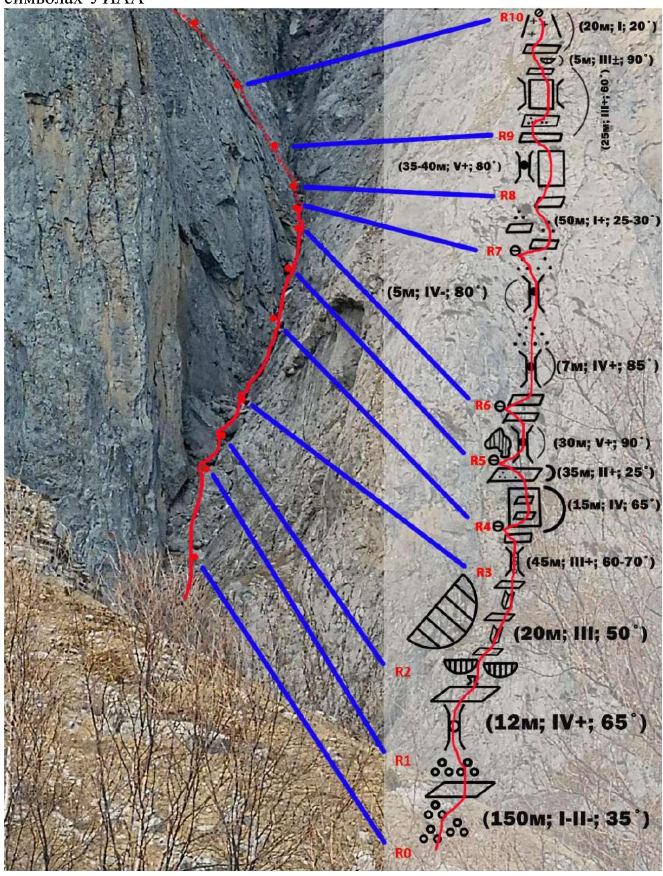
Fig. 3a. Technical photograph of the route
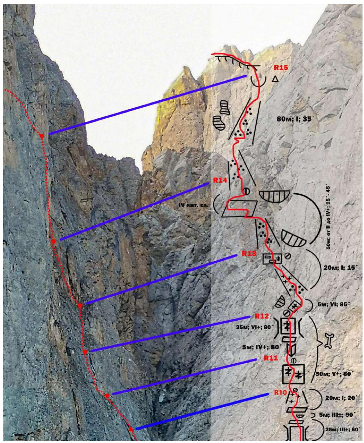
Fig. 3b. Technical photograph of the route
| Section # | Friends | Stoppers | Anchors | Difficulty in UIAA symbols | Section length, m | Slope, ° |
|---|---|---|---|---|---|---|
| R0–R1 | 0 | 0 | 0 | I | 150 m | 35° |
| R1–R2 | 0 | 0 | 0 | IV+ | 12 m | 65° |
| R2–R3 | 0 | 0 | 0 | III | 20 m | 50° |
| R3–R4 | 0 | 1 | 5 | III+ | 45 m | 65–70° |
| R4–R5 | 0 | 0 | 3 | IV, II+ | 15 м, 35 м | 65° — wall, 25° — shelf |
| R5–R6 | 1 | 0 | 1 | V+ | 30 m | 90° |
| R6–R7 | 0 | 0 | 1 2 | IV+, IV- | 7 м, 5 м | 85° — 1 chimney, 80° — 2 chimney |
| R7–R8 | 0 | 0 | 0 | I+ | 50 m | 25–30° |
| R8–R9 | 0 | 0 | 7 | V+ | 40 m | 80° |
| R9–R10 | 0 | 0 | 10 | III+, III+, I | 25 м 5 м 20 м | 60° — shelf and wall in the chimney, 90° — easy overhang, 20° — shelf and couloir |
| R10–R11 | 2 | 2 | 9 | V+ | 50 m | 80° — 1 wall |
| R11–R12 | 1 | 2 | 6 | IV, VI+, VI | 5 м 35 м 5 м | 80° — unclear inner corner, 80° — wall in a large chimney, 85° — small wall |
| R12–R13 | 0 | 0 | 0 | I | 20 m | 15° |
| R13–R14 | 0 | 0 | 4 | От II, IV+ | 40 м 10 м | 15° 45° |
| R14–R15 | 0 | 0 | 0 | I | 80 m | 35° |
| R15–R16 | 0 | 0 | 0 | I | 750 m | 25° |
3. Team Actions Characteristics
3.1 Brief description of the route passage
| Section # | Description | Photo # |
|---|---|---|
| R0–R1 | From the first large stone, move along a logical route, climbing left to a scree shelf, move straight along the coarse scree (talus), overcoming several simple climbing sections and reach a large ledge under the cornice. Simultaneous movement. | Fig. 4 |
| R1–R2 | Pass the ledge on the right through a chimney with a stopper and reach a convenient shelf. No protection points. Simultaneous movement. | Fig. 5 |
| R2–R3 | From the shelf, move left and climb into a cave, pass through it and exit to a convenient shelf, and then follow an inner corner. (Or go straight between two overhanging blocks). Through a series of shelves and inner corners, reach a large convenient shelf. Alternating movement. | Fig. 6 |
| R3–R4 | From the shelf, go straight up a chimney with stoppers and reach a large shelf. Convenient station. Small rocks fall from the Tsey-Loam wall. Possible to hide under an overhanging cornice. Alternating movement. | Fig. 7 |
| R4–R5 | Then from the station, go right along a series of small shelves, and then exit to a long shelf with live rocks. Convenient station. | Fig. 8 |
| R5–R6 | Then bypass a large stone on the right. Enter a chimney with stoppers and pass through the right part of the chimney. Alternating movement. Convenient station on a stone. | Fig. 9 |
| R6–R7 | From the station, simultaneously approach the next chimney with stoppers, overcome it, then follow a middle scree, and approach another chimney. Then exit to a middle scree and set up a convenient station. | Fig. 10 |
| R7–R8 | Move forward along a series of shelves and coarse scree to a large wedged stone. | Fig. 11 |
| R8–R9 | From the stone, go right. Overcome a rocky wall with live rocks. Difficult climbing. Poor placement of protection points – unreliable terrain. Better to have large Friends and pass under the stone. | Fig. 12, 13a, 13b |
| R9–R10 | Pass a difficult chimney, a shelf, a simple overhang, an oblique shelf. Set up a station. | Fig. 14 |
| R10–R11 | From the station, approach the left wall and climb up a crack along an unclear inner corner towards a chimney. | Fig. 15 |
| R11–R12 | From the station, climb up a large chimney along a wall in an unclear inner corner. Uncomfortable station. Under the cornice. | Fig. 16 |
| R12–R13 | From the station, traverse easily upwards 5 m of difficult climbing. Exit to a scree couloir. Uncomfortable station under another scree couloir (rockfall hazard). | Fig. 17a, 17b, 18 |
| R13–R14 | Extremely dangerous location. Scree couloir. Then – uncomfortable traverse left along an inclined wall (start of the traverse under the cornice). Difficult section. 5 m – and exit to the couloir. Station on a large stone. Uncomfortable. 50 m. Better – 60 m rope. We assume there is another variant to pass this section. Quite possibly. Due to objective reasons, we had to go this way, as we were able to scout it. | Fig. 19 |
| R14–R15 | From the station, climb up couloirs to a saddle with a cairn. | Fig. 20 |
| R15–R16 | From the saddle, continue along a small ridge, traverse right to a long couloir and reach a large pass, from which traverse long (part of Kurochkin's route 3B) to the trail of route 2A. Then follow the trail of route 2A to the summit. Descent via 2A. |
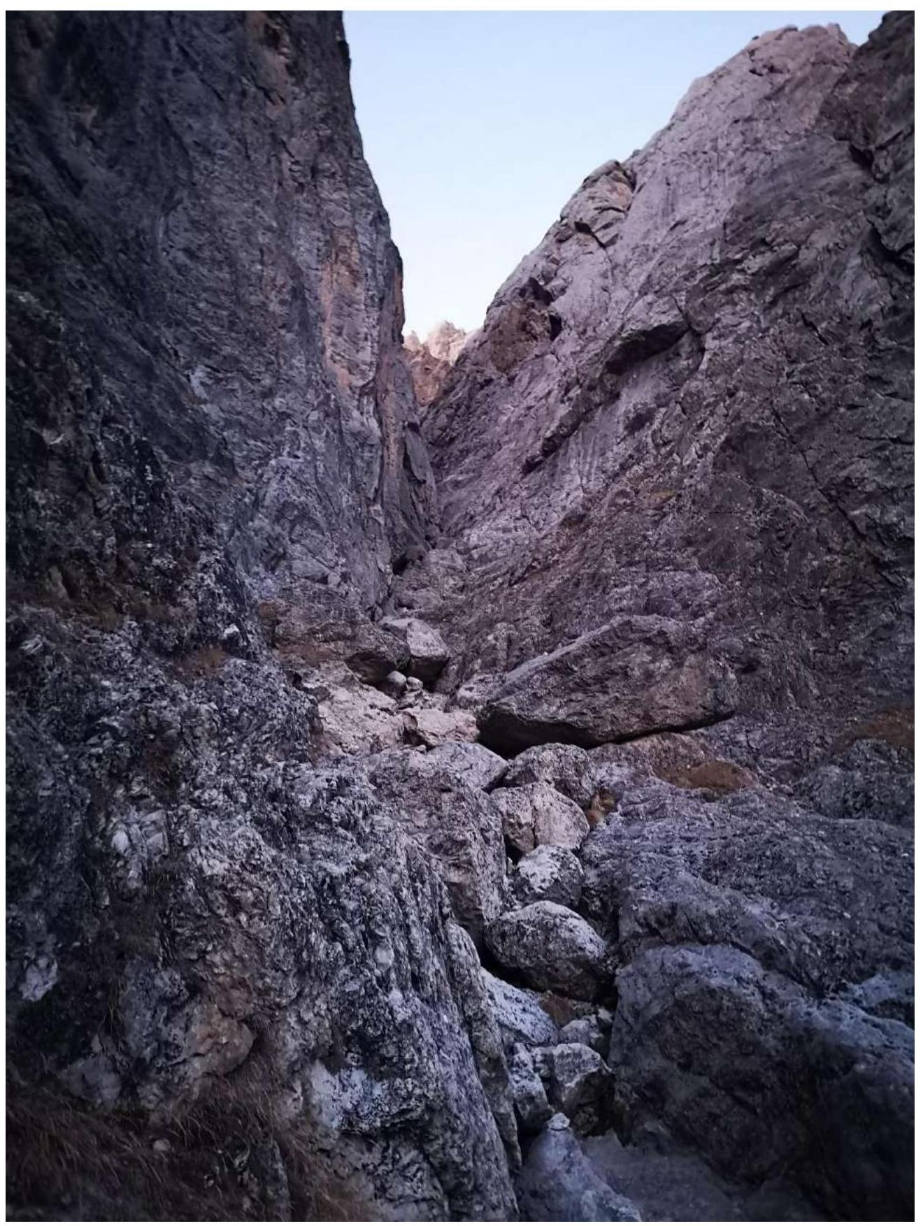
Fig. 4. Section R0–R1
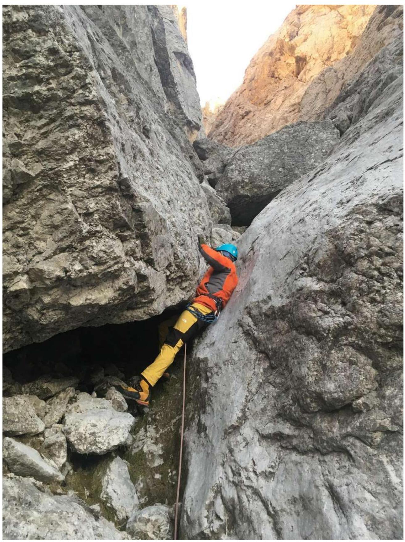
Fig. 5. Section R1–R2. Climb like a "snake"
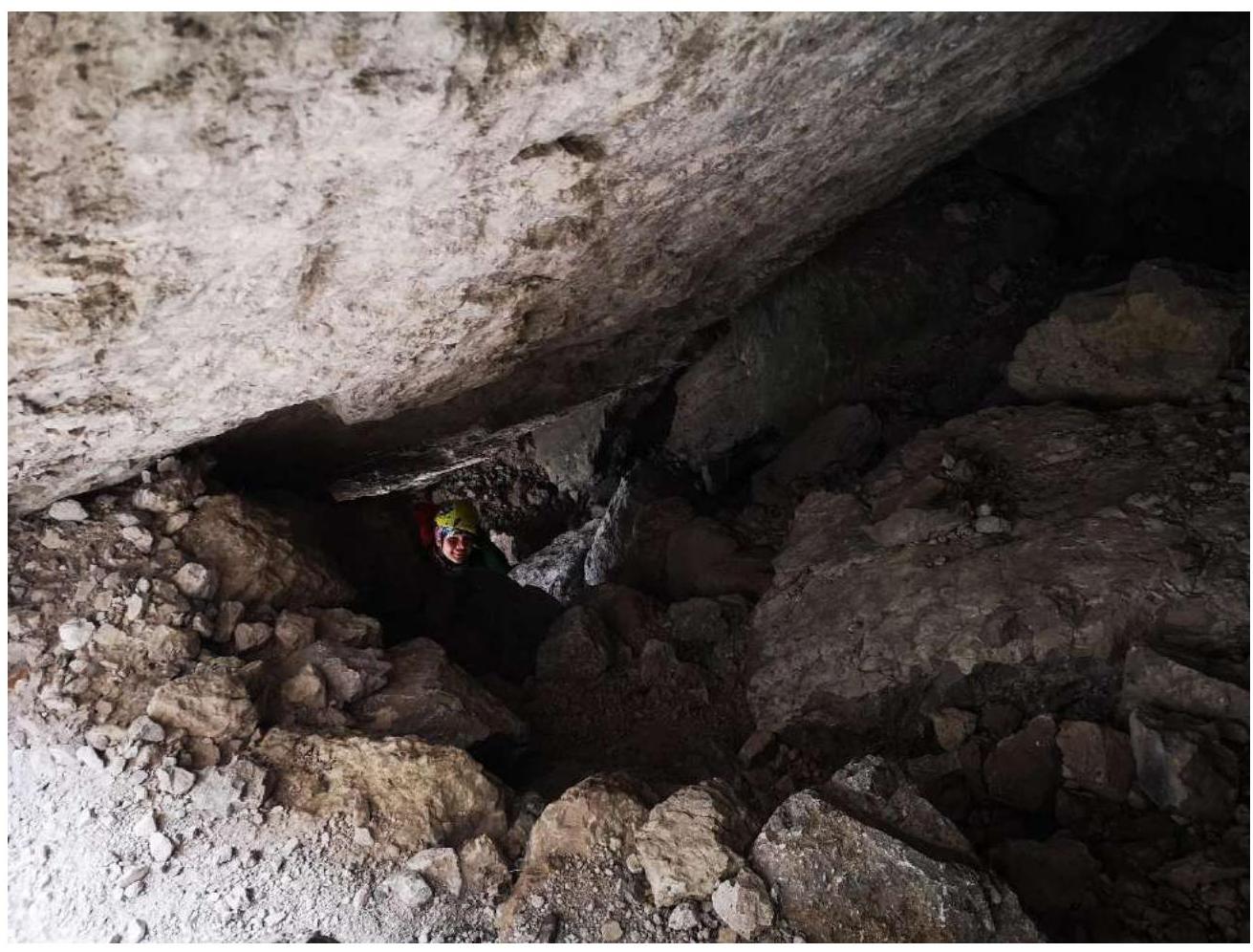
Fig. 6. Section R2–R3. Between two overhanging stones or under the left overhanging stone into a cave
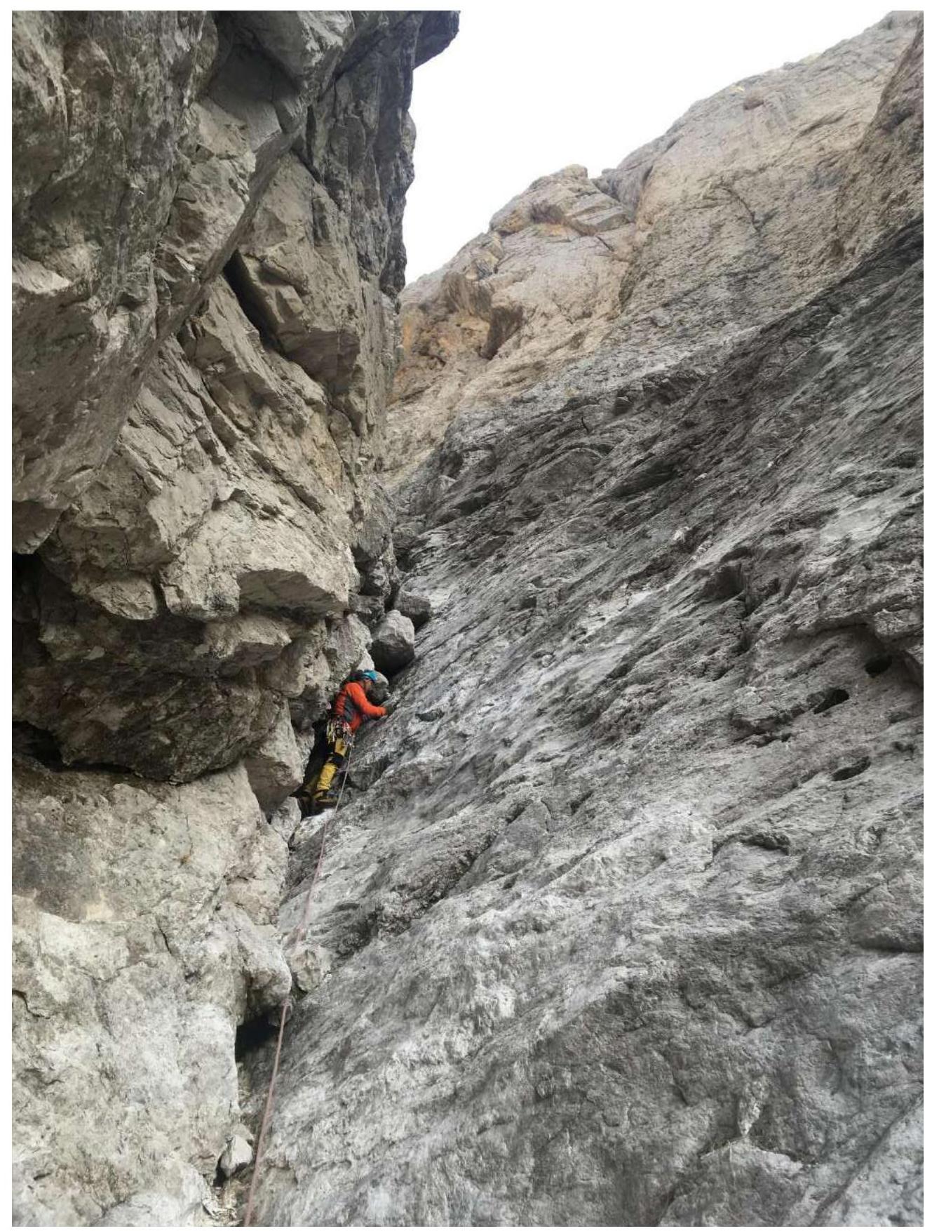
Fig. 7. Section R3–R4. Chimney with three stoppers.
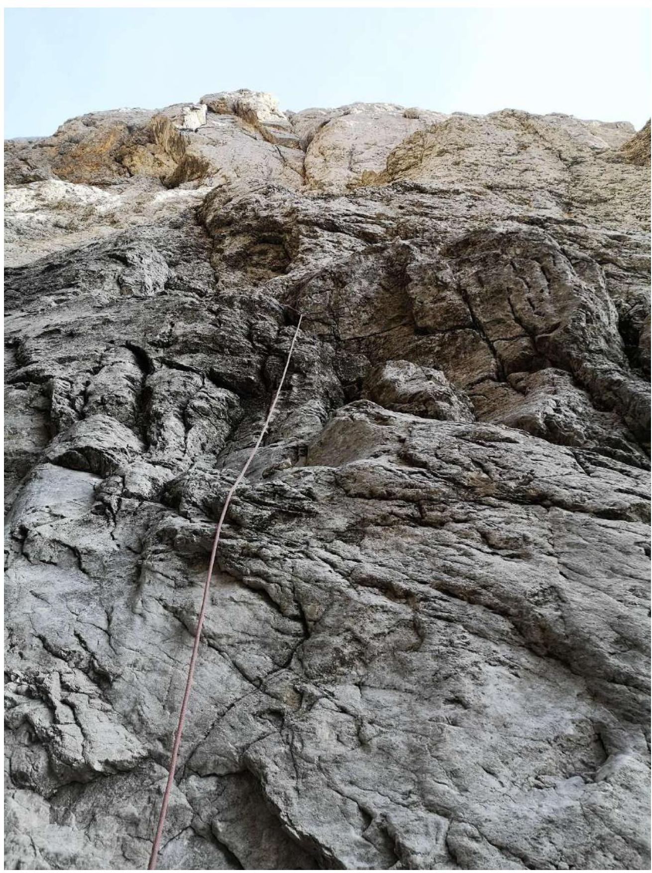
Fig. 8. Section R4–R5. From the station to the right along the wall.
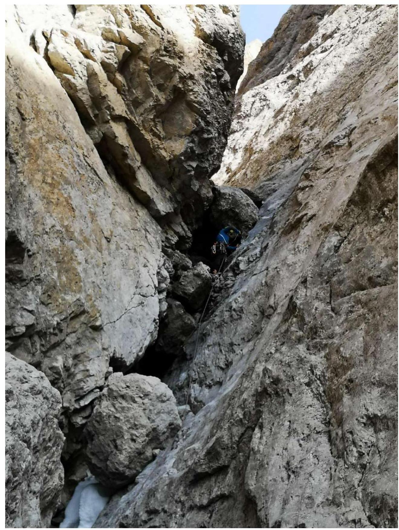
Fig. 9. Section R5–R6
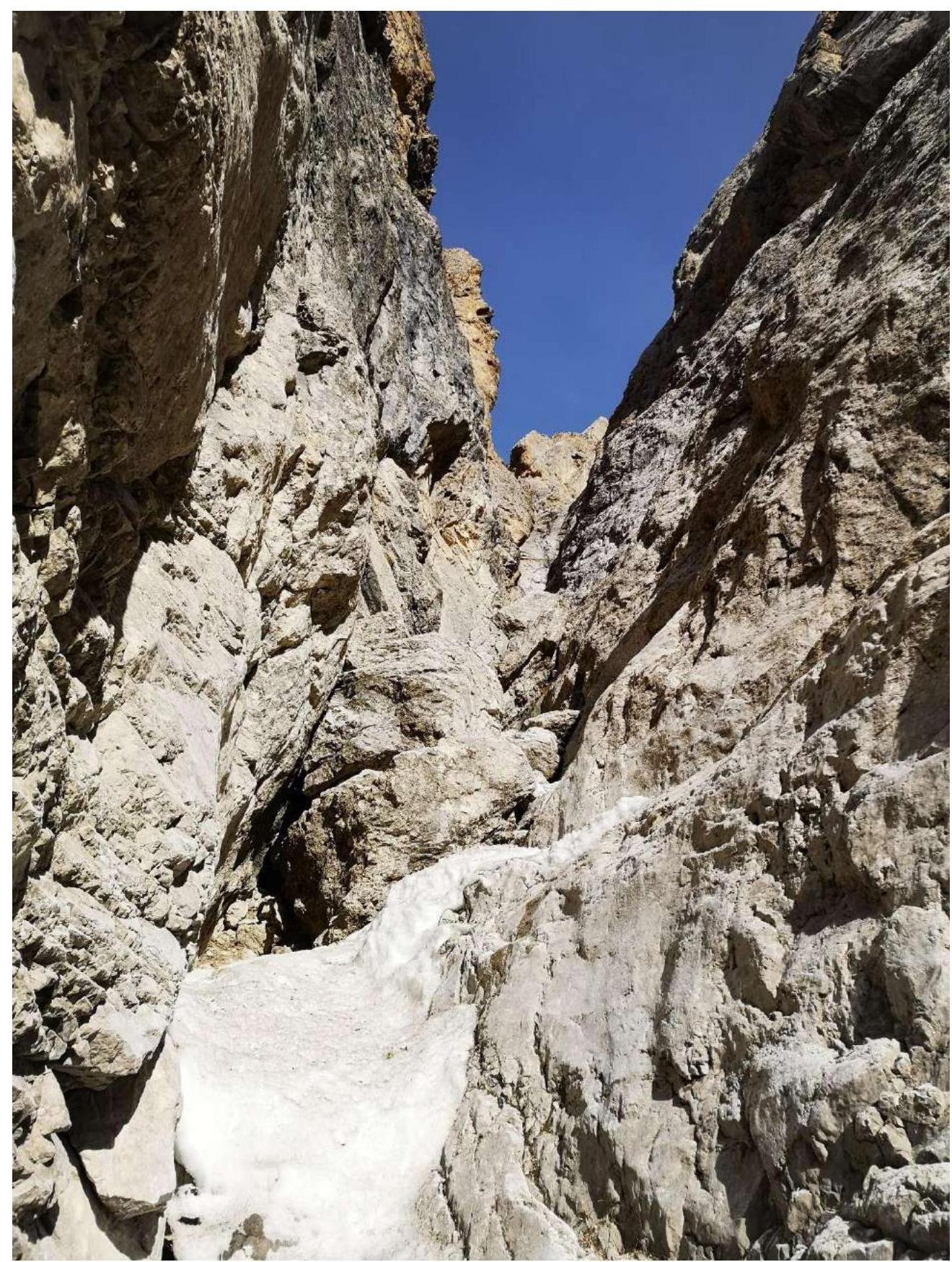
Fig. 10. Section R6–R7
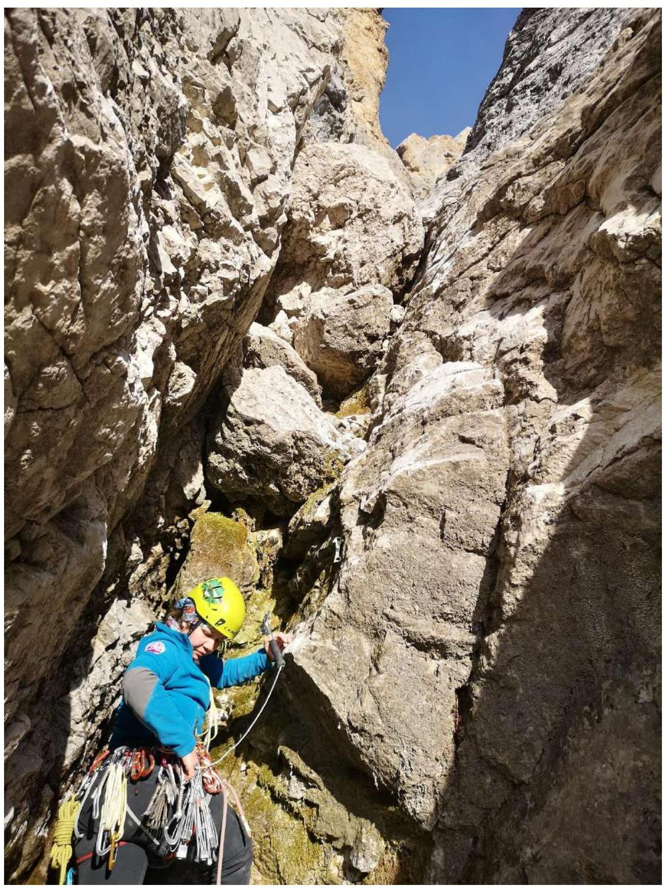
Fig. 11. Section R7–R8
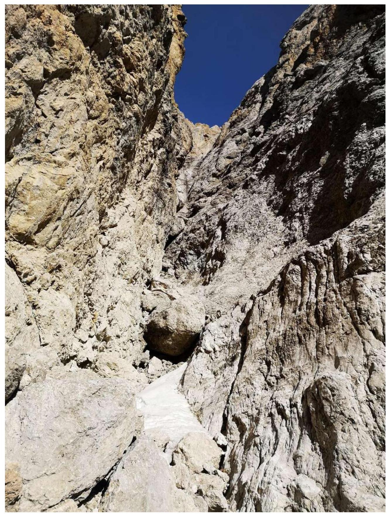
Fig. 12. Section R8–R9
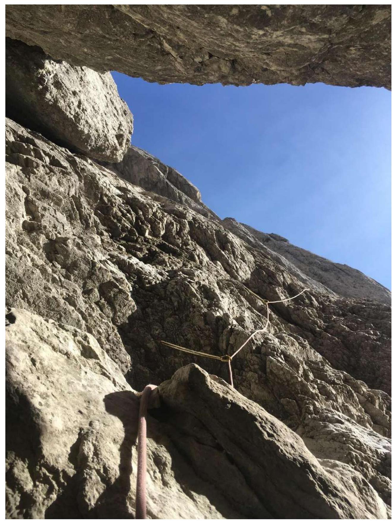
Fig. 13a. Section R8–R9. Bypassing the overhanging stone on the right along very broken rocks
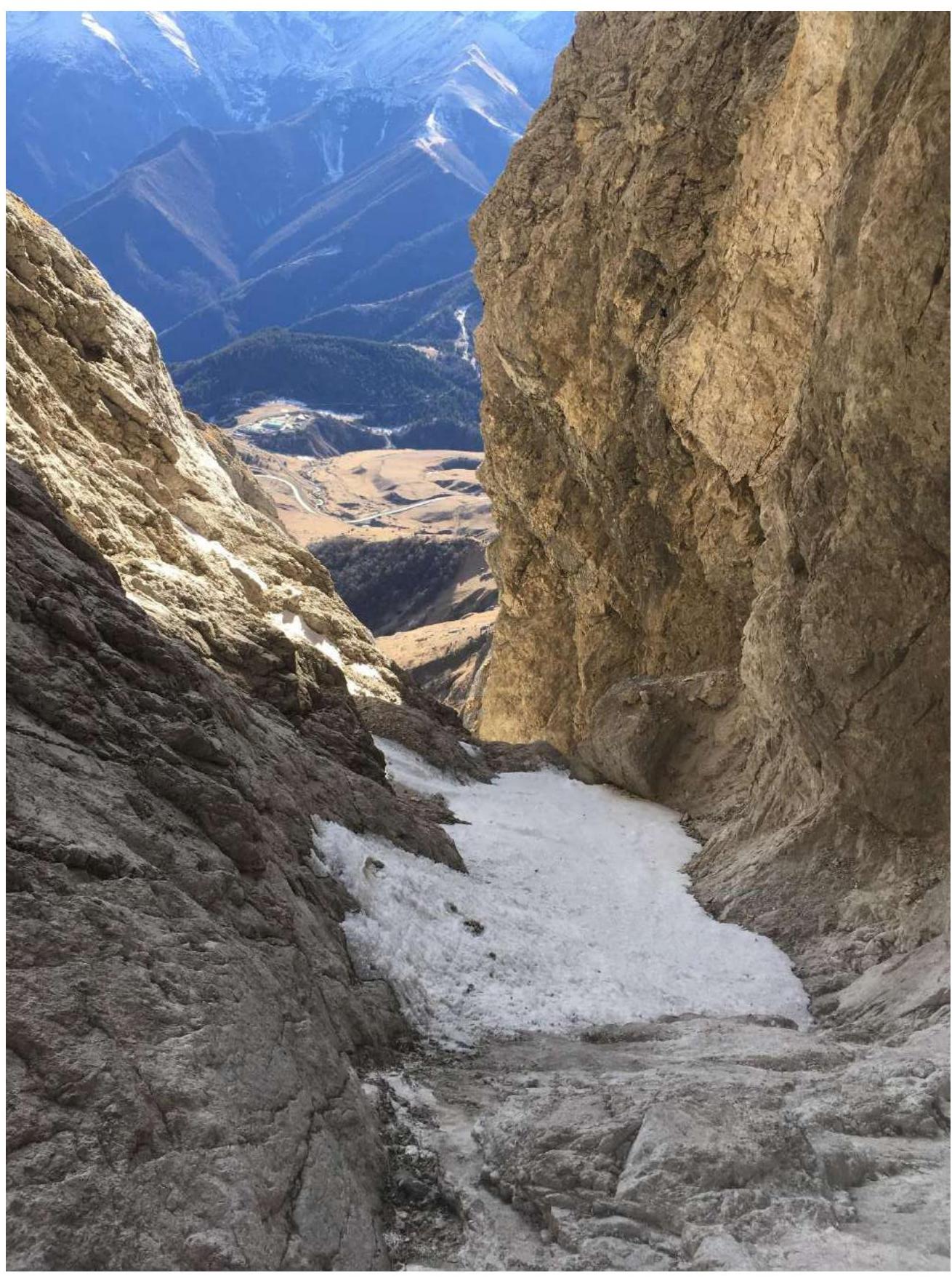
Fig. 13b. Section R8–R9. Exit from broken rocks to a shelf (left), station above the overhanging stone (right) on the wall
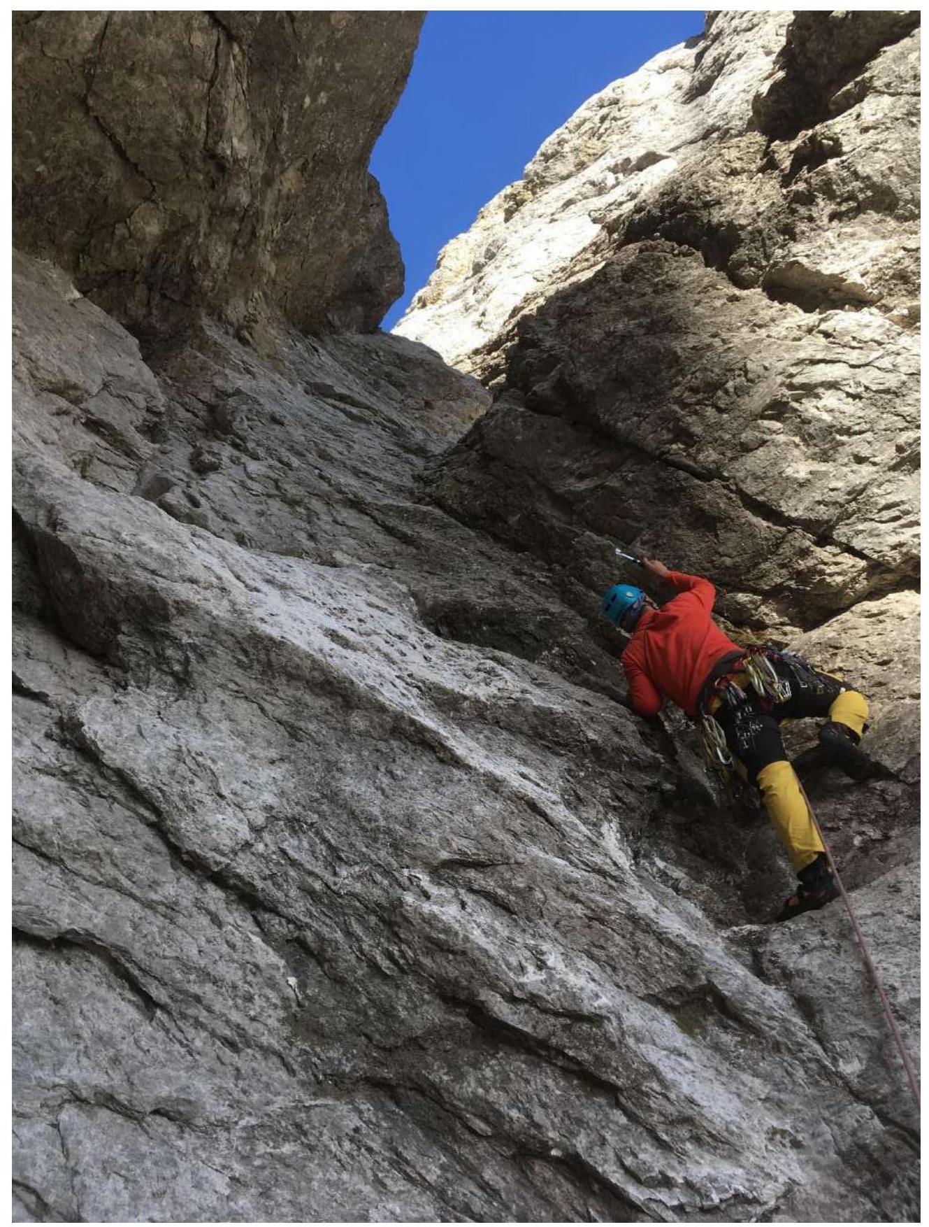
Fig. 14a. Section R9–R10
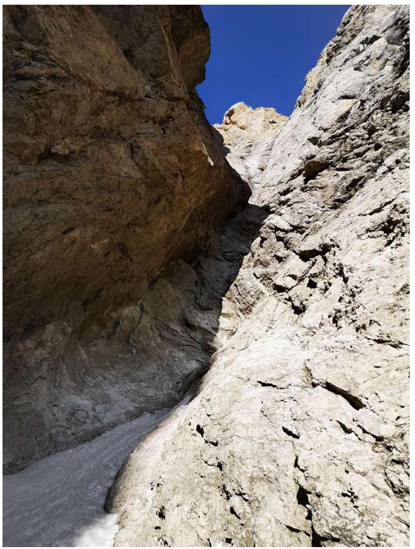
Fig. 14b. Section R9–R10
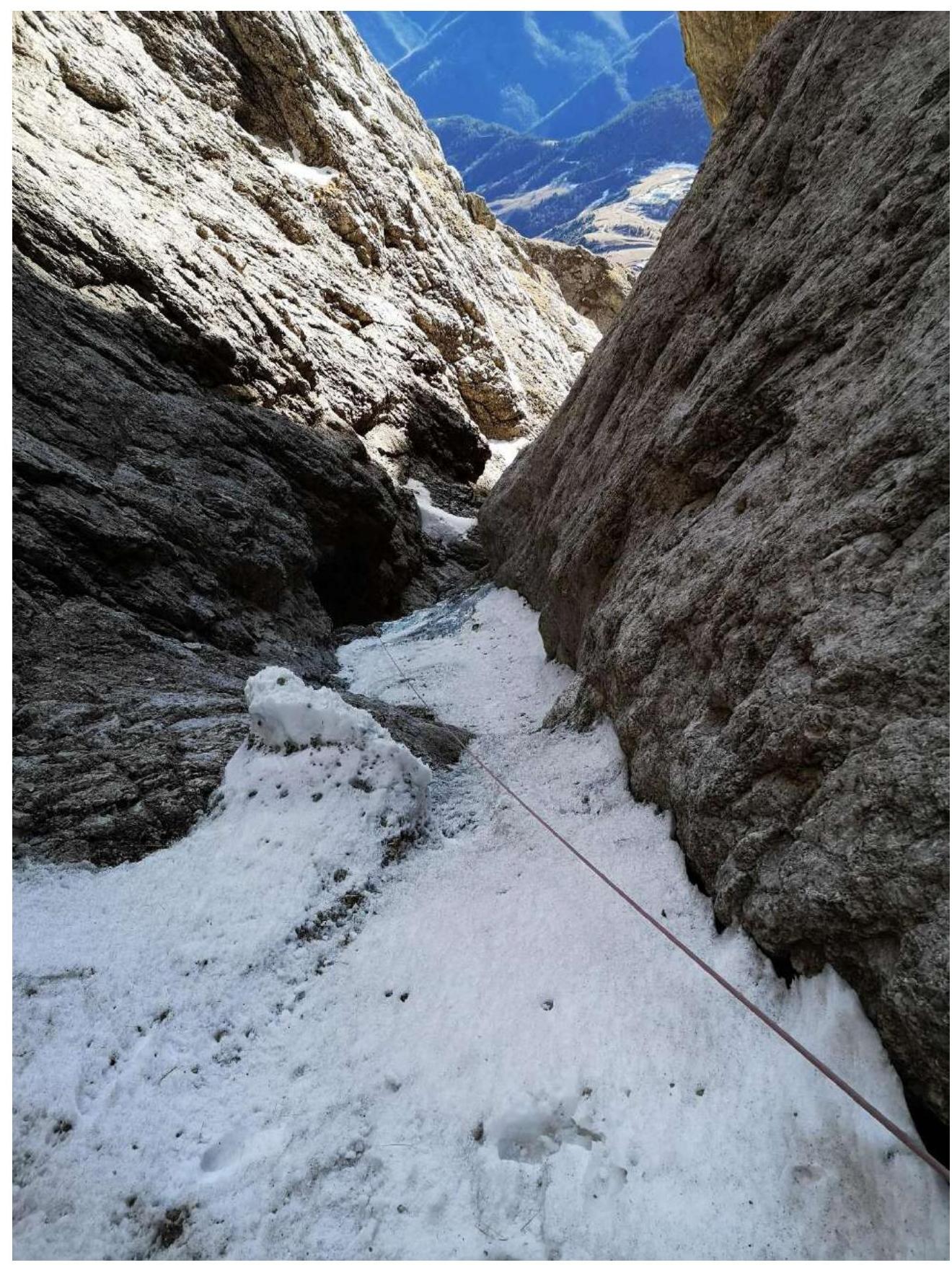
Fig. 14c. End of section R9–R10
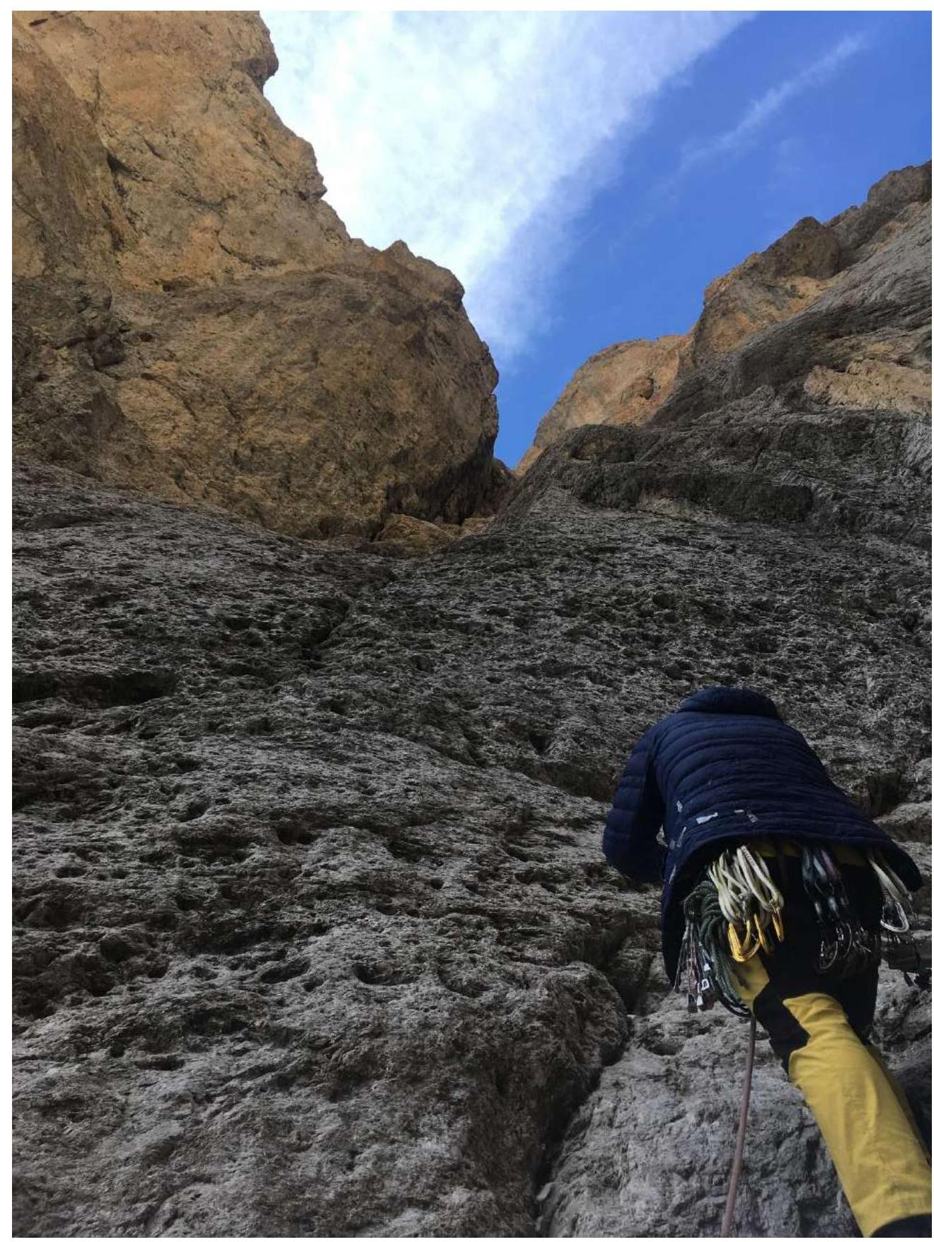
Fig. 15. Section R10–R11
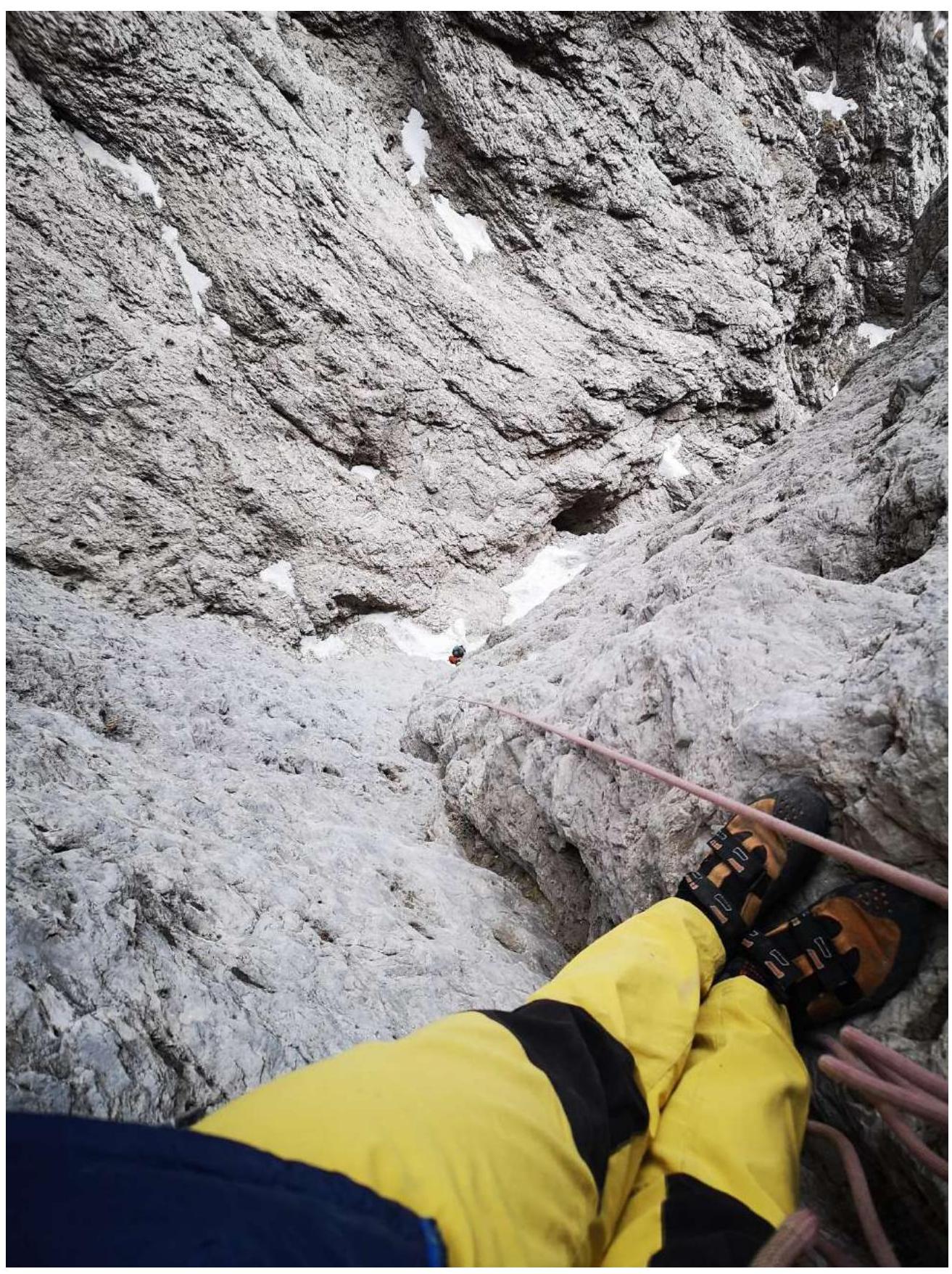
Fig. 15b. View from station R11 downwards
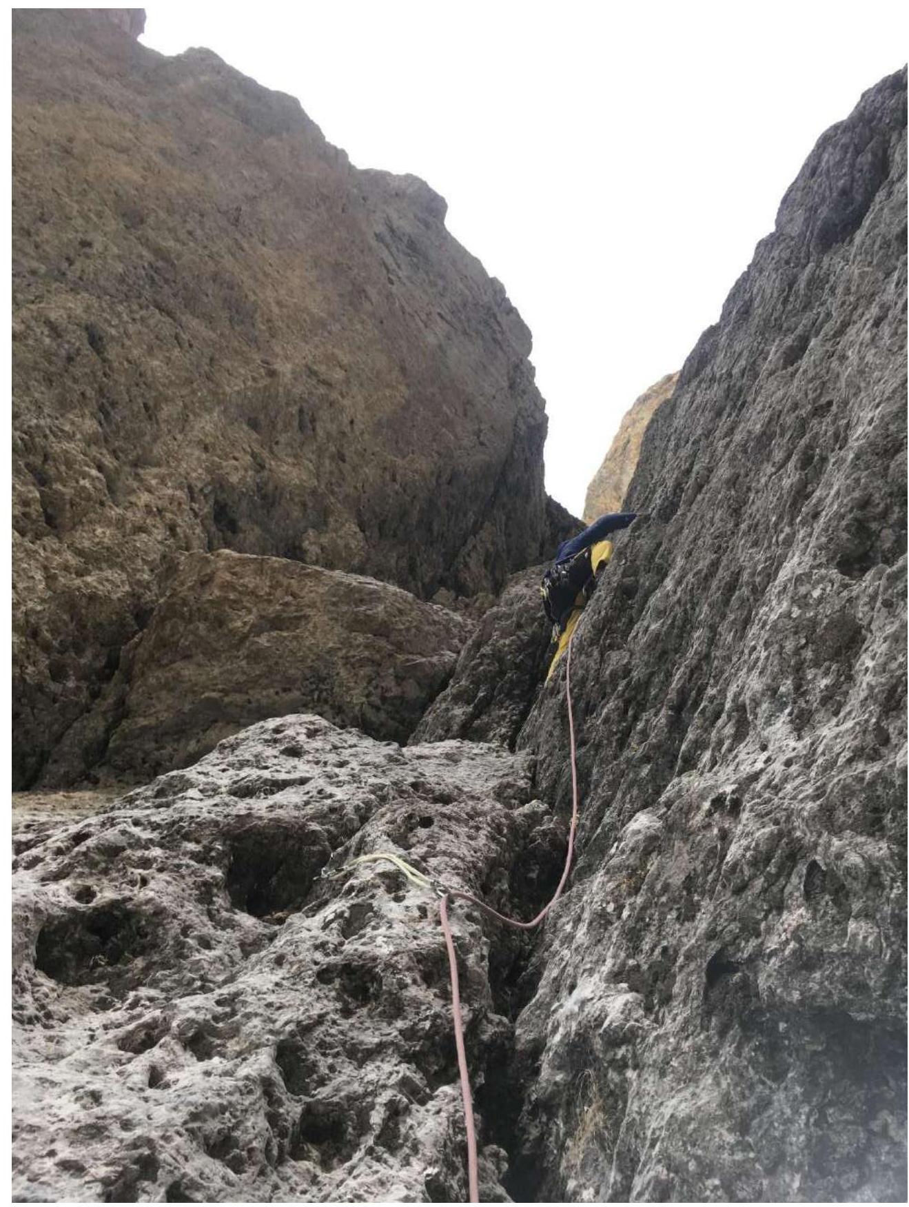
Fig. 16. Start of section R11–R12
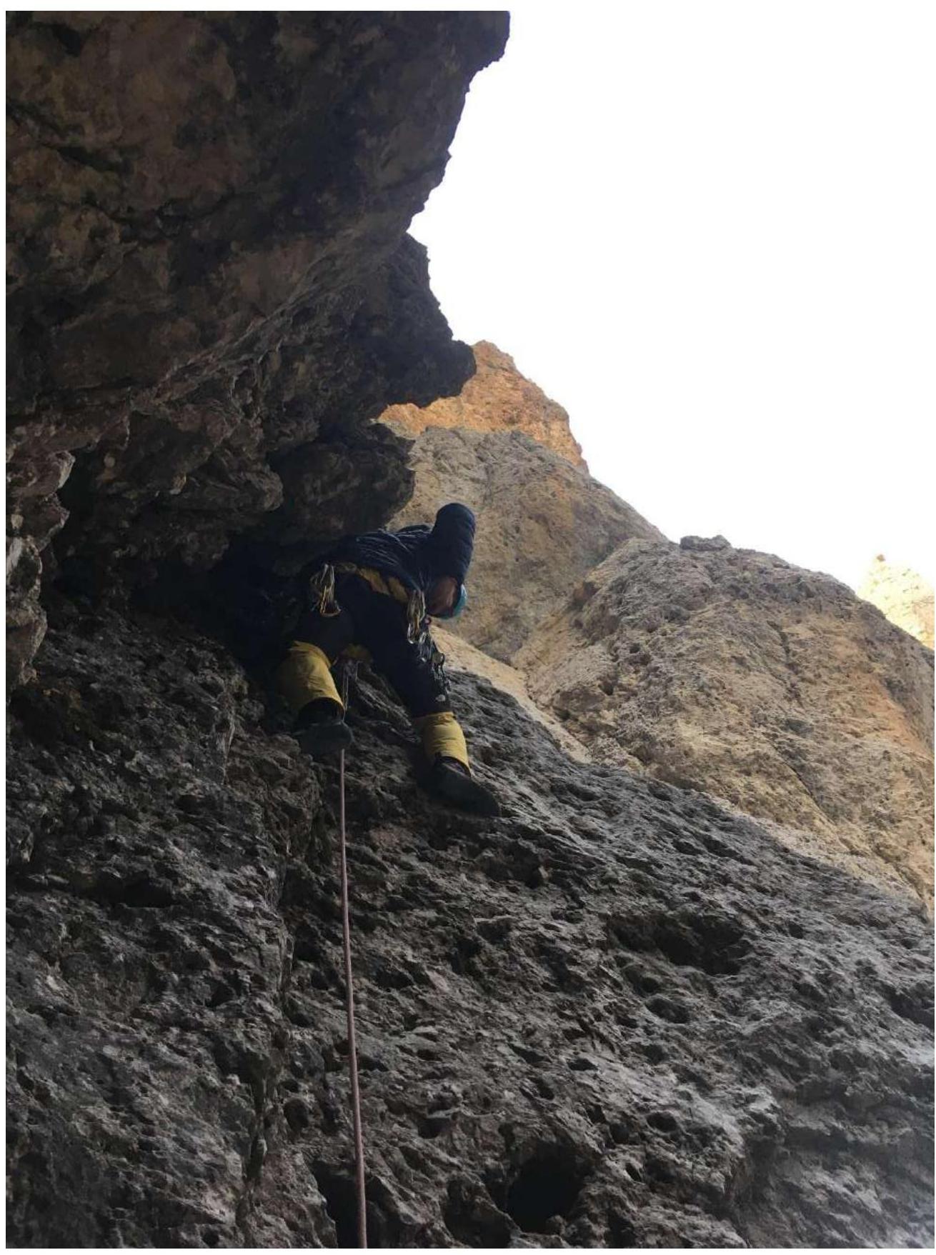
Fig. 17. Start of section R12–R13
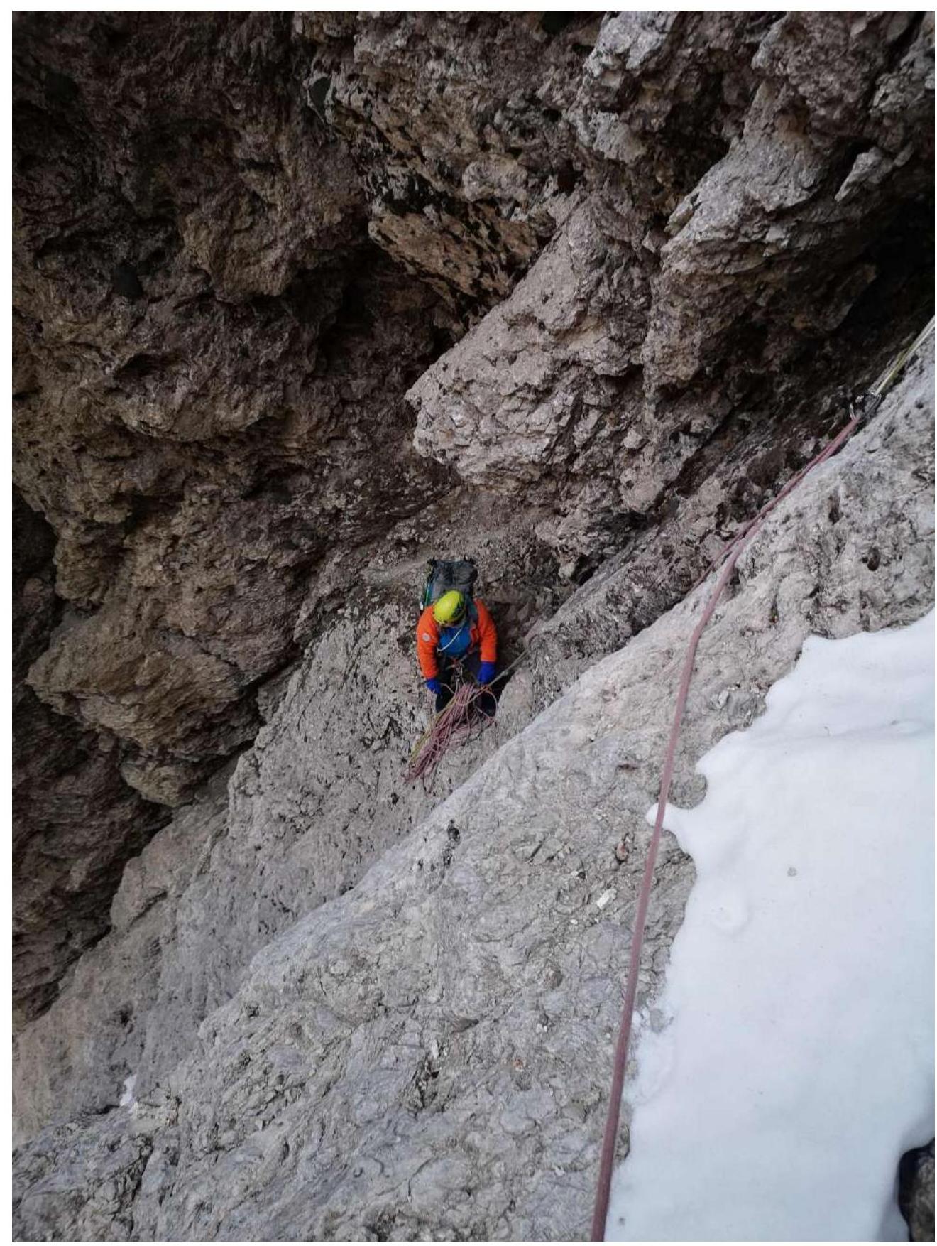
Fig. 17b. View of station R12
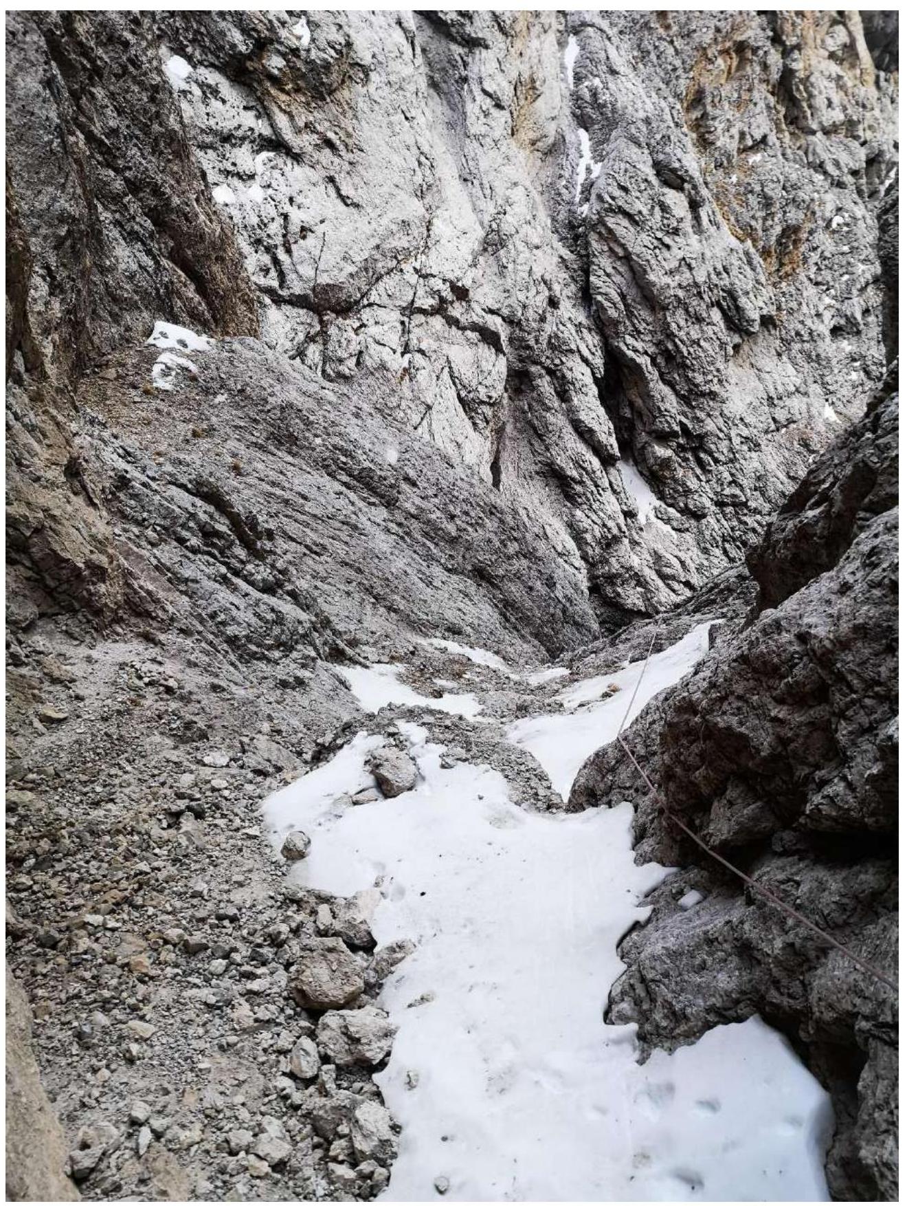
Fig. 18. End of section R12–R13
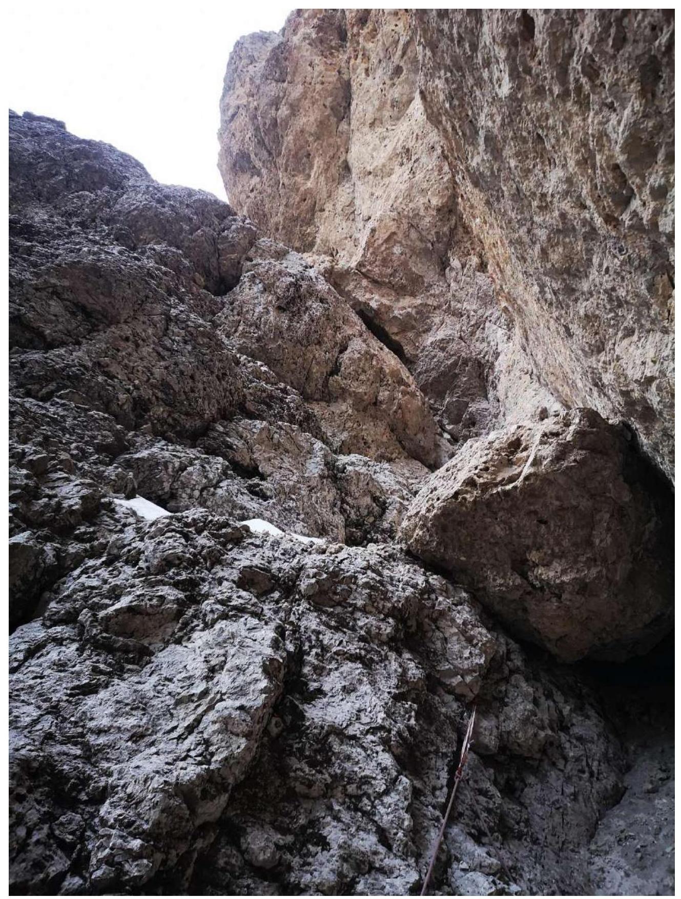
Fig. 19. View from station R13 to section R13–R14
Fig. 20. View from an uncomfortable station to section R13–R14
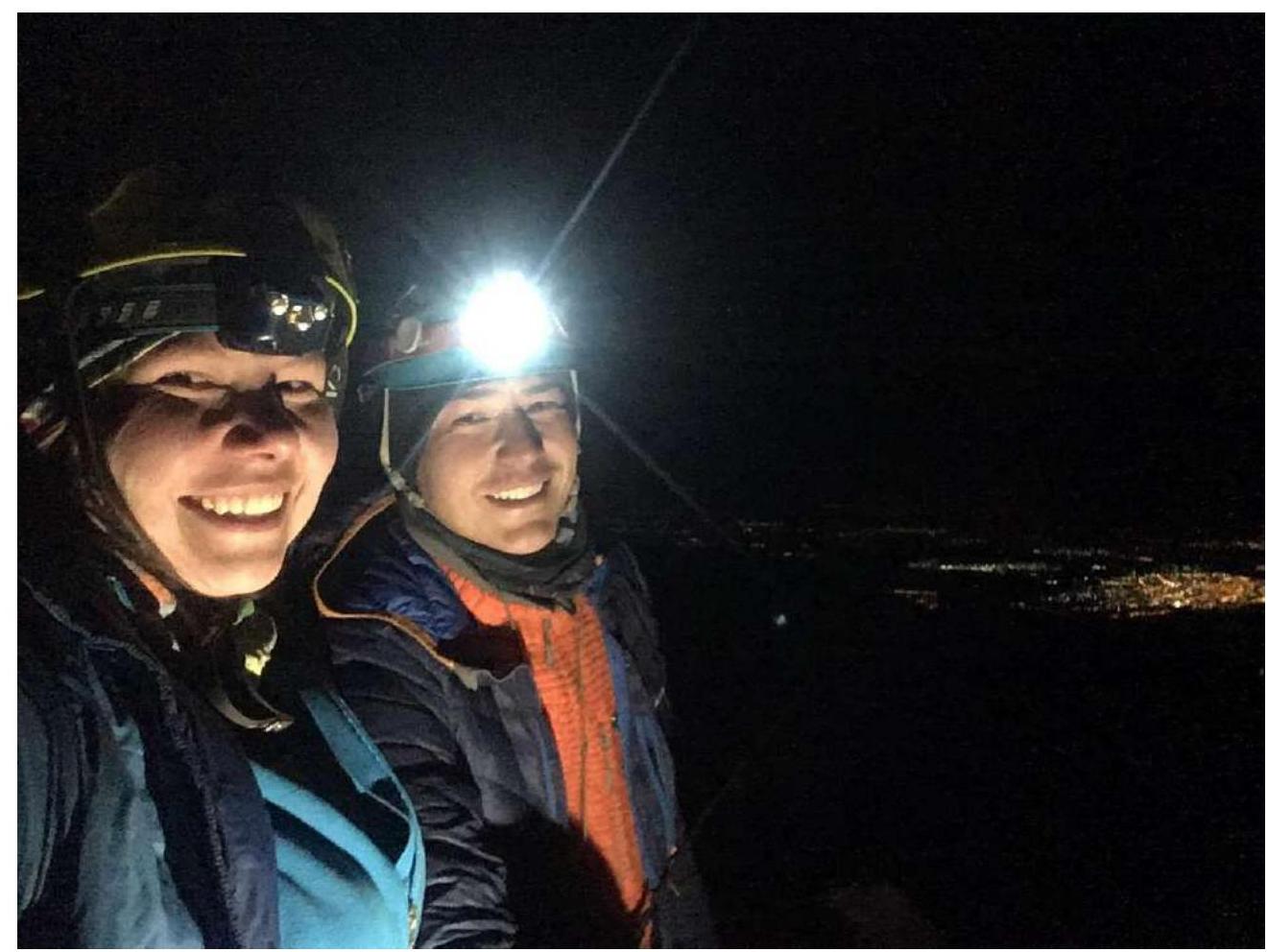
3.2 Photo of the team at the summit near the control cairn
3.3. Route safety:
The route is rockfall-prone throughout, with small rocks falling from the hanging walls of the couloir, but it's possible to hide under small overhangs up to station R10. Key sections pass through terrain with broken walls or shelves. The couloir ends with a vertical wall, from which a large amount of rocks fall onto station R10. It's difficult to set up protection points along the route, as the terrain is either live or "dead".
Communication on the route: there is communication throughout the route, except for the section from R15 to the start of the trail on route 2A. On the descent, communication is lost in narrow couloirs. There is cellular communication at the summit.
Recommendations for future climbers: the route is recommended only for teams of two. Take more anchors, medium and large stoppers, and #3 cams.
Conclusion: Based on the objective difficulty of the route and the experience of the participants, the team assesses the difficulty category of the route as 4B. No signs of previous ascents were found along the main part of the route. A cairn is built on the saddle for orientation. The team initially planned to move along the eastern ridge after exiting the couloir to the saddle, but due to the short daylight and lack of visibility after reaching the saddle, they continued in a bypass around the summit and ascended via the described route 2A category from the west.
Comments
Sign in to leave a comment