
Ascent Passport
- Region 2.9. From Krestovyi Pass to Shaviklde peak.
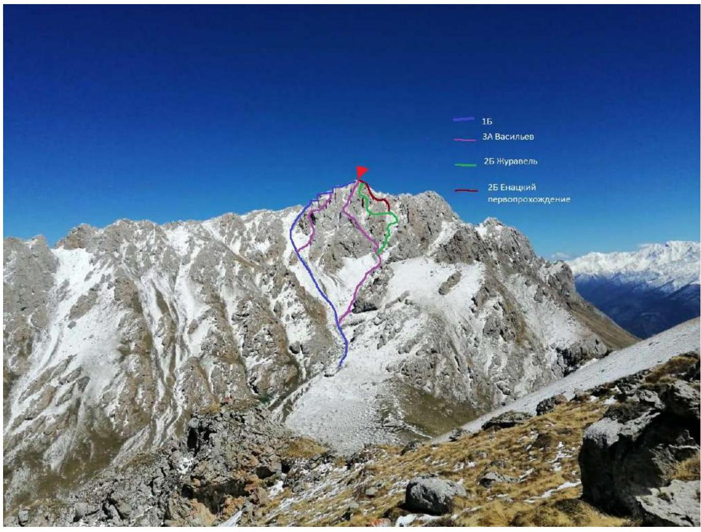
- Jarlam Central via the right edge of the southern wall's counterfort.
- Proposed — Category 2B difficulty, first ascent
- Route type: rock
- Route elevation gain: 300 m. Section lengths: non-technical — 220 m, 1 — 100 m, 2 — 78 m, 3 — 10 m, 4 — 12 m. Wall section slope — 80°; entire route slope — 40°.
- Protection used: anchor pitons — 3 protection devices — 15 Protection left on the route: Total — 0
- Team climbing hours: 10 h 45 min, 1 day of which time on the route: 7 h, 1 day
- Leader: Yenatskiy Andrey Nikolayevich. Participants: Krasnov Evgeniy Vladimirovich 3rd sports category Kuleshova Yuliya Andreyevna 3rd sports category Posokhov Andrey Vladimirovich 3rd sports category Shilyaev Alexey 3rd sports category
- Coach: Yakovenko Alexander Nikolayevich, Master of Sports, 1st category instructor, cert. # 1195
- Establishing Base Camp, cargo delivery to the start of the route: May 7, 2021. Route started: 5:00 AM, May 8, 2021. Reached the summit: 12:58 PM, May 8, 2021. Returned to Base Camp: 3:45 PM, May 8, 2021. Descent from the summit: Descent via the northwest ridge (Category 1B route).
- Team from UAL ("Management of Alpine Camps") mountaineering club.
- Responsible for the report: Yenatskiy A. N. prepared by: Posokhov A. V., Kuleshova Yu. A.
Route Description
Approach to the route: Guli settlement, Dzheyrakhsky district, Republic of Ingushetia, turn off the road at 42.812174, 44.811439 then left, crossing two gullies, and up the couloir to Jarlam Pass, 1.5–2 hours. Then right up 400 m along a grassy slope towards Jarlam Central massif to a flat area suitable for camping. No water, only snow. This is where the assault camp is set up. From the assault camp, move towards the scree-filled couloir to the right of Jarlam Central massif towards the southern counterfort, 40–50 minutes. (Fig. 1). The starting point of the route (Fig. 2) R0 — a large rounded overhanging rock above a 4 m long inclined slab, slightly to the right of the rock, a ridge begins. To the left of the slab, there are pre-hung fixed ropes. Using the fixed ropes, ascend to the rounded rock, go around it along the ridge, then through the overhanging rock reach a ledge and establish the first belay station on the ledge R1 (Fig. 3). Then along a wide scree-filled couloir to the right for about 150 m, then it turns left and continues for another 70 m, ending at a circular yellow wall (Fig. 4). Landmarks: to the left, a chimney with a plug, to the right, a gentler couloir veering right, 20 m long (Fig. 5), bounded on the left by a wall and on the right by "ram's foreheads". At the top of this couloir is the start of the rock section of the route — R2, belay station on protection devices (Fig. 6). Then up and left along the wall on rock of above-average difficulty (Fig. 7) for about 12 m to the mouth of a narrow couloir, before entering the couloir, there is a slight overhang, then along the right side of this couloir for about 7 m to a widening in the couloir, establish a belay station R3 there (Fig. 8). From this platform, along the right side of the couloir, overcoming short walls, up 6 m, then left across an edge another 4 m to a substantial rock outcrop at the start of an inclined ledge, establish a belay station R4 on it. Caution! The outcrop above is rounded, carefully loop a sling around the rock corners of the outcrop. Then along a 25 m inclined ledge along the wall to the right (Fig. 9). At the end of the wall, up and right 3 m through a chimney with a plug to a scree-filled platform at the junction of couloirs R5, establish a belay station on a substantial rock outcrop there (Fig. 10). Then on easy rocks in the right part of a weakly defined cirque (Fig. 11), ascend about 30 m (Fig. 12) to the pre-summit ridge — R6. Then along the broken rocks of the pre-summit ridge, traverse 100 m to the summit marked by a triangulation tower with a flag — R7 (Fig. 13). R0–R1 20 m from the round rock 2 R1–R2 220 m couloir non-technical R2–R3 12 m wall 3+ R3–R4 10 m from the platform to the outcrop 3 R4–R5 25 m inclined ledge 2, 3 m exit from the ledge to the scree platform 2 R5–R6 30 m along a weakly defined cirque to the pre-summit ridge 2 R6–R7 100 m along the pre-summit ridge 1
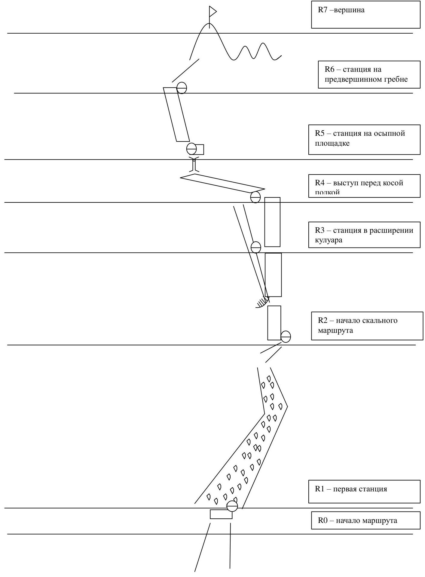
R7 — summit R6 — belay station on the pre-summit ridge R5 — belay station on the scree platform R4 — outcrop before the inclined ledge R3 — belay station in the widening of the couloir R2 — start of the rock route R1 — first belay station R0 — start of the route
General view of the mountain massif
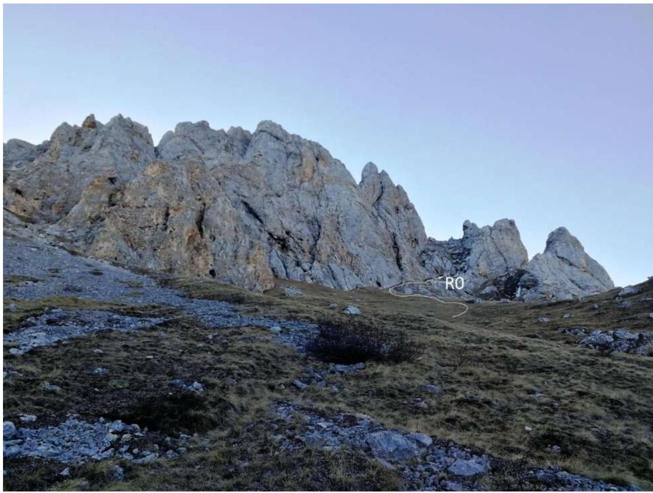
Figure 1
Start of the route
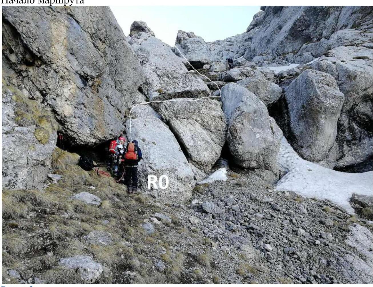
Figure 2
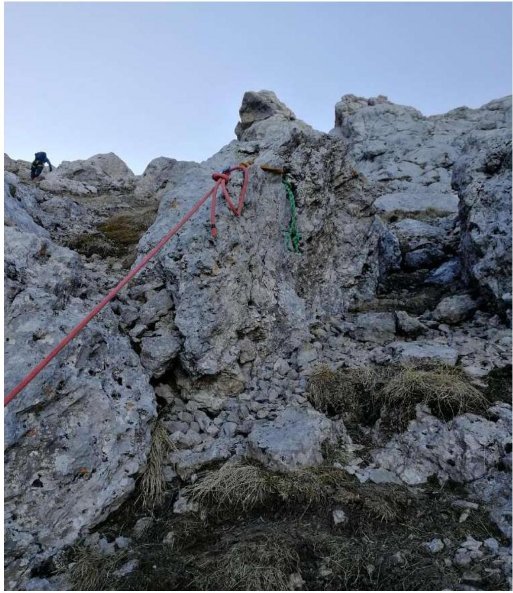
Figure 3
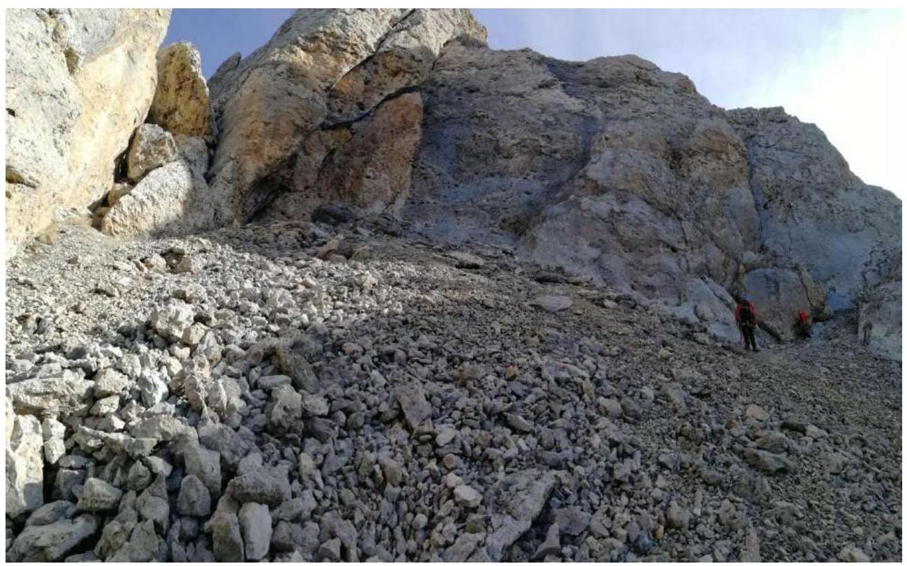
Figure 4

Figure 5
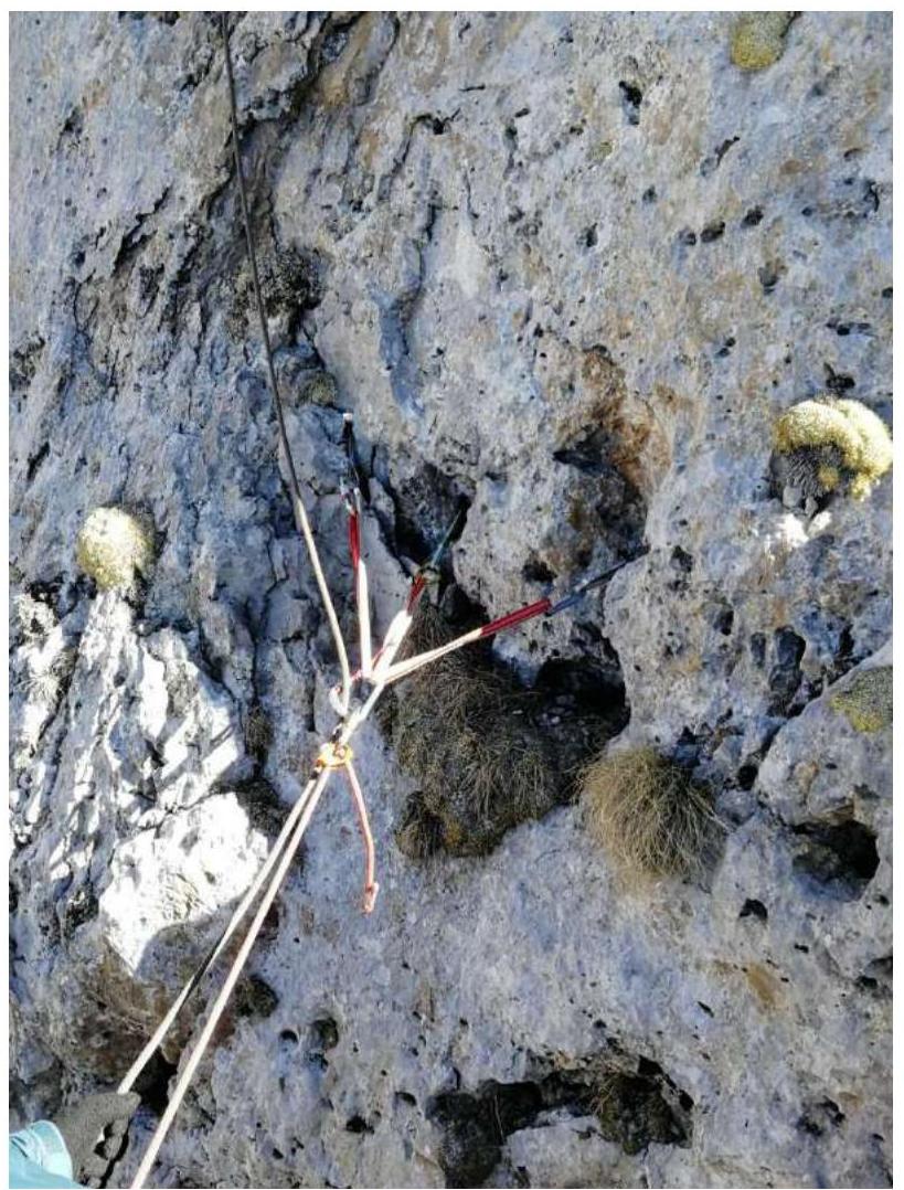
Figure 6
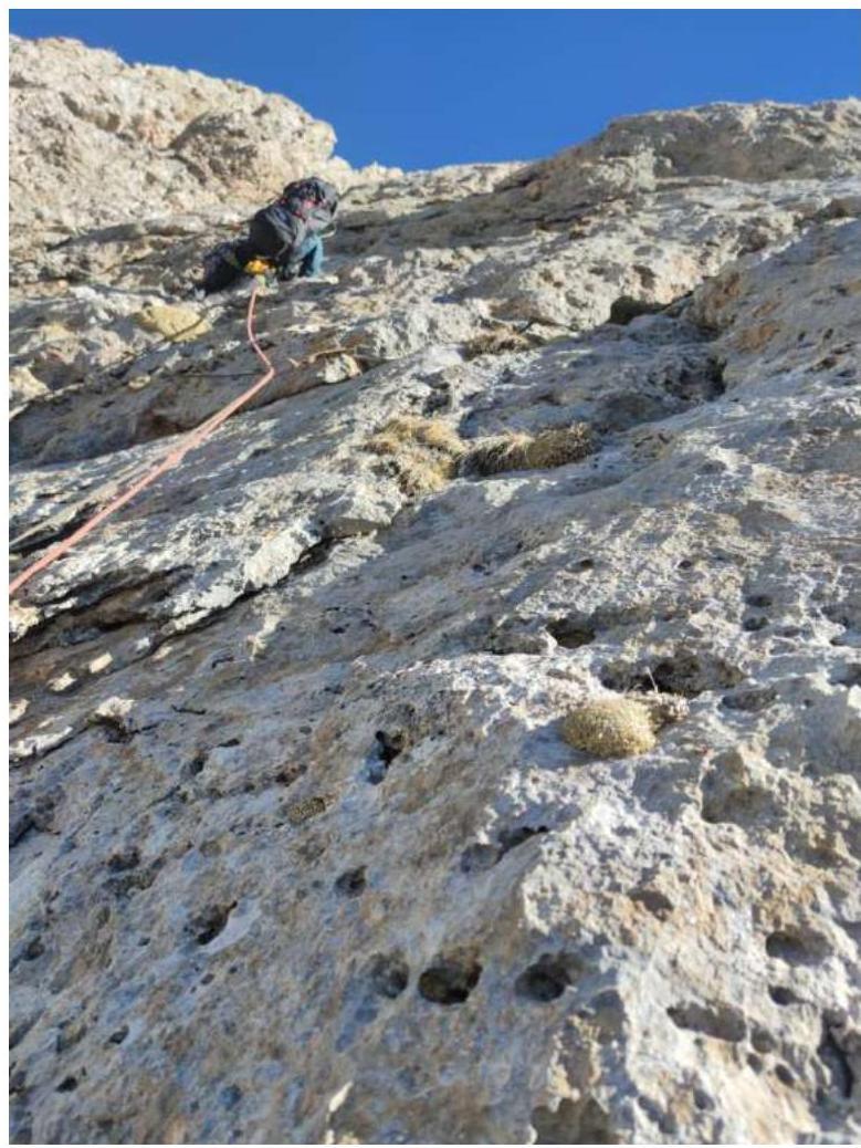
Figure 7
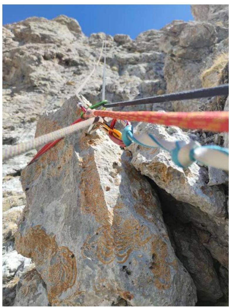
Figure 8

Figure 9

Figure 10
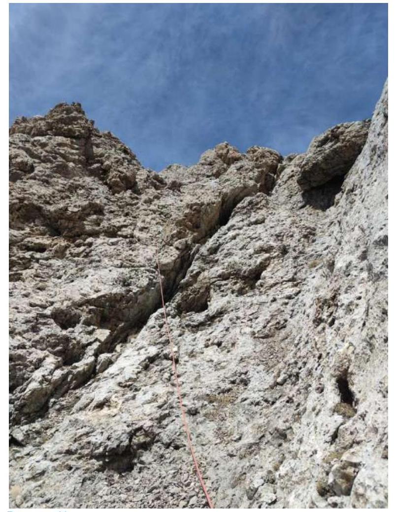
Figure 11
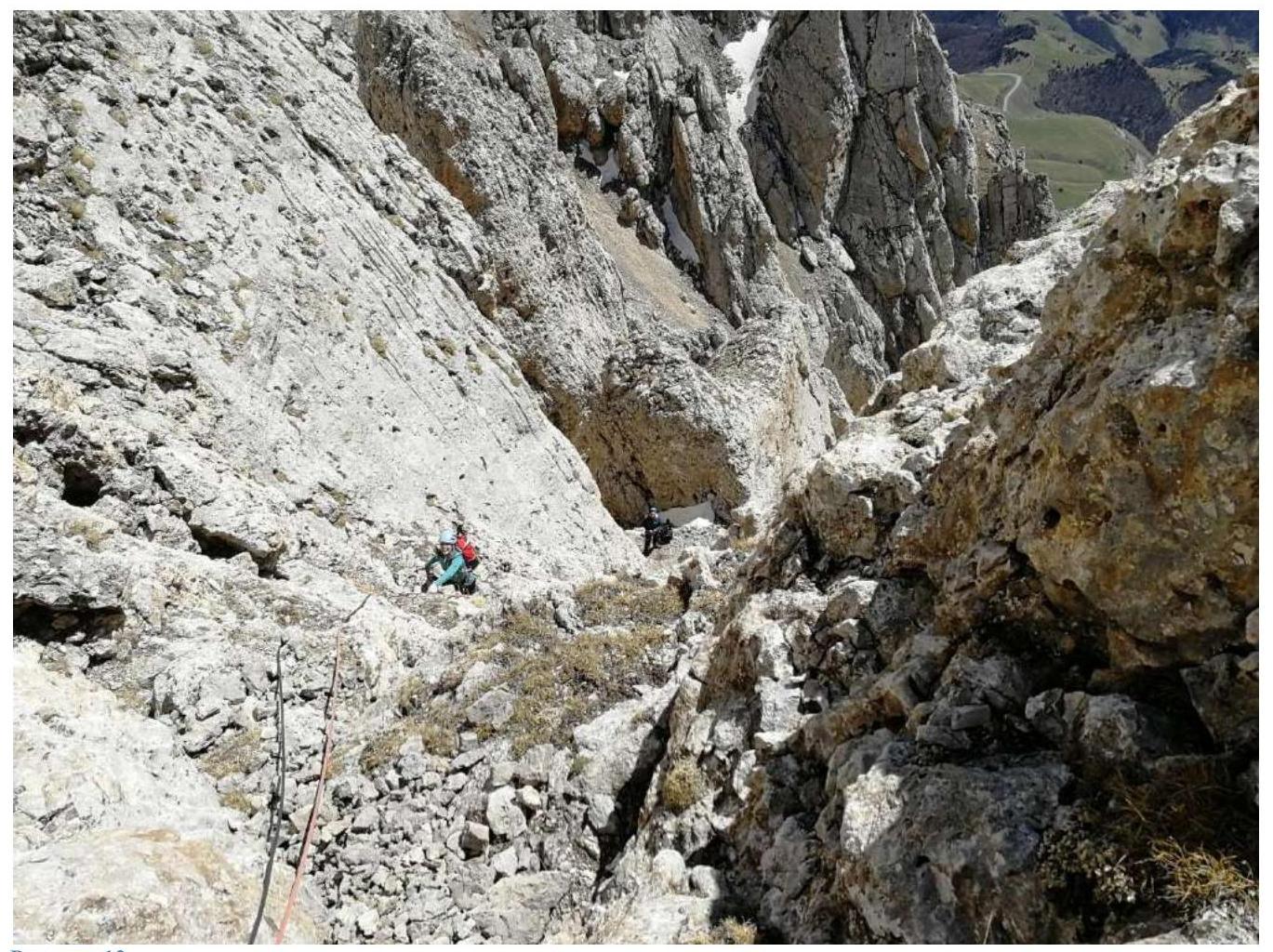
Figure 12
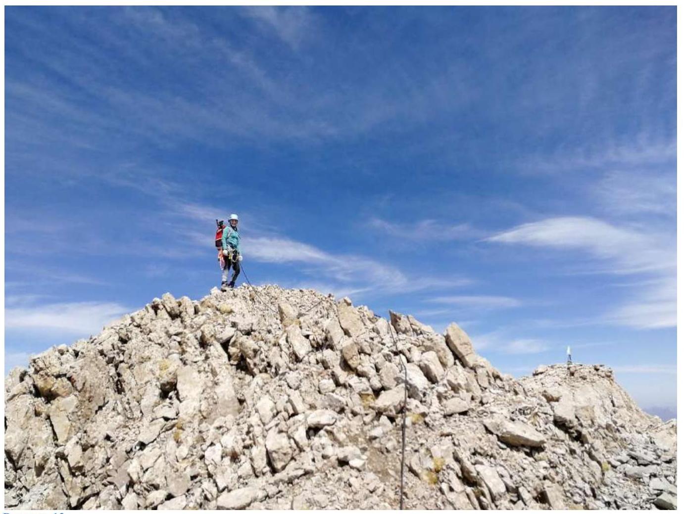
Figure 13
Comments
Sign in to leave a comment