
Report
On the ascent to the summit "Koazoy-Loam, Zub 2860 m." via route 4A cat. complexity (orientation) by the team of the Alpinism Federation of the Republic of Buryatia on August 18, 2020
1. General Information
1.1 Head of the ascent: Zurbulaev Sergey Vasilievich, 1st sports category 1.2 Participants:
- Sidyakin Sergey Vyacheslavovich, 2nd sports category 1.3 Organization: Alpinism Federation of Buryatia
2. Characteristics of the Ascent Object
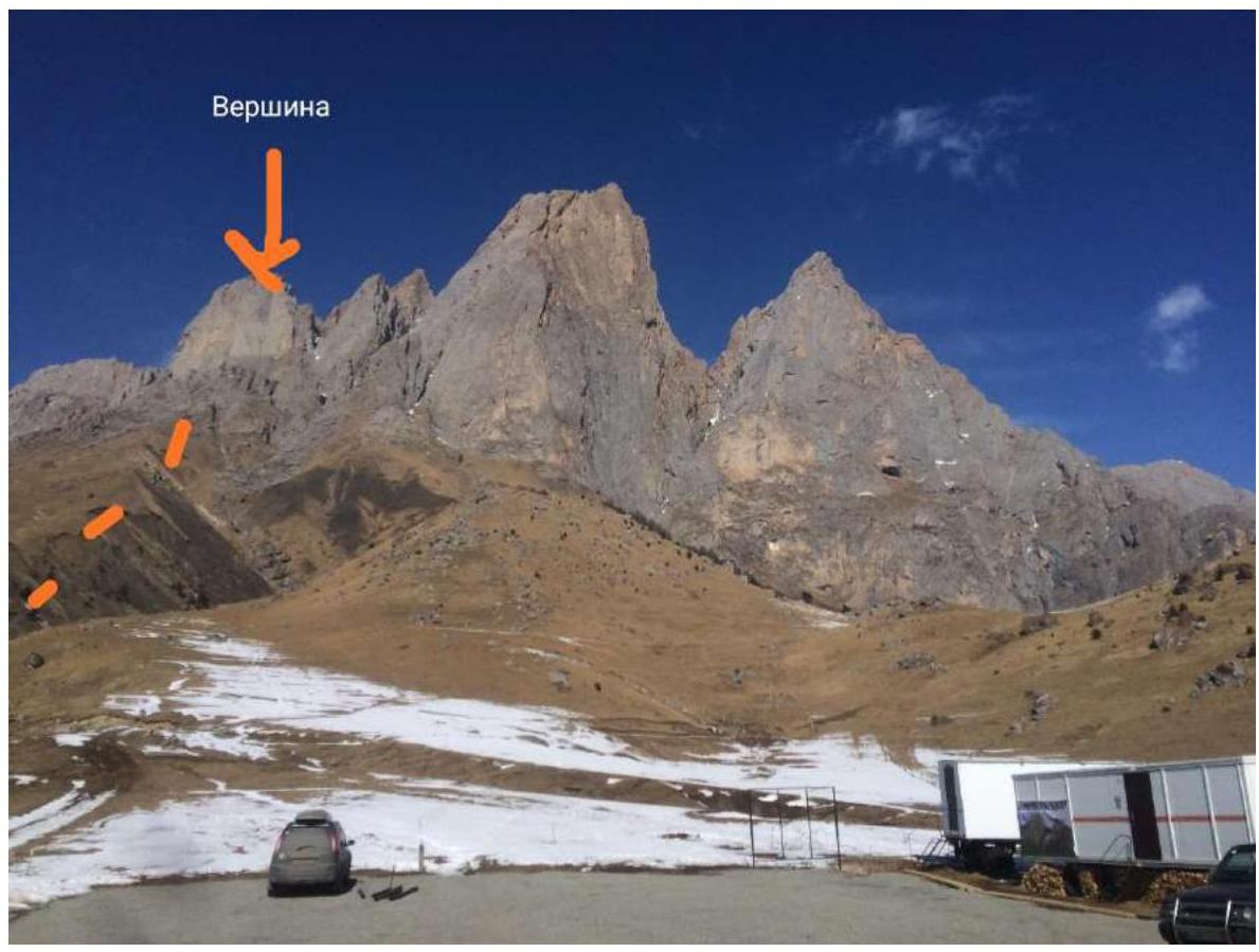
2.1 Ascent area: From Chiperazau pass to Gumachi peak (Baksan, Adylsu, Shkhelda, Kyrtik valleys) 2.2 Name of the summit: "Koazoy-Loam, Zub 2986 m."
3. Characteristics of the Route
3.1 Name of the route: via a series of chimneys on the right part of the Southeast wall. 3.2 Estimated category of complexity: 4A 3.3 Nature of the route: rock climbing 3.4 Degree of освоенности: second ascent 3.5 Height difference: 250 m 3.6 Route length: 430 m 3.7 Technical elements of the route:
1st cat. complexity: 50 m 2nd cat. complexity: 50 m 3rd cat. complexity: 120 m 4th cat. complexity: 150 m 5th cat. complexity: 70 m 6th cat. complexity: 20 m
3.8 Descent from the summit: via grassy slopes into the 2A couloir.
4. Characteristics of the Team's Actions
4.1 Time of movement: 11 h 30 min 4.2 Start of the route: 08:00 on February 18, 2020 4.3 Reaching the summit: 19:30 on February 18, 2020 4.4 Return to base camp: 22:00
5. Characteristics of Weather Conditions
5.1 Temperature: 0 °C in the morning, up to +12 °C during the day.
5.2 Wind speed: up to 5 m/s.
5.3 Precipitation: absent, clear sunny weather throughout the ascent.
General photo of the summit:
Route line:
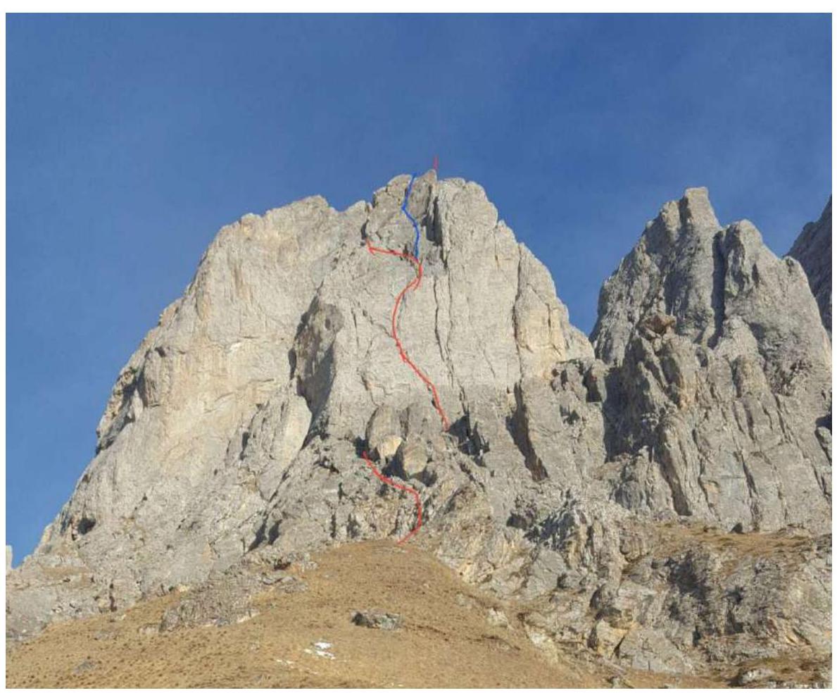 The red line marks the route of the first ascenders. The team consisting of Verbitsky A., Dmitriev A., Katanaev S. made the ascent on February 4, 2020. We followed a more direct logical line, resulting in a slightly more complex route variant that took 3 hours longer to complete.
Start of the Route
Approach via a grassy slope (steep in the upper part), bypassing the rock to the left

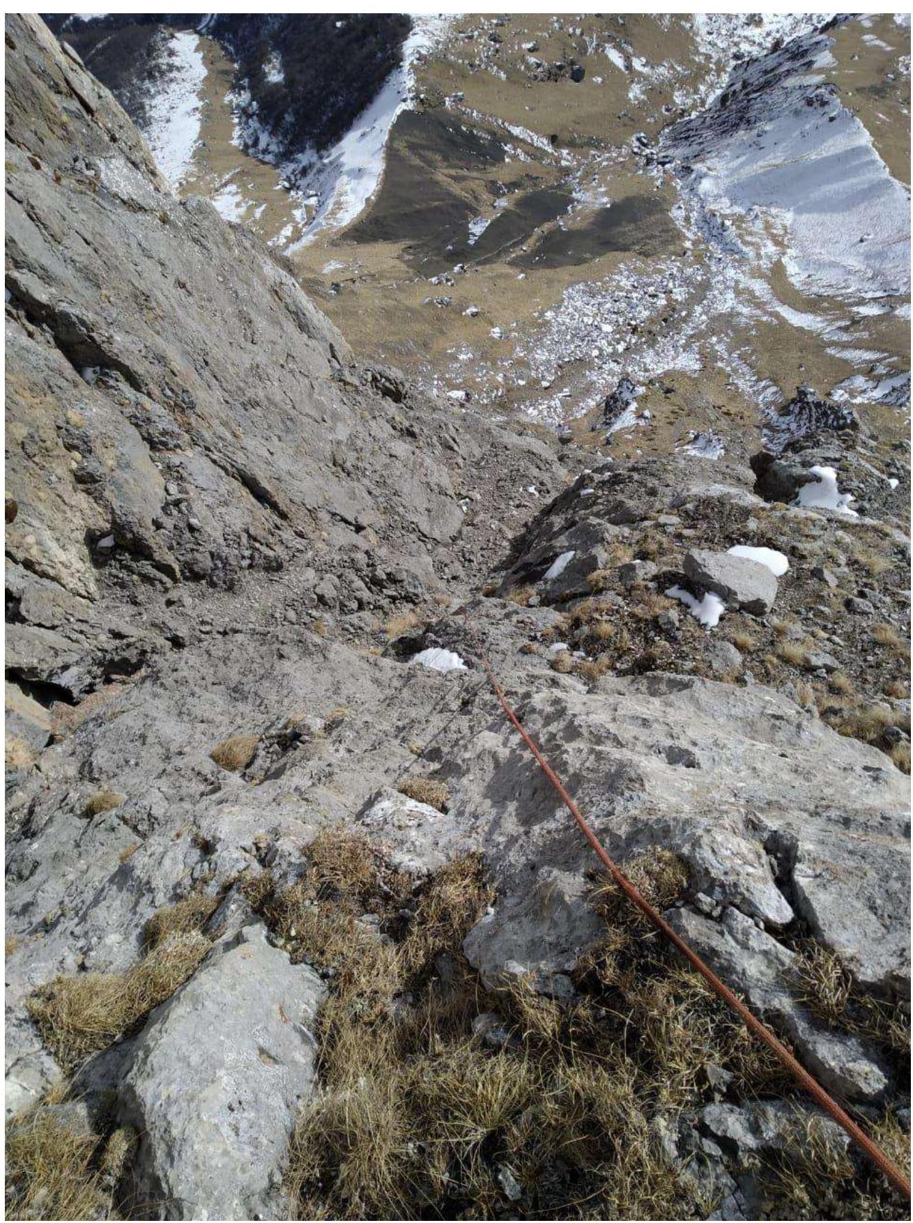
R0–R2
Series of walls and scree ledges to a pedestrian bridge. Rockfall hazard!
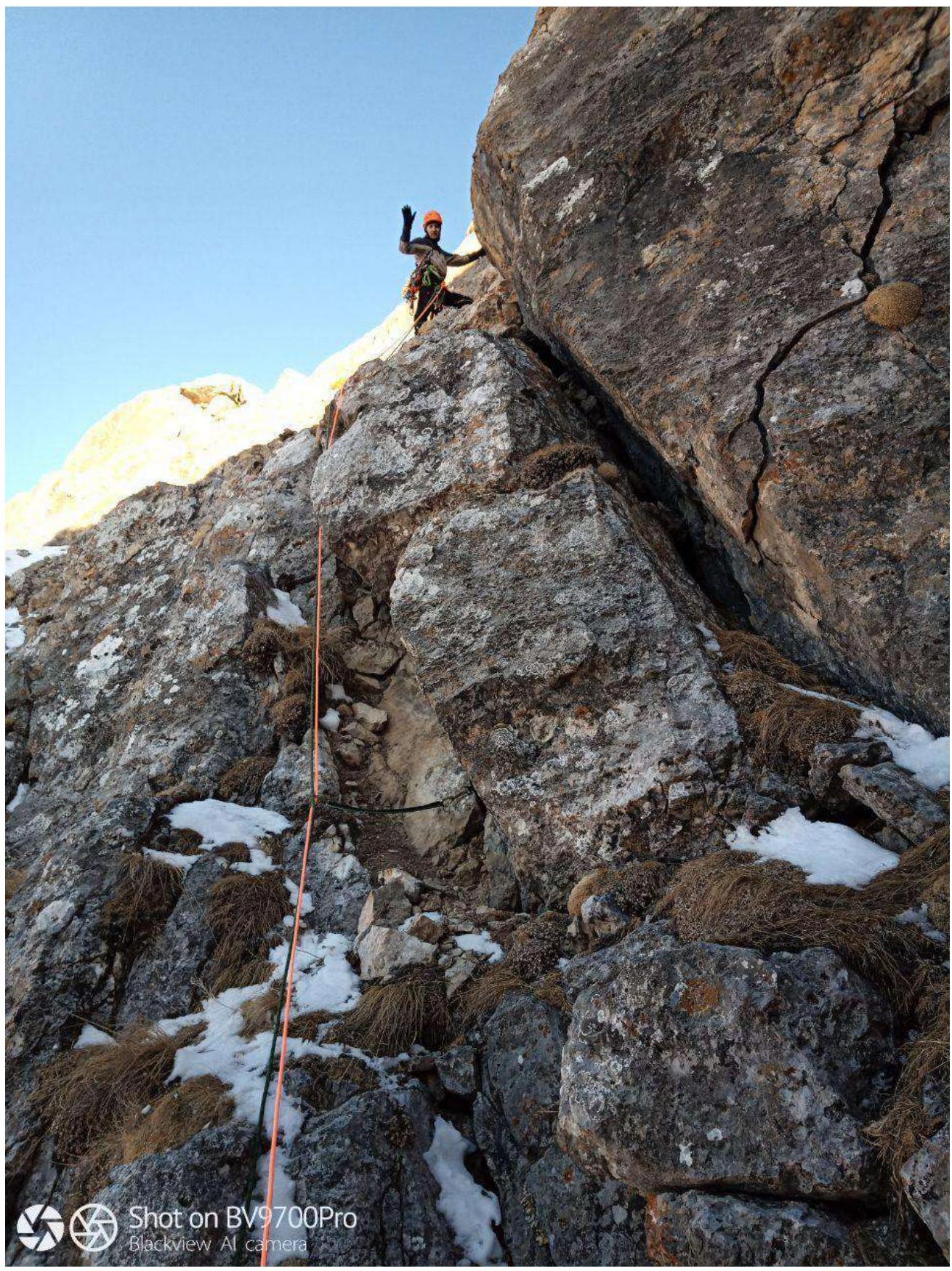
R3–R5
Series of chimneys and internal corners (photo from the first ascent)
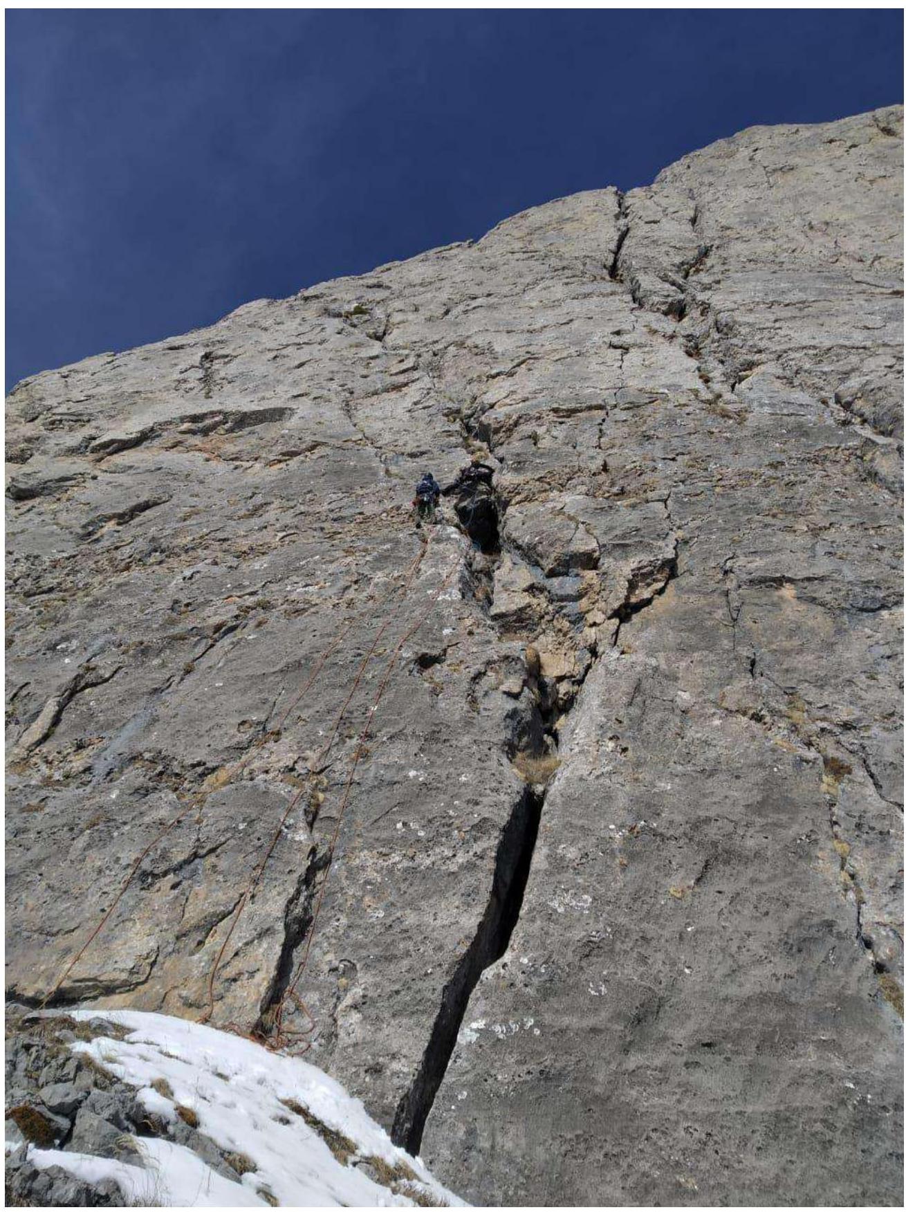
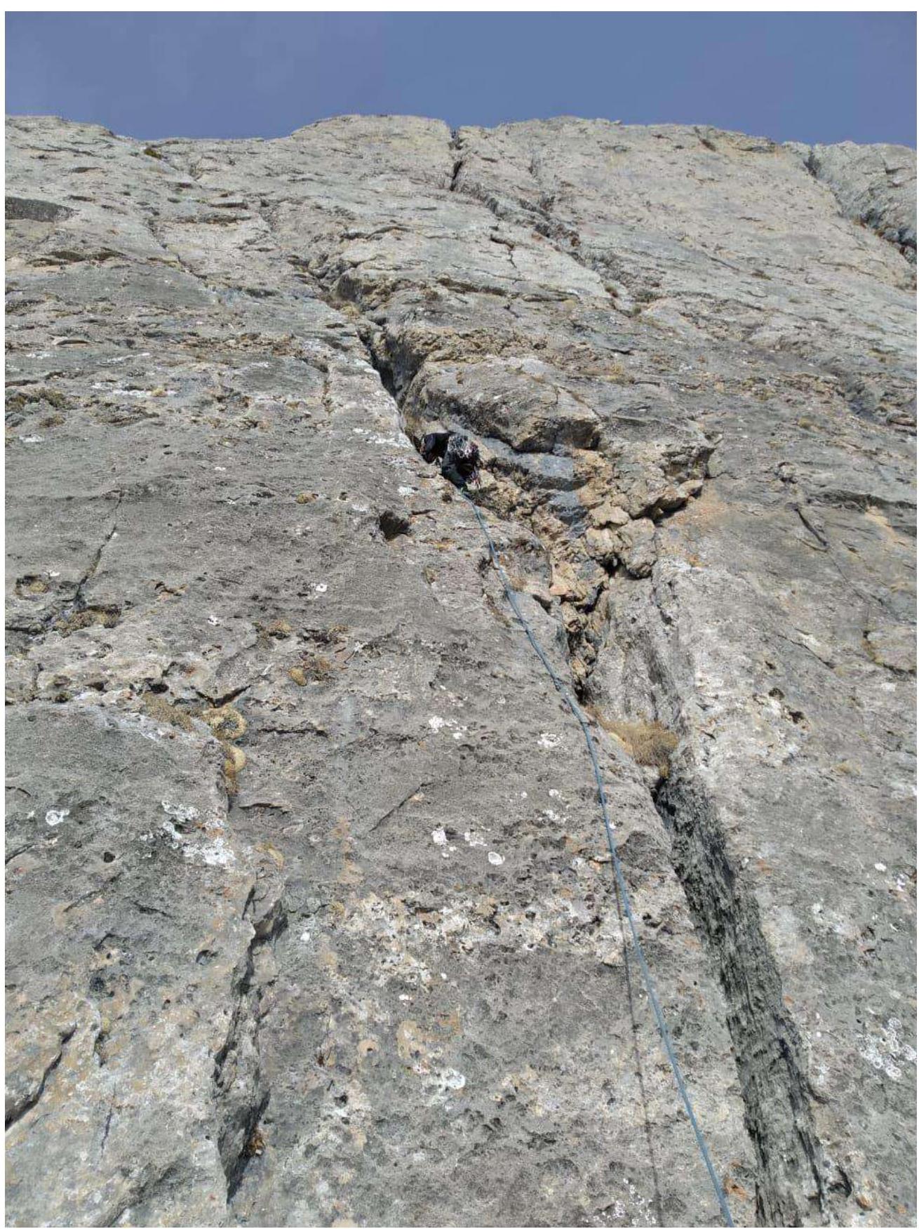
R5–R6
Internal corner, key section of the route.

R6–R8
Series of walls and scree ledges, moving left around the corner, bypassing the overhanging rock destruction.
R8–R10
Series of internal corners and chimneys.
R10–R11
Reaching the summit via:
- a 20 m wall
- or through a chimney to the right.
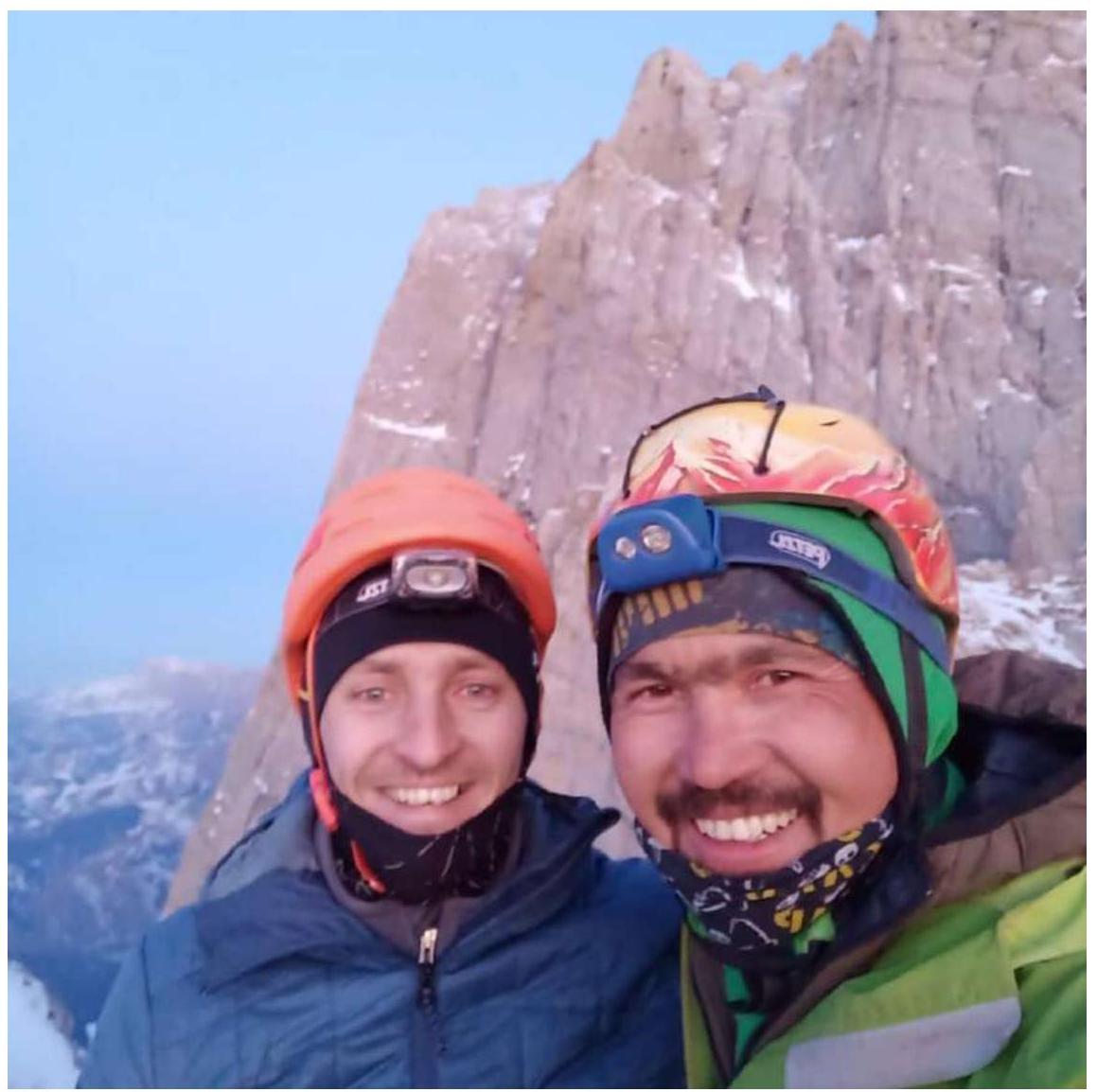
Photo at the summit. Sidyakin S., Zurbulaev S.
 Route diagram in UIAA symbols:
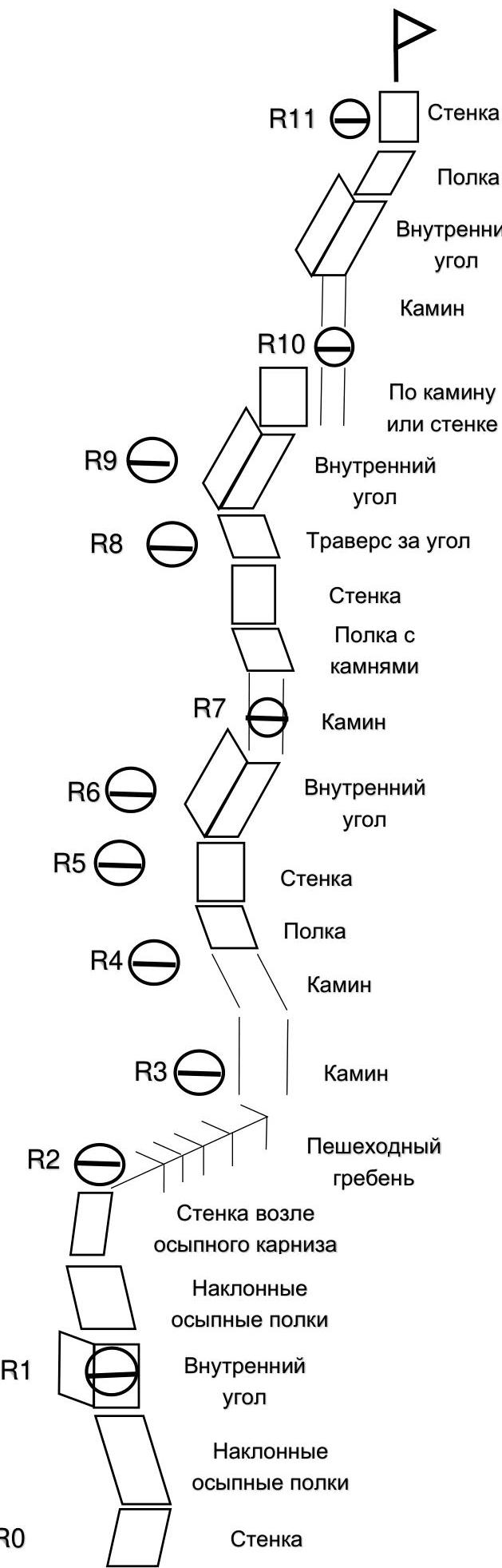
| Section number | Section length | Section steepness | Section complexity |
|---|---|---|---|
| R10–R11 | 20 m | 70° | V |
| R9–R10 | 30 m 20 m | 40° 70° | IV |
| R8–R9 | 10 m 40 m | 70° 40° | IV III |
| R7–R8 | 30 m 10 m | 30° 70° | III III |
| R6–R7 | 30 m | 30° | III |
| R5–R6 | 35 m 15 m | 60° 80° | IV VI |
| R4–R5 | 50 m | 70° | V |
| R3–R4 | 20 m | 80° | VI |
| R2–R3 | 50 m | I | |
| R1–R2 | 50 m | 70° | II+ |
| R0–R1 | 40 m 10 m | 30° 70° | III |