
Report
On the first ascent of g. Zub Koazoy-Loam, 2986 m.
4B via the left part of the SE wall by the GK UAL team from 09.04.2024 to 09.04.2024
I. Climbing Report
| 1. General Information | ||
|---|---|---|
| 1.1 | Full name, sports category of the leader | Chikin Artem Borisovich CMS |
| 1.2 | Full name, sports category of the participants | Chelekhsaty Villi Levanovich 3rd sports category |
| 1.3 | Full name of the coach | Yakovenko Alexander Nikolaevich |
| 1.4 | Organization | GK UAL |
| 2. Characteristics of the Climbing Object | ||
| 2.1 | Region | From Krepostovoy Pass to Shaviklde peak |
| 2.2 | Valley | |
| 2.3 | Number according to the classification table | 2,9 |
| 2.4 | Name and height of the peak | g. Zub Koazoy-Loam, 2986 m |
| 2.5 | Geographic coordinates of the peak (latitude, longitude), GPS coordinates *(1) | 42.831786, 44.846512 |
| 3. Route Characteristics | ||
| 3.1 | Route name | via the left part of the SE wall |
| 3.2 | Proposed category of difficulty | 4B |
| 3.3 | Degree of route exploration | First ascent |
| 3.4 | Relief characteristics of the route | Rocky |
| 3.5 | Height difference of the route (altimeter or GPS data) | 300 m |
| 3.6 | Route length | 360 m |
| (in meters) | ||
| 3.7 | Technical elements of the route | I cat. rock - 30 m. II cat. rock - 10 m. III cat. rock - 100 m. IV cat. rock - 60 m. V cat. rock - 105 m. VI cat. rock - 55 m. |
| 3.8 | Average steepness of the route | 60° |
| 3.9 | Average steepness of the main part of the route | 75° |
| 3.10 | Descent from the peak | via the S ridge of g. Tsey-Loam (Kyazi), 3rd category |
| 3.11 | Additional route characteristics | Absence of water |
| 4. Team Actions Characteristics | ||
|---|---|---|
| 4.1 | Movement time | 7 h |
| 4.2 | Overnights | - |
| 4.3 | Route preparation time | - |
| 4.4 | Start of the route | 7:30 09.04.2024 |
| 4.5 | Reaching the peak | 14:30 09.04.2024 |
| 4.6 | Return to the base camp | 16:30 09.04.2024 |
| 5. Person responsible for the report | ||
| 5.1 | Chikin Artem Borisovich | artem.chikin@mail.ru |
II. Climbing Description
1. Climbing Object Characteristics
 1.1.
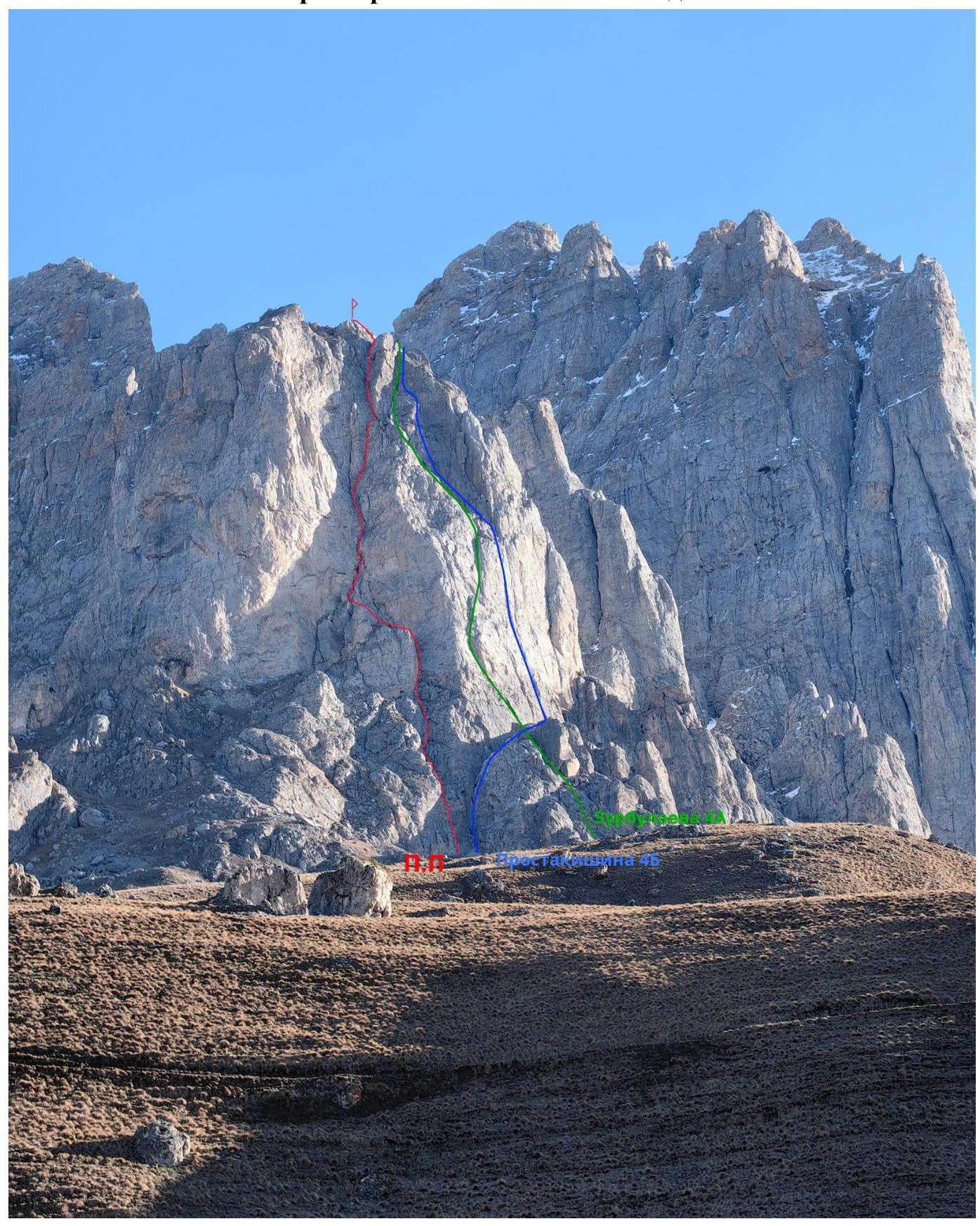
Overall photo of the peak and the route thread.
1.1.
Overall photo of the peak and the route thread.
 1.2.
Photopanorama of the area, view from the alpine camp.
1.2.
Photopanorama of the area, view from the alpine camp.
 1.3.
Map of the area
1.3.
Map of the area
2. Route Characteristics
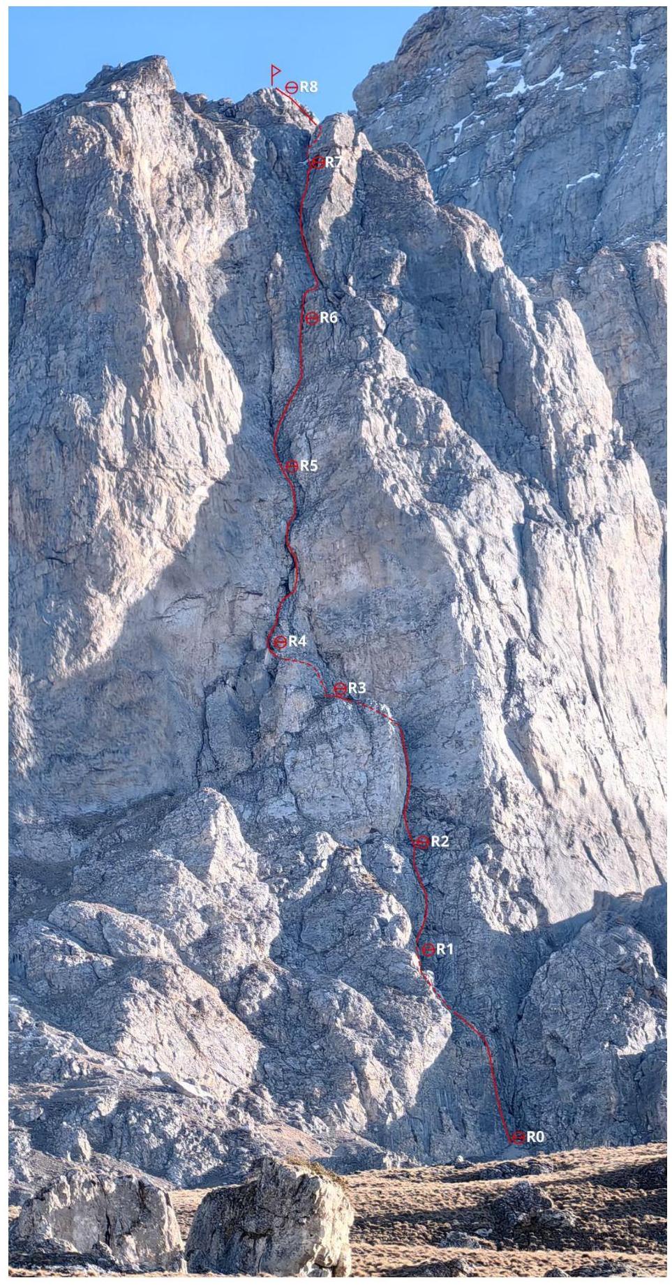 2.1.
Technical photograph and profile
of the route.
2.1.
Technical photograph and profile
of the route.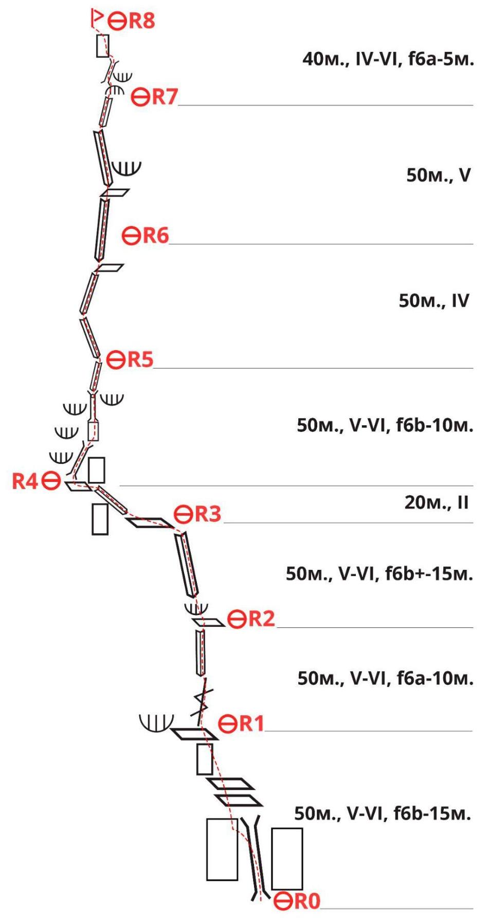
- 40 m, IV–VI, f6a — 5 m.
- 50 m, V
- 50 m, IV
- 50 m, V–VI, f6b — 10 m.
- 20 m, II
- 50 m, V–VI, f6b+ — 15 m.
- 50 m, V–VI, f6a — 10 m.
- 50 m, V–VI, f6b — 15 m.
2.3. Route diagram in UIAA symbols.
| Section | Protection points | Route line in UIAA symbols | Difficulty | Length, m | Steepness, ° | |
|---|---|---|---|---|---|---|
| Friends | Anchors | |||||
| R7–R8 | 0 | 3 | III+ | 35 | 65 | |
| VI | 5 | |||||
| R6–R7 | 1 | 3 | V | 30 | 65 | |
| IV | 20 | |||||
| R5–R6 | 1 | 1 | V | 10 | 70 | |
| III | 40 | 60 | ||||
| R4–R5 | 4 | 2 | IV | 20 | 75 | |
| VI | 10 | |||||
| IV | 20 | |||||
| R3–R4 | 0 | 0 | I | 20 | 20 | |
| R2–R3 | 2 | 4 | I | 10 | 80 | |
| V+ | 25 | |||||
| VI | 15 | |||||
| R1–R2 | 2 | 2 | II | 10 | 65 | |
| V | 30 | |||||
| VI | 10 | |||||
| R0–R1 | 1 | 4 | III | 25 | 70 | |
| VI | 15 | |||||
| V+ | 10 |
3. Team Actions Characteristics
3.1. Brief description of the route passage.
| Section | Description | Photo number |
|---|---|---|
| R0–R1 | Climb straight up a smoothed chimney, transitioning to the left wall at the top and onto a ledge. Then, follow grassy ledges under an overhanging rock, on the left before a cleft, and establish a belay station here. Climbing the chimney is strenuous with few active holds; insurance is on anchors. Station on friends. 70°, 50 m (V+ — 10 m, VI — 15 m — f6b, III — 25 m) | Photo 1 |
| R1–R2 | Climb up the cleft, which is slippery with grassy tufts that don't provide good holds. Then exit via an inner corner under an overhang before a small fracture. Establish a belay station on a ledge. 65°, 50 m (VI — 10 m — f6a, V — 30 m, II — 10 m) | Photo 2 |
| R2–R3 | Squeeze under the wall to an overhanging, somewhat destroyed cornice near an inner corner, then over the cornice and up a very smoothed inner corner. Climbing is done with back and feet against the left side of the corner. Insurance is on anchor hooks. Climbing becomes easier, and you exit onto a grassy ledge. Establish a belay station at the end of the ledge on your own points. 80°, 50 m (VI — 15 m — f6b+, V+ — 25 m, I — 10 m) | Photo 3 |
| R3–R4 | From the grassy ledge, enter the inner corner to the right of a standalone rock and move left to a chimney. Before the chimney, under an overhanging rock, establish a belay station on friends. 20°, 20 m (I — 20 m) | Photo 4 |
| R4–R5 | Climb up the chimney for about 20 m. Then, follow a destroyed, reddish wall to a chimney with a plug. Use friends for good insurance to climb over the overhang formed by the plug. Be very cautious on this pitch due to loose rocks. Exit into the next inner corner, which is also heavily destroyed, and climb it to a relatively comfortable spot for a belay station on its left side. Station on anchors. 80°, 50 m (IV — 20 m, VI — 10 m — f6b, IV — 20 m). | Photo 5 |
| R5–R6 | Climb the inner corner, which gradually eases and then becomes more challenging again before the end of the rope. Establish a belay station on a small ledge using anchors. 60°, 50 m (III — 40 m, V — 10 m). | Photo 6 |
| R6–R7 | Exit the inner corner onto a ledge and start climbing the next inner corner with a cleft. The left side is smoothed but not too difficult to climb. Exit into a niche under an overhanging rock. Establish a belay station on a large rock. 65°, 50 m (IV — 20 m, V — 30 m) | Photo 7 |
| R7–R8 | Climb left into a heavily smoothed chimney. Climb in a stemming position with some friction climbing and not very good anchor protection. The clefts are deep. Exit onto a saddle and turn left onto a simple wall that leads to the summit. Establish a belay station on yourself over the summit ridge. 65°, 40 m (VI — 5 m, III+ — 35 m) | Photo 8, Photo 9 |
3.1. Photographs.
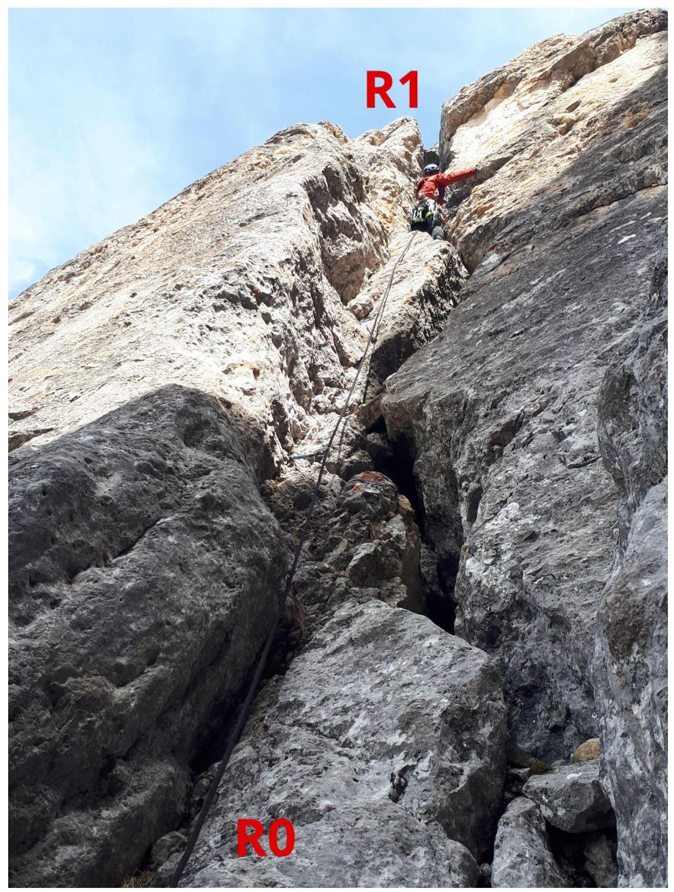
Photo 1. Section R0–R1
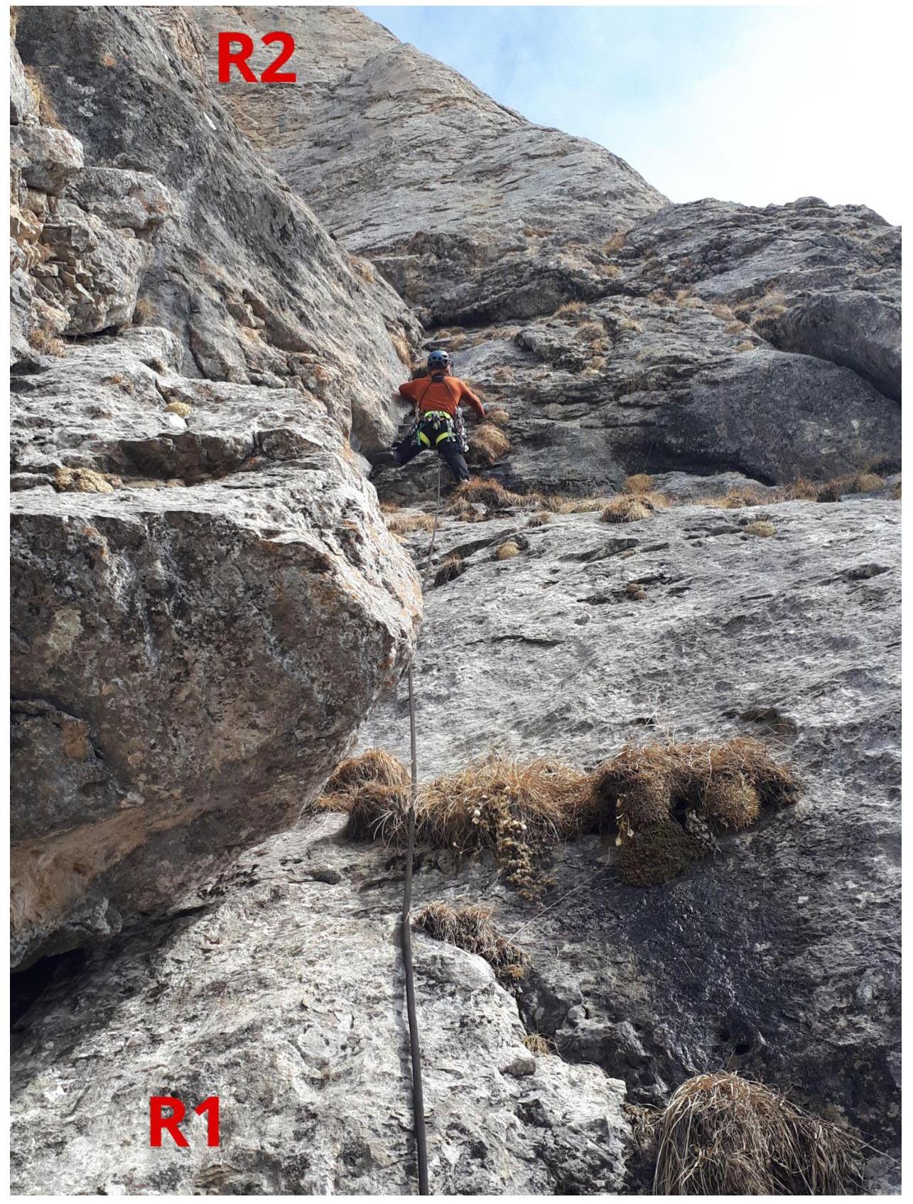
Photo 2. Section
R1–R2.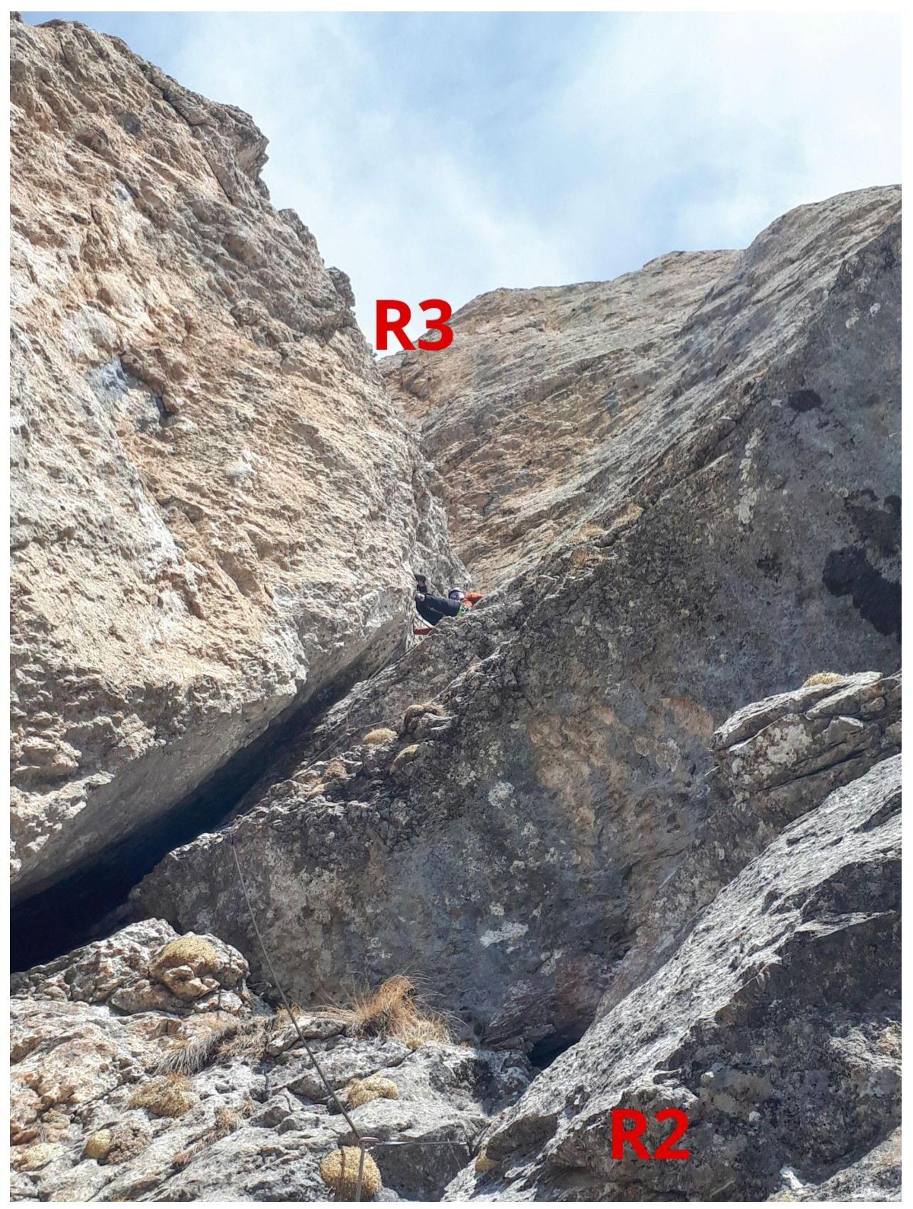
Photo 3. Section
R2–R3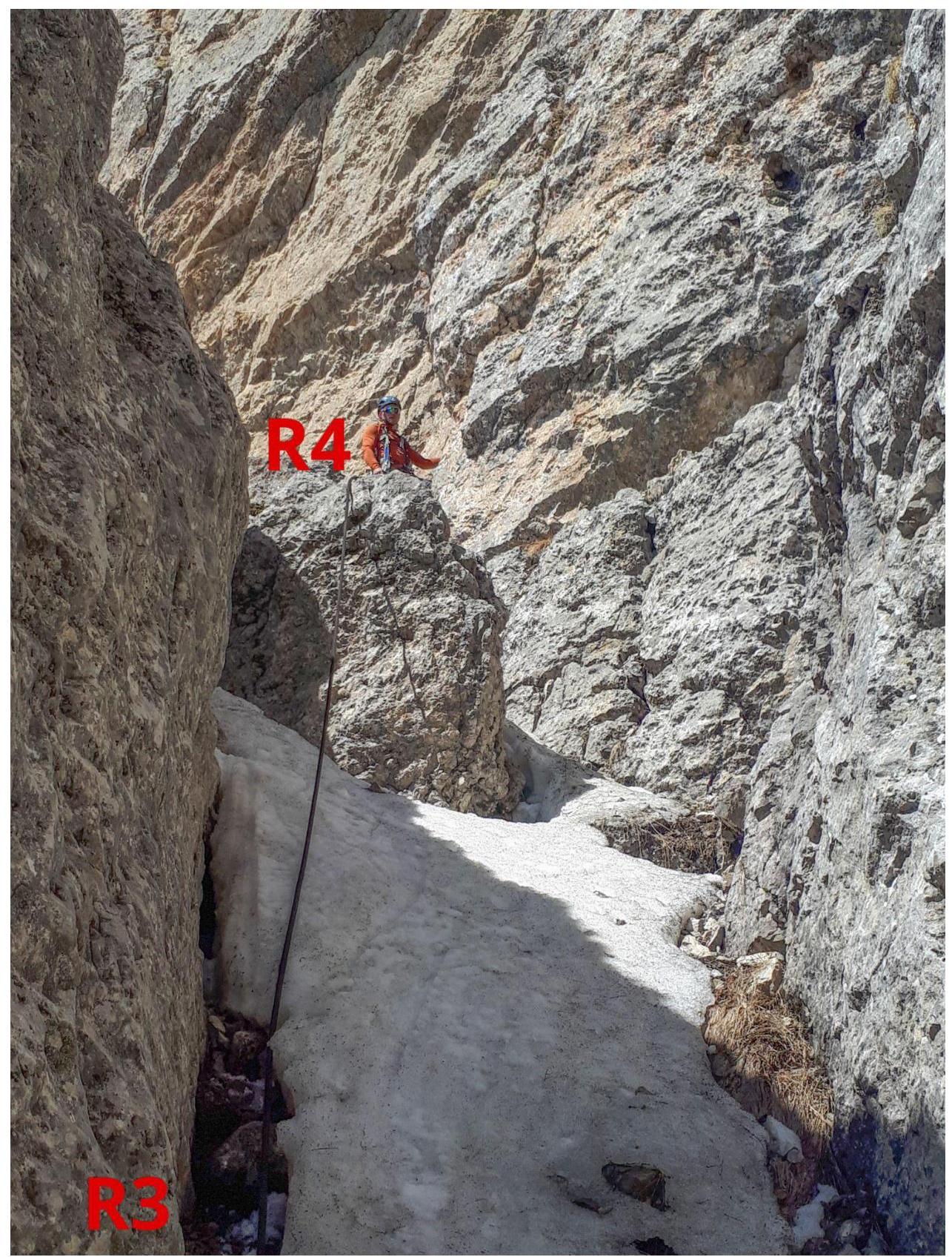
Photo 4. Section
R3–R4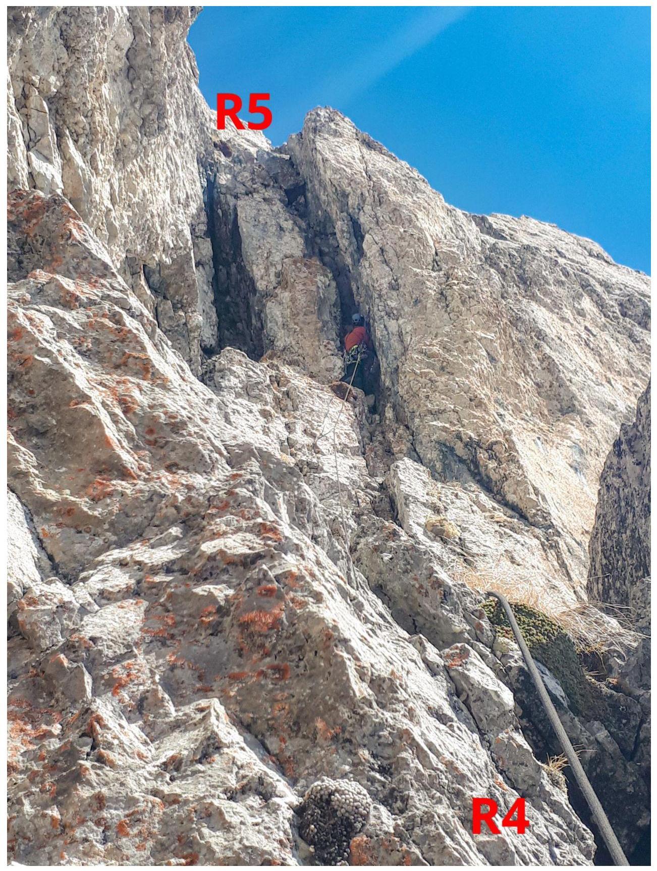
Photo 5. Section
R4–R5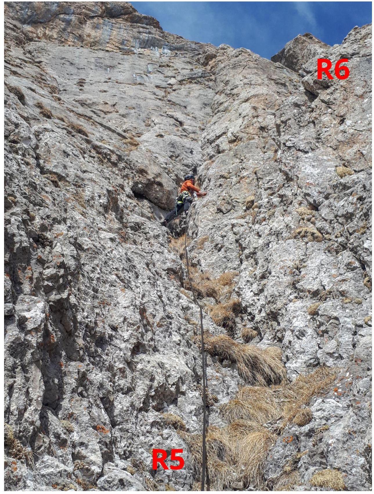
Photo 6. Section
R5–R6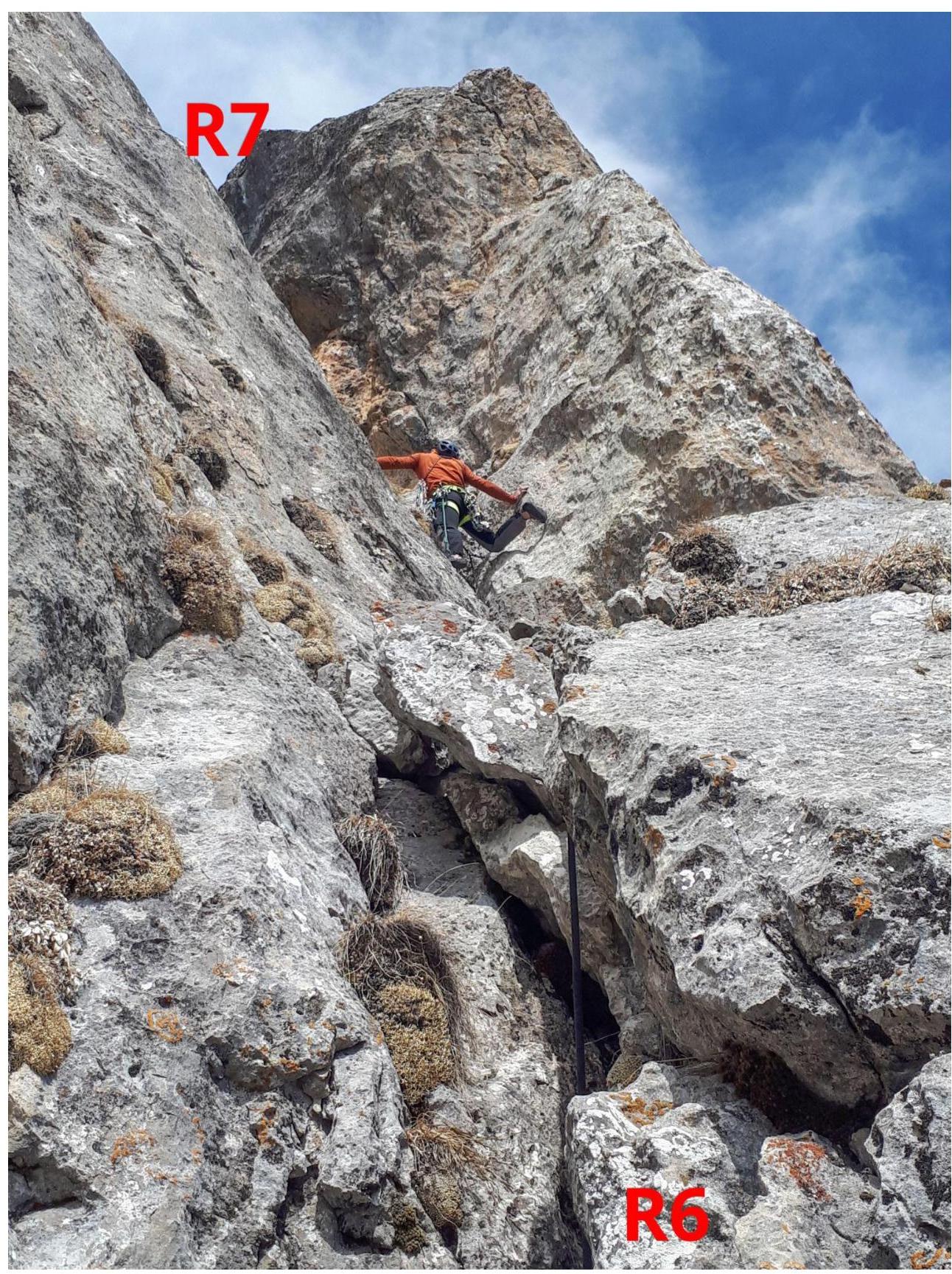
Photo 7. Section
R6–R7
Photo 8. Section
R7–R8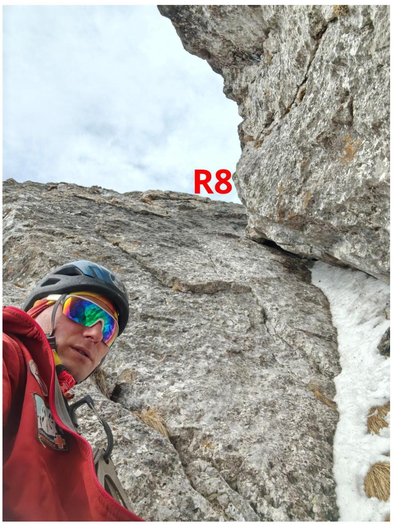
Photo 9. Section R7–R8 smoothed inner
corner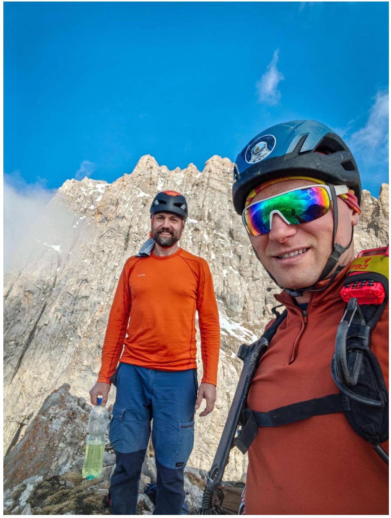
Photo 10. Team on the summit
3.3. The route line is very logical and easy to follow, proceeding through a series of chimneys and inner corners from start to finish. There is a lot of friction climbing, making rock shoes a necessity rather than boots.
- Be very cautious on inner corners and in the chimney with a plug due to loose rocks.
- From section R5 onwards, climbing proceeds through a single inner corner with the belayer also positioned within it, so take care not to dislodge rocks downwards.
- Climbing on certain sections is more challenging than on the neighboring routes on Zub: 3–4 pitches of 4B Prostashkinskaya and Vasilieva, and 4B Donskov's on Koazoy-Loam.
- Passage during periods of snow and verglas will likely be very difficult and may require IT (Artificial Technical) aids on sections R0–R1, R2–R3, R4–R5, R7–R8. The route is very interesting due to the variety of stemming and chimney climbing techniques used. Radio communication with the Kyazi alpine camp is good, and Beeline cellular coverage is available. Descent from the route is not particularly complicated: follow the ridge, then traverse through two couloirs to reach the classic 2A route on the S ridge of g. Tsey-Loam (Kyazi). From here, a well-trodden path leads to the camp or directly to the road.
Comments
Sign in to leave a comment