
Report
On the first ascent of g. Zub Koazoy-Loam, 2986 m via the center of the SE wall by the team of GK MGSU (Moscow) on the route "Kaminio"
I. Climbing Report
| 1. General Information | ||
|---|---|---|
| 1.1 | Full name, sports rank of the team leader | Prostakov Dmitry Alexandrovich, 2nd sports rank |
| 1.2 | Full name, sports rank of the participants | Komarov Pavel Fedorovich, 2nd sports rank, Zherdev Kirill Valerievich, 2nd sports rank |
| 1.3 | Full name of the coach | |
| 1.4 | Organization | GK MGSU Moscow |
| 2. Characteristics of the Climbing Object | ||
| 2.1 | Region | From the pass Krepostovyy to the summit Shaviklde |
| 2.2 | Valley | |
| 2.3 | Number of the section according to the classification table | 2,9 |
| 2.4 | Name and height of the summit | g. Zub Koazoy-Loam, 2986 m |
| 2.5 | Geographical coordinates of the summit (latitude/longitude), GPS coordinates (1) | 42.831786, 44.846512 |
| 3. Characteristics of the Route | ||
| 3.1 | Name of the route | via the center of the SE wall, route "Kaminio" |
| 3.2 | Proposed category of difficulty | 4Б |
| 3.3 | Degree of route development | First ascent |
| 3.4 | Nature of the route terrain | Rock |
| 3.5 | Height difference of the route (data from altimeter or GPS) | 300 m |
| 3.6 | Length of the route (indicated in m.) | 410 м |
| 3.7 | Technical elements of the route | Rocks cat. diff. 1 – 70 m. Rocks cat. diff. 2 – 0 m. Rocks cat. diff. 3 – 140 m. Rocks cat. diff. 4 – 70 m. Rocks cat. diff. 5 – 100 m. Rocks cat. diff. 6 – 30 m. |
| 3.8 | Average steepness of the route | 60° |
| 3.9 | Average steepness of the main part of the route | 75° |
| 3.10 | Descent from the summit | via the S ridge 3 of the crest Tsey–Loam (Kyazi) |
| 3.11 | Additional characteristics of the route | Lack of water |
| 4. Characteristics of the Team's Actions | ||
| :--: | :-----------------------------------------------------------------------: | :------------------------------------------------------------------------------------------------------------------------------------------: |
| 4.1 | Time of movement | 6 h |
| 4.2 | Overnight stays | - |
| 4.3 | Time of route preparation | - |
| 4.4 | Start of the route | 7:00, January 7, 2021 |
| 4.5 | Reach the summit | 15:00, January 7, 2021 |
| 4.6 | Return to the base camp | 17:00, January 7, 2021 |
| 5. Responsible for the Report | ||
| 5.1 | Zherdev Kirill Valerievich | ppe_expert@mail.ru |
II. Description of the Ascent
1. Characteristics of the Climbing Object
1.1. General photo of the summit and route thread:
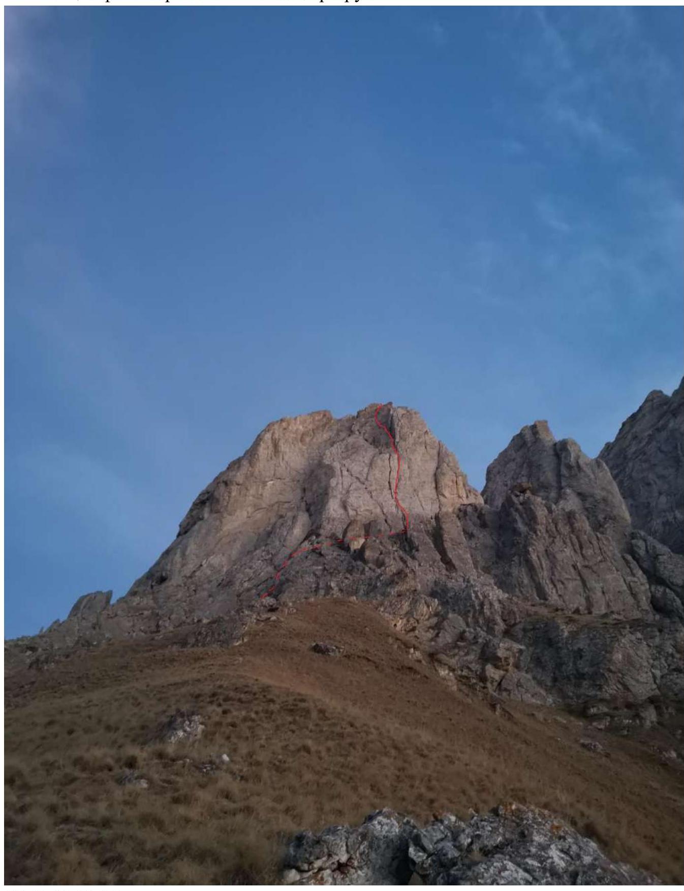 January 7, 2021. Approach to the route.
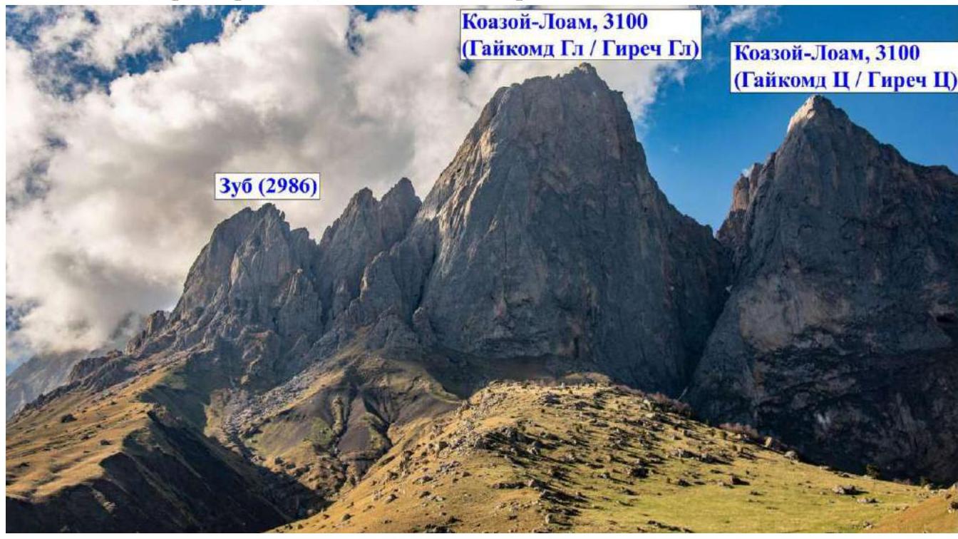
1.2. Photopanorama of the area, view from the alp camp:
January 7, 2021. Approach to the route.
1.2. Photopanorama of the area, view from the alp camp:
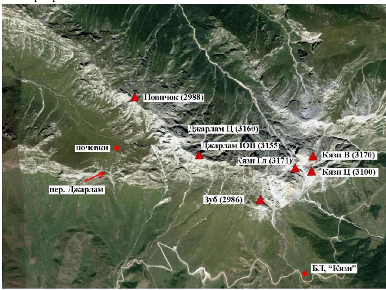
 1.3. Map of the area:
2. Characteristics of the Route
2.1. Technical photograph of the route.
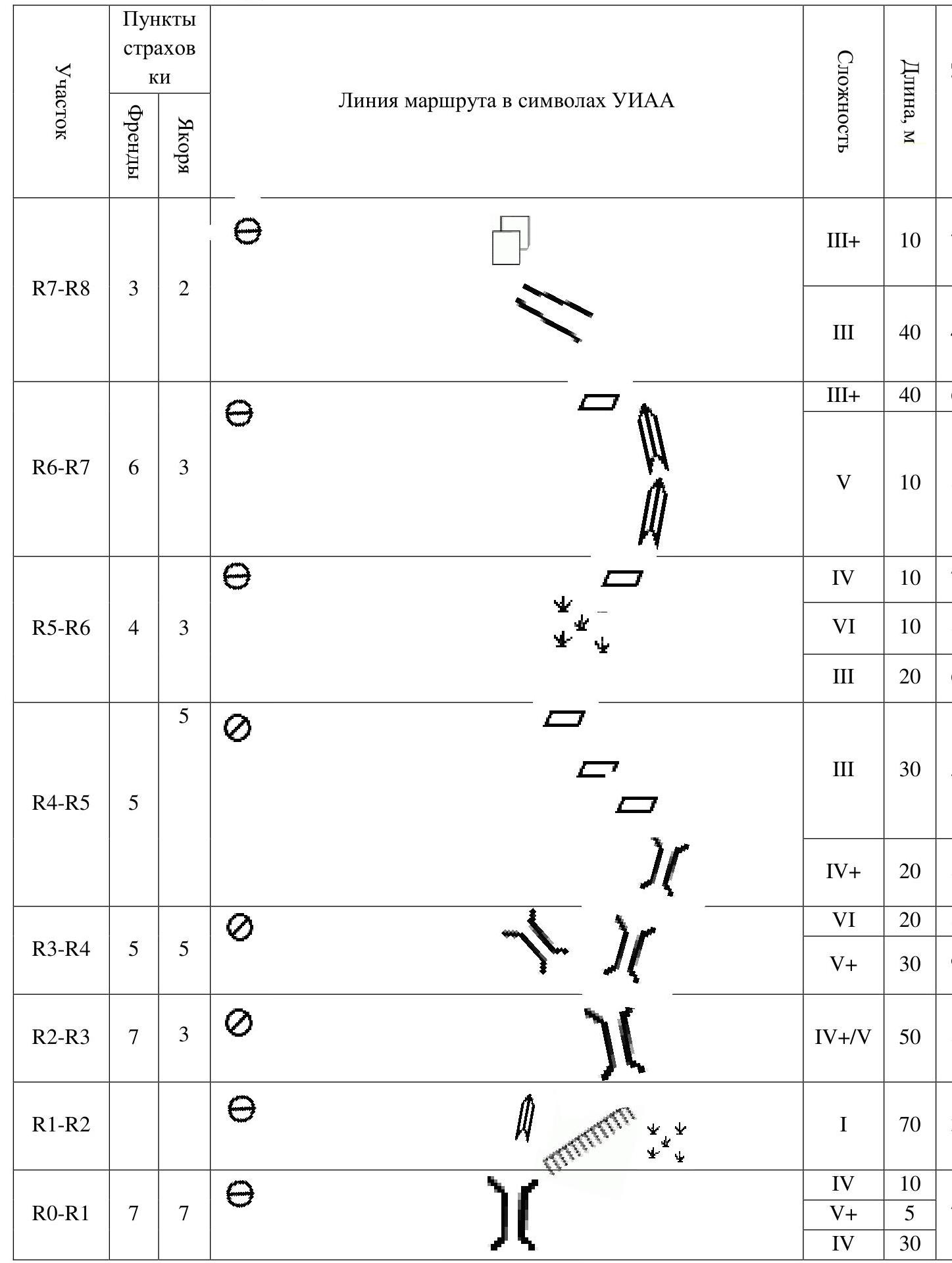
 2.3. Scheme of the route in UIAA symbols.
3. Characteristics of the Team's Actions
3.1. Brief description of the route passage.
| Section # | Description | Photo # |
|---|---|---|
| R0–R1 | Up the right part of the chimney 45 m, 70°. (30 m 4; 5 m 5+; 10 m 4). Station on own points, anchors. | Photo 1 |
| R1–R2 | Along a simple grassy-scree slope 70 m 1, 30°. | Photo 2 |
| R2–R3 | Enter the right chimney, then up, after 30 m bypass the overhanging rock "tooth-icicle" on the left. Mainly monolithic terrain with pleasant spatial climbing. Station on own points (anchors + camalots) under the next overhanging "tooth" on the fork of the chimney. Used as intermediate belay points: anchor hooks 3 pcs., nutcrackers 7 pcs. (50 m 4/5, 80°). | Photo 3 |
| R3–R4 | Move to the right chimney, you can shift to the right and go up the wall, then up the chimney. The terrain is monolithic. On the second half of the rope, the chimney narrows and forms two parallel walls, here begins the key section of the route and its main highlight in the form of vertical chimney climbing. Climbers should remove their backpacks and hang them on the harness, it's quite narrow, belaying is rare, outside the chimney, but climbing in a wedge is confident. Station on own points (anchor hooks, left wall of the chimney) on a small shelf three meters below the plug. Climbers are positioned one above the other. Used as intermediate belay points: anchor hooks 5 pcs., nutcrackers 5 pcs. (50 m: 30 m 5+, 85°; 20 m 6, 90°). | Photo 4, Photo 5, Photo 6, Photo 7 |
| R4–R5 | Further up the chimney, approximately 20 m. After the chimney, shift to the left and continue the ascent along a system of shelves with a transition to a positive, not pronounced internal corner. After the chimney, the terrain becomes much more crumbly. Station to the left of the internal corner on own points. Used as intermediate belay points: anchor hooks 5 pcs., nutcrackers 5 pcs. (50 m: 20 m 4+, 80°; 30 m 3, 50°). | Photo 8, Photo 9 |
| R5–R6 | Along simple rocks, enter the internal corner "like a book", where the difficulty increases, then up. Station behind a large stone on a convenient slab, before the next internal corner. Station looped around a protruding part. Used as intermediate belay points: anchor hooks 3 pcs., nutcrackers 4 pcs. (40 m: 20 m 3, 60°; 10 m 6, 80°; 10 m 4, 70°). | Photo 10 |
| R6–R7 | Up the crack of the internal corner. After 10 m, shift to the left into a weakly expressed internal corner and continue the ascent, be careful with "live" stones. Then, along the shelves, reach a large chimney, where the station is on own points. Used as intermediate belay points: anchor hooks 3 pcs., nutcrackers 6 pcs. (50 m: 10 m 5, 80°; 40 m 3+, 60°). | Photo 11, Photo 12 |
| R7–R8 | Bypass the flake on the right. Through a couloir, reach a "saddle", from it up to the right 10 m. Summit. Used as intermediate belay points: anchor hooks 2 pcs., nutcrackers 3 pcs. (50 m: 40 m 3, 40°; 10 m 3+, 70°). |
3.2. A beautiful direct route through the center of the wall. It will be especially liked by fans of chimney climbing. The route is significantly more difficult than the parallel "Along a series of chimneys in the right part of the SE wall" 4A category of difficulty. In our opinion, this is a confident 4Б, in which a small length is compensated by interesting, quite difficult climbing.
The descent from the route is not particularly difficult: along the ridge, and then traverse through 2 couloirs to reach the classic 2A along the S ridge 3 of the crest Tsey–Loam (Kyazi). From here, a well-trodden path leads to the camp.
4. Photographs.
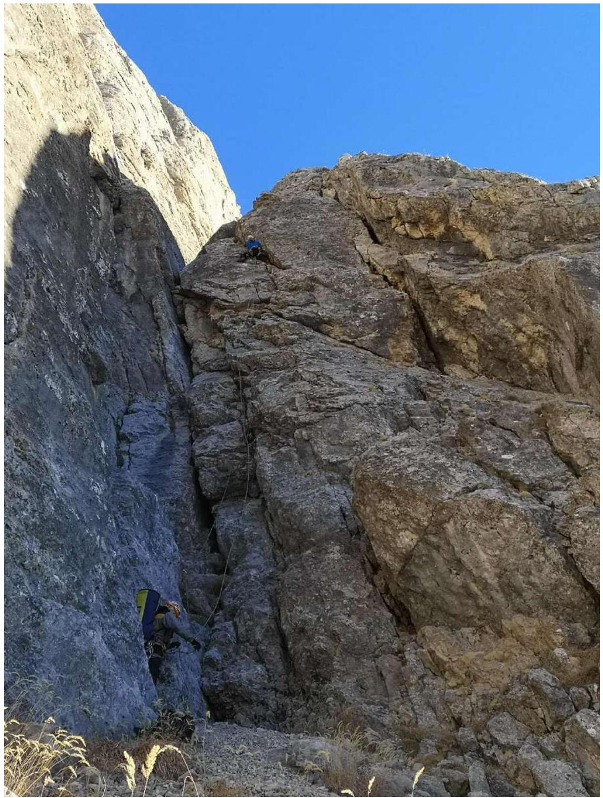 Photo 1. Start of the route.
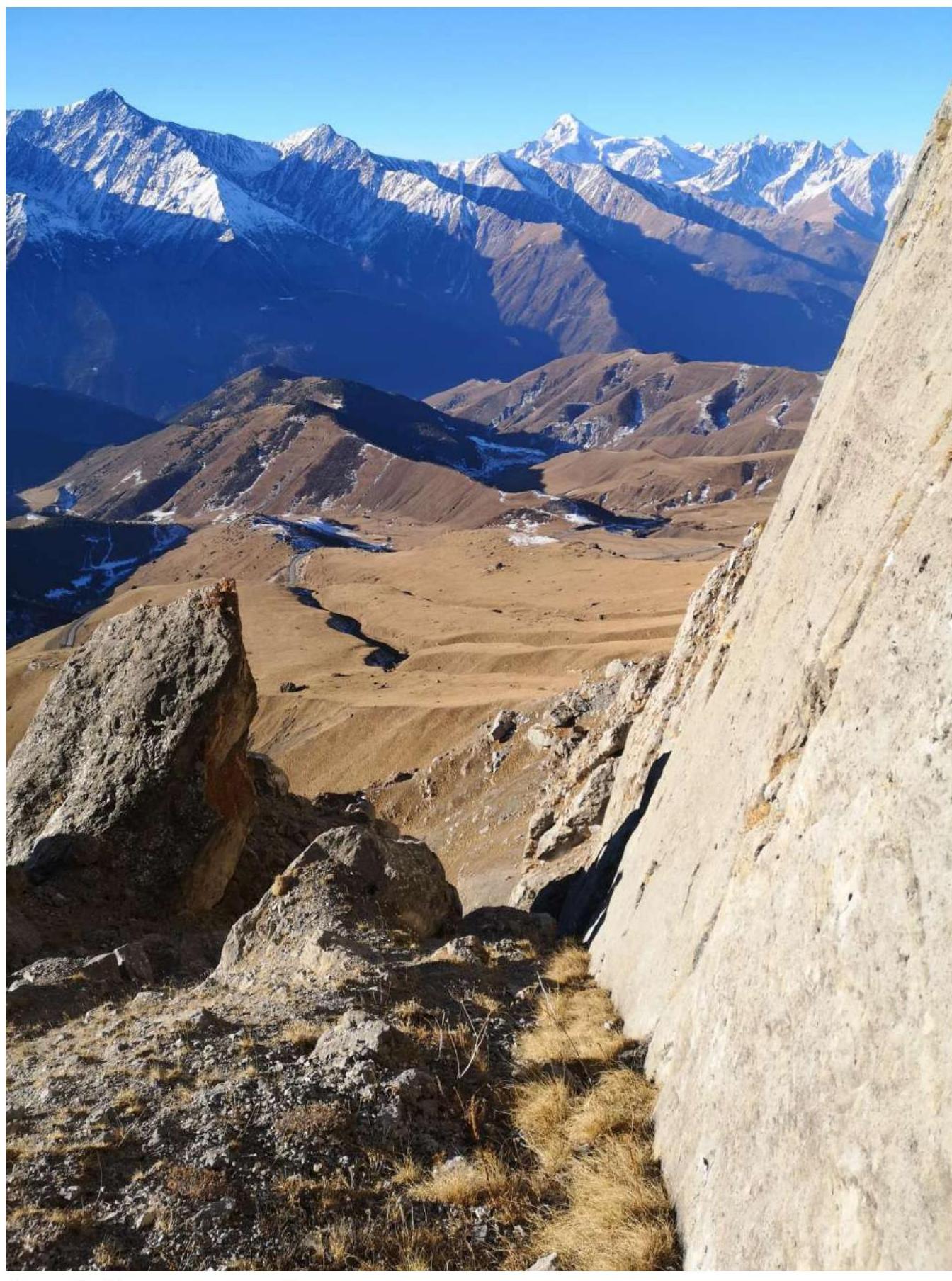 Photo 2. Shelf on the second rope.
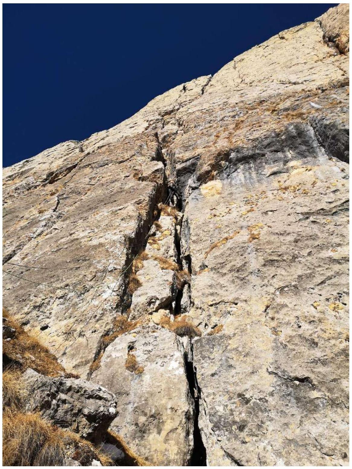 Photo 3. Start of the chimney.
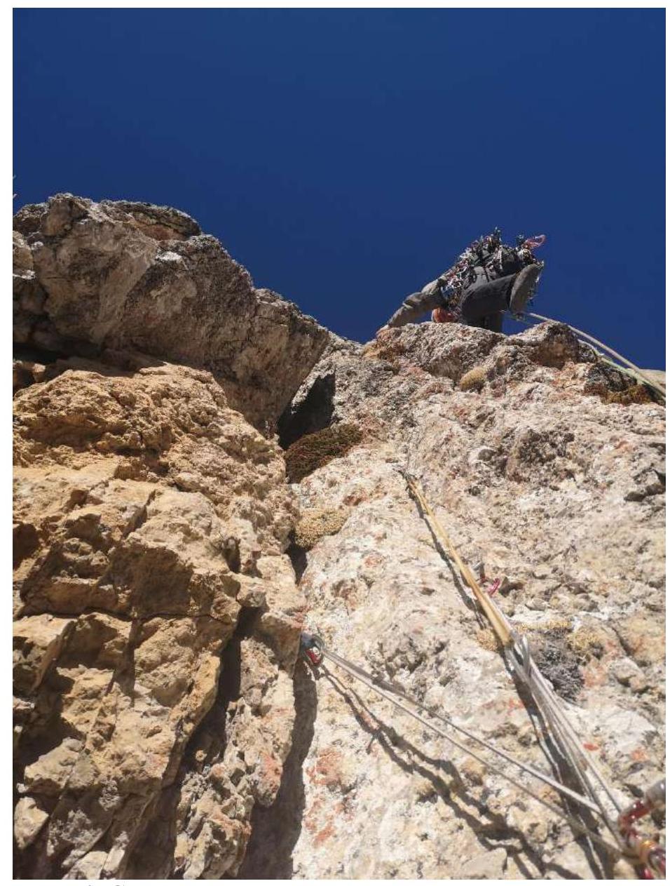 Photo 4. Station at the fork of the chimney.
 Photo 5. Chimney.
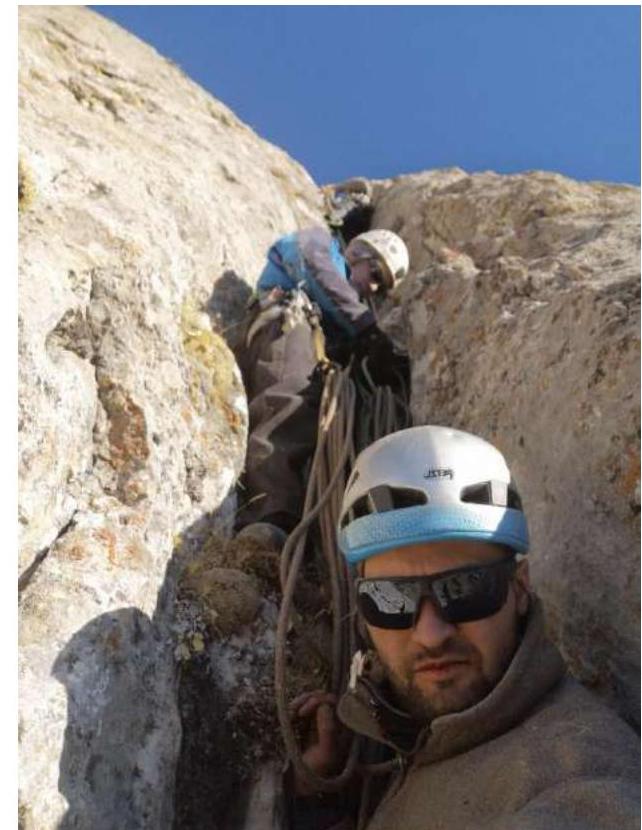 Photo 6. Station under the plug.
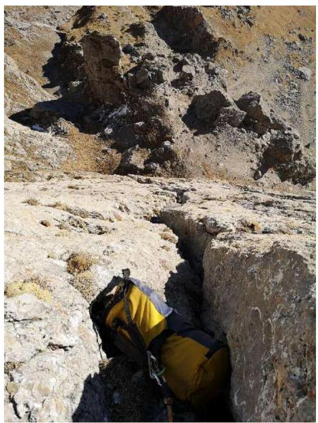 Photo 7. Station under the plug, view down.
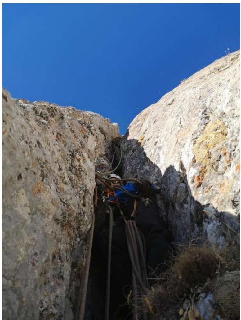 Photo 8. Plug.
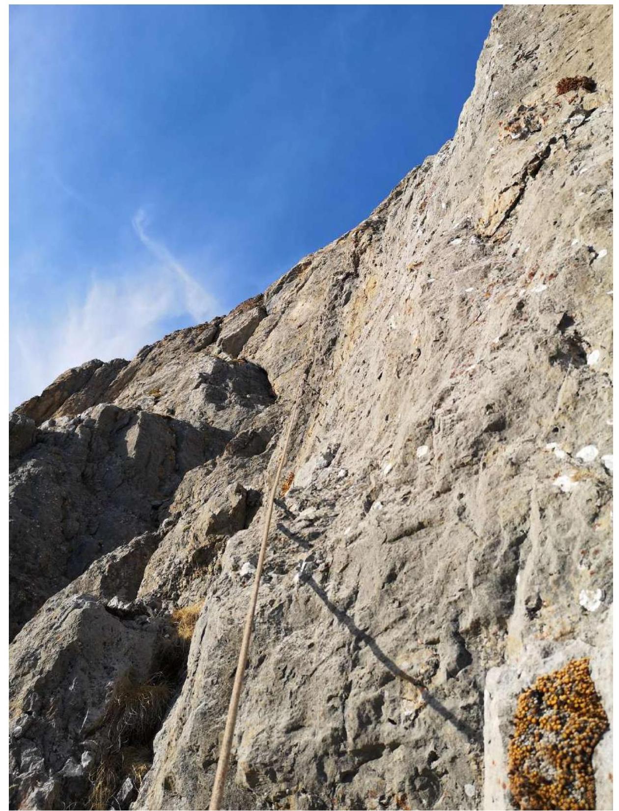 Photo 9. After the chimney.
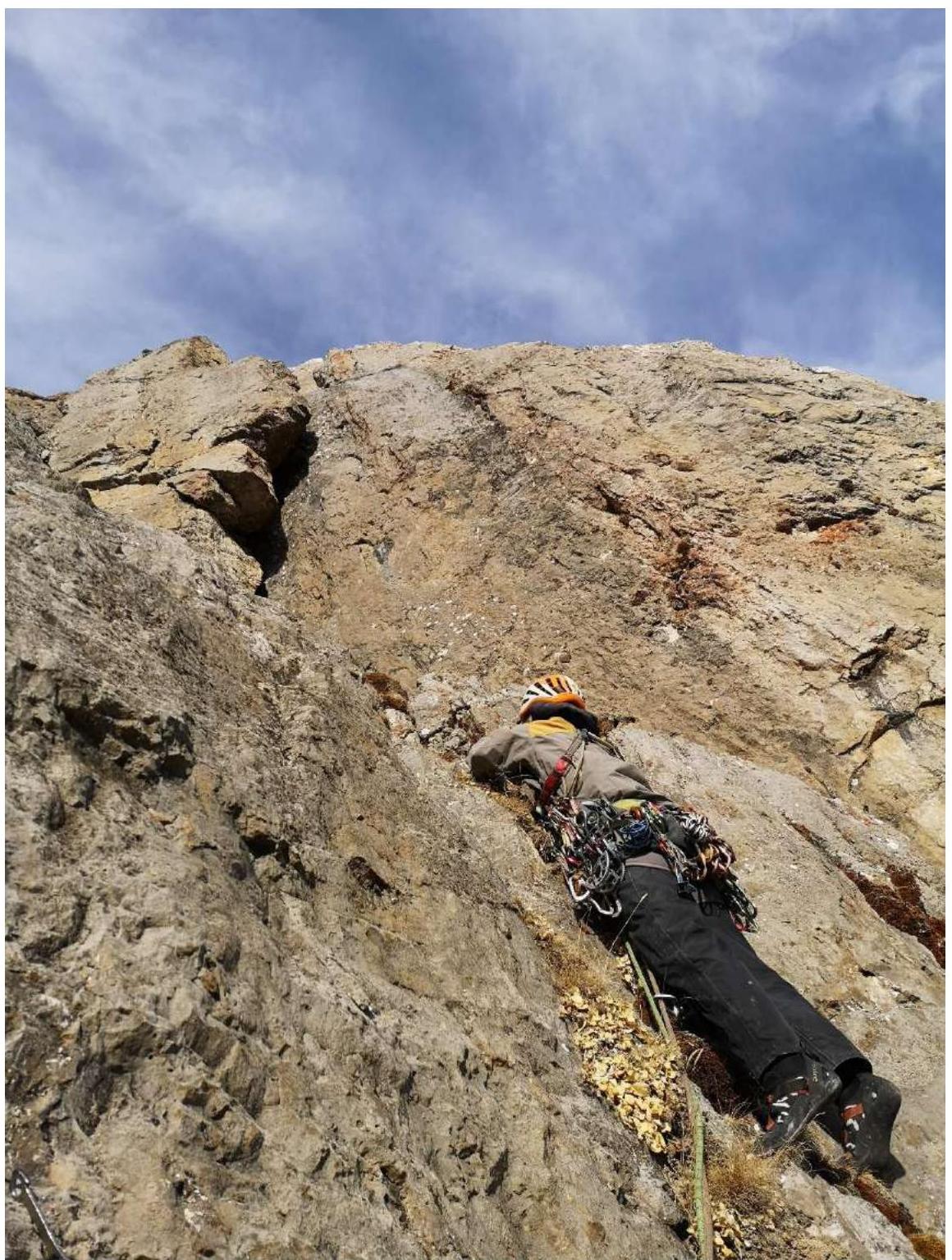 Photo 10. Start of internal corners.
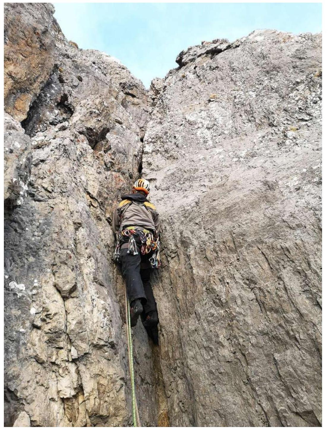 Photo 11. Internal corner on the 7th rope. View from station R6.
 Photo 12. End of the seventh rope. Exit to the couloir.
Comments
Sign in to leave a comment