
Report
ON THE FIRST ASCENT TO THE SUMMIT ЗУБ (2986 m) VIA THE ROUTE THROUGH THE CENTER OF THE RIGHT BASTION («Зуб на Зуб») CATEGORY 4B BY A TEAM FROM ROSTOV REGION ON MAY 8, 2021
I. Ascent Passport
| 1. General Information | ||
|---|---|---|
| 1.1 | Full Name, Sports Rank of the Leader | Vasiliev Andrei Sergeevich, MS |
| 1.2 | Full Name, Sports Rank of Participants | Sapotnitsky Yuri Grigorievich, 1st sports rank |
| 1.3 | Full Name of Coach | |
| 1.4 | Organization | a/c «Planeta» |
| 2. Characteristics of the Ascent Object | ||
| 2.1 | Region | From Kreстовый Pass to Шавиклде Peak |
| 2.2 | Valley | |
| 2.3 | Section Number according to the 2013 Classification Table | 2.9 |
| 2.4 | Name and Height of the Summit | Зуб, 2986 m |
| 2.5 | Geographical Coordinates of the Summit (Latitude/Longitude), GPS Coordinates | 42.831786, 44.846512 |
| 3. Route Characteristics | ||
| 3.1 | Route Name | Through the center of the right bastion, «Зуб на Зуб» |
| 3.2 | Proposed Category of Difficulty | 4B |
| 3.3 | Degree of Route Exploration | First Ascent |
| 3.4 | Nature of the Route Terrain | Rock |
| 3.5 | Height Difference of the Route (altimeter or GPS data) | 350 m |
| 3.6 | Route Length (in meters) | 425 m |
| 3.7 | Technical Elements of the Route (total length of sections with different categories of difficulty and terrain type (ice-snow, rock)) | II cat. diff. — 80 m. III cat. diff. — 110 m. IV cat. diff. — 55 m. V cat. diff. — 170 m. VI cat. diff. — 10 m. |
| 3.8 | Average Steepness of the Route, (°) | 70° |
| 3.9 | Average Steepness of the Main Part of the Route, (°) | 70° |
| 3.10 | Descent from the Summit | Traverse to the west to the lower part of Kozorezov's route 1B on Цей-Лоам, n/c |
| 3.11 | Additional Route Characteristics | No water |
| 4. Characteristics of the Team's Actions | ||
| 4.1 | Time of Movement (team's walking hours, in hours and days) | 7 h 20 min |
| 4.2 | Overnights | — |
| 4.3 | Time of Route Processing | — |
| 4.4 | Start on the Route | May 8, 2021, 06:40 |
| 4.5 | Reach the Summit | May 8, 2021, 14:00 |
| 4.6 | Return to the Base Camp | May 8, 2021, 15:40 |
| 6. Person Responsible for the Report | ||
| 6.1 | Full Name, e-mail | Vasiliev A.S., andre.vasiliev@gmail.com |
1. Characteristics of the Ascent Object
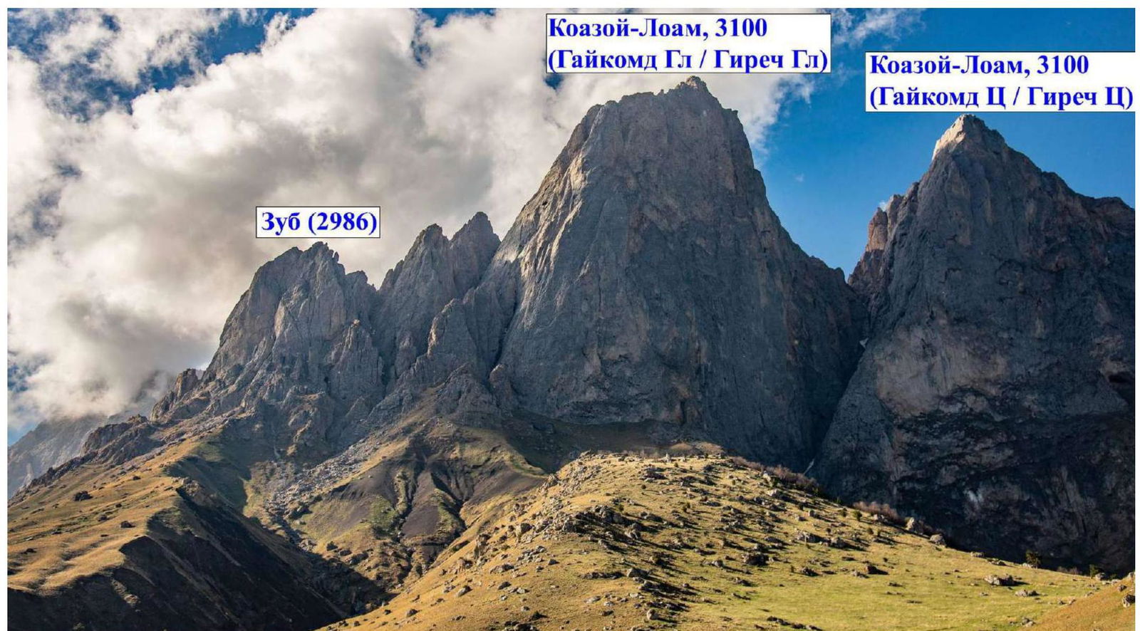
1.1. General Photo of the Summit
 1.2. Photopanorama of the Area
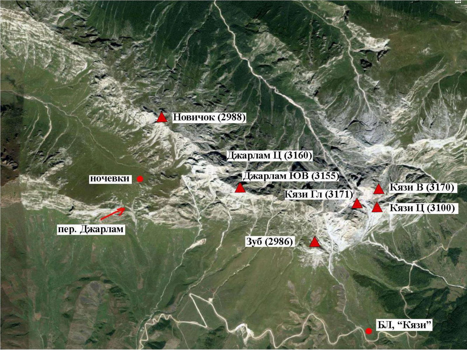
 1.3. Map of the Area
2. Route Characteristics
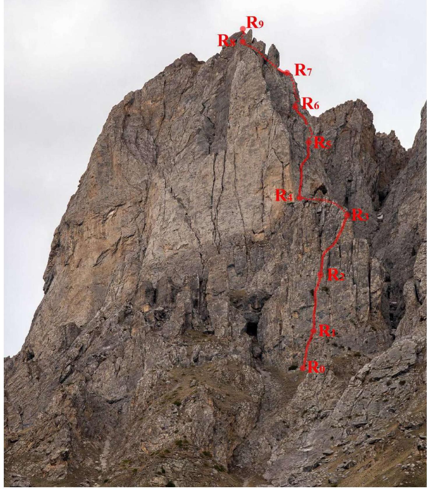
2.1. Technical Photograph of the Route
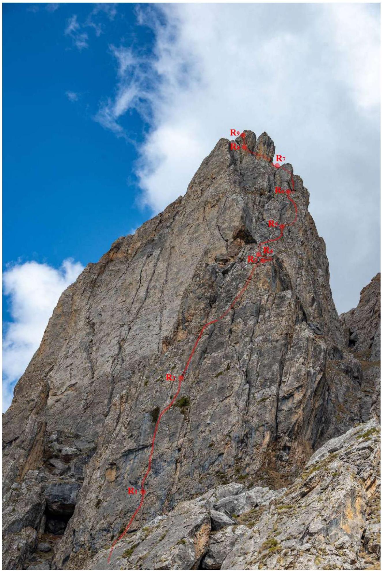
 2.2. Route Profile and Technical Photograph #2
2.3. Route Diagram in UIAA Symbols
Second Bastion
| Section # | Friends | Nuts | Anchor Bolts | UIAA Symbols | Technical Description of the Section |
|---|---|---|---|---|---|
| R8–R9 | 2 / 0 | 15 m, 80°, 4 | |||
| R7–R8 | 2 / 0 | Route through a series of chimneys 4A starts here | 55 m, 50°, 3 | ||
| R6–R7 | 3 / 0 | 1 / 0 | 4 / 0 | 55 m, 70°, 5 | |
| R5–R6 | 1 / 0 | 20 m, 50°, 3 | |||
| 3 / 0 | 10 m, 75°, 5 (5b–5c max) | ||||
| 1 / 0 | 15 m, 50°, 3 | ||||
| R4–R5 | 3 / 0 | 25 m, 65°, 4 | |||
| 6 / 1 | 2 / 0 | 30 m, 80°, 5 (6a+ max) |
First Bastion
| Section # | Friends | Nuts | Anchor Bolts | UIAA Symbols | Technical Description of the Section |
|---|---|---|---|---|---|
| R3–R4 | 1 / 0 | Ledge at the base of the SE ridge 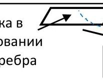 | 70 m, 40°, 2 | ||
| R2–R3 | 3 / 0 | 1 / 0 | 1 / 0 |  | 35 m, 80°, 5 |
| 15 m, 80°, 5 (6a max) | |||||
| R1–R2 | 2 / 0 | 1 / 0 | 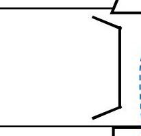 | 15 m, 65°, 4 | |
| 6 / 0 | 1 / 0 | 2 / 0 | 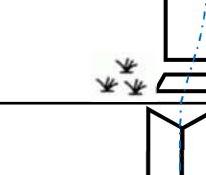 | 15 m, 85°, 5 10 m, 90°, 6 (6a+–6b max) | |
| R0–R1 | 1 / 0 | 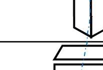 | 20 m, 60°, 3 | ||
| 2 / 0 | 1 / 0 | 10 m, 80°, 5 (5b–5c max) | |||
| 1 / 0 | 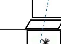 | 10 m, 50°, 2 |
3. Characteristics of the Team's Actions
3.1 Route Description
| Section # | Description | Photo # |
|---|---|---|
| R0–R1 | The route starts on the left side of a wide grassy ledge at the base of the steep bastion of the SE ridge. Begin on a simple grassy inner corner, then 10 m up a steep wall with careful climbing (much grass) and 20 m up grassy ledges to the base of a steep inner corner. Here is the belay station. The rope looks much simpler than it actually is. 10 m, 50°, 2; 10 m, 80°, 5; 20 m, 60°, 3 (5c max) | Photo 1 |
| R1–R2 | Up under an overhanging bulge. It's more convenient to climb through the right crack, with difficult climbing. The terrain then becomes easier. Climb through the crack — sometimes a narrow chimney — to the bend 25 m with difficult climbing (key section). Then move right and up with simpler climbing to the base of a wide (3 m) chimney. At the end of the vertical crack, on the left wall, there is ivy growing, which is clearly visible from afar and serves as a clear landmark for the route. Belaying is mostly on friends. The first 5 m are the most difficult, with problems organizing reliable protection — on "sloppy" anchors. 10 m, 90°, 6; 15 m, 85°, 5; 15 m, 65°, 4 (6a+–6b max) | Photo 2 |
| R2–R3 | Climb the chimney with interesting climbing, finding good, convenient holds, 25 m. Then a small ledge. Continue through a system of inner corners, with easier climbing, but loose rocks are encountered in the cracks. Belay station on a convenient grassy ledge 15 m, 80°, 5; 35 m, 80°, 5 (6a max) | Photo 3 |
| R3–R4 | Climb simply through grassy ledges and a ridge to reach the summit of a rocky "tooth" at the base of the SE ridge. Belay station on a convenient ledge at the base of a narrow vertical chimney. 70 m, 40°, 2. | Photo 4 |
| R4–R5 | Climb the narrow chimney up 8 m, then the chimney narrows and turns into a system of inner corners, interspersed with ledges. After 30 m, through a small overhang, reach a grassy ledge. On the ledges, move right and up 10 m to a gentle chimney. Above it, belay station at the base of a large steep chimney. 30 m, 80°, 5; 25 m, 65°, 4 (6a+ max) | Photo 5 |
| R5–R6 | Move right around the corner through a simple grassy inner corner, past a stone wedged against the wall. Then on a grassy ledge to the right. From the right part of the ledge, climb up, with the climbing gradually becoming more difficult | |
| R5–R6 | There is much grass underfoot, and it's slippery. Reach a wide grassy terrace. On it, 20 m to the belay station. Belay station on a shoulder to the right of the steep inner corner. The route is not obvious, and it's possible to climb different variations. 15 m, 50°, 3; 10 m, 75°, 5; 20 m, 50°, 3 (5b–5c max) | |
| R6–R7 | On the ledge, move right 5 m through wedged blocks to an inner corner. Climb the vertical inner corner 10 m with careful climbing (there is "live" rock) to a ledge, then straight up to the next inner corner-chimney. Inside it, climb unpleasantly (it's better to move with opposition, not loading the holds "on yourself" as the rock is destroyed), with poor protection. Exit through a "plug" and the right wall to the next grassy ledge to the belay station on a rocky outcrop with anchors. This is the most unpleasant rope on the route. It would be good to clean it of "live" rock. 55 m, 70°, 5. | Photo 6 |
| R7–R8 | Through grassy ledges and a short wall, bypass steep rocks, to reach the saddle (connection with 4A). 55 m, 50°, 3. | Photo 7 |
| R8–R9 | A short simple wall leads to the summit. 15 m, 80°, 4. | Photo 8 |
For protection, friends of medium size and anchors work well. All belay stations are on their own points. There are sections with destroyed rock and slippery grass where you need to be careful.
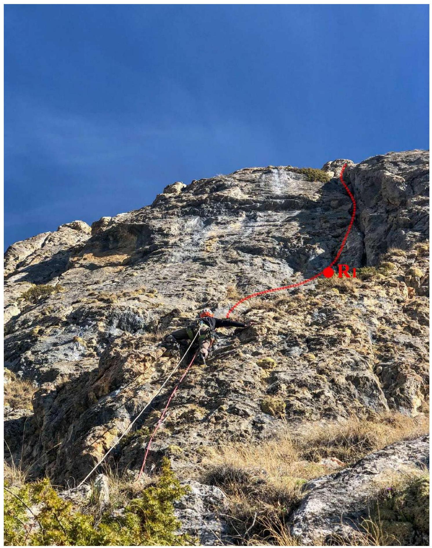
Photo 1. Start of the route.
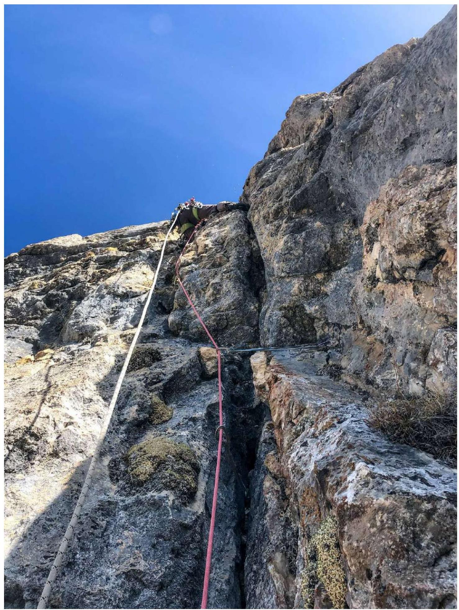
Photo 2. Second rope. Key section.

Photo 3. Third rope. Wide chimney.
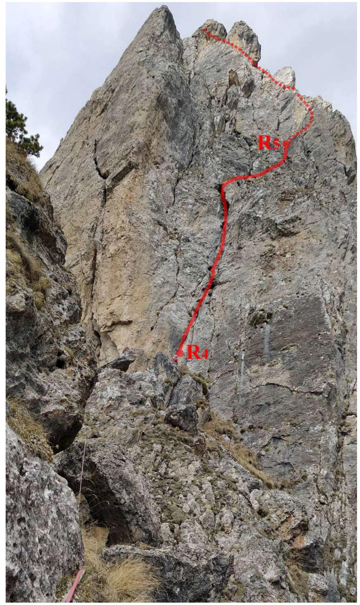
Photo 4. Fourth rope and view of the second bastion.
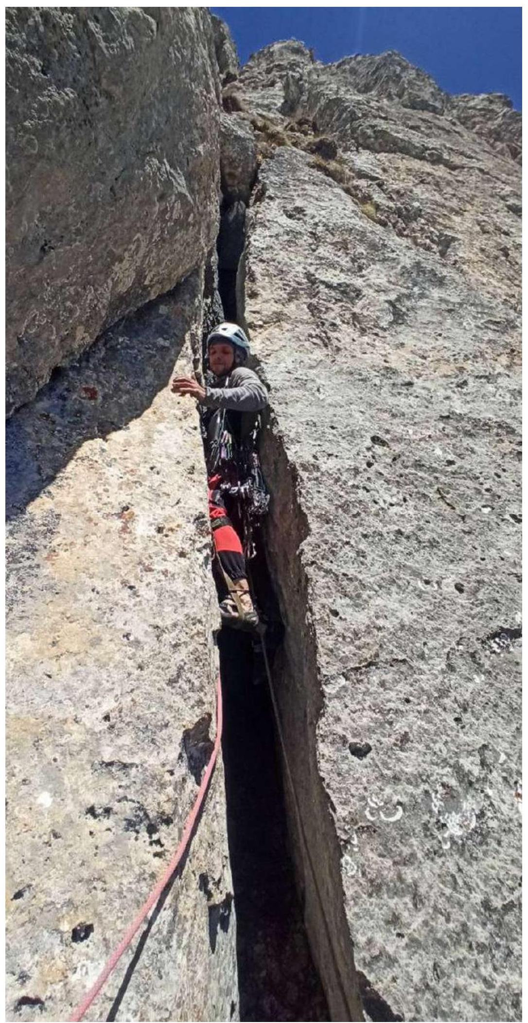
Photo 5. Fifth rope. Narrow chimney. Difficult for the thick :)
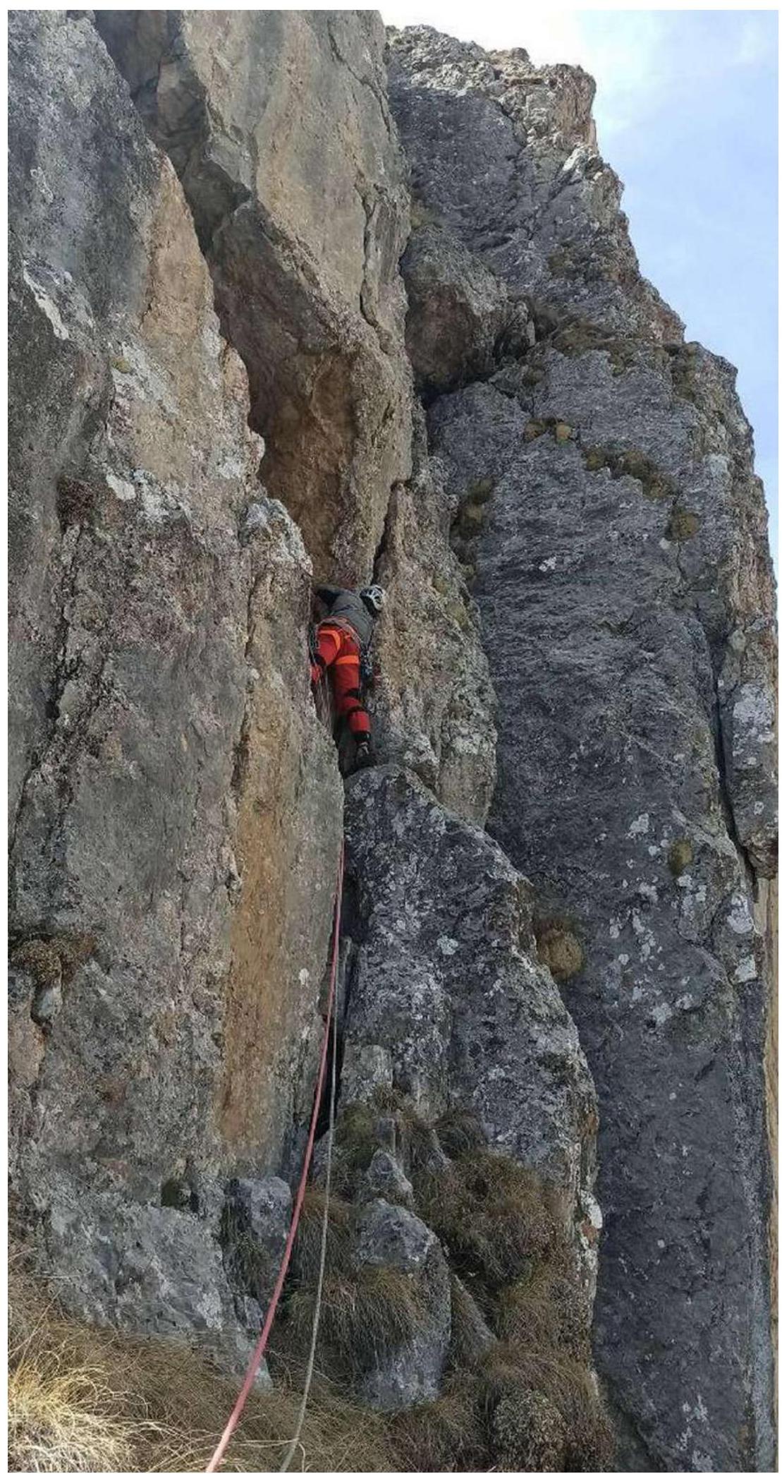
Photo 6. Seventh rope. Second key section.
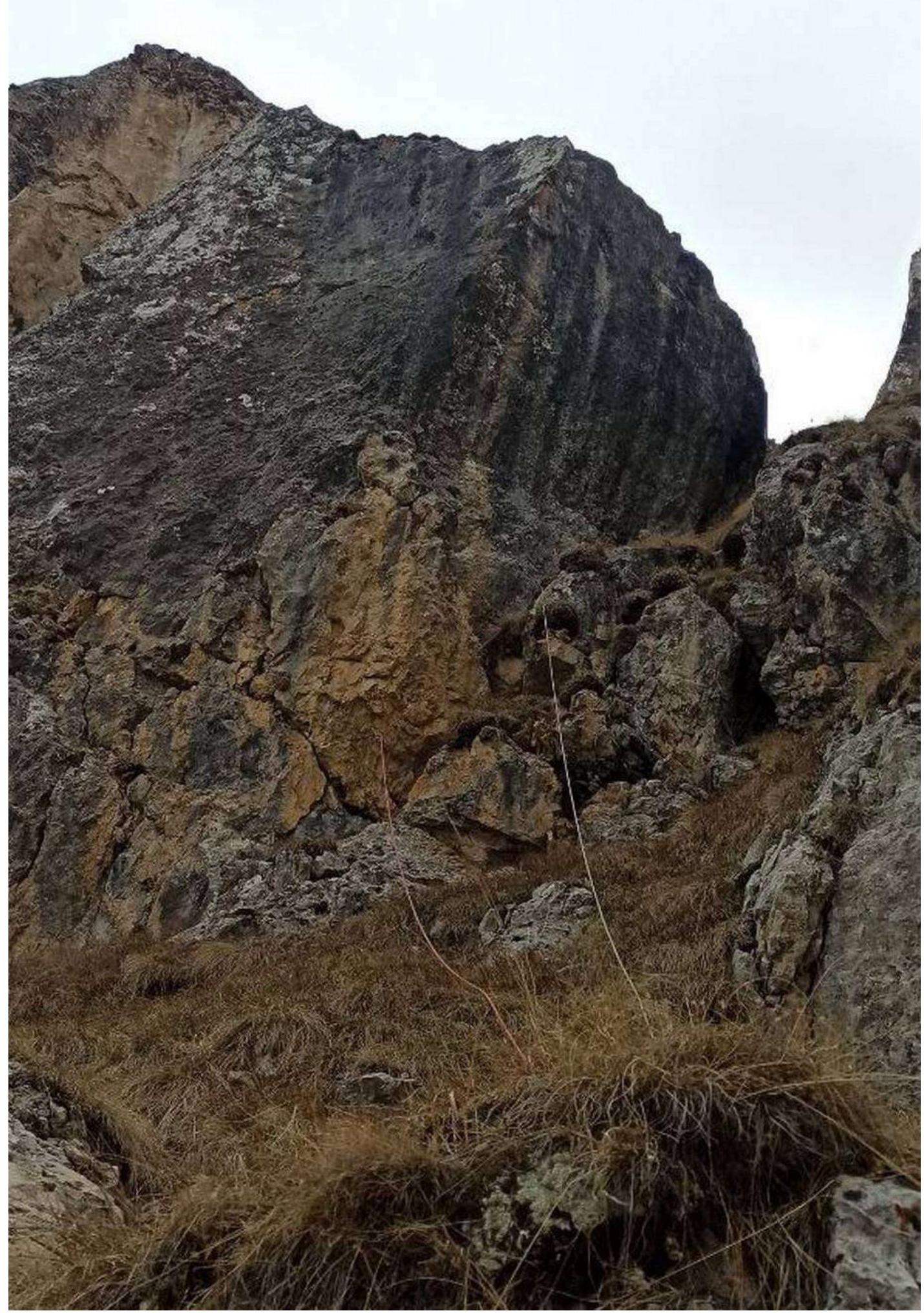
Photo 7. Eighth rope. Roof.

Photo 8. Exit to the summit.
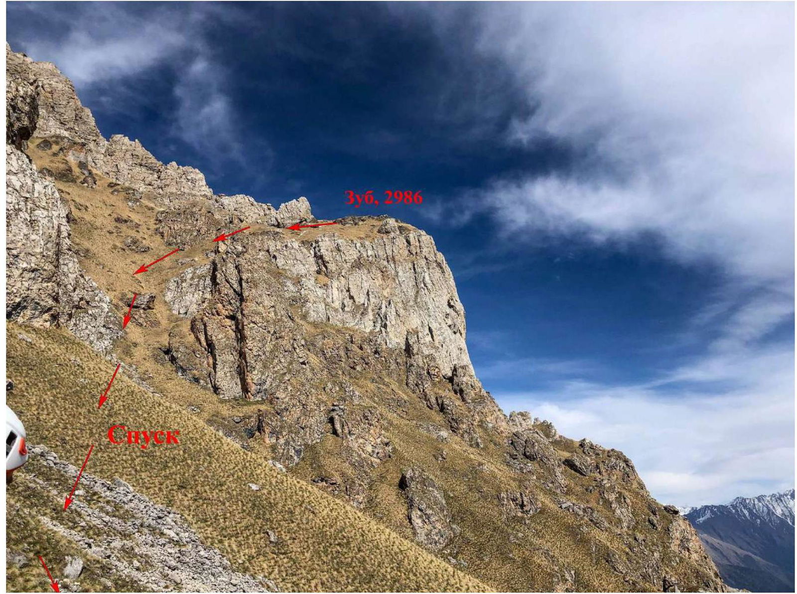
Photo 9. Descent from the summit.
3.2 Photo of the Team on the Summit with the Control Tour

3.3. Route Assessment
The route is technically difficult for its category. The key sections significantly exceed the complexity of the Donskov route on Коазой-Лоам category 4B and correspond to the Crimean fifth category on the Форосский кант. It's convenient for warming up before more difficult ascents. The lower part of the route from point R0 is logical.
The upper part of the route, after R5, is a series of grassy ledges and inner corners; here, many variations are possible, but we tried to follow the simplest path.
Impressions of the second ascenders (Vasiliev I.V. — Kravchenko I.A., 1st sports rank, May 9, 2021): «In this area, besides this route, we climbed two category 4 routes:
- 4A through a series of chimneys on Зуб Peak
- 4B Donskov on Коазой-Лоам Peak
The new route on Зуб is interesting, logical, and quite complex. It's an order of magnitude more complex than 4A through a series of chimneys (they have one similar short rope) and more complex than 4B Donskikh in terms of climbing, but shorter. We think that the new route on Зуб corresponds to category 4B».