
REPORT ON THE ASCENT TO THE SUMMIT TRAVERSE DZharlam CENTRAL 3160 m – DZharlam SOUTH-EAST 3155 m VIA THE ROUTE ALONG THE COUNTERFORT OF THE SOUTHERN WALL AND THE WESTERN RIDGE, FOR CATEGORY COMPLEXITY. BY THE TEAM OF ALPINE CAMPS MANAGEMENT FOR THE PERIOD FROM May 9, 2024 TO May 9, 2024.
2024
I. Ascent Passport
1. General Information
| No. | 1. General Information | |
|---|---|---|
| 1.1 | Full Name, Sports Rank of the Leader | Chikin Artyom Borisovich CMS |
| 1.2 | Full Name, Sports Rank of Participants | Bautin Alexey 3rd sports rank, Ismagilov Anton 3rd sports rank, Sigaleva Tatyana 3rd sports rank, Larina Valeria 3rd sports rank. |
| 1.3 | Full Name of Coach | Yakovenko Alexander Nikolaevich, MS |
| 1.4 | Organization | Alpine Camps Management |
2. Characteristics of the Ascent Object
| No. | ||
|---|---|---|
| 2.1 | Region | 2.9. From the Krestovy Pass to the Shaviklde peak |
| 2.2 | Valley | Armhi |
| 2.3 | Number of Section According to the Classification Table of 2013 | 11,9 |
| 2.4 | Name and Height of the Summit | DZharlam (Central), 3160 m – DZharlam SE, 3155 m |
| 2.5 | Geographical Coordinates of the Summit (Latitude/Longitude), GPS Coordinates | – |
3. Characteristics of the Route
| No. | ||
|---|---|---|
| 3.1 | Route Name | along the counterfort of the Southern wall and the Western ridge |
| 3.2 | Proposed Category of Complexity | 3А |
| 3.3 | Degree of Route Exploration | first ascent |
| 3.4 | Character of Route Relief | Rocky |
| 3.5 | Height Difference of the Route (altimeter or GPS data) | 400 m |
| 3.6 | Route Length (in meters) | 1130 m |
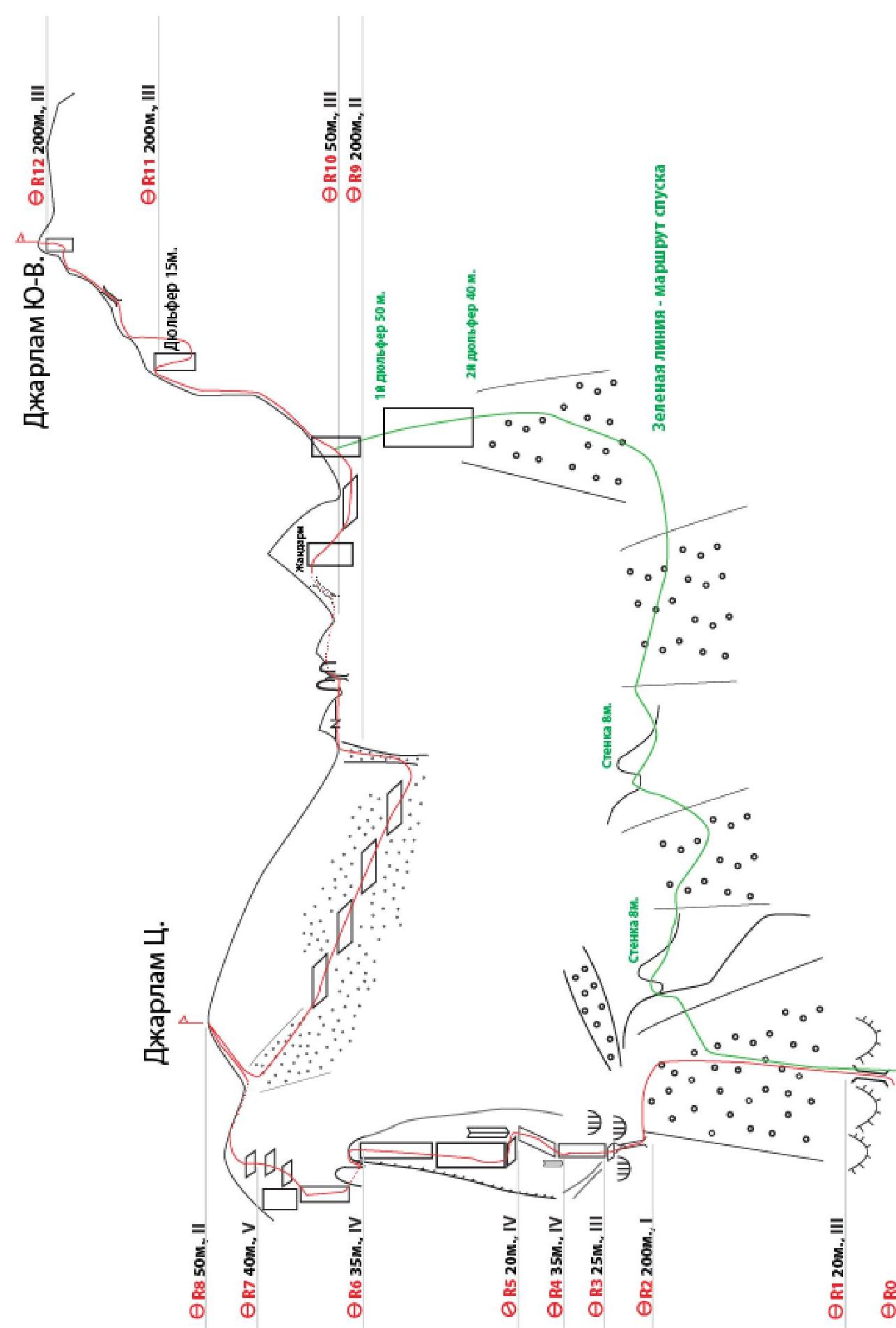
| 3.7 | Technical Elements of the Route (total length of sections of various complexity categories with indication of relief character (ice-snow, rocky)) | I cat. rocky — 350 m. II cat. rocky — 50 m. III cat. rocky — 590 m. IV cat. rocky — 100 m. V cat. rocky — 40 m. |
| 3.8 | Descent from the Summit | Via route 2B, along the Western ridge |
| 3.9 | Additional Route Characteristics | No water |
4. Characteristics of the Team's Actions
| No. | ||
|---|---|---|
| 4.1 | Time of Movement (team's traveling hours, in hours and days) | 13 h 40 min |
| 4.2 | Overnights | No |
| 4.3 | Departure on the Route | 04:20, May 9, 2024 |
| 4.4 | Arrival at the Summit | 13:20, May 9, 2024, 16:30, May 9, 2024 |
| 4.5 | Return to the Base Camp | 22:00, May 9, 2024 |
5. Responsible for the Report
| No. | ||
|---|---|---|
| 5.1 | Full Name, e-mail | Chikin Artyom Borisovich artem.chikin@mail.ru |
II. Description of the Ascent
1. Characteristics of the Ascent Object
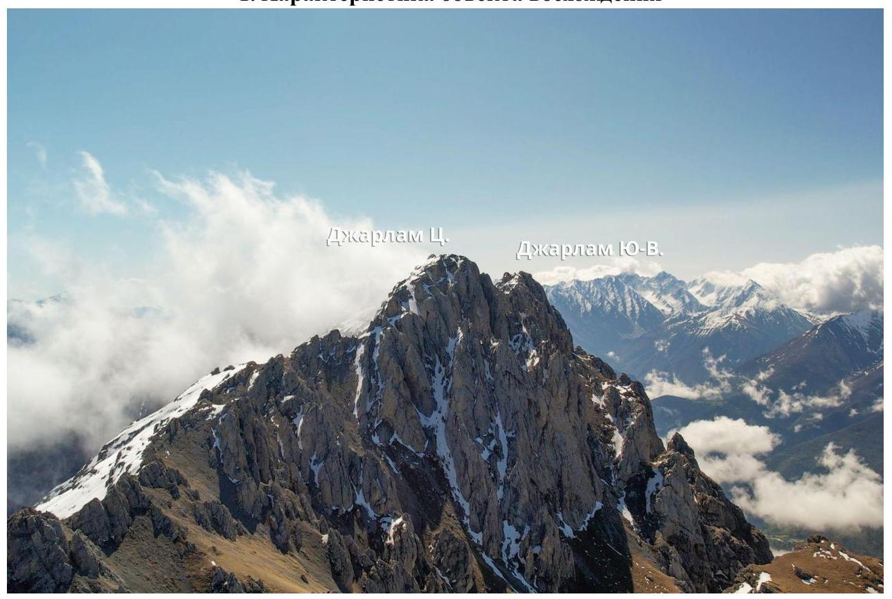
1.1. General Photo of the Summit
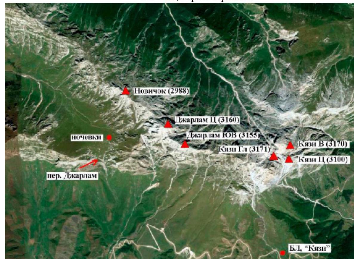
1.2. Map of the Region
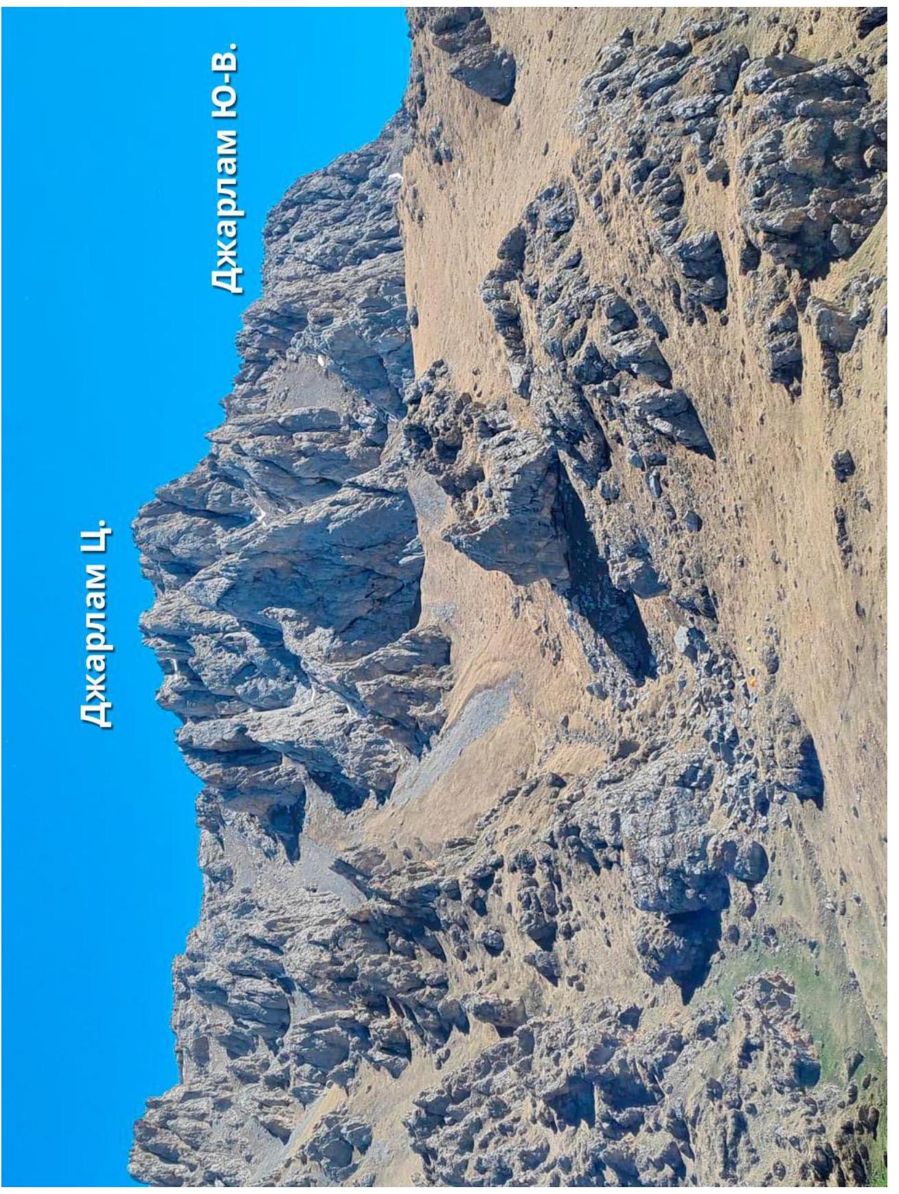
1.3. Photopanorama of the Region
2. Characteristics of the Route
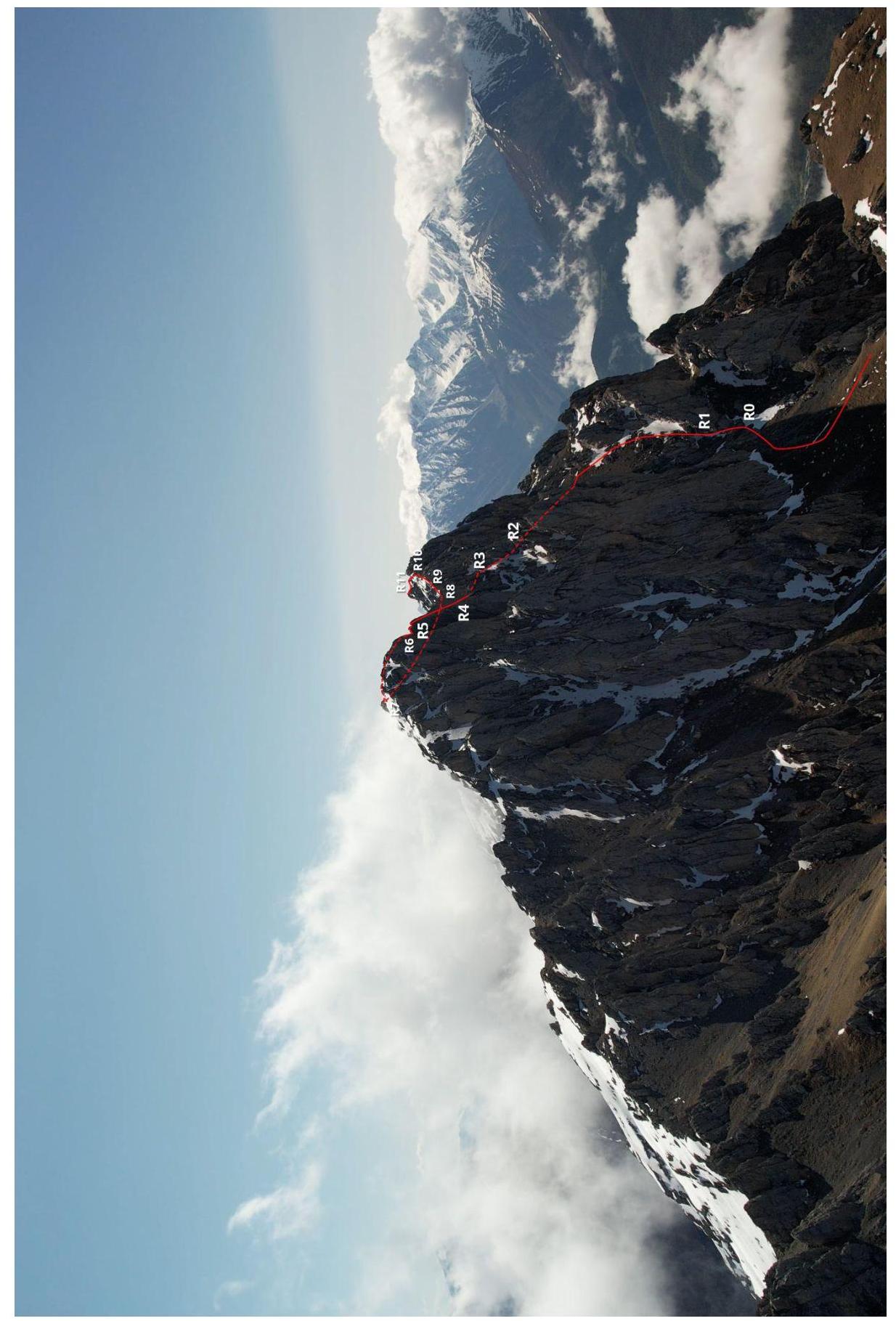
2.1. Technical Photograph of the Route
2.1.4. Route in UIAA Symbols
2.3. Technical Characteristics of Route Sections
| Section | Relief Character | cat. complexity | Length, m | Steepness | Type and Number of Pitons |
|---|---|---|---|---|---|
| R0–R1 | «Eggs» ram's foreheads, rocks | III+ | 25 m | 50° | 2 anchors, 1 friend |
| R1–R2 | Scree | I | 200 m | 20° | 0 |
| R2–R3 | Rocks, chimney | III | 25 m | 60° | hourglass, 1 anchor |
| R3–R4 | Rocks, wall | IV | 35 m | 75° | 3 anchors, 2 friends |
| R4–R5 | Rocks, wall | IV | 20 m | 60° | 2 anchors, 1 friend |
| R5–R6 | Rocks, wall | IV | 35 m | 80° | 4 anchors, 2 friends |
| R6–R7 | Rocks, wall | V | 40 m | 75° | hourglass, 4 anchors, 2 friends |
| R7–R8 | ridge, ledges | II | 50 m | 30° | 0 |
| R8–R9 | Scree, ledges | I–III | 200 m | 20°–45° | 0 |
| R9–R10 | Rocks, ridge, rappel | III | 200 m (15 m — rappel) | 40° | ledges |
| R10–R11 | Rocks, ridge, chimney | III–IV | 200 m | 40° | ledges |
| R11–R12 | Rocks, walls | III | 100 m | 40° | ledges |
3. Characteristics of the Team's Actions
3.1. Brief Description of Route Passage
| Section | Description | Photo Number |
|---|---|---|
| R0–R1 | Turn right from the DZharlam pass, move along the gully with a trail, then along the western wall to the right, through a small, simple rocky step to a small cirque in front of the ram's foreheads — «eggs». Climb through several options depending on the amount of snow and ice. It's easiest in the middle through a through hole or an inner corner-chimney. Station on a ledge. | Photo 1 |
| R1–R2 | Up the scree slope, enter the cirque, to the left is a chimney — the second climbing section. | Photo 2 |
| R2–R3 | Through the inner corner and through the chimney with a plug to a large ledge. Station on a large stone. | Photo 3 |
| R3–R4 | Up the wall to the right of the couloir in the direction of the inner corner in the left part of the wall. Station on hourglass, need to search for it. | Photo 4 |
| R4–R5 | Up to the right in the direction of the gap along the inclined slab and wall. Before the gap above a separate stone, station on a ledge. | Photo 4 |
| R5–R6 | Up to the left along the inclined ledge and further up the wall to the top of the counterfort. From it, descend 5 m and ascend 5 m to the next step. Station on a ledge or immediately on the first top of the counterfort or on the next one behind the corner. | Photo 4,5 |
| R6–R7 | Slightly down, step over to the wall. Better to set a belay point while still in a stance between the two sides of the counterfort. Climbing up and to the right, in the middle of the section hourglass with a loop. Further to the right along the destroyed ledge. Station on a ledge. | Photo 6 |
| R7–R8 | Along the scree ledges to the ridge, to the right is the DZharlam Ts. peak. | Photo 7 |
| R8–R9 | Start descending slightly below the summit to the southeast along the scree with small rocks from the walls. Reach the couloir leading to the ridge in front of the gendarme. | Photo 8 |
| R9–R10 | Along the ridge with a ledge for feet and along the top of the ridge, descend to a ledge. Further through a plug between two large stones-gendarmes to the northern side, slightly descend to the next ledge with a huge stone. Belay from ledges and bends of the ridge, possibly alternate and simultaneous movement. | Photo 9 |
| R10–R11 | Along the ledge to the inner corner-chimney, climb to the southern side of the ridge. Along the walls and ridge, mainly from the southern side, move to the gap in the ridge. From the top of the ridge, rappel 15 m to the southern side. You can leave one of the ropes here and jumaring on the return trip. | Photo 10,11,12 |
| R11–R12 | Along the ridge, sometimes from the south, sometimes from the north, along the way a smoothed chimney 6 m, approach under the summit tower, climb it from the west — along the way. | Photo 13 |
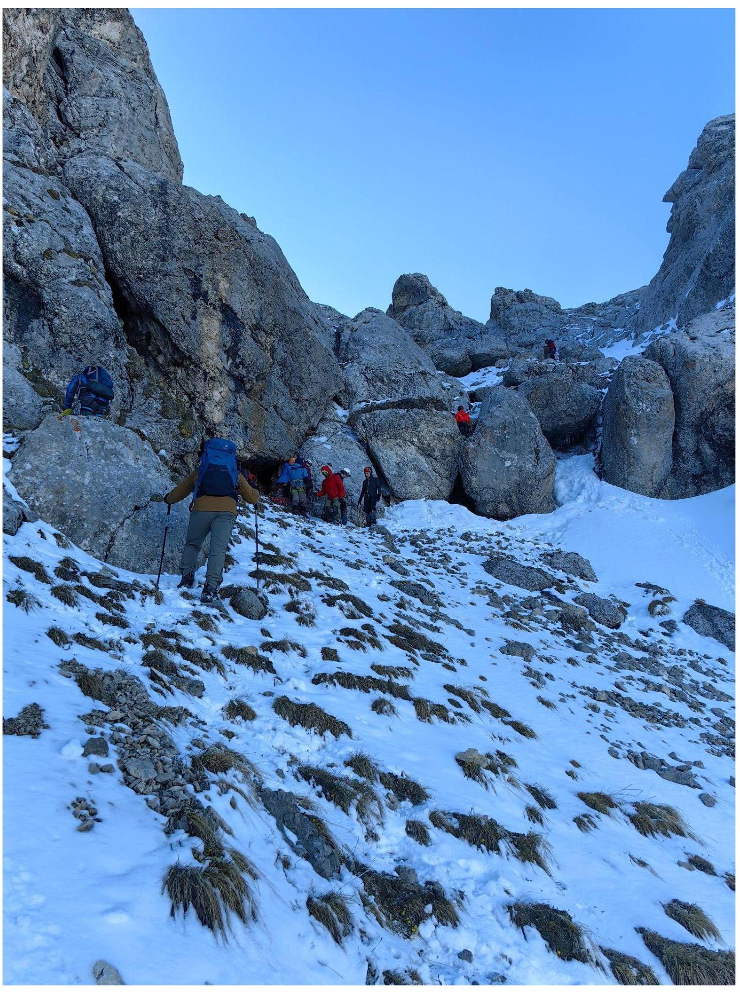
Photo 1. R0–R1
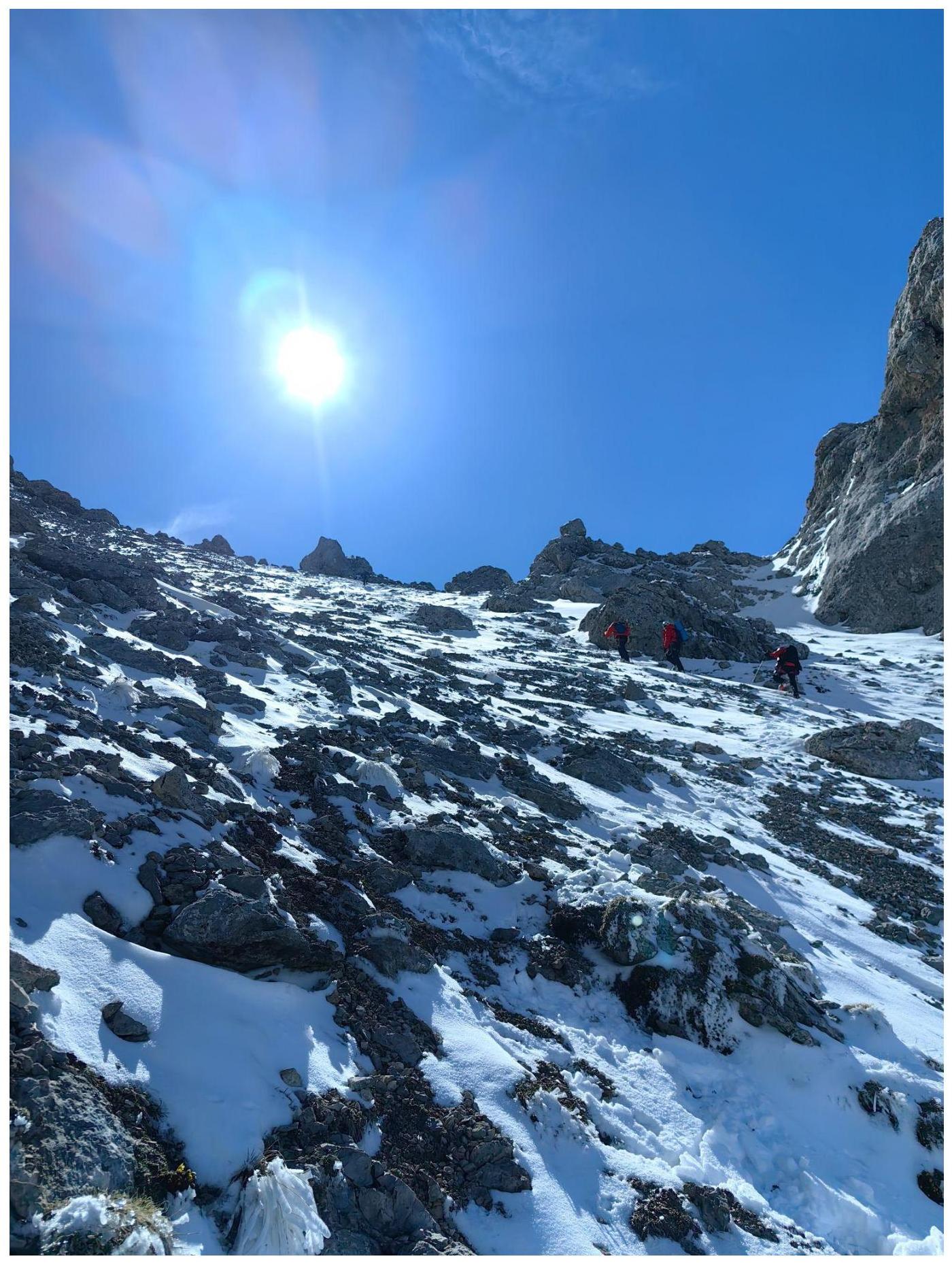
Photo 2. Section R1–R2
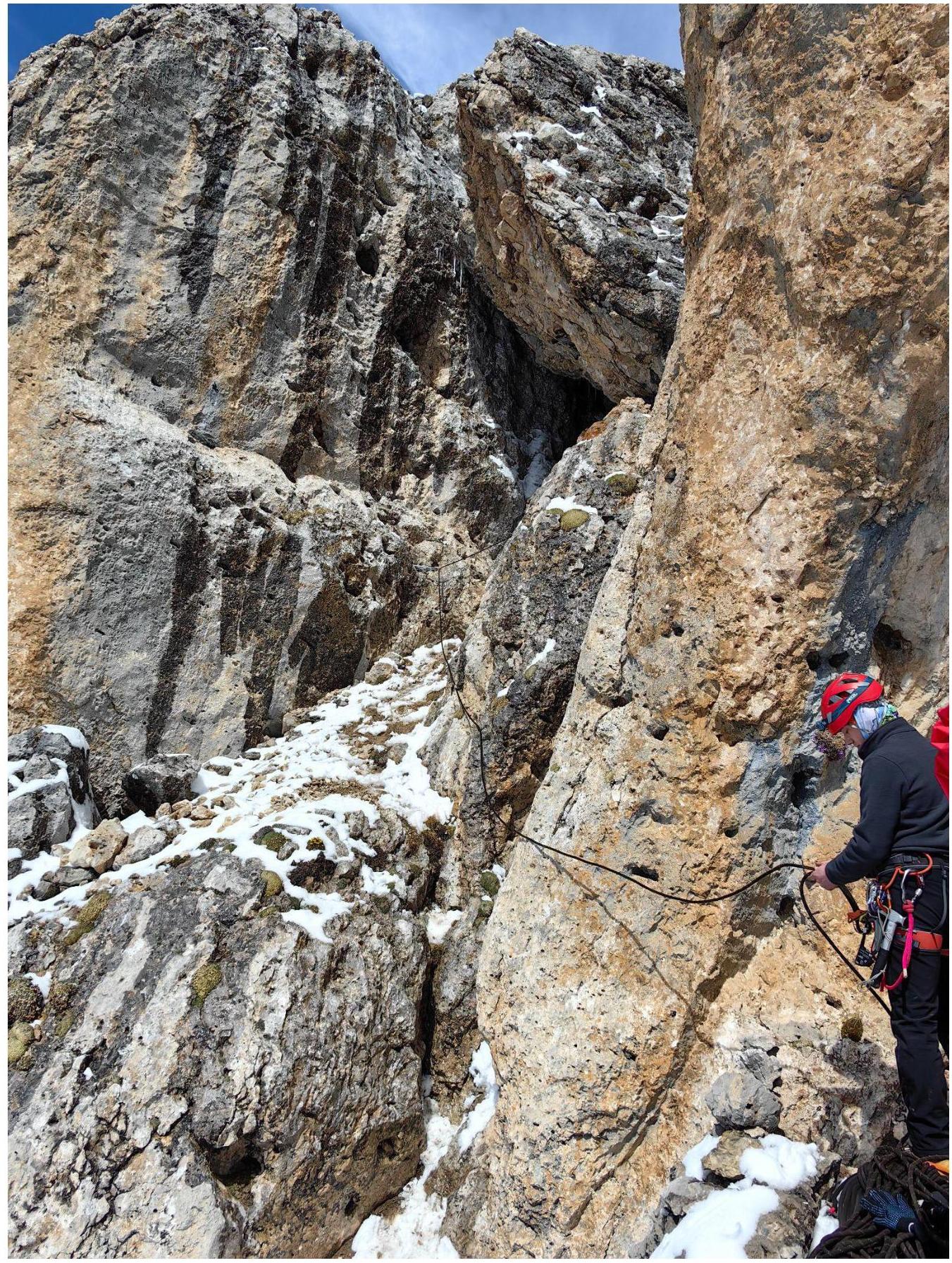
Photo 3. R2–R3
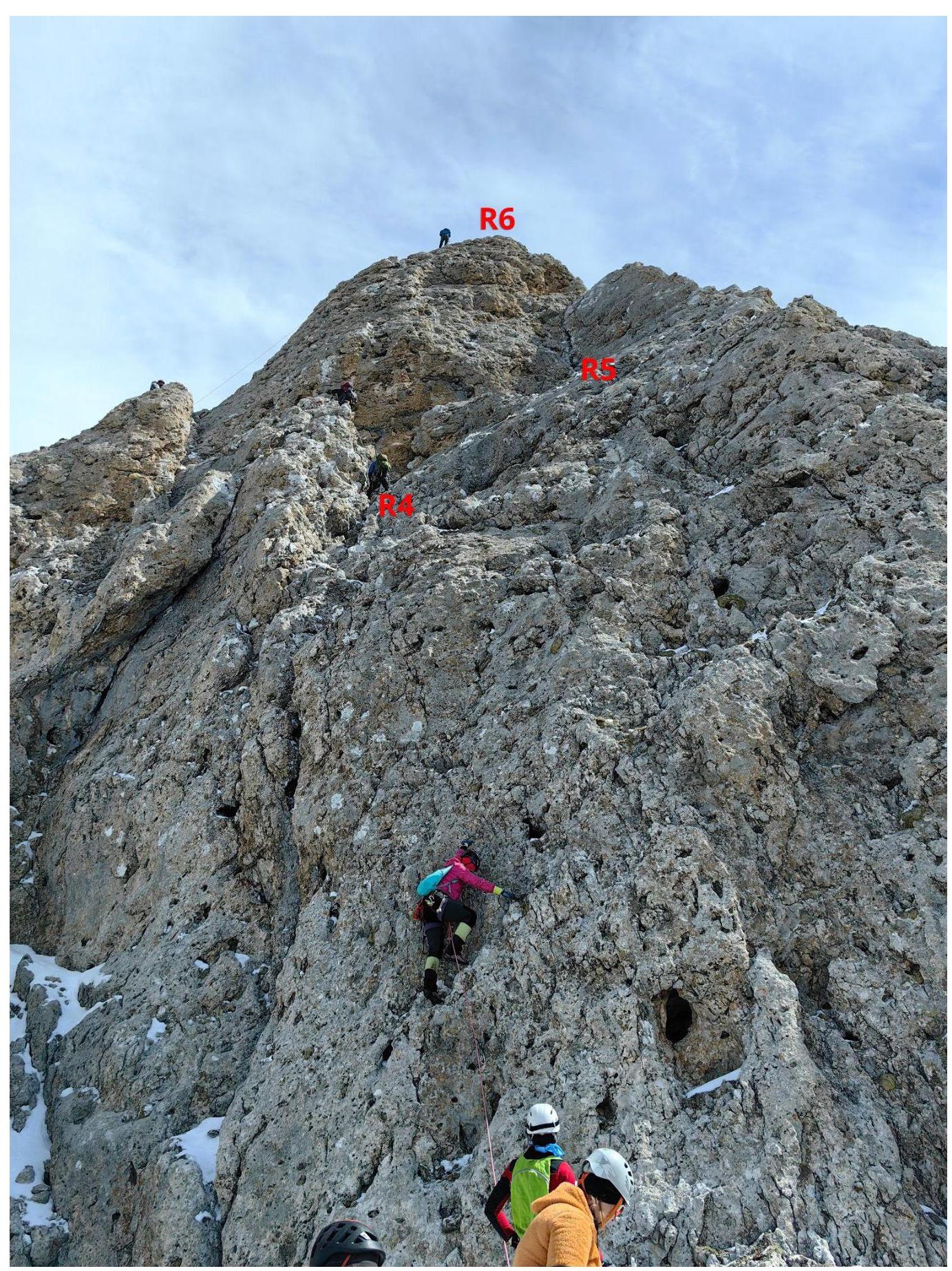
Photo 4. Sections R3–R4, R4–R5, R5–R6
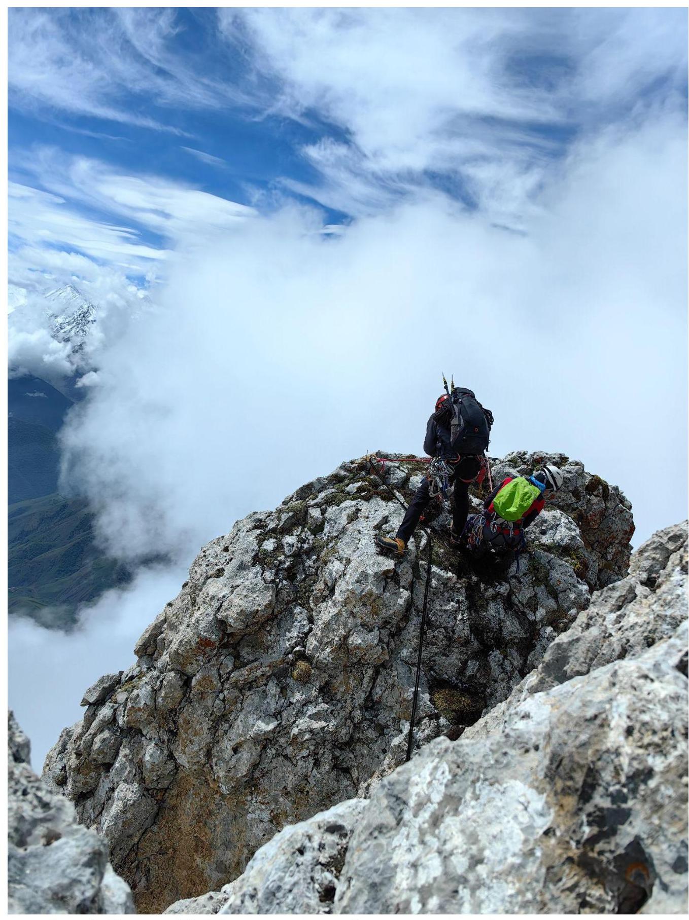
Photo 5. Section R5–R6, transition from the first top of the counterfort to the next
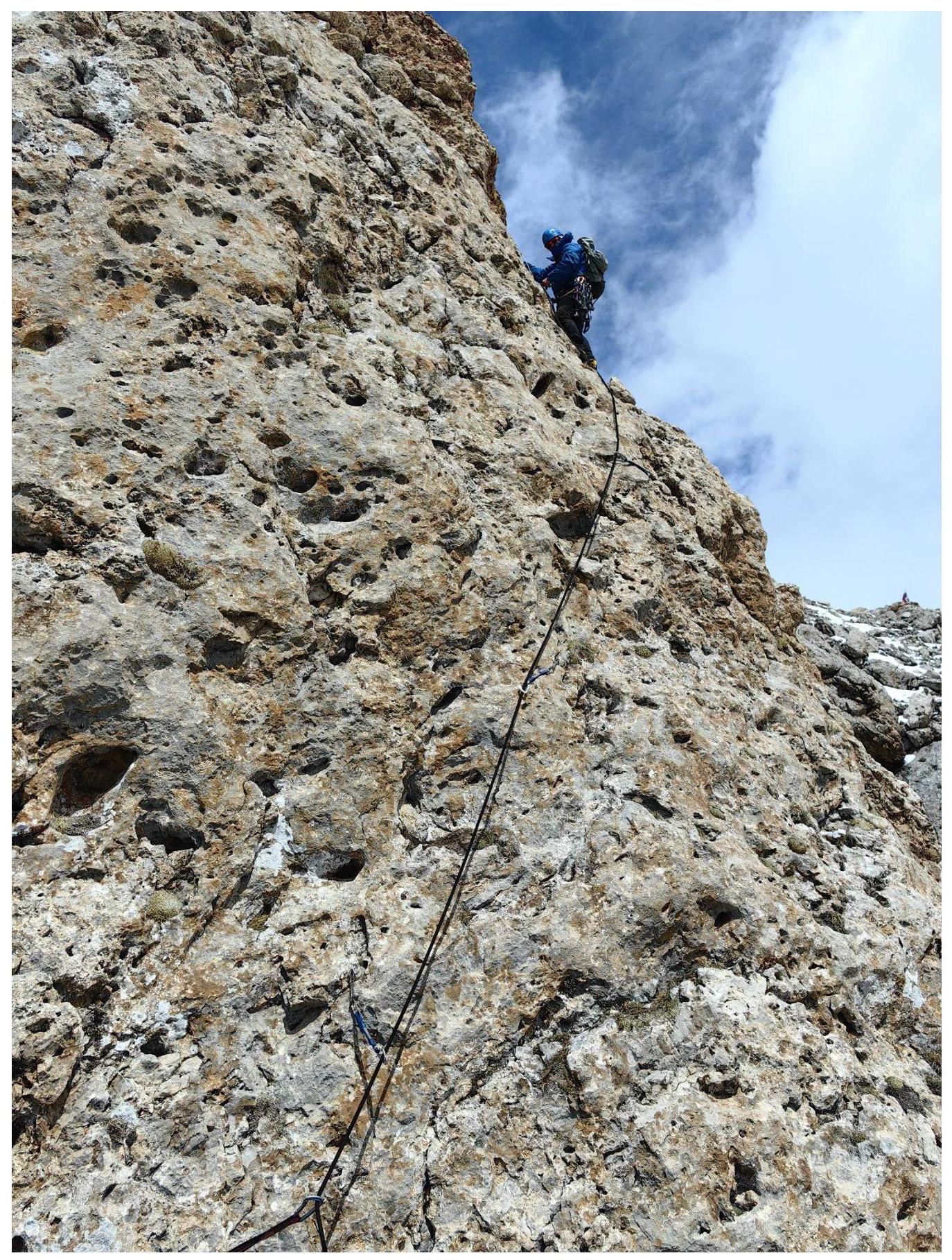
Photo 6. Section R6–R7
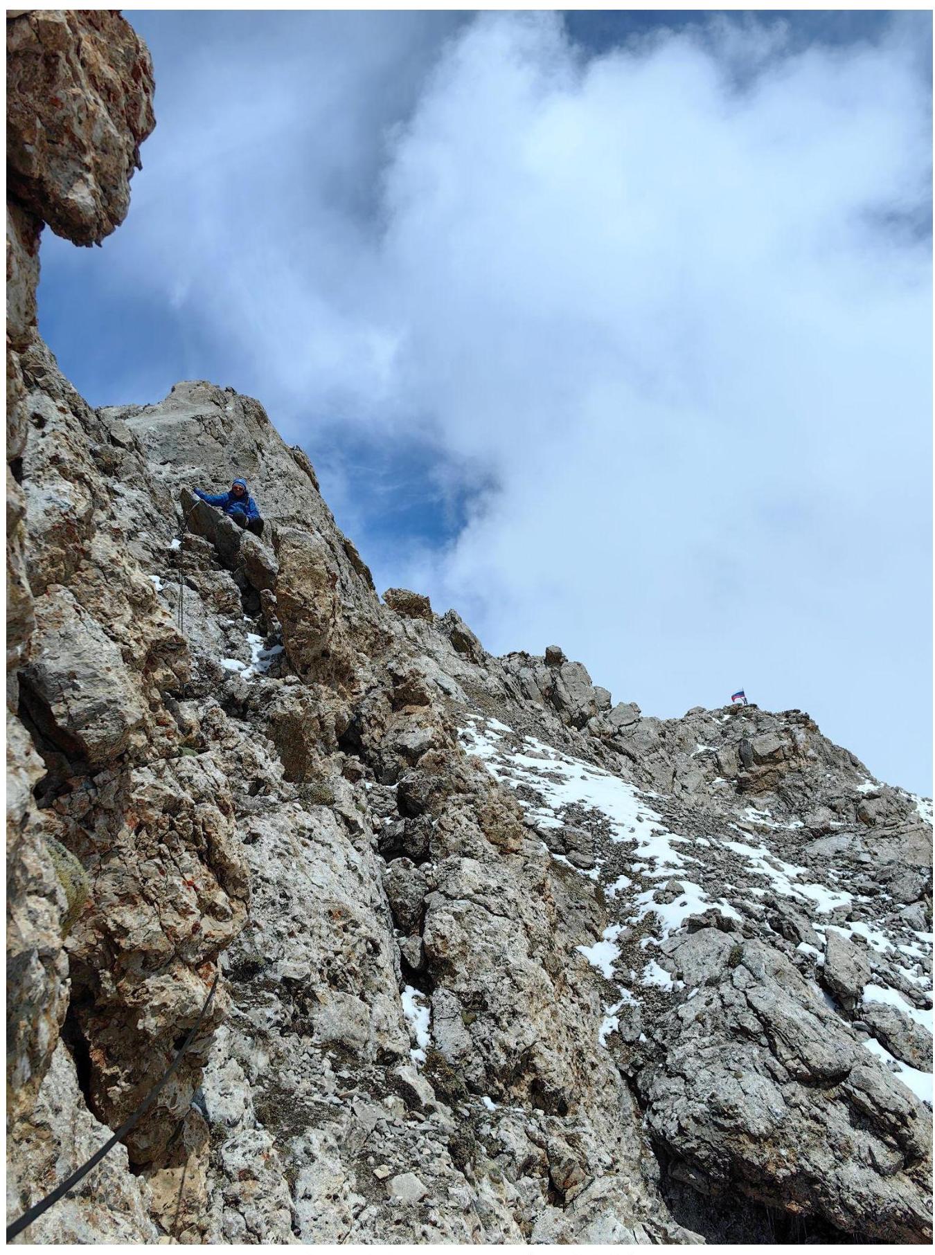
Photo 7. Exit to the ridge R7–R8
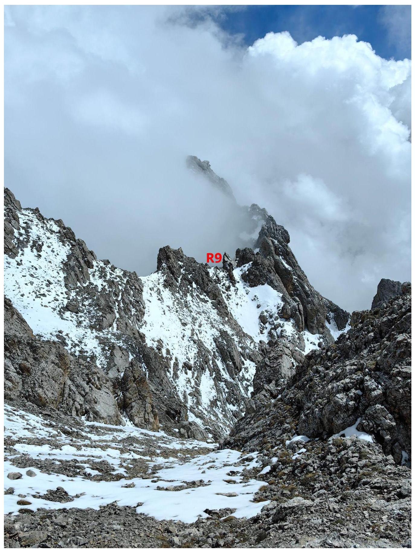
Photo 8. Section R8–R9

Photo 9. Section R9–R10
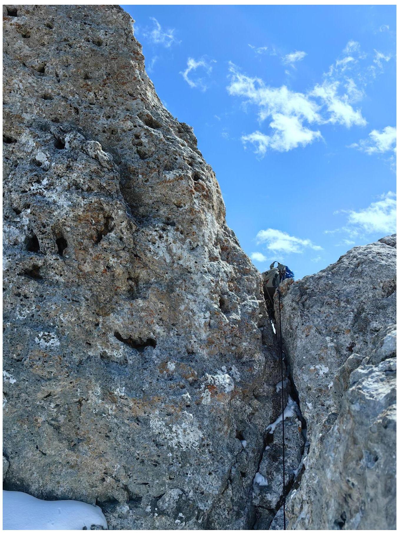
Photo 10. Chimney, beginning of section R10–R11
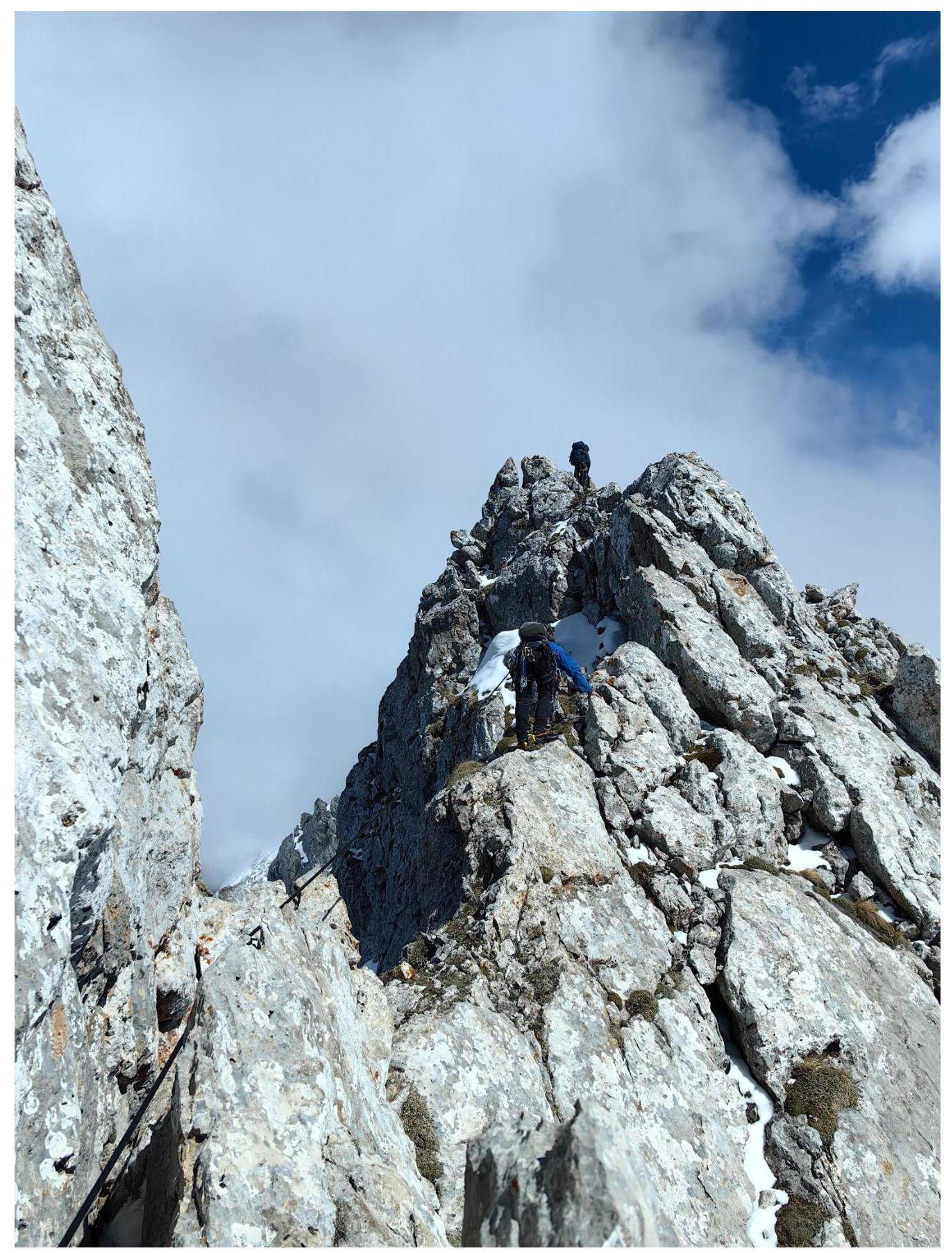
Photo 11. Section R10–R11
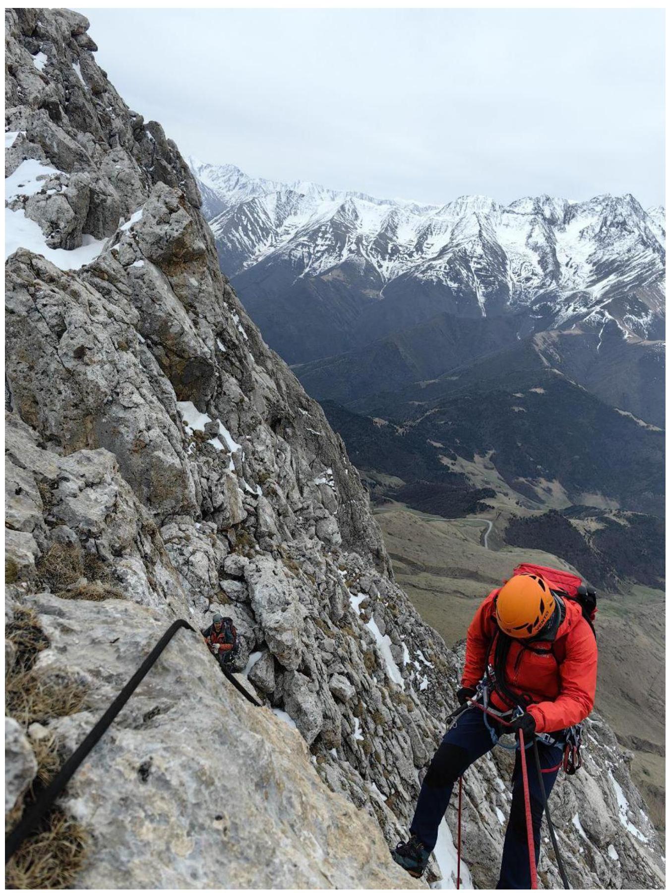
Photo 12. Section R10–R11, rappel.
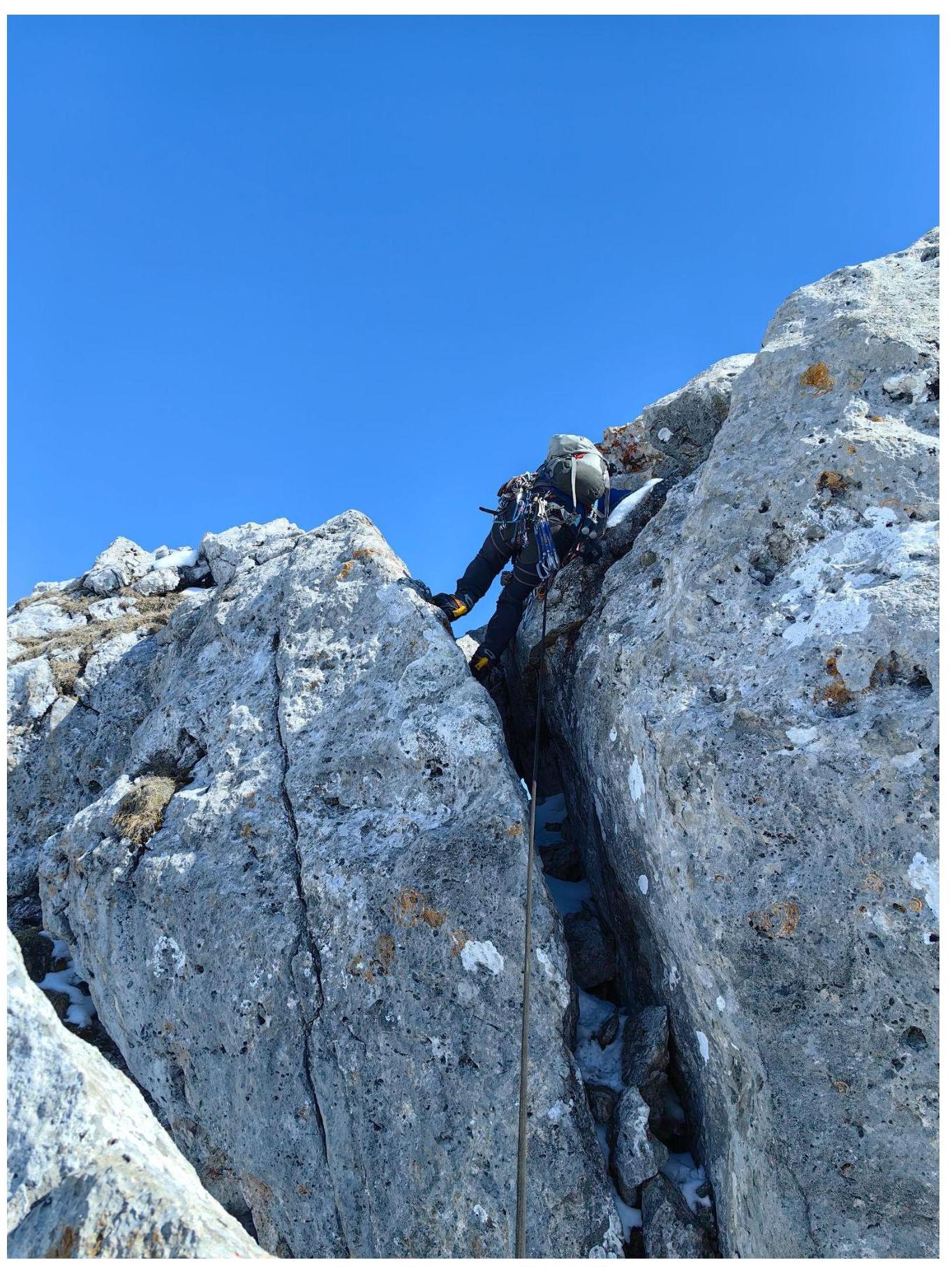
Photo 13. Section R11–R12
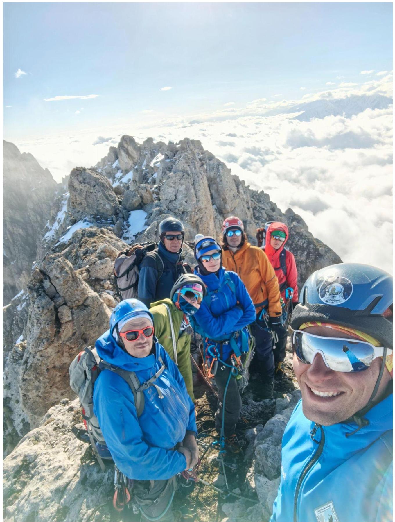
3.2. Photo of the team on the summit with a control post
3.3. Assessment of Route Safety:
Overall, the entire route is considered safe. Quite lengthy, with a lot of work with a rope, especially during simultaneous belaying on the ridge. The first part of the route follows the Zhuravel route, which is the most complex 2B in the region, and is supplemented by half of the Sedykh 2B route to DZharlam SE. During movement along the northern side of the Western ridge of DZharlam SE, snow is possible, which will complicate the passage.
Options for communication on the route: Cellular communication is available along almost the entire route: Megafon and Beeline. Exceptions may be natural obstacles, due to which communication sometimes disappears. Radio communication works, but not everywhere. On the summit — excellent.
Recommendations for subsequent climbers: It is recommended to take crampons, as hard snow and icy rocks are possible. It is recommended to pass in a small group of up to 4 people. In case of failure to reach the summit within daylight hours, descent options are available via 1B from DZharlam Ts. and via route 2B from DZharlam SE.
Descent from the summit of DZharlam SE via the ascent route and entirely via the Sedykh 2B route along the Western ridge.
Conclusion on the preliminary assessment of the route: Based on the experience of climbers and general opinion, it can be stated that this route corresponds to the declared category of complexity, as the set of obstacles objectively reflects its complexity.
Comments
Sign in to leave a comment