
Ascent Passport
- Area 2.9: from Kreстовый Pass to Shaviklde Peak
- Dzhartlam, Central, 3160, via South buttress Geographic coordinates of the summit (latitude/longitude): 42.841989 / 44.827054
- Proposed 3B category of difficulty, first ascent (classified as 3A)
- Route type: rocky
- Height difference of the route: 300 m
Route length: 560 m. Average steepness: main part of the route – 50°; total route – 40°.
- Pitons left on the route:
total 0; including pitons drilled 0
- Team's travel hours: 5.5 hours, 1 day
- Leader: Shipilov Vitaly Viktorovich, MS
Team members:
- Kolisnyk Vasily Vladimirovich, MS
- Exit to the route from Base Camp: 19:00, May 5, 2018
Route started: 6:15, May 6, 2018 Summit reached: 11:45, May 6, 2018 Descent from the summit: via Northwest ridge, category 1B
-
Organization: a/c "Planeta", Rostov-on-Don
-
Responsible for the report Shipilov V.V.
Email and phone: vetal-ship@yandex.ru, +79001214589.
General photo of the summit
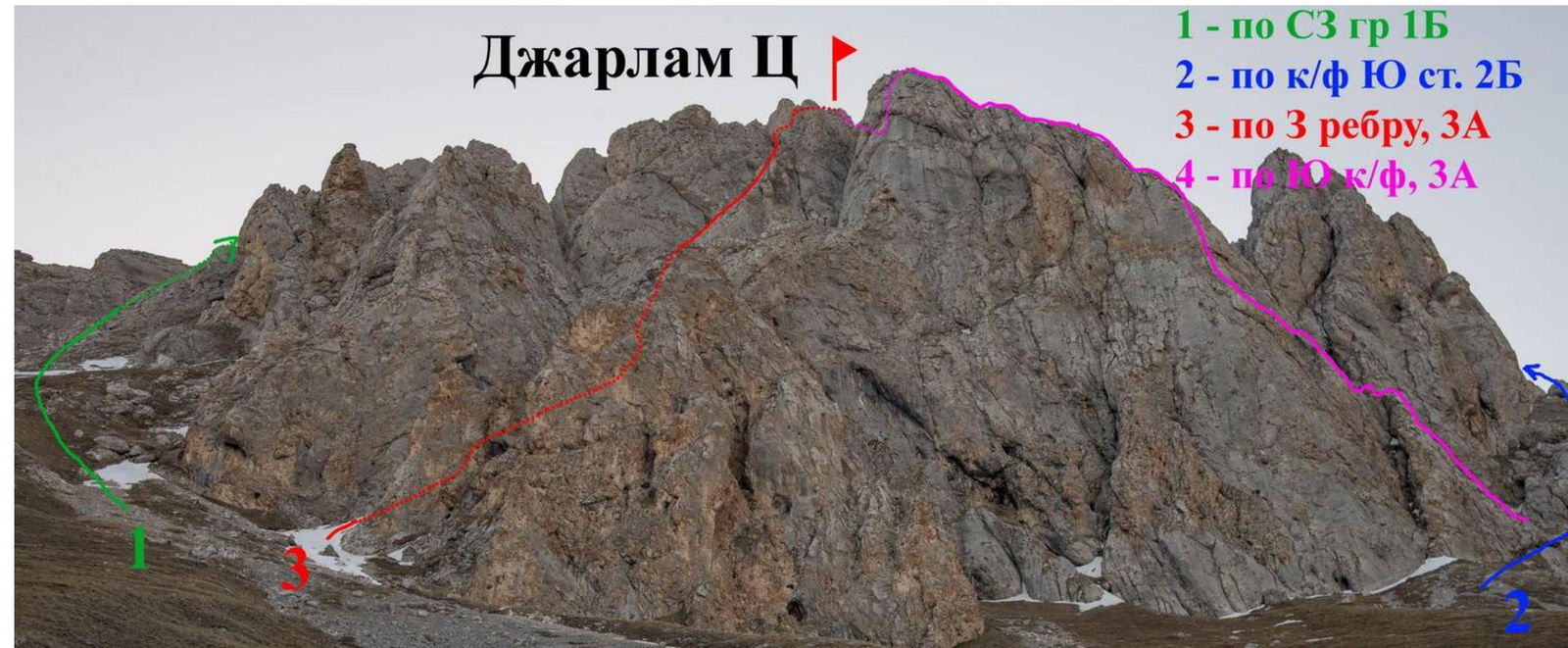 Dzhartlam Central
1 — via NW ridge 1B
2 — via S buttress 2B
3 — via 3rd edge, 3A
4 — via rock/fall, 3A
May 4, 2018, taken during approach to the route.
Dzhartlam Central
1 — via NW ridge 1B
2 — via S buttress 2B
3 — via 3rd edge, 3A
4 — via rock/fall, 3A
May 4, 2018, taken during approach to the route.
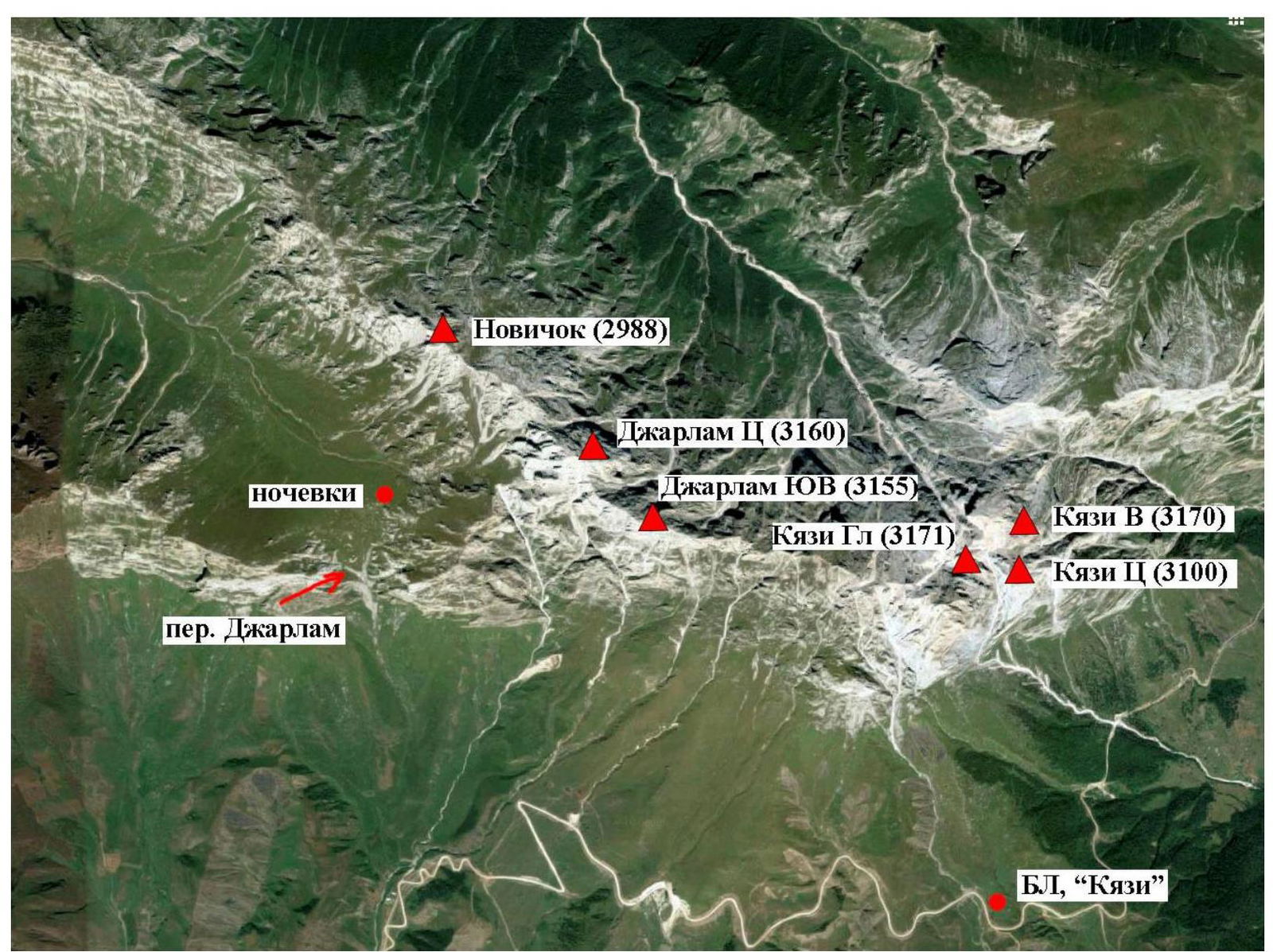
Map of the area
 Photopanorama of the area
 Route scheme by sections
| Section # | Length | Steepness | Terrain type | Difficulty category | Number of pitons |
|---|---|---|---|---|---|
| R0–R1 | 30 m | 60° | Rocky | IV | 6 |
| 15 m | 20° | Rocky | II | ||
| R1–R2 | 30 m | 60° | Rocky | IV | 4 |
| 5 m | 45° | Rocky | II | ||
| 4 m | 80° | Rocky | V | 1 | |
| 8 m | 45° | Rocky | III | 2 | |
| R2–R3 | 45 m | 60° | Rocky | III | 5 |
| R3–R4 | 45 m | 45° | Rocky | III | 3 |
| R4–R5 | 35 m | 45° | Rocky | III | 3 |
| R5–R6 | 30 m | 40° | Rocky | II | |
| R6–R7 | 5 m | 60° | Rocky | II | |
| 15 m | 45° | Rocky | I | ||
| R7–R8 | 5 m | 45° | Rocky | II | |
| 100 m | 30° | Scree | I | ||
| R8–R9 | 50 m | 45° | Scree | II | |
| R9–R10 | 30 m | 50° | Rocky | III | 3 |
| 8 m | 60° | Rocky | IV | 1 | |
| R10–R11 | 100 m | 20° | Mixed | I |
Route Description
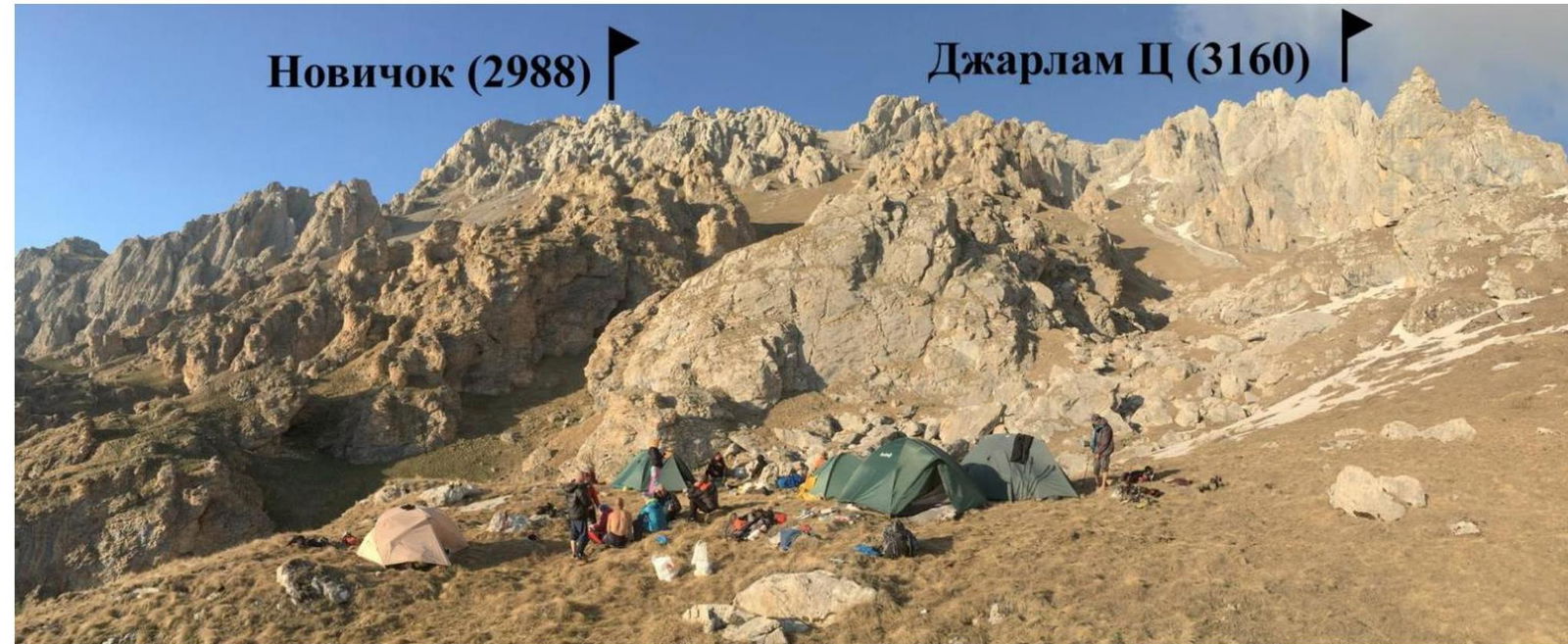
From "Kazhi" alpine camp, move towards the monument for 40–60 minutes (can be reached by car), then left, crossing two gullies, and up to Dzhartlam Pass for 1.5–2 hours. Overnight stay to the right of the pass towards Dzhartlam Central massif. No water, only snow. From the overnight stay, move towards the scree couloir to the right of Dzhartlam Central massif to the South buttress for 30–40 minutes. The landmark for the start of the route is a large rounded overhanging rock; the edge starts slightly to the right of the rock. Approach via easy terrain for 15 m upwards (30°, I). R0–R1. Move up a wide edge for 30 meters to a small shoulder with three "teeth". Through them, approach the wall – a continuation of the edge, with a station on pitons R1–R2. Slightly right and up the edge, then to the right of the edge via easy rocks to a shelf. From here, climb up a steep external corner for 4 m (key section). The terrain is strong, monolithic with sharp needle-like holds. Further terrain becomes much easier and gentler. R2–R5. Move along the edge until it turns into a horizontal crest with gaps. R5–R6. The crest descends down to a large gap before a gendarme. From the station, move 7 meters along the crest, descend slightly to the left for 2.5 m and enter a small gap in the crest, turning into a chimney. Above the chimney, move left, with a station on a ledge. R6–R7. Descend left and down via climbing for 5 m and then right and down under the wall via a narrow scree for 15 m to a small shelf. Station is behind a corner. R7–R8. Enter a wide scree couloir. Climb up the couloir via easy rocks for 5 m and then via scree for approximately 100 m. R8–R9. About 50 m of easy rocks lead to a wall with a cleft. R9–R10. Climb up the cleft, turning into a narrow chimney in its upper part, to a wide pre-summit ridge. R10–R11. Move right for 100 m to a triangulation tower via a gentle wide ridge. Summit. Descent: via 1B route along the Northwest ridge (in the lower part of the ridge, a 10 m rappel from a ledge). To the overnight stay for 1 hour.
The route is logical, the terrain is sufficiently monolithic. Stations are mostly on natural points. Works well:
- Friends
- Medium-sized stoppers
- Anchor pitons
Technical photo of the route
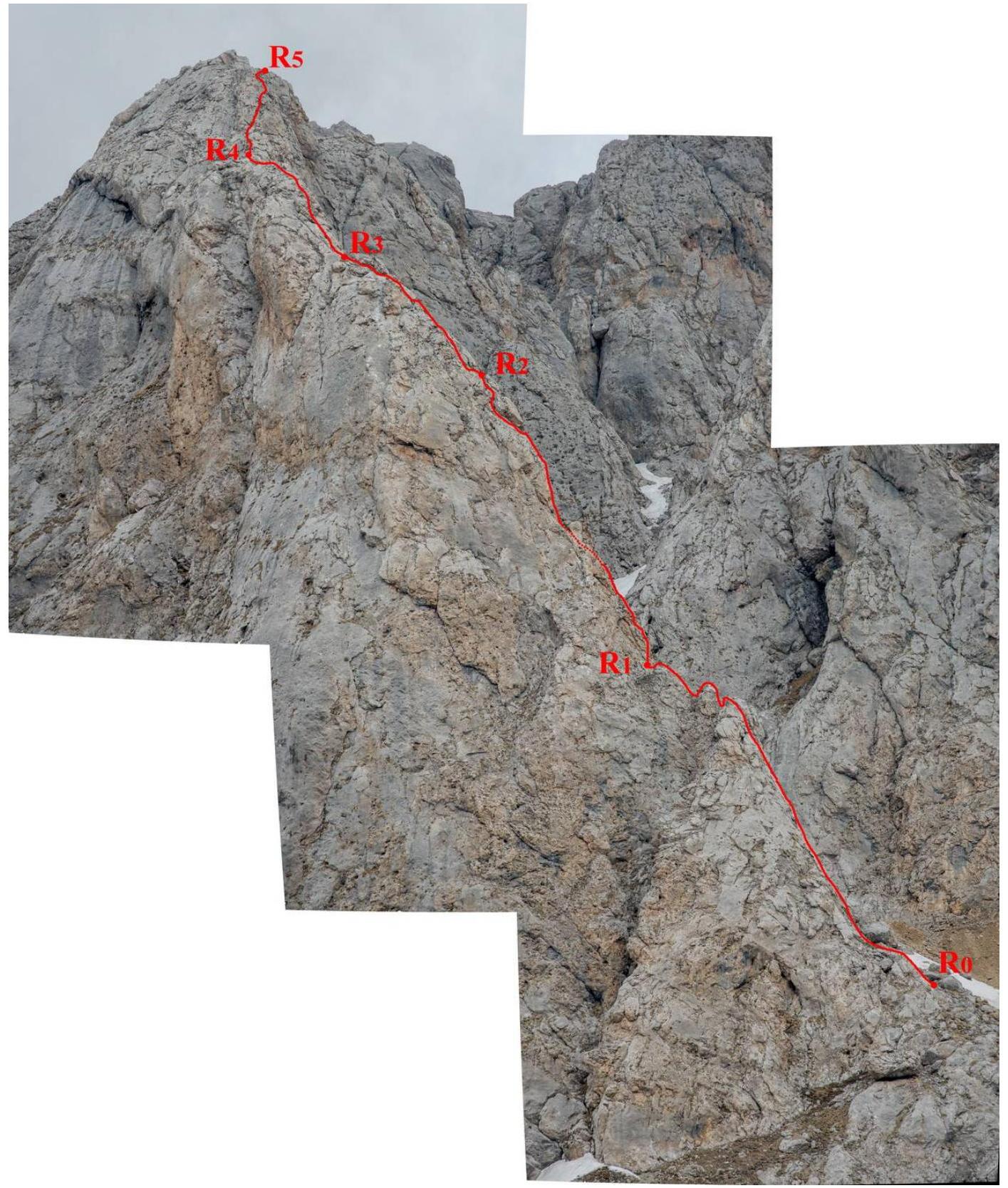
Photo Report

Photo 1. Section R0–R1
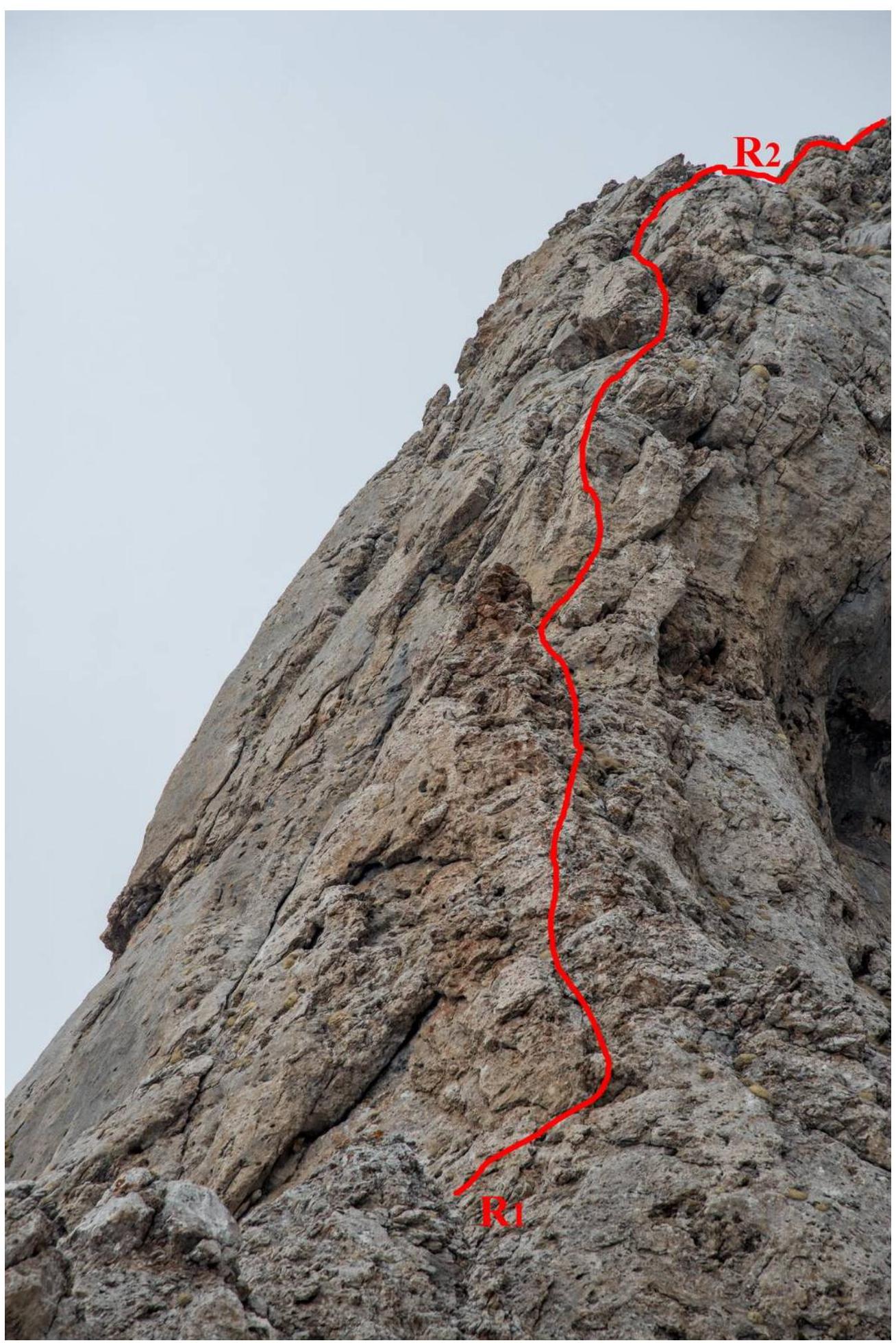
Photo 2. Section R1–R2
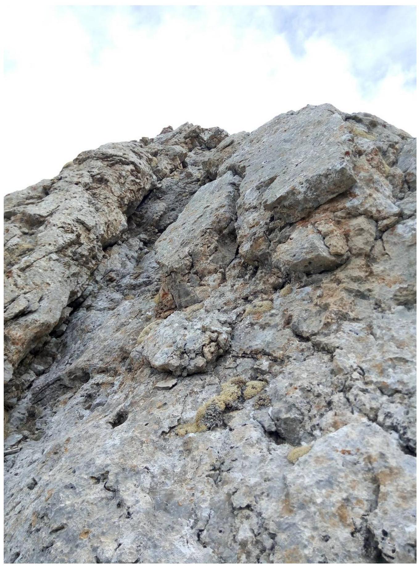
Photo 3. Section R2–R3
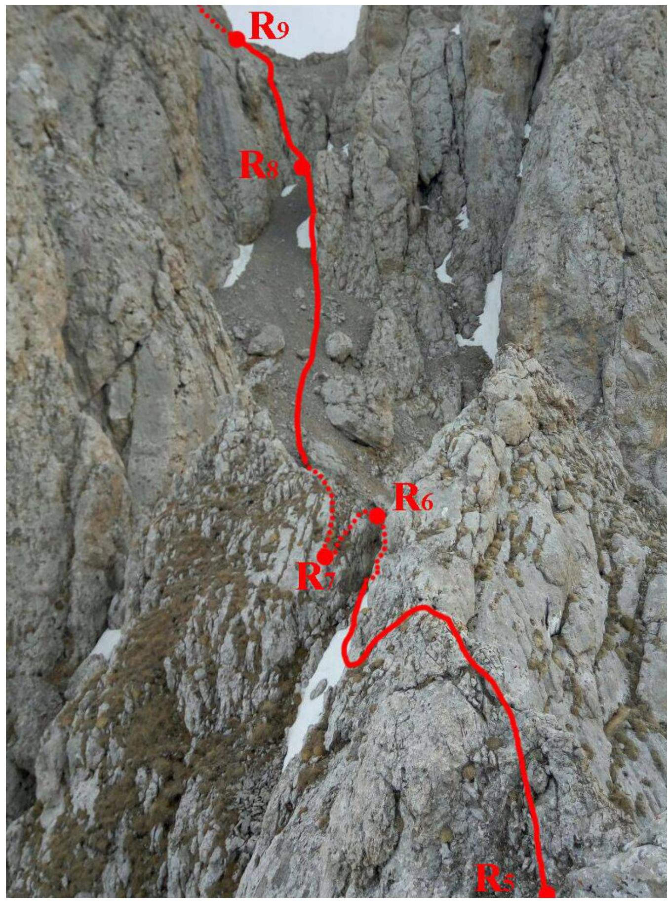
Photo 4. Sections R5–R9
Comments
Sign in to leave a comment