Ascent Record
- Region: CAUCASUS
- Area: 2.5.1. From Kitlod Pass to Gezivtsvek Pass (south of the Main Caucasian Range)
- Peak: Dzharlam, Southeast
- Height: 3155 (3180 according to GPS)
- Route: via the Western Ridge
- Category of difficulty: 2B
- Route characteristics: rock climbing
Elevation gain of the route: 530 m. Route length: 980 m
- Equipment used on the route:
Protection gear – 4
- Ascent duration: 9.5 hours
Departure from the bivouac (overnight stay at Dzharlam Pass): 04:30. Start of the route: 05:30. Reaching the summit: 10:00. Return to the bivouac (overnight stay at Dzharlam Pass): 14:00
- Year of ascent: 2020
- Leader: Egorov Sergey (1st sports category)
Team members:
- Podolsky Alexey
- Riterman Vadim
- Kopteva Albina
- Vatolin Ivan
- Person responsible for the report: Riterman Vadim, valankor@gmail.com
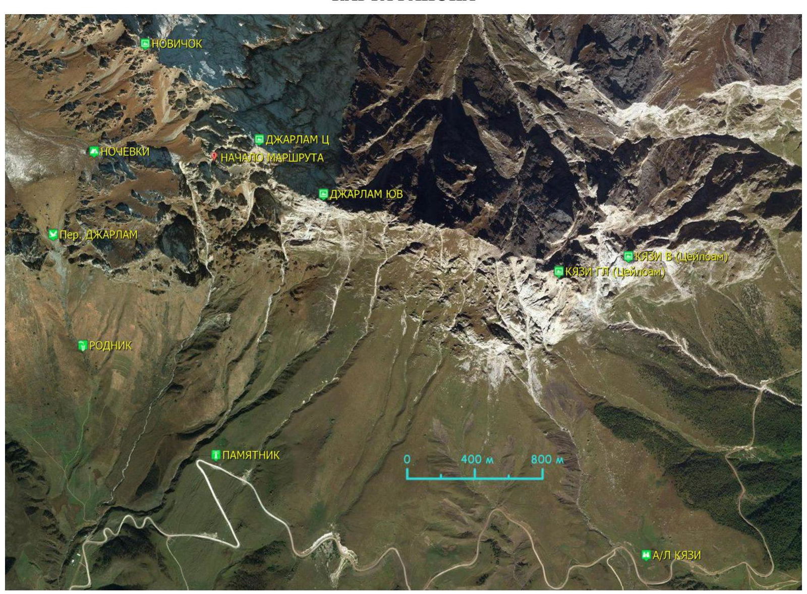
AREA MAP
 START OF THE ROUTE
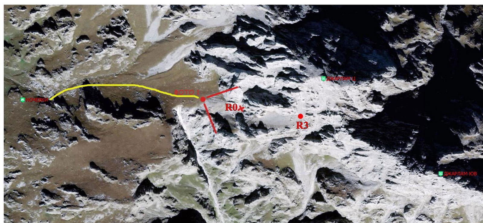
Route Description
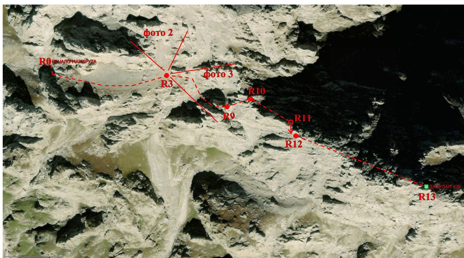 PHOTO 1. Beginning of the route. А
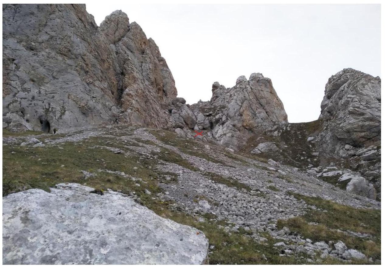
B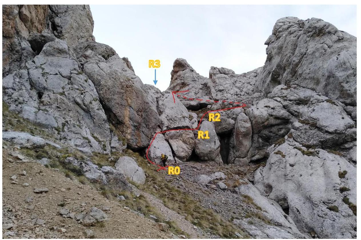 PHOTO 2, R3
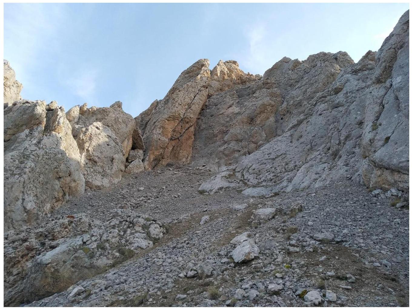 PHOTO 3, R3
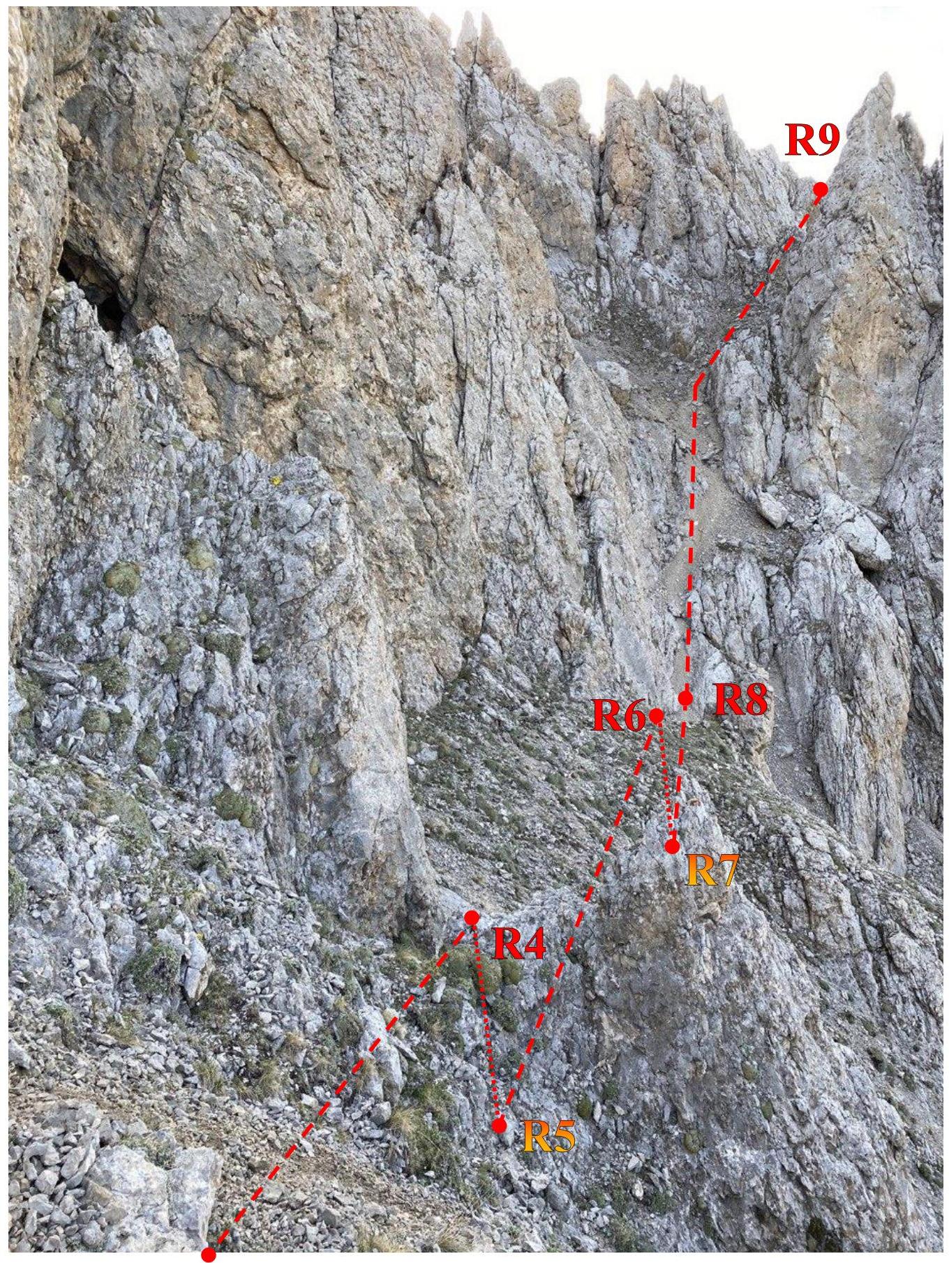
R3
Approach
From the Kazbegi Alpine Camp, move towards the monument (preferably by car). From the monument, ascend to Dzharlam Pass (2–3 hours). Overnight stay on the other side of the pass.
From the overnight stay location, ascend along the grassy slope under the Dzharlam Central massif. In the upper part of the slope, move right towards the "sheep's foreheads" (see photo 1, A). The journey from the overnight stay to the "sheep's foreheads" takes 30–60 minutes.
Route Description
| Pitons | Cams (protection) | UIAA Symbols | Section Description |
|---|---|---|---|
| R12–R13 300 m I traverse along the ridge, mostly on the right/left side R11–R12 20 m rappel R10–R11 120 m II traverse along the ridge, mostly on the right side | |||
| 3 |  | R9–R10 20 m III | |
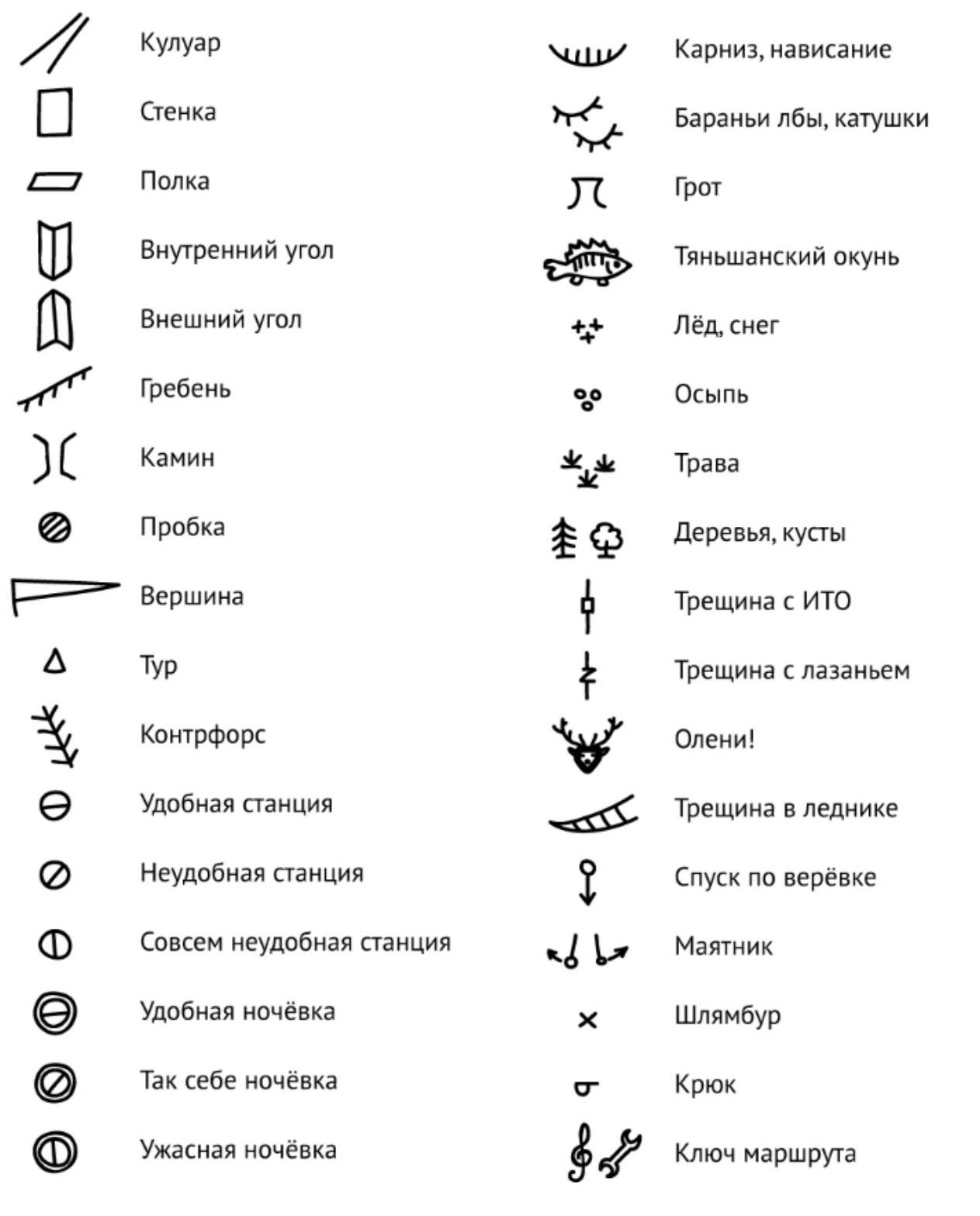
 | (photo 3) R8–R9 200 m I gully R7–R8 40 m I traverse of the slope R6–R7 4 m II R5–R6 10 m I traverse of the slope R4–R5 4 m II R3–R4 4 m I traverse of the slope | ||
| 1 | R3 | (photo 1, B) R2–R3 250 m walking R1–R2 2 m II R0–R1 8 m I |
Descent is via the ascent route. For sections traversed using free climbing, the following difficulty scale is applied:
- I, II, III, IV±, V±, VI±.
I — easy — basic technical knowledge is required. Footing is reliable, and techniques are generally straightforward. Maintaining balance and transferring body weight do not require significant effort. Overall, it's not difficult. II — moderately difficult — an ice axe is needed for balance; various footholds and techniques are available; transferring body weight requires sufficient effort; some knowledge of movement techniques is necessary. III — difficult — foothold choices are not limited, but not all provide convenience and reliability. Movement is primarily on feet; hands are used for balance and to facilitate smooth foot transfers. IV — very difficult — choices of footholds and techniques are limited. Those that are available do not ensure maneuverability or confidence. Significant effort is required for movement and maintaining balance. V — particularly difficult — few footholds are available, not all are reliable, requiring careful testing; choosing a path and techniques demands serious consideration; maintaining balance and transferring body weight require substantial effort and agility. VI — extremely difficult — very few footholds; technique choices are very limited. Maintaining balance and movement demand agility and strength, potentially to the maximum. In addition to the above requirements, classification methods adopted in other countries are allowed.
When climbing using artificial support (ladders, loops, platforms hung on pitons), difficulty is assessed on a 4-point scale: A1, A2, A3, A4.
A1 — single pitons; terrain is straightforward and reliable; (safe artificial support: all points are reliable) A2 — series of artificial points; terrain is straightforward and reliable (not all protection points are reliable; in case of a fall, there is a risk of injury) A3 — large series of artificial points; terrain is complicated; overcoming cornices and overhangs (50 % of protection points are unreliable; in case of a fall, there is a significant risk of injury) A4 — large series of artificial points; terrain is complex and unreliable; overcoming large cornices over 1 meter:
- about 80 % of protection points are unreliable
- in case of a fall, there is a risk of life-threatening injuries
| Route Line | Invisible Part | |
|---|---|---|
| Alternative Route |