Ascent Passport
- Area: 2.9, from Kreстовый Pass to Shaviklde peak
- Peak, route: Jarlam South-East via Western ridge, 3155 m (first ascent)
- Complexity category: 2B cat. sl.
- Route characteristics: rock
Height difference of the route: 240 m Route length: 810 m Section lengths:
- 2 — 530 m
- 3 — 80 m
- 4 — 12 m Pitons left on the route: 0
-
Pitons used on the route:
- anchor pitons — 18
- chocks — 16 Team's moving hours: 11 h
-
Leader: Sedykh Igor Anatolyevich, 1st sports category
Team members:
- Borodaenko Ivan Ivanovich
- Drozd Olga Nikolaevna
- Ermolenko Maxim Viktorovich
- Levchuk Andrey Andreevich
- Savchenko Andrey Alekseevich
- Seliverstova Olga Viktorovna
- Coach: Nazarenko Olga Vyacheslavovna
- Departure to the route: May 7, 2018 5:00 AM Arrival at the summit: May 7, 2018 4:00 PM Return to Base Camp: May 7, 2018 10:00 PM
- Report responsible: Sedykh Igor Anatolyevich, +79298131117.
General photo
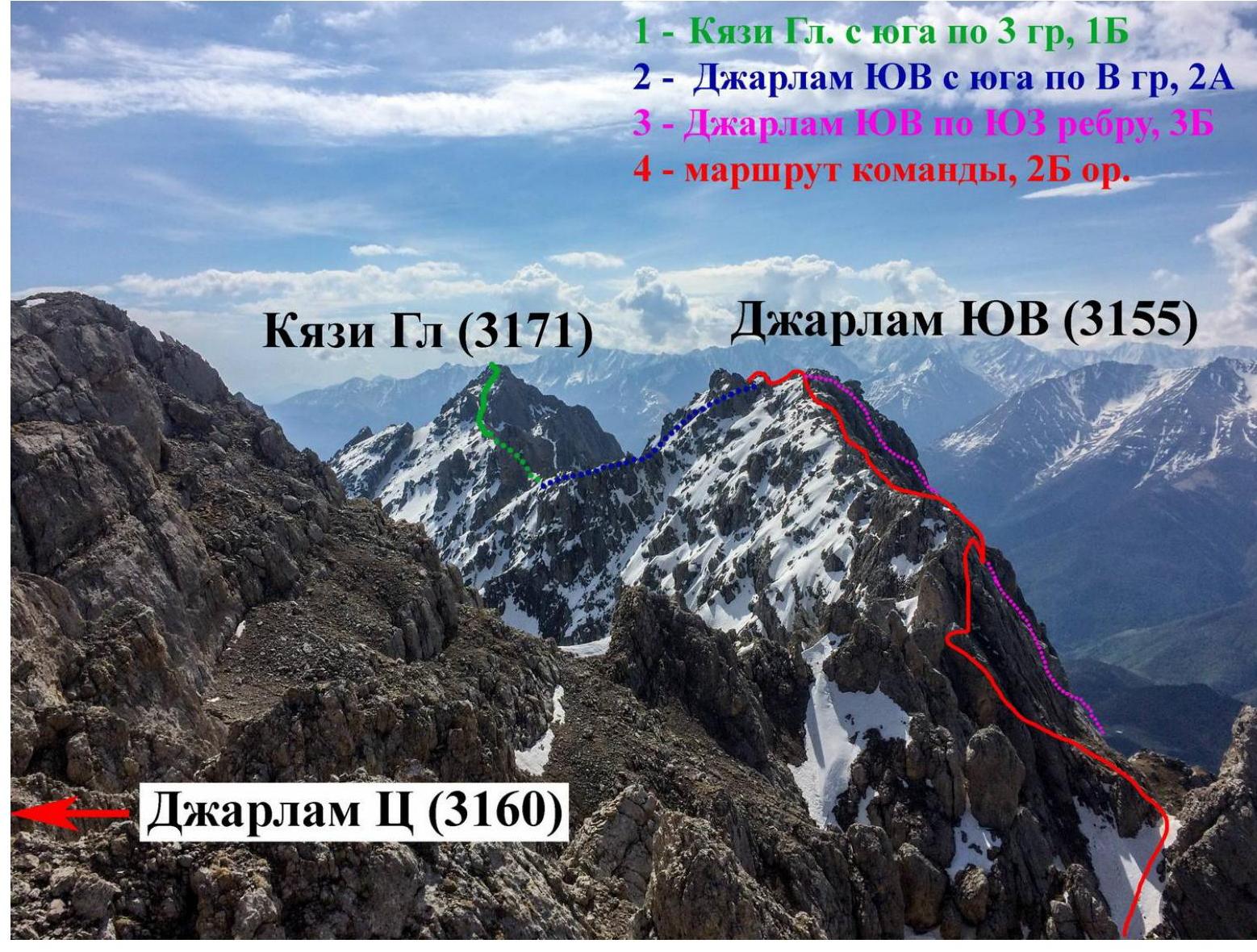
Taken from Jarlam Ts (3160 m) summit
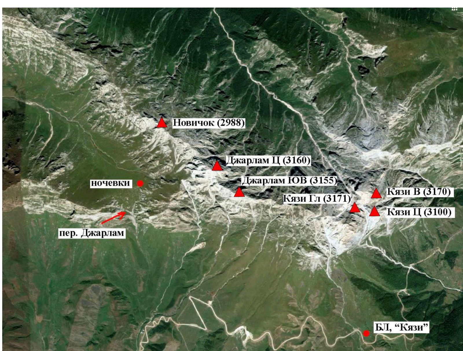
Area map
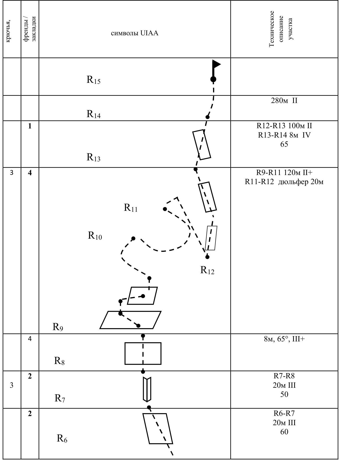
UIAA symbol diagram

Route Description
From Kyazi camp, we move to the monument. The ascent to Jarlam Pass begins from the monument.
Overnight stay is under the pass, closer to Jarlam Central slopes.
From the overnight stay, we ascend via a grassy slope under Jarlam Central massif, similar to route 2B (Zhuravel 1988). In the upper part, the grassy slope turns into talus and abuts "ram's foreheads". Through the "ram's foreheads" and further along the talus slope, we approach the start of Zhuravel's route.
From it, we descend 8–10 m to the right into a depression (R1–R2) via moderately difficult rocks onto a talus slope, and along it, about 30–40 m, we approach another depression with a 10 m descent onto a talus slope (R3–R4). Both descents can be made by climbing with alternate belay.
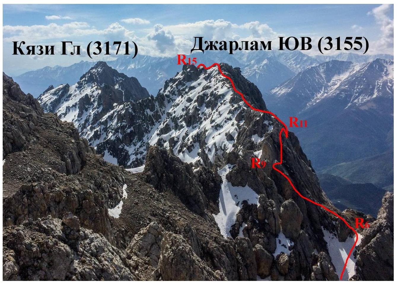
Further along the talus ledges under the start of a snow patch (R4–R5) and up the snow, we ascend 50 m to a ridge (R5–R6).
Along the ridge, there is a steep ascent (60–65°) for 50 m with a transition to an internal corner, which ends with a "plug" at the top. Under the "plug", there is a ledge convenient for belay. Before reaching the ledge, there is an 8 m wall (R8–R9).
Further along the ledges that run along the ridge (with a slight descent), we move with alternate belay for 90–100 m to a pronounced internal corner that leads to a ledge. We descend along the corner (18–20 m, rappel R11–R12).
Further along the ledges (alternate belay), we reach the ridge in 80–100 m (R12–R13). The section R13–R14 is a narrow chimney 6 m long. After the chimney, we exit onto the ridge, along which we proceed for 280 m to approach the summit ascent (simultaneous movement). We ascend to the summit via moderately difficult rocks.
The descent from the summit follows the ascent route. Two rappels were organized on the descent:
- from under the "plug" to the snow patch;
- along the snow.
The group made the ascent in May. They used meltwater for overnight stays, which stopped flowing at night. There is likely no water at the overnight stays in summer.
Belay on most of the route is achieved using rock features. For intermediate belay points, the following were used:
- rock pitons
- chocks
Weather conditions during the ascent:
- fog (sometimes very dense), alternating with
- wind with rain and snow
- after 4 PM — sparse fog.
In terms of steepness and difficulty of climbing sections and length, the route corresponds to 2B cat. sl.
Technical photo of the route
Photos from the route
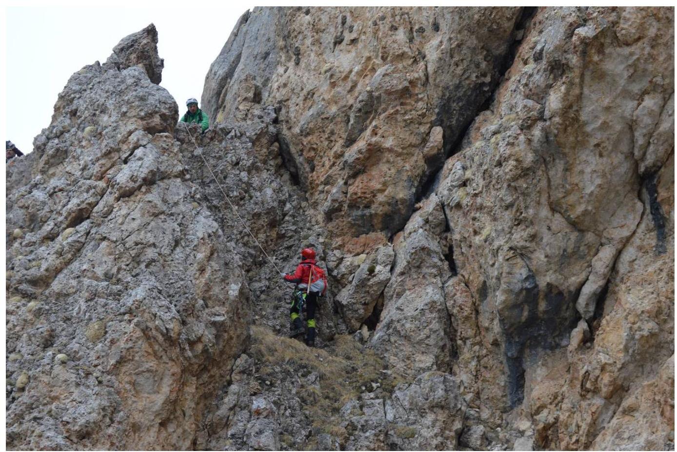
Photo 1. Section R3–R4

Photo 2. Section R4–R5
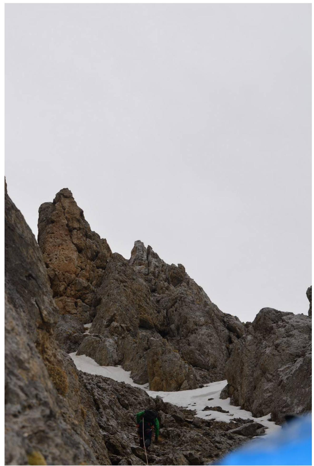
Photo 3. At the start of section R5–R6.
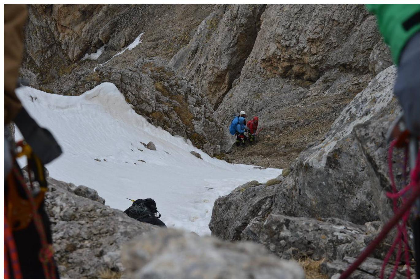
Photo 4. On section R6

Photo 5. Start of section R6–R7.

Photo 6. On section R6–R7
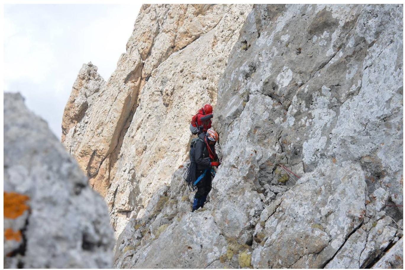
Photo 7. Section R9–R10
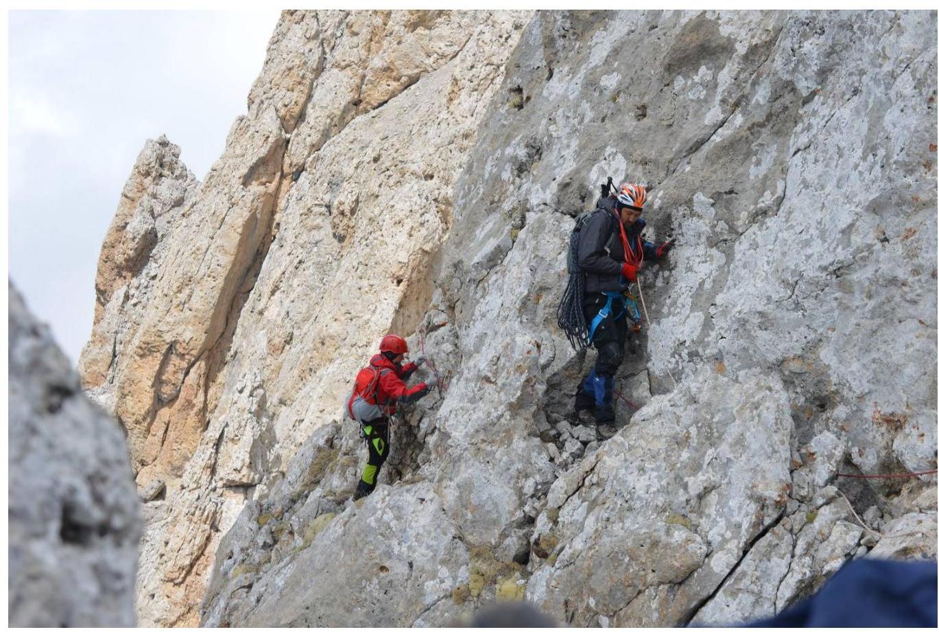
Photo 8. Exit to the ridge on section R10–R11
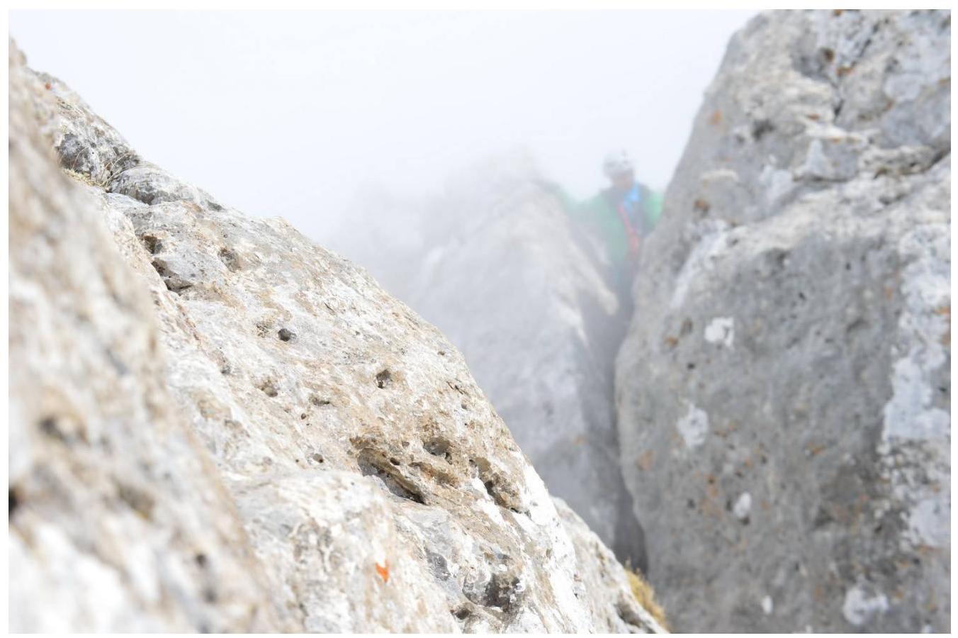
Photo 9. Chimney on section R13–R14.
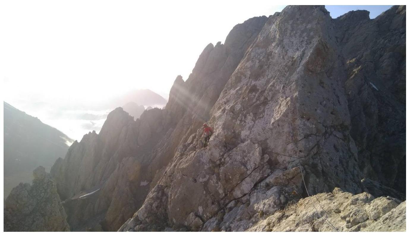
Photo 10. Section R10–R9 on descent.