
REPORT ON ASCENT TO DASHTSAR PEAK VIA THE TERRACES OF THE WEST WALL ROUTE, CATEGORY 2A COMPLEXITY. By the team of the Climbing Camps Management from June 2, 2024, to June 2, 2024.
I. Ascent Passport
| Item No. | 1. General Information | |
|---|---|---|
| 1.1 | Full Name, sports rank of the leader | Chikin Artem Borisovich, Candidate for Master of Sports |
| 1.2 | Full Name, sports rank of participants | Gumashvili V.L., 3rd sports rank; Barsukova E.A., 3rd sports rank. |
| 1.3 | Full Name of the coach | Yakovenko Alexander Nikolaevich, Master of Sports |
| 1.4 | Organization | Climbing Camps Management |
| 2. Characteristics of the Ascent Object | ||
| 2.1 | Area | 2.8 From Mamison Pass to Krestovy Pass |
| 2.2 | Valley | Kurtatinskoye |
| 2.3 | Section number according to the 2013 classification table | 2.8 |
| 2.4 | Name and height of the peak | Dashtsar 2918 m |
| 2.5 | Geographical coordinates of the peak (latitude/longitude), GPS coordinates | – |
| 3. Route Characteristics | ||
| 3.1 | Route name | via the terraces of the West wall |
| 3.2 | Proposed category of complexity | 2A |
| 3.3 | Degree of route exploration | first ascent |
| 3.4 | Nature of the route terrain | Rock |
| 3.5 | Elevation gain of the route (altimeter or GPS data) | 350 m |
| 3.6 | Route length (in meters) | 890 m |
| 3.7 | Technical elements of the route (total length of sections of various complexity categories with indication of terrain type (ice-snow, rock)) | I cat. rock — 670 m. II cat. rock — 70 m. III cat. rock — 40 m. IV cat. rock — 10 m. |
| :-- | :-- | :-- : |
| 3.8 | Descent from the peak | Via the n.k. route, along the East ridge and South slope |
| 3.9 | Additional route characteristics | No water |
| 4. Characteristics of the Team's Actions | ||
| 4.1 | Time of movement (team's walking hours, in hours and days) | 4 hours 00 minutes |
| 4.2 | Overnights | No |
| 4.3 | Start of the route | 9:20, June 2, 2024 |
|---|---|---|
| 4.4 | Reaching the peak | 13:20, June 2, 2024 |
| 4.5 | Return to base camp | 15:00, June 2, 2024 |
| 5. Responsible for the report | ||
| 5.1 | Full Name, e-mail | Chikin Artem Borisovich, artem.chikin@mail.ru |
II. Ascent Description
1. Characteristics of the Ascent Object
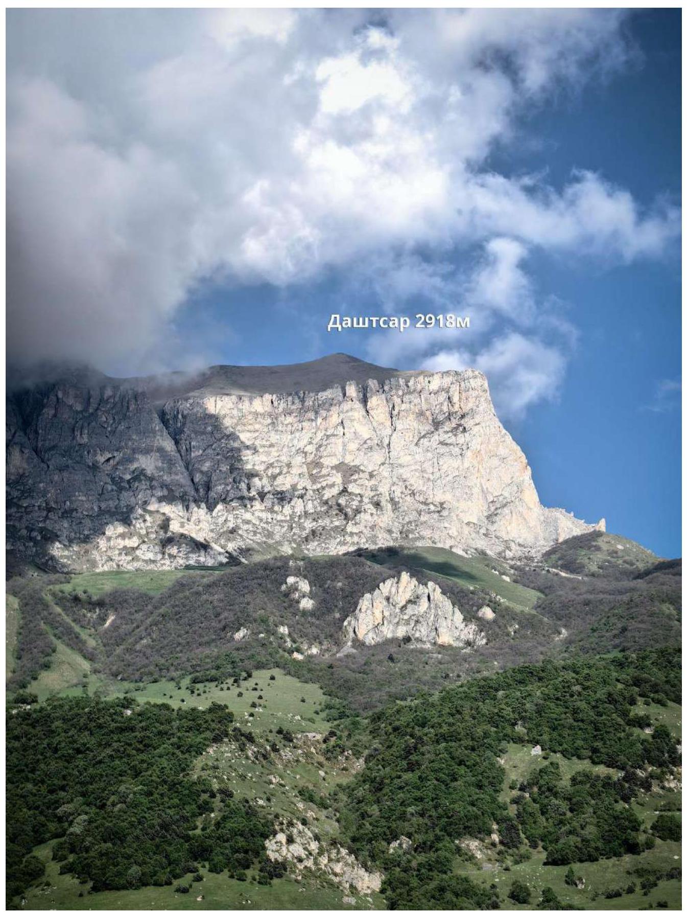 1.1. General photo of the peak
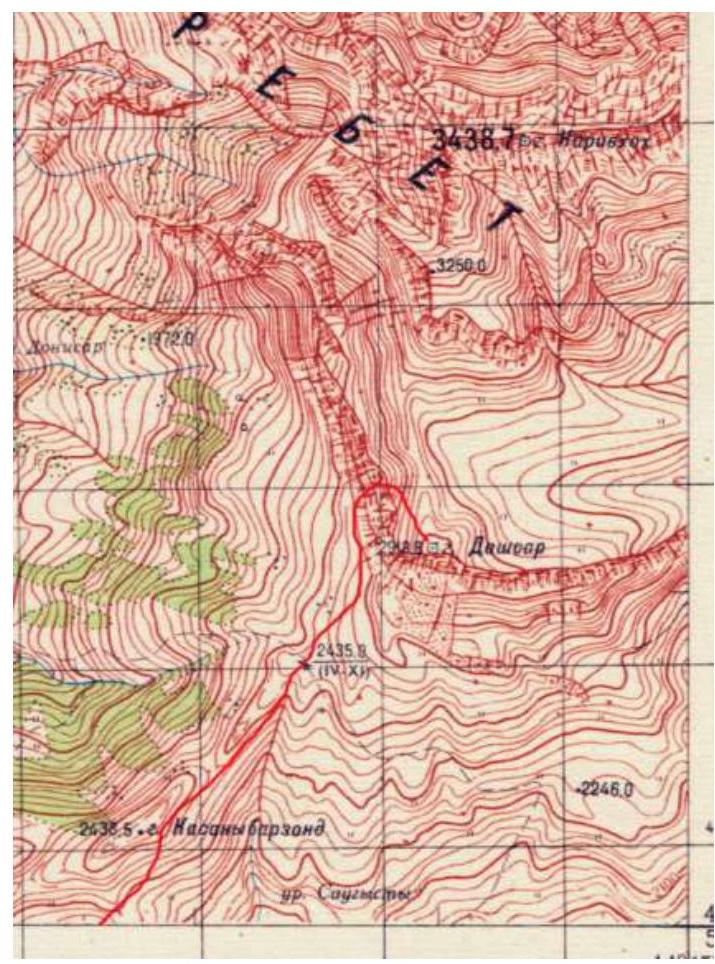 1.2. Area map
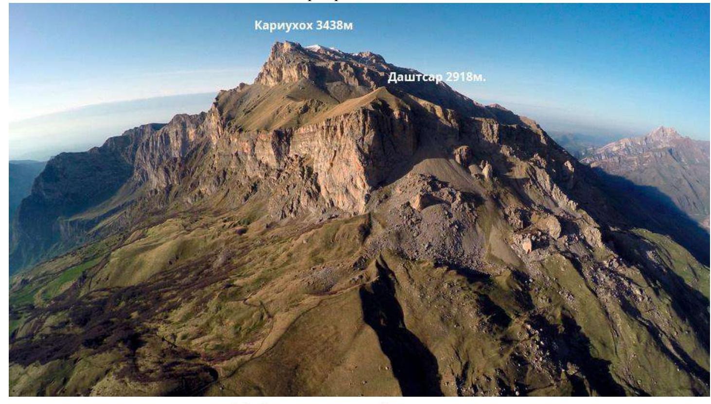 1.3. Photopanorama of the area
2. Route Characteristics
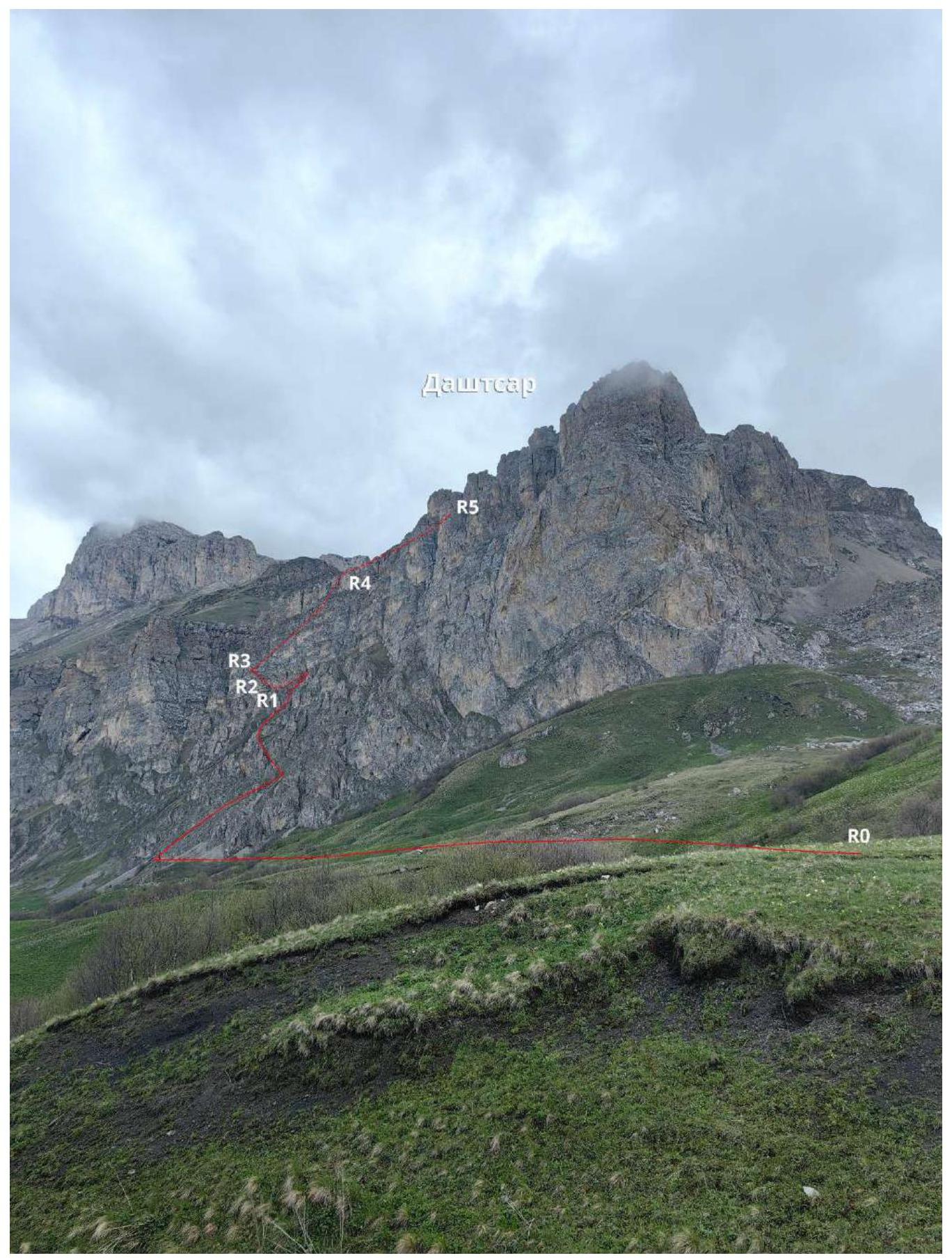 2.1. Technical photograph of the route
2.1.4. Route in UIAA symbols
Description of the approach to the route.
From Vladikavkaz to the working village of Fiagdon in the Kurtatinskoye valley, take a bus for about an hour. Then, drive up the valley to the village of Kharisdzhin. Turn right after the bridge and, after passing through Kharisdzhin, start ascending to the Arkhonsky Pass (2206 m) via a dirt road.
At the pass, turn right and follow a narrow dirt road north towards the visible peak of Dashtsar — it's possible to drive on this road with a high-clearance vehicle. The direction of movement is towards the base of the West wall. First, follow the grassy slopes, then approach the walls via small scree. To the left, a grassy inclined terrace goes north under the walls of Dashtsar. Follow it upwards to the left.
2.3. Technical Characteristics of Route Sections
| Section No. | Terrain Characteristics | Complexity Category | Length, m | Steepness | Type and Number of Hooks |
|---|---|---|---|---|---|
| R0–R1 | Grassy slope, scree | n.c. — I | 500 m | 50° | 0 |
| R1–R2 | Rocks, grassy ledges | II–IV | 45 m | 20–60° | 4 anchor hooks, 1 friend |
| R2–R3 | Rocks, grassy ledges | II–III | 45 m | 20–60° | 3 anchor hooks |
| R3–R4 | Grassy terrace, chimney | I–III | 250 m | 20–60° | 3 anchor hooks, ledges |
| R4–R5 | Grassy slope | n.c. | 300 m | 30° | 0 |
3. Characteristics of the Team's Actions
3.1. Brief Description of Route Passage
| Section No. | Description | Photo No. |
|---|---|---|
| First, follow the grassy slopes, then approach the walls via small scree next to the start of the 3A route on the West wall, move left along the terrace towards the couloir separating the West wall, landmark — a light-brown rock on the terrace — first rope on the right on the wall, not reaching it. | Photo 1 | |
| R1–R2 | Up a slightly destroyed wall to the left onto a narrow grassy ledge with short walls and then left to a wall where a station can be organized on own points. Insurance is frequent due to inclined belays to avoid a strong pendulum. | Photo 2 |
| R2–R3 | Along a narrow grassy ledge with short destroyed walls to the left and up towards the turn of the grassy ledge sharply to the right. Station before the turn on a jammed stone plug near a large gray stone. | Photo 3 |
| R3–R4 | Left and sharply right — up the grassy ledge, then along it, with 2 short chimneys 5–10 m along the way. To the right of the grotto at the end of the inclined ledge, climb through несложные скалы — a wall onto a grassy slope. Movement is simultaneous, insurance on anchor hooks and ledges. | Photo 4 |
| R4–R5 | Along a grassy slope to the northeast to the peak. | Photo 4 |
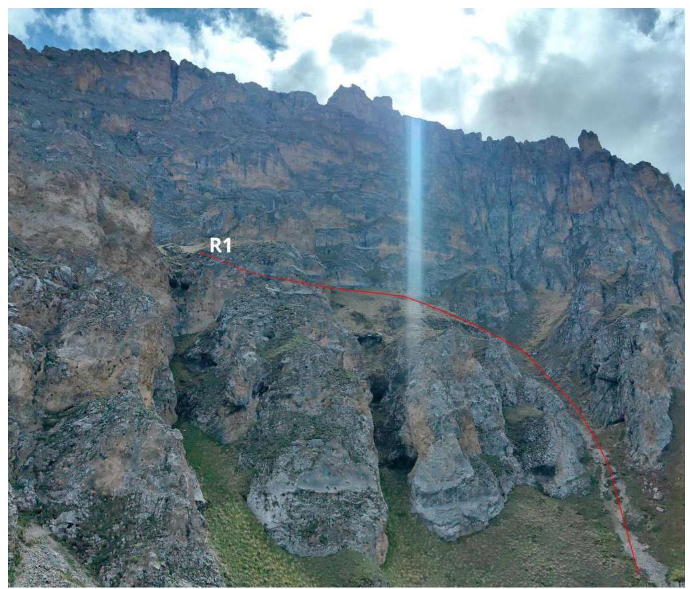
Photo 1. R0–R1
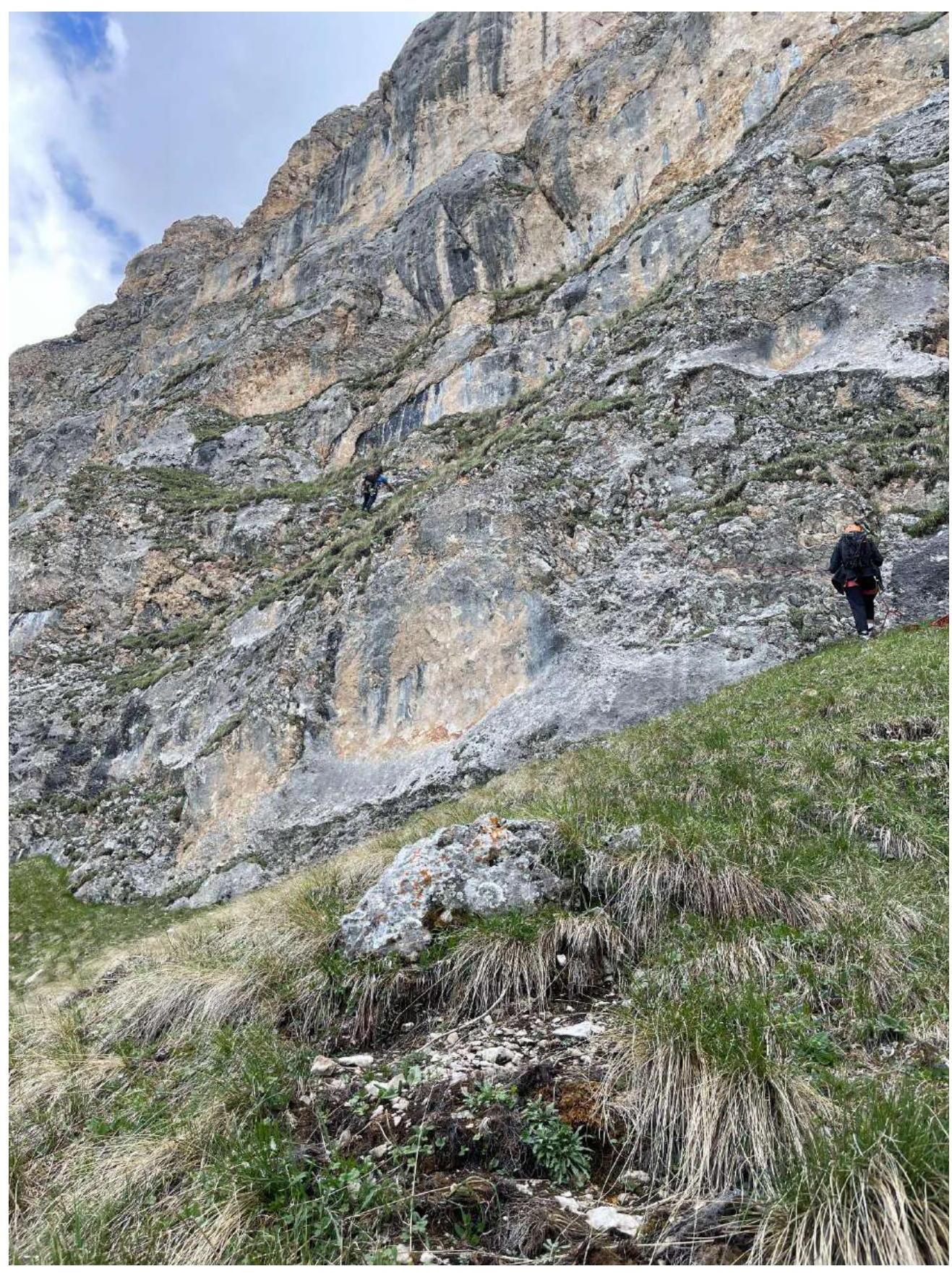
Photo 2. Section R1–R2
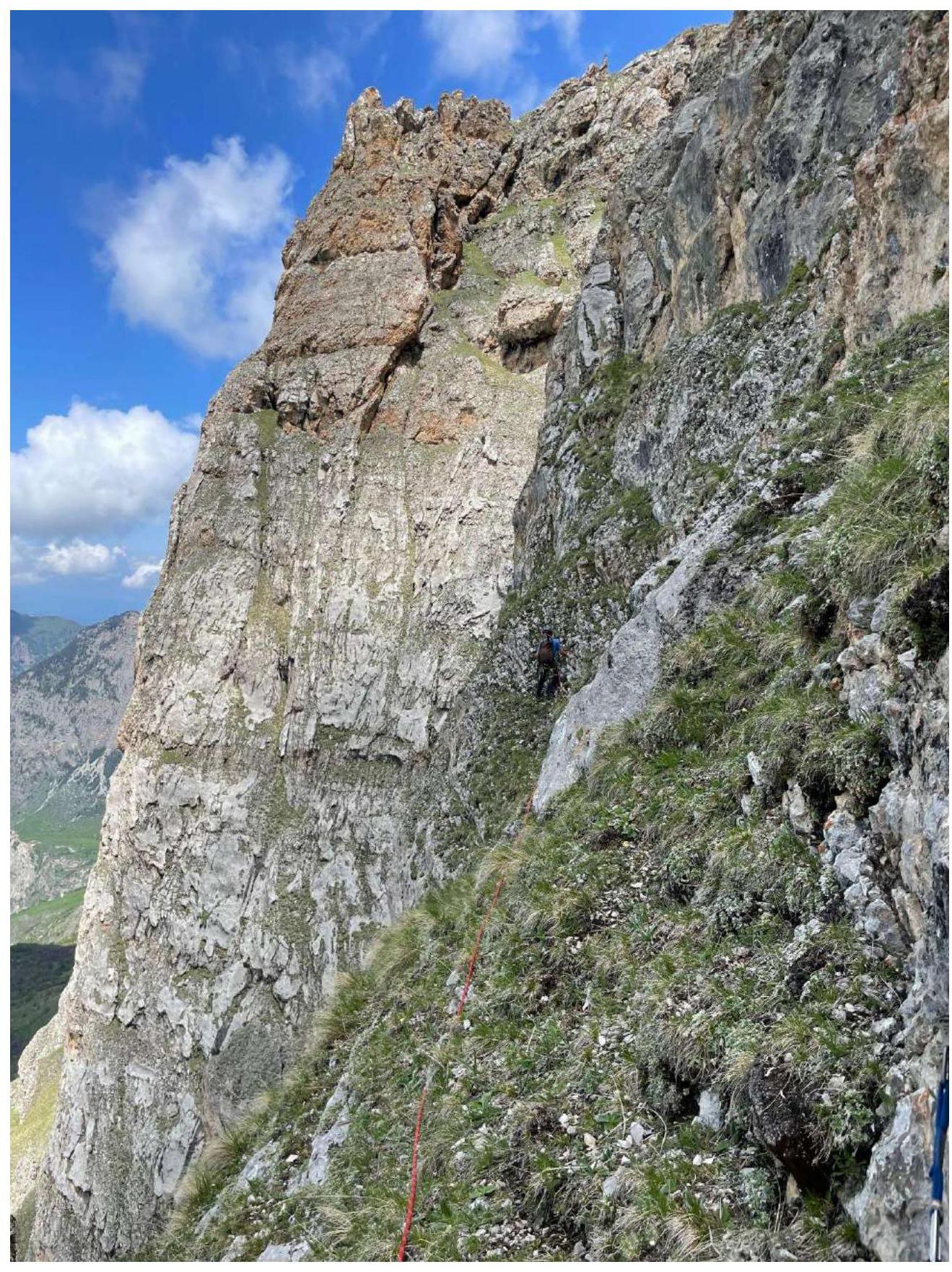
Photo 3. Section R2–R3
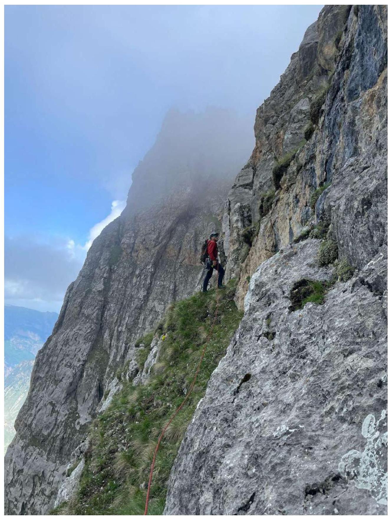
Photo 4. Section R3–R4
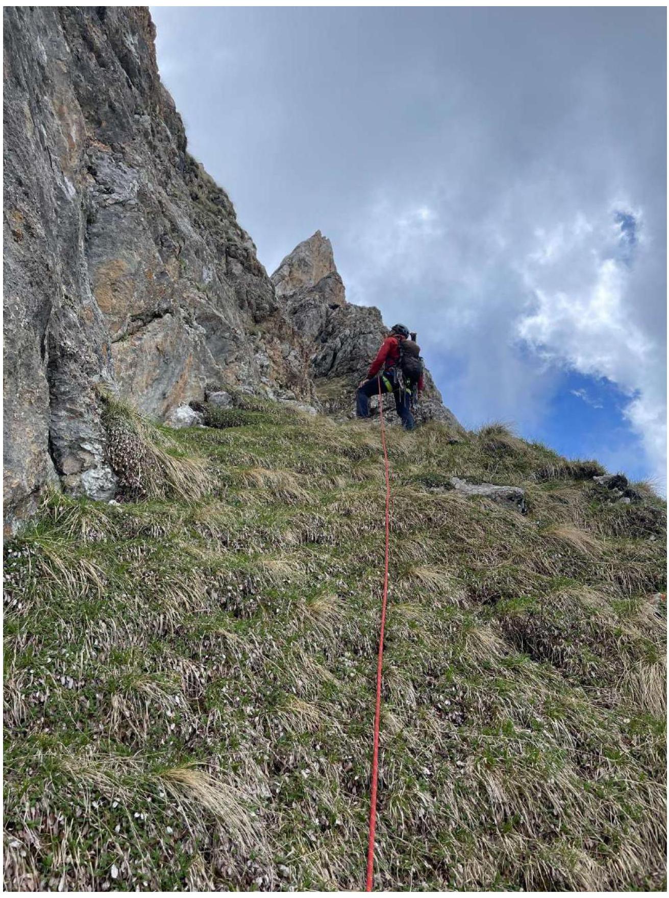
Photo 5. Section R3–R4
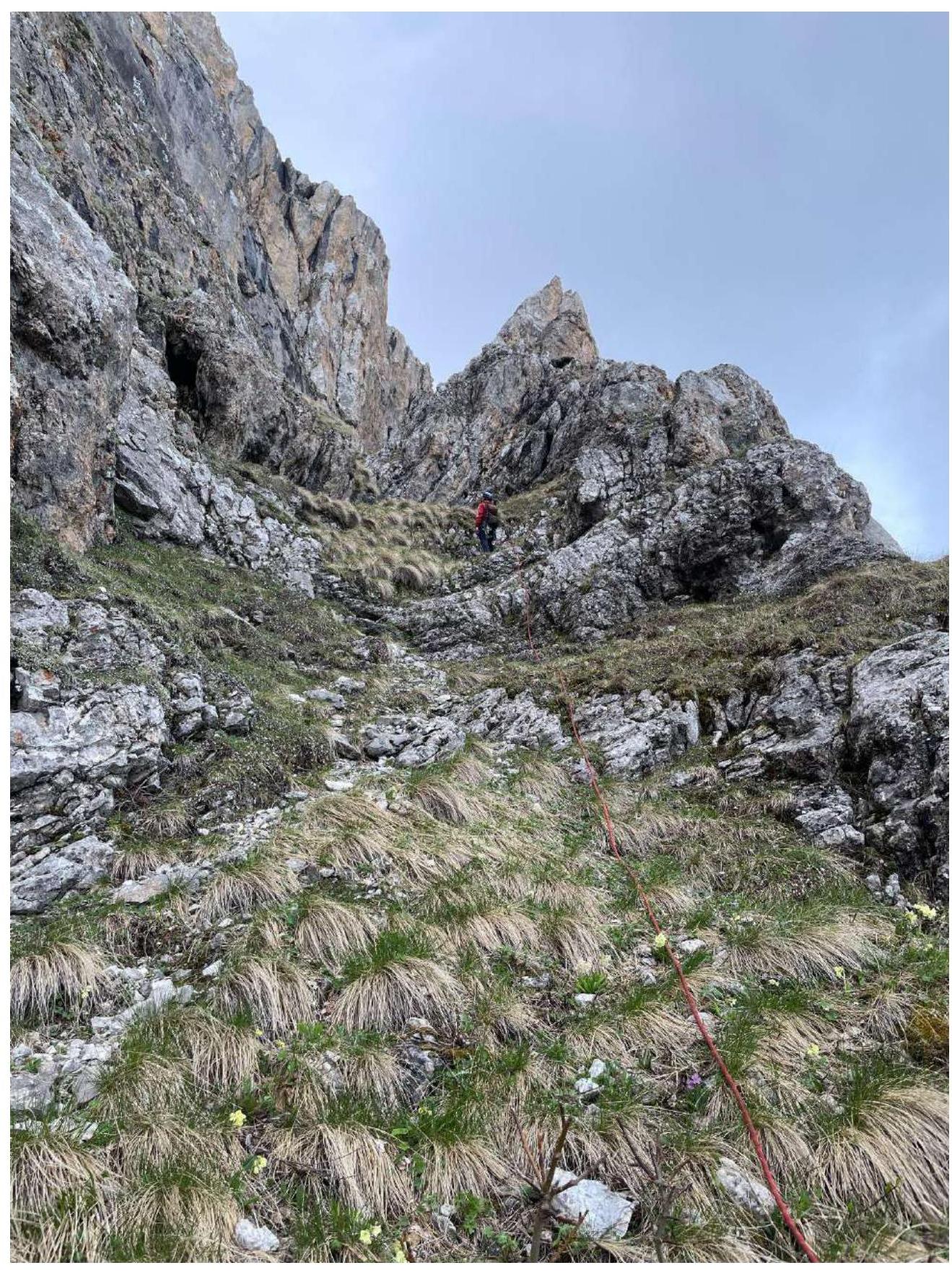
Photo 6. Section R3–R4
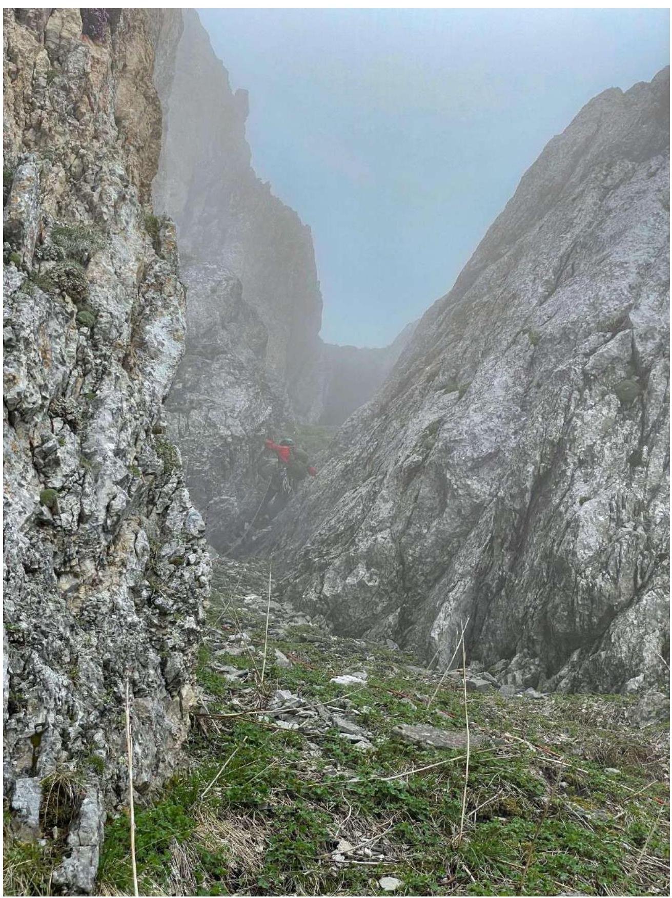
Photo 7. Section R3–R4
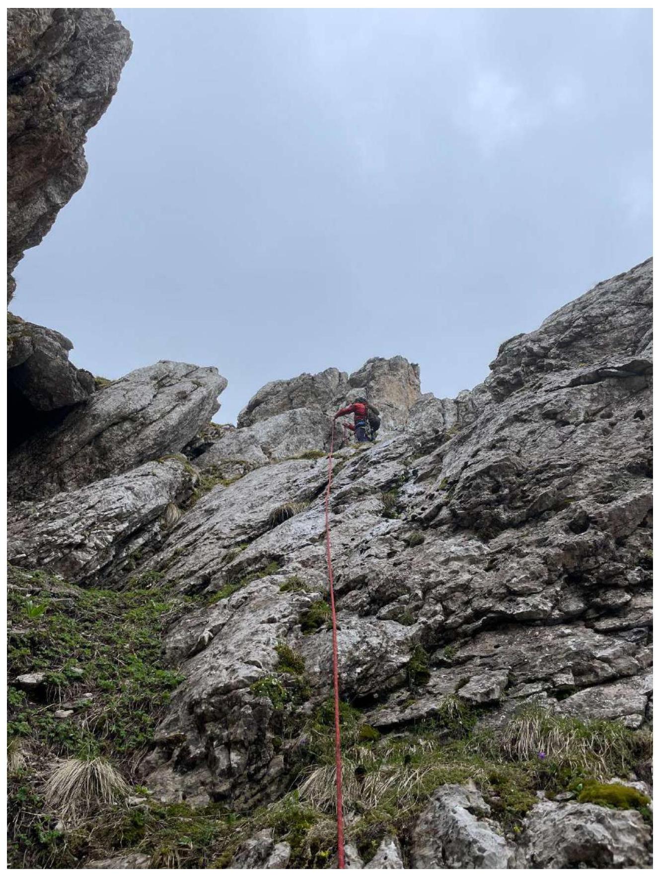
Photo 8. Section R3–R4
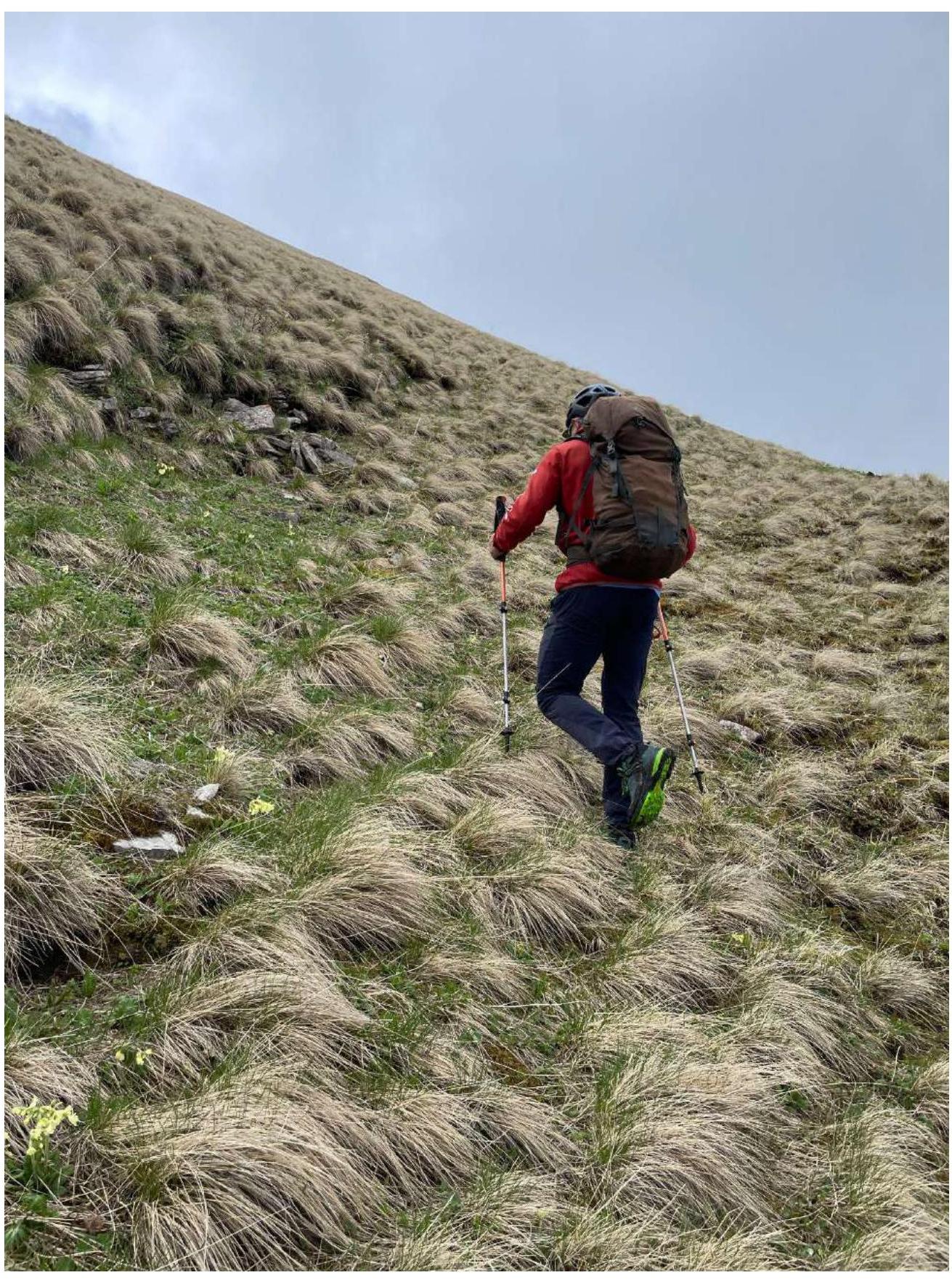
Photo 9. Section R4–R5

3.2. Photo of the team on the peak at the control tour
3.3. Route Safety Assessment
Overall, the entire route is safe. On the approach to the technical part, there are options for passing along the terraces. On the first two ropes, it's recommended to set more points, as the belays run significantly across the slope. On section R3–R4, there may be more snow and moisture.
Options for communication on the route:
- Cellular connection is available along almost the entire route: MTS and Beeline.
- Exceptions may be natural obstacles that sometimes cause signal loss.
- Radio communication works.
- On the peak, there is good cellular and radio communication.
Recommendations for future climbers: It's recommended to bring crampons after snowfall and rain. Anchor hooks are the best for insurance, as there aren't many places for placements on the technical part.
Descent from the peak:
- Along the ridge to the east
- Down the slope to the south
There's a trail and cairns.
Conclusion on the preliminary route assessment: Based on the experience of the climbers and the general opinion, it can be stated that this route corresponds to the declared category of complexity, as the set of obstacles objectively reflects its complexity.
Comments
Sign in to leave a comment