
Passport
- Ascent class: rock climbing.
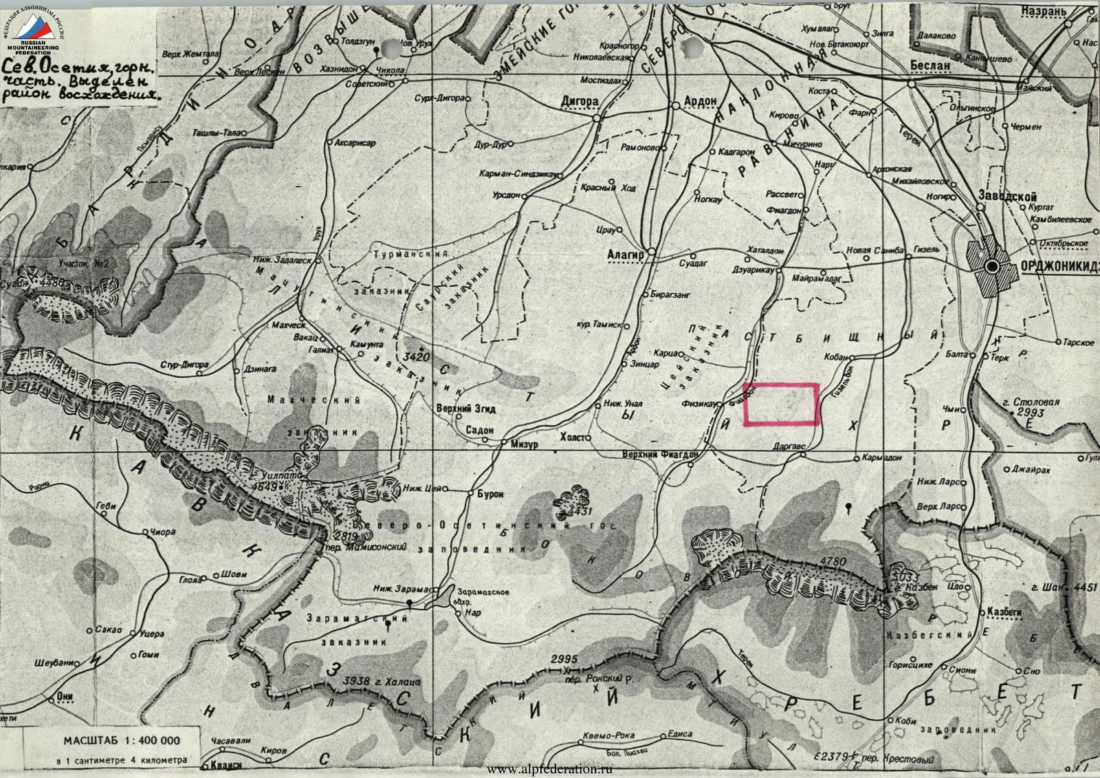
- Ascent area: Caucasus, Rocky Ridge.
- Peak, route: Tbaukhoh (3007 m), via the left part of the Southwest wall.
- Estimated category of difficulty: 3B–4A, first ascent.
- Height difference: 600 m — including 400 m of actual wall climbing — total route length: 900 m — length of wall climbing: 450 m, including: — 35 m of 5th category complexity — — average steepness of wall: 65° — average steepness of route: 45°.
- Number of pitons: — rock pitons: 12/0 — ice screws: 0/0 — chocks: 9/0 — bolt pitons: 0/0
- Number of climbing hours/days: 7 hours / 1 day.
- Overnight stays: none.
- Leader: Sergey Vladimirovich Egorin, Candidate Master of Sports. Participant: Igor Oleg-Slavyanovich Afanasyev, Master of Sports.
- Coach: Boris Nikolayevich Korabdin, Master of Sports, Honored Coach of the RSFSR.
- Departure to the route: November 3, 1996. Summit: November 3, 1996. Return: November 3, 1996.
- Organization: North Ossetian Republican Search and Rescue Service of the Ministry of Emergency Situations of Russia.
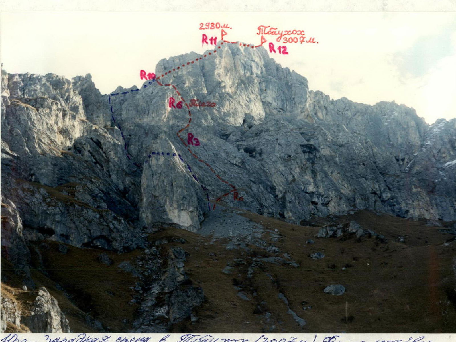
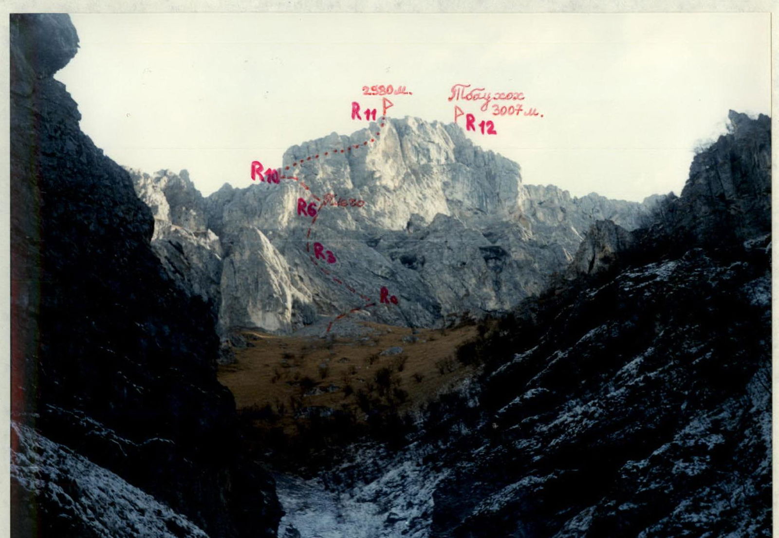
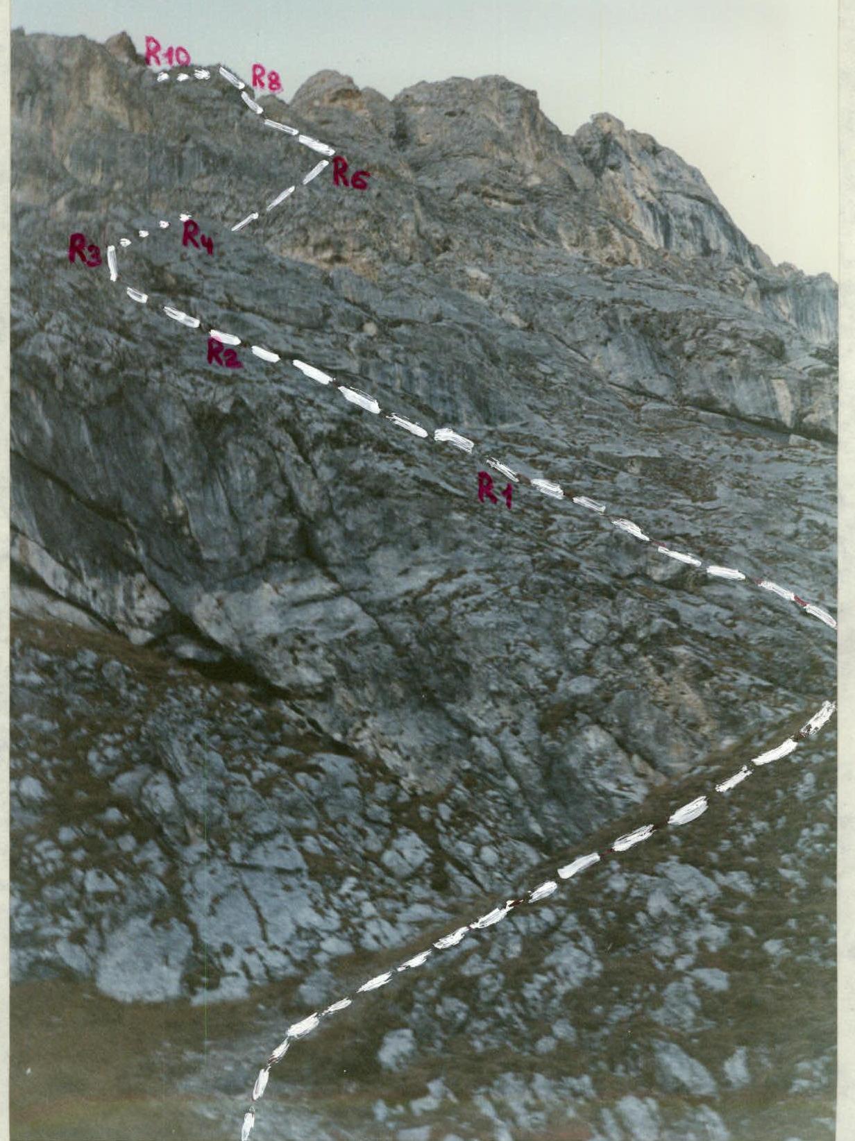
Southwest wall of Tbaukhoh (3007 m). Photo taken from overnight bivouac. November. The first ascent route is marked in red. The route by Yu. Levkovsky, 3A category, from the South to the Northwest ridge is marked in blue – 1994.
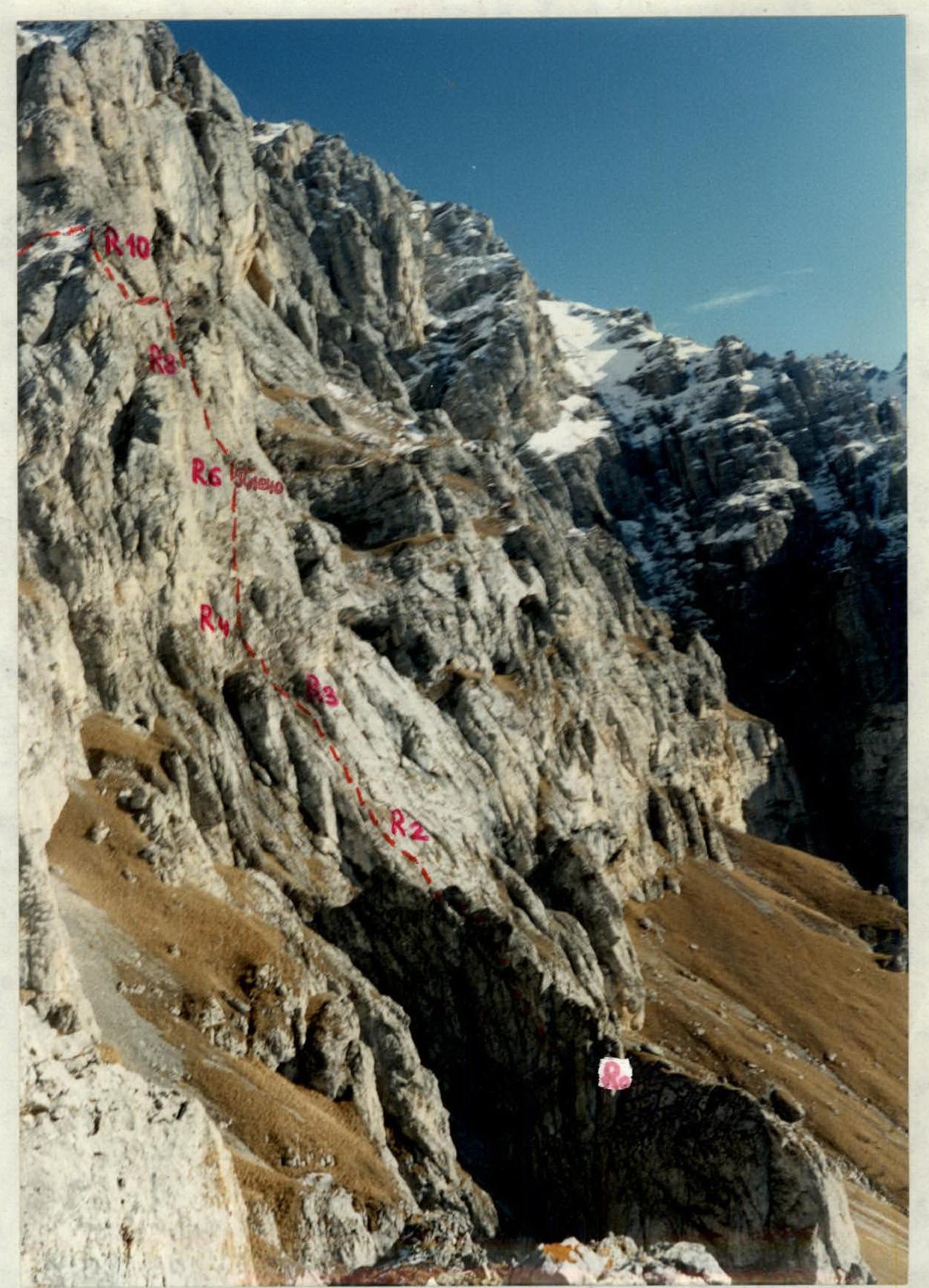
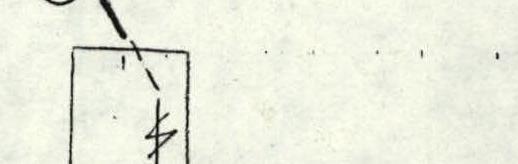
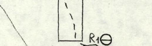
Profile of the lower left part of the Southwest wall. November. The first ascent route is marked.
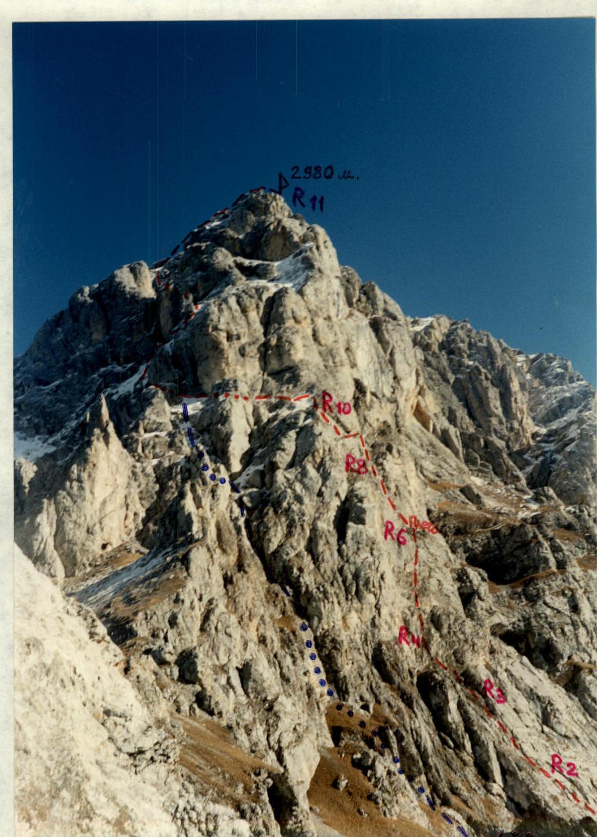
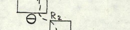
Profile of the upper left part of the Southwest wall. November. The first ascent route is marked in red. The route by Yu. Levkovsky's group: from the South to the Northwest ridge – 1994.
SCALE 1:400 000, 1 cm = 4 km

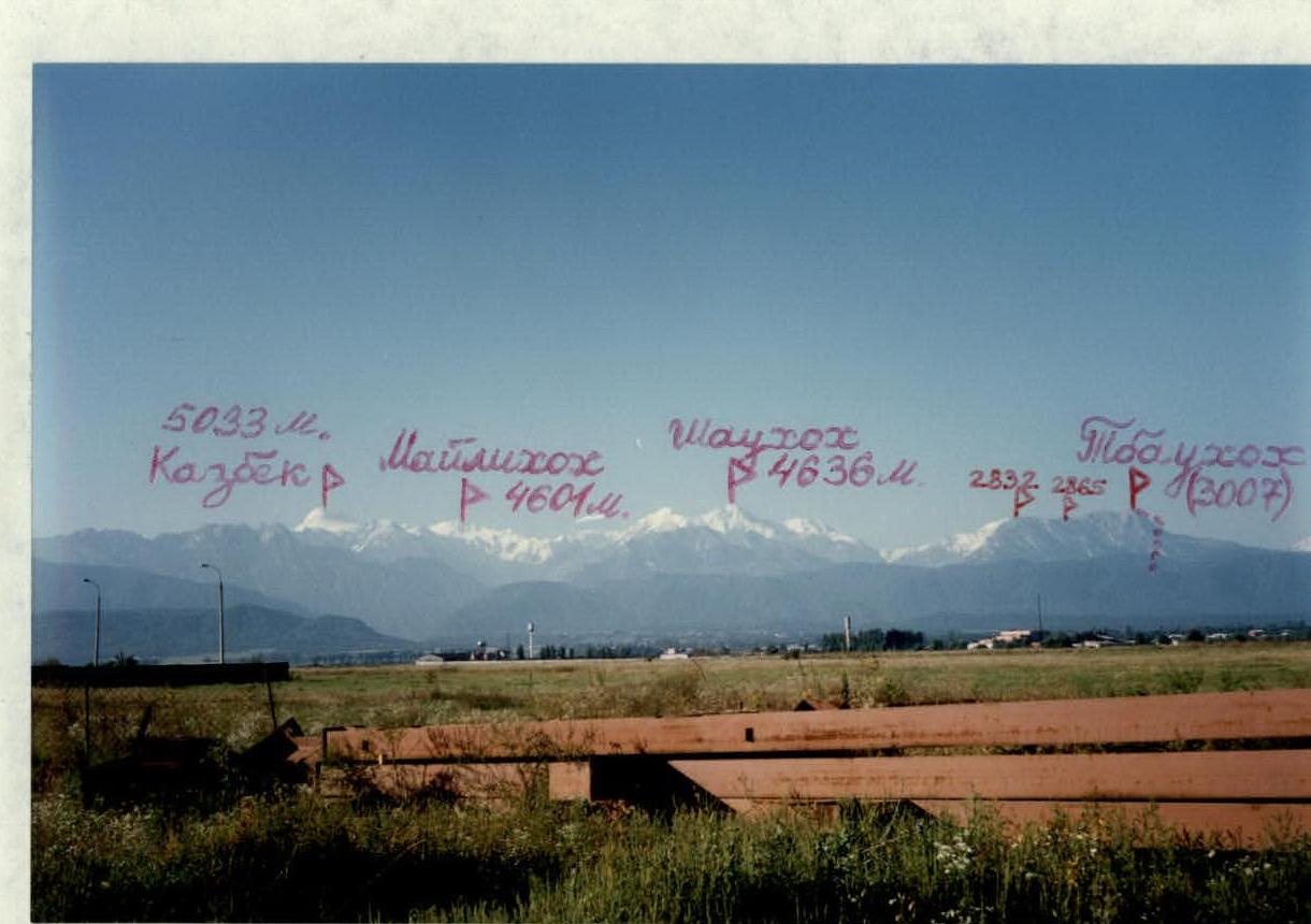
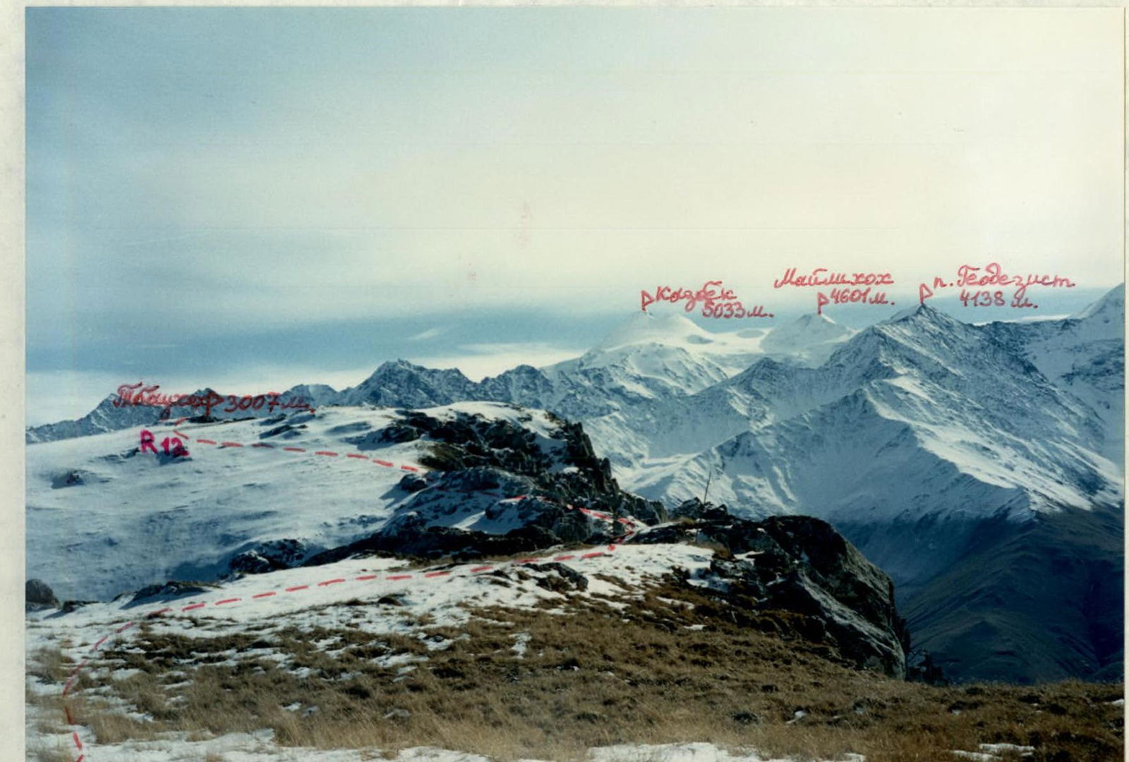
Panorama of the ascent area. Photo taken from the northwest outskirts of Vladikavkaz, September. The peaks of the Lateral Ridge and the Tbaukhoh massif are marked. All peaks are visible from the North. The first ascent route is marked.

View of the Southwest wall from the approach, at the beginning of the gorge. November. The first ascent route is marked.
Brief overview of the ascent area
The ascent area is located in the Rocky Ridge on the territory of the Republic of North Ossetia — Alania, between the Fiagdon River to the West and the Gizeldon River to the East. The Tbaukhoh peak massif stretches from West to East for three kilometers and has four peaks. The highest one is the Main Tbaukhoh, with a height of 3007 m. To the Northwest is the Northwest Tbaukhoh, 2980 m. To the East of the Main peak is the Eastern peak, 2865 m. To the Northeast of the latter is another Tbaukhoh peak, 2832 m.
The rocks forming Tbaukhoh are of sedimentary origin — limestones, dolomites, and occasionally calcites and marble. Like all peaks of the Rocky Ridge, Tbaukhoh is a typical escarpment, with relatively gentle northern slopes and steep southern slopes with wall outcrops. Thus, the 2980 m and 3007 m peaks drop steeply to the Southwest towards the Kurtatinsky gorge, with a 500–600 m wall, and the 2832 m peak drops to the Southeast with bastions, with a 300–400 m drop. All these walls are climbable.
The rocks of Tbaukhoh are stronger and more monolithic than those to the West, such as Kariuhoh and the Kion massif of the Rocky Ridge.
Previously, Tbaukhoh was only visited from the South, from the villages of Kakadur and Fazikau, via a route of approximately 1A–1B category (winter).
Among the Ossetians of the Dargavsky gorge, Tbaukhoh is considered a sacred peak, the abode of Tbau-uad-Ila (St. Elijah of Tbau). Annually, in July, the villagers of Dargavs still celebrate a festival in his honor.
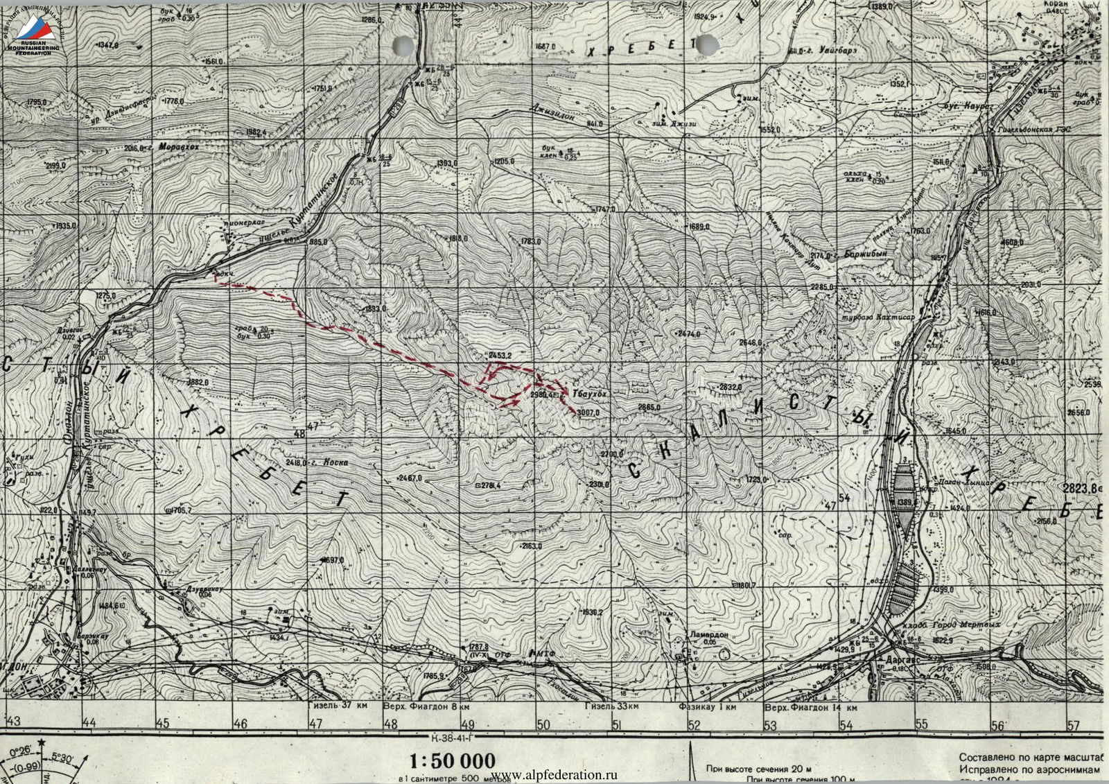
Description of the approach to the route
From Vladikavkaz, take a regular bus to Kharisdzhin, travel along the Kurtatinsky gorge to the "Metallurg" pioneer camp — approximately 1.5 hours.
Here, cross the Fiagdon River by bridge and ascend along a dirt road. Passing through a forest and two clearings, you will reach the beginning of a gorge (on its left orographic slope), situated between the Northwest and Southwest ridges of Tbaukhoh. Follow an old abandoned road upwards through a beech forest. The road eventually disappears; cross a stream to the right orographic side of the gorge. From the water intake to this point — approximately 1.5 hours.
Continue up the gorge along grassy slopes. Upon reaching a narrow canyon, divert to the right-hand slopes, which are forested.
After the canyon ends, continue ascending along the narrow gorge's bottom towards the visible Southwest wall of Tbaukhoh (3007 m).
Upon reaching a fork in the gorge, turn left and ascend via a scree-filled couloir.
Once the walls bounding the couloir on both sides end, stop for an overnight stay. The Southwest wall of Tbaukhoh is visible ahead. The height here is approximately 2200 m.
- From the bridge over the Fiagdon River to this point — approximately 5 hours.
- Elevation gain — 1200 m.
- No water at the overnight stay location.
- Snow is possible from December to June (on the southern slopes of the Northwest ridge of Tbaukhoh).
- It is also possible to find an overnight stay in a grotto within the surrounding walls.

Route description
From the overnight stay, move directly upwards towards the visible Southwest Description wall of Tbaukhoh (3007 m). The route follows grassy and scree slopes; maintain direction towards the left part of the Southwest wall. In particular, aim for the reddish triangular rock, "The Nose," situated before the wall.
Upon reaching the base of the wall (approximately 1 hour from the overnight stay, height approximately 2400 m), divert right along a grassy ledge towards the start of Yu. Levkovsky's route, 3A category, from the South to the Northwest ridge. Follow the ledge for about 50 m.
SECTION R0–R1: Ascend the left part of the Southwest wall via a faintly visible ledge upwards to the left. The ledge is 2–3 with sections of 4. 50 m.
SECTION R1–R2: Continue left and upwards, bypassing steep rocks with black streaks on the left. The wall is 3 and 3+, with sections of 4, up to 70°, 50 m.
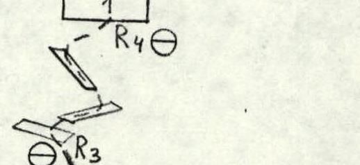
SECTION R2–R3: Ascend directly up the wall (3+ and 4) to a cleft. Climb up the cleft — narrow, with "live rocks," 5, 6 m. Above the cleft, reach a small ridge. The entire section is 50 m.
SECTION R3–R4: Continue along grassy ledges with rock steps. Keep to the right of the visible hanging reddish rocks above. This section is 2–3. 50 m.
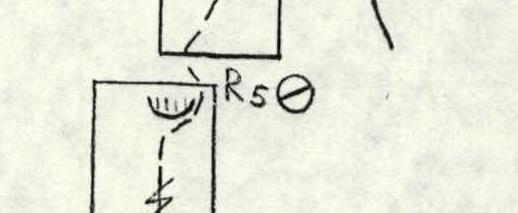
SECTION R4–R5: Ascend right and upwards along the wall towards a visible wall edge against the sky. To the edge, 4. Left of it, via cracks and the wall, ascend 10 m, 5. Further, approaching the wall under a cornice, traverse right beneath it and exit upwards to a ledge — 5, 4 m. The entire section is 50 m.
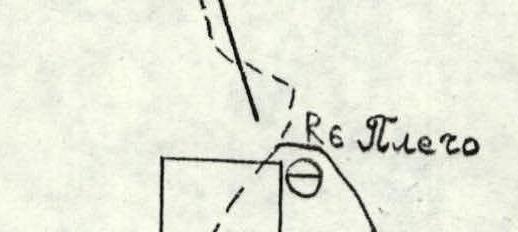
SECTION R5–R6: From the ledge, ascend a monolithic wall with few holds, right and upwards, 5, 10 m. Then, follow rocks of 2 and +, 25 m, to the shoulder of the left part of the Southwest wall.
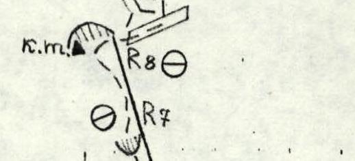
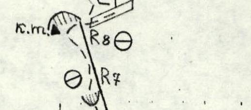
SECTION R6–R7: From the shoulder (overnight stay possible), ascend directly up a faintly visible reddish rib. Initially, from the shoulder, reach its right part via a ledge, 2, 10 m. Then, follow the right part of the rib, and subsequently the left part under a cornice — 3 to 4+, 20 m. Traverse the cornice, 5+ upwards, 5 m. Then, ascend the wall another 5 m to small ledges, 1. The entire section is 40 m.
SECTION R7–R8: Ascend the walls of the left part of the rib, 30 m, 3+ and 4. Here, under an overhanging rock in the left part of a scree-filled niche, there is a control cairn.
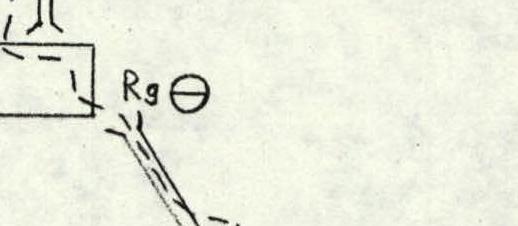
SECTION R8–R9: From the control cairn, traverse a ledge, 2, right for 15 m to a chimney-cleft. Then, ascend the chimney through rock blocks within it and on the walls. "LIVE ROCKS"! Another 30 m, 4.
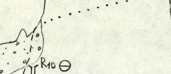
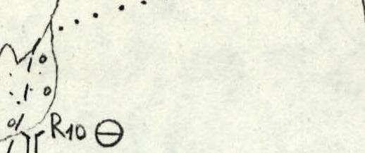
SECTION R9–R10: Ascend directly up the wall, then traverse left 5 m and exit, left of a large chimney-cleft, over the wall's inflection to scree slopes. The entire section is 50 m, 4 and 4+. The traverse is psychologically challenging. From the start of the route — 6 hours.
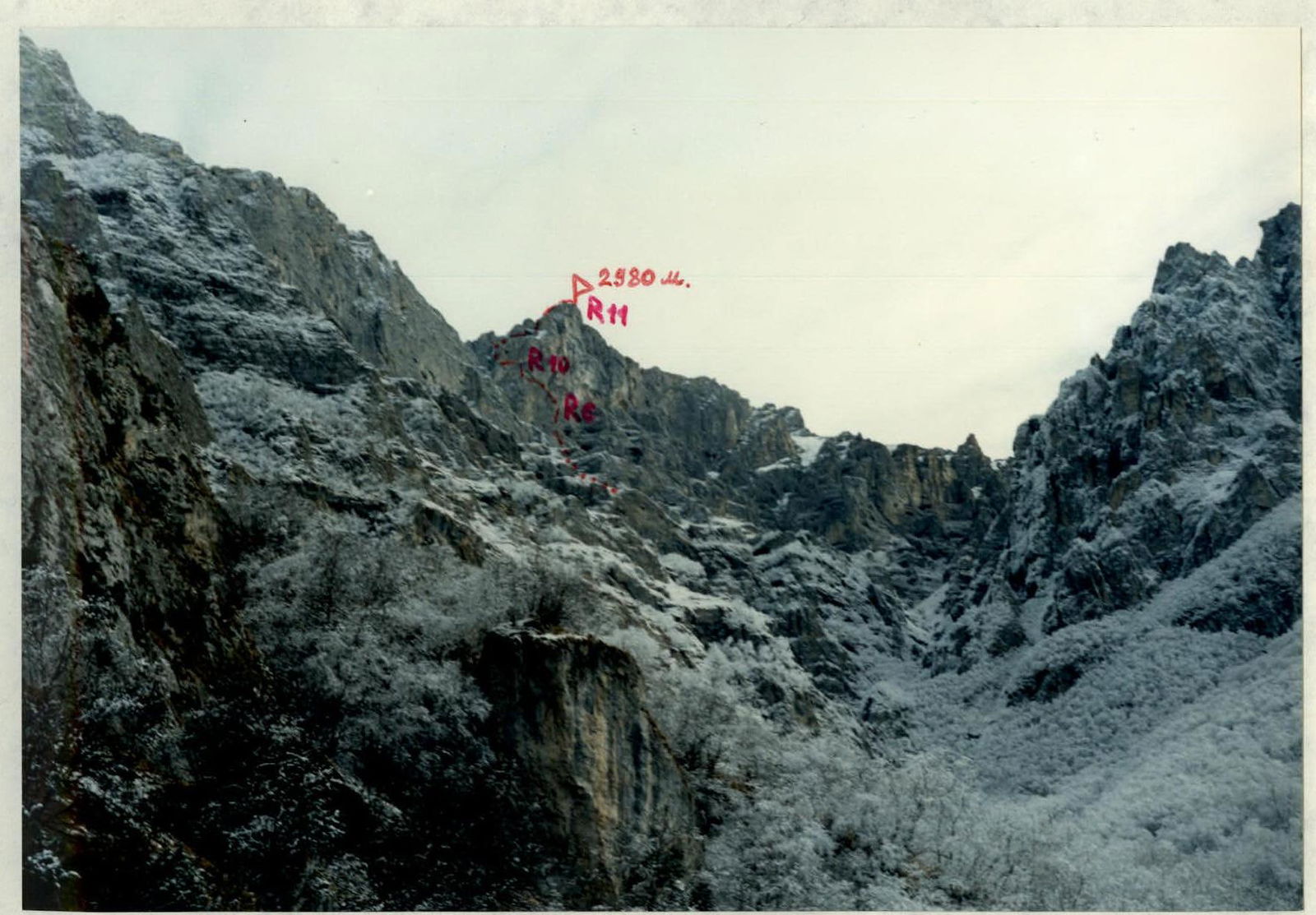
SECTION R10–R11: Ascend scree slopes, 1, under hanging reddish walls to a visible col. On the col, turn right and follow the Northwest slope along grassy-scree paths and scree slopes, 1–2, bypassing difficult sections. Approach the summit tower and divert left beneath it. Ascend the tower from the East via walls and slabs, 2–3. From the wall's inflection — approximately 1 hour.
This tower is 2980 m; its summit cairn also contains notes. To reach the highest point of the Tbaukhoh massif, continue further South.
SECTION R11–R12: From the 2980 m peak, descend along grassy slopes to the South, bypassing rock outcrops, to a col between the peaks. Then, ascend Southwards, bypassing rocks via paths, 1–2, to the highest point of the Tbaukhoh massif, 3007 m. From the 2980 m peak — approximately 20 minutes.
Descend from the 3007 m peak Eastwards along broken rocks, then divert into the next scree-filled couloir to the South and descend into the Dargavskoe gorge towards the villages of Kakadur and Fazikau; the descent in this direction takes approximately 4–5 hours.
An alternative descent to the overnight stay beneath the Southwest wall: from the 2980 m peak, descend along the Northwest slope, bypassing difficult sections via scree and ledges. Then, reach the Northwest ridge to a large old cairn. This ridge drops steeply to the South, while to the North, it has grassy-scree slopes. Follow the right side of the Northwest ridge Southwards to a faintly visible couloir leading South (approximately 10 minutes from the cairn). Descend a steep grassy-scree couloir, with "live rocks"! In the middle section of the couloir — 15–20 m rappel or sport climbing. Further, along scree to a 5-meter wall, also descend with a rope. Then, follow scree to the overnight stay. From the summit — 2–2.5 hours.
View of the Southwest wall of Tbaukhoh (3007 m) from the approach. November. Photo taken from a height of approximately 2100 m. The first ascent route is marked.
View of the left part of the Southwest wall of Tbaukhoh (3007 m) from the start of the route.
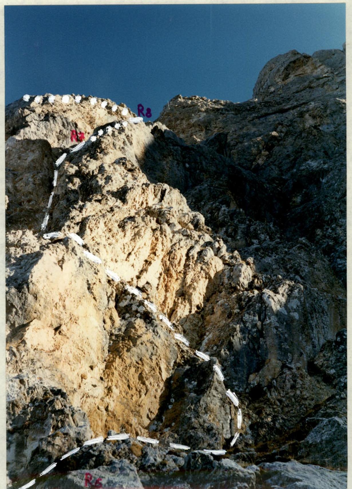
View from the "Shoulder" to the upper part of the wall. The section numbers are marked on the photo.
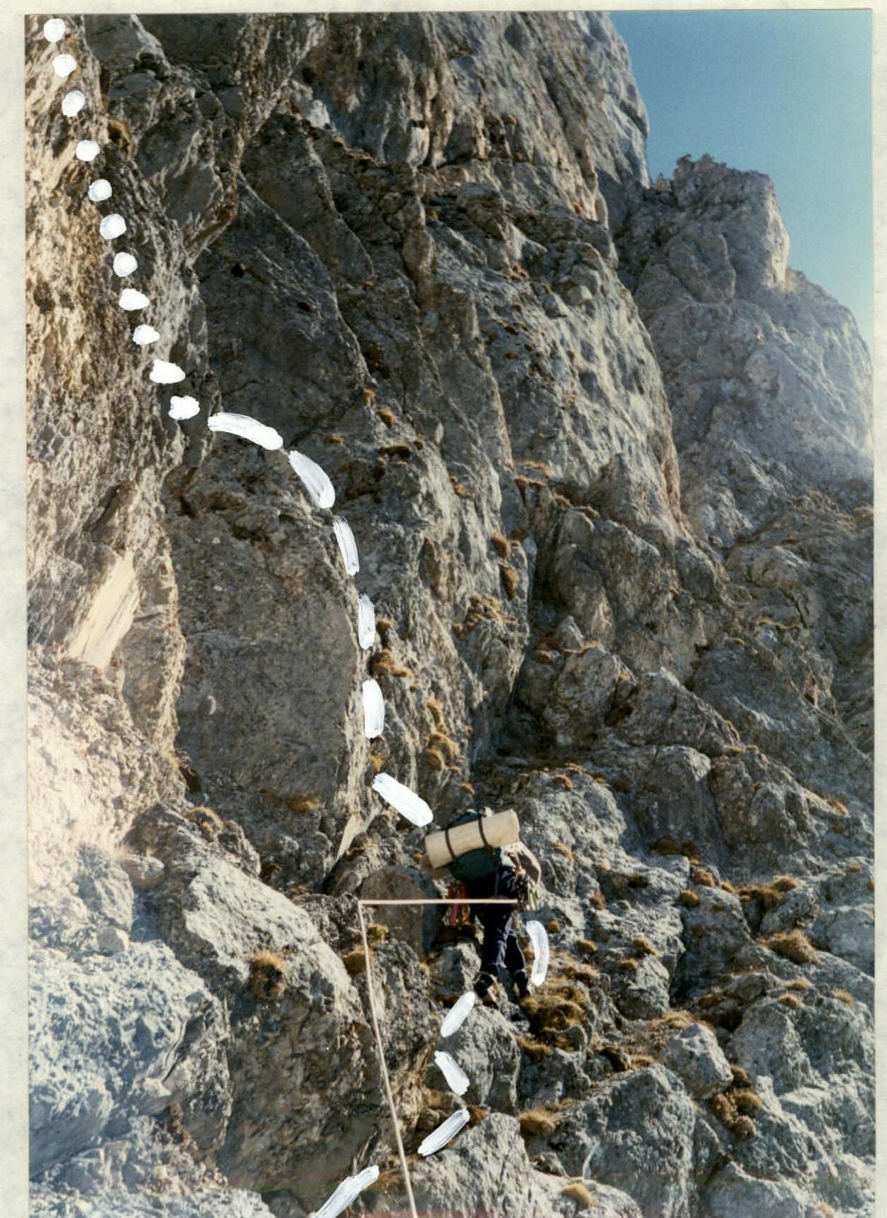
Passage of the start of section R8–R9 (first 15 m along the ledge to the right). Photo taken from the control cairn.
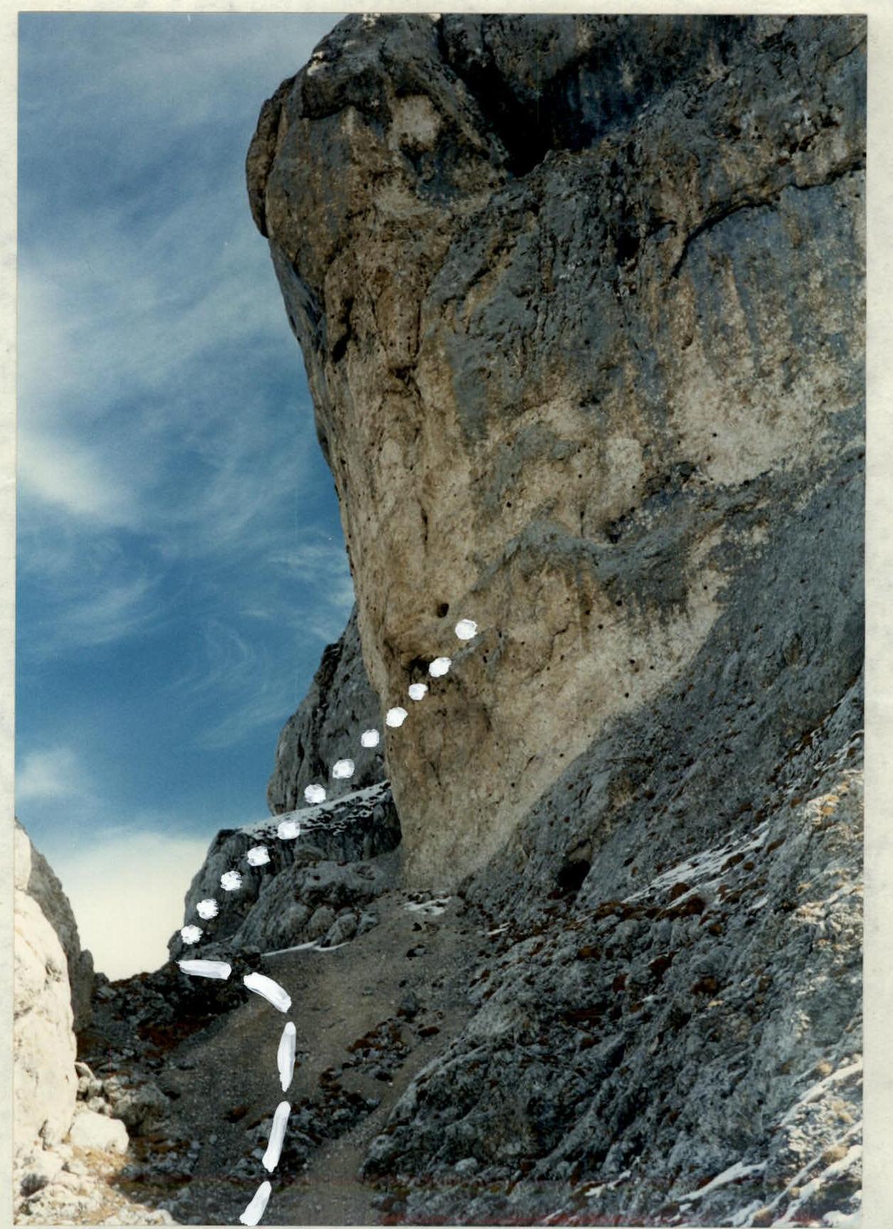
Section R10–R11. Ascent after the wall along the Northwest ridge. Photo taken from the end of the wall.
Conclusions and recommendations for the route
The route can be undertaken at any time of the year, even in winter, since the ascent to the ridge is from the South, and snow melts quickly on the southern walls of the Rocky Ridge even after heavy snowfalls. Generally, the climate on the southern slopes is much drier than on the northern slopes due to the "rain shadow" effect. South of the Rocky Ridge lies the Sun Valleys, where annual precipitation is nearly half that of Vladikavkaz or Alagir. Thus, the route is safe from the South in terms of avalanches; however, on the ridge from the North, snow slabs can occur, necessitating staying as close as possible to the ridge. Caution is required on scree slopes during ascent and descent due to loose rocks. Water (or snow) is only available in winter on the route and along the approach path. On the northern slopes of the ridge, snow persists even in the off-season, approximately from October to early June.
The route is quite interesting in a sporting sense as a purely rock climb with engaging and challenging climbing for its category. It can be recommended for both training and competitive ascents, especially in winter and during the off-season. Due to the relatively low height of the peak (compared to the Lateral Ridge), to make the route more interesting in a sporting sense, it is recommended that peaks in this area be classified within the proposed category of difficulty, similar to peaks in the Western Caucasus, such as Kardyvach and Tsyndyshokh — i.e., from October 15 to May 15.
Comments
Sign in to leave a comment