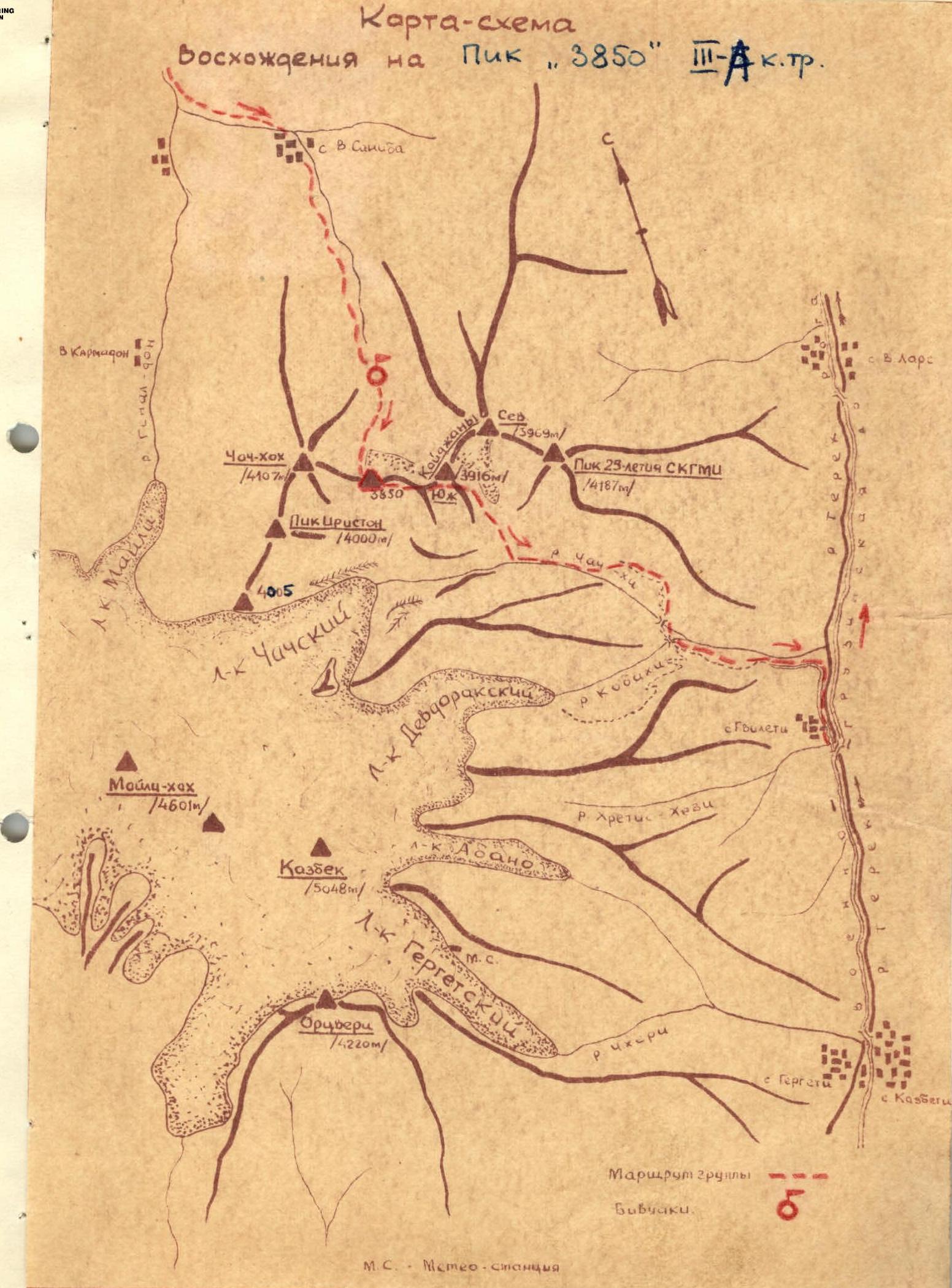
Ascents to Peak "3850" 3B cat. (in North Ossetia it is called Peak "3944").
The summit is located in the northern spur of the Lateral Ridge of the Caucasus. The spur branches off from Peak Spartak (4677 m) on the Kazbek firn plateau and includes the following peaks from south to north:
- Unnamed (Peak Ordzhonikidzevskaya Railway — 4007 m)
- Peak Iriston (4000 m)
- Chach-khokh (4100 m)
- Peak "3850"
- South Kaidzhani (3916 m)
- North Kaidzhani (3969 m)
Climbers ascending the Kaidzhan–Chach-khokh traverse have twice reached the summit. In January 1959, D. Shevchuk's group ascended Peak "3850" as an independent ascent object from the east; however, the route from the east remained unclassified (approximately 1B cat.).
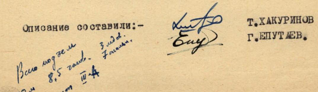
The first ascent of the northern ice-rock rib of Peak "3850" was made by a group of climbers from the North Ossetian Sports Society "Spartak" under the leadership of T. Khakurinov on October 3, 1965. Following the pioneers, a group from the SO Council "Spartak" under the leadership of G. Eputaev ascended the route.
Day 1. From Ordzhonikidze, take a car to the village of Saniba — the road goes through the village of Gizel along the Genaldon Gorge. When exiting the Genaldon Gorge narrows, cross the bridge to the right (orographic) bank of the Genal-don River, and then continue on the upper road to the village of Saniba. The car journey takes 1.5 hours.
From Saniba, ascend the gorge to the South-Kaidzhany – Peak "3850" – Chach-khokh cirque. Initially, it is a fairly narrow road (up to the abandoned well) that follows the right (orographic) slope of the gorge. Without descending to the drilling site, turn sharply left and exit onto the trail. After 1.5–2 hours, the trail becomes barely noticeable, but the path is easily discernible.
Above the upper forest boundary, the gorge widens slightly, and moraine hills begin. The path goes through the middle of the gorge towards a grassy ascent. After reaching the middle terrace and walking another 100–150 m, you arrive at a small lake under a moraine ridge stretching from the base of Chach-khokh's counterfort to the opposite side of the gorge. It is better to set up camp here as there is no water above, and the location is well-protected from the wind. The journey from Saniba to the small lake takes 4–4.5 hours.
Day 2. From the campsite, ascend to the moraine ridge and then to the distinctly visible northern rib of Peak "3850". The path to the rib's rocks initially goes across scree slopes with 15–25° steepness, then transitions to a snow-ice slope with 25–30° steepness. Before reaching the snow-ice slope, rope up and continue with alternate belay. It takes 1–1.5 hours to reach the rocks from the campsite.
Without reaching the first rocks, bypass part of the rib to the right towards an ice couloir, and without entering the couloir, exit onto the second rock massif of the rib, forming the couloir's edge. Rockfall and ice avalanches are possible in the couloir! The slope's steepness on the bypass is 35–40°, and the length is 2 ropes. Movement along the rib is with alternate belay through outcrops. The rib's rocks are composed of heavily weathered schist. There are many "live" stones. The overall steepness of the lower part of the rib is 60–65°. Small vertical walls with 70–75° steepness are encountered.
After 3 hours of movement along the route, you reach a gentle snow step on the rib, dividing it into lower and upper parts. There is a convenient wide area suitable for camping, where a control cairn is built.
The break represents a snow-ice slope with up to 45–50° steepness in the upper part, under a rock "triangle", and is 6 ropes long. Belay on the slope is via pitons; three ice screws are hammered in, and movement is in crampons. The direction of movement is under the right angle of the "triangle" rock wall. The ice slope and the "triangle" rock wall are the most challenging sections of the route. Through the "triangle" rocks, exit under the edge of a hanging glacier and then left upwards onto the upper part of the rib. The rock steepness is 65–75°. Belay is via pitons; seven rock pitons are hammered in. The length is 1.5 ropes. There are many "live" stones! The upper part of the rib becomes gentler, with 30–35° steepness, and represents a snow-ice ascent with embedded rock sections. It is necessary to move with alternate belay. Belay on rocks is challenging. Crampons are worn until the summit.
The rib leads to the Chach-khokh – Peak "3850" ridge near the latter's summit. The exit to the summit is along a simple snow ridge.
The journey from the control cairn to the summit takes 4.5 hours. The height difference from the start of the route to the summit is 500 m.
The descent from the summit is by traversing the ridge to the east. Without losing height, bypass the tower of South Kaidzhani, cross over its southern ridge into the trough valley (descent from the southern ridge along a scree couloir to the east). From the Kaidzhani glacier trough, descend south into the Chach gorge. The descent from the summit to the gorge takes 2.5 hours. Initially, descend along the riverbed, and then, after the second "gates" of the gorge, ascend to the left (orographic) grassy slope of the gorge, and find a trail that leads down to the confluence of the Kobakhi and Chach-khi rivers.
After crossing both streams, follow the broad terrace on the right (orographic) bank of the Kobakhi River to the Darial gorge, and then continue along the Darial to the right towards the village of Gvileti. The journey from Gvileti to Ordzhonikidze takes just over an hour by car along the Georgian Military Road.
The route corresponds to 3B cat. Recommended equipment for a group of four:
- Ropes – 2 pcs. x 40 m
- Ice screws – 4 pcs.
- Rock pitons – 9 pcs.
- Crampons – 4 pairs
- Carabiners – 8 pcs.
Map Diagram