To the Alpinism Federation of Russia.
The Classification Commission of the FSR of Alania sends a report on the first ascent made by the climbers of the Mountain Club of SKGMI "Krokus" from Vladikavkaz to the peak Kursantov (3915 m) via the Southwest Ridge on August 29, 2011.
The route taken is preliminarily assessed as 1B rock.
REPORT
On the first ascent to peak Kursantov (3915 m) via the Southwest Ridge.
Approximately 1B rock. Made by the climbers of the Mountain Club of SKGMI "Krokus" from Vladikavkaz on August 29, 2011.
Under the leadership of Levkovsky Yuri Vasilyevich.
address: 362035 RSO-Alania, Vladikavkaz, pr. Kosta — 273/69 (uvl53@yandex.ru)
Ascent Passport
- Type of ascent: rock climbing
- Region of ascent: Caucasus, Dzamarashdon gorge, 2.8
- Peak, route: Kursantov (3915 m), Southwest ridge
- Supposed category of difficulty: 1B rock, p/p
- Characteristics of the route:
Height difference — about 1400 m. Route length — 1700 m. Length of sections: 2–3 category of difficulty — 150 m. Average steepness of the main part of the route — 40°
- Belaying through ledges, rock hooks
- Number of climbing hours/days — 8/1
- Number of overnight stays: 2 — at a bivouac
- Leader: Yu. V. Levkovsky — CMS
Participants: Korenkov V. A. — instructor, Nalbandsyan A., Chikin A., Perepelitsyna A., Kochiev A., Dzugkoev V., Saiduev R., Popov N., Plieva Z., Tedeeva A., Arakelyants V., Dziyev Kh., Polbin M., Bugulov A., Khamitsaev S., Kanukov A., Naniev A.
- Coach: Levkovsky Yuri Vasilyevich, CMS
- Exit to the route from the bivouac: August 29, 2011
Return to the bivouac: August 29, 2011
- Organization: MC SKGMI "Krokus"
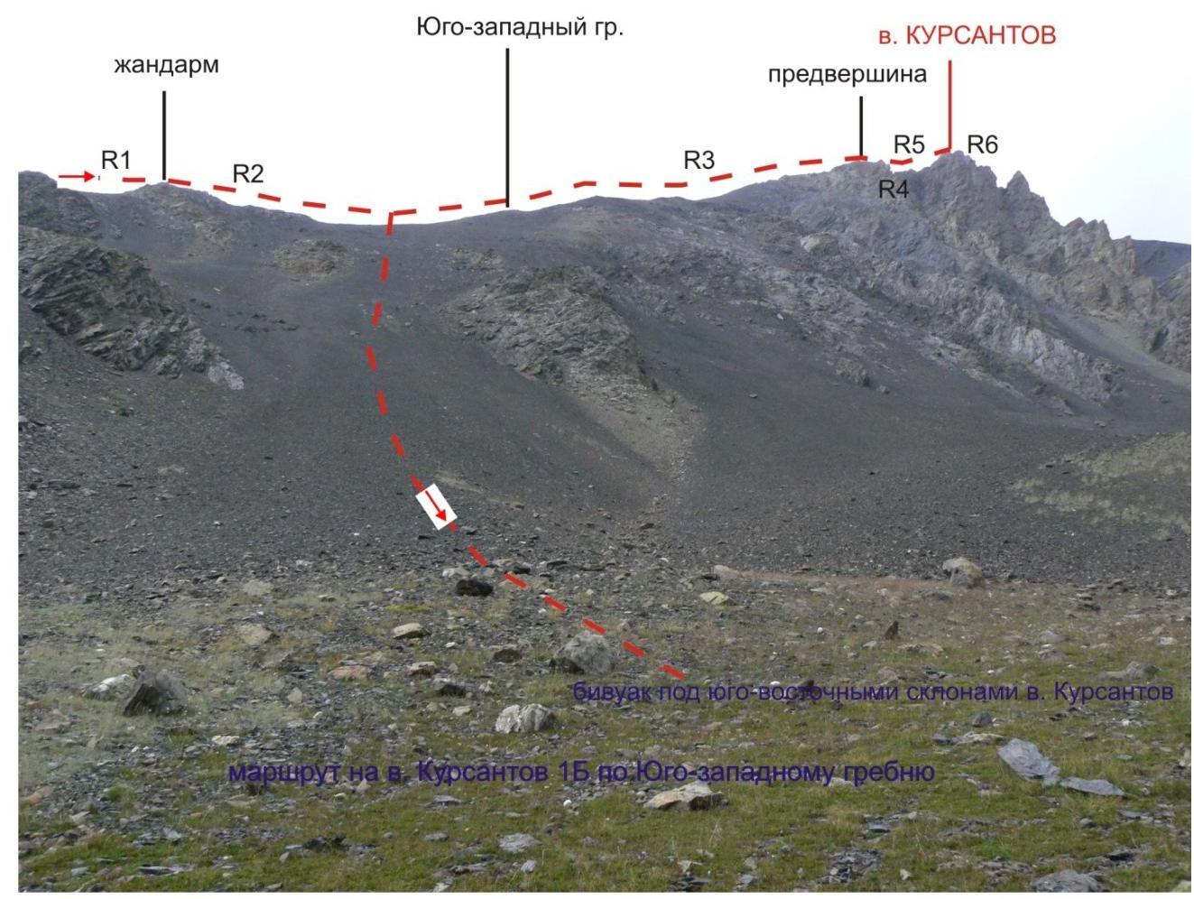
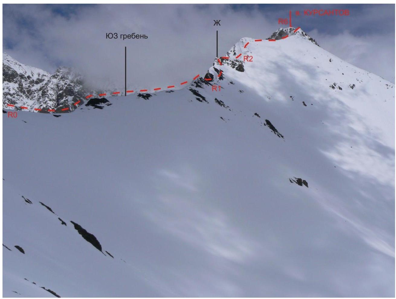
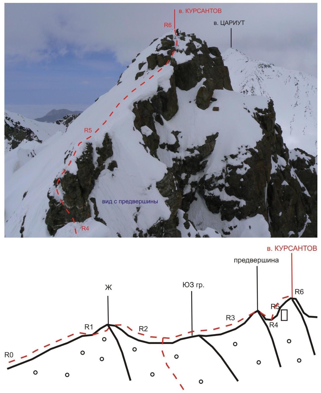
Fig. Peak Kursantov from the southwest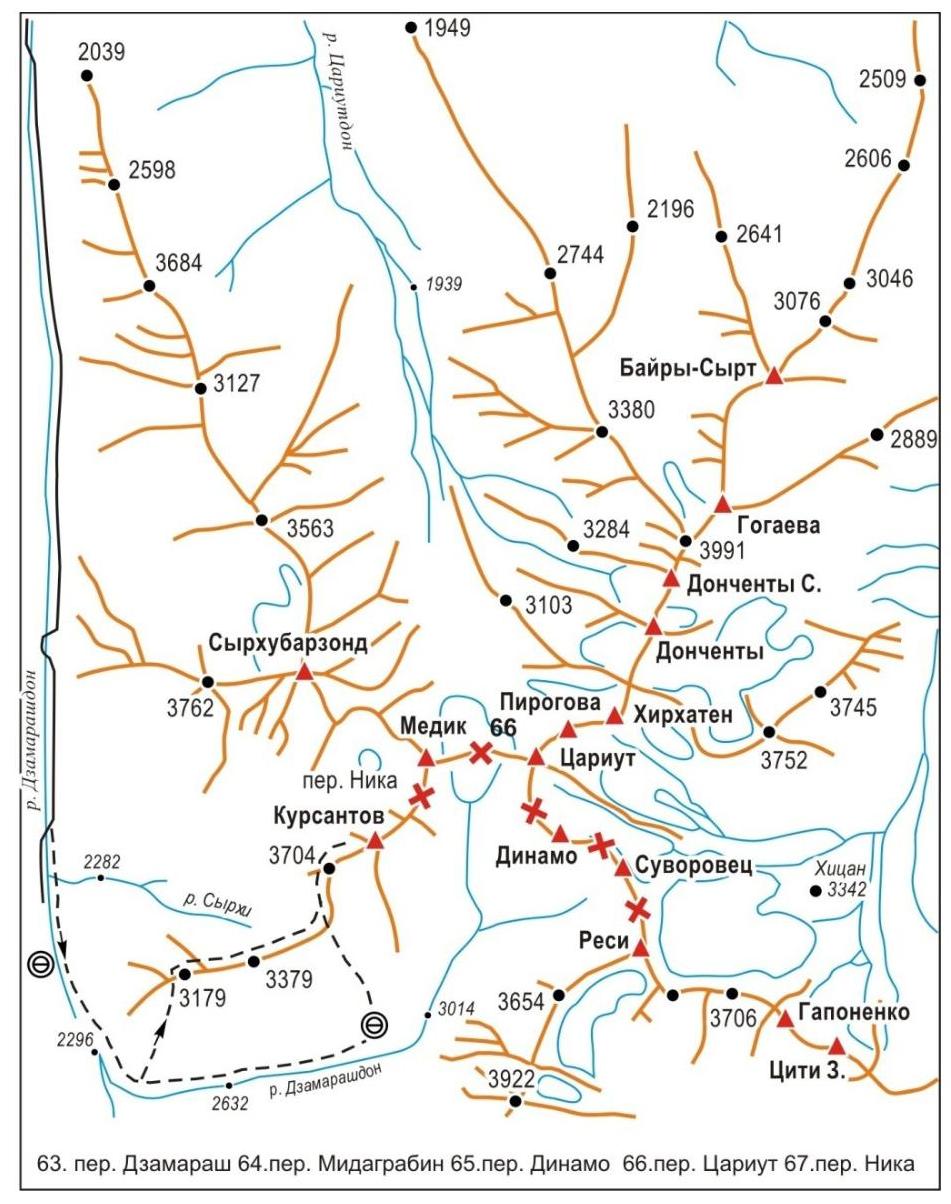
-
pass Dzamarash 64, pass Midagrabin 65, pass Dinamo 66, pass Tsariut 67, pass Nika
Brief overview of the ascent region, history of peak exploration
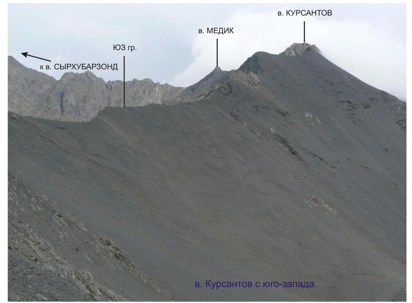
Peak Kursantov (3915 m) is located in the upper reaches of the Dzamarashdon gorge. To the northeast, the peak is bounded by the Nika pass (3850 m), behind which are located:
- peak Medik (3928 m)
- Syrikhubarzon (4148 m)
To the southwest stretches a long rocky ridge, ending in the middle reaches of the Dzamarashdon river.
The massif of the peak is composed of destroyed shales and diabases.
To the northwest, steep scree slopes of the massif descend with outcrops of destroyed rocks; to the southeast, gentle scree slopes descend from the massif.
The peak is named in honor of the cadets of the All-Army Higher Twice Red Banner Command School of Ordzhonikidze (now Vladikavkaz) by the alpinists of this school, who first ascended it under the leadership of A. Avakumyants on May 5, 1968.
The ascent was made along the northeast edge, approximately 3A category of difficulty. The route description has not been preserved, and the route was not formalized.
The second ascent to peak Kursantov was made by geologist Ozerin V. V. from North Ossetia on September 1972 via the southwest ridge, approximately 1B category of difficulty. The route was not formalized.
Preparation for the ascent
In preparation for the ascent, available materials were studied, the location of the peak was determined, and a preliminary reconnaissance and assessment of the route, approach path, and bivouac site were conducted, as well as the principle of ensuring radio communication.
It was established that:
- radio communication is desirable with Vladikavkaz;
- mobile communication is possible on the route.
Description of the approach
The bivouac is located in the middle part of the Dzamarashdon gorge (under the first squeeze) on the territory of North Ossetia (border zone, state reserve) or under the southeastern slopes of the Kursantov massif.
The Dzamarashdon river, together with the Bugultadondon river, forms the Fiagdon river. The path along the Dzamarashdon gorge begins from the confluence of these rivers.
To the confluence of the rivers from the settlement Kharisdzhin (1400 m) leads:
- a good dirt road.
Travel along this dirt road from the settlement Kharisdzhin to the fork takes 1 hour, and the approach takes 3 hours.
Movement passes through the Dzamarashdon gorge along the left bank of the Dzamarashdon river (20 min) initially along a dirt road (possible passage by car), then along a clearly marked trail. After 1.5 hours, we approach under a large first squeeze overgrown with grass. Here, on grassy areas, a convenient bivouac is possible. You can also drive here by a high-clearance vehicle along a dirt road along the right bank of the river, crossing it several times. In this place, the gorge sharply turns east. The Dzamarashdon river in its upper part is formed by the confluence of two streams:
- One of them originates in the eastern circus from under the peaks Suvorovets and Resi.
- The second stream flows from the northern circus from under the peaks Tsariut and Medik.
Here are located the passes Tsariut, Dinamo, Nika.
The ascent along a steep trail along the right side of the gorge leads to a large grassy shoulder above the first squeeze. From the confluence of the Dzamarashdon and Bugultadondon rivers — 2.5–3 hours. Another 1–1.5 hours of movement along the trail along the right grassy slope of the Dzamarashdon river leads to the second squeeze. The second squeeze is overcome along a steep grassy slope of the right side of the gorge. Here, a convenient bivouac is located behind the squeeze near a stream under the southeastern scree slopes of peak Kursant. Height 3254 m. From the settlement Kharisdzhin — 6–8 hours.
Description of the route
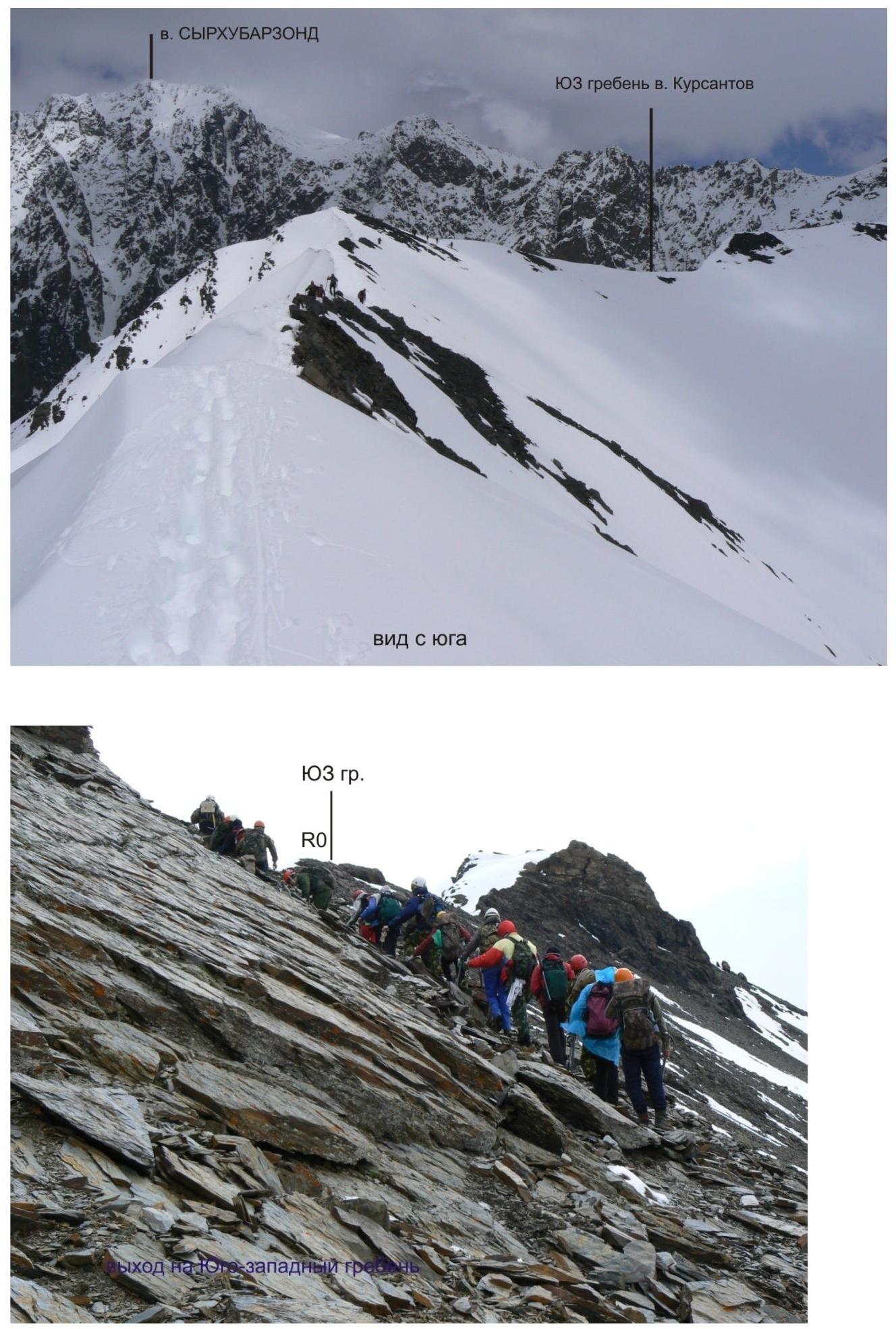
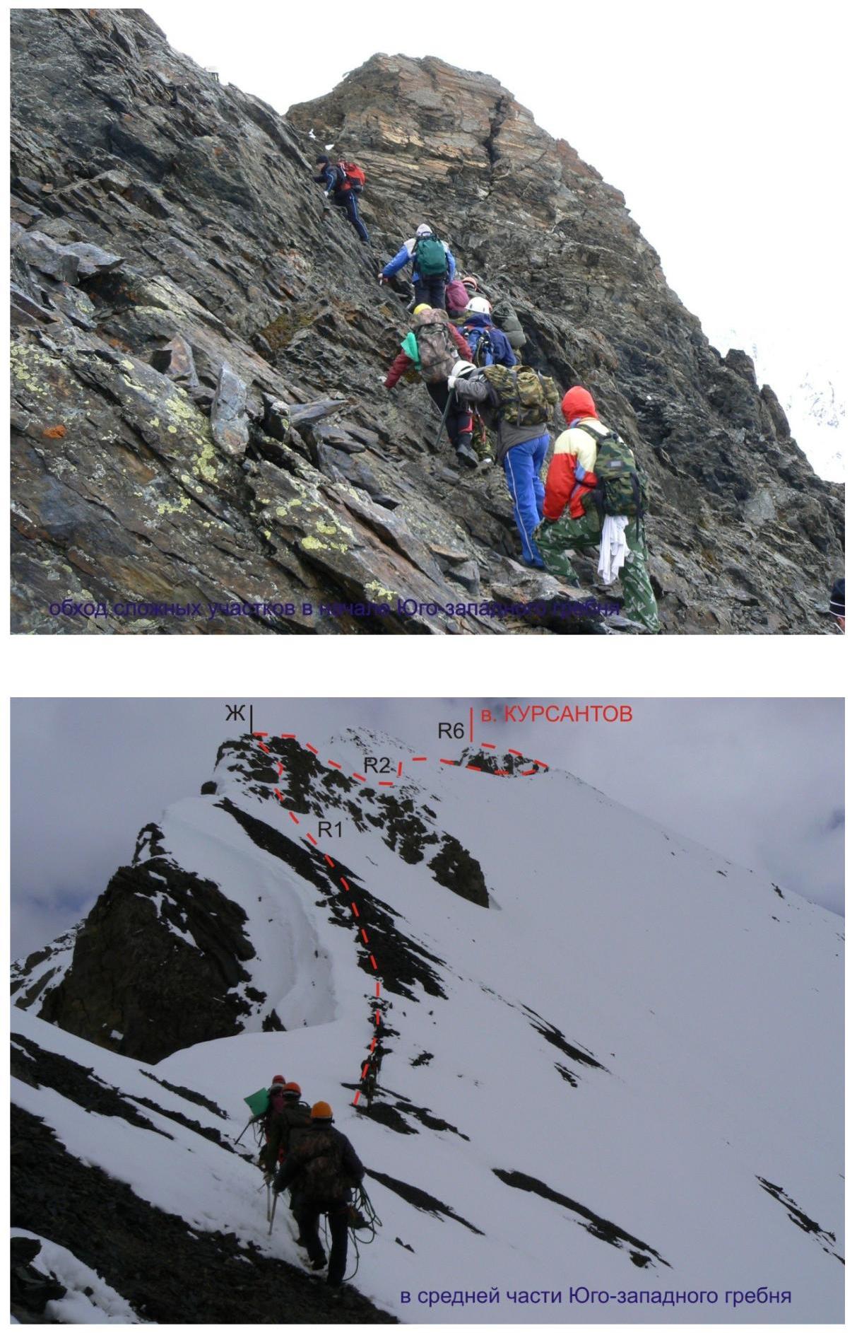
Ascent from the bivouac under the first ledge (2500 m). Exit to the first ledge (40 min). Left upwards — movement along a grassy slope (30–35°, 22:30) to exit to the SW ridge.
Section R0–R1.
- Right upwards along a simple SW ridge (500–600 m).
- Having ascended to the shoulder of the ridge, movement left upwards along a scree ascent of the ridge (300–400 m).
- Further, the ridge becomes narrower and turns northeast (400 m, snow cornice).
Section R1–R2. A large rocky gendarme is passed head-on (3 category of difficulty, 45–50°, 50–60 m). Section R2–R3. Behind the gendarme, movement along a simple scree ridge to the pre-summit (250–300 m). Exit to the pre-summit along simple rocks (2 category of difficulty, 45°, 50 m).
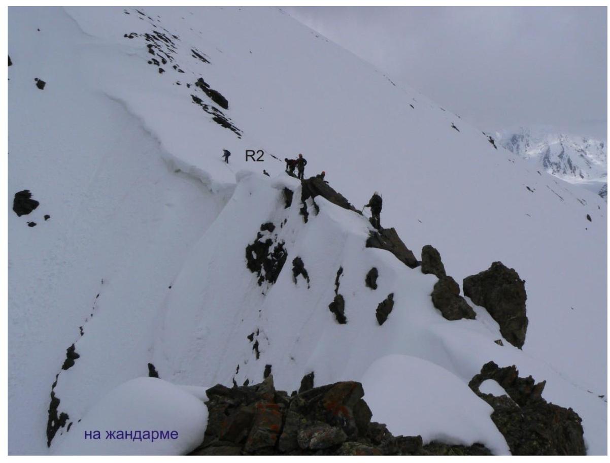
Section R3–R4. From the pre-summit, descent to a narrow saddle before peak Kursantov (2 category of difficulty, 45°, 15 m).
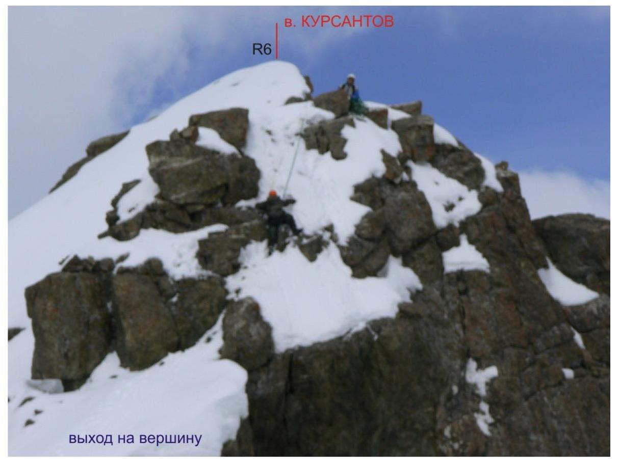
Section R4–R5. From the saddle, 10 meters under a rocky wall. Upwards along the wall (4 category of difficulty, 60°, 5 m), exiting to a section of a narrow rocky ridge. This section of the ridge is overcome by crawling along it (5 m).
Section R5–R6. Upwards along a simple scree ridge (1 category of difficulty, 35°, 30 m), possible snow, cornices. Exit to the summit passes:
- initially along simple rocks (2 category of difficulty, 45°, 15–20 m),
- further along a scree ridge.
From the bivouac 7–8 hours.
Recommendations
The route is logical, objectively safe, and passable at any time of the year. However, in the off-season, one should be wary of cornices hanging to the northwest.
Special features of the route:
- Passable at any time of the year
- Belaying on the route through ledges, rock hooks
- Recommended for training groups
Descent from the summit initially follows the ascent path. Further, turning left, movement downwards along the finest, gentle scree, exiting to the bivouac under the southeastern slopes of peak Kursantov.
Photos of the peak, route:
 Peak Kursantov from the southwest
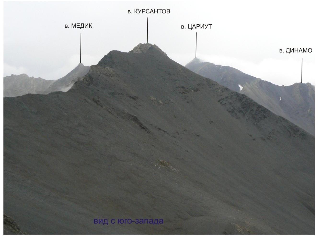
SW ridge
in the middle part of the southwest ridge
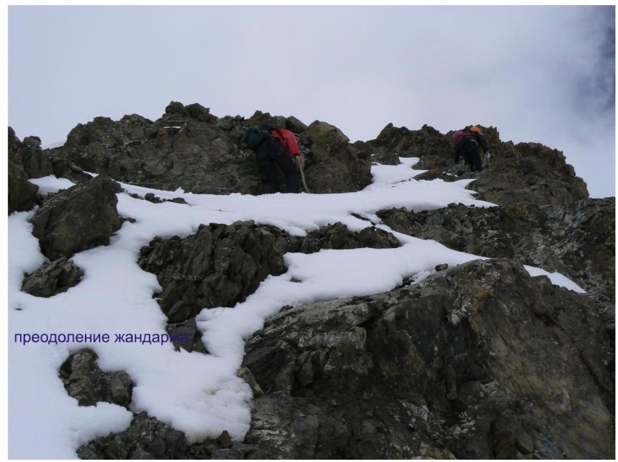
 on the gendarme
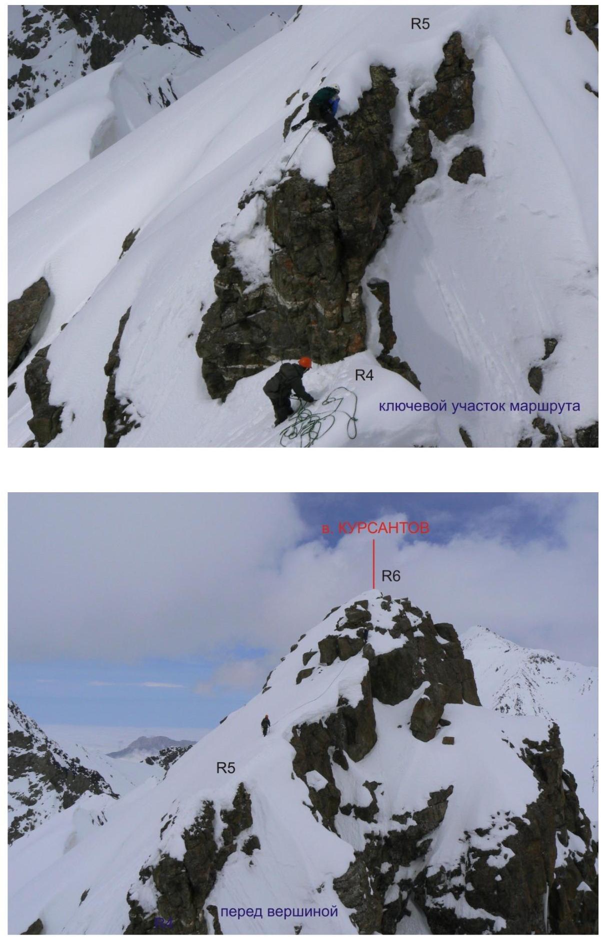 □
□