
Report
on the first ascent to the summit of Kionkhoh from the North, category 1B, by the team of "Kaskad" climbing club on November 1, 2023
I. Ascent Passport
| № | 1. General Information | |
|---|---|---|
| 1.1 | Full name, sports rank of the leader | Egorin S.V. — Master of Sports |
| 1.2 | Full name, sports rank of participants | Artyukhovskaya E.N. — 3rd sports rank |
| 1.3 | Full name of coach | Egorin S.V. |
| 1.4 | Organization | "Kaskad" climbing club |
| 2. Characteristics of the ascent object | ||
| 2.1 | Region | Caucasus, Rocky Range |
| 2.2 | Valley, massif | Kion massif |
| 2.3 | Section number according to the 2020 classification table | 2.7 |
| 2.4 | Name and height of the summit | Kion 3421 m |
| 3. Characteristics of the route | ||
| 3.1 | Name of the route | from the North |
| 3.2 | Proposed category of complexity | 1B |
| 3.3 | Degree of route development | First ascent |
| 3.4 | Relief characteristics of the route | Rocky |
| 3.5 | Height difference of the route | 750 m |
| 3.6 | Route length | 2000 m |
| 3.7 | Technical elements of the route | I cat. complexity ice/rock/combination — 1200 m, II cat. complexity ice/rock/combination — 600 m, III cat. complexity ice/rock/combination — 180 m, IV cat. complexity ice/rock/combination — 20 m Movement on a closed glacier — none. |
| 3.8 | Descent from the summit | Via the ascent route or via the East ridge (2A) |
| 3.9 | Additional information on the route | Mobile connection on the route, on the West ridge and summit — Megafon. |
| 4. Characteristics of team actions | ||
| 4.1 | Time of movement | 6 hours |
| 4.2 | Overnight stays | None |
| 4.3 | Start of the route: from R0 | 8:00, November 1, 2023 |
| 4.4 | Reaching the summit | 14:00, November 1, 2023 |
| 4.5 | Descent to the road (via 2A) | 18:00, November 1, 2023 |
| 5. Responsible for the report | ||
| 5.1 | Full name, e-mail | Egorin S.V., e.s.128@mail.ru |
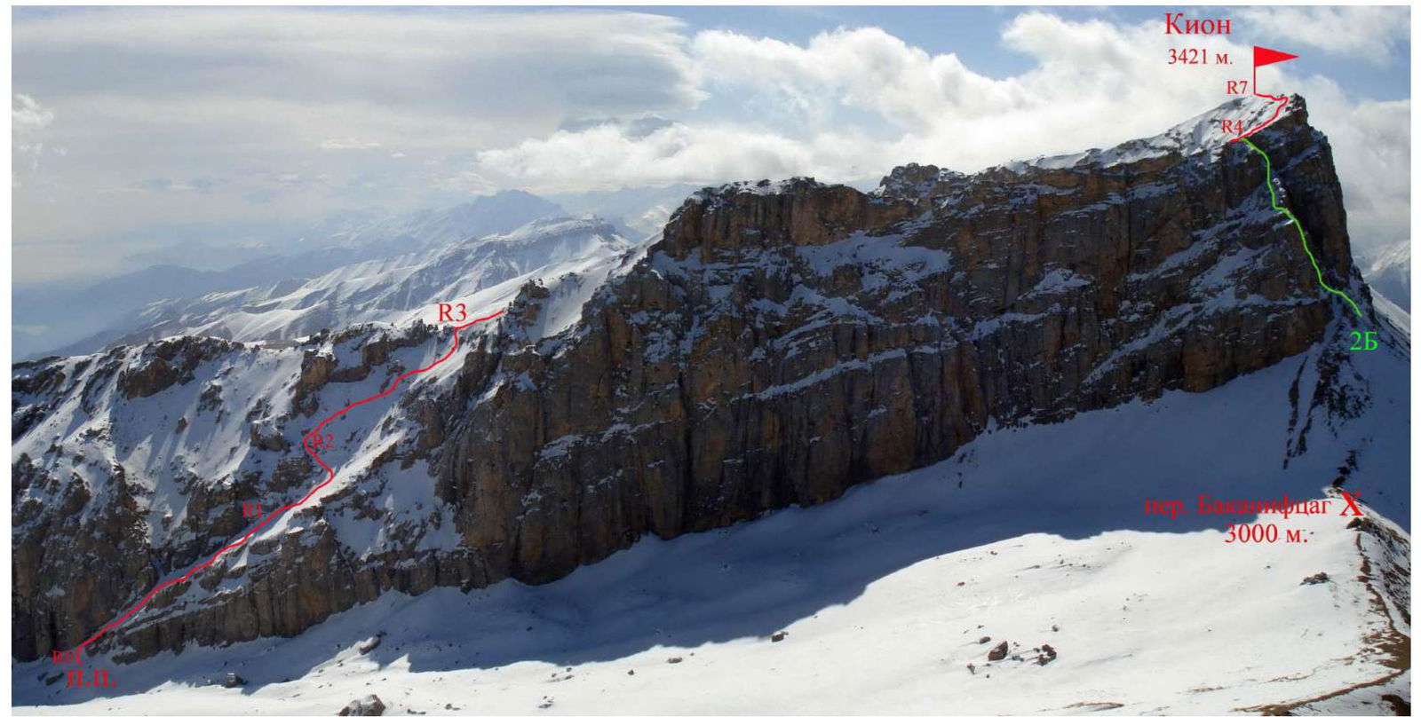
Photo 1. General photo of the Kion summit. April 2009. View from the West.
The route of the first ascent is marked in red (visible part). The classified route 2B is marked in green.
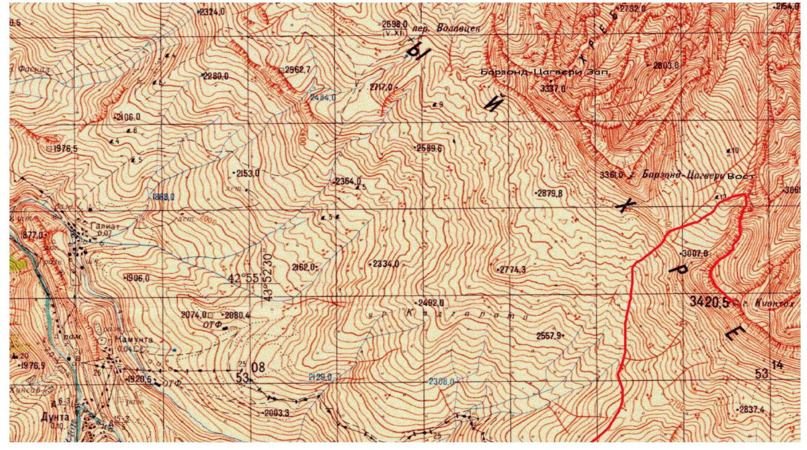
Photo 2. Map of the ascent area. Scale 1:50000.
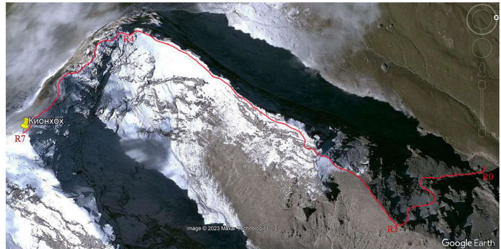
Photo 3. View of Kion from space. Photo from a height of 5000 m. October.
2. Technical Characteristics of Route Sections
| Section № | Relief characteristics | Category of complexity | Length, m | Type and number of pitons |
|---|---|---|---|---|
| R0–R1 | Rocky-scree terrace | 1–3 | 250 m | |
| R1–R2 | Rocky slabs with ledges. | 1–3 | 150 m | Insurance |
| R2–R3 | Rocky-scree slope. | 1–2 | 300 m | through |
| R3–R4 | Rocky-scree ridge. | 1–2 | 900 m | rock outcrops |
| R4–R5 | Rocky-scree slope. Exit to the ridge. | 1–4 | 150 m | |
| R5–R6 | Rocky ridge of the main massif. | 1–3 | 150 m | |
| R6–R7 | Rocky ridge of the main massif. | 1–4 | 100 m |
3. Characteristics of Team Actions
3.1 Description of Approaches to the Route
It takes 1.5–2 hours to drive from Vladikavkaz to the village of Verkhny Zgid. The village is bypassed from below and from the East on a dirt road. Then we drive towards the Zgid pass, leading to Digoria, and near the entrance to the watershed ridge — the slope separating Digoria and the Zgid valley, we start moving on foot, straight up, to the North.
Coordinates of the starting point: 42.895768° N, 43.907838° E, elevation 2390 m. Initially, we follow a dirt road, the landmark is higher and to the right, a large stone.
Having ascended the steep dirt road to the shepherd's hut, we continue along the remains of the road along the watershed ridge. Where the road disappears, we start moving left and down, traversing the western slopes of the watershed ridge. The direction of movement is towards the pass ascent, a visible saddle between the peaks Barzond — Tsagveri (left) and Kion (Kionkhoh) (right).
We follow numerous cattle trails, traversing the slopes, crossing gullies and streams along the way. After 1.5–2 hours, we reach the pass Bakaniftsag. Then, along a grassy-scree ascent, we reach the saddle of the pass 3000 m, n. k. To our right (East), the Western walls of the North spur of the Rocky Range are visible, descending from the Western shoulder of the Kion peak. Our further path is along these walls, down to the North. The descent from the pass to the start of the 1B route is almost 300 m vertically.
We approach the beginning of the inclined rocky-scree terrace, leading to the North spur of the Western shoulder. Coordinates of this location: Point R0: 42.928379° N, 43.943148° E.
The route of the first ascent was noticed at the end of the last century from the slopes of the Barzond — Tsagveri East peak. In 2000, the route was traversed by a group led by Egorin S.V. on the descent from Kionkhoh in February. And in 2023, the route was traversed for the first time on the ascent.
3.2 Brief Description of Route Passage
| Section № | Description | Photo № |
|---|---|---|
| R0–R1 | Approaching the beginning of the inclined rocky-scree terrace, leading to the North spur of the Western shoulder, we turn right and start ascending up its right part. | 4 |
| R1–R2 | Approaching the narrowing of the terrace, we cross the stream bed to its right part. Then we ascend through the "ram's foreheads". After another 50 m ascent, we start moving left, to the col between the rocks, on a goat trail. | |
| R2–R3 | Along the left part of the scree slope, we move up and to the right, towards the ridge. The rock in the middle of the section is bypassed from below. At the end of the section, through a narrow rocky belt — we exit to the North spur of the Rocky Range. | |
| R3–R4 | Along the North spur, we ascend towards the Western shoulder of the Kion peak. The path lies to the left of the ridge line. | 5 |
| R4–R5 | To the Western ridge of Kionkhoh, we first ascend between the rocks on the North slope, then traverse left and exit to the ridge along the slabs. | 6 |
| R5–R6 | Along the ridge line, we move towards the summit. The rocks on the ridge are bypassed first on the right, then on the left. | 7 |
| R6–R7 | Further, moving along the ridge, we bypass two pre-summit "gendarme" peaks from the North and exit to the summit of Kion along the Western ridge. | 8,9 |

Photo 4. Beginning of the ascent along the inclined terrace on section R0–R1.

Photo 5. Movement in the upper part of section R3–R4. The further path along the Western ridge is visible.
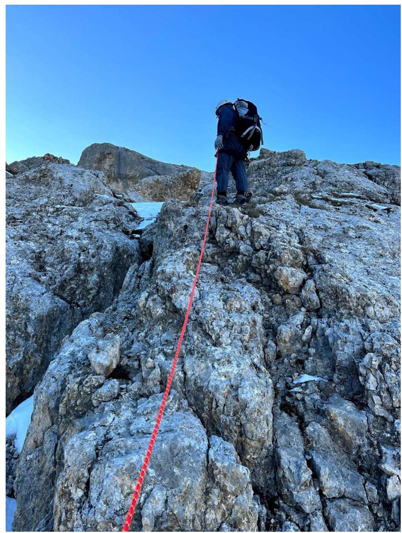
Photo 6. Movement on section R4–R5. Ascent along the slabs to the ridge.
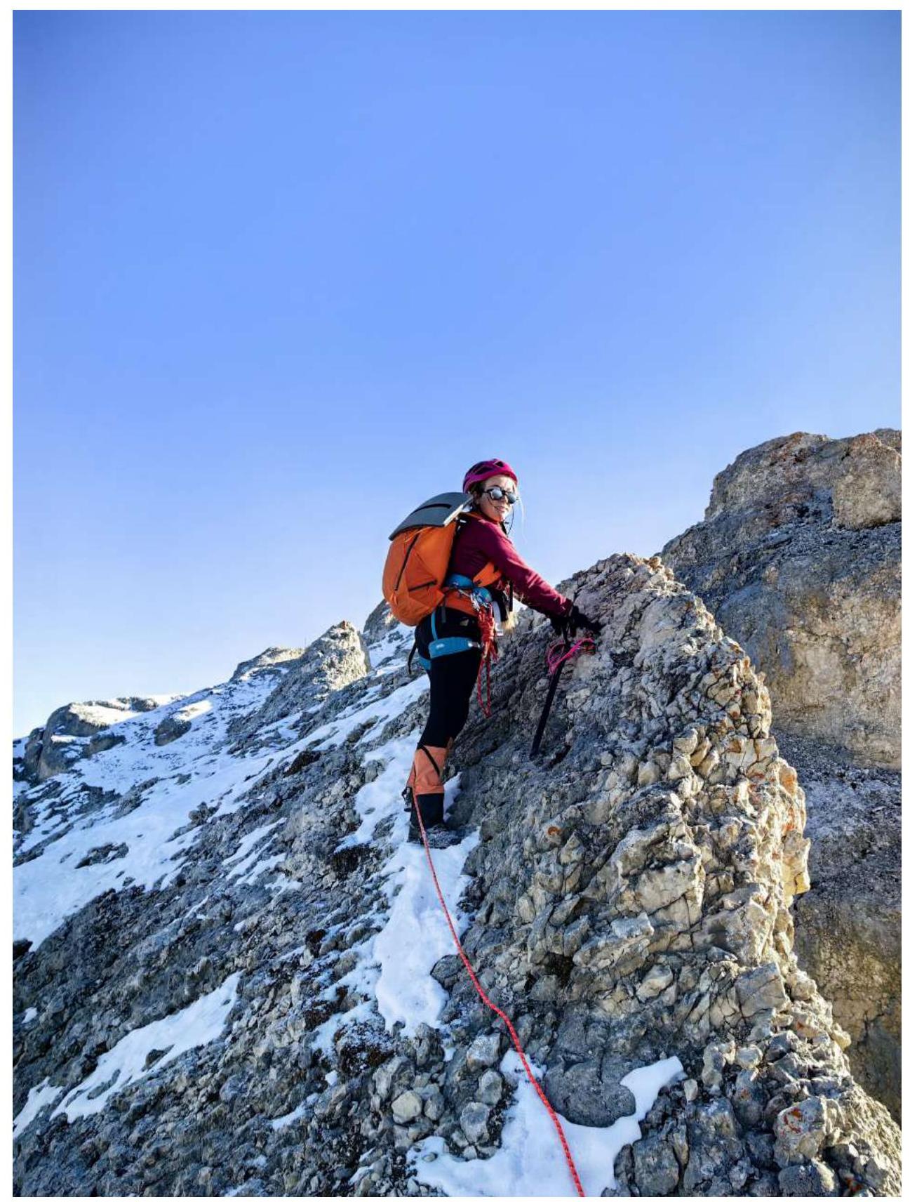
Photo 7. Movement along the ridge on section R5–R6.
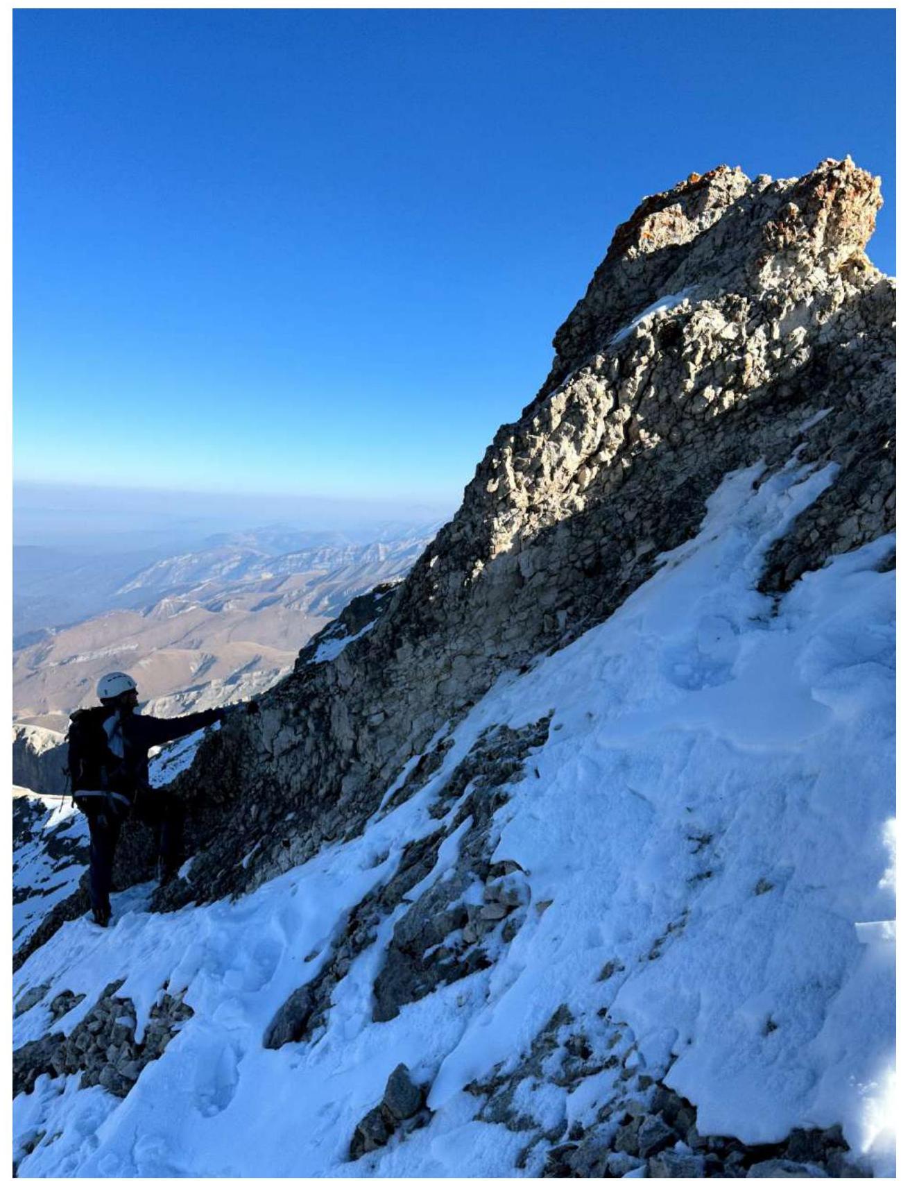
Photo 8. Bypassing the pre-summit "gendarme" on section R6–R7.
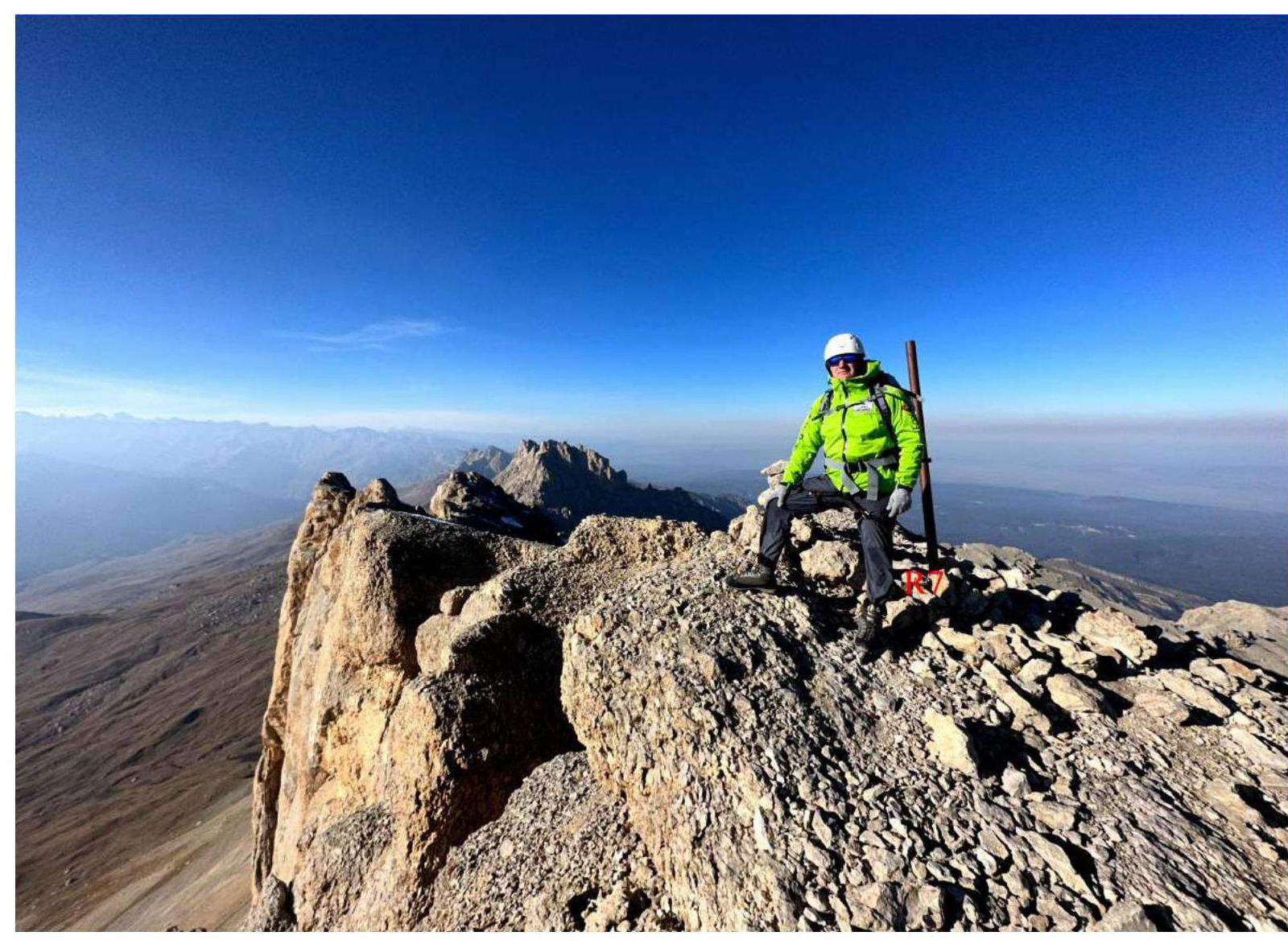
Photo 9. View from the summit of Kion to the West. Photo at the summit cairn. November 1, 2023.
3.3 Recommendations
Descent from the summit via the ascent route or via the East ridge, category 2A.
The traversed route to the summit of Kion is logical and safe with a small amount of snow on sections R0–R3. The route corresponds to category 1B. It is a good route for practicing movement of training groups on rocks of initial categories.
The route of the first ascent is the easiest path to the highest point of the Kion massif. However, due to its considerable length, it can be recommended for traversal only by strong training groups.