Description of the ascent route to the summit Zaramag, 4221 m, from the south, via the left couloir. Approximately 2B category of difficulty.
From the lower Zaramag camps in the Zaramag gorge, head towards the glacier descending from Mt. Zaramag. Cross the stream and river via a small bridge and ascend right-upwards along the trail in the direction of the ridge moraines. Approach the left moraine and ascend it. Traverse across the scree to the right (in the direction of travel) moraine. Follow it until the reddish rocks and, bypassing them on the right, continue upwards to the upper camps. The journey from the lower camps to the upper ones takes around 2 hours.
From the upper camps, head left upwards, traversing under the slopes of the Adai-Khokh massif to avoid the conical moraine. Reach the Zaramag glacier. The journey from the upper camps takes 30–40 minutes.
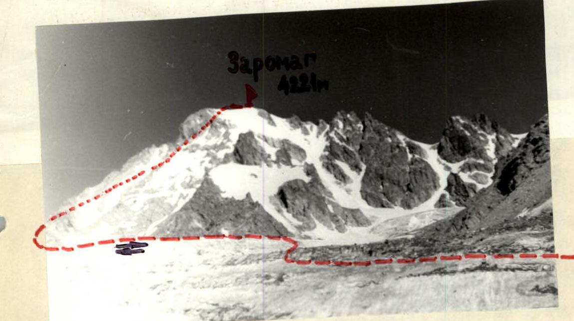
While crossing the glacier, move left towards the ridge with Mt. Zaramag, visible against the skyline (1.5–2 hours). Bypass the ridge on the left and head towards the rocky white-yellow "island", leaving the entire Mt. Zaramag massif on the right (in the direction of travel). (Fig. 1)
Ascend the snowy-icy slope (about 45°) to the right-upwards, 4–5 ropes. CAUTION! Crevasses possible! Continue in the direction of the steep, snowy-icy, even couloir between the gendarme on the ridge leading to Mt. VTsSPS and Mt. Zaramag. The couloir's steepness is 30–35°, and in its upper part, 40–45°. The extent is 8–10 ropes. The couloir is visible from bottom to top. In the middle of its upper part, a rocky "island" is visible. There may be ice in the upper part of the couloir.
Travel in crampons or with piton protection. (Fig. 2)
From the start of the snowy-icy ascent to reaching the saddle is 2–3 hours. From the saddle, head right-upwards along the snowy slope (35–40°) and reach a gentle snowy ridge. Follow the ridge to the right until a gendarme (3–4 ropes). Bypass the gendarme on the left, reach the pre-summit ridge, and follow it to the summit. The journey from the saddle to the summit takes around 30 minutes.
Descent is via the ascent route. Descent to the lower camps takes 2–3 hours. Total time is 6–8 hours.
The route to Mt. Zaramag from the south, via the left couloir, was first climbed in 1972. Repeated estimated ascents were made on 17/V and 8/VII — 1975.
The group of first ascenders:
- Goncharov V.D., 1st sports category — leader
- Akhtyrchenko G.V., CMS
- Paunksis A.A., 1st sports category
- Cherkasova I.B., 1st sports category
- Batyshkin V.G., 2nd sports category. The group members had completed 6–15 routes of the second category of difficulty. The group considers the route to Mt. Zaramag from the south, via the left couloir, to correspond to the 2B category of difficulty.
Massif — Mt. Zaramag.
Fig. 1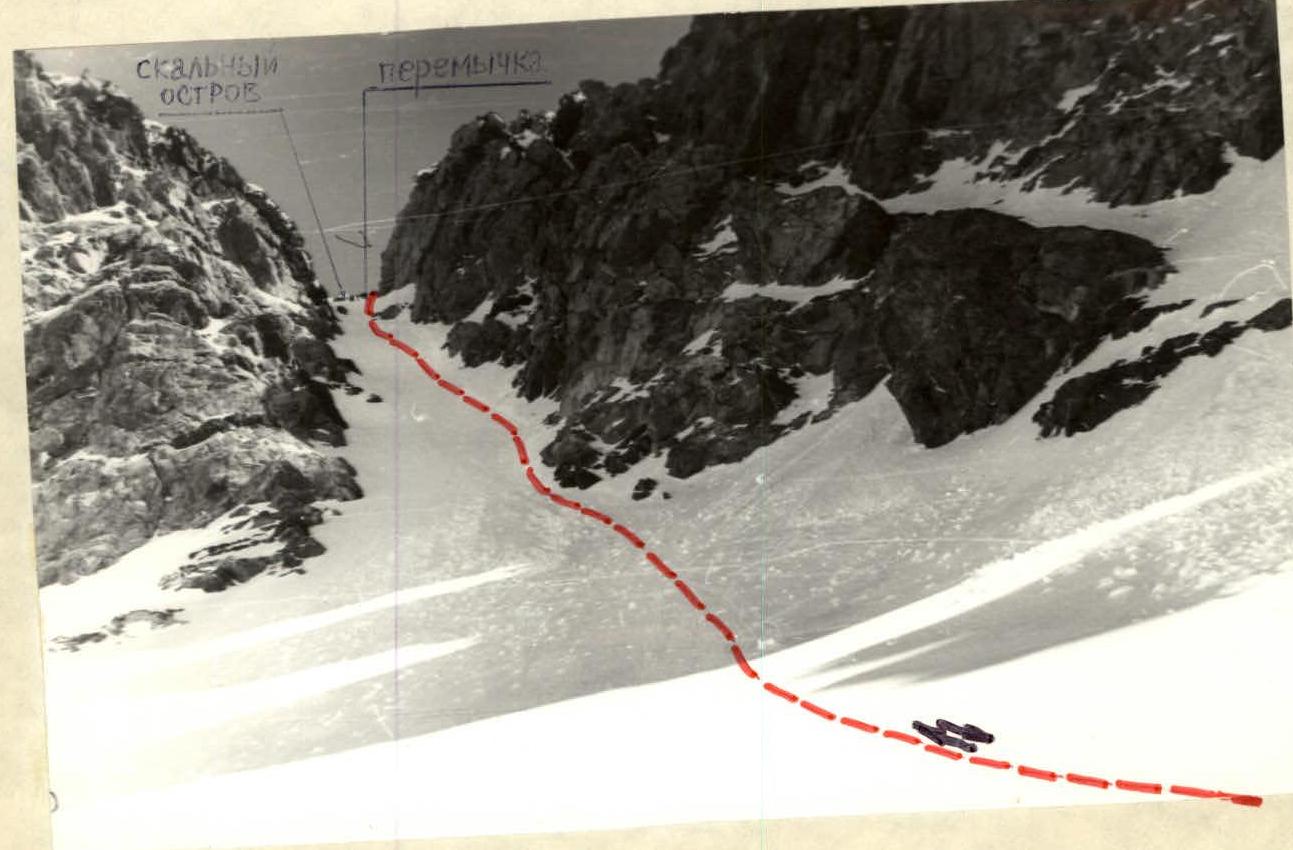
Fig. 2 --- path of movement along the couloir