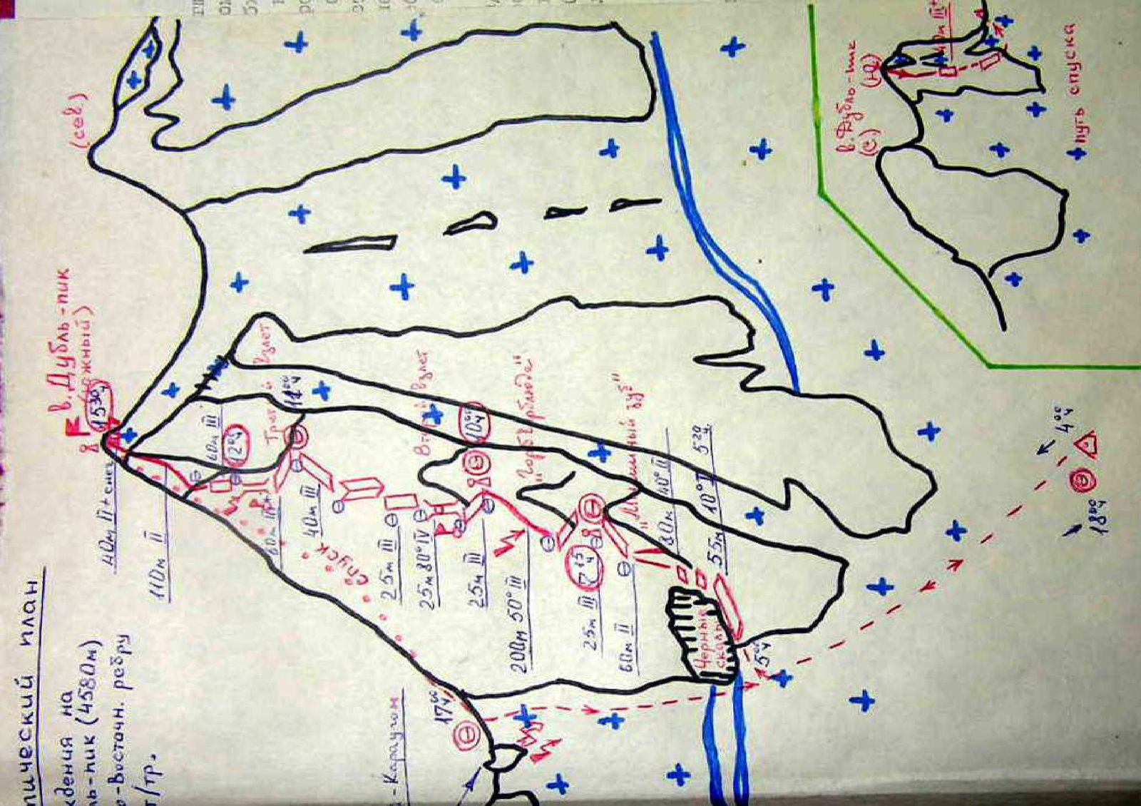
Technical Plan for Ascending Dubl'-pik Peak (4580 m) via the Eastern Ridge
Category of Difficulty: 3A category of difficulty (according to technical description)
Peaks:
- Dubl'-pik Peak (4580 m) (southern)
- Dubl'-pik Peak (northern)
- Dubl'-pik Peak (N-2) (C)
Route Sections (main, from "Dubl'-pik southern" peak):
- R0: 40 m II+ snow
- R1: 110 m II
- R2: 60 m II (marked on the map – number "2")
- R3: Ladder III
- R4: 40 m III
- Descent (marked on the map as point 14°)
- Ascent
- R5: 25 m III
- R6: 25 m 30° IV
- Ascent
- R7: 25 m III
- R8: 200 m 50° III
- R9: 25 m II (marked on the map – number "7")
- R10: 60 m II
- Landmark: Black Rocks
- Landmark: "Luminous Tooth"
- R11: 30 m 40°
- R12: 55 m 10°, 5–20 min (marked on the map – number "20" nearby)
Approach to the Route (dashed line, from the Karaugom area):
- Start: Karaugom
- Point 17°
- Section: 25 m III
- Point B: Ascent (merges with the main route here)
Additional Markings on the Map:
- Slope angle: 18°
- Slope angle: 4°
- Descent path (marked with arrows on the map)
