Report
ON THE FIRST ASCENT TO THE SUMMIT OF VOENNYKH RAZVEDCHIKOV VIA THE SOUTHEAST RIDGE, CATEGORY 3B DIFFICULTY, BY THE TEAM OF THE MINISTRY OF DEFENSE OF THE RUSSIAN FEDERATION ON AUGUST 25, 2018
I. Ascent Passport
| № | 1. General Information | |
|---|---|---|
| 1.1 | Full name, sports rank of the leader | Bolkovoi Evgenii Vladimirovich, Master of Sports |
| 1.2 | Full name, sports rank of the participants | Dmitrienko Evgenii Vladimirovich, Master of Sports, Matkin Sergei Vladimirovich, Master of Sports, Maksimov Denis Sergeevich, Candidate for Master of Sports, Geleverya Andrei Aleksandrovich, 1st sports rank, Kesarevskii Vladislav Andreevich, 1st sports rank |
| 1.3 | Full name of the coach | Bolkovoi Evgenii Vladimirovich, Master of Sports |
| 1.4 | Organization | Ministry of Defense of the Russian Federation |
| 2. Characteristics of the Ascent Object | ||
| 2.1 | Region | Caucasus, Saudor Range |
| 2.2 | Valley | Sargidon |
| 2.3 | Section number according to the 2013 Classification Table | 2.7 |
| 2.4 | Name and height of the summit | Voennykh Razvedchikov, 4153 m |
| 2.5 | Geographical coordinates of the summit (latitude/longitude), GPS coordinates (1) | 42°49.36′ N, 43°46.12′ E |
| 3. Characteristics of the Route | ||
| 3.1 | Route name | via the southeast edge |
| 3.2 | Proposed difficulty category | 3B |
| 3.3 | Degree of route development | First ascent |
| 3.4 | Nature of the route relief | Combined |
| 3.5 | Route elevation gain (altimeter or GPS data) | 835 m |
| 3.6 | Route length (in meters) | 1040 m |
| 3.7 | Technical elements of the route (total length of sections of varying difficulty with indication of relief type: ice/snow, rock) | Category I difficulty ice/rock/combination — 0/380/0 m. Category II difficulty ice/rock/combination — 0/150/0 m. Category III difficulty ice/rock/combination — 0/340/0 m. Category IV difficulty ice/rock/combination — 0/100/0 m. Movement on closed glacier — 0 m. Dülfer descent (on descent) — 6 rappels, 350 m |
| 3.8 | Descent from the summit | Via the ascent route to the Sargidon Valley |
| 3.9 | Additional route characteristics | Presence of water |
| 4. Characteristics of the Team's Actions | ||
| 4.1 | Time of movement (team's walking hours, in hours and days) | 6.5 hours, 1 day |
| 4.2 | Overnight stays | None |
| 4.3 | Start of the route | 5:00 on August 25, 2018 |
| 4.4 | Reach the summit | 11:30 on August 25, 2018 |
| 4.5 | Return to the base camp | 8:00 on August 25, 2018 |
| 5. Person Responsible for the Report | ||
| 5.1 | Full name, e-mail | Maksimov Denis Sergeevich, deltoro87@mail.ru |
II. Ascent Description
1. Characteristics of the Ascent Object
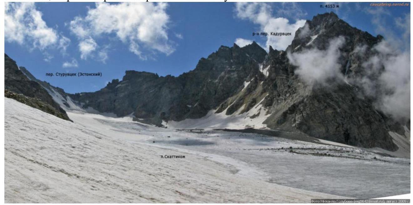
1.1. General photo of the summit (photo taken in August 2009)
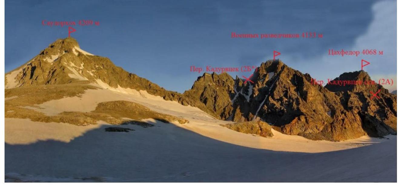
1.2. Photopanorama of the area
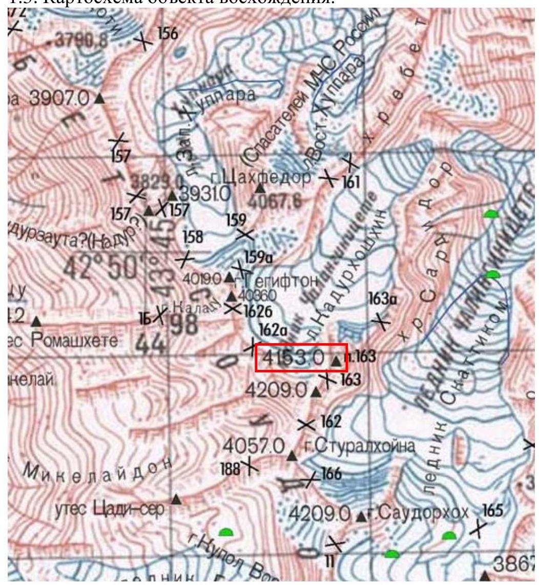
1.3. Schematic map of the ascent object.
1.4. Geographical location of the area:
From the city of Vladikavkaz, take a regular bus to the village of Dunta — about 120 km. It is not possible to access the valley of the Sargidon River from below due to a canyon in the lower part of the valley, so from the village of Dunta, one must cross the Kazatyvtseg Pass (also known as Dunta Pass among tourists, non-category difficulty), which is 2337 m high. To reach the trail leading to the pass, enter the village of Dunta, cross the Dargom River by bridge, then descend to the right to the bridge over the Songutidon River. After crossing the bridge, take the old trail and follow it for 2–3 hours to the left and upwards to the saddle of the Kazatyvtseg Pass. The ascent from the village of Dunta is about 600 m.
From the pass, the descent goes to the left and downwards on a good trail. After 30 minutes, you reach a cattle enclosure (kosh). After passing the kosh, you ascend to the bank of the Sargidon River and see a stream flowing into it from the right — this is the Khuppara River. Continue for about 700 m above the confluence of the rivers until the Sargidon River diverges into several branches, and then ford it.
Attention! In the first half of the summer, especially towards the evening, or after rain, the flow can be very strong!
From the pass to the ford is about 1.5 hours.
Continue on the left bank of the Sargidon River for 3 hours until a shallow stream flows into it. There are places for 2–3 tents behind the stream. Further up the left-bank moraine, follow the trail for 1.5 hours to good camping spots on the "ram's foreheads" (baran'i lbakh) where there is water. From the campsite, the beginning of the route is visible in a westerly direction. It takes about 1 hour to reach the route.
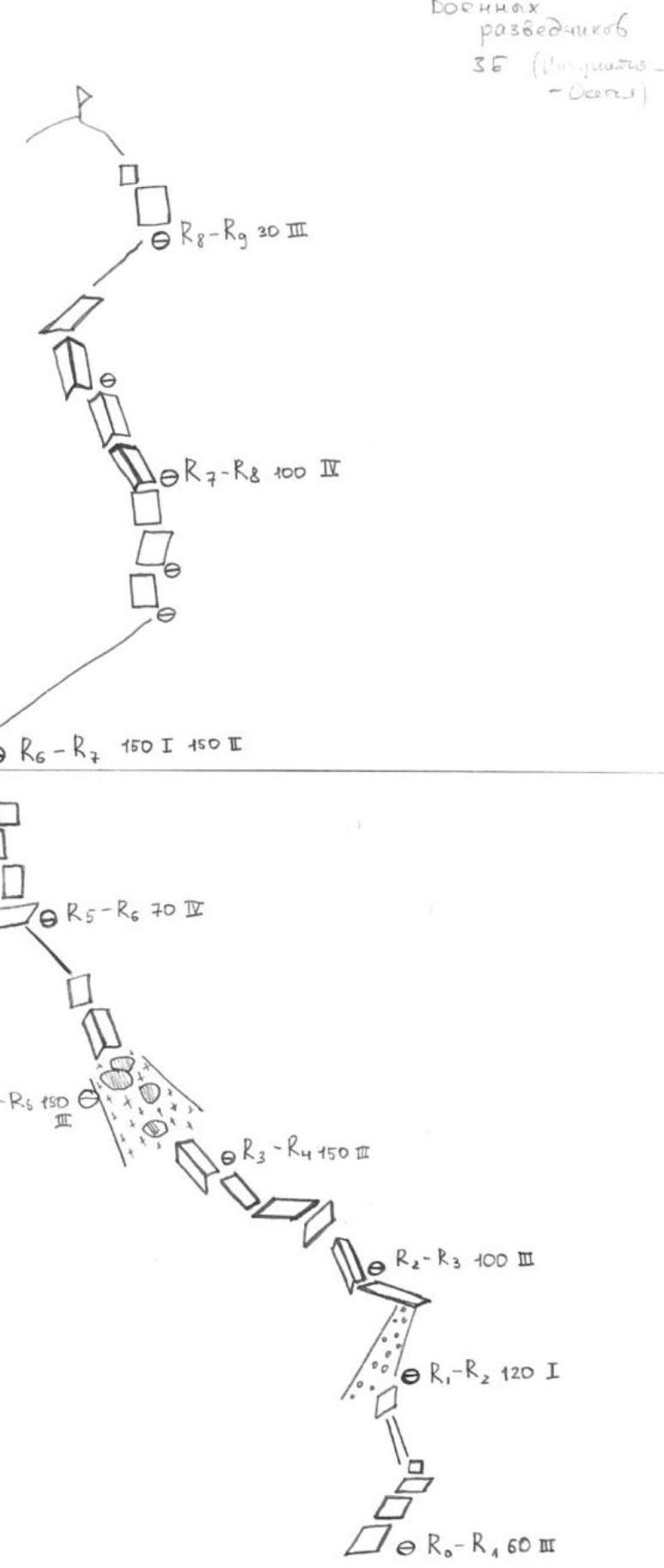
2. Characteristics of the Route
2.1. Technical photograph of the route
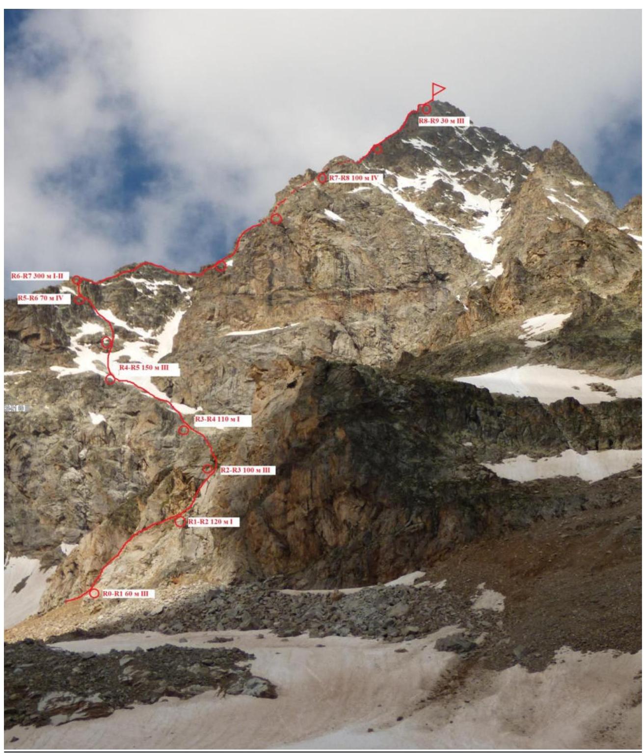
2.2. Technical characteristics of the route sections
| Section | Length | Steepness in degrees | Nature of relief | Difficulty category | Number of pitons |
|---|---|---|---|---|---|
| R0–R1 | 60 m | 70 | Rocky | 5 | 2 |
| R1–R2 | 120 m | 35 | Rocky | Non-category | 0 |
| R2–R3 | 100 m | 60 | Rocky | 5 | 4 |
| R3–R4 | 110 m | 50 | Rocky, snowy | Non-category | 2 |
| R4–R5 | 150 m | 45 | Rocky | 5–75 m, 5–75 m | 10 |
| R5–R6 | 70 m | 70 | Rocky | 5–70 m | 12 |
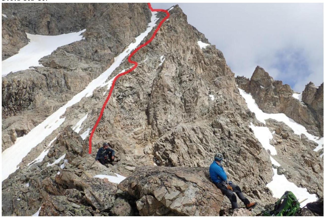
| R6–R7 | 300 m | 45 | Rocky | Non-category — 150 m, 5–150 m | 11 |
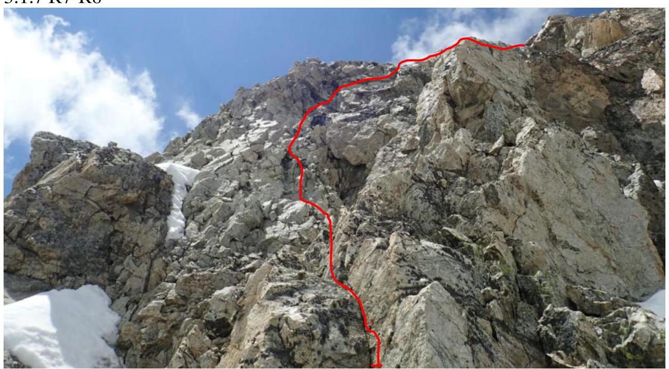
| R7–R8 | 100 m | 75 | Rocky | 5 | 14 |
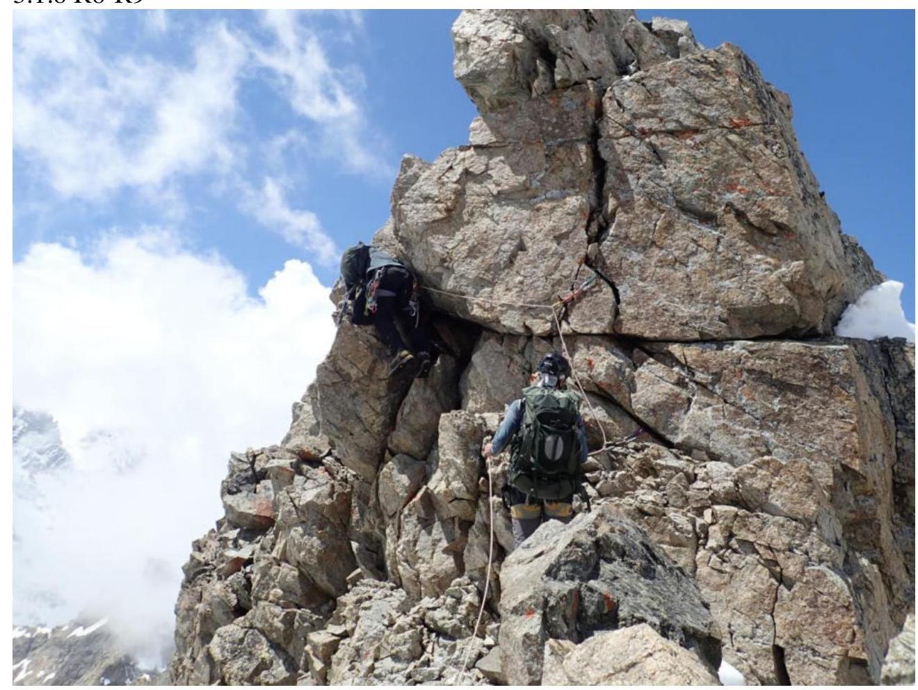
| R8–R9 | 30 m | 60 | Rocky | 5 | 6 |
3. Characteristics of the Team's Actions
Brief description of the route passage.
3.1.1 R0–R1
3.1.2 R1–R2

3.1.3 R2–R3
3.1.4 R4–R5
3.1.5 R5–R6
3.1.6 R6–R7
3.1.7 R7–R8
3.1.8 R8–R9
| Section | Description | Photo number |
|---|---|---|
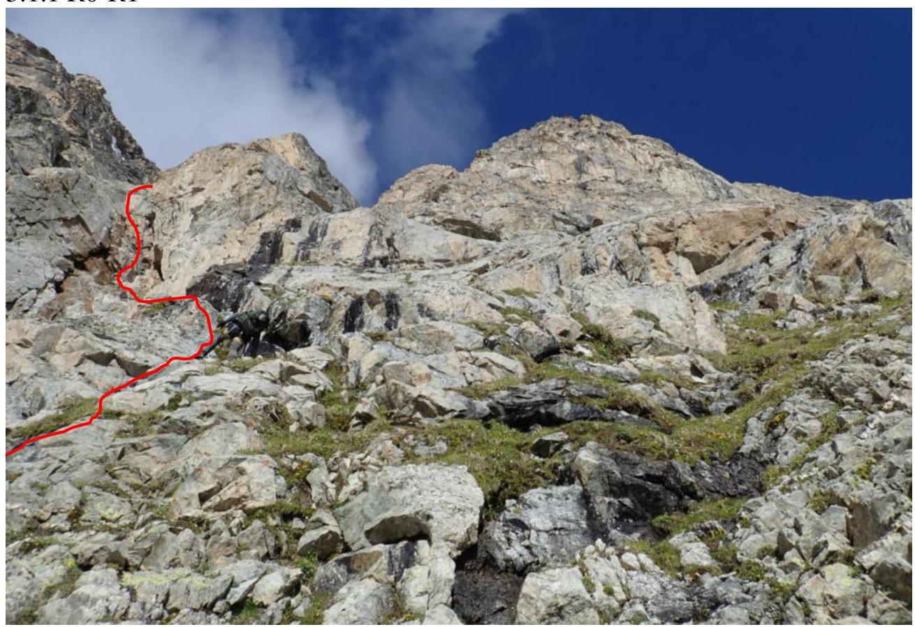
| R0–R1 | 60 m — Category 5 difficulty, slabs, ledges, protection on anchor pitons. | 3.1.1 |
| R1–R2 | 120 m — Non-category section on scree slope along rocks upwards to the stop. | 3.1.2 |
| R2–R3 | Up and left at an angle 100 m Category 5 difficulty, protection on pitons. | 3.1.3 |
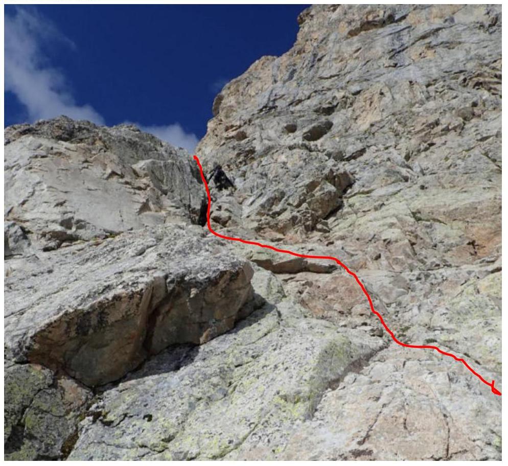
| R3–R4 | Into the corner with large stones and traverse left across a stream 60 m. Then up to rocky outcrops in snow — 50 m (non-category section). | - |
| R4–R5 | Along rocky outcrops left and up towards the main ridge Category 5 difficulty 150 m, protection on pitons, nuts, Friends. Exit to the ridge along the edge. | 3.1.4 |
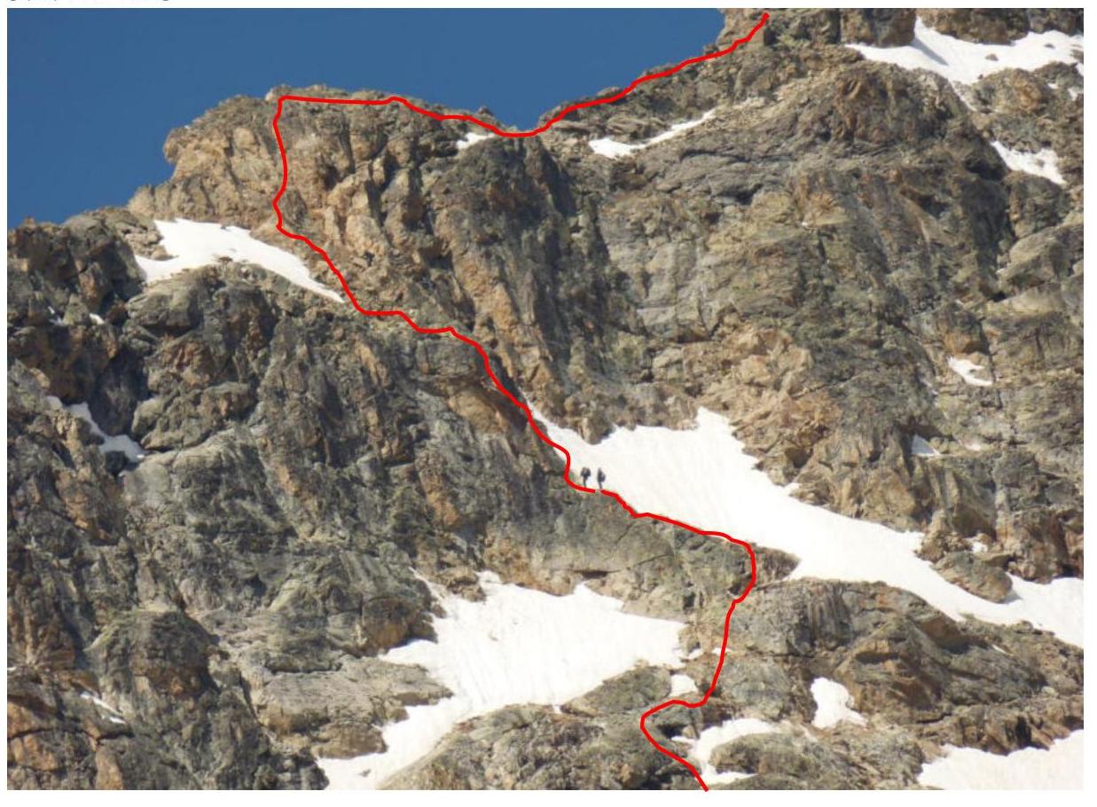
| R5–R6 | Along the ridge right 70 m Category 5 difficulty, protection on pitons, nuts, Friends. | 3.1.5 |
| R6–R7 | Along the ridge right 150 m non-category rocks, then 150 m Category 5 difficulty under the main tower. | 3.1.6 |
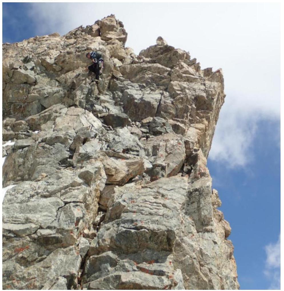
| R7–R8 | Exit to the main tower 100 m, difficulty Category 5. High complexity due to a large number of loose stones. | 3.1.7 |
| R8–R9 | 30 m Category 5 difficulty, then traverse along the ridge to the summit with a small descent and ascent to the summit. | 3.1.8 |
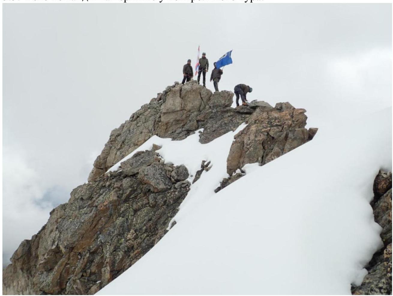
3.3. Photo of the team on the summit at the control tour.
3.4. The route is generally safe, but there are loose stones on the ridge, on the main and summit towers. Communication with the assault camp throughout the route. Descent from the summit via the ascent route:
- First rappel from the summit tower to the pre-summit ridge.
- Next rappel from the main tower to the ridge.
- Movement along the ridge for 300 m.
- Third rappel (70 m) to a rocky outcrop in the snow.
- Fourth rappel along rocky outcrops to a stream.
- Fifth and sixth rappels (100 m) along an inner corner to a scree slope.
- Walking on the scree slope and further along the approach route to the assault camp.
The route is recommended for fulfilling the 2nd sports rank.
Route scheme in UIAA symbols
Government of the Russian Federation
Decree
of November 29, 2018 № 2631-r Moscow
In accordance with the Federal Law "On Names of Geographical Objects" and based on the proposal of the Parliament of the Republic of North Ossetia-Alania, as well as to commemorate the feats of military scouts and the memory of Hero of the Russian Federation A.A. Prokhorenko, assign the following names to unnamed geographical objects located on the territory of the Irafsky district of the Republic of North Ossetia-Al-X at the following locations:
"Voennykh Razvedchikov" — to the unnamed mountain with coordinates 42°49.3′ north latitude, 43°46.1′ east longitude, and an absolute height of 4153 m;
"Alexandra Prokhorenko" — to the unnamed mountain with coordinates 42°57.2′ north latitude, 43°34.6′ east longitude, and an absolute height of 3823 m.
 D. Medvedev