Burevestnik-Tseyskiy
The rocky tower of the summit is located between Malaya Songuti to the west and Spartak-Tseyskiy to the east. The summit is technically simple, with only one route laid by V. Tsiruk and V. Markarov in 1953.
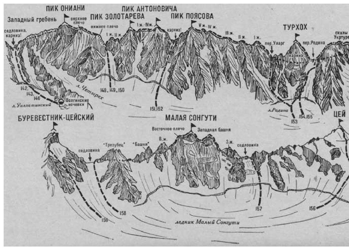
- Burevestnik-Tseyskiy via the North Ridge (combined route, category 2B, Fig. 33).
The path from the CSP of the Tsey region (group of 4–12 people) to the initial bivouac at the sites near Turye Lake under the Maly Songuti glacier is described in route 156.
From the bivouac, ascend via the scree, then via the Maly Songuti glacier in the direction of the col between the summits of Malaya Songuti to the right and Burevestnik-Tseyskiy to the left. Before reaching the slopes of the col, turn left and approach the snowy couloir descending from the North Ridge from under the summit tower of Burevestnik.
Along the couloir 160–200 m to the left and upwards to the rocks, then:
- across simple rocks to the right and upwards along the slope between the North and West ridges of the Burevestnik-Tseyskiy peak to the snowy slope,
- crossing a small rocky outcrop (protection via ledges).
Along the steep icy-snowy slope 90–100 m to the left and upwards to the North Ridge and follow it to under the summit tower.
Along the rocks of the steep ascent, 30–40 m climb to the summit of Burevestnik-Tseyskiy.
From the initial bivouac near Turye Lake — 4–5 hours.
Descent is via the ascent route. Duration of the route is 2 days.
Source:
- Naumov A. F. Karagom, Digoria, Tsey (Central Caucasus), M., "Fizkultura i sport", 1976.
| :--: | :--: |