Report
On the first ascent by the team of the multidisciplinary alpinism club "Freeline" (Essentuki) to the summit of Muldzugi-Barzond on January 28, 2023, via the southwest ridge
Presumably 4B category of difficulty
Essentuki 2023
I. Ascent Passport
| 1. General Information | ||
|---|---|---|
| 1.1 | Full name, sports rank of the leader, date of birth | Mikhail Lvovich Popov, Candidate for Master of Sports, September 20, 1963 |
| 1.2 | Full name, sports rank of participants, date of birth | Danil Alexandrovich Grabovenko, 2nd sports rank; Ksenia Alexandrovna Demidova, 2nd sports rank |
| 1.3 | Full name of the coach | Nikolai Ilyich Motienko |
| 1.4 | Organization | MAC "Freeline" |
| 2. Characteristics of the Ascent Object | ||
| 2.1 | Region | Digoria, Skalisty Ridge |
| 2.2 | Valley | Urukh River valley |
| 2.3 | Section number according to the 2013 classification table | 2.4 |
| 2.4 | Name and height of the summit | Muldzugi-Barzond |
| 2.5 | Geographical coordinates of the summit (latitude/longitude), GPS coordinates (1) | |
| 3. Route Characteristics | ||
| 3.1 | Route name | via southwest ridge |
| 3.2 | Proposed category of difficulty | 4B |
| 3.3 | Degree of route exploration | first ascent |
| 3.4 | Relief characteristics of the route | Rocky |
| 3.5 | Height difference of the route (altimeter or GPS data) | 430 m |
| 3.6 | Route length (in meters) | 735 m |
| 3.7 | Technical elements of the route (total length of sections of varying difficulty with relief characteristics (ice-snow, rocky)) | I difficulty — rocks — 25 m II difficulty — rocks — 236 m III difficulty — rocks — 222 m IV difficulty — rocks — 137 m V difficulty — rocks — 115 m VI difficulty — ice/rocks/combination — 0 m Rock VI, A3 — 0 m Rock VI, A4 — 0 m |
| 3.8 | Average steepness of the route, (°) (2) | |
| 3.9 | Average steepness of the main part of the route, (°) (2) | |
| 3.10 | Descent from the summit | Along the eastern ridge and then to the saddle |
| 3.11 | Additional characteristics | Water is absent |
| 4. Characteristics of the Team's Actions | ||
| :--: | :------------------------------------------------------------------------------------------: | :------------------------------------------------------------------------------------------------------------------------------------------------------------------------------------------------------------------------------------------: |
| 4.1 | Time of movement (team's walking hours, in hours and days) | 13 hours, 1 day |
| 4.2 | Overnights | absent |
| 4.3 | Time spent on route preparation (3) | - |
| 4.4 | Departure onto the route | January 28, 2023, 7:00 |
| 4.5 | Reaching the summit | January 28, 2023, 17:00 |
| 4.6 | Return to the base camp | January 28, 2023, 19:00 |
| 5. Meteorological Conditions (4) | ||
| 5.1 | Temperature, °C | |
| 5.2 | Wind force, m/s | |
| 5.3 | Precipitation | |
| 5.4 | Visibility, m | |
| 6. Person Responsible for the Report | ||
| 6.1 | Full name, e-mail | Mikhail L. Popov, 89282657130, mikl_popov@inbox.ru |
General photo of the summit
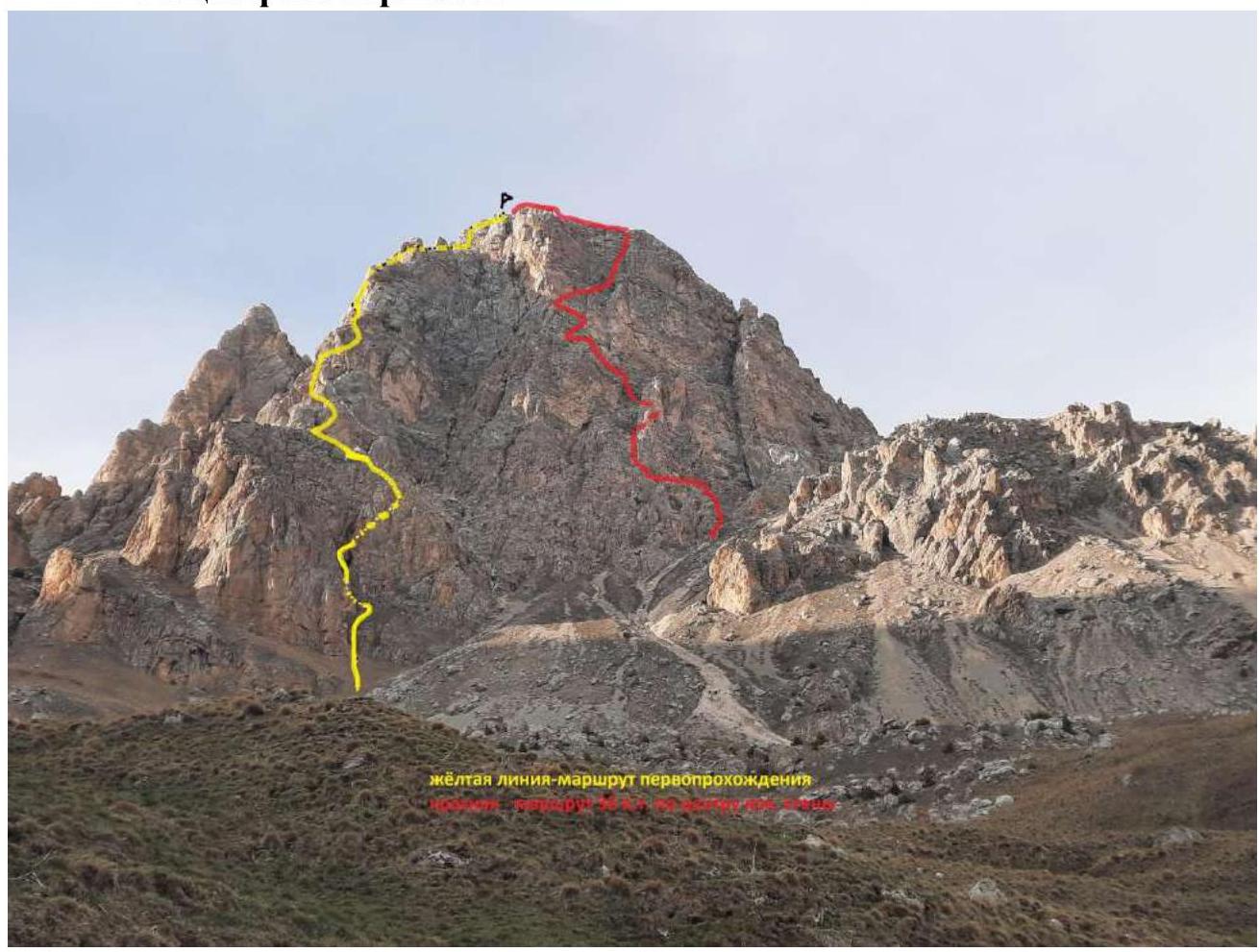
Yellow line — team's ascent route Red line — 3B category route
January 27, 2023. Photo taken from the last hut.
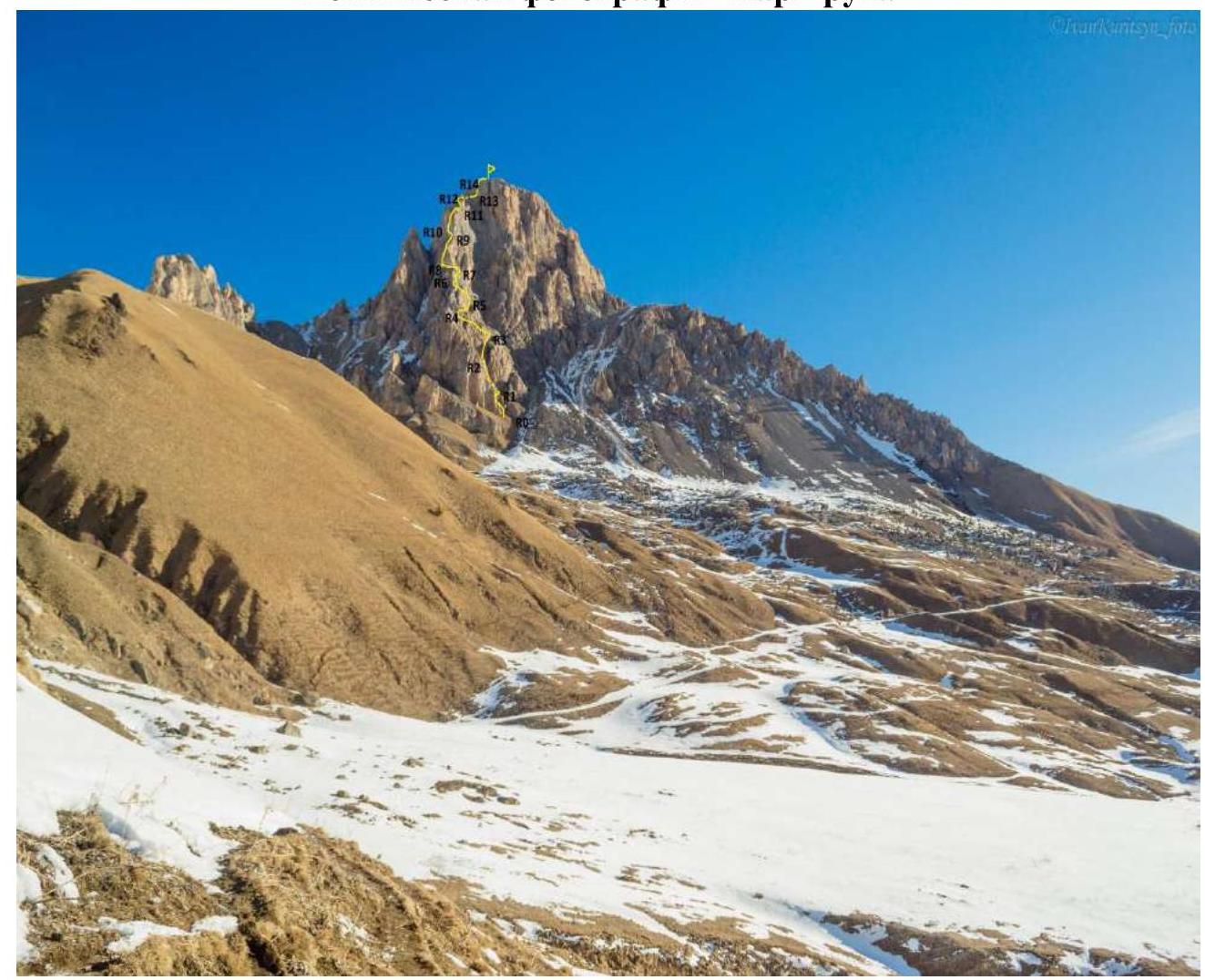
Route profile photo

Panorama of the area

Brief Overview of the Ascent Area
The summit of Muldzugi-Barzond is part of the Skalisty Ridge in the Greater Caucasus mountain system (Republic of North Ossetia, Irafsky district). The path to the mountain goes through the Urukh River valley. 2 km after the village of Matsuta, turn right. The road is dirt, partially in poor condition. After approximately 5 km, the road leads to a large "estate" built on the site of the ruins of the village of Kumbulta. There is a fork: straight to the village of Donifars, to the summit turn left. This fork can also be reached from Donifars, but the bridge over Urukh is in poor condition. After Kumbulta, the road is very bad, suitable only for off-road vehicles, even in summer. Those traveling in winter are advised to leave their cars on a gentle grassy slope just above the "estate". On foot, it takes about 2 hours to reach the last hut (there are 3 huts in total). The hut is located at the foot of the mountain. In summer, there is a spring there, but with low water flow, so it's necessary to bring water. Currently, there are no issues with water, as there is plenty of snow around. The hut has four beds, and there are many convenient places for tents nearby. The hut serves as a base camp. Its coordinates are: 43.0112 N, 43.7169 E, elevation 2480 m. It is marked on the ViewRanger navigator at maximum scale. In Fig. 1, it is marked with an asterisk. Mobile connection (Megafon) in the area is available but unstable. Registration with the Ministry of Emergency Situations by phone: 8-928-492-09-62.
2. Route Characteristics
Technical photo of the route
Technical Description of the Route (presumably 4B category) to the summit of Muldzugi-Barzond via the southwest ridge
| Section | Description | Photo number |
|---|---|---|
| R0–R1 | The route begins from the right part of the huge rusty wall ending the southwest ridge. A steep grassy slope abuts a small 12 m wall 3 (60°). Then along the grassy slope to the right upwards 30 m 2 (30°) to the turn into a deep rocky couloir cutting through the start of the southwest ridge. | Photo 1 |
| R1–R2 | Turn left into the couloir. Along a short wall 5 m 3 (50°) ascend into a chimney 20 m 40° 3 to a huge cork. The cork is bypassed on the left along the wall 10 m 4 (65°). Then along the grassy slope straight 15 m 2 (30°) to the wall. Control tour. | Photo 2 |
| R2–R3 | Turn right along the grassy slope 46 m 40°, 2. Reach the ridge. The grassy slope is interrupted in the middle by a short overhanging wall with a chimney 4 m 4 (95°). Total section 50 m. | Photo 3 |
| R3–R4 | Along a simple wide ridge, exit to a saddle towards the rusty wall cut by smoothed, rounded chimneys 80 m 35°, 2. | Photo 4 |
| R4–R5 | Traverse right along a simple talus slope 25 m 2 and start ascending along the destroyed rocks on the right side of the ridge. A short wall leads to a destroyed chimney with a cork of two stones. Up the chimney to a small saddle on the right 40 m 45–50°, 3. | Photo 5 |
| R5–R6 | Left along a steep grassy ledge initially 5 m 4 (65°), then 3 (40°). The ledge turns sharply right and leads to a small rocky cirque with a gray wall with a crack in the middle. Entire section 45 m. | Photo 6 |
| R6–R7 | Along the left edge of the wall in a jam between the wall and a fragment 10 m 5 (75°) to an indistinct rusty ledge crossing the wall from left to right. Along the ledge, a complex traverse right 15 m 5 to the widening of the ledge. Then 15 m 3 (40°) along the ledge to a wide talus ridge. | Photo 7 |
| R7–R8 | Along the wide ridge towards the huge rusty wall 20 m 2 (25°). The ridge narrows to a saw. Approach the wall 20 m 3. Traverse left, slightly descending and exit to the left edge of the wall 20 m 3 to a convenient platform. | Photo 8 |
| R8–R9 | Ascend along the edge of the wall upwards 12 m 5 (65°). Then a difficult traverse left 3 m and along the smooth wall upwards 30 m 5 (75–80°) to the flattening of the wall on a steep inclined ledge. | Photo 9 |
| R9–R10 | Initially into a deep chimney 8 m 4 (75°), and then along ledges traverse left to the base of a destroyed internal angle 35 m 4 (60°). | Photo 10 |
| R10–R11 | Along the internal angle, intersected in the middle by a ledge, upwards 45 m 75–80°, 5 to a wide talus ledge. Exit to the ridge. | Photo 11 |
| R11–R12 | Along a simple talus slope on the left side of the ridge to the left 20 m to a wall intersected by deep chimneys 2. Along the wall and chimneys 25 m upwards 4 (75°) to a wide talus platform. | Photo 12 |
| R12–R13 | Ascend to the ridge and, bypassing a gendarme on the left, move towards the pre-summit tower 3 (50 m). | Photo 13 |
| R13–R14 | Along the ridge, approach the destroyed wall of the pre-summit tower and overcome it directly 50 m 65°, 4. | Photo 13 |
| R14–R15 | Along a simple slope, exit to the summit 25 m 1. | Photo 13 |
Start of the Route
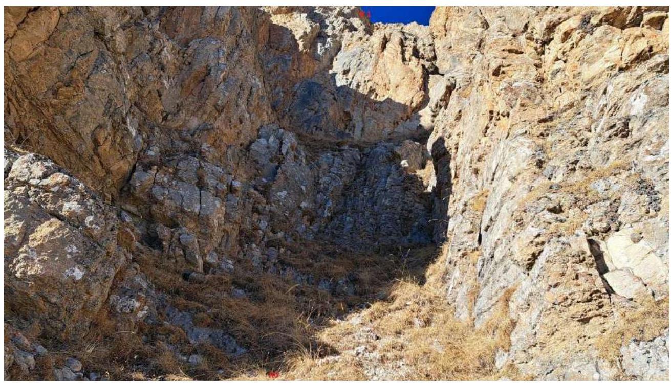
Photo 1 R0–R1
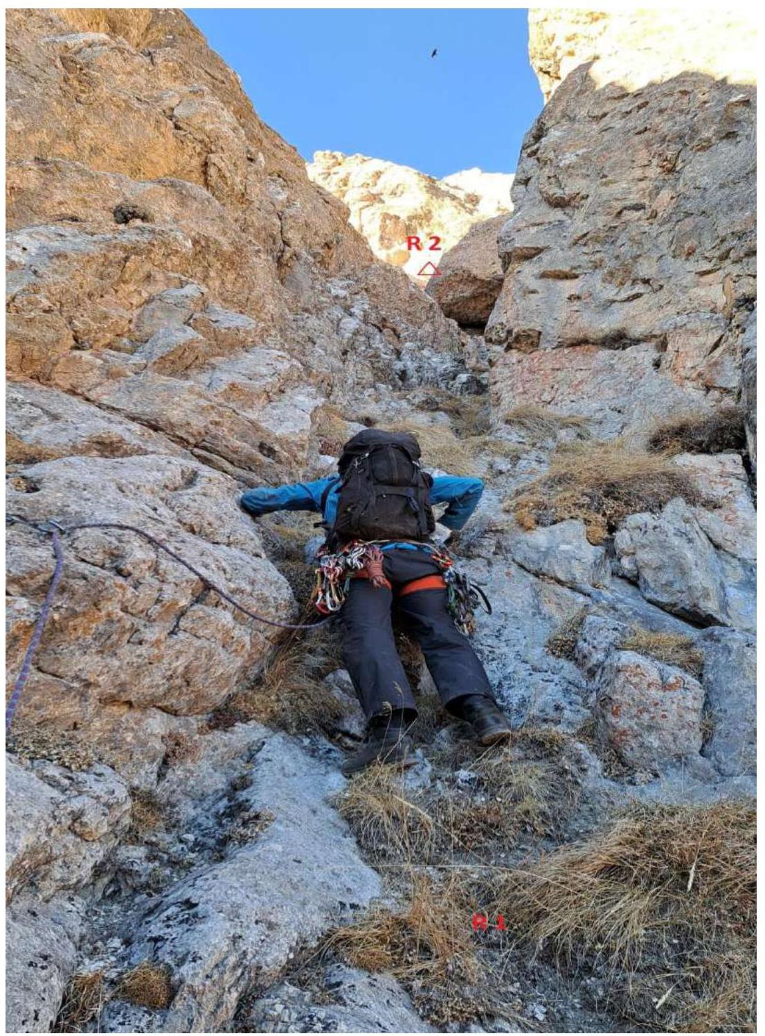
Photo 2 R1–R2
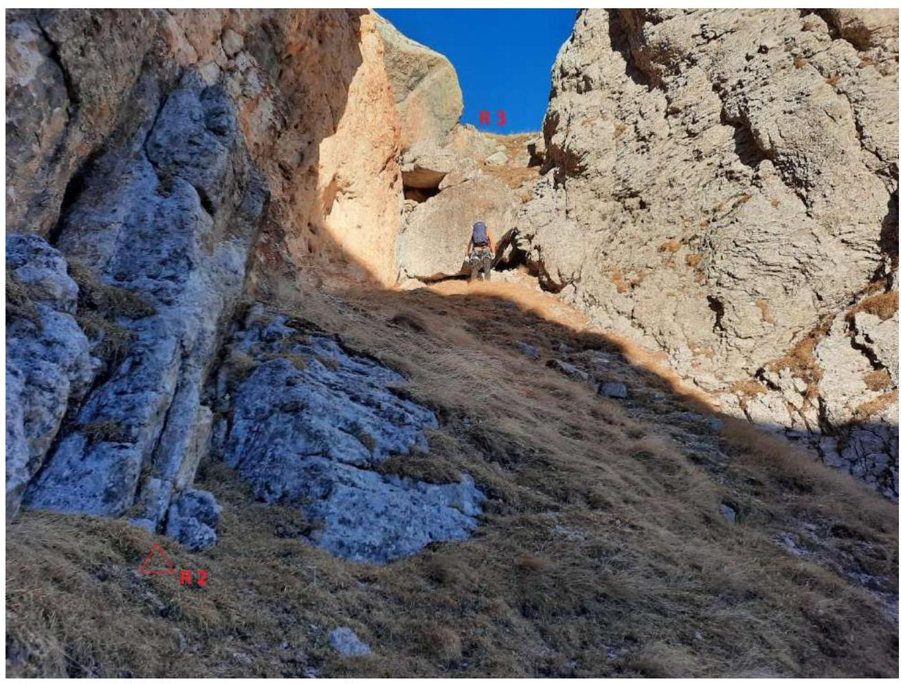
Photo 3 R2–R3, control tour
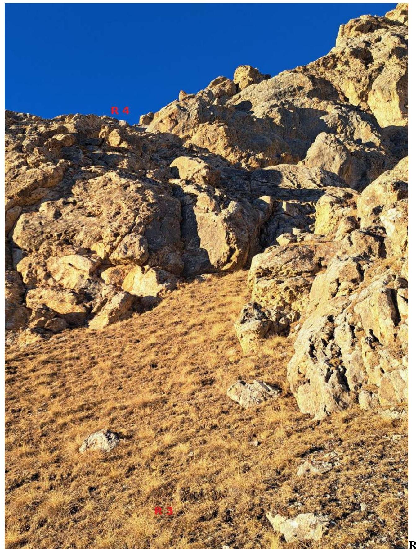
Photo 4 R3–R4 
Photo 5 R4–R5
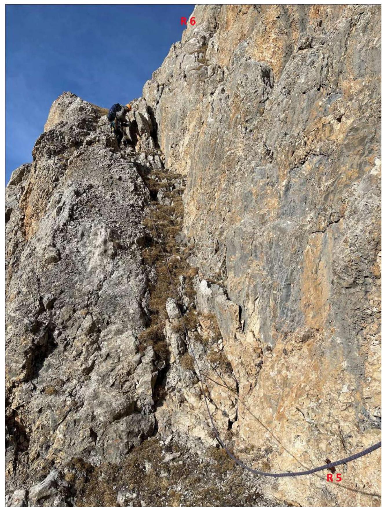
Photo 6 R5–R6
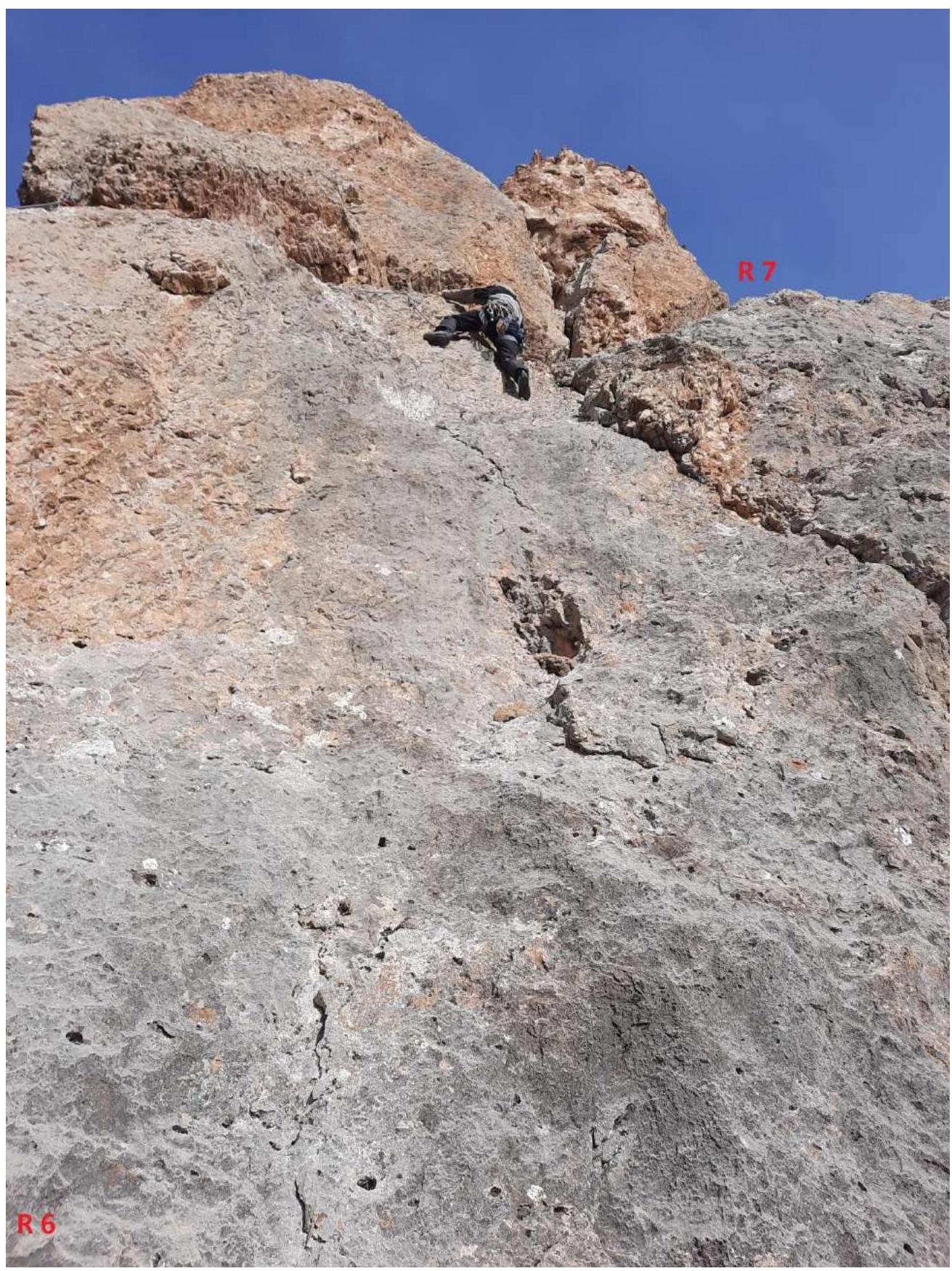
Photo 7 R6–R7
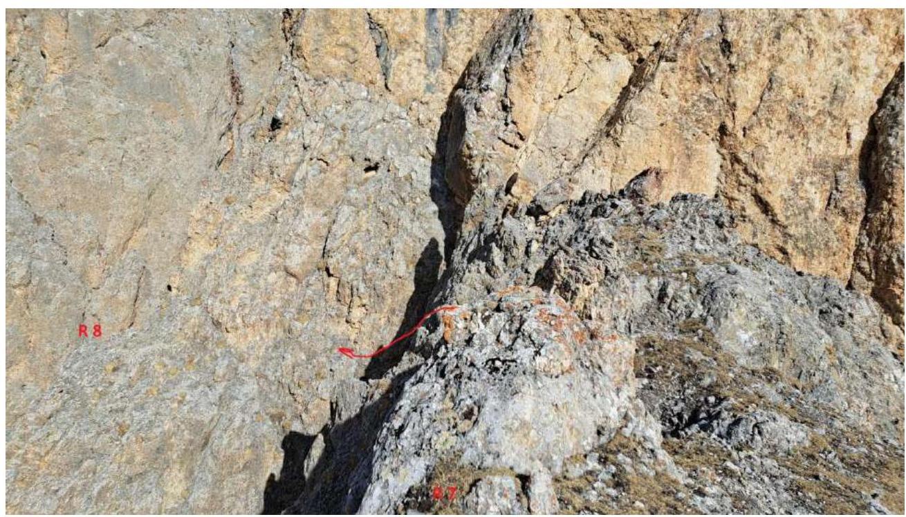
Photo 8 R7–R8
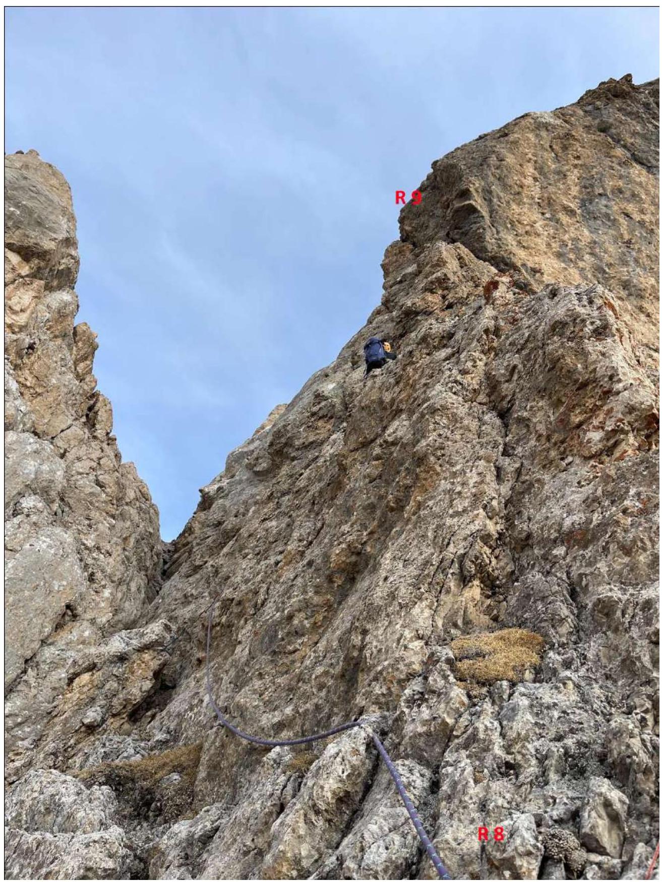
Photo 9 R8–R9
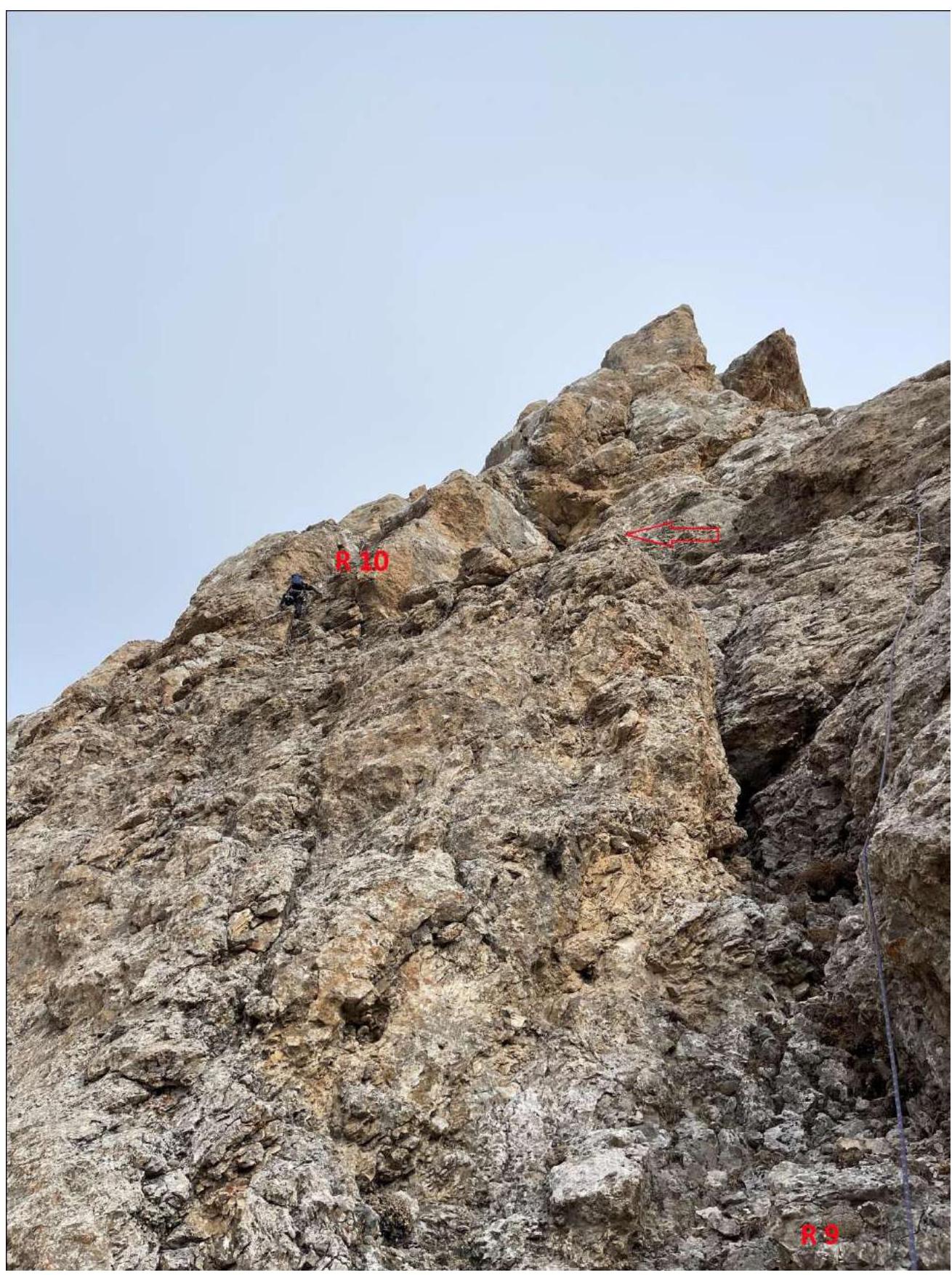
Photo 10 R9–R10
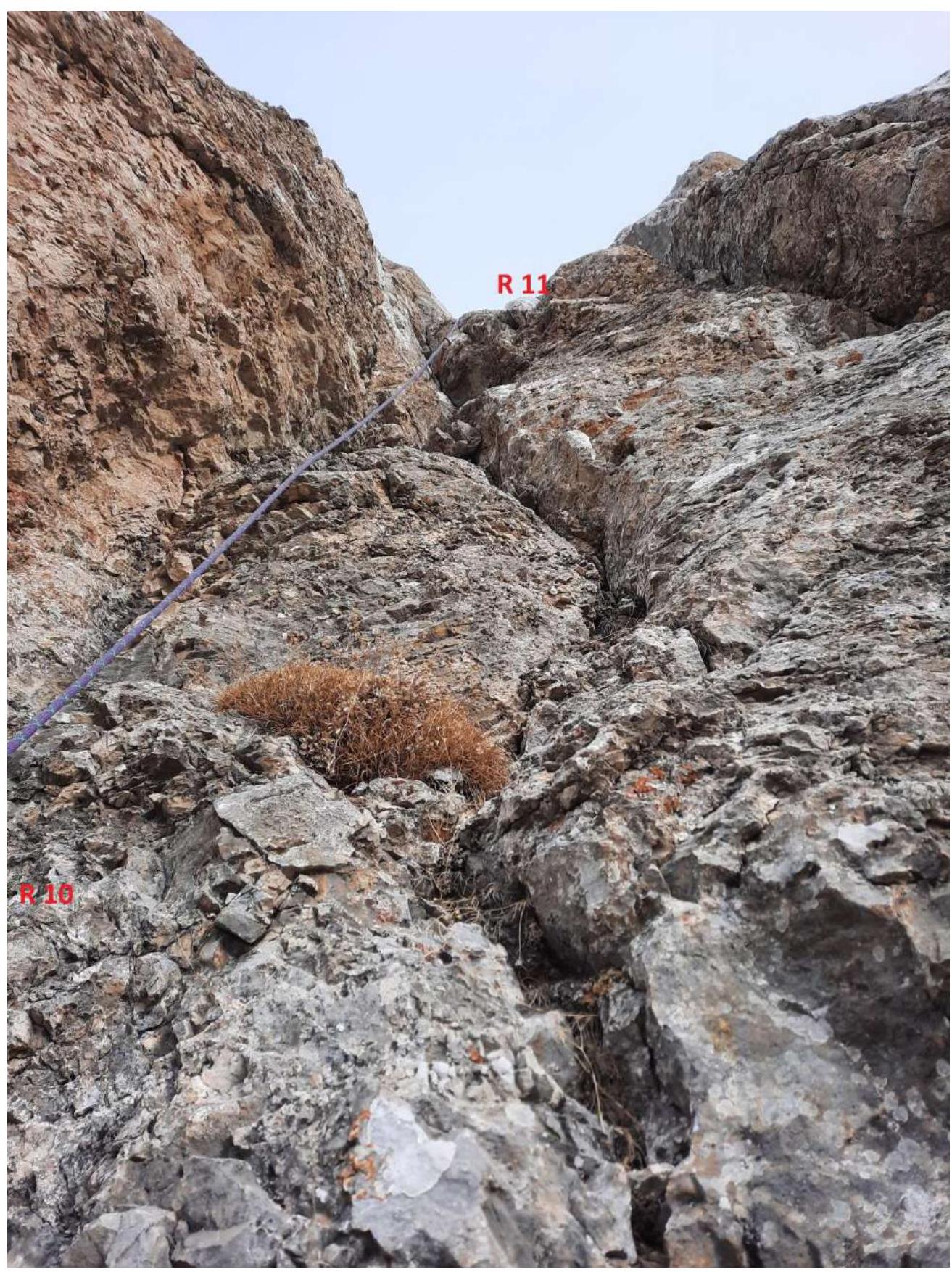
Photo 11 R10–R11

Photo 12 R11–R12

Photo 13 R12–R15
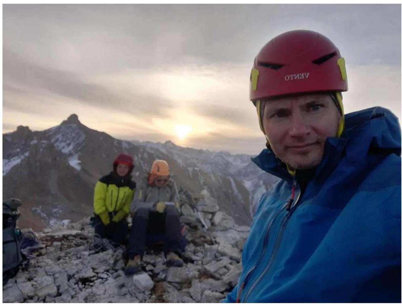
Photo 14 at the summit
Conclusions and Recommendations
The route is logical and safe. It corresponds to the stated category of difficulty 4B. It is the longest route in the area, twice as long as almost all other lines. When assessing the first ascent, we compared it to similar routes on Pik Ine 4B category, Terskolak 4B category, completed by the team earlier. We believe that the technical complexity of the first ascent is higher than these routes. Not recommended for the first 4B ascent. It is convenient for inter-season ascents. The most frequently used technical means were large and medium-sized chocks, hexes of all sizes, friends of medium and large sizes, and anchors — occasionally. Generally, the relief is rich for organizing belay points. On both key sections R6–R7, R8–R9, there are difficult traverses representing increased complexity for the second participant. We recommend that the second participant pass these sections via pendulum movement on a rope. On complex sections, there is a lot of friction climbing, so we recommend passage in rock shoes or at least in trekking boots. Descent is to the east until the end of the wall, then back to the west along the wall to the saddle of the southern ridge and descent along the talus slope in the direction of the hut.