Ascent Passport
-
Caucasus, Digoria, Chirh ridge, section number 2.6.
-
Chirh – 3515 m; via the North Ridge.
-
Category 2A is proposed; first ascent.
-
Route character — rocky.
-
Route height difference – 700 m (from the base of the ridge).
Route length — 280 m (from the point of exit onto the North Ridge, from point R1).
Length of sections with category 4 difficulty – 5 m. Steepness of the main part of the route — 80 °. Average steepness of the entire route is around 30 °.
-
Pitons left on the route — none.
Total equipment used on the route:
- pitons – 3;
- chocks – 7.
-
Team's travel hours – 5 hours; days – 1.
-
Leader: Egorin Sergey Vladimirovich — Master of Sports
Participants:
- Gagiev William Taymurazovich — 1st sports category;
- Zhirnov Dmitry Nikolayevich — 2nd sports category.
-
Coach: Egorin Sergey Vladimirovich — Master of Sports
-
Approach start: May 20, 2003.
Summit reached: May 21, 2003. Return: May 22, 2003.
-
Organization: FSR of the Republic of North Ossetia-Alania.
North ridge of Chirh (3515 m). View from the East. The first ascent route is marked.
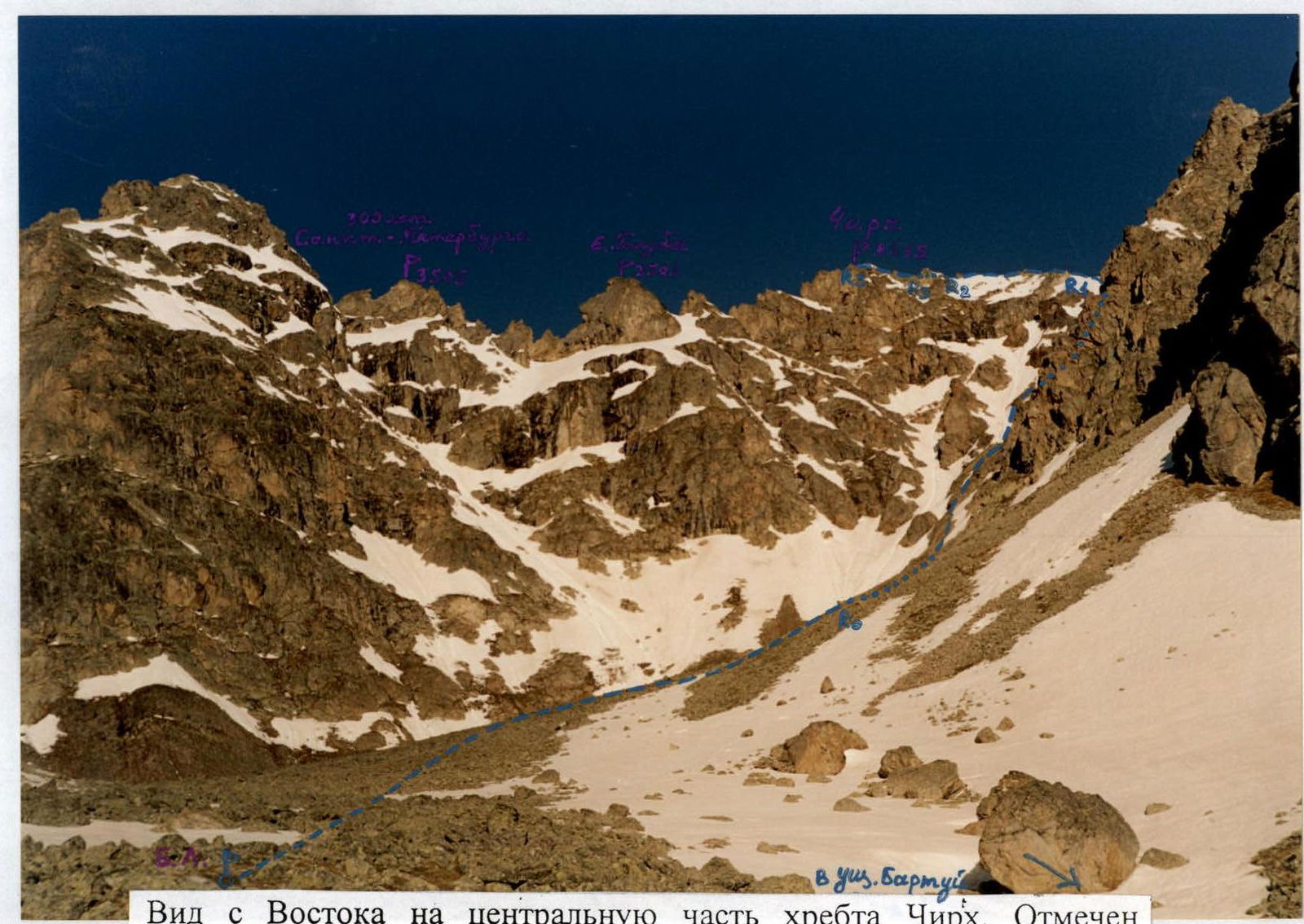
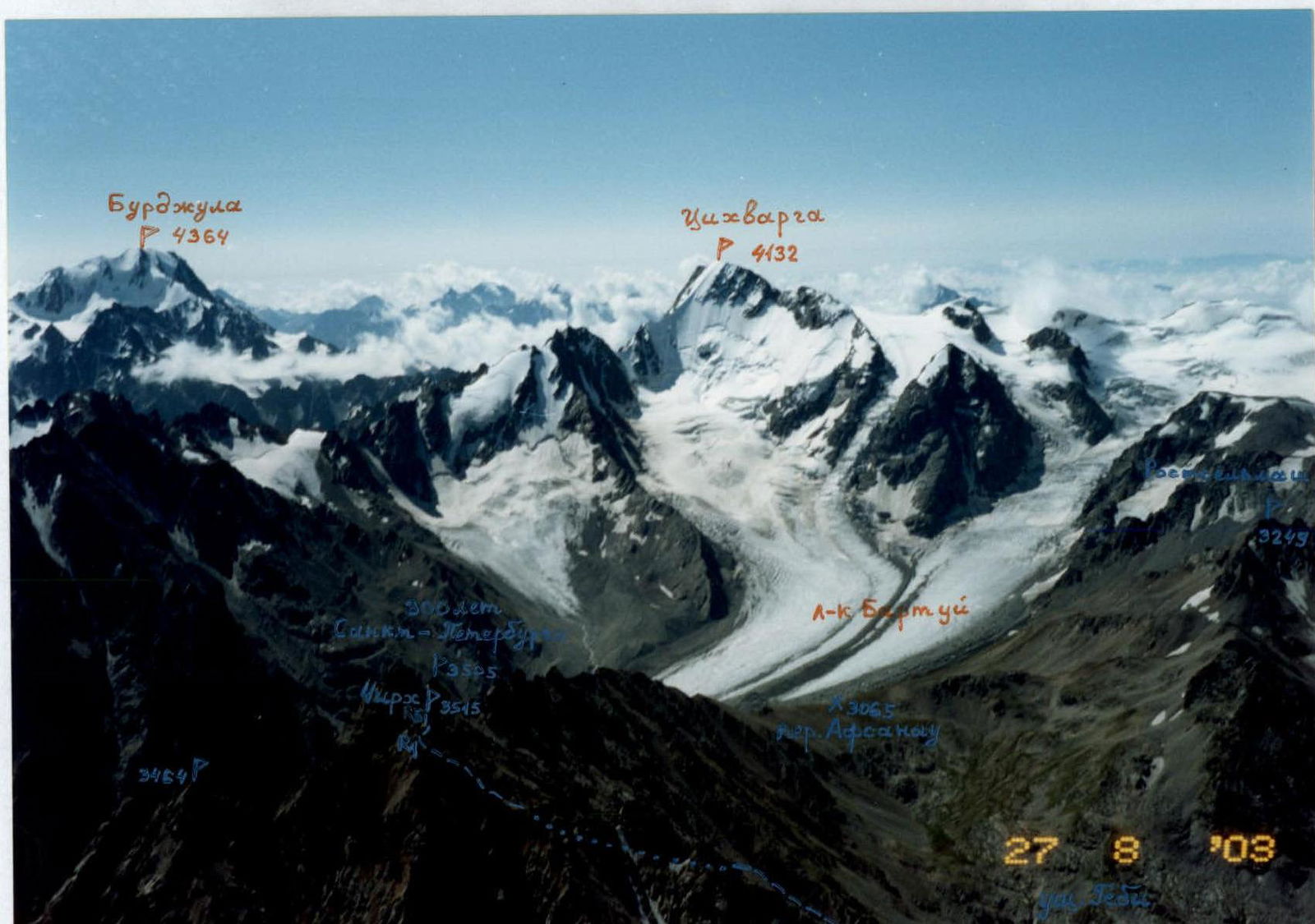
View from the East on the central part of the Chirh ridge. The ascent route is marked. Photo taken from the bivouac, from the scree cirque. The variant of the exit to the North ridge of Chirh from the East, from the Bartuy gorge, is marked.
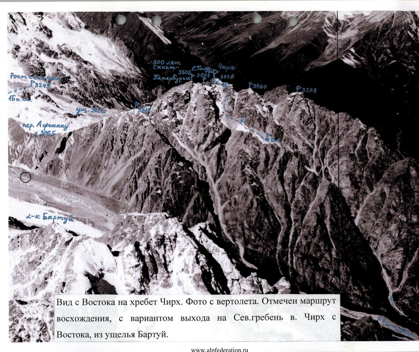
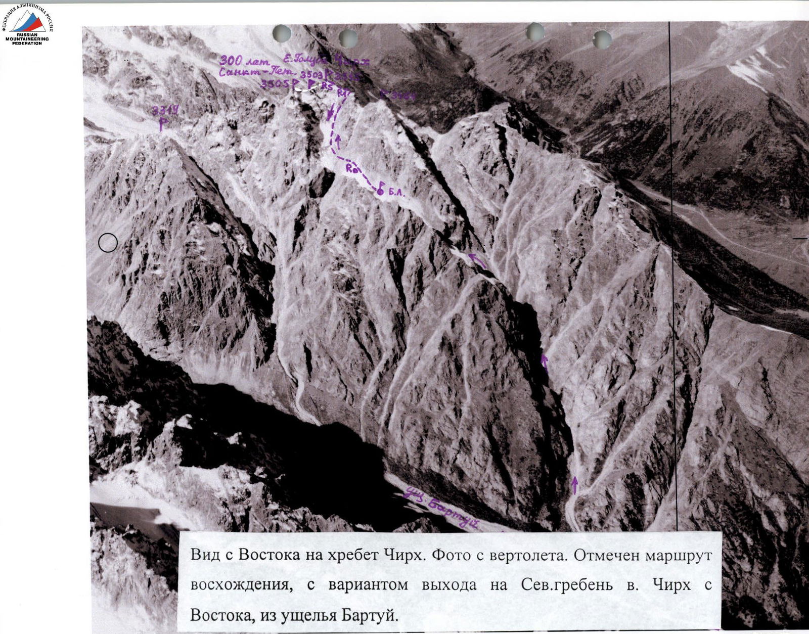
View of the ascent area from the North. Photo taken from a helicopter. The ascent route is marked, with a variant of the exit to the North ridge from the West, from the Gebi gorge. Peaks are marked:
- G.K.Kh.
Route Description
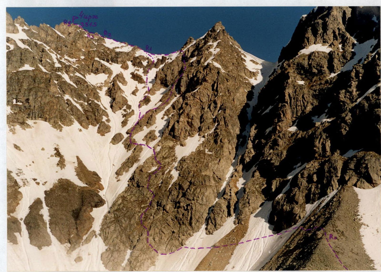
R0–R1 (when ascending from the Bartuy gorge): From the bivouac in the scree cirque, we head West towards the tectonic fault in the Eastern ridge of the South-East tower. A tectonic impact formed a giant funnel in the upper reaches of the cirque; we need to traverse the Southern slope of peak 3464 m along its Northern edge. After passing a narrow couloir, we reach the rocks with scree ledges and move up and to the left, to the right of the couloir (rocks 1–2). To reach the ridge, we either go through the couloir or along the rocks 2–3 to the right of it (if there is a lot of snow). When reaching the ridge (watch out for cornices!), we turn left and ascend onto the North ridge of Chirh (3515 m). From the bivouac, it takes 3 hours and around 700 m.
R0–R1 (when ascending from the Gebi gorge): We head East, ascending along the Western slope of the Chirh ridge. The ascent path goes to the right of the counterforts coming from above. We need to ascend the scree slope to the left, aiming for the left edge of the central part of the Chirh ridge. Before reaching the North ridge, we turn left onto its Western spur. We ascend this rocky-scree counterfort onto the North ridge of Chirh. The entire section is category 1–2. Around 900 m. From the bivouac, it takes 3–4 hours.
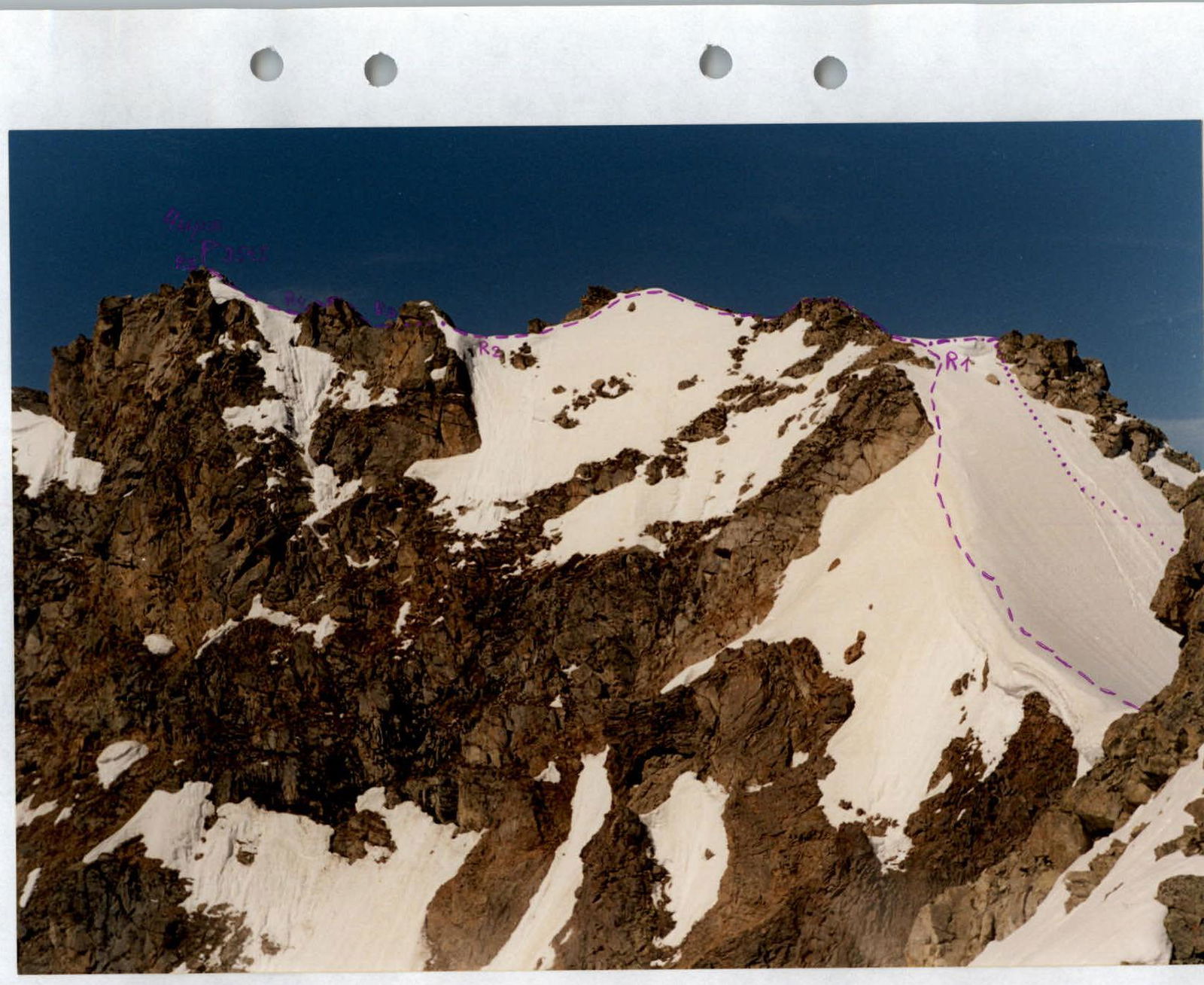
R1–R2: After reaching the North ridge of Chirh, we follow it South. First, we pass a small gendarme, then we follow a wide snow-scree ridge, bypassing the rocks on the left, and approach the Square gendarme. The distance from the North ridge to the gendarme is around 150 m. Category 1–2.
R2–R3: From the connecting ridge, we start bypassing the gendarme on the right. We traverse it through cracks and flakes, category 3; one section of category 4, 80 ° — 5 m. Behind the gendarme, we again reach the connecting ridge. The entire section is 40 m.
R3–R4: We overcome the pre-summit gendarme of Chirh directly along the ridge, category 2–3, 20 m; 50 °. From its summit, we descend back onto the ridge. The entire section is 40 m.
R4–R5: The summit ascent is 50 m, category 1–2; we follow directly along the ridge line. No signs of human presence were found at the summit. We propose to name this point 3515 m — Chirh summit; as the highest point of the Chirh ridge.
The summit is a good panoramic point, with views of Western and Eastern Digoria. Descent is made via the ascent route.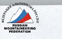
0304112238778118
Variant of the exit to the North ridge of Chirh from the East from the Bartuy gorge. View from the South.
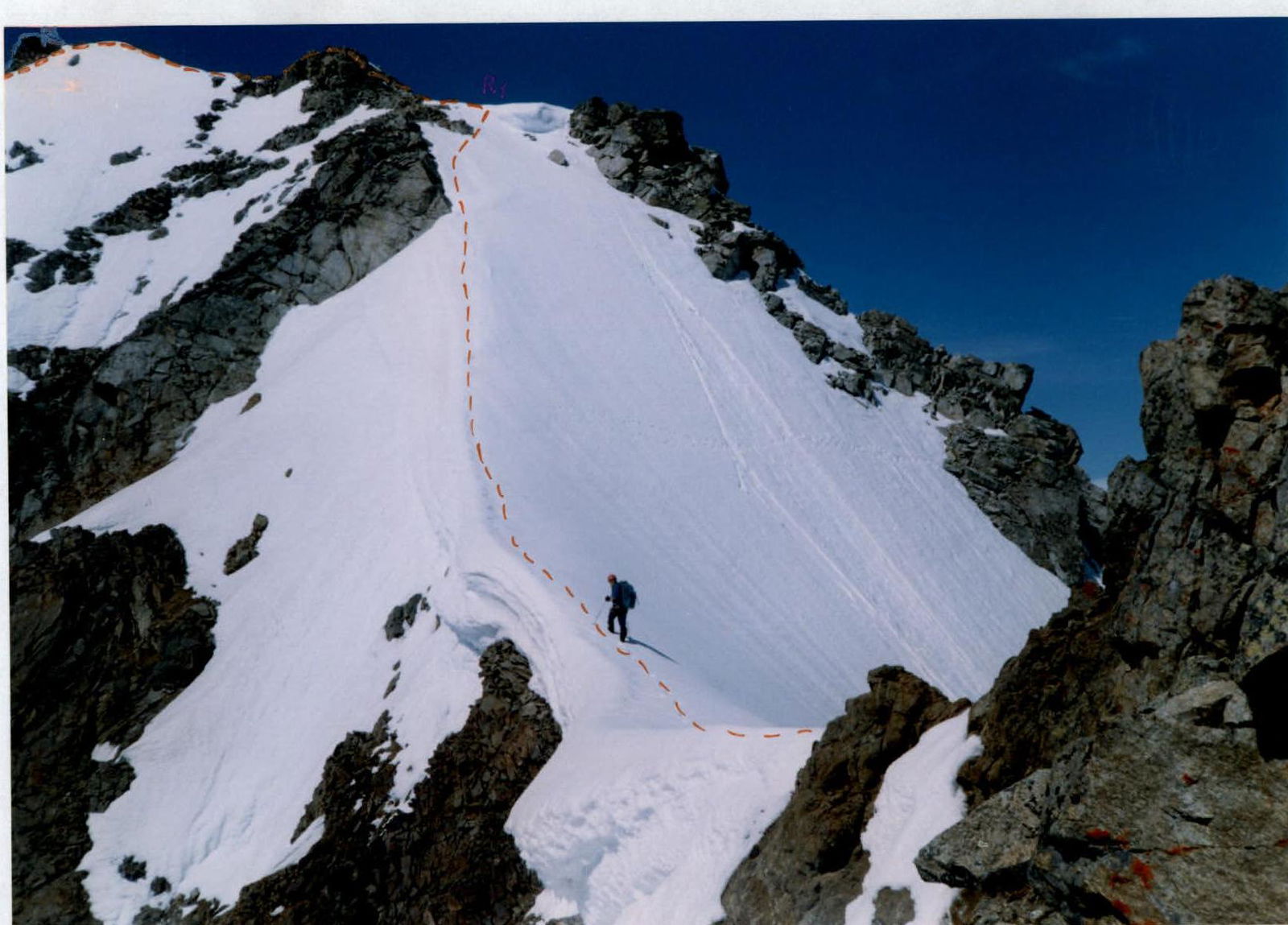
Variant of the exit to the North ridge of Chirh from the East from the Bartuy gorge. The photo shows the final meters of the R0–R1 section.