Tsiteli
The snow-capped rocky dome of Tsiteli peak (4258 m) is located in the Main Caucasian Range between Bezymyannaya and Laboda to the west and Chashura to the east.
In 1895, Tsiteli was ascended by:
- K. Dent
- G. Woolley
The peak is weakly explored by mountaineers.
- Tsiteli via the Western ridge (combined route, category IV difficulty, fig. 17).
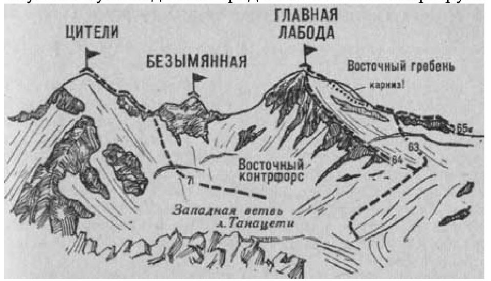
The path from the "Taimazi" clearing (group of 4-8 people) to the exit to the upper plateau of the Western branch of the Tanatseti glacier with an initial bivouac on the plateau or the Southeast counterfort of the Northeast ridge of Laboda is described in route 63. From the initial bivouac:
- cross the plateau (covered crevasses)
- approach the saddle of the Main Range between Tsiteli to the east and the Bezymyannaya peak-jandarm to the west.
From the plateau, having overcome the bergschrund along a snow bridge, ascend a steep icy-snow slope (insurance) to a narrow saddle of the ridge between the peaks. Here, turn left and exit onto the rocks of the Western ridge of Tsiteli peak.
From here, along simple, then steep rocks of medium difficulty of the Western ridge (hook insurance), ascend to the Western shoulder.
Along a poorly expressed snow ridge with two icy-snow rises (cornices, insurance) — reach the summit of Tsiteli.
From the initial bivouac, 6-7 hours.
Descent along the ascent path. Duration of the route is 2-3 days.
Naumov A. F. Karaugom, Digoria, Tsey (Central Caucasus), M., "Fizkultura i sport", 1976.