Ascent Passport
- Ascent class: rock climbing
- Ascent region: Caucasus: 2.6: Sugansky Ridge
- Peak, route: Aikhva Yuzhnaya (3725 m), from the South
- Estimated category of difficulty: 3A rock, partially traversed
- Route characteristics:
Height difference – approximately 200 m. Route length – 565 m. Length of sections:
- 5th category of difficulty – 7 m
- 4th category of difficulty – 35 m
- 3rd category of difficulty – 70 m
- 2nd category of difficulty – 200 m. Average steepness of the main part of the route – 45°
- Pitons hammered: 4 pieces
- Number of climbing hours/days – 6/1
- Number of overnight stays: 1 – at a bivouac
- Leader: Levkovsky Yu.V. – Candidate Master of Sports
Participants:
- Bessarab A. – 3rd sports category
- Kulikov S. – 3rd sports category
- Rodin A. – 3rd sports category
- Surovcev A. – 3rd sports category.
- Coach: Akhtyrchenko Galina Vasilievna – Master of Sports
- Route entry: August 16, 2000 Return to bivouac: August 16, 2000
- Organization: AUS "Digoria".
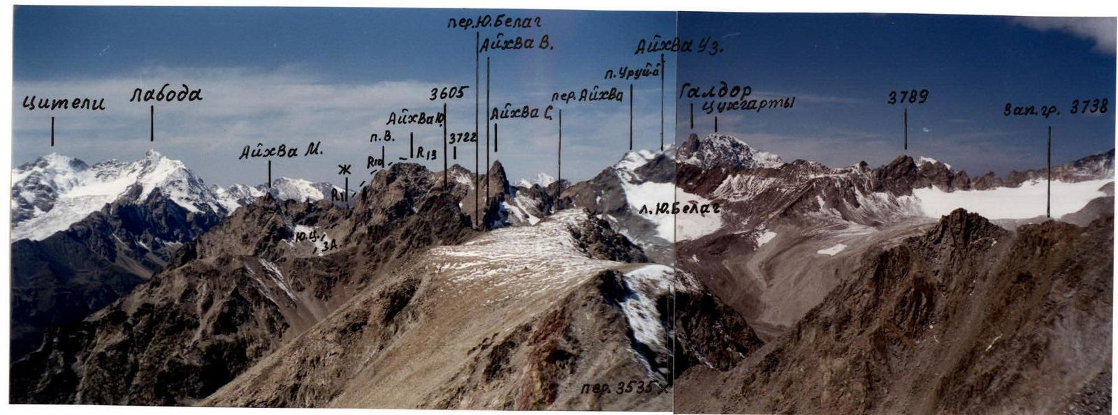 P. V. – subpeak. Fig. 1 Eastern part of Sugansky Ridge. View from the east, from peak "3738 m".
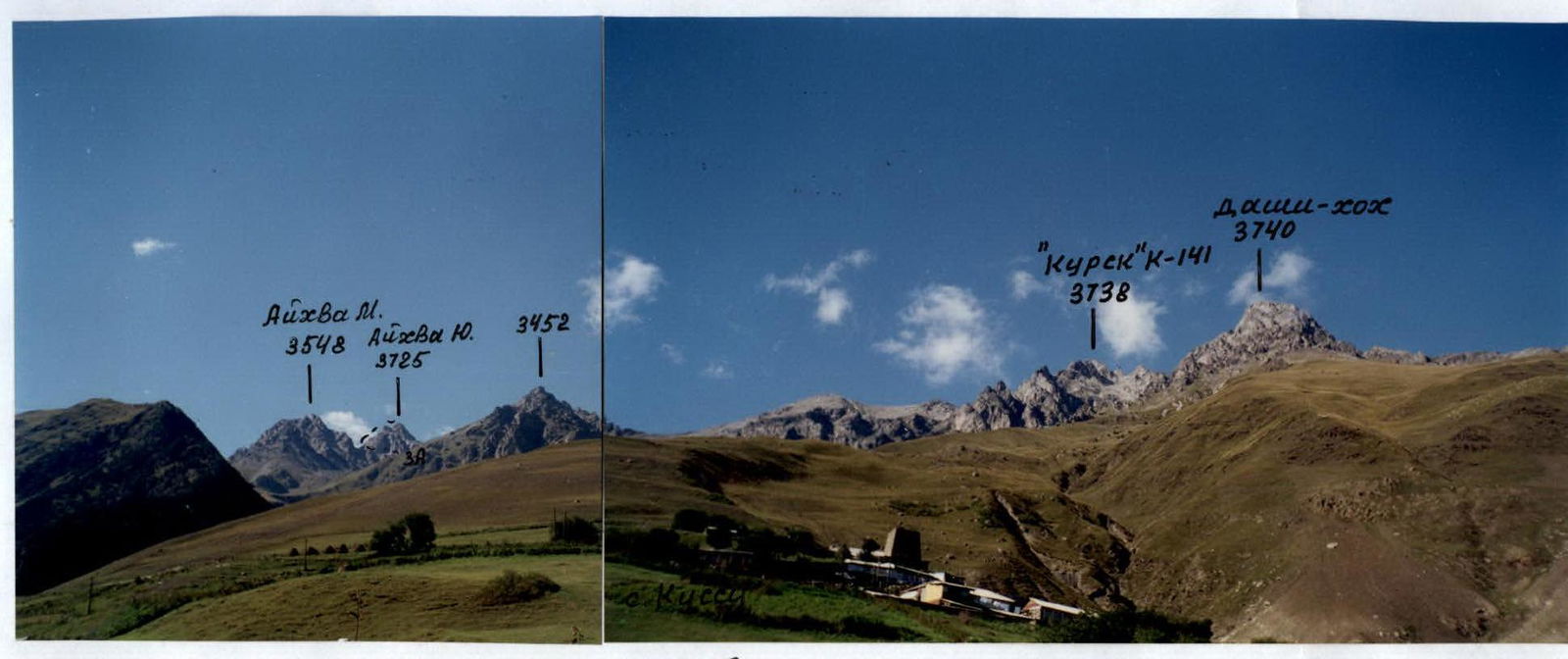 Fig. 2 Eastern part of Sugansky Ridge from the south (from the village of Kussu).
Route Description
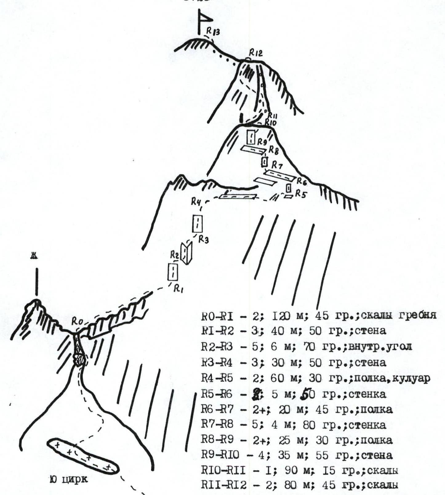
R0–R1 – 2; 120 m; 45°; ridge rocks R1–R2 – 3; 40 m; 50°; wall R2–R3 – 5; 6 m; 70°; inner corner R3–R4 – 3; 30 m; 50°; wall R4–R5 – 2; 60 m; 30°; ledge, couloir R5–R6 – 8; 5 m; 50°; wall R6–R7 – 2+; 20 m; 45°; ledge R7–R8 – 5; 4 m; 80°; wall R8–R9 – 2+; 25 m; 30°; ledge R9–R10 – 4; 35 m; 55°; wall R10–R11 – 1; 90 m; 15°; rocks R11–R12 – 2; 80 m; 45°; rocks R12–R13 – 2; 50 m; 45°; ledge, rocks
From the bivouac on the moraine in the cirque, move up through large and medium-sized scree to the entrance of the South cirque on the eastern side of the Southern spur. The massif of peak Aikhva Yuzhnaya is clearly visible, with its eastern part cut by a couloir that separates the subpeak from the peak.
Exit onto a small glacier in the South cirque, from which ascend to the right – up to the saddle via fine, steep scree under the rocks (danger of falling stones). In the upper part of the couloir, there is a large rock plug that is bypassed on the right via несложным скалам and then similarly via rocks in the narrowing couloir, exiting onto a narrow saddle to the right of a large gendarme (start of the route).
Turn right and move along the rocks of the wide southern ridge of peak Aikhva Yuzhnaya – 120 m. Further up, via a wide wall to an inner corner, through which move right and then left – up the wall to the ridge of the gendarme. Turn right and ascend via the rocks on the right side, an osypnoy кулуару to the shoulder under the tower of the subpeak from its SE side.
Directly up 5 m to a ledge, along which move left – up under the wall. Via the wall 3–4 m to a ledge, along which move left – up under the wall of the upper part of the tower. Directly up the wall to the tower of the subpeak.
Further, move left via rocks and descend 10 m to a saddle, approach which under the start of an osypnoy кулуар. Ascend to the middle of the couloir, turn left, and via rocks, ascend to the ridge, then from its right side via a 20 m ledge, exit to peak Aikhva Yuzhnaya.
From the start of the route – 4–5 hours.
Descend to the eggenу сторону North cirque on the right side of the Southern spur via несложным скалам and ledges on the eastern side of the ridge to the north onto a saddle, from which move right – down via fine scree into the North cirque and further via large and medium-sized scree to the bivouac.
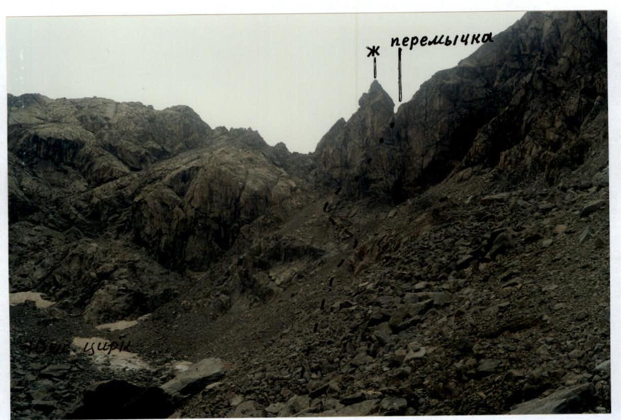 Path to the saddle in the Southern ridge. peak Aikhva Yuzhnaya.
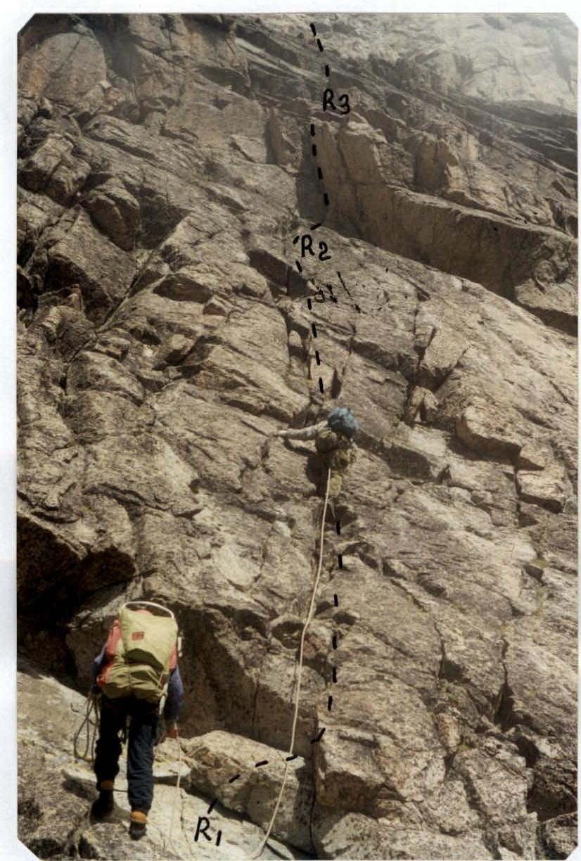 Fig. 3. Sections R1–R3. Wide wall.

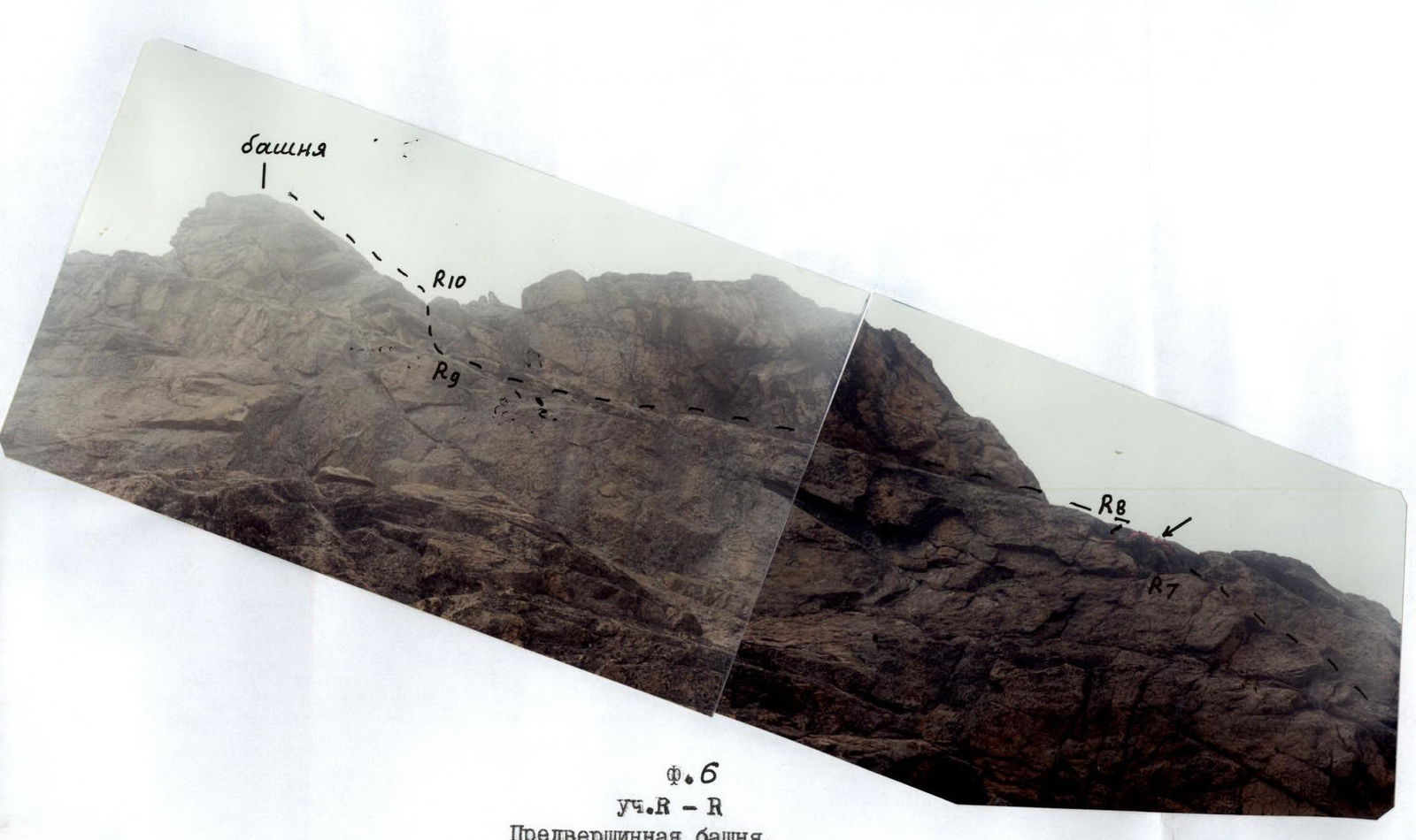 Fig. 6. Sections R9–R10. Pre-summit tower. View from below, from the shoulder of the ridge.