
Ascent Record
- Ascent type — rock climbing.
- Ascent area — Caucasus, Bezengi valley.
- Summit — Ullu-auz Malaya, 4450 m.
- Route — via the 10th ridge.
- Estimated grade — 4A.
- Main route characteristics: height difference — 400 m, distance — about 500 m, average steepness — about 60°.
- Pitons used: rock — 12/0, chocks 5/2.
- Climbing hours — 12.
- Number of bivouacs — none.
- Group members: Kolchin A.A. — Master of Sports of International Class, Saratov Yu.S. — Master of Sports, Kalaitan A.M. — 1st category.
- Route entry and exit — July 11, 1986.
- Ascent organized by the local tourist club.

Area Map
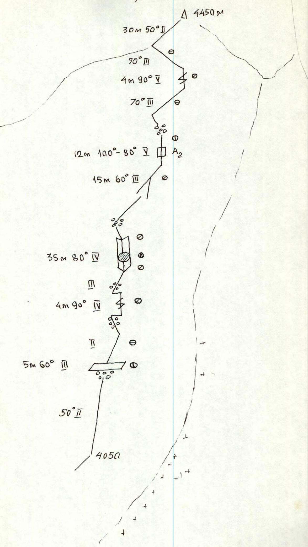
Route Diagram
Brief Description of the Approach and Descent
The approach from the Bezengi alpine camp to the "3900" bivouac in the upper reaches of the Kundryum-Mijirggi glacier takes 10–12 climbing hours. From the upper platforms, the approach is under the couloir that separates the southern counterforts of the Main and Malaya peaks of Ullu-auz. Up the couloir, and 30 m after the lowest point of the counterfort, a traverse left onto the rocks, then 60 m along easy rocks to the start of the route — section 1, elevation 4050 m. The further path follows the line of the counterfort ridge and is straightforward; deviation left or right is not possible.
The descent from the summit is along the 3rd ridge, simultaneously on rocks of about 2nd category difficulty to the shoulder. A section of steep ridge drop (30 m) is descended via rappel. An alternative is to bypass via the north snowy-icy slope, but this requires crampons for all and piton protection. Then, along easy rocks to the saddle before the Utug peak, and left down the couloir onto the glacier and to the bivouac.