From the "Djangi-kosh" hut along the crest of the right-bank ("crescent-shaped") moraine to its flattening, then along the Sella Glacier. Along the left edge or through the middle of the icefall (Fig. 1) exit to the upper circus (cautious — closed crevices) and through it under the N wall of the Sella peak, 1 h 31 min.
Through the bergschrund along the ice-snow slope to the left of the ice fall with piton belay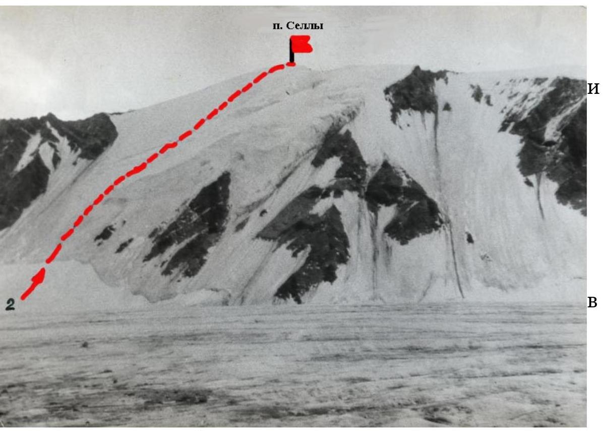
in the direction to the summit (attention — do not deviate left, rockfall hazard from the rocks of the NE ridge counterfort). Along the steepness, the route has sections: 1 — ice slope (120 m, 45–50°) from the lower bergschrund to the ice edge of the ice fall. 2 — ice slope (40 m, 50–55°) in the ice fall zone. 3 — ice-snow slope (80 m, 45°) from the ice fall to the upper bergschrund. 4 — ice-snow slope (120 m, 45–30°) from the second bergschrund to the summit ridge. The difference of edges of the second bergschrund along the path is 1.5–2 m, in the absence of bridges traverse right for 20 m — here the difference is smaller. Depending on the ascent timing, the length of the snow sections of the wall is 120–150 m, belay — through ice axes. For ascent 8–12 h. Descent from the summit along the NE ridge to the saddle, then along the slope to the right onto the Bezengi Glacier and along it (attention — closed crevices, under the S slopes of the Varshava peak — rockfall hazard) to the hut 1.5–2 h. Hazardous places: on glaciers — closed crevices and rockfall hazard under the S slopes of the Varshava peak, on the N wall of the Sella peak — rockfall hazard when deviating left, on the NE ridge — possible cornices to the right. Special equipment: ice axes 8–12 pcs., crampons — for all.