
Report
of the UTС FASIL St. Petersburg team on the ascent of Mekhtygen Eastern (3085 m) via the couloirs of the Southeast wall
"Nevsky Prospekt" route - first ascent
Proposed category: 2A
Skalisty Ridge, Caucasus 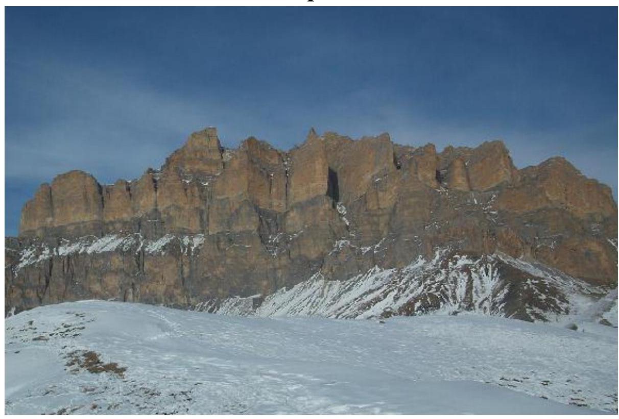
Team leader: Marshakov D.A.
Team coach: Timoshenko T.I.
St. Petersburg, 2012
Ascent Passport
- Caucasus, Skalisty Ridge, Cherek gorge
- Mekhtygen Eastern peak, 3085 m, "Nevsky Prospekt" route
- Proposed category: 2A, first ascent
- Route type: rock
- Route elevation gain: 635 m (by GPS)
Route length: 1965 m. Section lengths:
- Category V: none
- Category VI: none
Average slope:
- Main part of the route: 30°
- Entire route: 18°.
-
Number of pitons on the route: placements - 10 pieces
-
Team's total climbing time: 10 h 50 min, 1 day
-
Team leader: Marshakov Dmitry Alexandrovich, 1st sports category
Team members: Pilyak A.V., 3rd sports category
- Coach: Timoshenko T.I., Master of Sports
- Departure from base camp: hour, day, month, year
Route started: 7:00 AM, February 8, 2012 Reached the summit: 12:50 PM, February 8, 2012 Returned to base camp: 5:50 PM, February 8, 2012 Descent from the summit: via the ascent route
- Organization: UTС FASIL, St. Petersburg, LETI mountaineering club
- Person responsible for the report: Marshakov D.A.
Email: dim_etu@rambler.ru 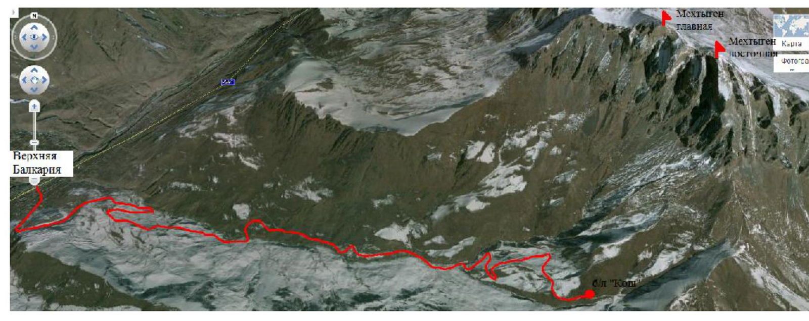
Fig. 1 - 3D panorama of the ascent area.
Kabardino-Balkarian Republic, Chereksky district, Upper Balkaria village, Mekhtygen Eastern peak (3085 m above sea level).
The main part of the Greater Caucasus mountain system is formed by two parallel ridges of similar height: the Main (Watershed) Ridge and the Front Ridge, which transitions into the Lateral Main Ridge in the east. These ridges are considered high-altitude.
The Main Caucasian Ridge (MCR) stretches as a continuous mountain chain and serves as a watershed between north and south. The Front and Lateral ridges are composed of alternating mountain massifs separated by transverse river valleys. To the north of them lie three rows of middle-altitude ridges, oriented in a latitudinal direction and decreasing in height towards the plain. These are known as the Skalisty, Pastbishchny, and Lesisty ridges (the latter two are often combined as the Melovoy Ridge in literature).
Among these, the Skalisty Ridge is significant in height after the Lateral Ridge. It rises as a giant gray wall along the northern boundary of the area, 10 to 35 km away from the Lateral Ridge. It has asymmetrical cuesta slopes, with a steep, abrupt southern slope and a more gentle, forested northern slope. The Skalisty Ridge is composed of thick layers of limestone, dolomites, and marls (a sedimentary rock of mixed clay-carbonate composition (calcite, sometimes dolomite)), tilted at an angle of 25-30° to the north. The limestone, being easily soluble in water, contributes to the formation of numerous niches, grottos, and caves on the ridge slopes, which are karst features resulting from leaching.
The steep southern slope of the ridge is dissected by numerous gullies and couloirs. At its foot lie small and large talus slopes in the form of limestone fragments and boulders.
The Skalisty Ridge stretches for 375 km from the Belaya River (Kuban basin) almost to the Terek River. Its height in the west is 1200-1700 m, in the east up to 3000 m, with the highest point being 3646 m (Karai-Kaya peak, between the Chegem and Cherek rivers). The mountaineering exploration of the Skalisty Ridge began relatively recently. In 1979, the USSR Championship was held here. All routes were laid on the peaks of Ak-Kaya and Kara-Kaya.
Mekhtygen Eastern (3085 m) and Main (3185 m) are peaks located where the Ekrdzygen spur, branching off from the Sugan peak, meets the Skalisty Ridge. Mekhtygen resembles a castle with whimsical sheer walls and towers. From the south, the massif drops off with vertical walls. The height difference of the wall section is 600-800 m. Horizontally, Mekhtygen is divided into three parts by ledges that cross almost the entire massif. The lower part is monolithic, while the two upper parts are the most heavily eroded. 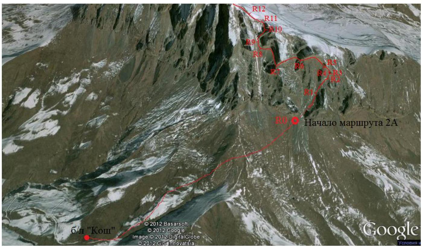
Fig. 2 - Route line on a 3D panorama of the area.
GPS Coordinates:
Base camp: 43.1083° N, 43.5196° E, 2058.6 m; Start of the route: 43.1147° N, 43.5383° E, 2448.5 m; Mekhtygen Eastern summit: 43.1215° N, 43.5319° E, 3085.3 m 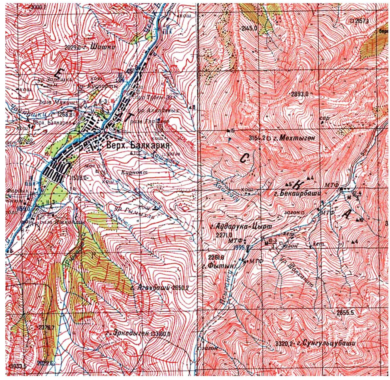
Fig. 3 - Map of the area at a scale of 1:100,000
Brief technical description of the route sections:
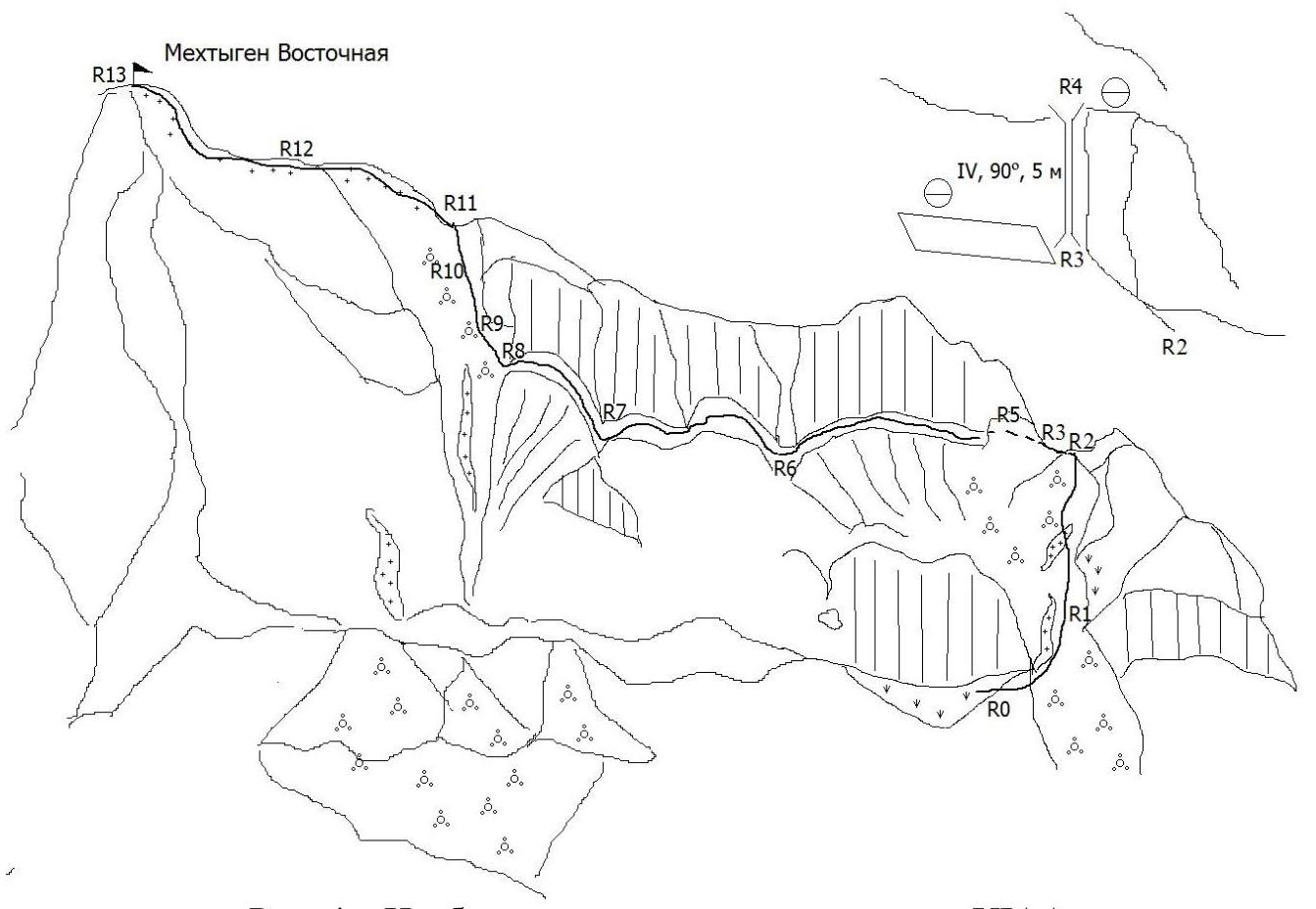
Fig. 4 - Route representation in UIAA symbols
Table 1 - Description of route sections.
| Section № | Length, m | Slope, degrees | Terrain characteristics | Difficulty category | Number of pitons |
|---|---|---|---|---|---|
| R0–R1 | 250 | 25–30 | Couloir, talus with snow patches | 2 | |
| R1–R2 | 250 | 30–35 | Couloir, medium talus | 2 | |
| R2–R3 | 50 | 40 | Shoulder, medium talus | 3 | 3 |
| R3–R4 | 5 | 90 | Chimney | 4 | 4 |
| R4–R5 | 50 | 15–20 | Talus slope | 2 | 3 |
| R5–R6 | 200 | 5 | Horizontal ledge, 2-5 m wide | 2 | |
| R6–R7 | 200 | 5 | Horizontal ledge | 2 | |
| R7–R8 | 200 | 15 | Horizontal ledge | 2 | |
| R8–R9 | 50–70 | 30 | Talus slope | 2 | |
| R9–R10 | 300 | 35–40 | Couloir, talus with snow patches | 3 | |
| R10–R11 | 100 | 40 | Couloir, steep talus slope with snow | 3 | |
| R11–R12 | 150 | 20–30 | Snow slope with rock outcrops | 2 | |
| R12–R13 | 150 | 25–30 | Snow slope | 2 |
The base camp (b/c) is located near a corral at an altitude of 2059 m above sea level, 8.86 km from the village of Upper Balkaria. The starting point of the route is marked by a wide talus couloir (see Figs. 2 and 4-5) situated in the right (eastern) part of the Mekhtygen rock massif, descending 300-400 m below the start of the rocks.
The approach to the vertical wall to the left of the couloir (start of the route, 2448 m) from the b/c along the left (orographic) side of the Khashkhasu river tributary and traversing the grassy slope along the Mekhtygen massif takes 1-1.5 hours. This is a convenient place for team members to gear up.
Then, move up and to the right through the talus couloir (with snow patches in places) towards the depression in the shoulder (R0–R2, 500 m). In the upper part of the couloir, while moving along the rocks, it is possible to organize belay points. From the col, traverse left along the shoulder (R2–R3, 50 m) to a vertical wall, where a comfortable belay station can be set up on a ledge. On the right part of the ledge, there is a 5 m chimney (90°, category 4) - the key section of the route. In the chimney, organizing 3-4 intermediate protection points (camalots 0.5-2) is mandatory. At the top, to the right, 2 m away, there is a massive slab with a sling for organizing a belay station. Then, move straight up the talus slope (R4–R5, 50 m) towards the vertical wall (see Fig. 6). It is dangerous to approach the wall closer than 2-3 m due to the risk of falling rocks! After bypassing the hazardous section to the left (10-15 m), the route proceeds along ledges directly along the wall (R5–R8, 600 m), crossing three cirques. The width of the ledges ranges from 1.5 to 5 m. The section R6–R7 is most simply and safely traversed in close proximity to the rocks. The rock walls (section R7–R8) are bypassed to the left. Then, ascend the talus couloir (R8–R10, 400 m) up to the col on the ridge (control cairn, 2977 m). From here to the summit of Mekhtygen Eastern (3085 m), there are two snow ascents (R11–R13, 300 m). The time from the start of the route to the summit is 4-5 hours.
The descent follows the ascent route back to the b/c, taking 2-3 hours. 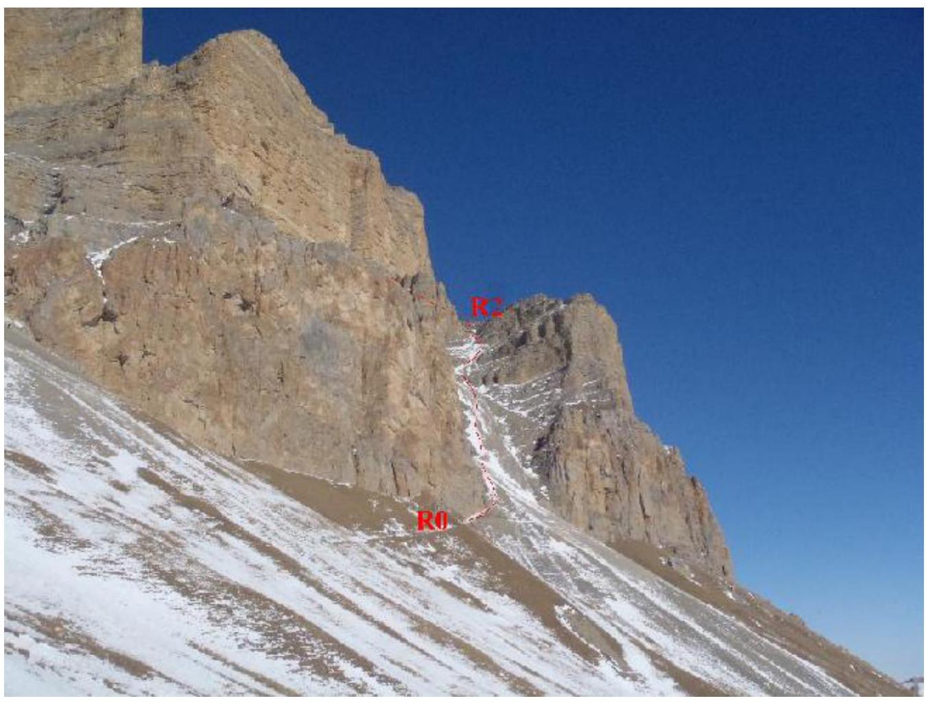
Fig. 5 - Photograph of the lower part of the route (sections R0–R2)
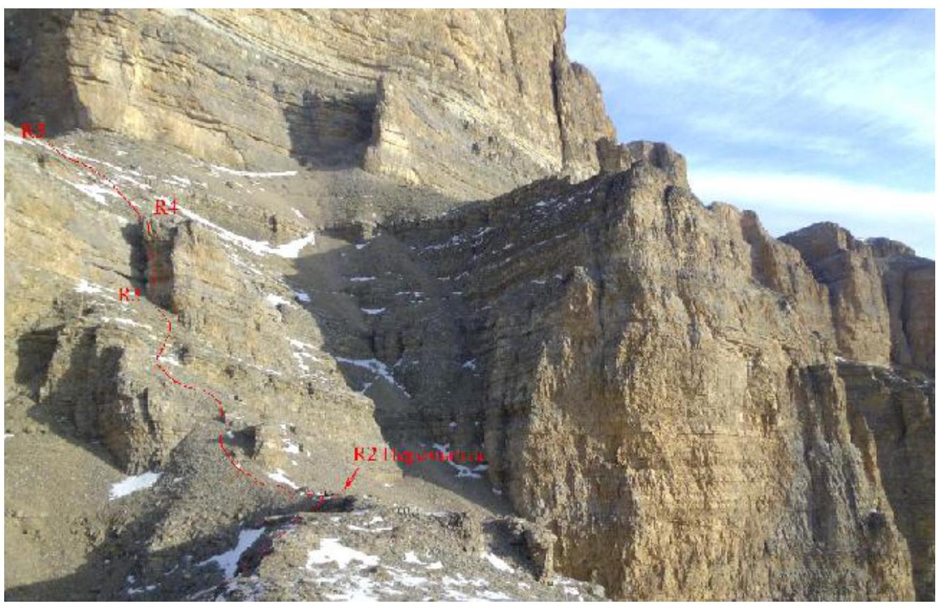
Fig. 6 - Photograph of sections R2–R5 of the route
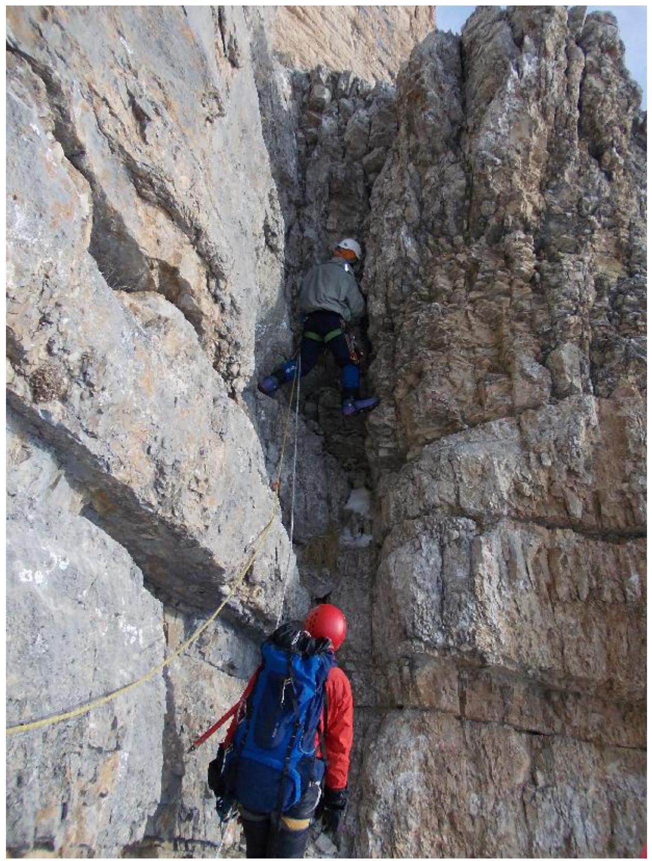
Fig. 7 - Work on the key section R3–R4 (photograph taken from a group led by Marshakov D.A., ascent on February 10, 2011)
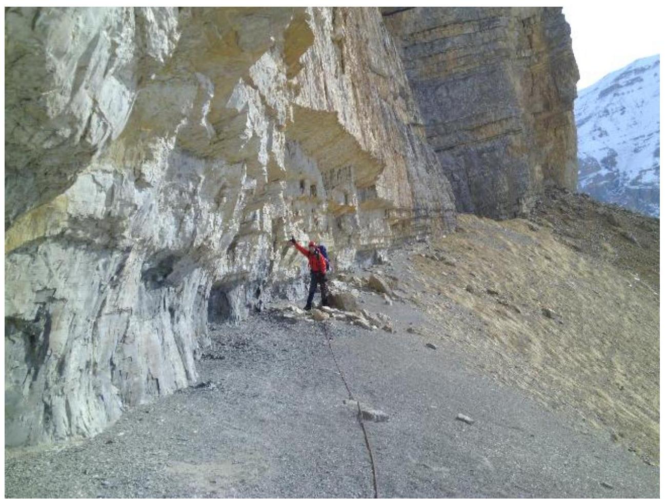
Fig. 8 - Section R5–R6 of the route.
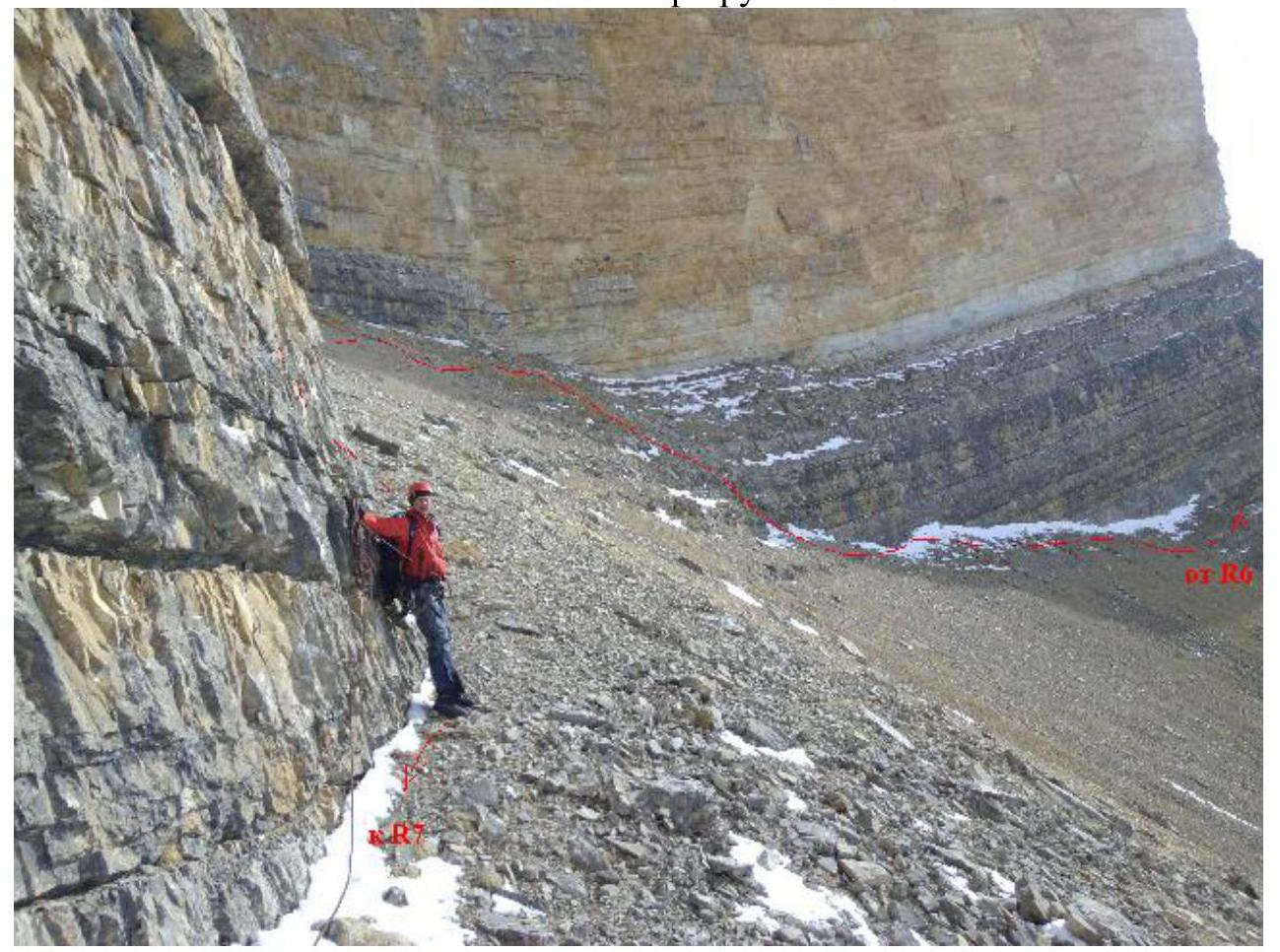
Fig. 9 - Passage of section R6–R7 of the route.
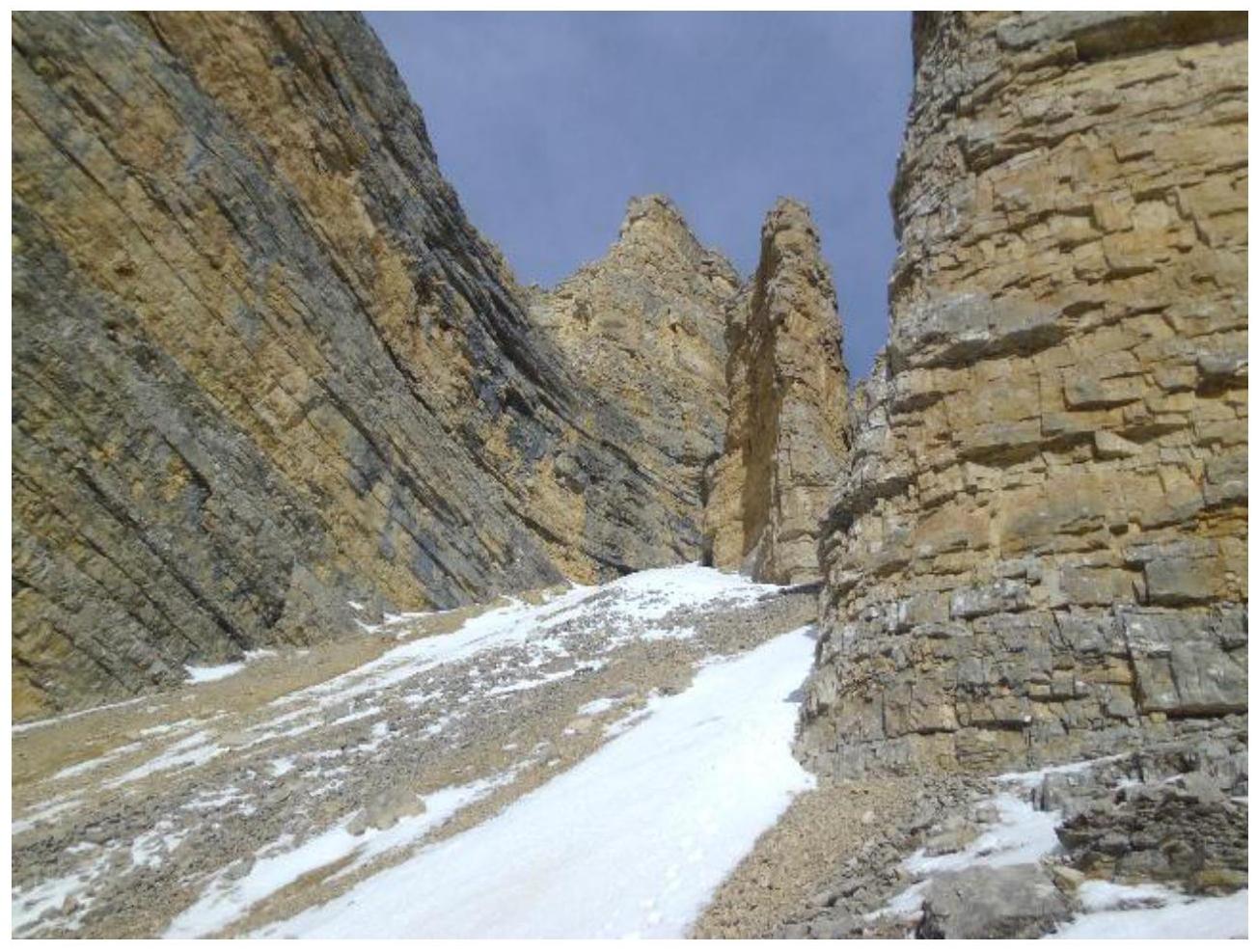
Fig. 10 - Entrance to the middle part of the large couloir (section R8).
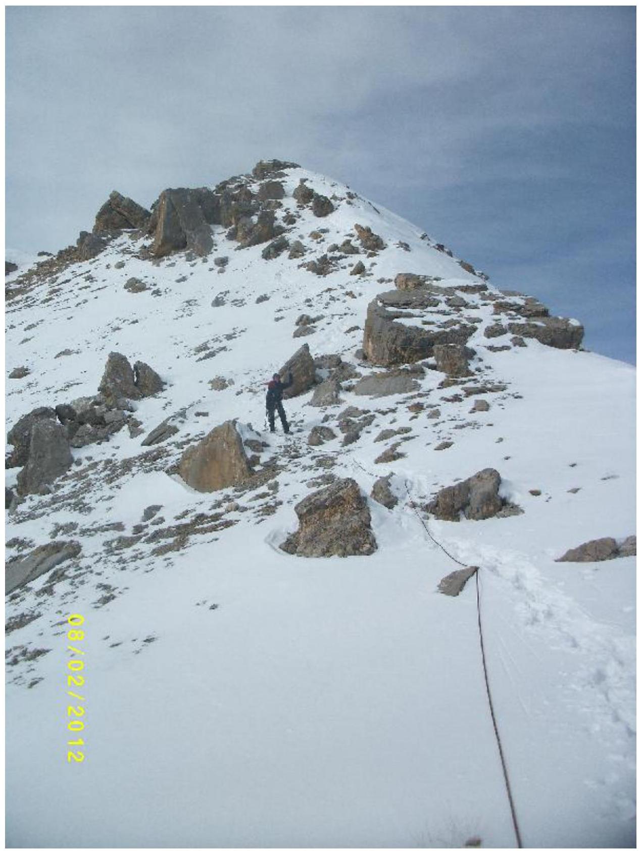
Fig. 11 - Pilyak A.V. descending from the summit (R13–R12).
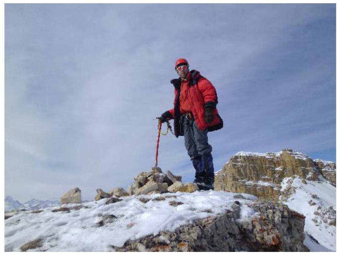
Fig. 12 - Marshakov D.A. on the summit.
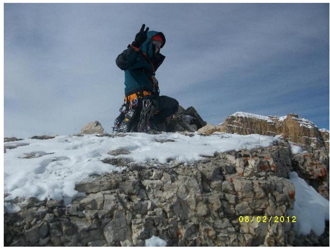
Fig. 13 - Pilyak A.V. on the summit.
List of equipment used:
Main rope 1 × 50 m, static rope
Expendable rope 5 m
Placements 1 set
Camalots 6 pieces
Quickdraws 6 pieces
Muir'ed carabiners 6 pieces
Slings 3 pieces
Jumar 1 piece
Radio 1 piece