REPORT ON THE FIRST ASCENT OF TEGENEKLIBASHI PEAK VIA THE SOUTHEAST RIDGE, CATEGORY 2A (ORIENTATIONAL) DIFFICULTY LEVEL
AM AUSC Tyrnyauz UTS Tegenekli May 1, 2024
I. Ascent Passport
| № | 1. General Information | |
|---|---|---|
| 1.1 | Full name, sports rank of the team leader | Solovei Aleksei Igorevich, Master of Sports |
| 1.2 | Full name, sports rank of participants | Belyaev Vladimir Viktorovich, badge holder Voinov Alexander Alexandrovich, 2nd sports rank Lovushkin Aleksei Nikolaevich, 3rd sports rank Prokopchuk Dmitry Igorevich, badge holder |
| 1.3 | Full name of the coach | Solovei Aleksei Igorevich, Master of Sports |
| 1.4 | Organization | AUSC Tyrnyauz UTS Tegenekli |
| 2. Characteristics of the ascent object | ||
| Region | Caucasus. From Chiperezau pass to Gumači peak | |
| Valley | Baksan valley | |
| Section number according to the 2013 classification table | 2.4 | |
| Name and height of the peak | Tegeneklibashi, 3502 m | |
| Geographical coordinates of the peak (latitude/longitude), GPS coordinates | 43.165/42.352 | |
| 3. Characteristics of the route | ||
| Route name | Via the southeast ridge | |
| Proposed difficulty category | 2A | |
| Degree of route exploration | First ascent* (history unknown) | |
| Relief characteristics of the route | Rocky | |
| Height difference of the route (GPS data) | 450 m | |
| Route length | 805 m | |
| Technical elements of the route | 1 — rocks 500 m 2–3 — rocks 300 m 3 — snow cornice — 5 m | |
| Descent from the peak | Via route 1B along the SE ridge. Along the S couloir with its intersection in the middle part and exit to the SE saddle | |
| Additional route characteristics | The descent couloir is avalanche-prone, especially beware of the cornice collapse | |
| 4. Characteristics of the team's actions | ||
| Travel time | 1 day. 8.5 hours of walking time from the base camp under Tegeneklibashi peak and back (GPS coordinates of the camp: 43.26204, 42.59837) | |
| Overnights | none | |
| Start of the route | 5:40 from the base camp under Tegeneklibashi peak (2 hours 20 minutes approach from the camp to the route start) | |
| Reach the peak | 11:00 | |
| Return to the base camp | 14:10 | |
| 5. Responsible for the report | ||
| Full name, e-mail | Solovei A. I. |
Remnants of a stone cairn with a note from a previous group were found on the peak. The route is not listed in the Classifier, so it is formally considered a "first ascent".
II. Ascent Description
1. Characteristics of the Ascent Object
1.1. General Photo of the Peak
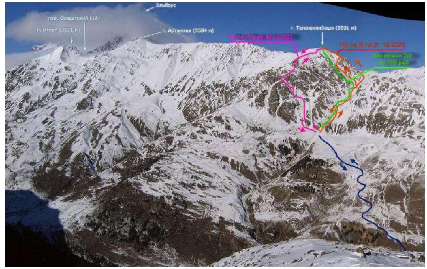
Fig. 1. Possible routes with approach from Tegenekli settlement (based on Golubev M.'s photo https://caucatalog.ru/↗)
1.2. Photopanorama of the Area
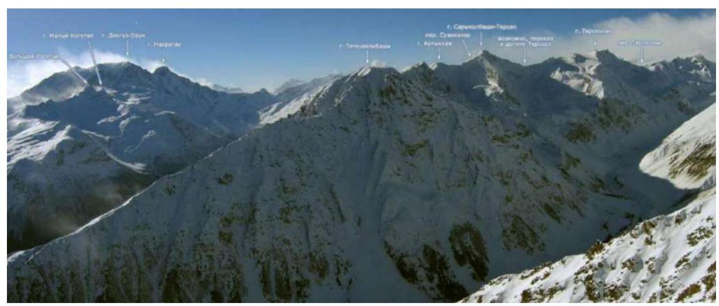
Fig. 2. Photopanorama of the area (photo by Golubev M. https://caucatalog.ru/↗)
1.3. Photo Profile of the Route
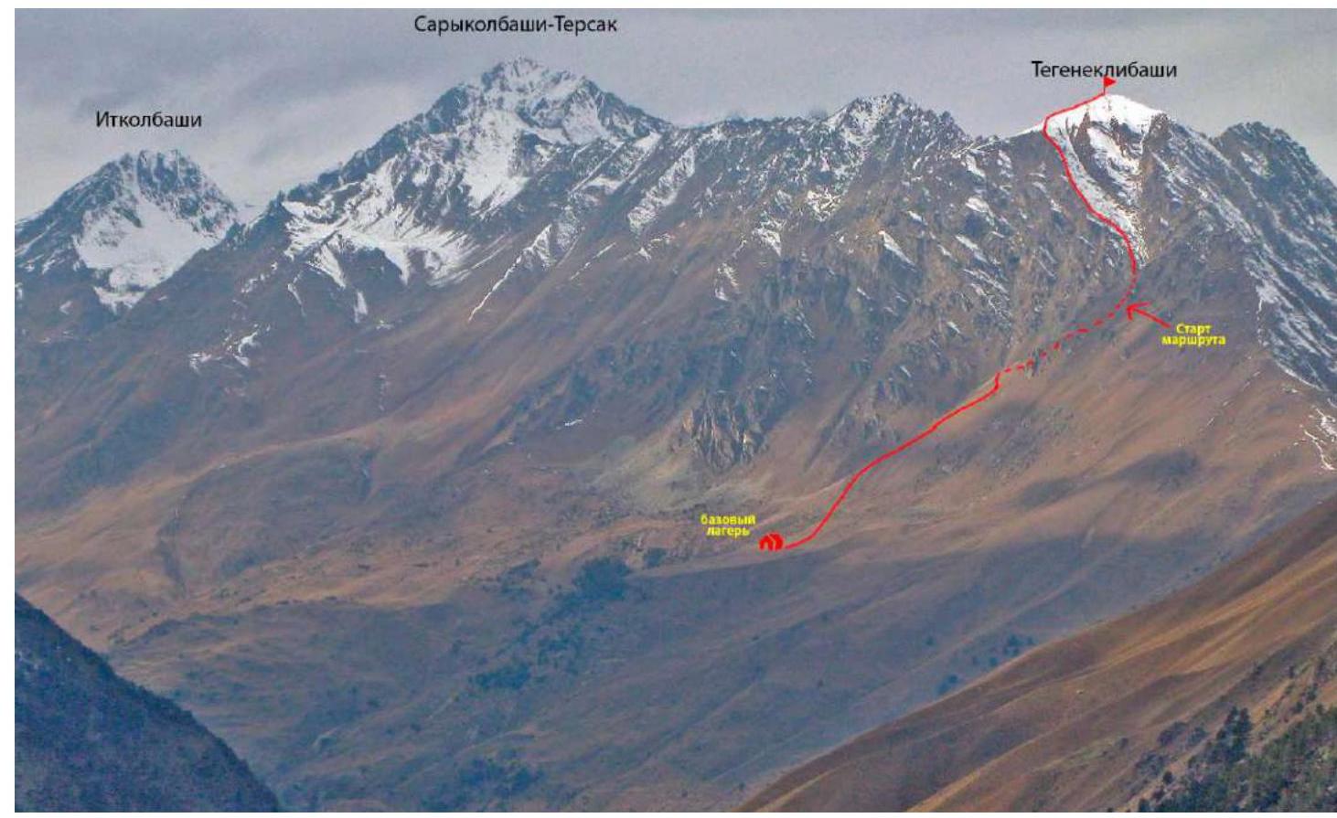
Fig. 3. Approach path and view of the main part of the route (Photo by M. Golubev, November 2014)
1.4. Geographical Location of the Area
The ascent object — Tegeneklibashi peak (3502 m) is located in the Caucasus mountains in the upper part of the Baksan valley. The rocky ridge Tegenekli is the eastern spur of Elbrus mountain and is located northwest of Tegenekli settlement (Elbrus district, Kabardino-Balkar Republic). Its length is 15 km.
The semantics of the locality name goes back to the Balkar "tegenek" — "thorn", "prickly shrub". This part of the valley is overgrown with thorny bushes (barberry, wild rose, sea buckthorn, juniper).
It's convenient to start the approach to the route in Tegenekli settlement. Cross the second bridge from the bottom of the valley into the settlement and approach the southern slopes of the valley. Cross the high-voltage power line near the transformer substation and turn left upwards onto a good, sometimes steep trail leading to the high-altitude pastures. Cross the stream in the direction of the grassy shoulder above the large rocky outcrop. It's possible to set up a base camp on the shoulder (GPS coordinates of the camp: 43.26204, 42.59837). Then follow the trails and grassy slopes, sticking to the eastern slope of the stream/snowfield bed upwards towards the clearly visible saddle in the eastern ridge of Tegeneklibashi peak. Before the snowfield turns towards Tegeneklibashi peak, cross the snowfield from right to left, this is the start of the route. From the start of the trail, which begins at the transformer substation, to the turn of the snowfield — the start of the route — is 3.5–4.5 hours of walking time with light backpacks.
2. Characteristics of the Route
2.1. Technical Photograph of the Route
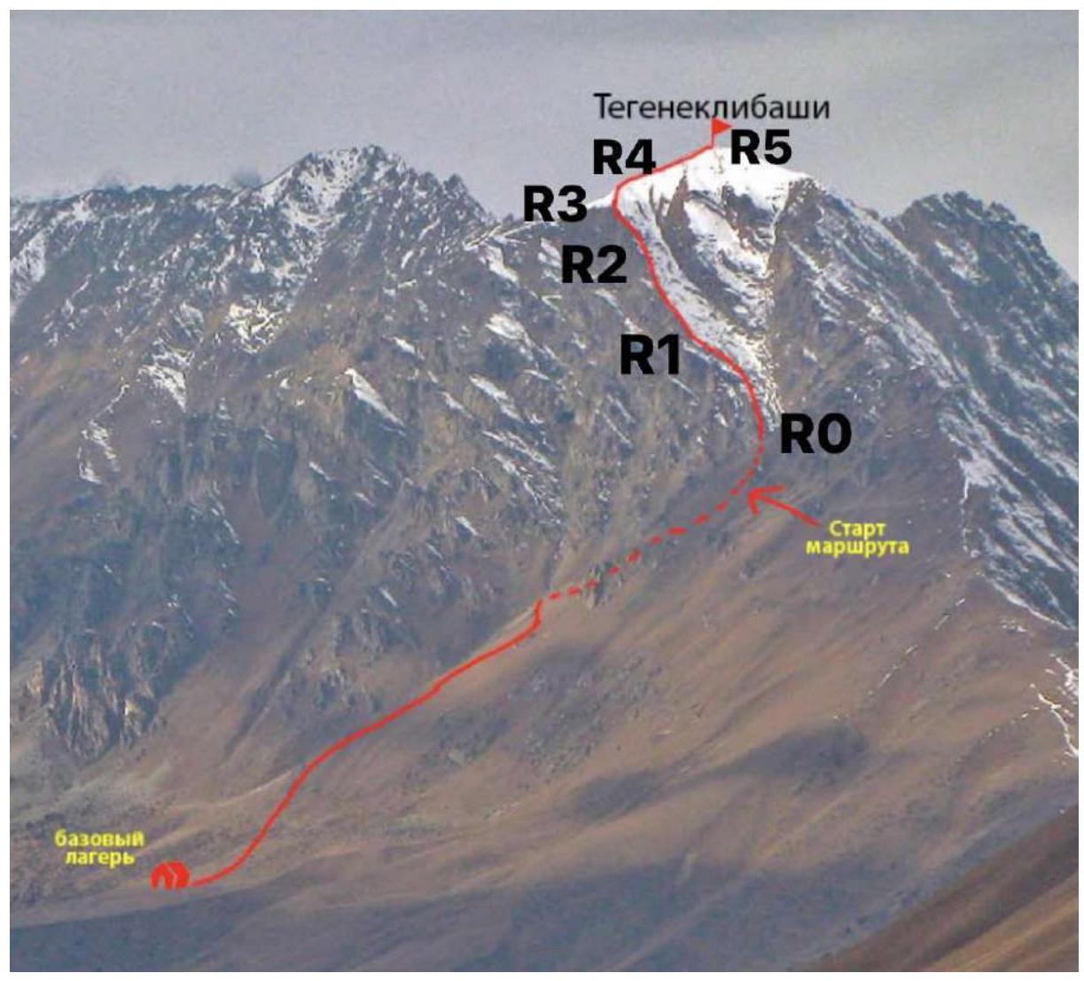
Fig. 4. Technical route.
2.2. Technical Characteristics of the Route Sections
| Section № | Relief Characteristics | Difficulty Category | Length | Type and number of safety elements |
|---|---|---|---|---|
| R0–R1 | grassy and rocky slope | 1 | 100 | none |
| R1–R2 | Rocks, walls, lots of scree rocky ridge | 2–3 | 300 | 2 stations on long loops around rocky outcrops. Safety points — friends/stoppers/pitons (approximately equal number). Total of about 16 points for the entire section. |
| R2–R3 | Simple rocky ridge | 1 | 50 | none |
| R3–R4 | Snow cornice | 4 | 5 | 2 snow anchors. |
| R4–R5 | Snow and firn, or simple rocky ridge | 1 | 300 | none |
2.2. Technical Photographs of the Route by Sections

Fig. 4.1. Technical photo of the first half of the route
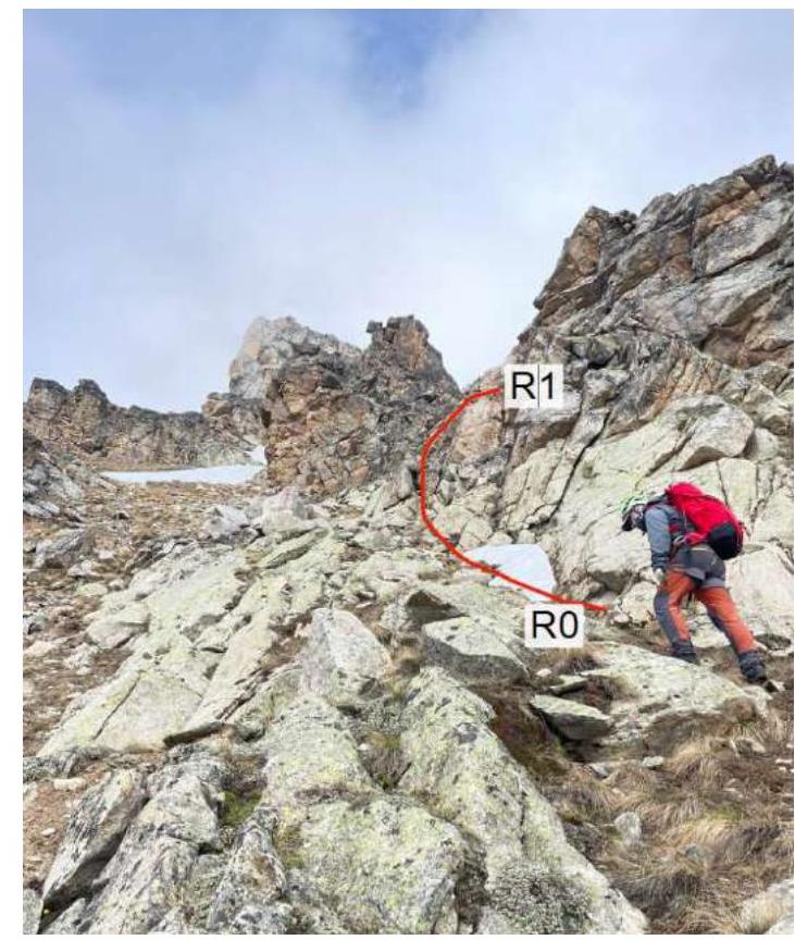
Fig. 5. Section R0–R1
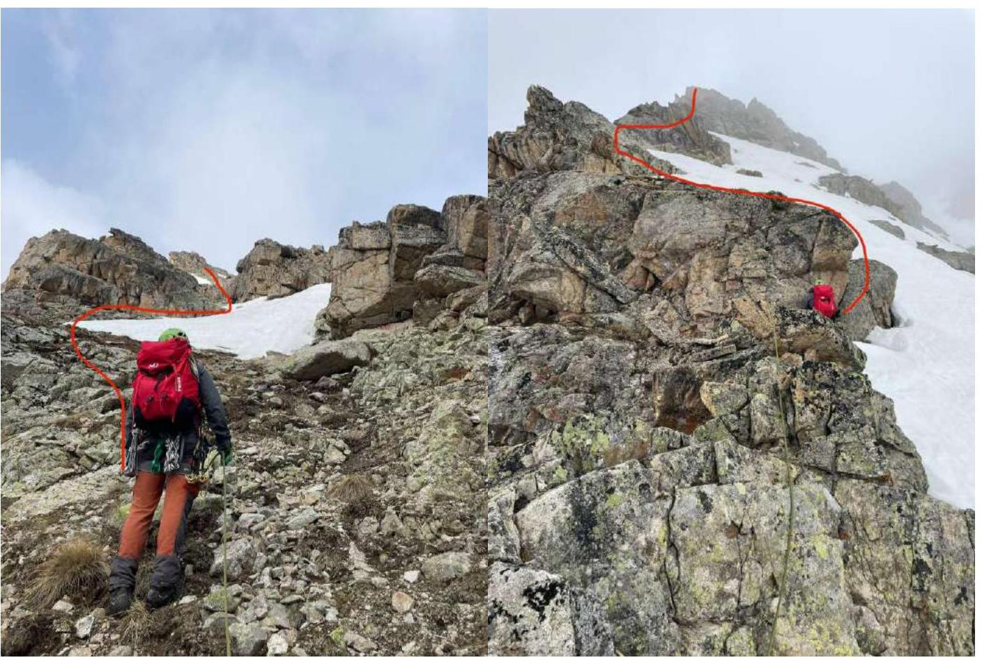
Fig. 6. Section R1–R2
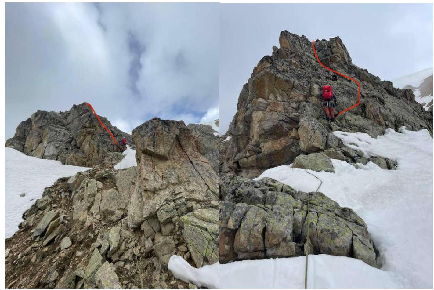
Fig. 7. Section R1–R2

Fig. 8. Section R1–R2
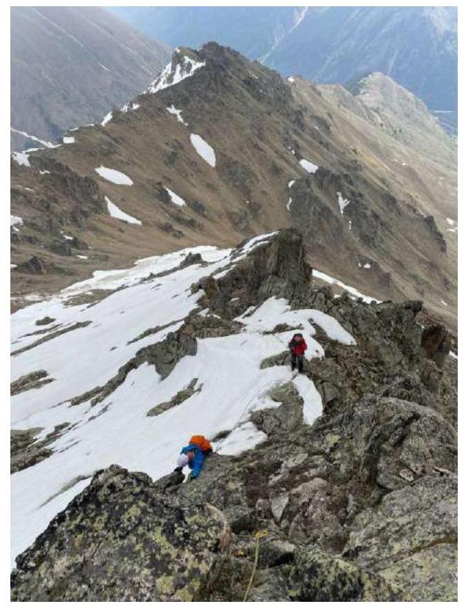
Fig. 9. Section R1–R2
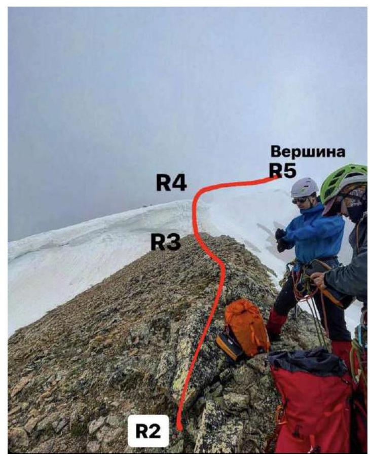
Fig. 10. Section R1–R2
Fig. 11. Section R1–R2 (view from above)
Fig. 12. Sections R2–R5
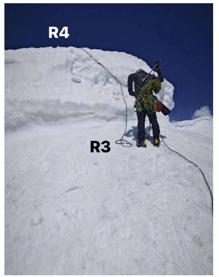
Fig. 13. Section R3–R4
3. Characteristics of the Team's Actions
3.1. Brief Description of the Route Passage.
| Section № | Description | Photo № |
|---|---|---|
| R0–R1 | Not reaching the saddle, at the level of the start of the SE ridge, cross the wide couloir. Along the scree slope with rocky outcrops and simple rocks, exit under the rocky walls to the right of the ridge. Simultaneous movement in roped parties with belay through the terrain. | Fig. 4.1, Fig. 5. |
| R1–R2 | Simultaneous movement in roped parties with their own intermediate belay points. Convenient stations on rocky outcrops. | Fig. 6 – Fig. 11 |
| R2–R3 | Along the rocky ridge to the snow cornice. Simultaneous movement of roped parties. Belay through the terrain. | Fig. 12 |
| R3–R4 | Alternating passage of the snow cornice. Use of two snow anchors. Belay of the following participants after the leader is done from above through an ice axe in the snow. | Fig. 12, Fig. 13 |
| R4–R5 | Along the simple rocky (snowy with cornices in winter) ridge, exit to the peak. |
3.2. Photo on the Peak at the Control Cairn.
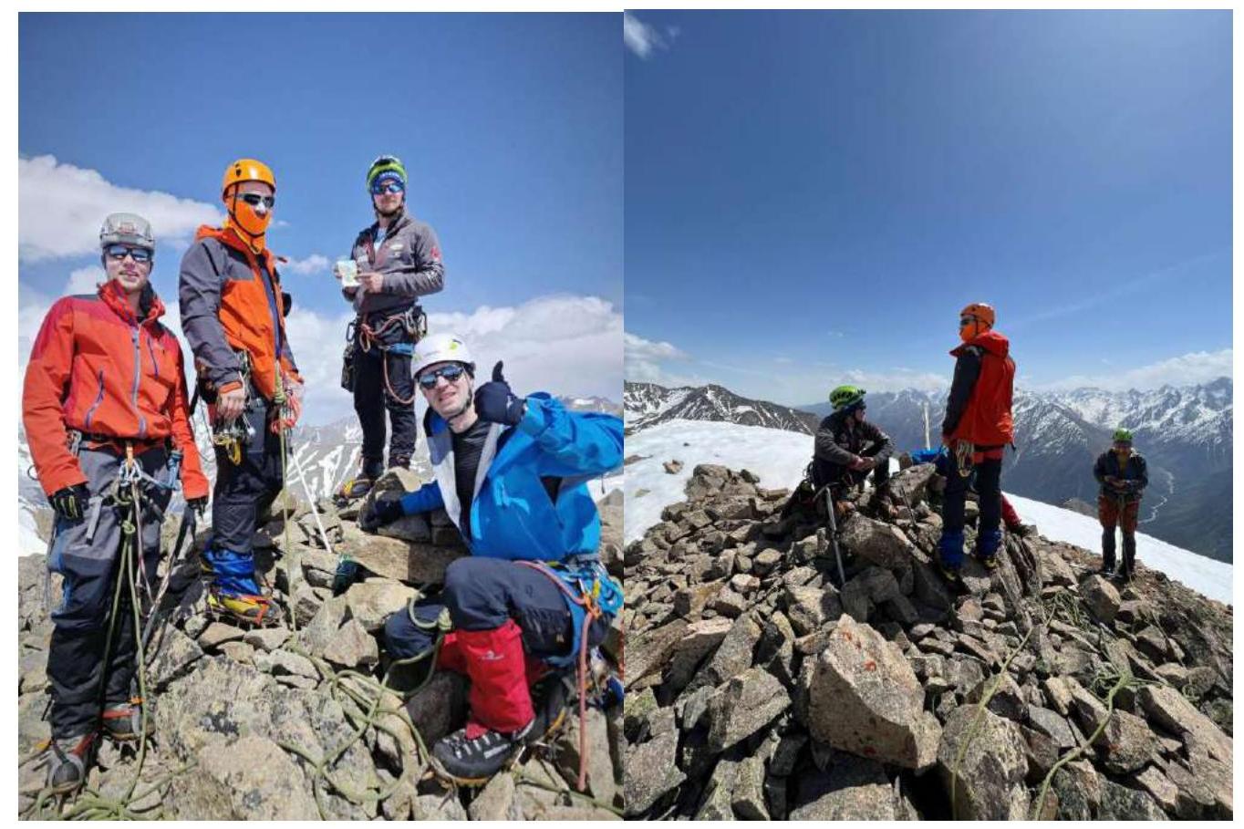
Fig. 14, Fig. 15
3.3. Assessment of Route Safety.
The route, like any ridge route, can be hazardous during a thunderstorm. In poor visibility, be careful on section R1–R2 to avoid going right onto one of the two false ridges. No random rockfall was observed during the route passage. The grassy slopes of the approach to the route in summer, as well as the couloirs and slopes on the descent from the route, can be avalanche-prone during periods of heavy snowfall and spring snowmelt. Radio communication with EMERCOM and MTS mobile communication work along the entire route.
3.4. Descent from the Peak
Descent from the peak, depending on the team's training goals, is equally possible along the ascent route to its start, or along the ascent route to the start of the ridge (R2) with a deviation to the left downwards along route 1B on the E ridge with an exit to the saddle above the start of route 2A. Then down along the ascent trail to Tegenekli settlement. From the peak to the settlement is 3.5–4 hours.


